
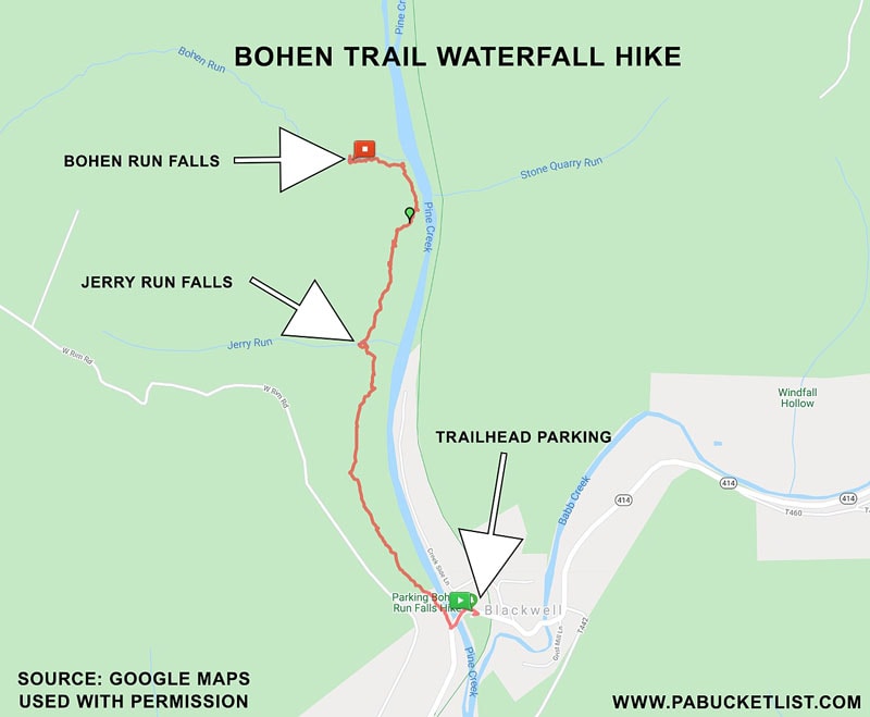
Bohen Run Falls and Jerry Run Falls are two of the many waterfalls on tributaries of Pine Creek near the southern end of the Pennsylvania Grand Canyon.
In fact, I talk about visiting Stone Quarry Run Falls and Water Tank Hollow Falls, directly across Pine Creek from Jerry Run Falls and Bohen Run Falls, in another write-up here on PABucketlist.com.
But whereas Stone Quarry Run Falls and Water Tank Hollow Falls are easily reached via the Pine Creek Rail Trail, Jerry Run Falls and Bohen Run Falls require a more strenuous out and back hike of approximately 4 miles.
And that is the subject of this write-up.
Where is the Bohen Trail?
How to Find the Bohen Trail in Blackwell, Pennsylvania
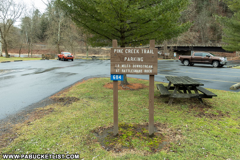
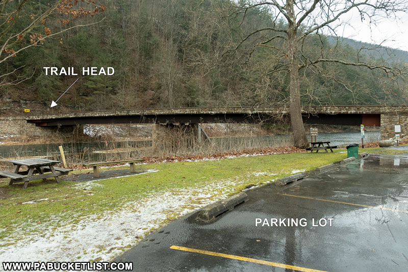
- From Route 414, navigate to GPS Coordinates 41.556318, -77.381956 in the village of Blackwell (Tioga County).
The parking area for this hike is a large paved lot just east of the bridge over Pine Creek.
- Park in the lot with a sign reading “Pine Creek Trail Parking”.
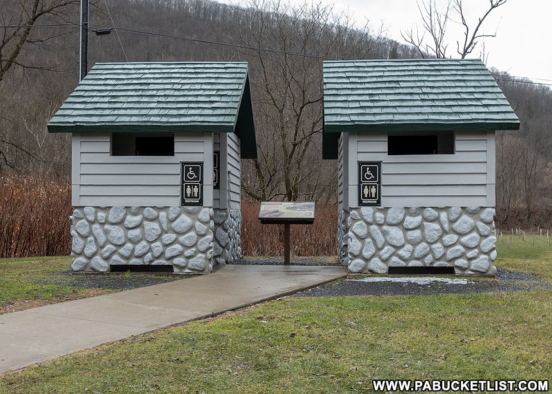
- Restrooms are available at the parking area in Blackwell.
- Walk across the bridge over Pine Creek and look for the Bohen Trail sign on the right side.
Hiking to Jerry Run Falls
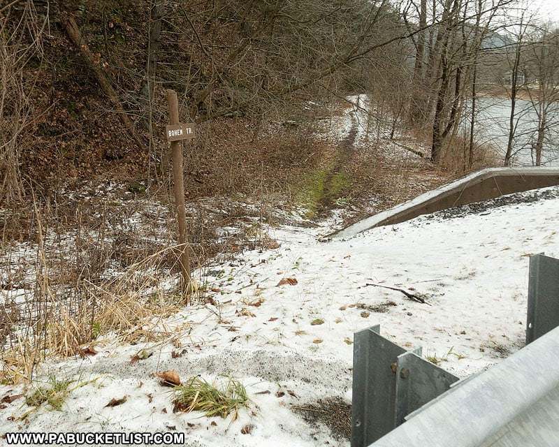
Hop the guardrail on the Route 414 bridge at the spot indicated in the photo above.
The obvious and well-worn Bohen Trail initially runs parallel to Pine Creek, before starting its ascent of the western wall of the Pine Creek Gorge.
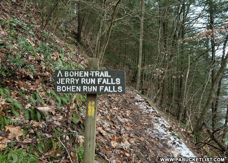
At the beginning of the ascent, you’ll see this sign (and yellow blaze), a reminder of the eventual payoff for the initial exertion required of you (347 feet of elevation gain in the first 1/2 mile).
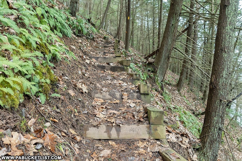
Parts of the steep initial section of the Bohen Trail feature steps built into the hillside.
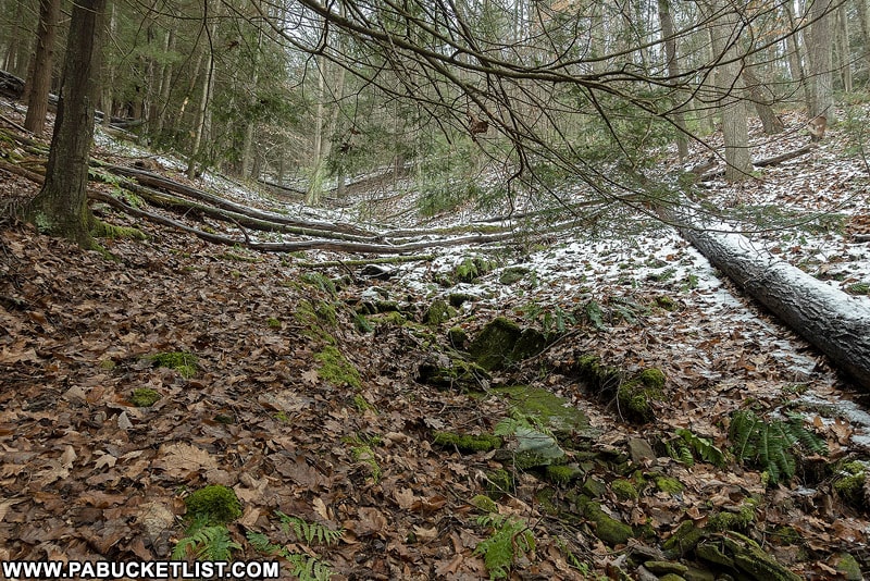
At .62 miles into the hike you’ll reach the highest portion of this hike, near what I call the “dry gulch”.
It’s a good spot to catch your breath and collect yourself – the rest of the hike will be easy by comparison.
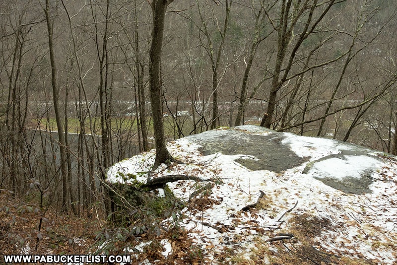
At .88 miles into the hike you’ll come to this rock outcropping overlooking Pine Creek.
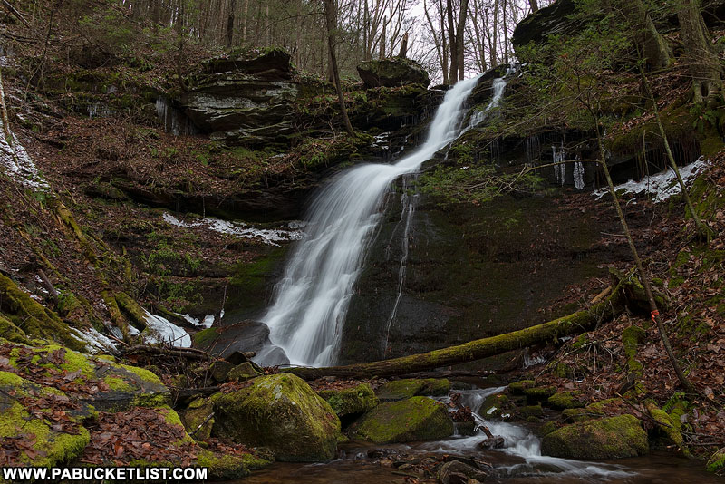
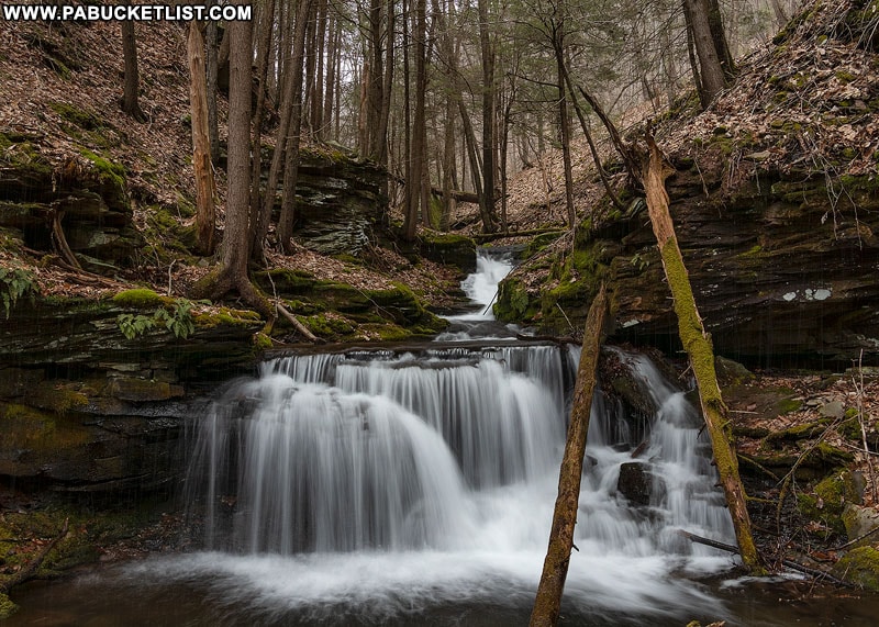
And at 1.1 miles into the hike you’ll get your first glimpse of Jerry Run Falls.
Viewing Jerry Run Falls
Your first glimpse of Jerry Run Falls will be from the top, as the Bohen Trail passes right above the falls.
GPS Coordinates for Jerry Run Falls: 41.566750, -77.387415
It’s a rather sheer drop from the trail to the base of the falls.
My advice is to photograph it (carefully) from above initially, and then shoot it from the bottom (should you wish) by going around it and hiking up to it from Pine Creek.
More on that in a bit.
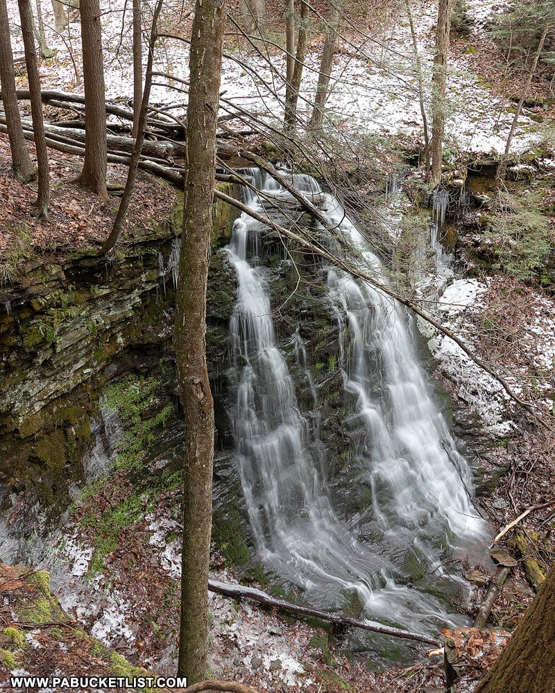
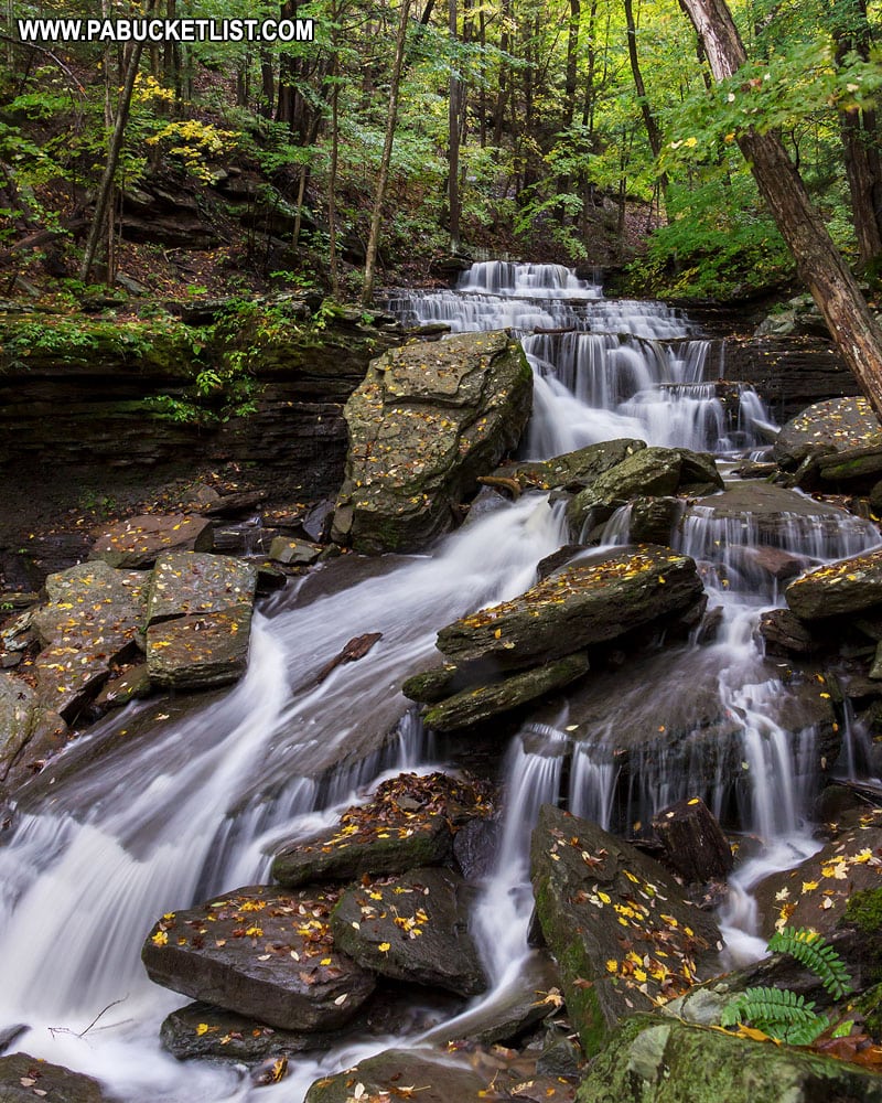
Jerry Run Falls comes in at around 18-20 feet tall, and it takes a fairly heavy rain event or snow melt to really get it flowing.
Once you’ve taken in the sights from above, cross over Jerry Run and continue to follow the yellow-blazed Bohen Trail.
Hiking to Bohen Run Falls
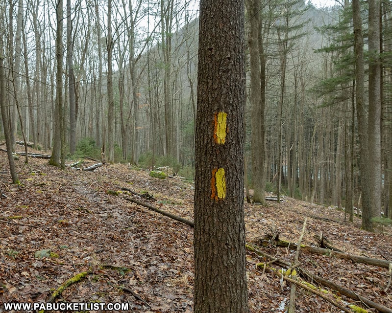
At 1.37 miles into the hike (roughly 1/3 of a mile past Jerry Run Falls) you’ll see this yellow double-blaze where the trail starts uphill again at a roughly 45 degree angle to Pine Creek.
DO NOT FOLLOW THE YELLOW-BLAZED TRAIL ANY FURTHER.
Instead, you want to veer off at a roughly 45 degree angle downhill, towards Pine Creek.
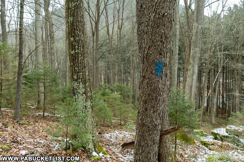
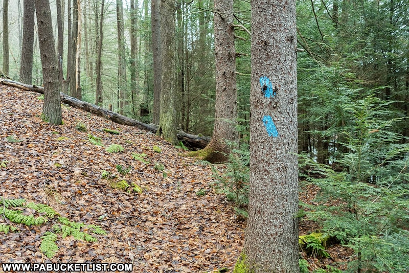
Soon you’ll see blue blazes indicating the Bohen Trail Spur.
Follow the blue-blazed Bohen Trail Spur down to the edge of Pine Creek and then north to Bohen Run, roughly 1/3 of a mile ahead.
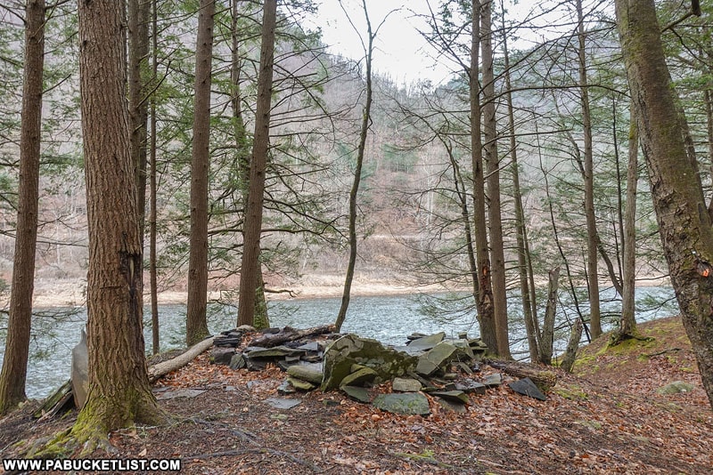
At 1.52 miles into the hike you’ll come across a campsite next to the Bohen Trail Spur.
If you look carefully across Pine Creek, you’ll see Stone Quarry Run Falls and the Pine Creek Rail Trail almost directly in front of you.
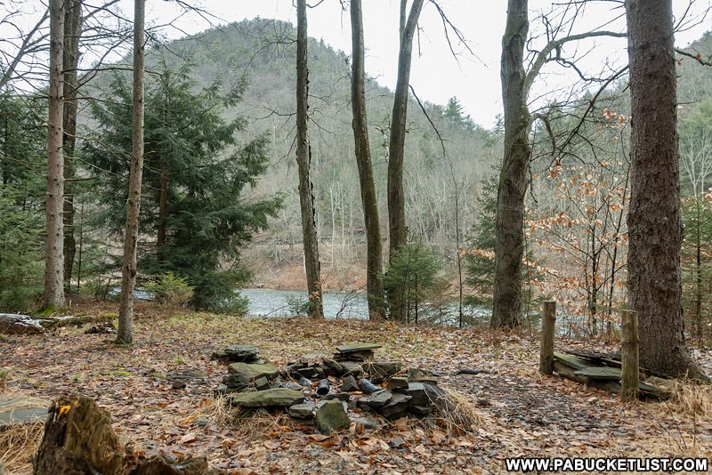
At 1.66 miles into the hike you’ll come to this fantastic campsite at the confluence of Bohen Run and Pine Creek.
From the campsite, turn and face upstream on Bohen Run.
You’ll see a pair of blue blazes indicating the trail heading uphill but away from Bohen Run.
DO NOT FOLLOW THE BLUE BLAZED TRAIL ANY FURTHER.
At least not initially.
Instead, follow an unblazed but obvious user trail straight up the banks of Bohen Run (left side as you hike upstream) 2/10ths of a mile to get your first glimpse of Bohen Run Falls.
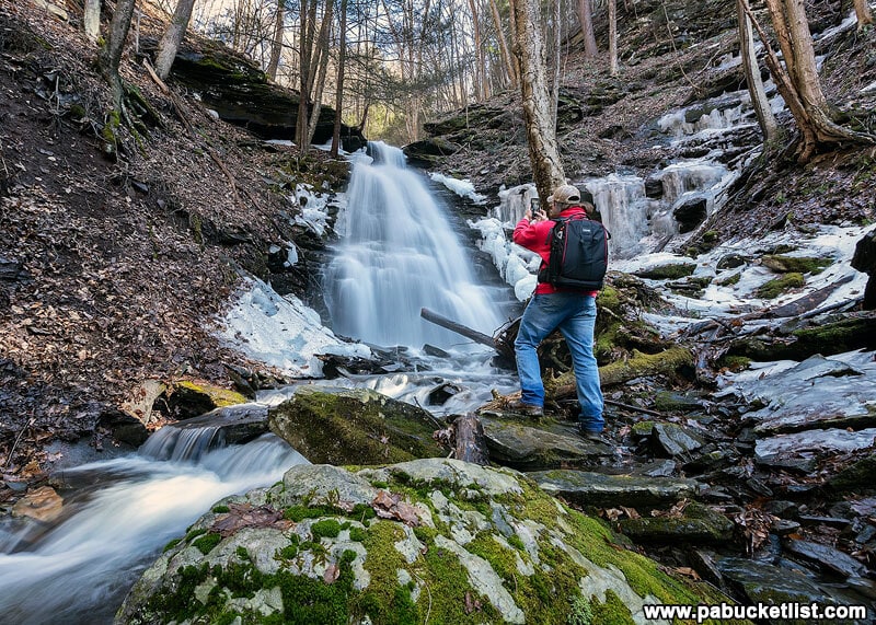
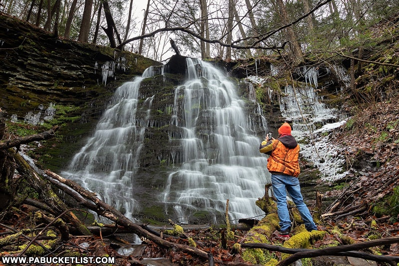
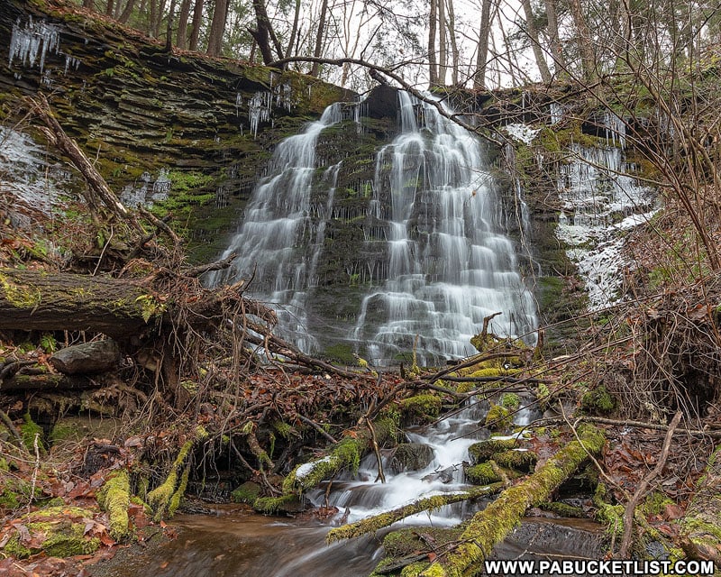
Viewing Bohen Run Falls
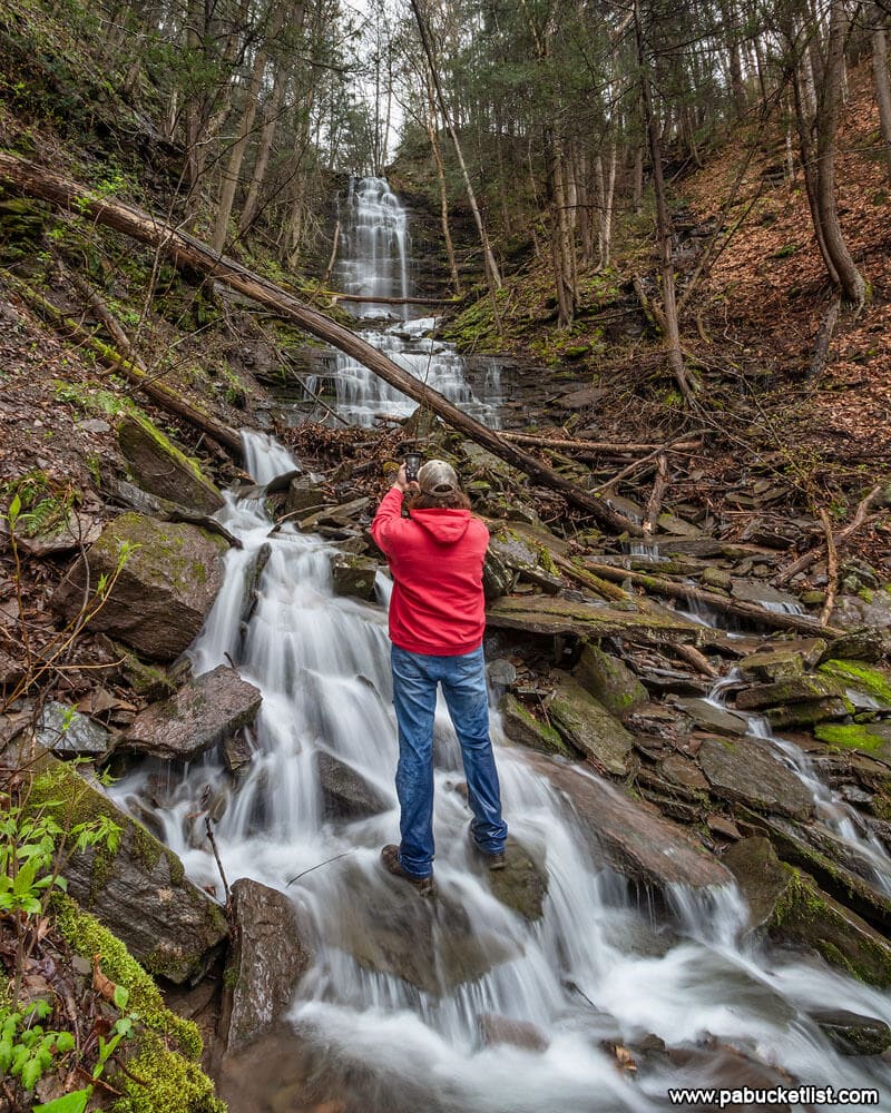
As you approach Bohen Run Falls from downstream, you’ll have to contend with some fresh blow-downs.
But once you reach the base of the falls, the scene has remained unchanged for several years.
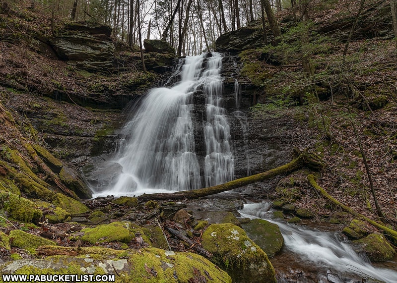
The two photos above were taken several years apart, but almost look as if they could have been taken the same week.
GPS Coordinates for Bohen Run Falls: 41.573866, -77.388154
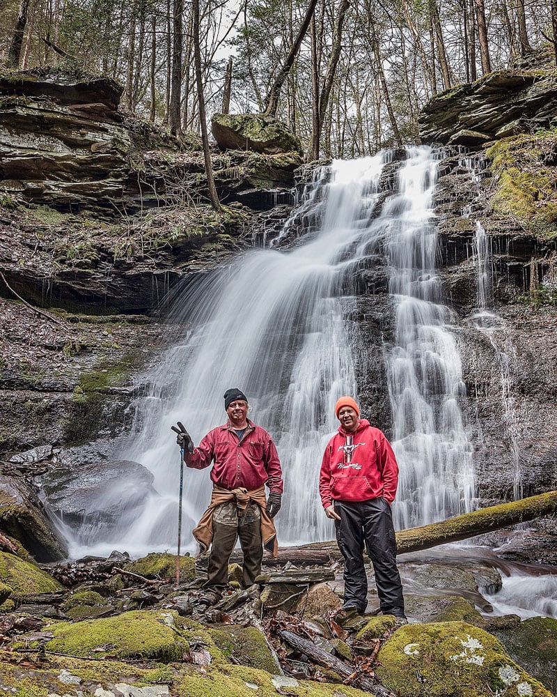
Bohen Run Falls is every bit of 25 feet tall, and I would not recommend trying to scale it if you want to see what lies above it.
Instead, backtrack to the campsite and now, if you choose, follow the double blue blazes as they lead you up and around Bohen Run Falls.
Sights Above Bohen Run Falls
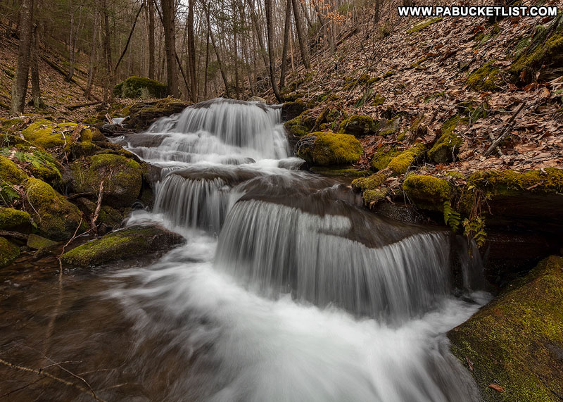
The blue-blazed Bohen Run Spur continues upstream above Bohen Run Falls, but takes you high up on the hillside above the stream.
Once I’m safely around the falls, I prefer to go off-trail hike the stream bank up the left side of the Bohen Run, to take in sights like the cascade above.
Other small waterfalls and cascades are numerous as you make your way upstream.
Usually I turn around at the unnamed waterfall pictured above, and backtrack down to the campsite at the confluence of Bohen Run and Pine Creek.
I then backtrack along the blue-blazed Bohen Trail Spur to the point where it veers back uphill towards the yellow-blazed portion of the Bohen Trail.
If you want to see Jerry Run Falls from the bottom, at this time just continue straight ahead (don’t veer uphill) and hike off trail another 1/3 of a mile until you reach the confluence of Jerry Run and Pine Creek.
From there, bushwack upstream a few hundred yards to the base of Jerry Run Falls.
Use caution and common sense as you pick your way over the wet, moss covered rocks and logs to this spot.
When finished, backtrack downstream to Pine Creek and retrace your steps to the Bohen Trail Spur.
From there, procede uphill to the yellow-blazed Bohen Trail, and then return to the parking area along Route 414 in Blackwell.
Final Thoughts on Hiking the Bohen Trail
The trek to Jerry Run Falls and Bohen Run Falls via the Bohen Trail is an extremely satisfying 4 mile out and back hike.
The level of exertion required is certainly greater than the hike to Stone Quarry Run Falls and Water Tank Hollow Falls (directly across Pine Creek along the rail trail), but the reward is proportionally greater as well.
Ideally you’d make a day of it, hitting the Bohen Trail with fresh legs in the morning, doing lunch in Blackwell, and then hit the Pine Creek Rail Trail to see Stone Quarry Run and Water Tank Hollow in the afternoon.
Nearby Attractions
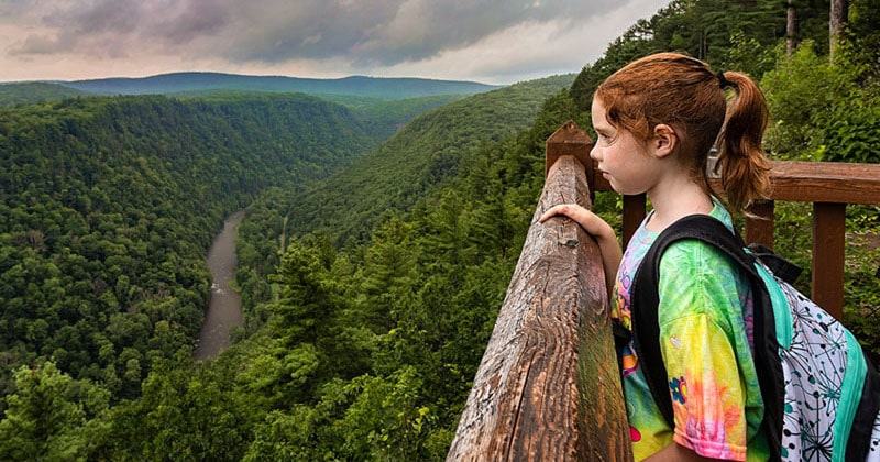
Looking for those AMAZING scenic views of the PA Grand Canyon?
Then you need to make the trip to Colton Point State Park.
Of course it takes 2 sides to make a canyon, so plan on visiting Leonard Harrison State Park, opposite from Colton Point, as well.
Not only is Leonard Harrison State Park home to spectacular overlooks of its own, but it’s also where you’ll find the famous Turkey Path waterfalls trail.
Or perhaps you’d rather see one of the tallest waterfalls in Tioga County, in which case you’ll want to check out my write-up on Chimney Hollow Falls.
Still not convinced you need to visit Jerry Run Falls and Bohen Run Falls?
Then check out this video!