
If you’re looking for directions to Grindstone Falls at McConnells Mill State Park, you’ve come to the right place!
Unlike many of the park’s better-known waterfalls, Grindstone Falls doesn’t appear on any official park maps, making it something of a hidden discovery for those willing to seek it out.
But don’t worry—this scenic cascade is very real, and with a little guidance, it’s surprisingly easy to find.
In the following paragraphs, I’ll show you exactly how to track down one of McConnells Mill’s most overlooked waterfalls.
Grindstone Falls FAQs
Grindstone Falls is located in the southeastern portion of McConnells Mill State Park (Lawrence County).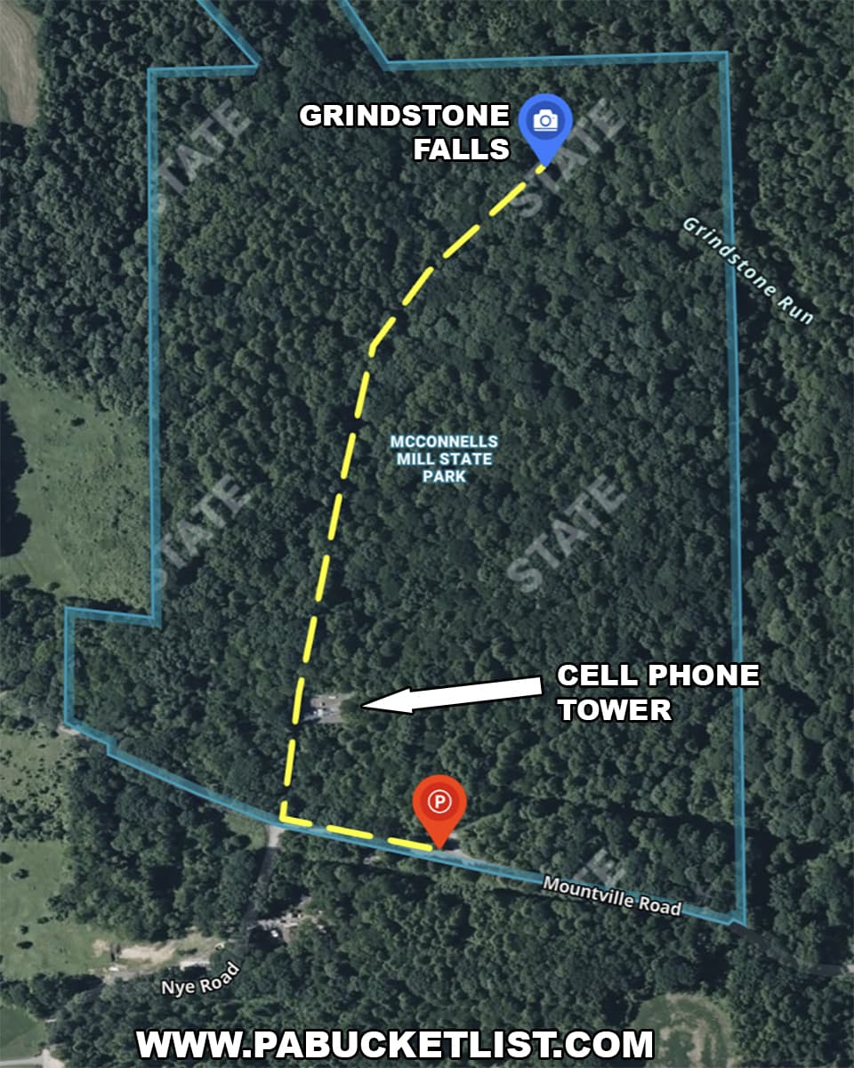
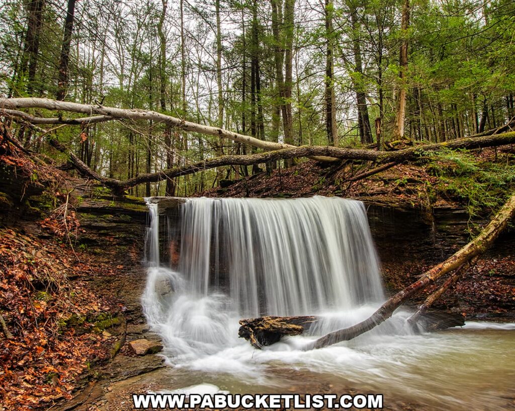
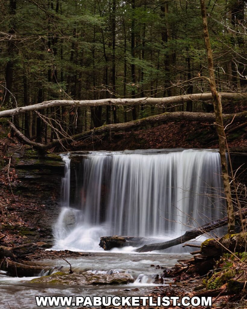
Approximately 8 feet tall.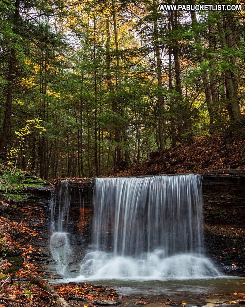
Yes – the GPS coordinates for Grindstone Falls are 40.915499, -80.194653
The trail is not blazed, but is well-worn and obvious. Despite not being on the “official” park map, people have been visiting Grindstone Falls for many, many years.
Hiking to Grindstone Falls
Time needed: 15 minutes
How to Find Grindstone Falls at McConnells Mill State Park
- Navigate to the intersection of Mountville Road and Nye Road, 3 miles west of Portersville.
The parking area for visiting Grindstone Falls is located 400 feet east of the intersection of Mountville Road and Nye road at the following GPS coordinates: 40.911096, – 80.195421.
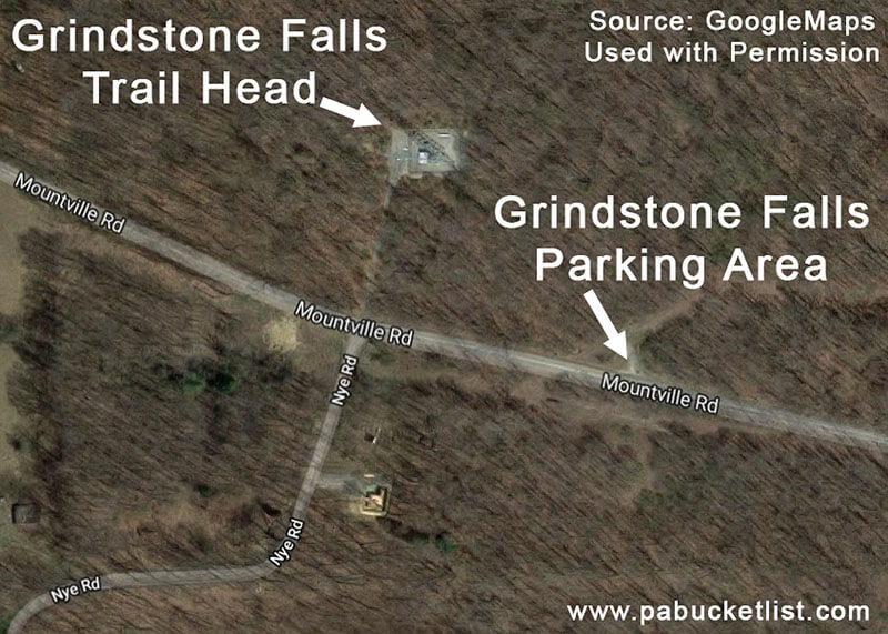
- From the parking area along Mountville Road, walk 400 feet west along the lightly-traveled road to the crest of the hill and a road leading to a cell phone tower pad.
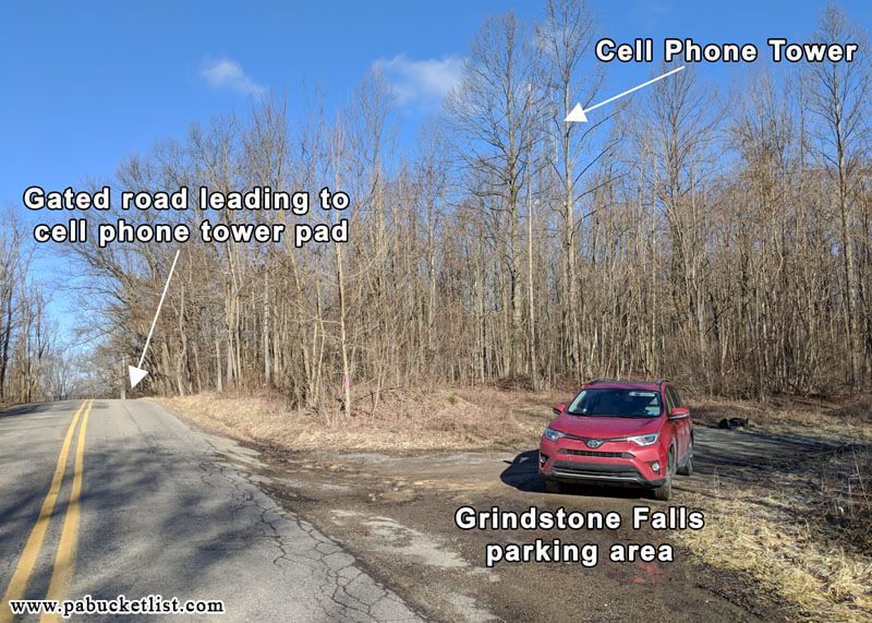
- At the crest of the hill you will see this gated road leading to the cell phone tower. Walk around the gate and towards the tower. DO NOT park in front of or otherwise block the gate.
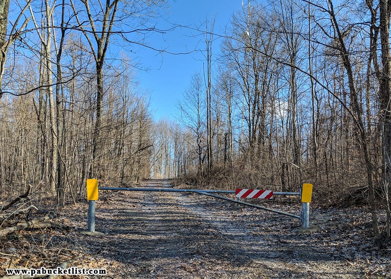
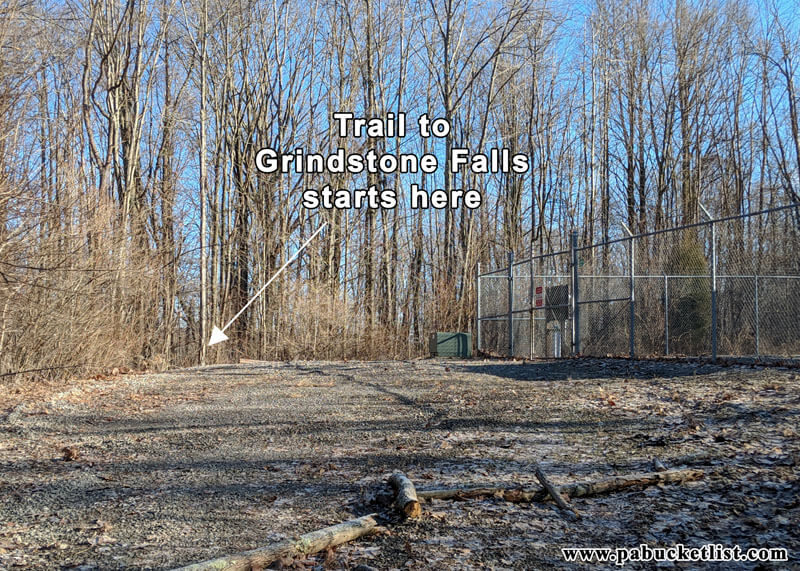
- Proceed to the back left corner of the gravel cell phone tower pad.
The trail to Grindstone Falls begins here.
- Hike 0.3 miles through open hardwoods along the unblazed but well-worn trail.
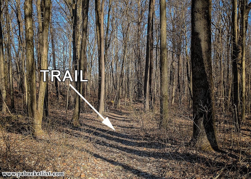
- At 0.3 miles the trail bears rather sharply to the right and enters a hemlock grove.
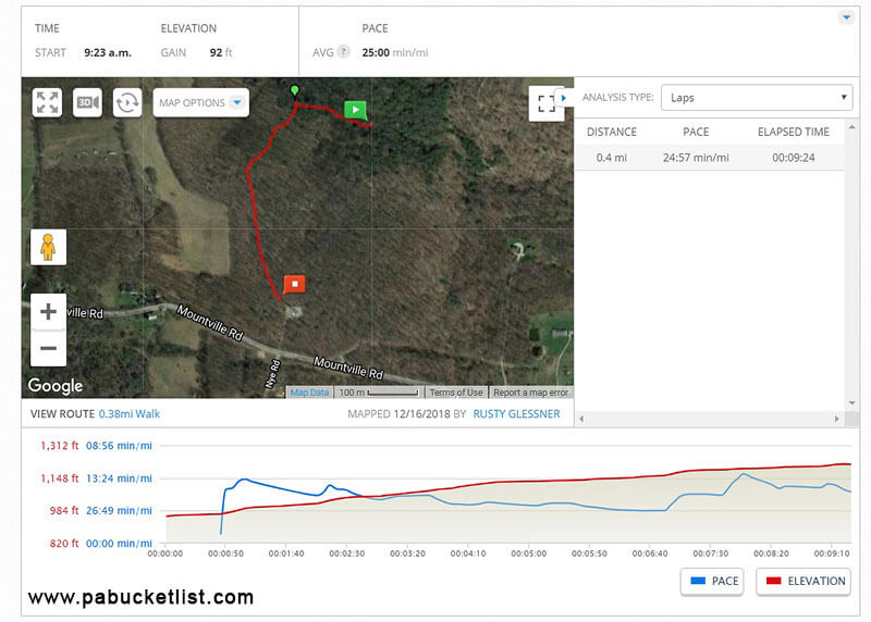
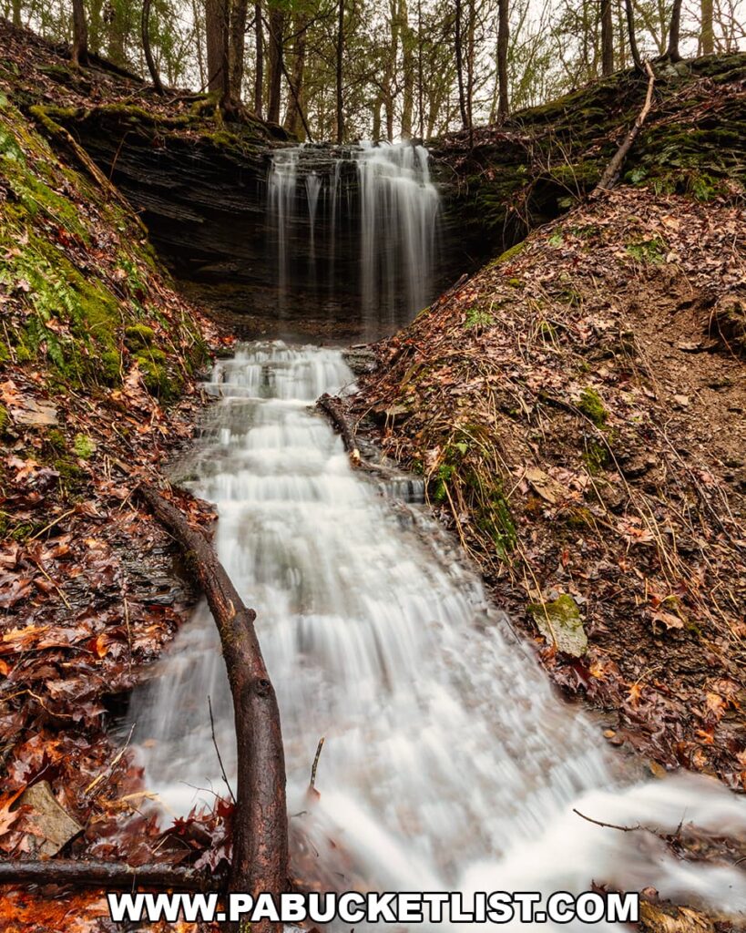
- At 0.4 miles arrive at Grindstone Falls.
Hiking at a comfortable pace and stopping to take a few cell phone shots along the way, I normally cover this distance in just under 15 minutes.
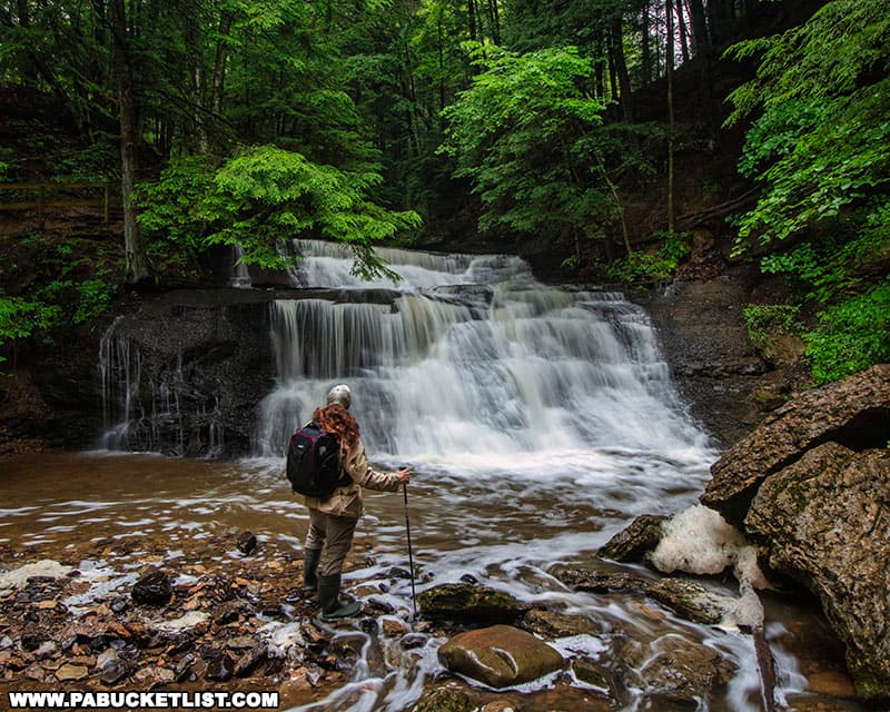
Photographing Grindstone Falls
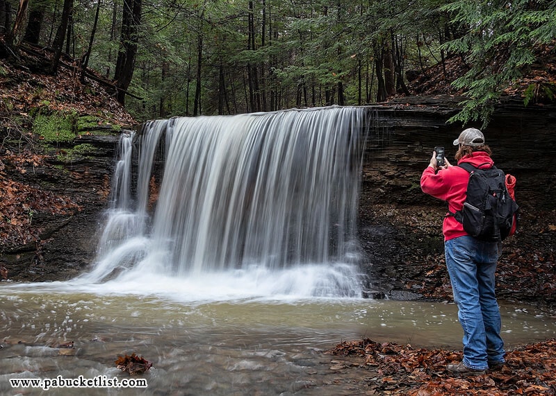
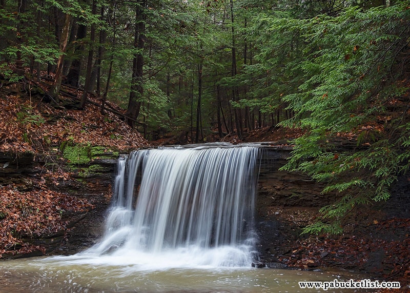
To get the best look at Grindstone Falls you’ll want to get down to stream level.
There are several spots along the trail side of the stream where you can carefully descend the bank to Grindstone Run, or you can simply cross the shallow water above the falls and approach from the opposite side.
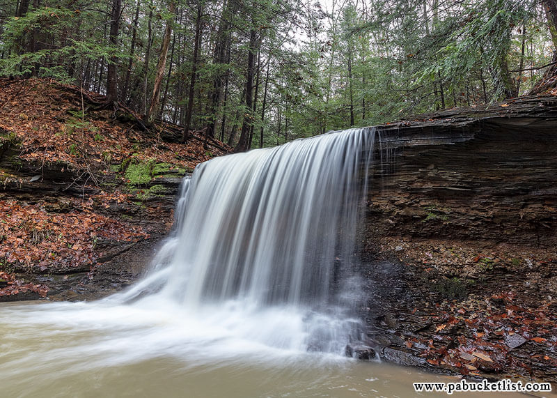
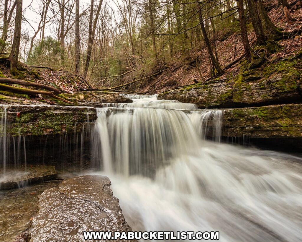
From the right side you can get a close look at the layers upon layers of rock that make up the stream bed.
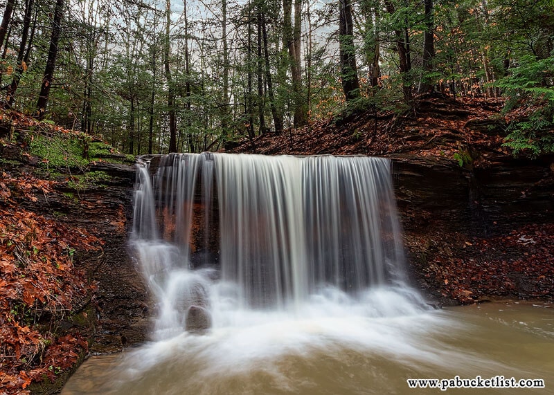
I’d feel comfortable saying Grindstone Falls is a good 8 feet tall and 12 feet wide.
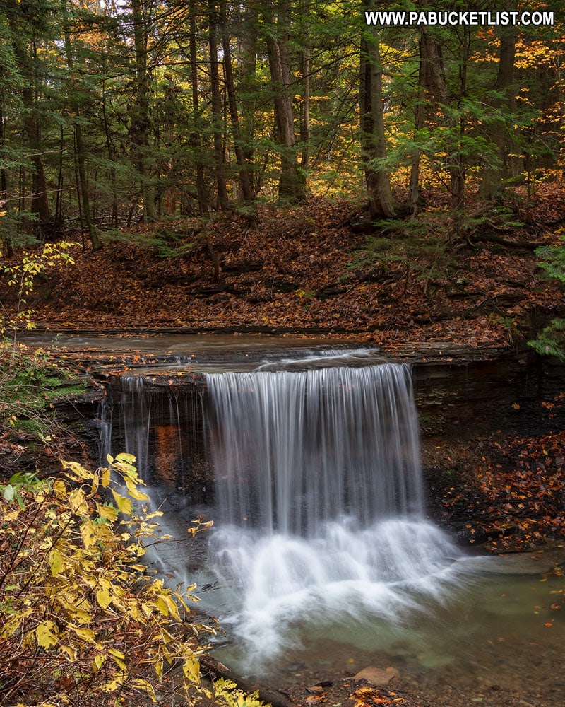
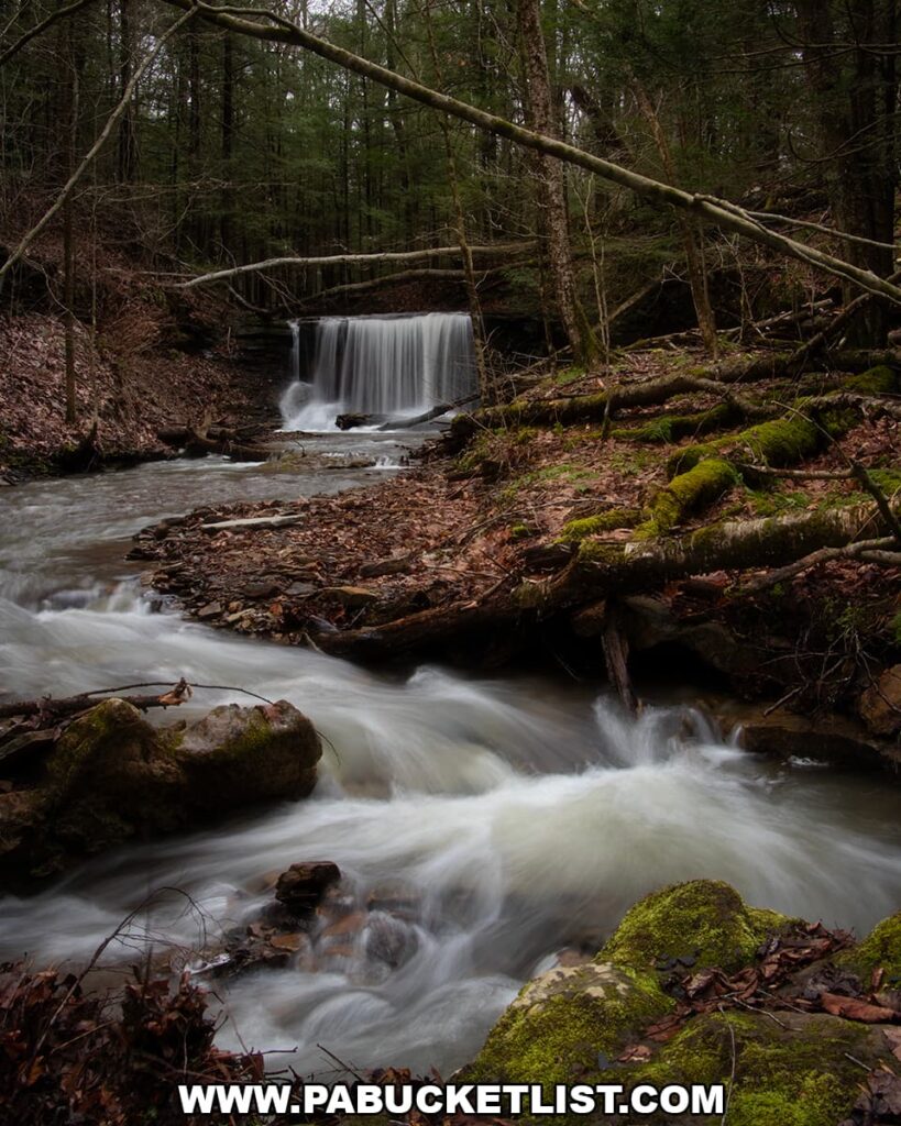
Downstream from Grindstone Falls are many picturesque cascades.
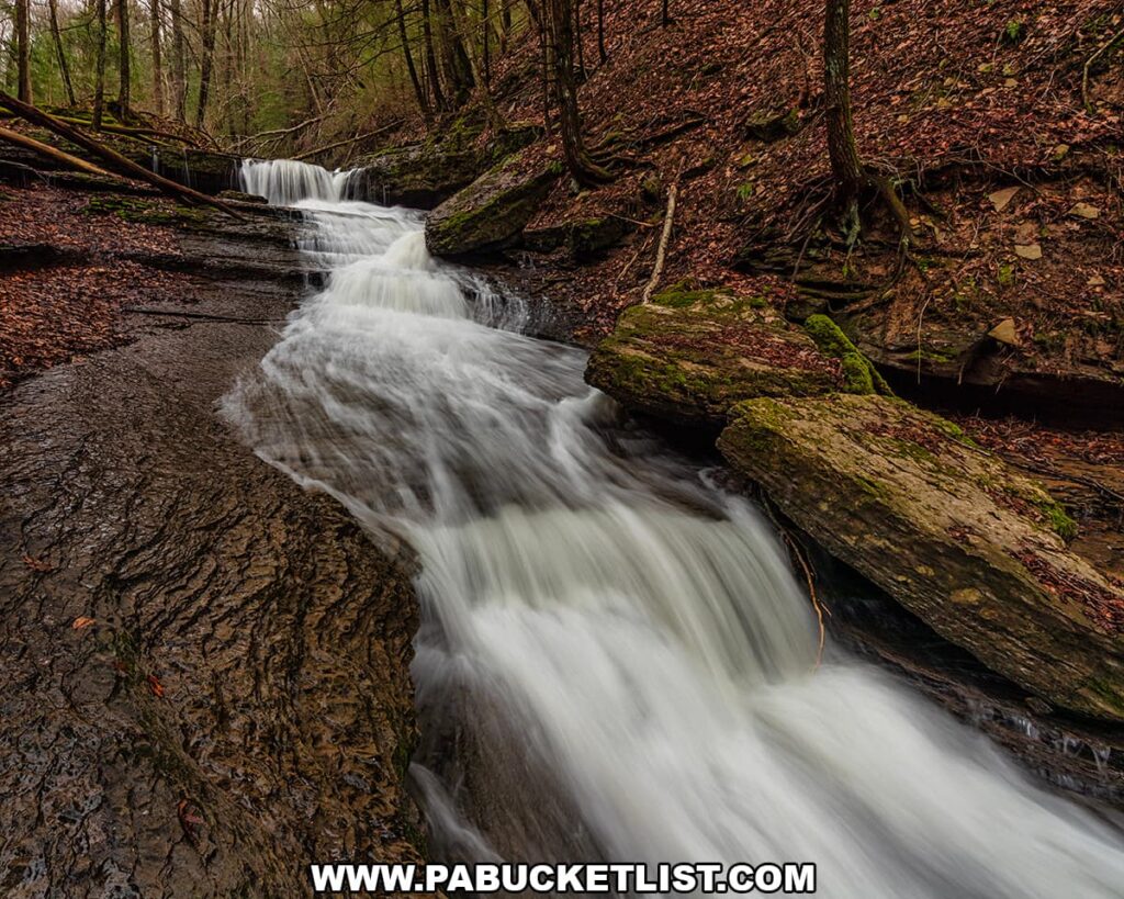
As with any waterfall hike, use caution and tread carefully when hiking the Grindstone Run stream bed.
Once you’ve had your fill of Grindstone Falls and the downstream cascades, simply retrace your steps back up the hill from the falls to Mountville Road and your vehicle.
Still not convinced you need to visit Grindstone Falls?
Then check out this video!
Nearby Attractions
Exploring McConnell’s Mill State Park in Lawrence County showcases more remarkable sights and experiences near Grindstone Falls.
A Smarter Way to Explore Pennsylvania
Explore Pennsylvania like a pro with the interactive PA Bucket List Travel Map, showcasing over 1,000 memorable destinations I’ve personally visited across the Keystone State.
Did you enjoy this article?
If so, be sure to like and follow PA Bucket List on Facebook, Instagram, and/or Pinterest to stay up-to-date on my latest write-ups about the best things to see and do in Pennsylvania!
Click on any of the icons below to get connected to PA Bucket List on social media.