
If you’re looking for information about hiking to the Halfway Point of the Appalachian Trail, you’re in the right place!
The Appalachian Trail is one of the most-famous hiking trails in the world, extending almost 2,200 miles between Springer Mountain in Georgia and Mount Katahdin in Maine, passing through 14 states along the way.
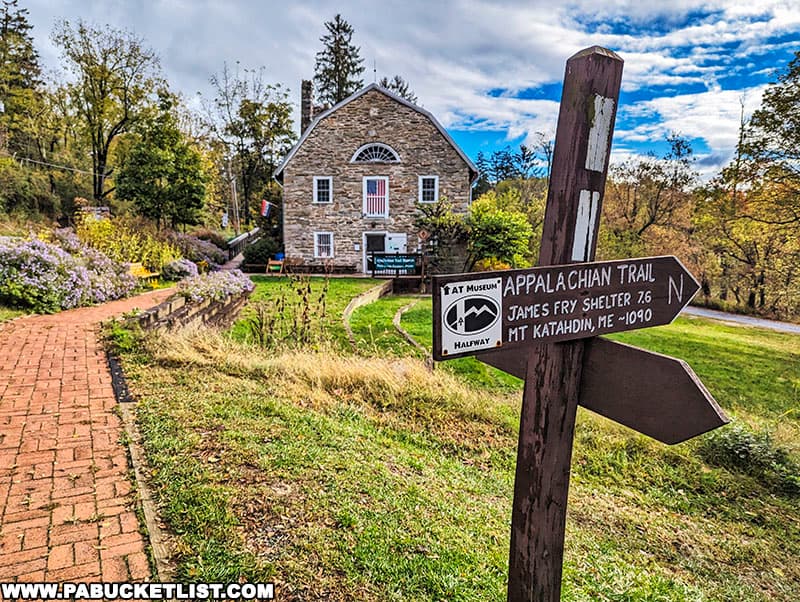
The Halfway Point of the Appalachian Trail is located in Pennsylvania’s Michaux State Forest in Cumberland County, just a short distance from Pine Grove Furnace State Park and the Appalachian Trail Museum.
And while the signpost is mainly symbolic (the actual midpoint of the Appalachian Trail varies from year to year), there’s a sense of camaraderie and achievement in reaching this spot, whether you’re a through-hiker journeying all the way from Georgia to Maine or a day hiker out for the experience.

This article is geared towards the latter group – I’m going to share with you everything you need to know to enjoy a short dayhike to this milestone marker along a world-famous footpath!

Hiking to the Halfway Point of the Appalachian Trail
The hike to the Halfway Point of the Appalachian Trail as I’m going to describe it here covers 0.9 miles (one-way) of mostly flat trail, making it an ideal day hike, even for beginners.
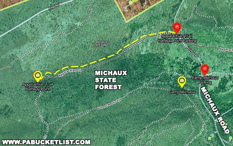
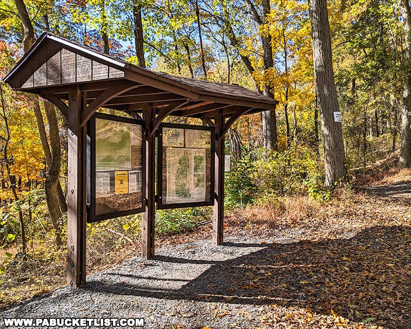
Parking is located along Michaux Road at the lot pictured below – use GPS coordinates 40.04073, -77.34176 to find it.

This kiosk at the northern corner of the parking area is a good landmark to keep an eye out for.
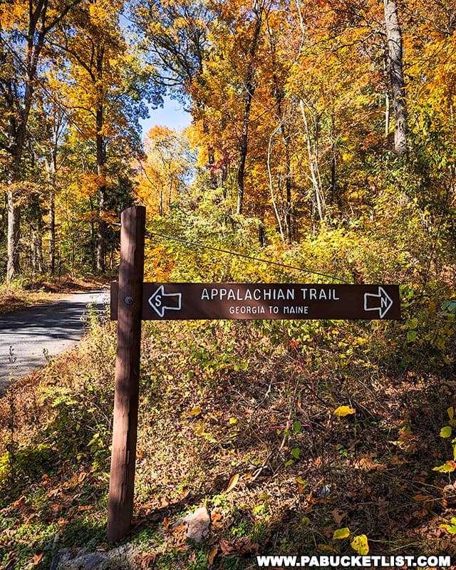
The hike to the Halfway Point of the Appalachian Trail begins at this gate pictured below, just a few steps beyond the kiosk.
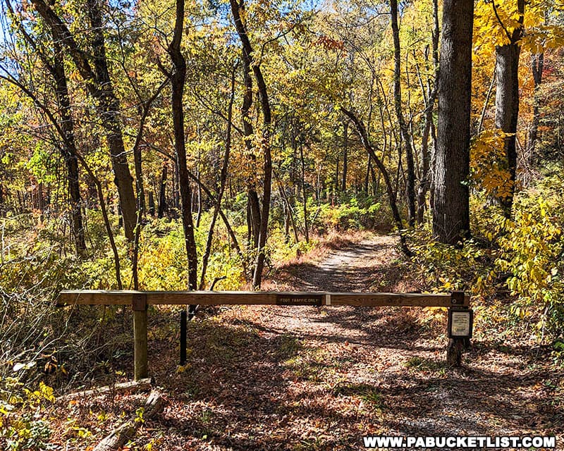
Go around the gate (meant to keep vehicles off the trail) and follow the white-blazed Appalachian Trail southbound for 0.9 miles.
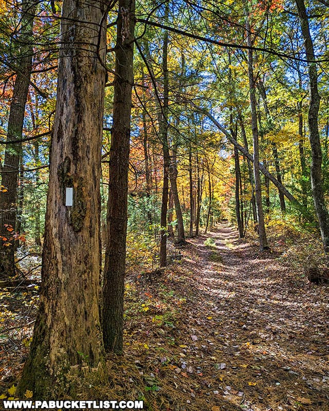
The hike passes through a gorgeous section of the Michaux State Forest, named after the French botanist André Michaux.

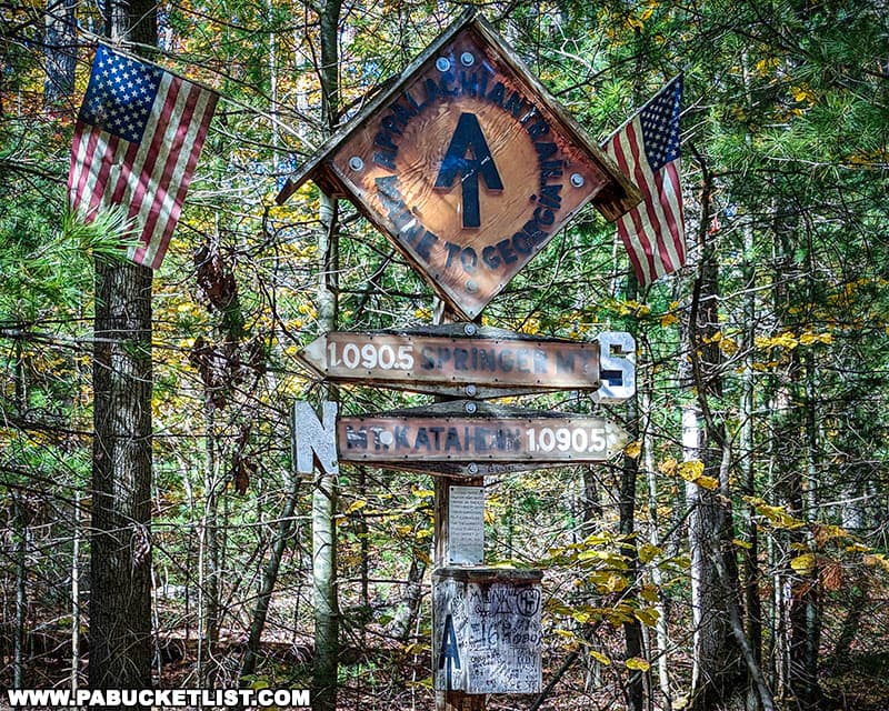
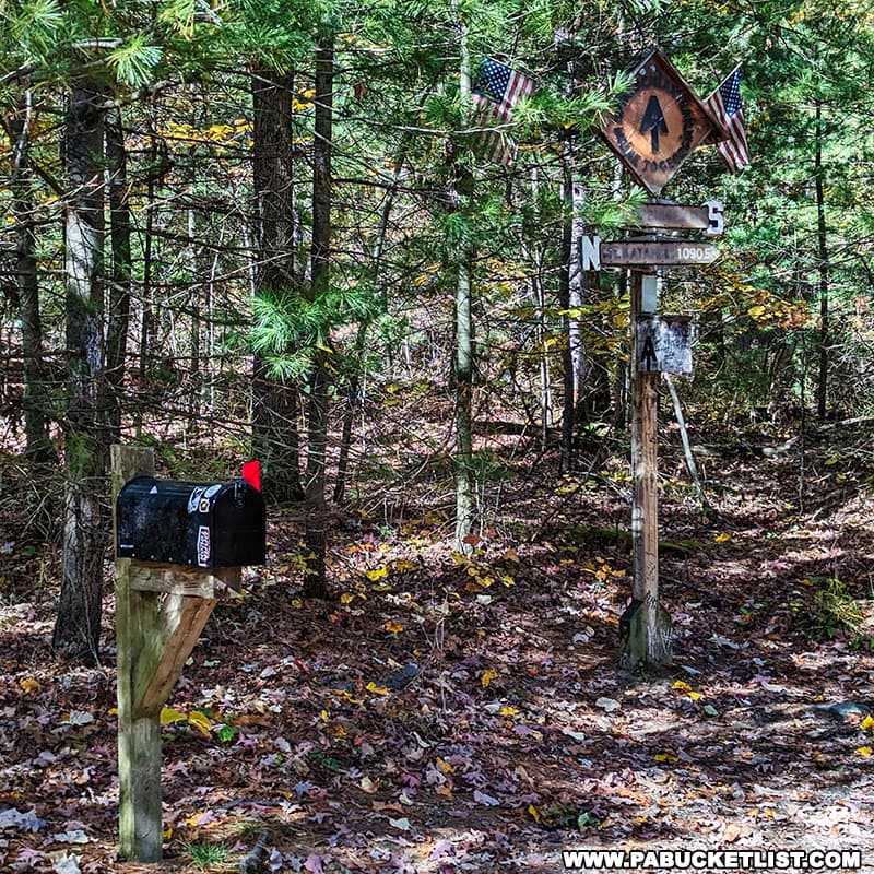
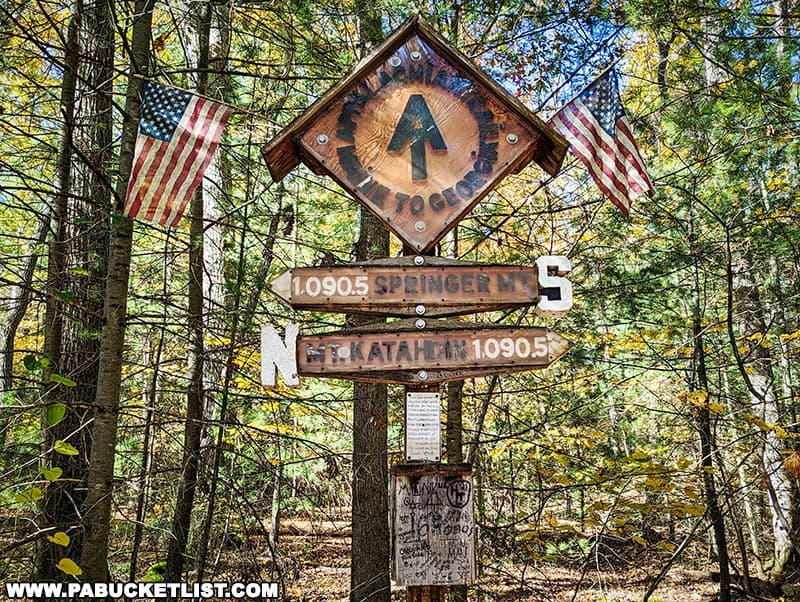
The Appalachian Trail Halfway Point marker and trail register will be on the right side of the trail, (if you’re hiking southbound as described here) at GPS coordinates 40.03661, -77.35732.
The Appalachian Trail Halfway Point Sign
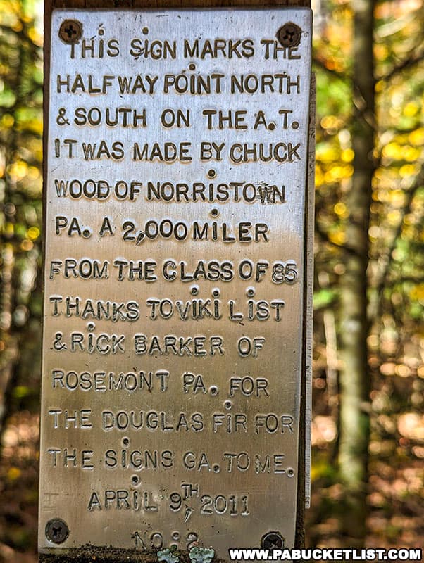
The Appalachian Trail Halfway Point marker was erected in 2011, when the trail was 2,181 miles long.
As mentioned previously, the sign is more symbolic than anything, as trail maintenance, trail reroutes, and changes in easements where the trail crosses private lands mean that the actual length of the Appalachian Trail varies slightly from year to year.
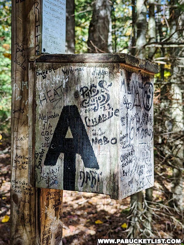
Nevertheless, many through-hikers celebrate reaching this symbolic midpoint of their journey by leaving their mark of the signpost or taking a commemorative photo.
Once you’ve taken your photo next to the signpost (you know you’re going to), simply retrace your steps to the parking area along Michaux Road.

Nearby Attractions
17 Must-See Attractions in Cumberland County showcases more remarkable sights and experiences near the Appalachian Trail Halfway Point.

Explore Pennsylvania like a pro with the interactive PA Bucket List Travel Map, showcasing over 1,000 memorable destinations I’ve personally visited across the Keystone State.
Did you enjoy this article?
If so, be sure to like and follow PA Bucket List on Facebook, Instagram, and/or Pinterest to stay up-to-date on my latest write-ups about the best things to see and do in Pennsylvania!
Click on any of the icons below to get connected to PA Bucket List on social media.