
If you’re looking for directions to Angel Falls in the Loyalsock State Forest, you’re in the right place!
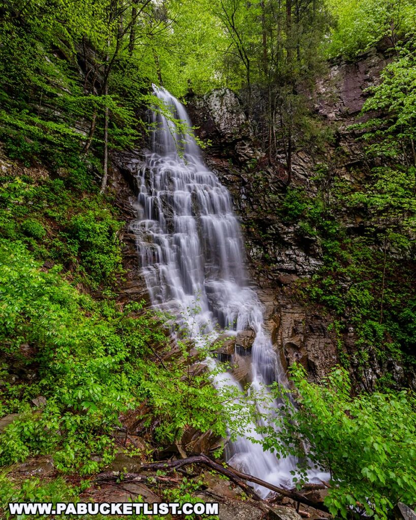
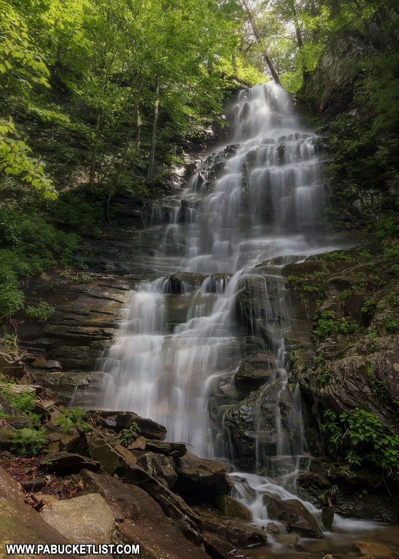
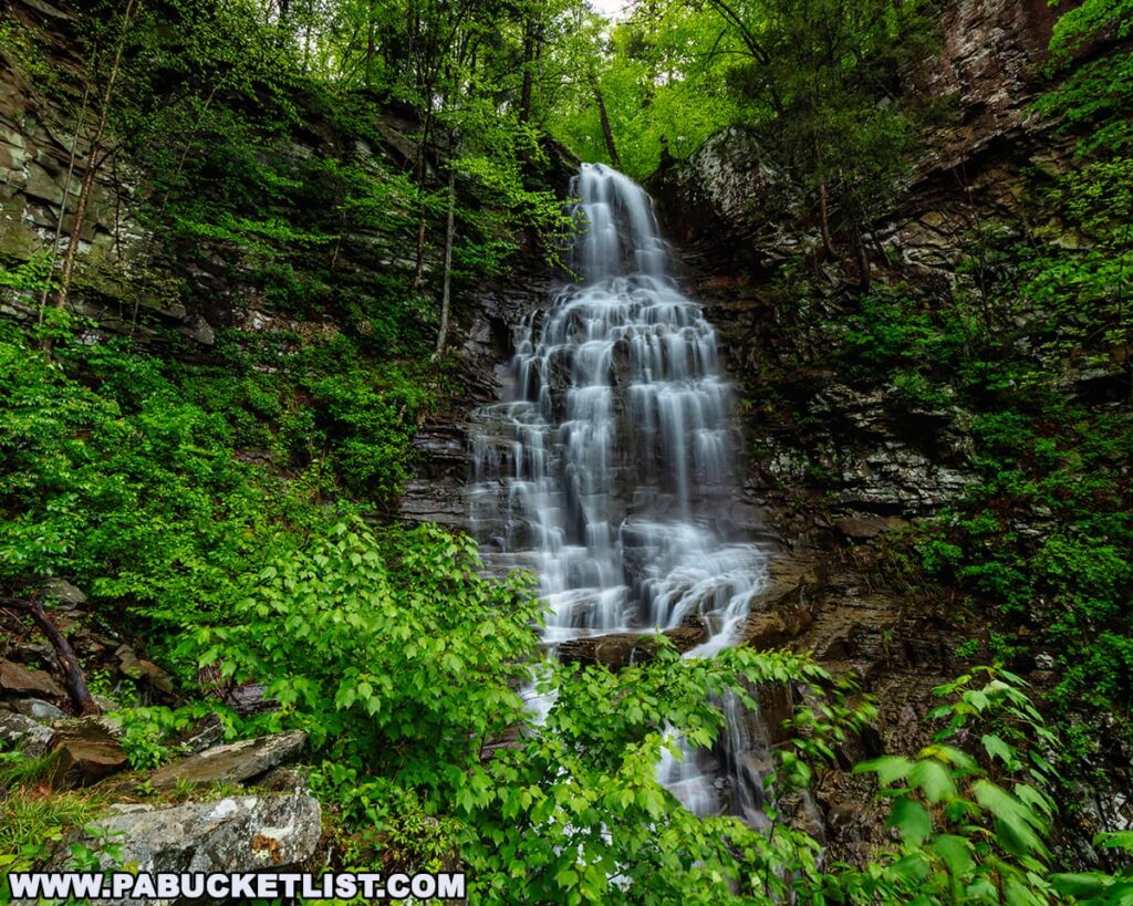
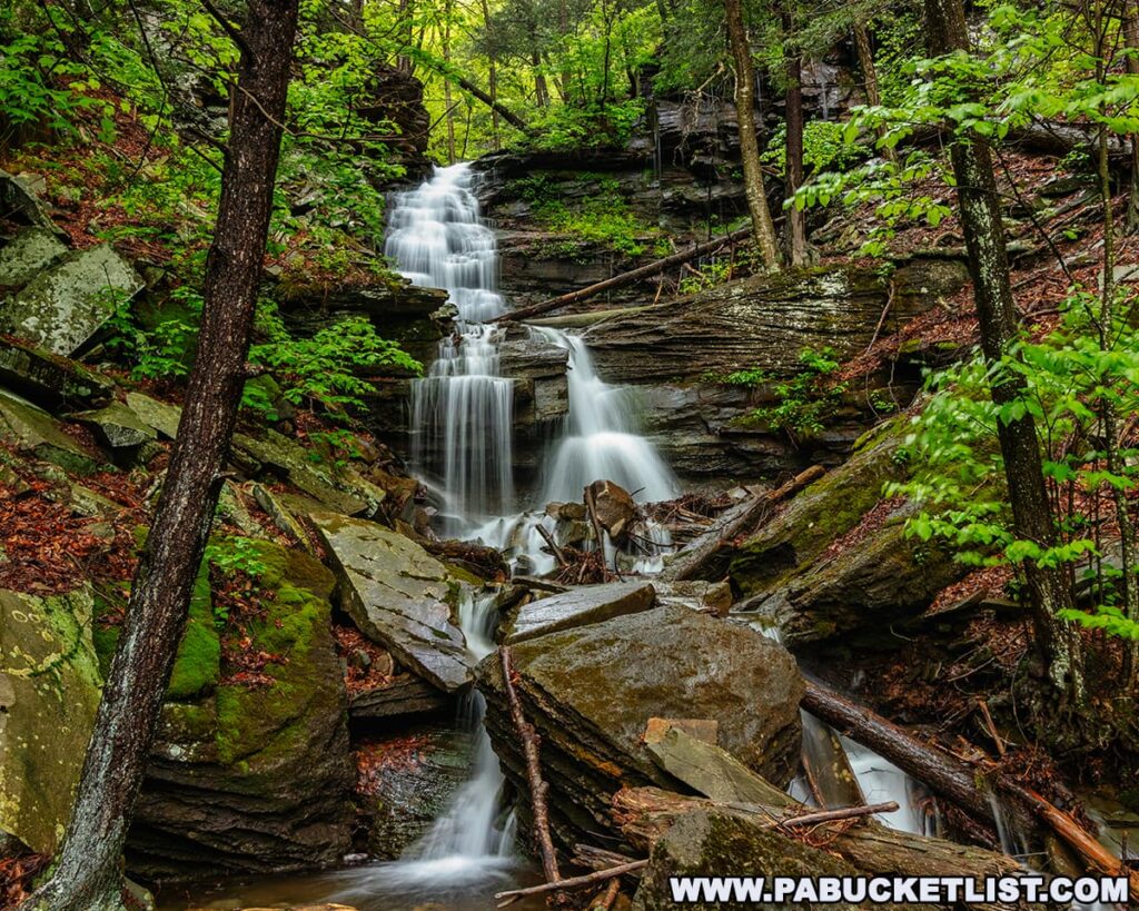
At 70 feet tall, Angel Falls is considered the tallest waterfall in the Loyalsock State Forest.
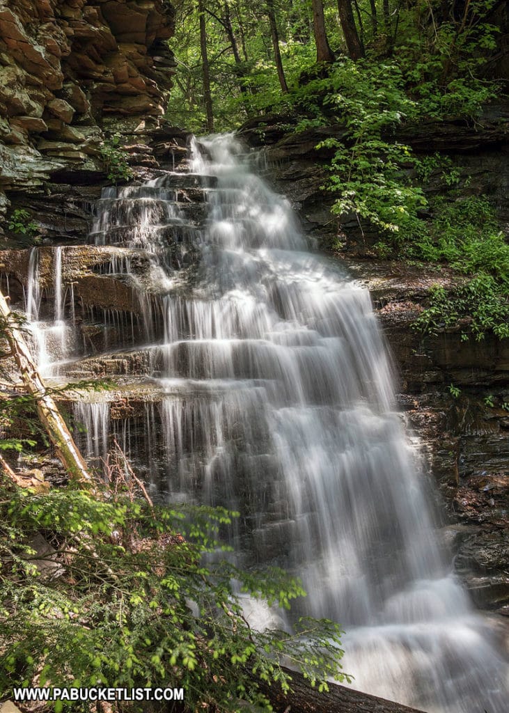
As if that weren’t enough to garner your interest, just below Angel Falls lies Gipson Falls, a fantastic 20-footer in its own right.
Directions to Angel Falls
Thanks to a 2025 reroute of the Loyalsock Trail, getting to Angel Falls (and Gipson Falls right below it) is easier than ever.
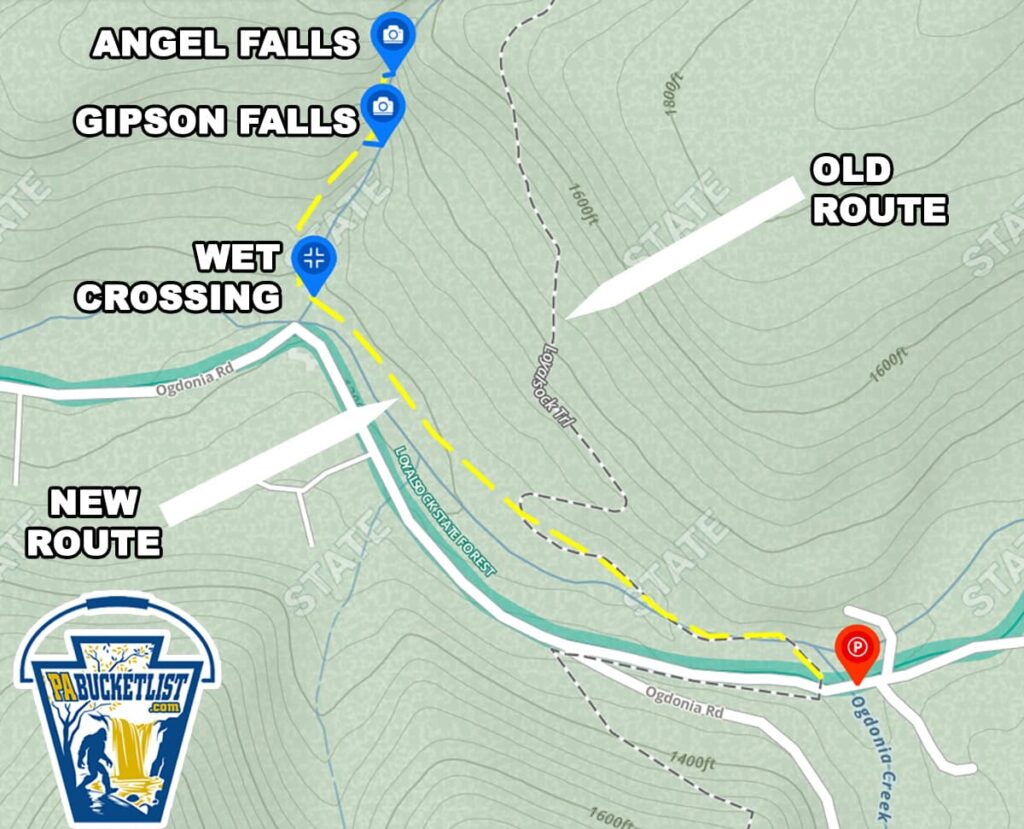
Parking is at the trailhead lot along Brunnerdale Road, pictured below.
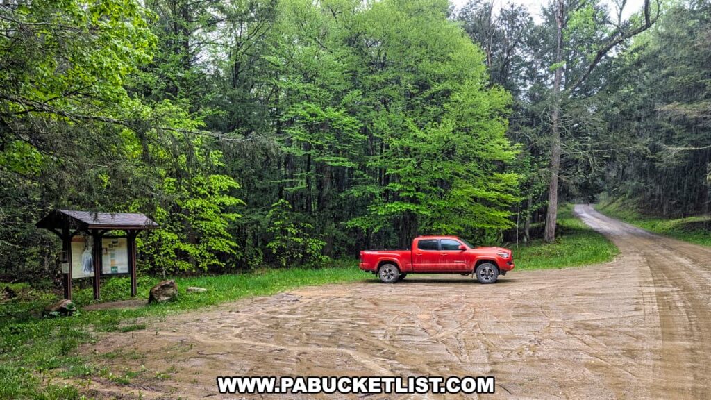
If navigating by GPS coordinates, use 41.38518, -76.66822 to find the parking lot.
From here, it’s a simple 1 mile hike along the Loyalsock Trail to Angel Falls.
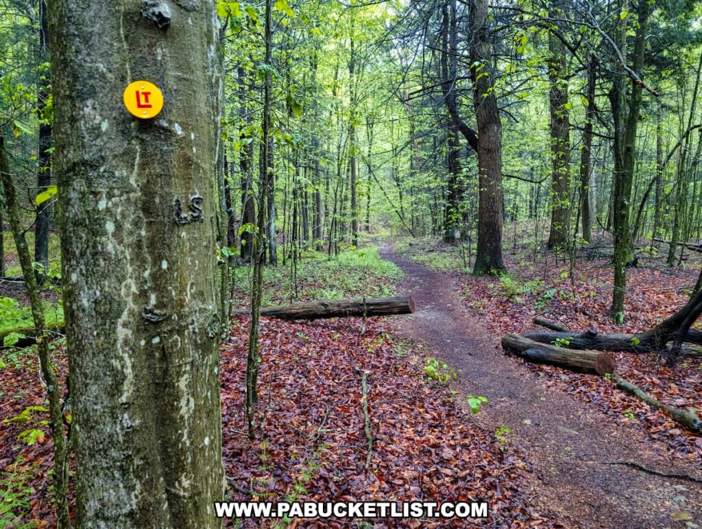
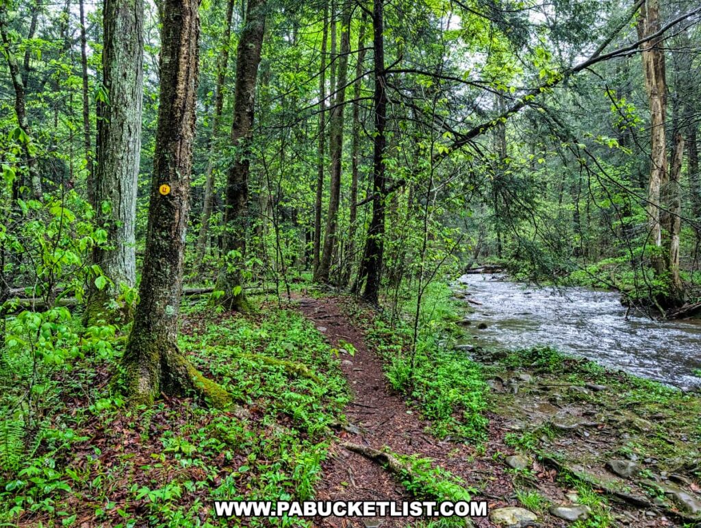
The first 2/3rds of the hike is essentially flat as you follow the Loyalsock Trail along Ogdonia Creek.
At roughly 1/3 of a mile into the hike, you’ll be directed onto the new, rerouted version of the Loyalsock Trail.
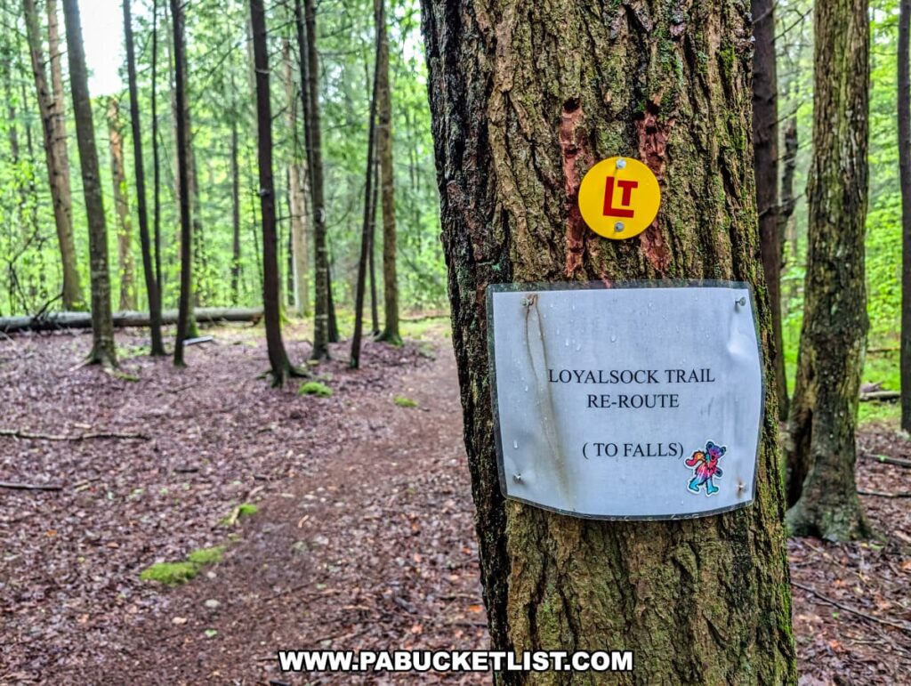
You’ll continue along the LT for another 1/3 of a mile until you reach a wet crossing (pictured below) of Falls Run.
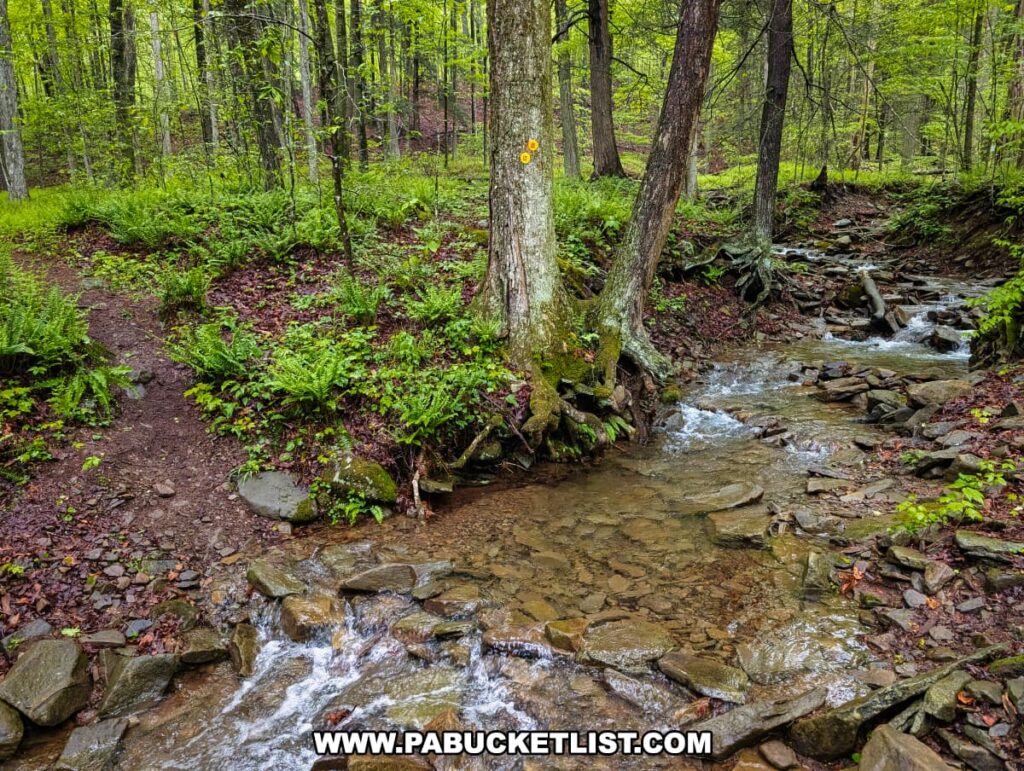
From here, you’ll hike the final 1/3rd of a mile uphill, climbing along Falls Run to reach Angel Falls.
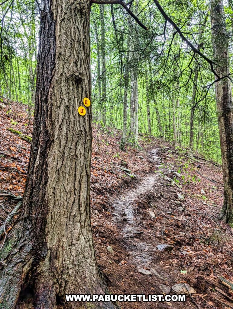
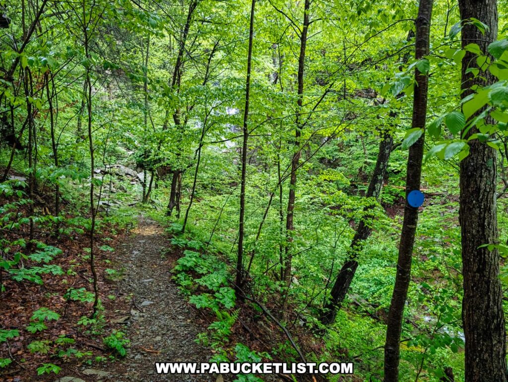
Both Gipson Falls and Angel Falls above it are marked with blue spur trail markers along the LT.
On my most recent visit I elected to visit Angel Falls first, stopping at Gipson Falls to my way back down the trail.
No matter which order you do them in, make sure to visit both.
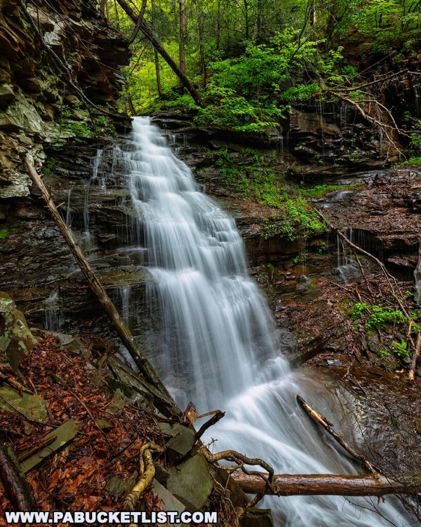
Exploring Angel Falls
Officially, Angel Falls is listed at 70 feet tall.

Let me tell you – when you’re standing at the base it feels taller than that!
It’s hard to catch Angel Falls raging unless you time things just right- during the spring thaw or after a hard summer rain are your best bets.
It’s difficult to fit the entirety of Angel Falls into a single photo, unless you are using a wide angle lens.
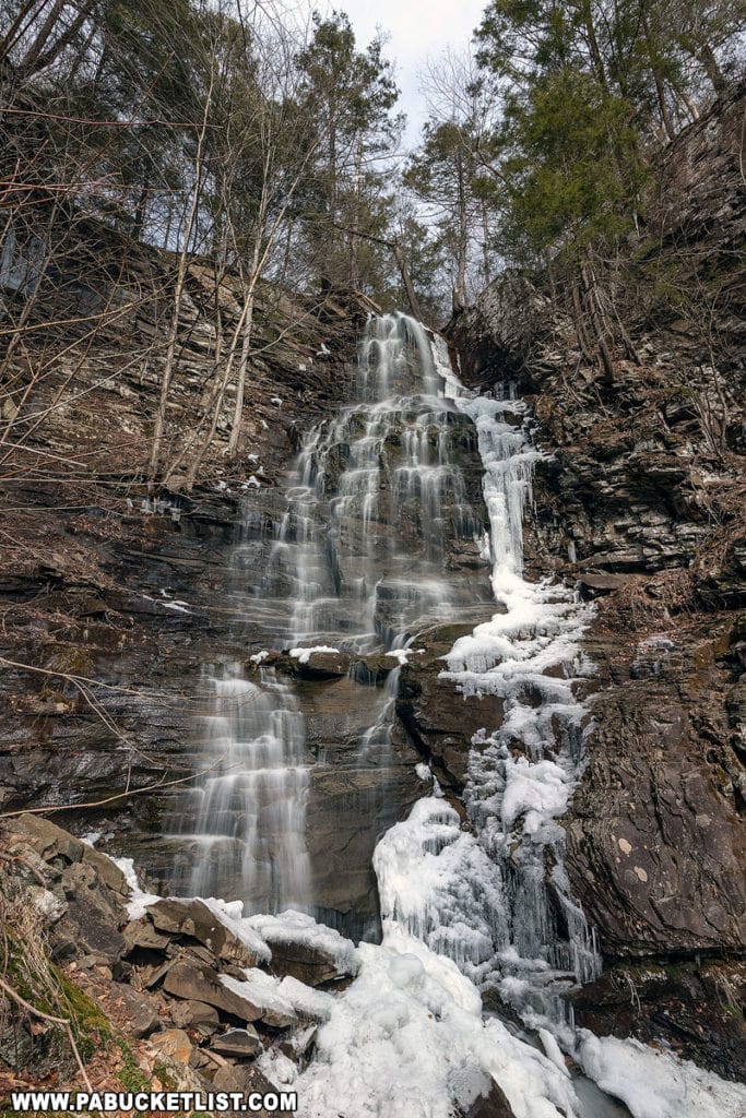
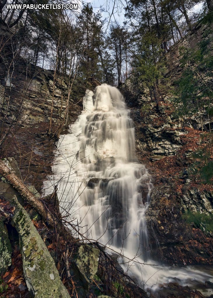
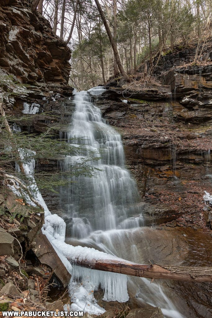
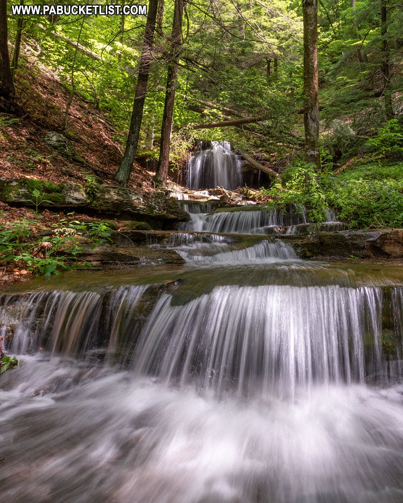
Exploring Gipson Falls
The downstream view of Gipson Falls is striking.
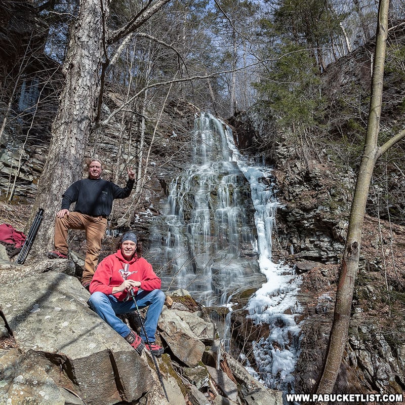
This is an excellent winter waterfall as you get some outstanding ice formations in the Falls Run Gorge.
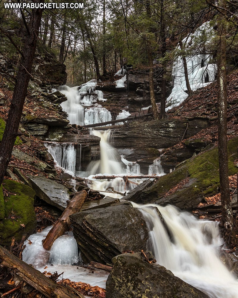
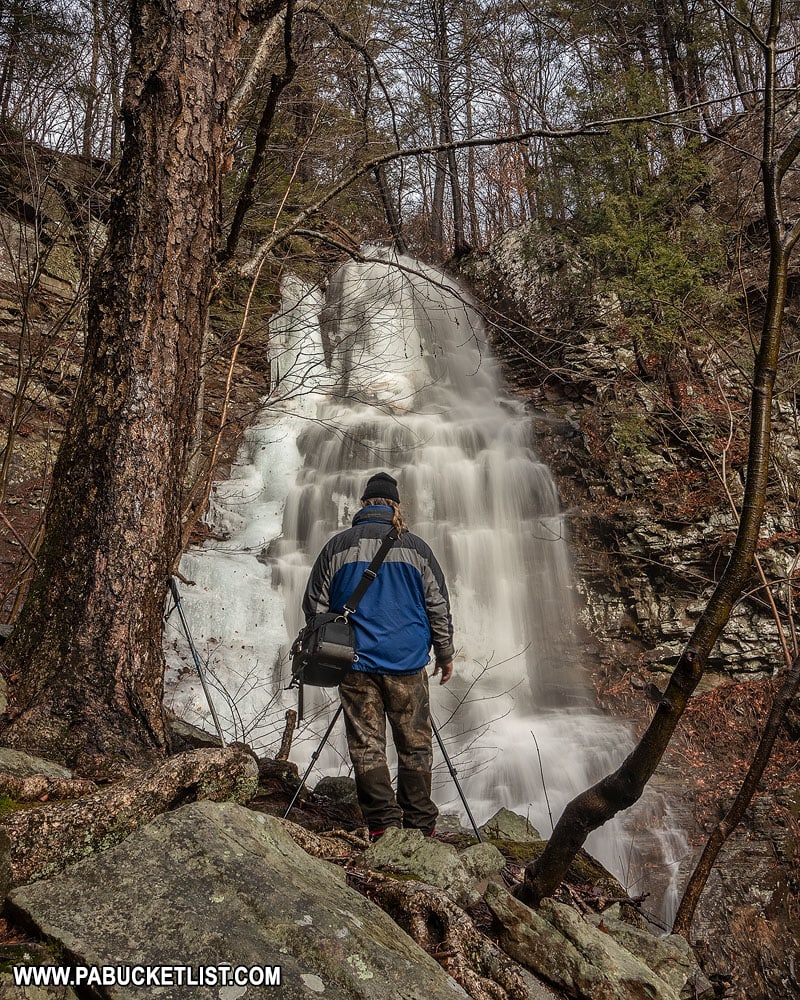
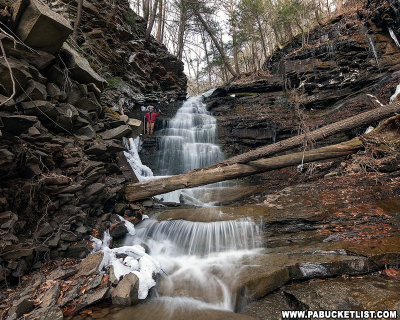
When you finally get up close to Gipson Falls, you realize it’s every bit of 20 feet tall.
Here’s my hiking buddy Steve standing on the left side of the falls for scale.
There are also some picturesque cascades just below Gipson Falls; if you have the time, they’re worth checking out.
When you’ve had your fill of Angel Falls and Gipson Falls, simply retrace your steps along the Loyalsock Trail, back to the parking area along Brunnerdale Road.
Related Attractions
20 Must See Pennsylvania Waterfalls highlights twenty of the most picturesque waterfalls in Pennsylvania, all personally visited and photographed during my travels across the Keystone State.

Nearby Attractions
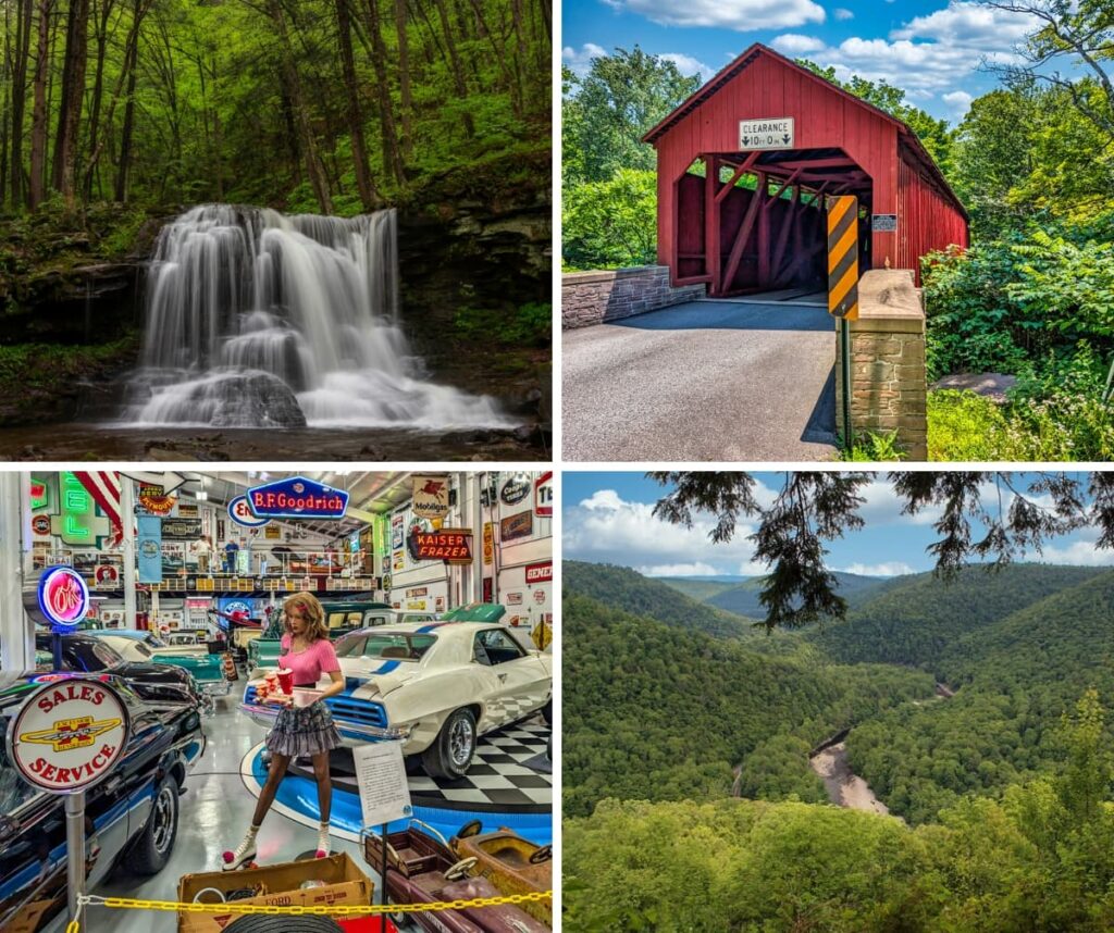
9 Must-See Attractions in Sullivan County showcases more remarkable sights and experiences near Angel Falls.
A Smarter Way to Explore Pennsylvania
Explore Pennsylvania like a pro with the interactive PA Bucket List Travel Map, showcasing over 1,000 memorable destinations I’ve personally visited across the Keystone State.
Did you enjoy this article?
If so, be sure to like and follow PA Bucket List on Facebook, Instagram, and/or Pinterest to learn more about the best things to see and do in Pennsylvania!
Click on any of the icons below to connect with PA Bucket List on social media.