
If you’re looking for information about McGees Mills Covered Bridge in Clearfield County, you’re in the right place!
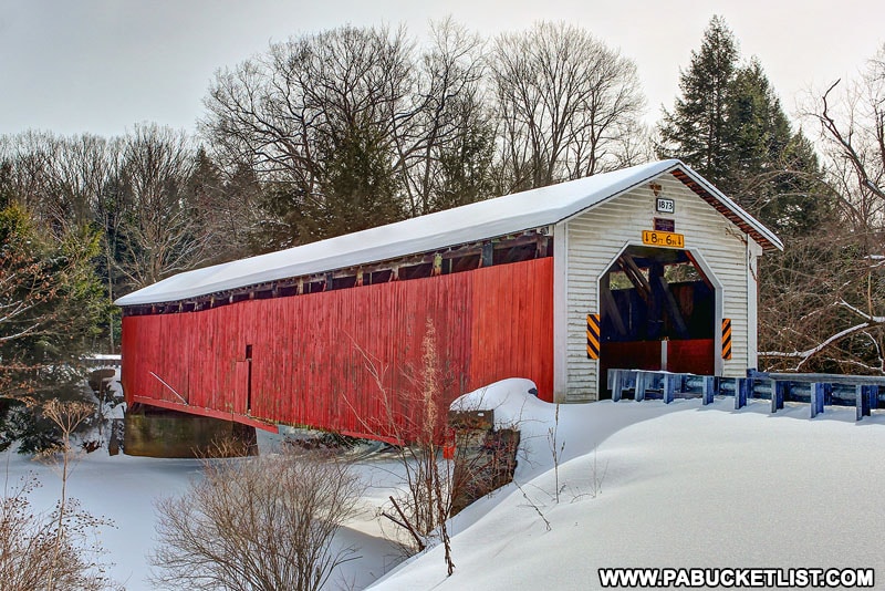
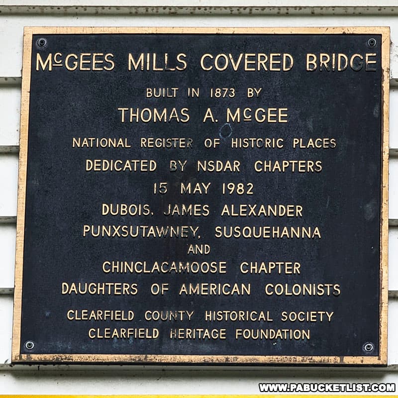
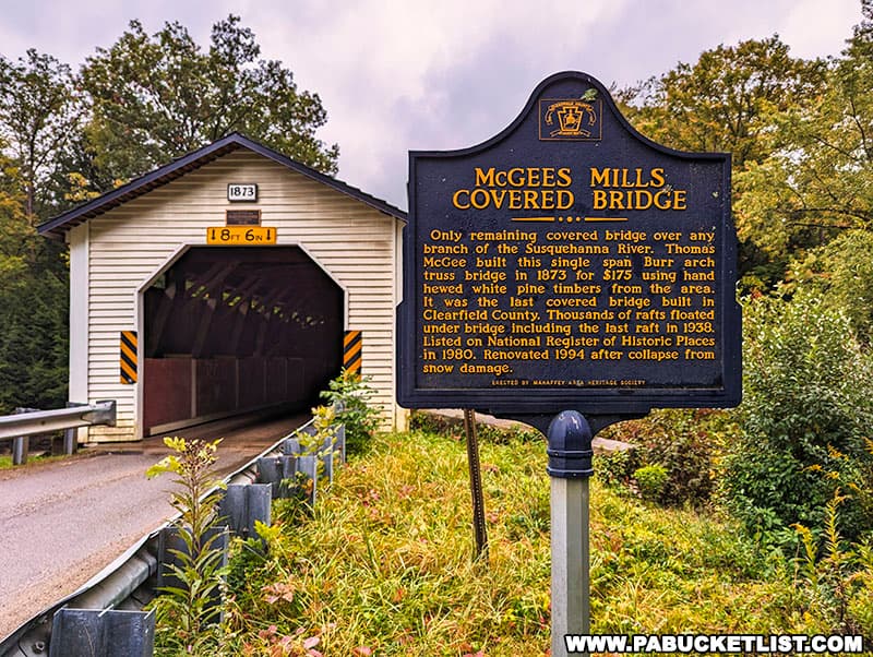
McGees Mills Covered Bridge is the last remaining historic covered bridge in Clearfield County.
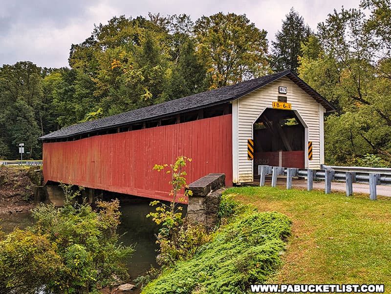
It’s also the only remaining covered bridge over ANY branch of the Susquehanna River.
McGees Mills Covered Bridge FAQ
It was built in 1873 by Thomas McGee.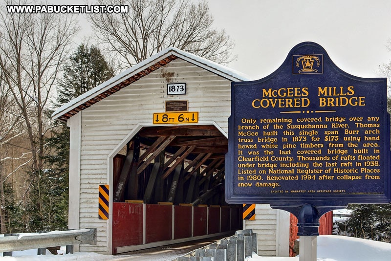
Yes – use coordinates 40.88001, -78.76530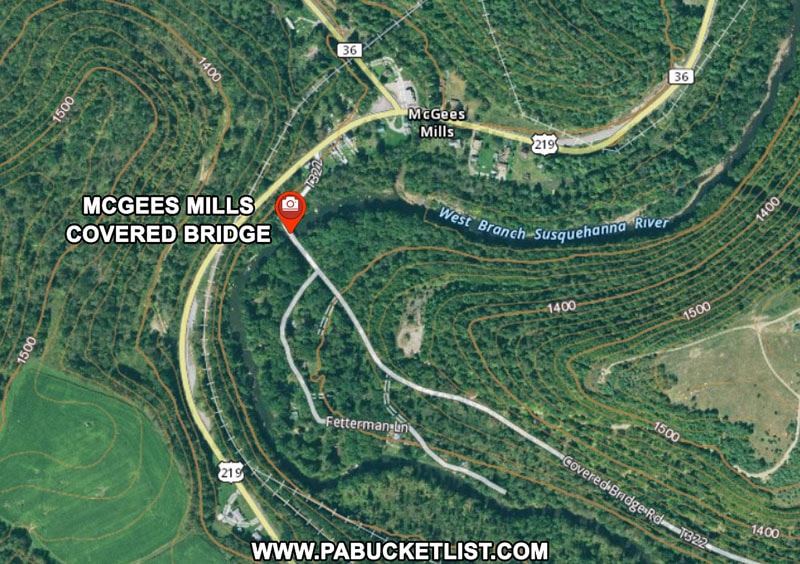
116 feet long.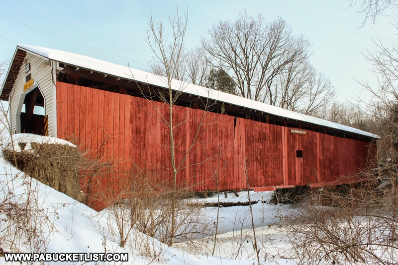
Burr Arch trusses.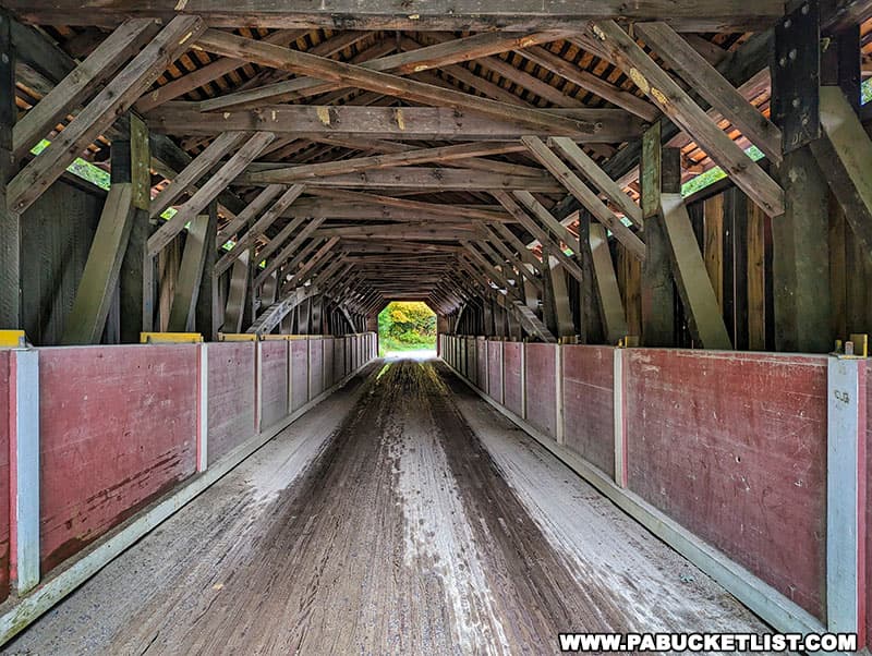
1980.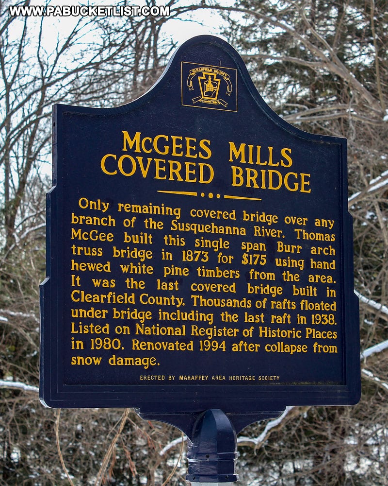
West Branch of the Susquehanna River.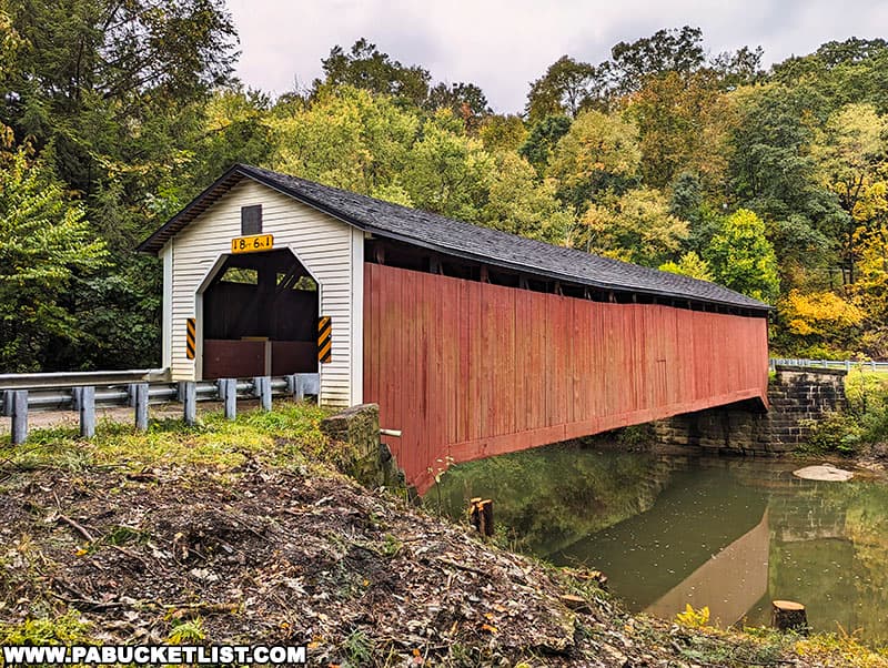
Yes – here is how it looked in 1972, nearly 100 years after initial construction.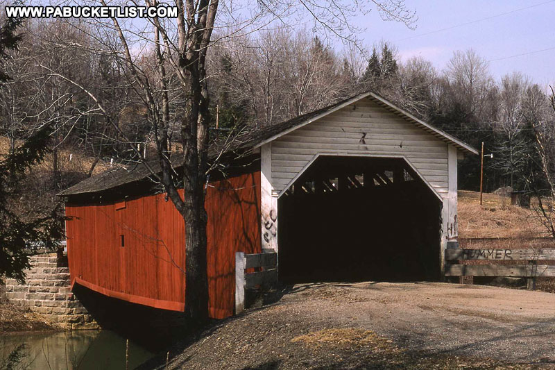
WGCB 38-17-01 (World Guide to Covered Bridges number)
NRHP 80003475 (National Register of Historic Places reference number)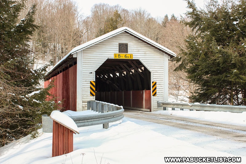
Yes – Covered Bridge Road passes through the bridge and is open to vehicular traffic.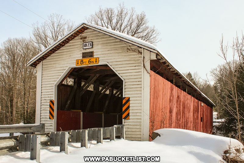
How to Find McGees Mills Covered Bridge
McGees Mills Covered Bridge is located just off of Route 219 along Covered Bridge Road.
There is ample pull-off parking along Covered Bridge Road on the northwest side of the bridge
There’s also a small parklet on that same side of the river, adjacent to the bridge.
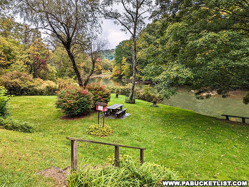
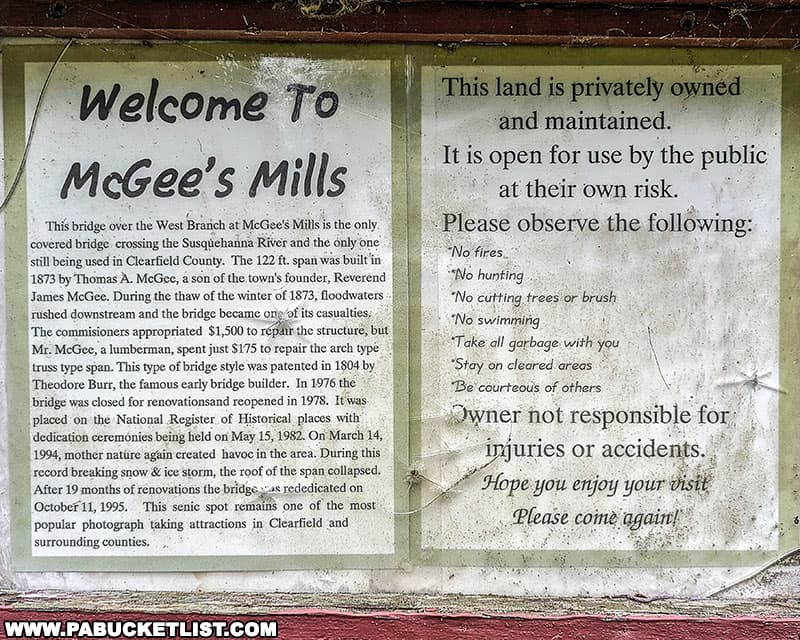
Here you’ll find a small informational kisok with a history of the bridge, in addition to a picnic table and some riverside benches.
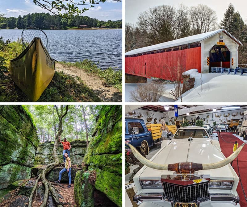
Nearby Attractions
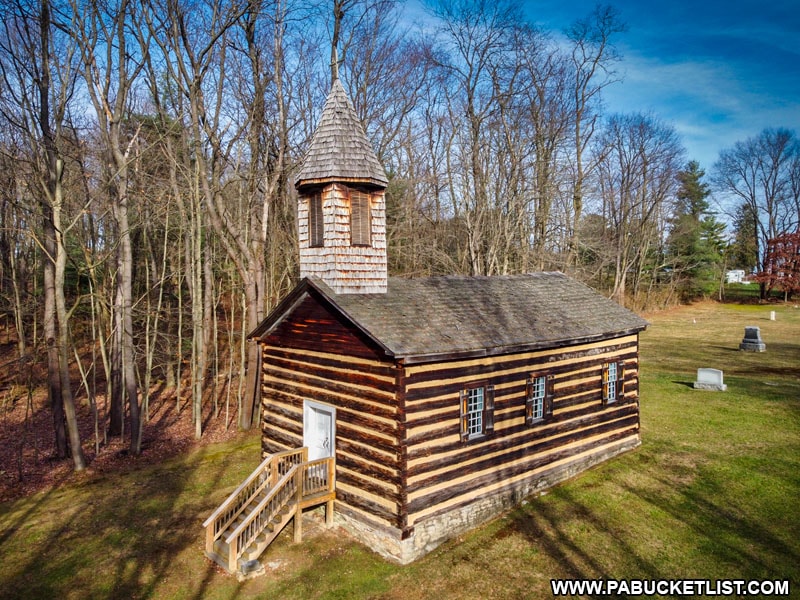
The Saint Severin Old Log Church in Clearfield County is one of the best-preserved mid-19th century churches in Pennsylvania.
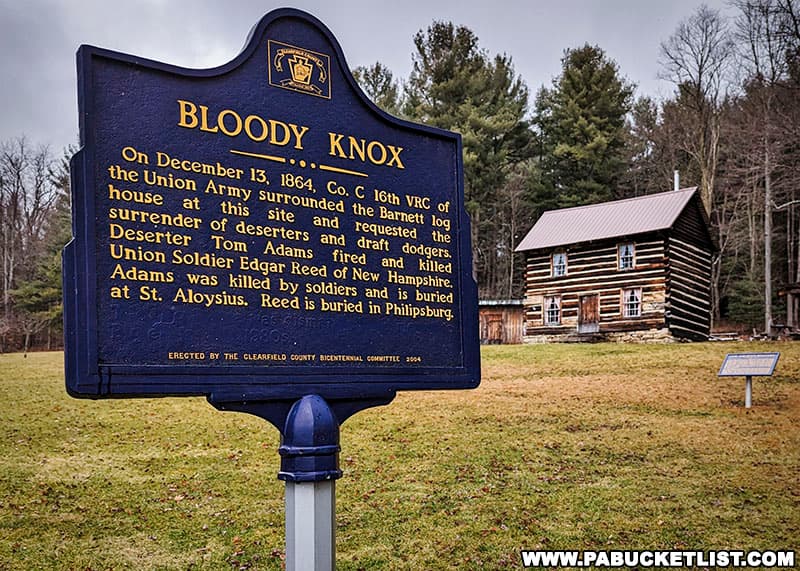
The Bloody Knox Cabin in Clearfield County was the scene of a Civil War skirmish between Union soldiers and Union deserters and draft dodgers that left 2 men dead, one on each side of the shoot-out.
10 Must-See Attractions in Clearfield County is your guide to even more great things to see and do in Clearfield County!
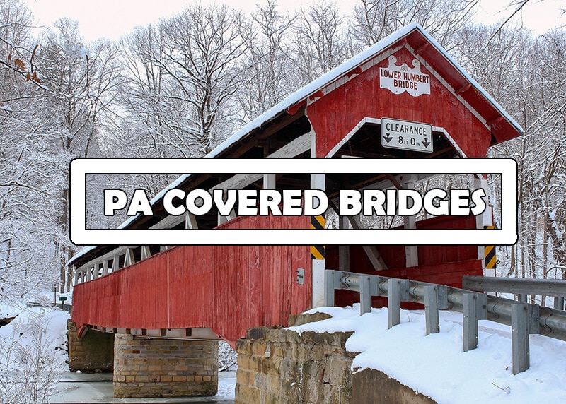
Looking for more Pennsylvania Covered Bridges?
Then be sure to check out the Covered Bridges page here on PABucketlist.com!
Did you enjoy this article?
If so, be sure to like and follow PA Bucket List on Facebook, Instagram, and/or Pinterest to stay up-to-date on my latest write-ups about the best things to see and do in Pennsylvania!
Click on any of the icons below to get connected to PA Bucket List on social media.