
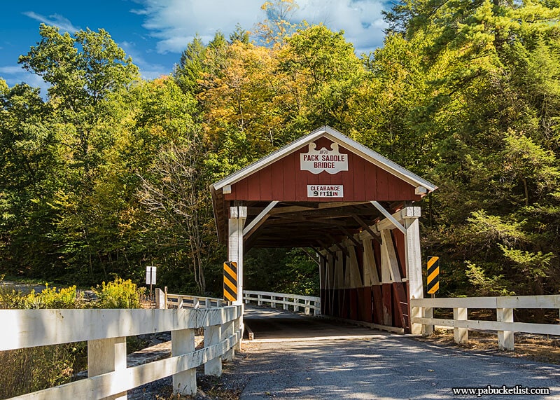
If you’re looking for information about visiting the Pack Saddle Covered Bridge in Somerset County, you’re in the right place!
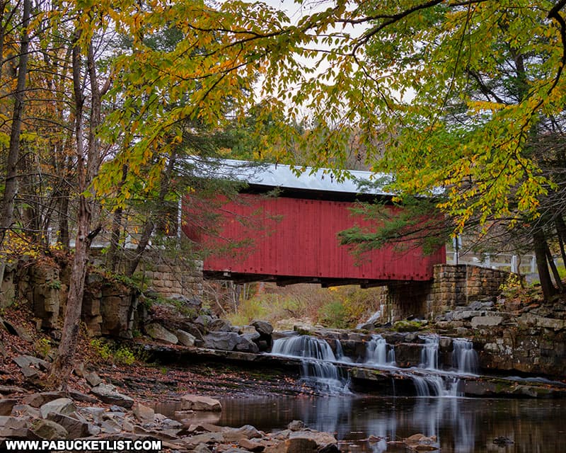
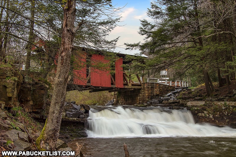
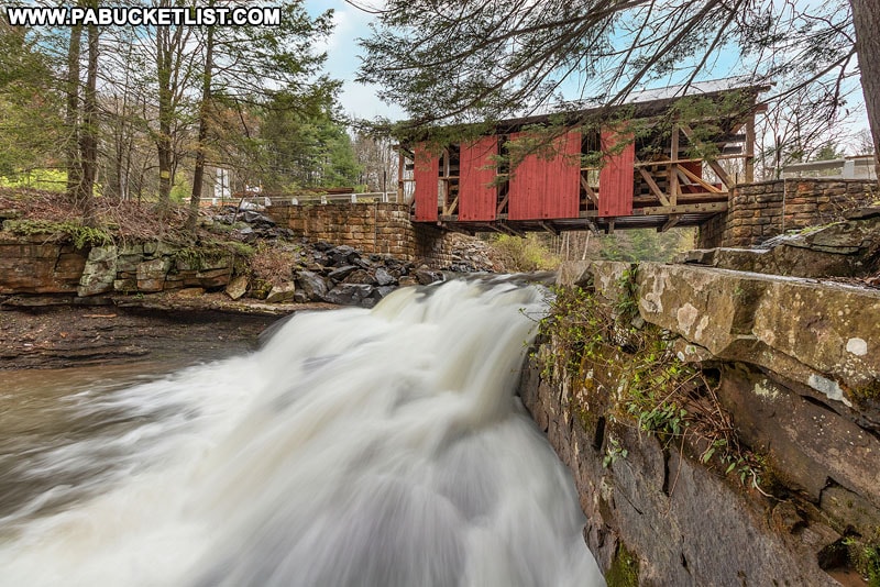
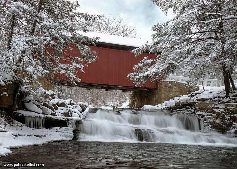
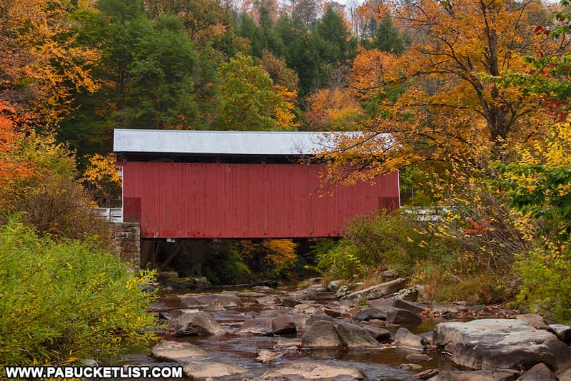
The Pack Saddle Bridge is famous for being the only covered bridge in Pennsylvania built over a natural waterfall.
Directions to the Pack Saddle Bridge
The Pack Saddle Bridge is located roughly 6 miles south of Route 31, along Pack Saddle Road.
If navigating by GPS, use coordinates 39.867592, -78.817354 to find the bridge.
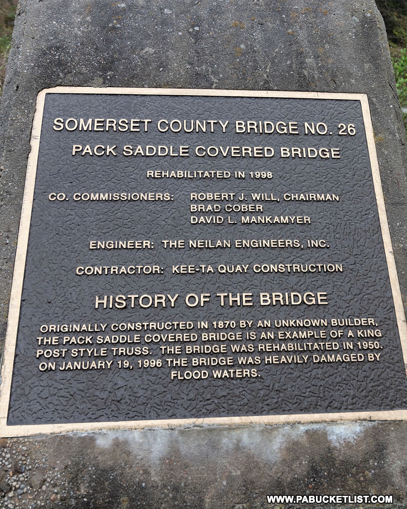
History of the Pack Saddle Bridge
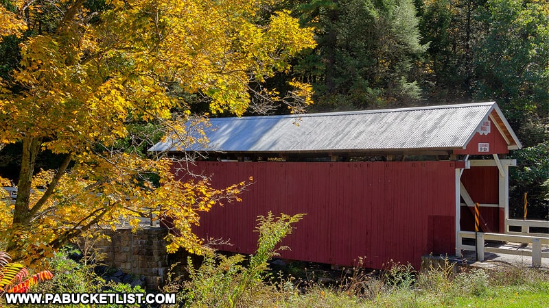
Built in 1870 by an unknown builder, the Pack Saddle Bridge is one of the most-picturesque and most-photographed spots in the PA Laurel Highlands.

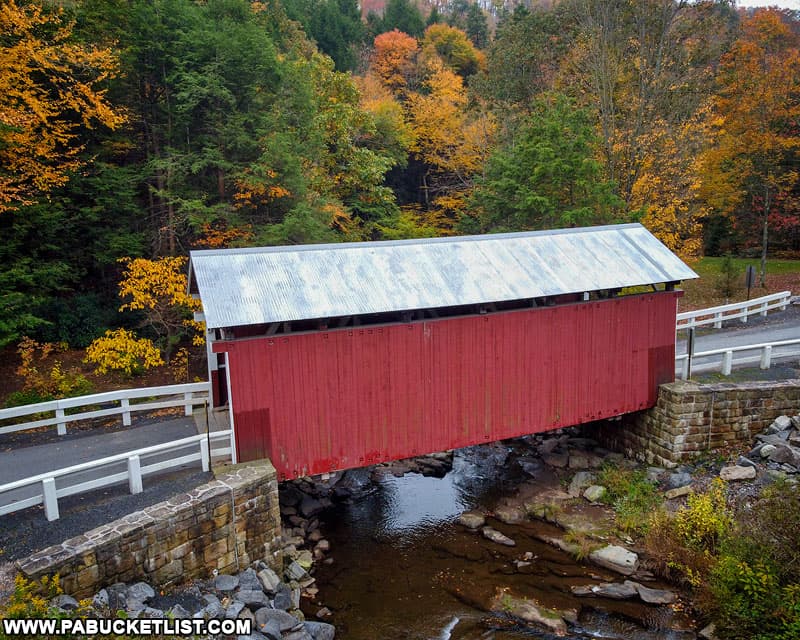
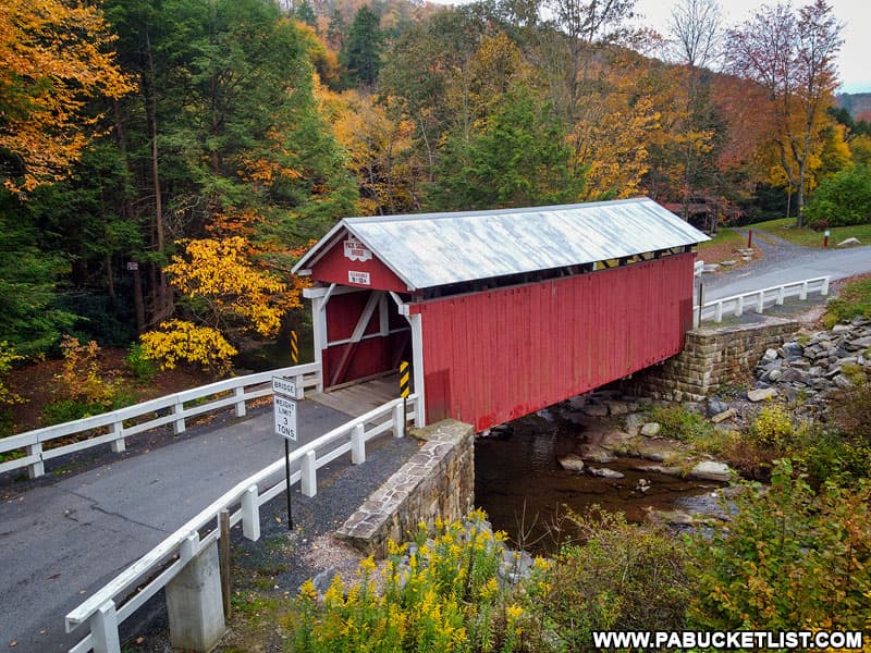
At 48 feet long, it is the shortest of the 10 covered bridges in Somerset County.
The bridge utilizes King Post style trusses in its construction.
An informational plaque is located near the eastern end of the bridge.
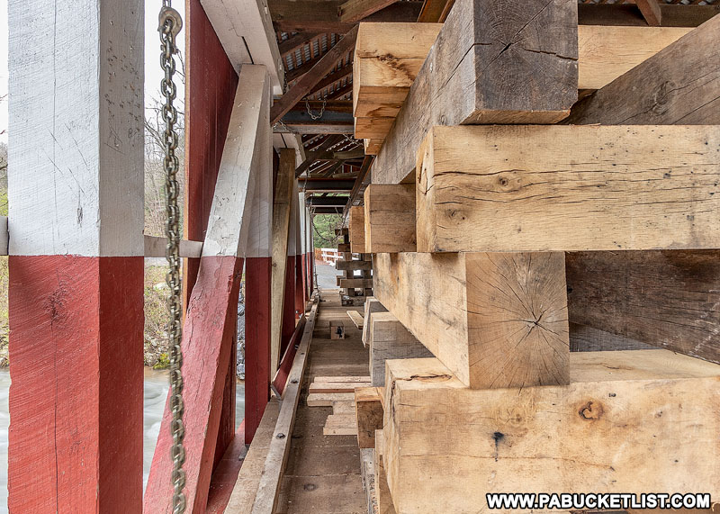
An extensive rehabilitation project took place at the Pack Saddle Bridge in April/May of 2020.
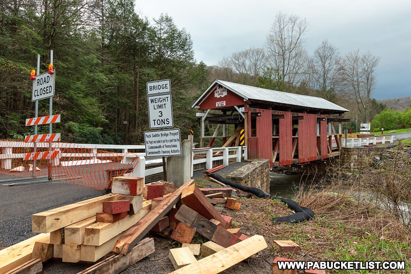
The Pack Saddle Covered Bridge had suffered a considerable amount of insect damage in recent years.
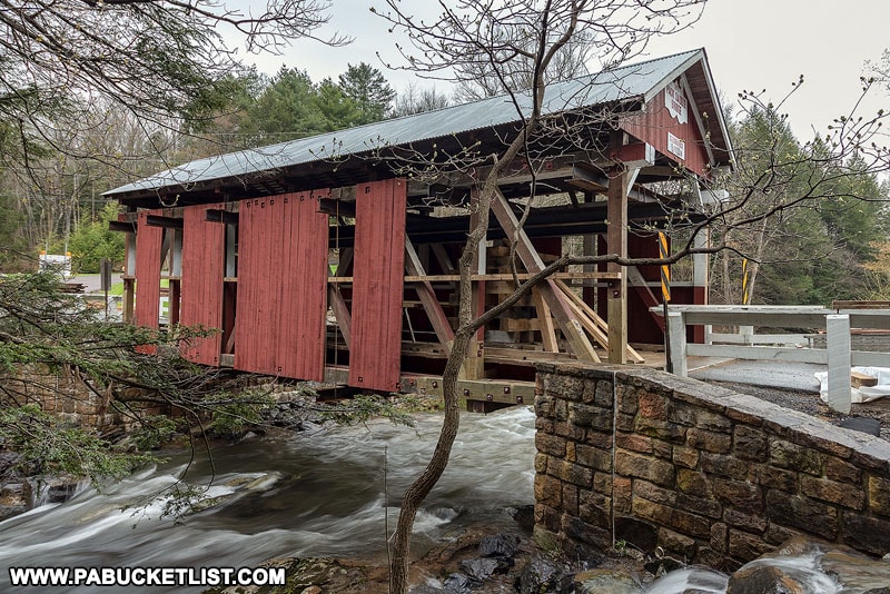
The fact that this bridge is used for everyday vehicular traffic made the repairs a matter of public safety.
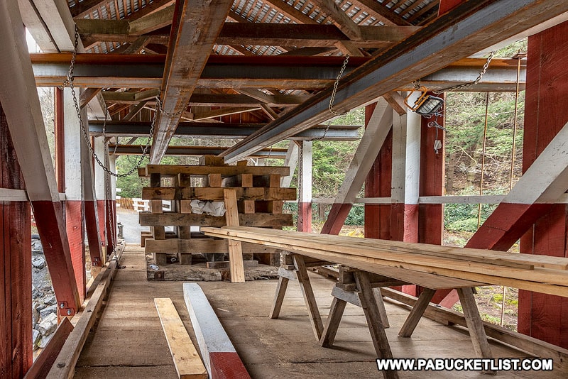
Thankfully, the repairs were made with the original aesthetics and historical authenticity in mind as well.
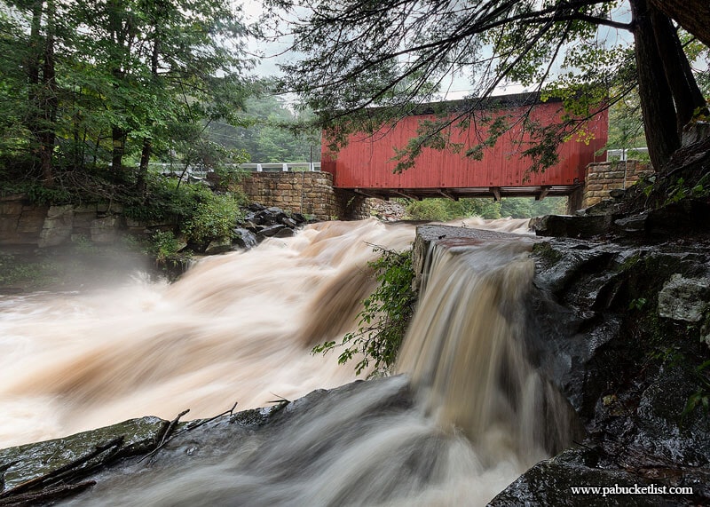
Photos of the waterfalls beneath the Pack Saddle Bridge looked a little strange in the interim.
Although I admit as a photographer, having the chance to document such an historic event was exciting.
What You’ll See at the Pack Saddle Bridge
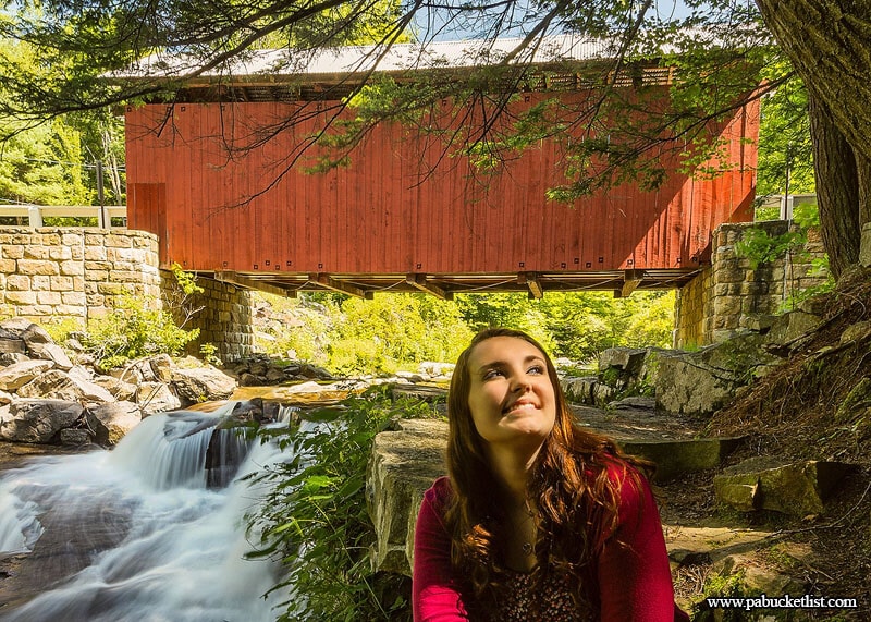
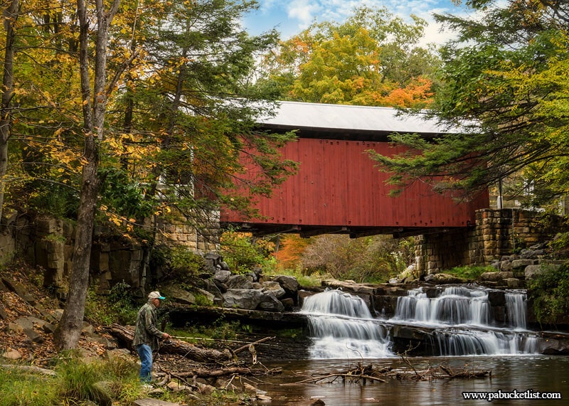
The downstream view of the bridge, framed by sky, hemlocks, and waterfalls, sets the Pack Saddle Bridge apart from every other covered bridge in Pennsylvania.
That also makes it a tremendously popular setting for senior portraits and engagement photos.
The large pool of water below the Pack Saddle Bridge is also makes it a popular local fishing hole.
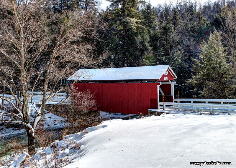
Even from above, the Pack Saddle Bridge is magnificent!
The Pack Saddle Bridge Mystique
For nearly 150 years, the Pack Saddle Bridge has been both a practical necessity as a creek crossing in the area, as well as a source of identity and pride in the Laurel Highlands.
Whether the unknown builder intentionally laid this bridge out with aesthetics in mind, we’ll never know.
But certainly all who have stopped to gaze upon the bridge, or cast a line beneath it, or snap a photo of it owe a debt of gratitude to the builders of the Pack Saddle Covered Bridge, perhaps Pennsylvania’s most beautiful covered bridge!

Related Attractions
Exploring PA’s Record-Holding Covered Bridges and Unique Spans highlights Pennsylvania covered bridges that each hold a unique record, whether for length, design, or historic distinction.
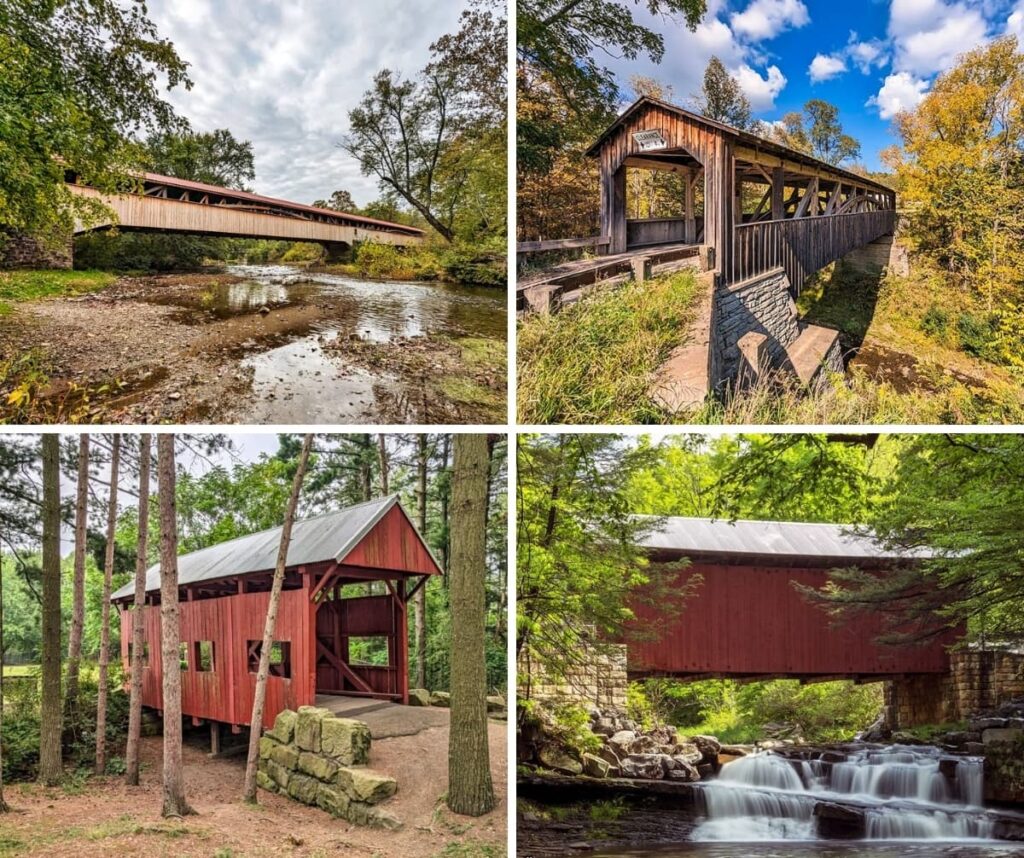
Exploring the Covered Bridges of Somerset County showcases all 10 historic covered bridges in Somerset County.

Nearby Attractions
25 Must-See Attractions in Somerset County showcases more remarkable sights and experiences near the Pack Saddle Bridge.
A Smarter Way to Explore Pennsylvania
Explore Pennsylvania like a pro with the interactive PA Bucket List Travel Map, showcasing over 1,000 memorable destinations I’ve personally visited across the Keystone State.
Did you enjoy this article?
If so, be sure to like and follow PA Bucket List on Facebook, Instagram, and/or Pinterest to stay up-to-date on my latest write-ups about the best things to see and do in Pennsylvania!
Click on any of the icons below to get connected to PA Bucket List on social media.