Exploring the Covered Bridges of Somerset County

Fall foliage at Walters Mill Covered Bridge in Somerset County PA

If you’re looking for directions to all 10 historic covered bridges in Somerset County, Pennsylvania, you’ve landed in the right place!

Shaffer Covered Bridge in Somerset County Pennsylvania.
Shaffer Covered Bridge in Somerset County.

This article provides you with maps, photos, and descriptions of all 10 Somerset County covered bridges.

Driving directions to all ten Somerset County Pennsylvania covered bridges.
Driving directions to all ten Somerset County, Pennsylvania covered bridges.

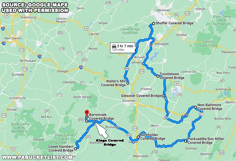
I’ve even created a downloadable version of this route on Google maps, to help you easily navigate this road trip.


Click on the blue text links to view more in-depth articles about the bridges mentioned below.

Aerial front view of the Barronvale Covered Bridge in Somerset County PA

And above all – enjoy this road trip to see all 10 Somerset County covered bridges!

Aerial side view of Kings Covered Bridge in September 2020.
Aerial view of Kings Covered Bridge in Somerset County, PA.

1. Walter’s Mill Covered Bridge

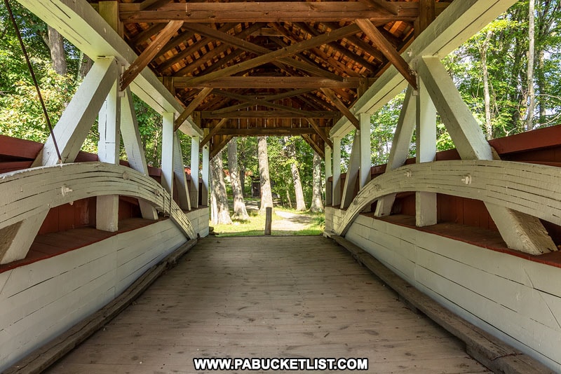
Walter’s Mill Covered Bridge was built in 1859 and originally spanned Coxes Creek, 4 miles south of Somerset.

Walters Mill Covered Bridge in Somerset County Pennsylvania.
Walter’s Mill Covered Bridge.

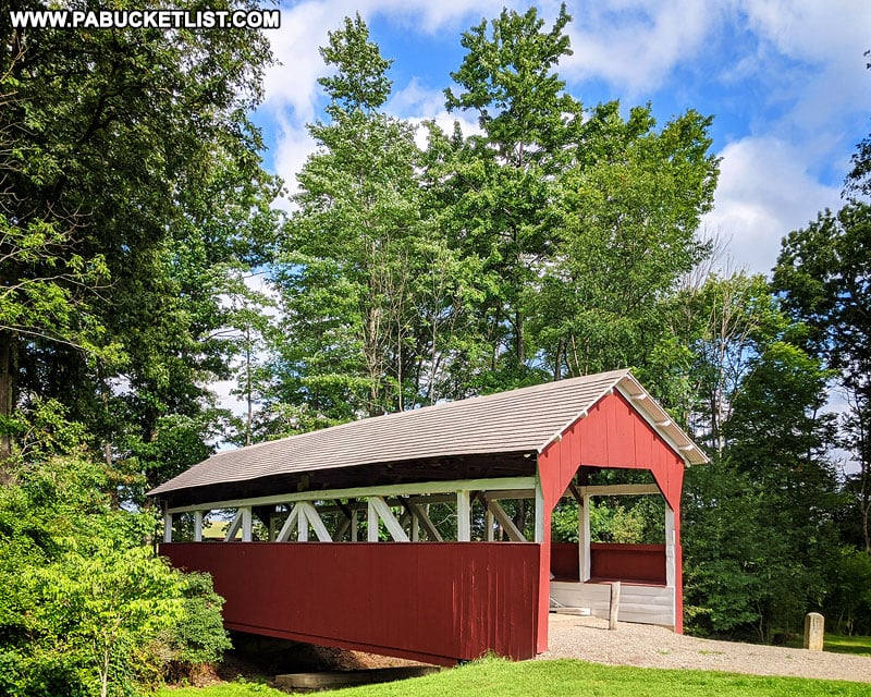
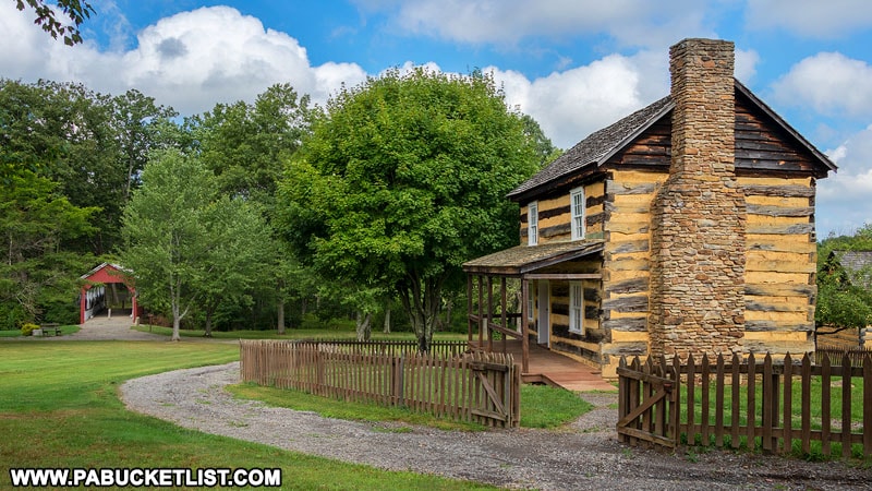
In the 1960s the bridge was relocated to the grounds of the Somerset Historical Center (to avoid demolition) and now spans Haupts Run.

Walters Mill Covered Bridge at the Somerset Historical Society grounds.
Walter’s Mill Covered Bridge at the Somerset Historical Center grounds.

The bridge is 60 feet long and features Burr arches trusses in its construction, which were added to its original Multiple Kingpost trusses in 1908 to strengthen the bridge to accommodate automobile traffic.

Interior of Walters Mill Covered Bridge in Somerset County PA
Interior of Walter’s Mill Covered Bridge.

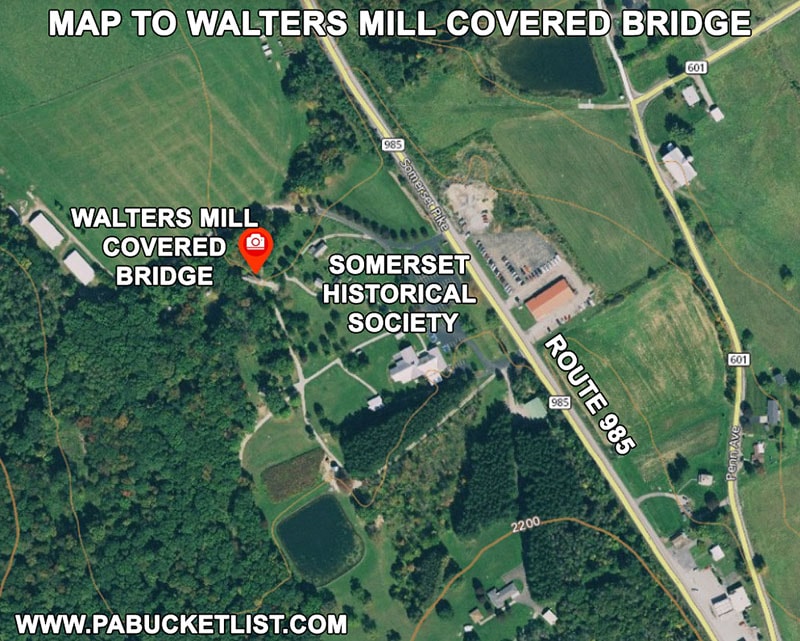
Walter’s Mill Covered Bridge is located at GPS coordinates 40.07100, -79.08282, on the grounds of the Somerset Historical Center, as mentioned earlier.

Map to Walters Mill Covered Bridge in Somerset County Pennsylvania.
Map to Walter’s Mill Covered Bridge.

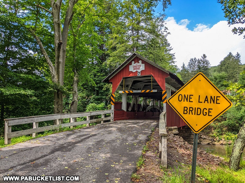
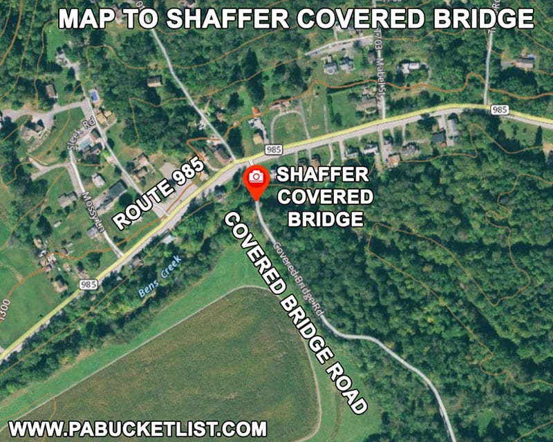
2. Shaffer Covered Bridge

Shaffer Covered Bridge was built in 1877 by William Kline, and is still open to vehicular traffic.

Front view of Shaffer Covered Bridge in Somerset County Pennsylvania.
Front view of Shaffer Covered Bridge

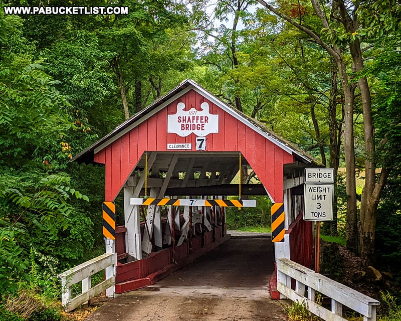
The bridge is 68 feet long and spans Bens Creek.

Side view of Shaffer Covered Bridge in Somerset County Pennsylvania.
Side view of Shaffer Covered Bridge over Bens Creek.

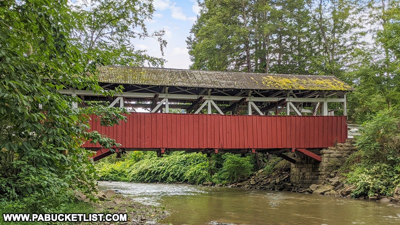
Shaffer Covered Bridge utilizes a single span Burr arch truss structure.

Interior of Shaffer Covered Bridge in Somerset COunty PA.
Interior of Shaffer Covered Bridge.

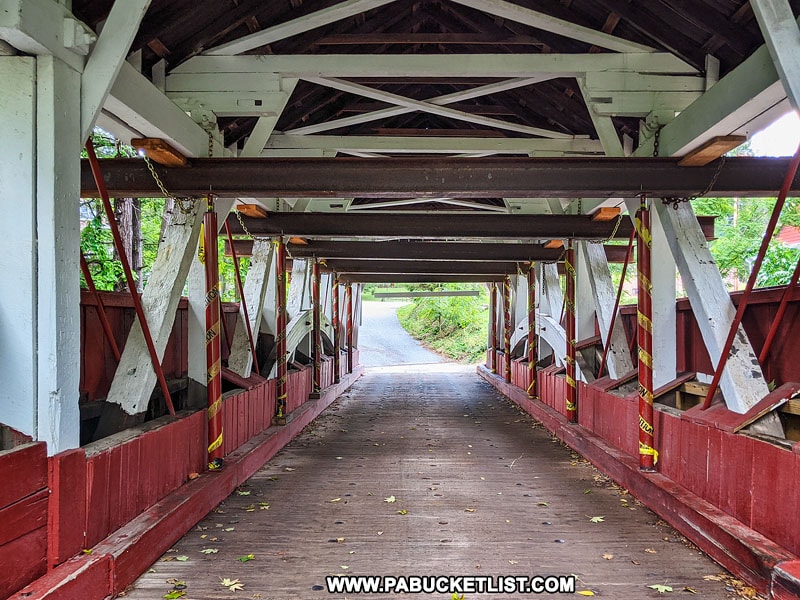
Shaffer Covered Bridge retains its original stone abutments, although steel stringers were added beneath the deck to strengthen it in 1978.

Shaffer Covered Bridge in northern Somerset County PA
Shaffer Covered Bridge in the summer.

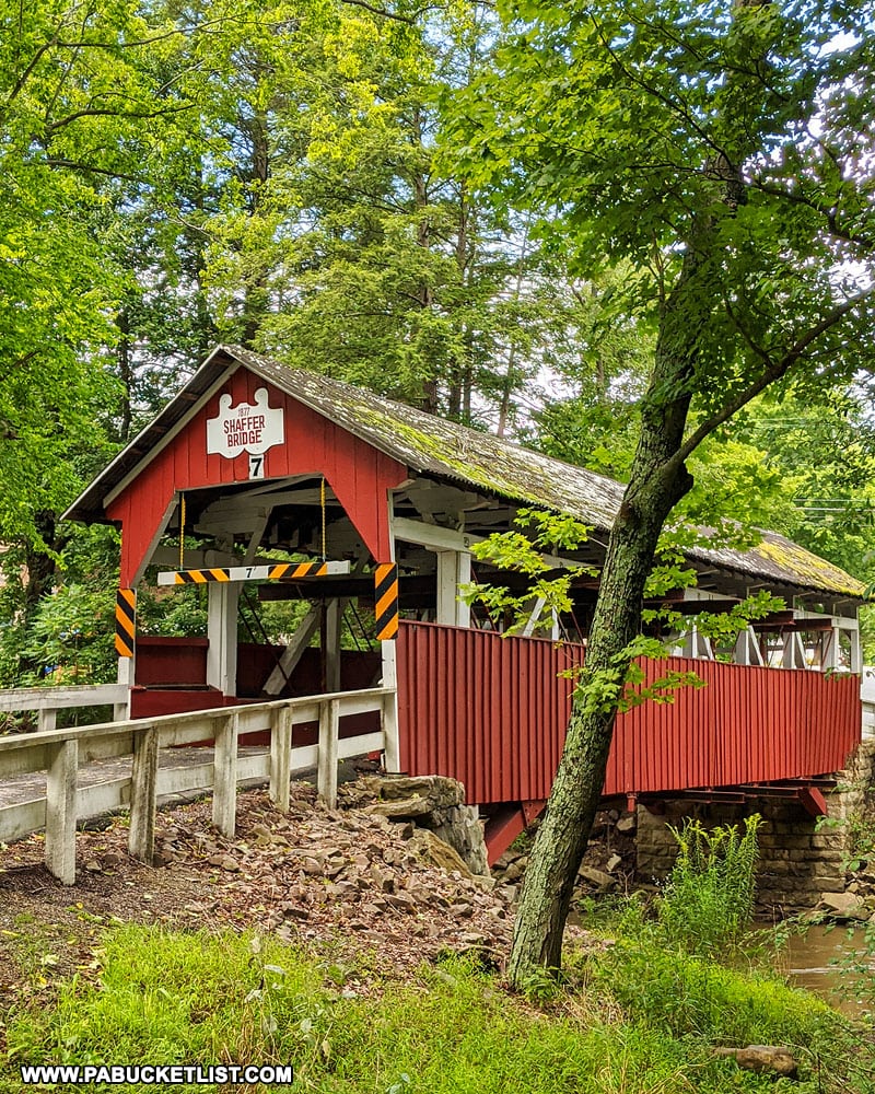
Shaffer Covered Bridge is located at GPS coordinates 40.28117, -78.96410, just off Route 985, 12 miles north of Jennerstown.

Map to Shaffer Covered Bridge in Somerset County Pennsylvania
Map to Shaffer Covered Bridge

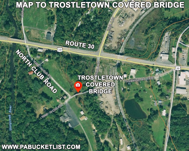
3. Trostletown Covered Bridge

The Trostletown Covered Bridge was built in 1873 (some sources say 1845), and beginning in 1965 was restored by the Stoystown Lions Club, whose park it now resides in.

Front of the Trostletown Covered Bridge near Stoystown Pennsylvania.
Front view of the Trostletown Covered Bridge near Stoystown.

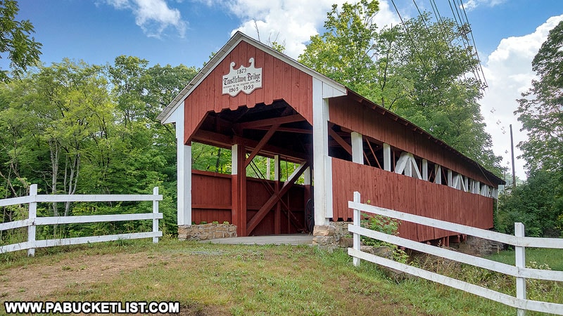
The Trostletown Covered Bridge is 104 feet long and spans the Stonycreek River.

Side view of the Trostletown Covered Bridge in Somerset County Pennsylvania
Side view of the Trostletown Covered Bridge.

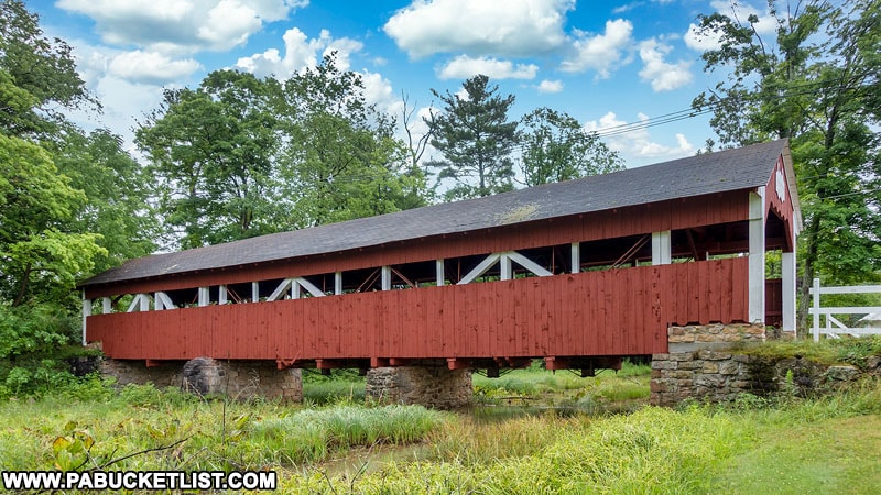
It utilizes Multiple Kingpost trusses, and is also home to a donated Conestoga wagon.

Interior of the Trostletown Covered Bridge in Somerset County Pennsylvania.
Interior of the Trostletown Covered Bridge

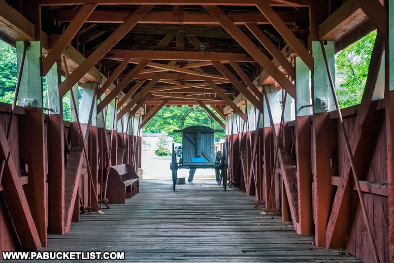
The bridge still stands in its original location on its original stone abutments, although it is now only open to pedestrian (and covered wagon) traffic.

Conestoga wagon on display inside the Trostletown Covered Bridge.

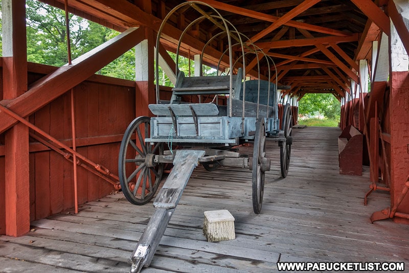
Trostletown Covered Bridge is located at GPS coordinates 40.09606, -78.94530, just off of Route 30 (the Lincoln Highway) near Stoystown.

Map to Trostletown Covered Bridge in Somerset County Pennsylvania
Map to Trostletown Covered Bridge.

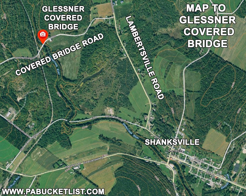
4. Glessner Covered Bridge

The Glessner Covered Bridge was built in 1881 by Tobias Glessner, and is still open to vehicular traffic.

The Glessner Covered Bridge near Shanksville Pennsylvania
The Glessner Covered Bridge near Shanksville, Pennsylvania.

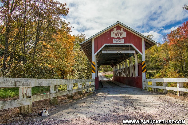
The bridge is 90 feet long and spans the Stonycreek River.

A winter view of the Glessner Covered Bridge in Stoneycreek Township, Pennsylvania.

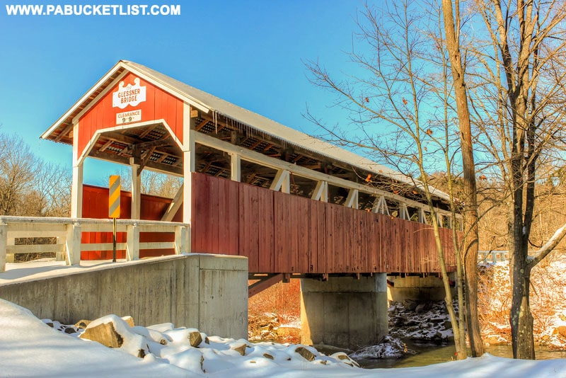
Refurbished in 1998, it features Burr arch trusses in its construction.

Trusses inside the Glessner Covered Bridge in Somerset County Pennsylvania.
Trusses inside the Glessner Covered Bridge in Somerset County, Pennsylvania.

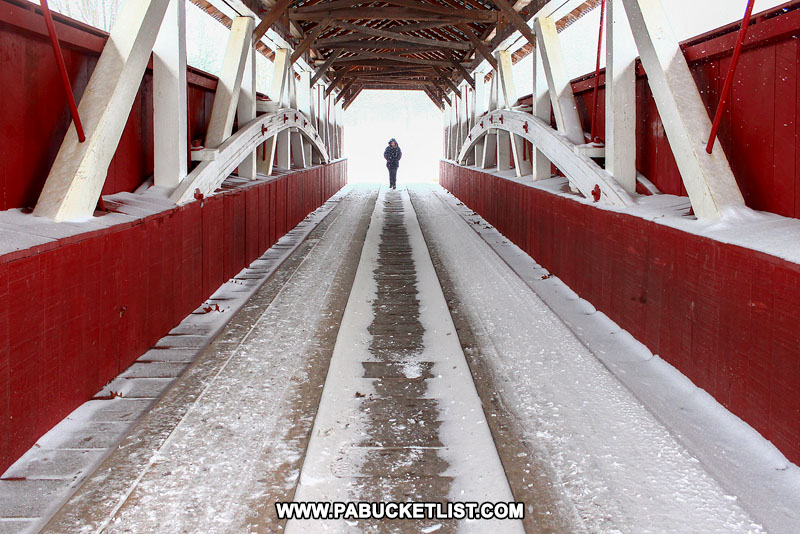
Glessner Covered Bridge is located at GPS coordinates 40.02616, -78.92091, near Shanksville.

Map to Glessner Covered Bridge in Somerset County Pennsylvania.
Map to Glessner Covered Bridge near Shanksville.

You can read a more in-depth article about the Glessner Covered Bridge HERE.

Red barn next to the Glessner Covered Bridge in Pennsylvania.
Red barn next to the Glessner Covered Bridge.

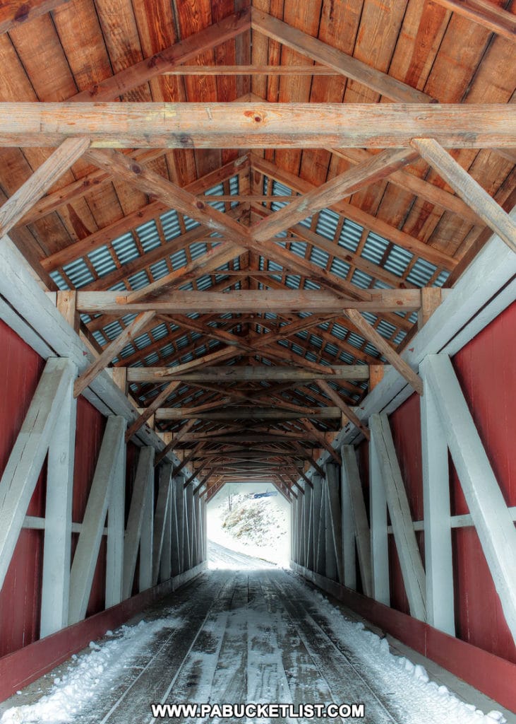
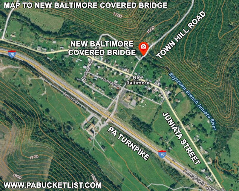
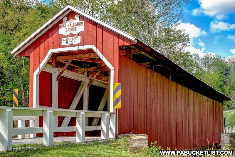
5. New Baltimore Covered Bridge

The New Baltimore Covered Bridge was originally built in 1879, destroyed by a flood in 1996, and rebuilt in 1998.

New Baltimore Covered Bridge in the spring.

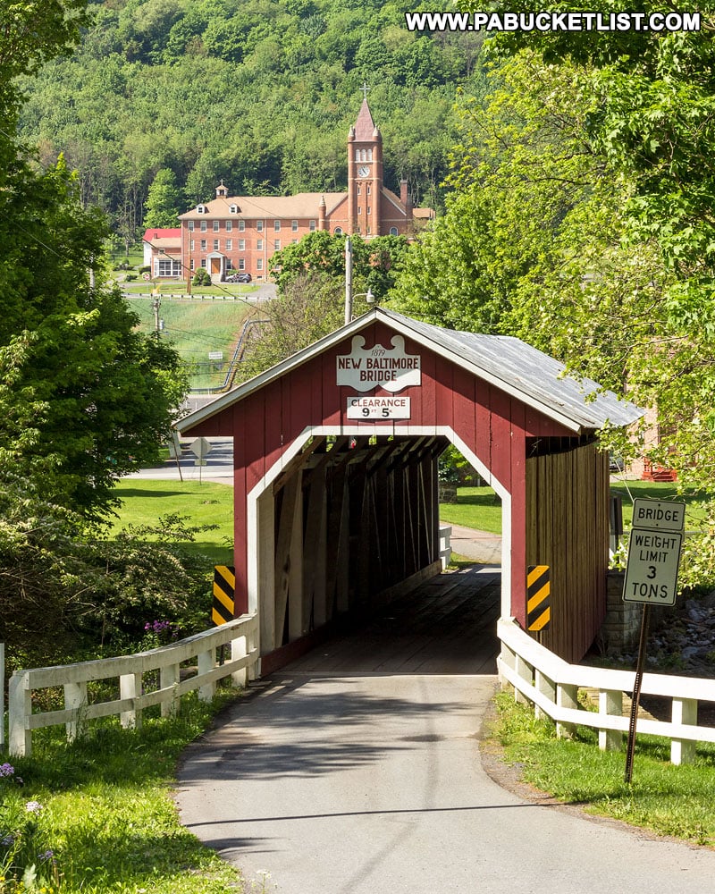
The bridge is 86 feet long and span the Raystown Branch of the Juniata River.

New Baltimore Covered Bridge surrounded by fall foliage.

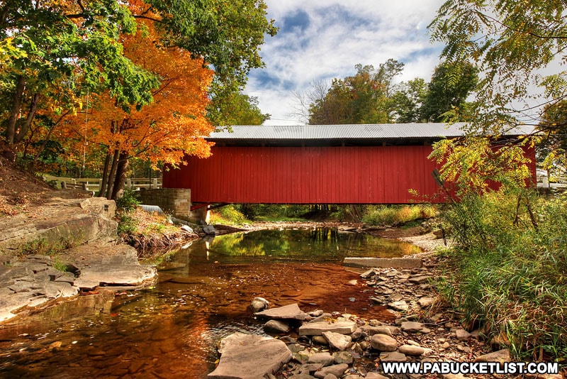
The New Baltimore Covered Bridge features Multiple Kingpost trusses in its construction.

Interior of the New Baltimore Covered Bridge

New Baltimore Covered Bridge is located at GPS coordinates 39.98690, -78.77235, in the town of New Baltimore.

Map to New Baltimore Covered Bridge in Somerset County Pennsylvania.
Map to New Baltimore Covered Bridge

You can read a more in-depth article about the New Baltimore Covered Bridge HERE.

Summer at New Baltimore Covered Bridge.

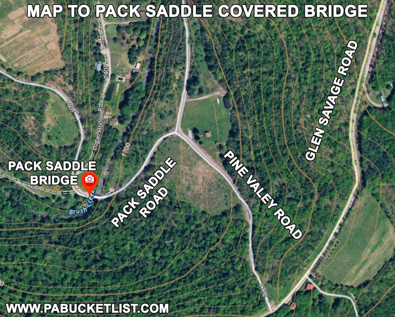
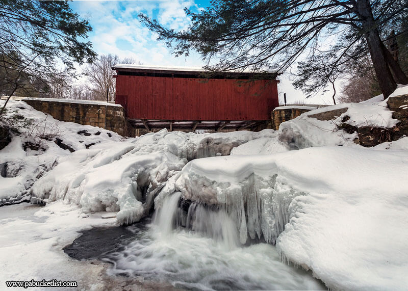
6. Pack Saddle Covered Bridge

The Pack Saddle Covered Bridge was constructed in 1870 by an unknown builder, and is still open to vehicular traffic.

Fall foliage starting to turn in the Laurel Highlands at the Pack Saddle Covered Bridge, Somerset County, Pennsylvania.

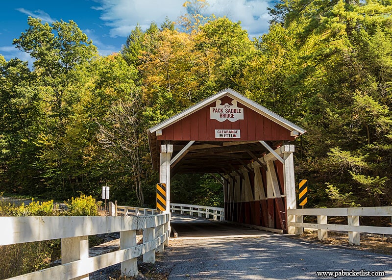
The bridge is 48 feet long and spans Brush Creek.

A summertime view of the Pack Saddle Covered Bridge in Somerset County, PA.

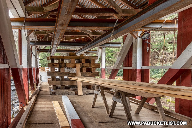
The Pack Saddle Bridge features Multiple Kingpost trusses, and underwent extensive renovations in the spring of 2020.

Pack Saddle Bridge construction progress as of May 2020

Although it is the shortest covered bridge in Somerset County, it is arguably the most famous, and a frequent spot for senior portraits and engagement photos.

The Pack Saddle Covered Bridge is an extremely popular spot for senior portraits and engagement photos.

The Pack Saddle Covered Bridge is located at GPS coordinates 39.86756, -78.81734, near the village of Fairhope.

Map to Pack Saddle Covered Bridge in Somerset County Pennsylvania.
Map to Pack Saddle Covered Bridge

You can read a more in-depth article about the Pack Saddle Bridge HERE.

The partially frozen waterfalls on Brush Creek beneath the Pack Saddle Covered Bridge.

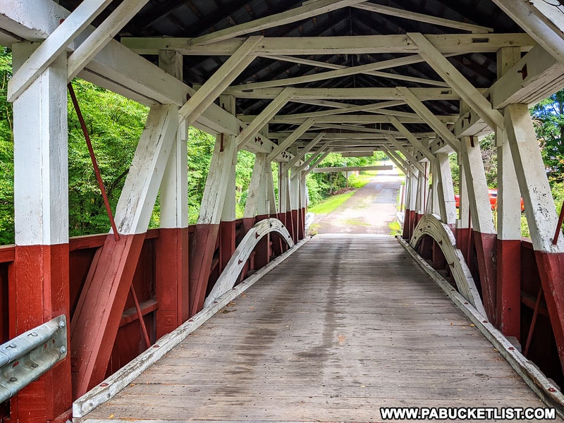
7. Burkholder Covered Bridge

The Burkholder Covered Bridge was built in 1870, and is still open to vehicular traffic.

Front view of Burkholder Covered Bridge in Somerset County Pennsylvania.
Front view of Burkholder Covered Bridge in Somerset County.

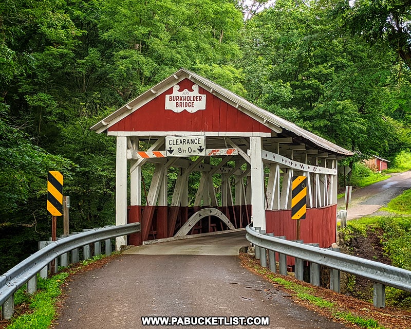
The bridge is 52 feet long and spans Buffalo Creek.

Burkholder Covered Bridge near Berlin Pennsylvania.
Burkholder Covered Bridge

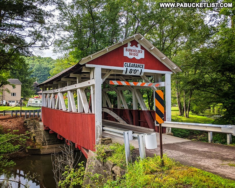
Burkholder Covered Bridge features Burr arch trusses in its construction.

Interior of the Burkholder Covered Bridge in Somerset County Pennsylvania.
Interior of the Burkholder Covered Bridge.

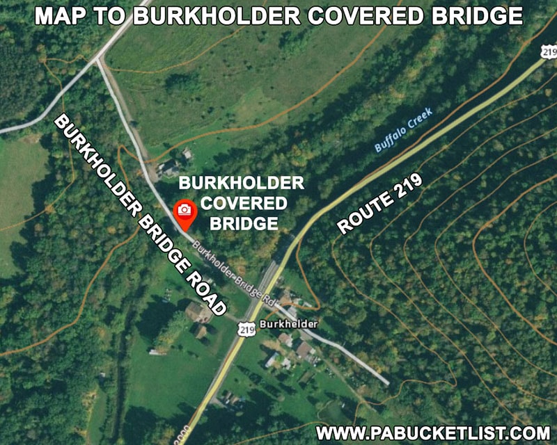
Burkholder Covered Bridge is located at GPS coordinates 39.88177, -79.03445, just off of old Route 219 / Mason-Dixon Highway between Garrett and Berlin.

Map to Burkholder Covered Bridge in Somerset County Pennsylvania.
Map to Burkholder Covered Bridge

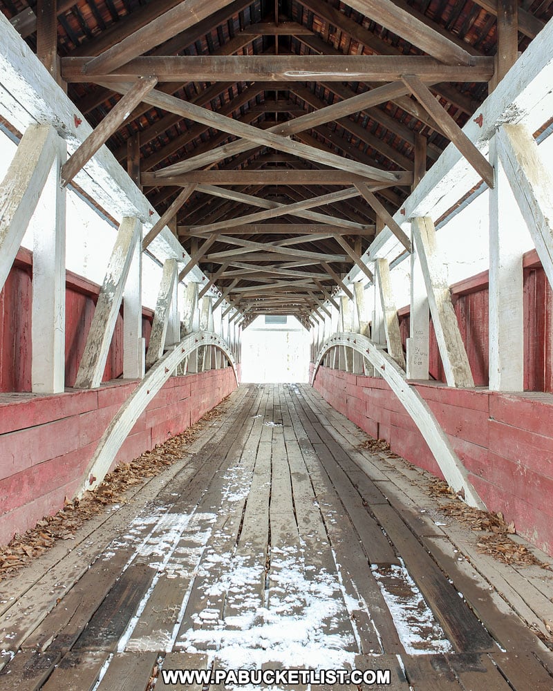
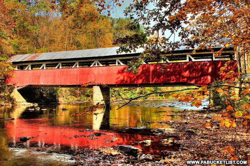
8. Lower Humbert Covered Bridge

The Lower Humbert Covered Bridge was built in 1891, extensively renovated in 1991, and is still open to vehicular traffic.

Lower Humbert Covered Bridge near Confluence PA

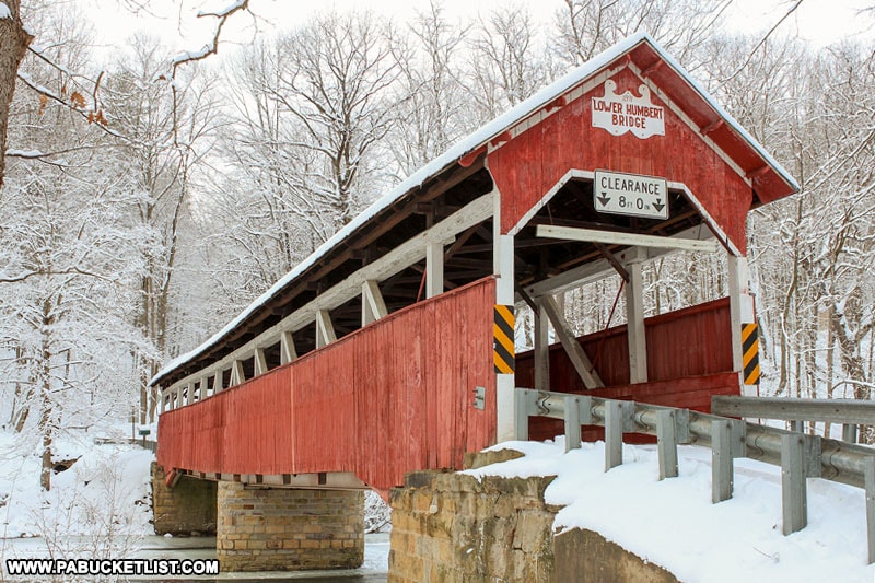
The bridge is 126.5 feet long and spans Laurel Hill Creek.

Autumn at Lower Humbert Covered Bridge

Lower Humbert Covered Bridge features Burr arch trusses in its construction.

Interior trusses on the Lower Humbert Covered Bridge
Trusses on the Lower Humbert Covered Bridge.

Lower Humbert Covered Bridge is located at GPS coordinates 39.84013, -79.32318, approximately 3 miles NW of Confluence in southern Somerset County.

Map to Lower Humbert Covered Bridge in Somerset County Pennsylvania.
Map to Lower Humbert Covered Bridge.

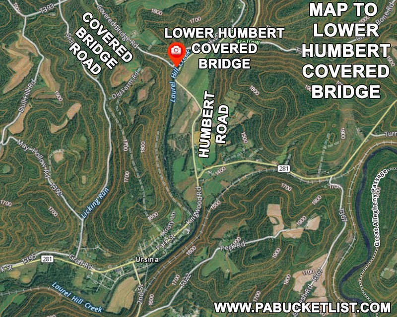
You can read a more in-depth article about the Lower Humbert Covered Bridge HERE.

Lower Humbert Covered Bridge over Laurel HIll Creek in Somerset County PA
Lower Humbert Covered Bridge over Laurel Hill Creek in Somerset County PA

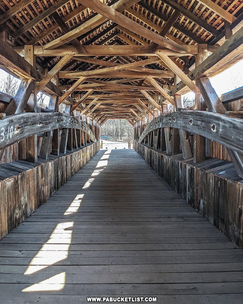
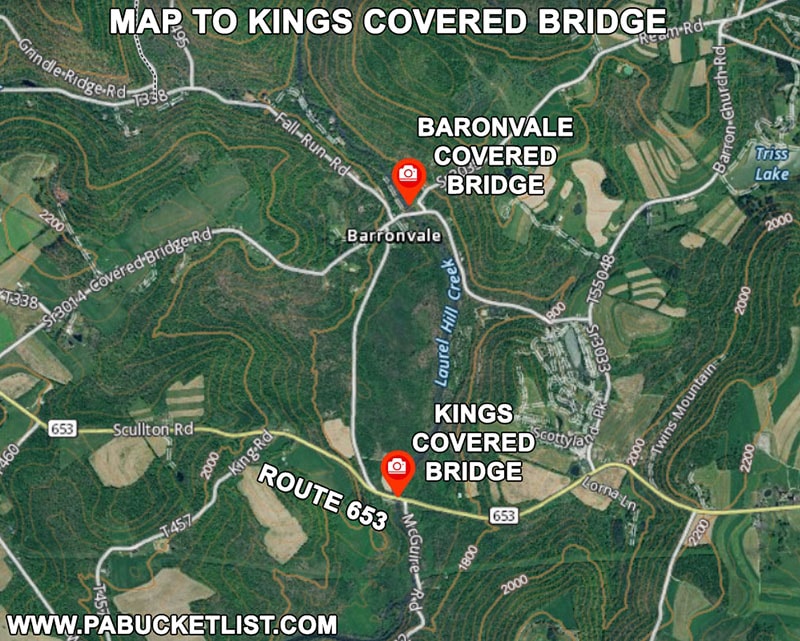
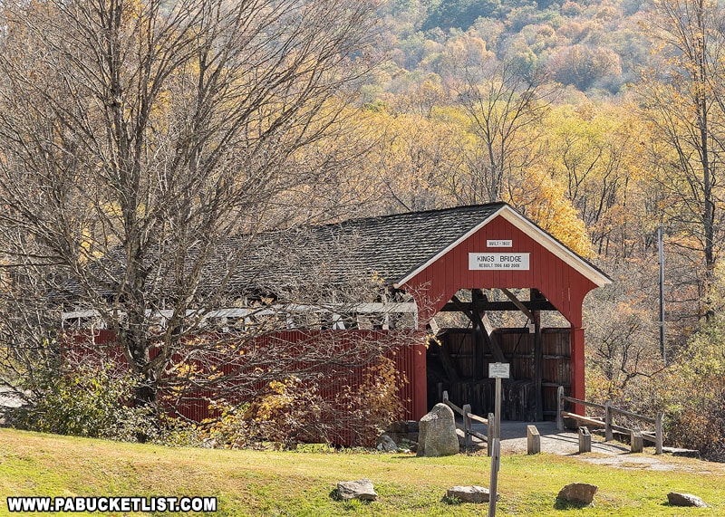
9. Kings Covered Bridge

Kings Covered Bridge was built in 1860 utilizing Multiple Kingpost trusses, rebuilt in 1906 using Burr arch trusses, and renovated again in 2008 to its current condition.

A springtime view of Kings Covered Bridge in Somerset County
A springtime view of Kings Covered Bridge in Somerset County.

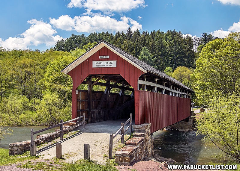
The bridge is 127 feet long and spans Laurel Hill Creek.

A reflection of Kings Covered Bridge in the still waters of Laurel Hill Creek.

An interesting fact about the interior of Kings Covered Bridge is that after it was bypassed by a modern steel bridge in the 1930’s, it was used for nearly a half-century as a livestock barn!

Interior of the Kings Covered Bridge in Somerset County.

Kings Covered Bridge is located at GPS coordinates 39.93767, -79.27125, along Route 653.

Map to Kings Covered Bridge in Somerset County Pennsylvania.
Map to Kings Covered Bridge

You can read a more extensive write-up about Kings Covered Bridge HERE.

Autumn in the Laurel Highlands at Kings Covered Bridge.

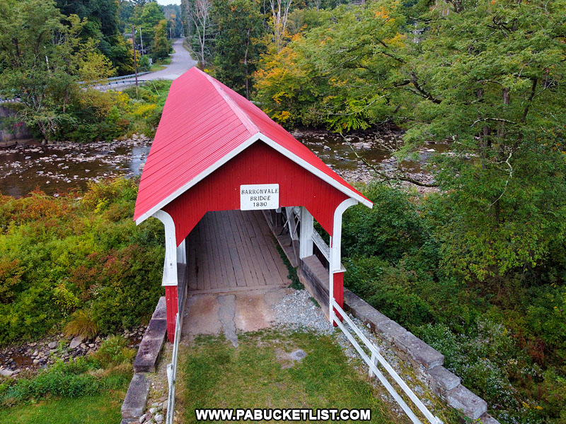
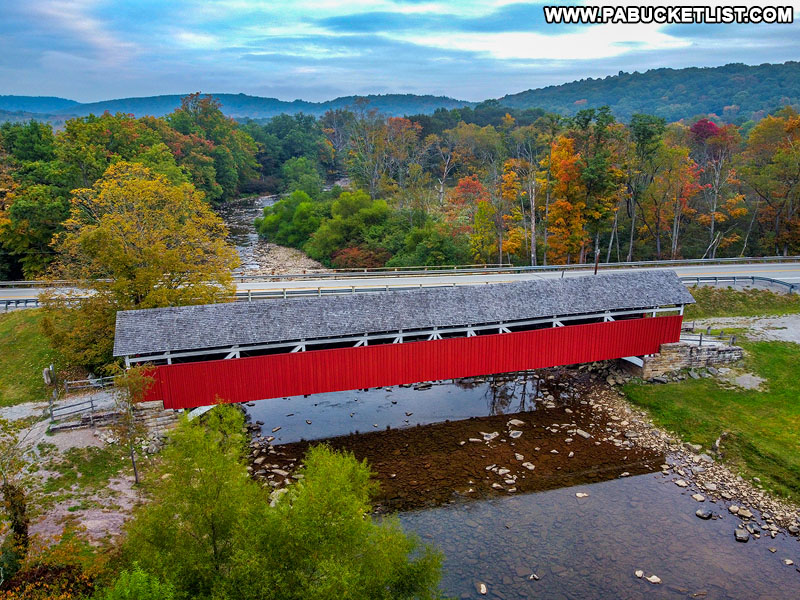
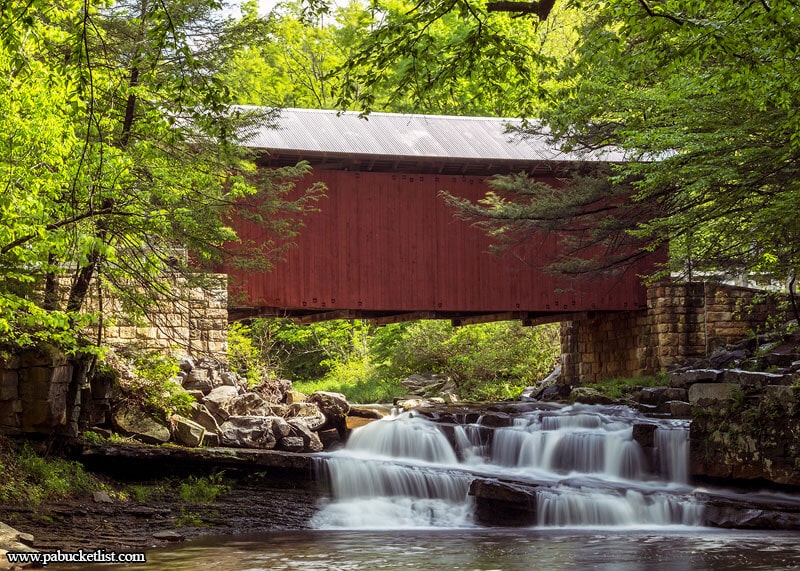
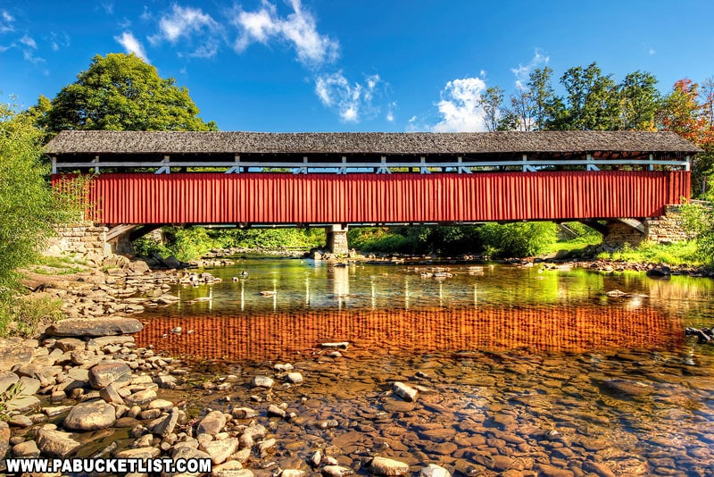
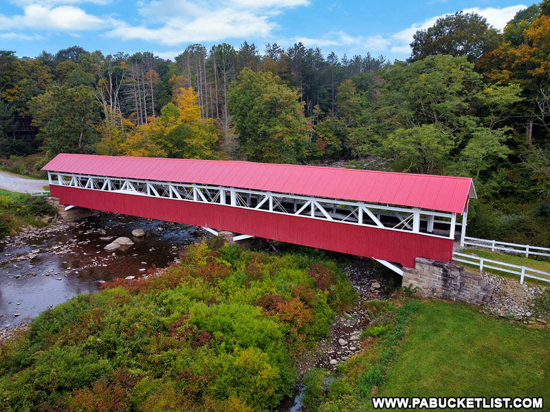
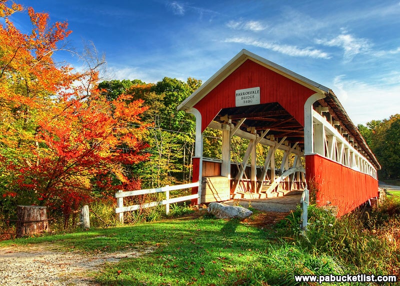
10. Barronvale Covered Bridge

The Barronvale Covered Bridge was likely constructed in 1902 (although some records indicate dates of 1830 or 1846) and is only open to pedestrian traffic.

Laurel Highlands fall foliage in full swing at the Barronvale Covered Bridge, Somerset County PA

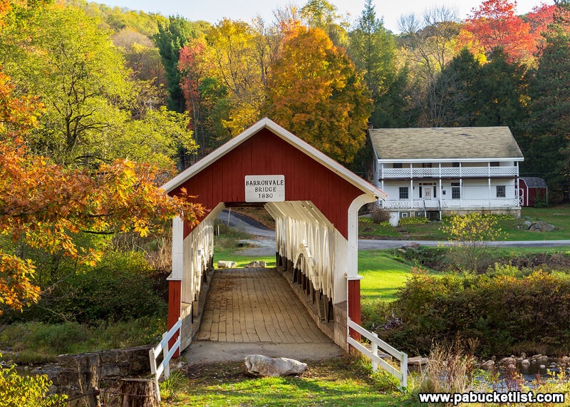
The bridge is 162.25 feet long and spans Laurel Hill Creek.

A late summer/early autumn view of Barronvale Covered Bridge and Laurel Hill Creek in Somerset County, PA

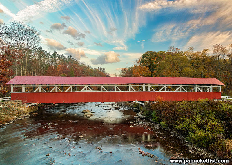
The Barronvale Covered Bridge features Burr arch trusses in its construction.

The Burr-arch trusses inside the Barronvale Covered Bridge in Somerset County Pennsylvania.
The Burr-arch trusses inside the Barronvale Covered Bridge in Somerset County, Pennsylvania.

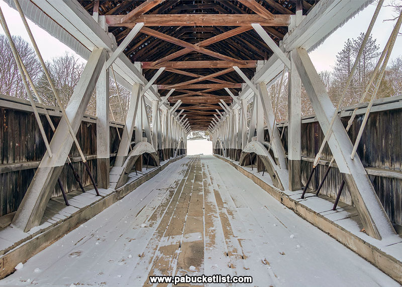
An interesting note about the trusses – due to the fact that the pier underneath the bridge is not centered, the arches themselves are of different heights.

Aerial side view oof the Barronvale Covered Bridge in Somerset County PA.
Aerial side view of the Barronvale Covered Bridge in Somerset County PA.

In the photo below you can see the height of the arch on the left (the longer span) extends above the opening in the side of the bridge, whereas the arch on the right does not.

A blue sky summer morning at the Barronvale Covered Bridge in Somerset County PA

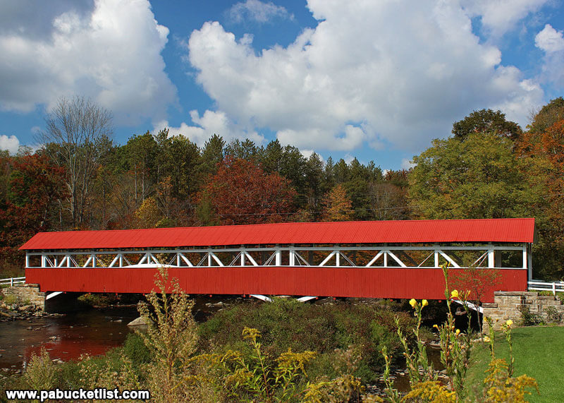
The Barronvale Covered Bridge is located at GPS coordinates 39.95275, -79.27050, one mile from Kings Covered Bridge.

Map to Barronvale Covered Bridge in Somerset County Pennsylvania.
Map to Barronvale Covered Bridge in Somerset County.

You can read a more in-depth article about the Barronvale Covered Bridge HERE.

Autumn arrives in the Laurel Highlands at the Barronvale Covered Bridge in Somerset County PA.

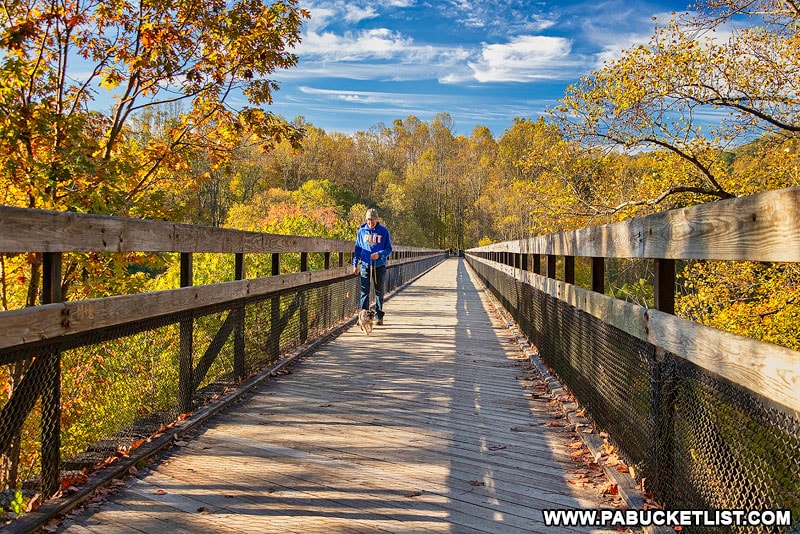
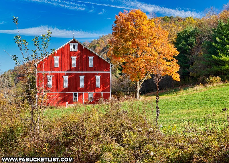
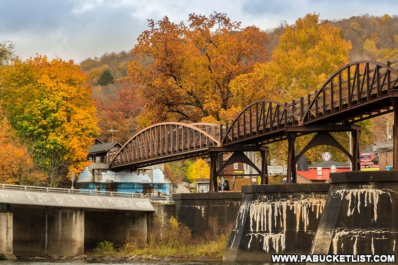
The Ultimate Somerset County Fall Foliage Driving Tour is a 128-mile road trip to 9 of the best fall foliage destinations in Somerset County.

The Ultimate Somerset County Pennsylvania Fall Foliage Road Trip
The Ultimate Somerset County Fall Foliage Driving Tour.

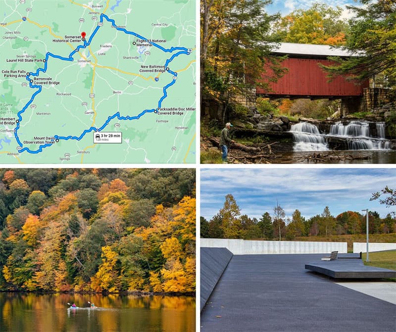
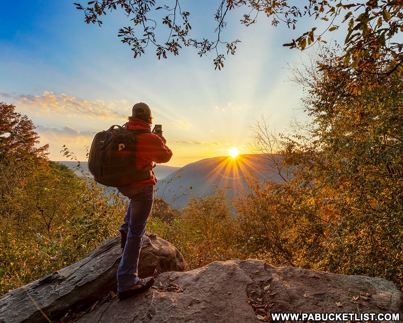
The Laurel Highlands are famous for exceptional mountain vistas, and you’ll find some of the finest ones in my write-up “The 14 Best Scenic Overlooks in the Laurel Highlands”.

The author photographing an autumn sunrise at Baughman Rock Overlook.

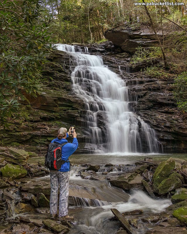
The Laurel Highlands are also home to an amazing array of waterfalls, and you’ll discover why in my write-up “24 Must-See Waterfalls in the Laurel Highlands”.

The author at Yoder Falls in the Laurel Highlands of Pennsylvania.

The Laurel Highlands was named by USA Today as one of the top destinations in the United States to view fall foliage.

Fall foliage around the High Bridge over the Youghiogheny River along the Great Allegheny Passage.
Fall foliage around the High Bridge over the Youghiogheny River at Ohiopyle State Park..

“22 Fabulous Fall Foliage Destinations in the Laurel Highlands of PA” will show you why!

Fall foliage in the Laurel Highlands of Pennsylvania.

Ohiopyle State Park in Fayette County is quite possibly the single best fall foliage destination in the Laurel Highlands.

Fall foliage at Ohiopyle Falls in Fayette County.

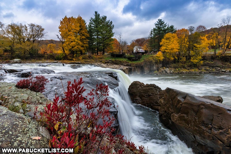
“The 12 Best Places to View Fall Foliage at Ohiopyle State Park” may convince you of that!

The Low Bridge over the Youghiogheny River surrounded by fall foliage.
The Low Bridge over the Youghiogheny River at Ohiopyle State Park, surrounded by fall foliage.

Did you enjoy this article?

If so, be sure to like and follow PA Bucket List on Facebook, Instagram, and/or Pinterest to learn more about the best things to see and do in Pennsylvania!

Click on any of the icons below to get connected to PA Bucket List on social media.


PA Bucket List 2022 Sasquatch Logo

Pennsylvania’s Best Travel Blog!

Rusty Glessner
Rusty Glessner is a professional photographer, lifelong Pennsylvanian, and a frequently-cited authority on PA's best travel destinations.