
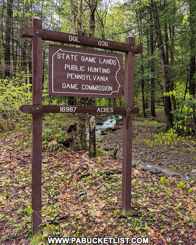
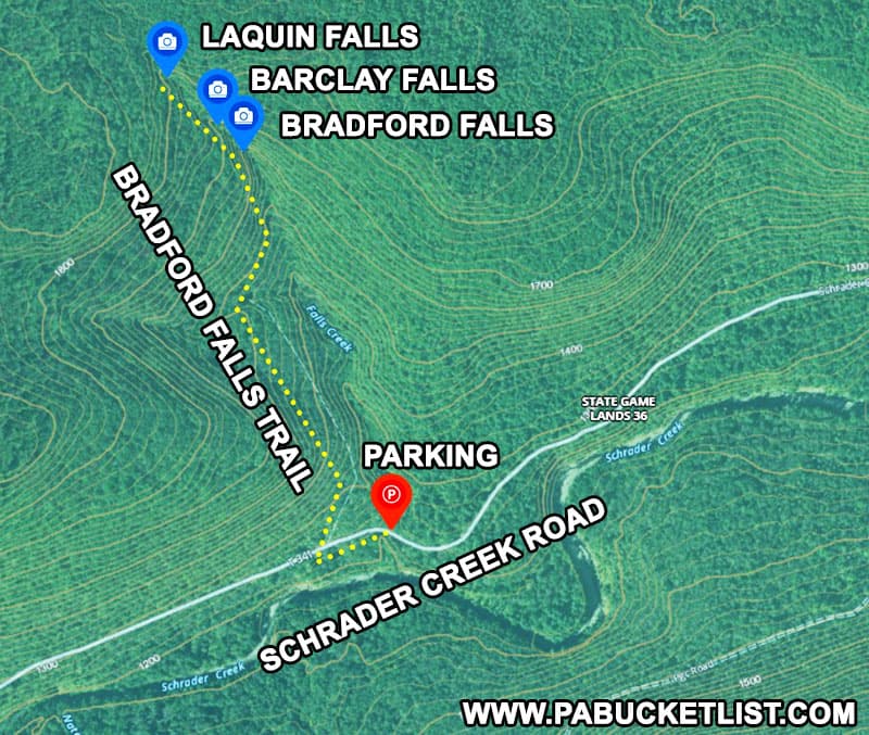
The Bradford Falls Trail on State Game Lands 36 in Bradford County is a 1.6 mile out-and-back hike to three incredible waterfalls and one real-life “bat cave”, all situated in a rugged forest area rich in mining and logging history.
As with any hike on State Game Lands, be sure to observe the PA Game Commission’s blaze orange clothing requirements relevant to the time of year you are visiting.
And while this is a relatively short hike, it’s rather strenuous with over 600 feet of elevation gain from beginning to end, and features rocky and slippery terrain in many places along the trail.
So dress and plan accordingly!
How to Find the Bradford Falls Trail
The Bradford Falls trail head is located along Schrader Creek Road in Bradford County, the closest town of note being the village of Leroy eight miles to the north and west.
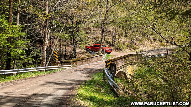
If navigating by GPS (which I recommend), use coordinates 41.64131, -76.59343 to find the Bradford Falls Trail parking lot, next to the single-lane bridge over Falls Creek along Schrader Creek Road.
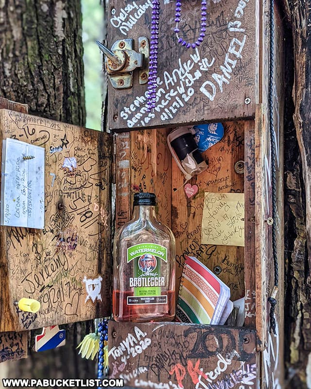
A rather “colorful” (and unofficial) trail register is located at the back of the parking area.
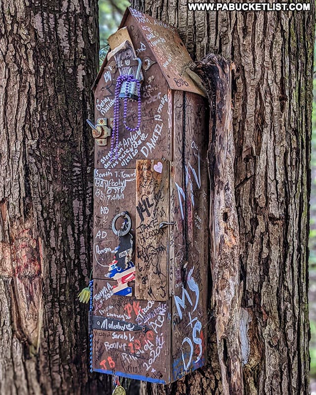
The person who takes a pull off of this bottle will never have to prove their bravery in any other way ever again!
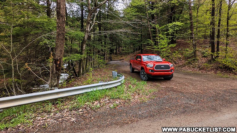
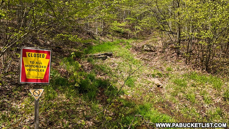
The Bradford Falls Trail itself begins 150 yards to the west of the parking lot, where an old forest road intersects with Schrader Creek Road.
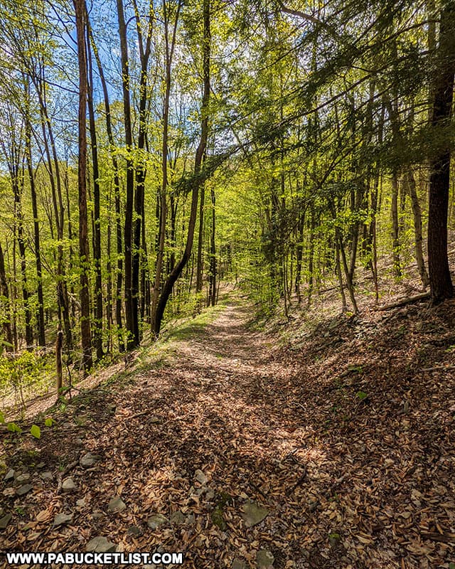
Hiking the Bradford Falls Trail
The first part of the hike utilizes the unblazed old forest road as it steadily progresses uphill towards the waterfalls.
At approximately 0.4 miles into the hike, you’ll cross of a small, unnamed tributary of Falls Creek.
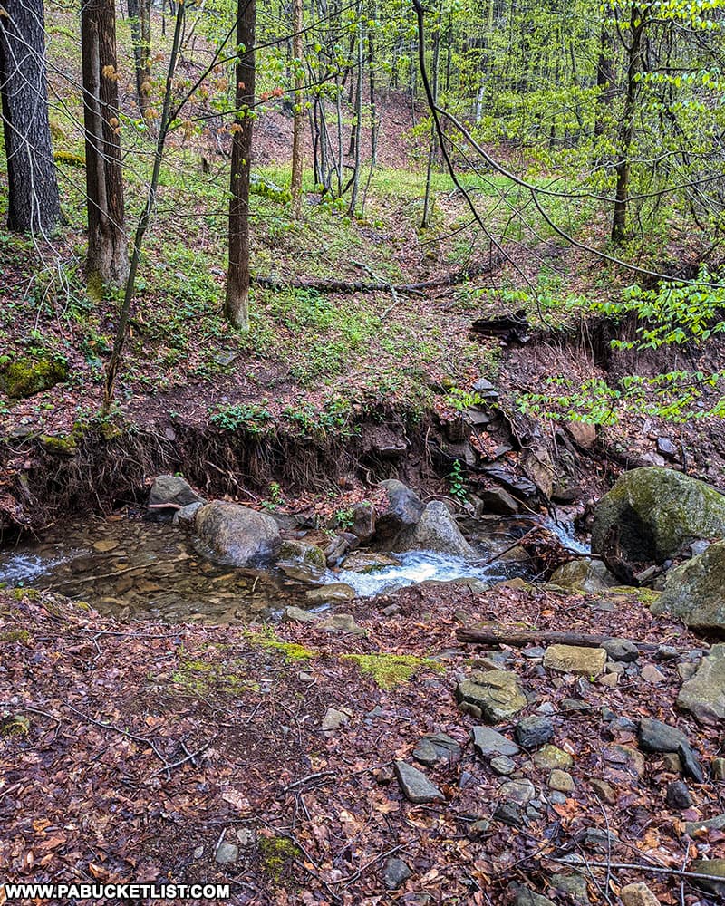
Just beyond this small stream crossing, you’ll enter a clearing in the forest, where the remnants of human activity in the form of scrap metal, stone retaining walls, and piles of coal are evident.
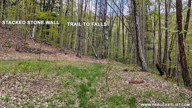
At the back right corner of the clearing (when facing uphill), you’ll leave the forest road and bear right past a stacked stone wall, following a fairly obvious user trail downhill towards Falls Creek.
Carefully make your way downhill towards the Falls Creek, where the trail proceeds to hug the left bank of the stream as you make your way upstream.
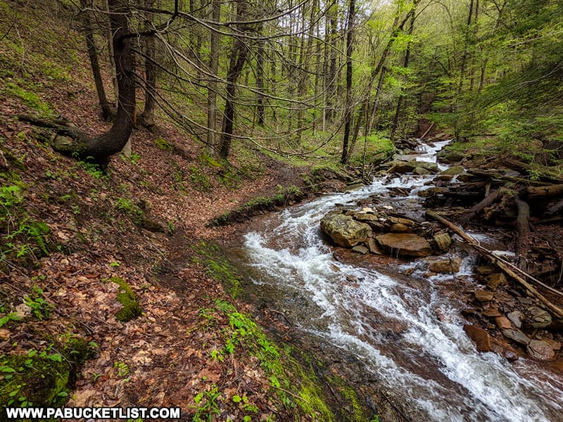
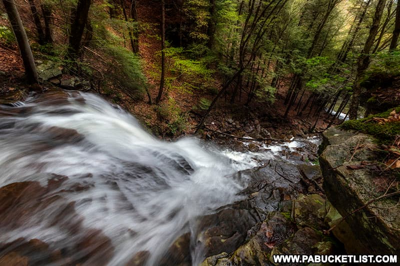
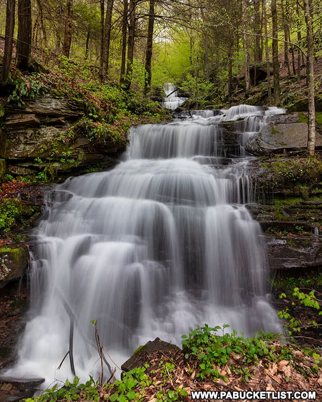
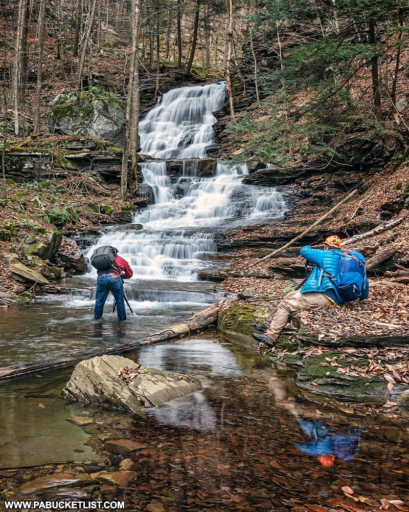
Approximately 0.6 miles into your hike, you’ll encounter some magnificent cascades as the upper half of Bradford Falls come into view.
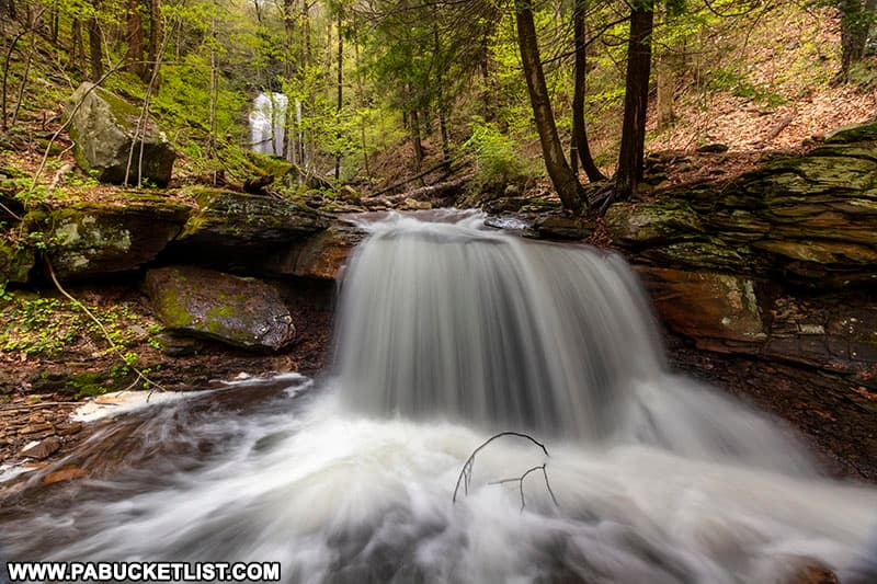
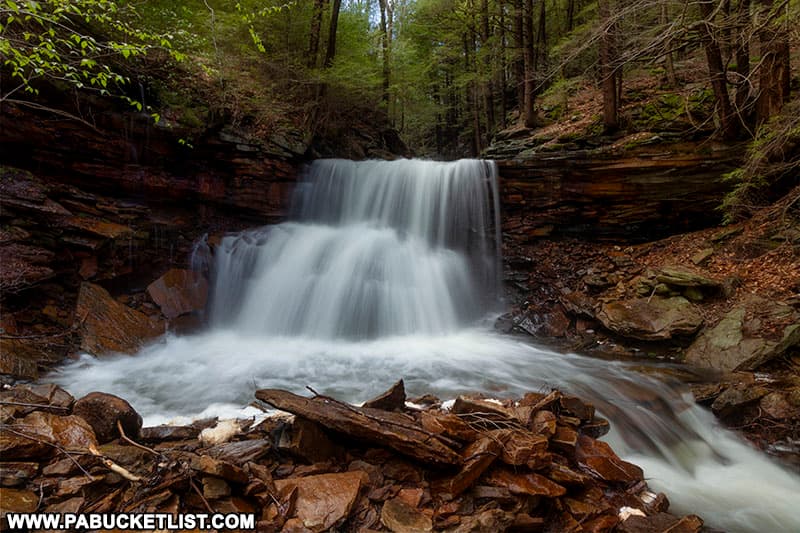
Bradford Falls
Bradford Falls is nearly 70 feet tall, making it one of the tallest waterfalls in Pennsylvania!
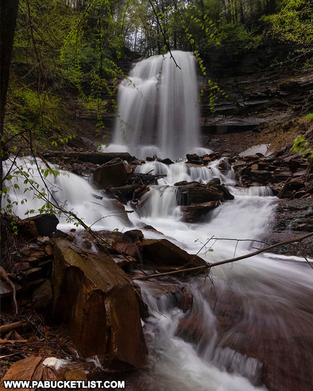
On the day these photos were taken, Bradford Falls was surging with flow from heavy spring rains the day before, meaning the only good photo ops without getting drenched in spray were from well downstream.
Be sure to check out the video at the end of this write-up to see and hear Bradford Falls in all its glory!
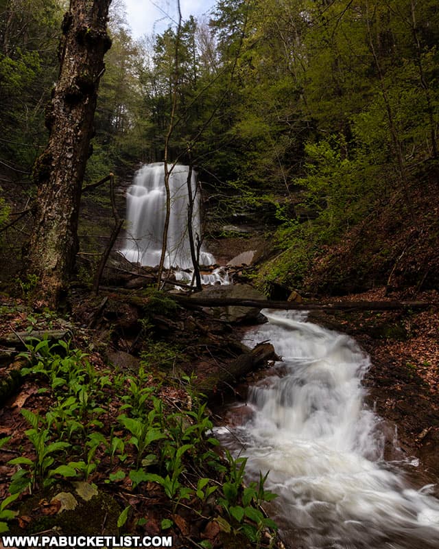
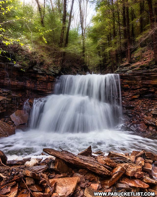
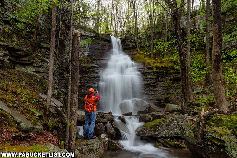
Barclay Falls
Immediately above Bradford Falls is another 30 foot-tall beauty known as Barclay Falls.
The easiest way to get to Barclay Falls is to backtrack downstream a hundred yards or so from Bradford Falls,and then make your way uphill in the direction of the old forest road, veering right, up and around Bradford Falls before veering back down to stream-level below Barclay Falls.
Standing below Barclay Falls means you are also literally standing at the top of Bradford Falls, so use caution, but enjoy the view!
From the base of Barclay Falls, backtrack up the slope you just descended and pick up the old forest road again.
If you want to, it’s easy to quickly pop down to the top of Barclay Falls to experience a view similar to the one from the top of Bradford Falls.
Back on the forest road, follow it uphill another 0.1 miles, until you encounter a low stone wall across the road.
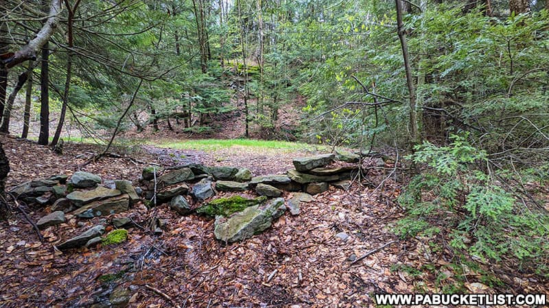
The stone wall marks the top of the Bradford Falls Trail.
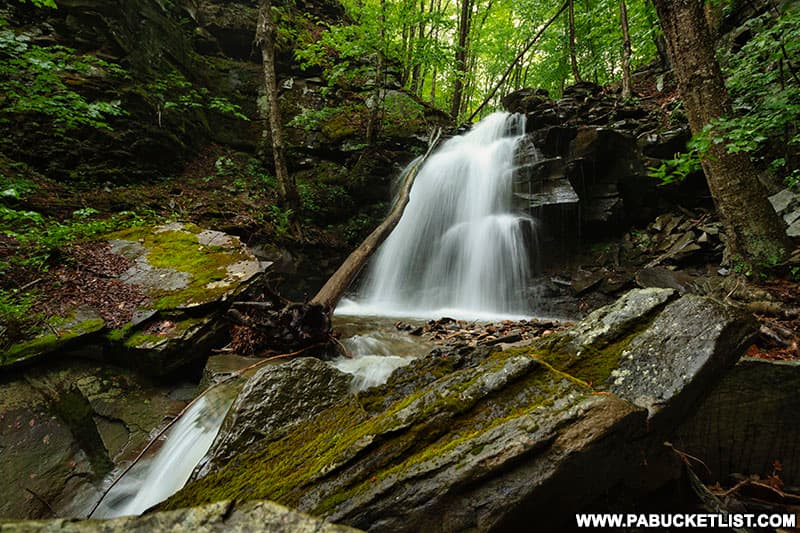
To your right will be Laquin Falls, to your left will be the “bat cave“.
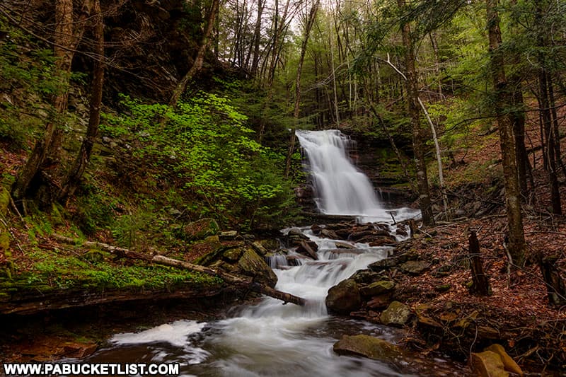
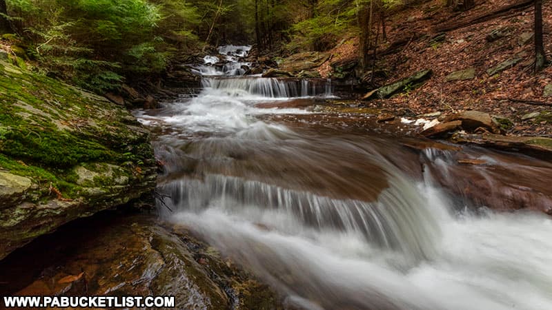
Laquin Falls
Laquin Falls is a 15 foot-tall waterfall named after a lumbertown that existed nearby in the early 1900s.
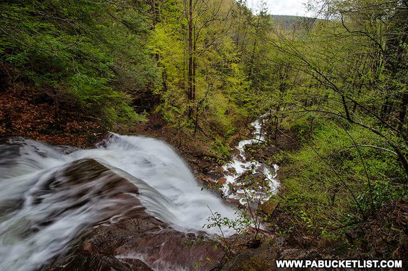
Aside from the three main waterfalls mentioned here, the entire length of Falls Creek is flush with picturesque cascades, so don’t be afraid to explore other stretches of the stream as well.
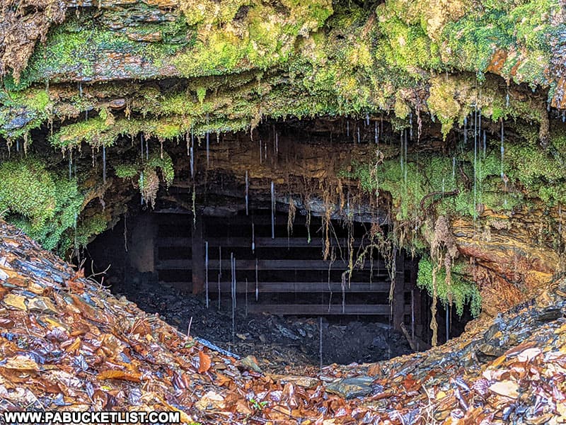
The Bat Cave Along the Bradford Falls Trail
Near the top of the Bradford Falls Trail, an old mine shaft has been repurposed into a bat habitat.
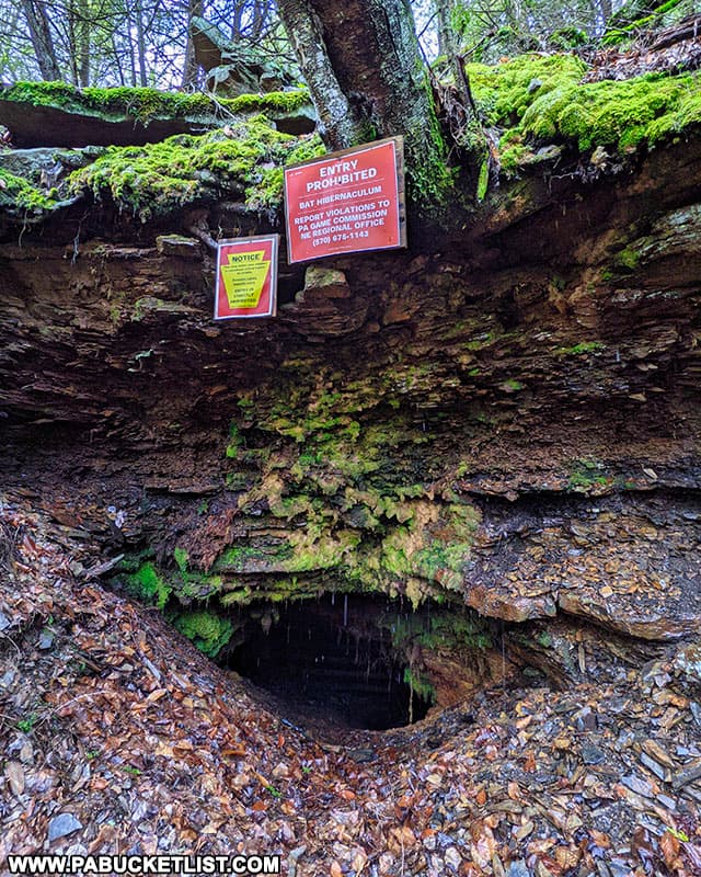
As mentioned earlier, this entire area was a hotbed of coal mining activity in the late 1800s, which was followed by years of extensive lumbering activity in the early 1900s that left the forest decimated, until the Civilian Conservation Corps began reforestation efforts here during the Great Depression.
So it’s nice to see some of these scars on the forest are now being put to good use as critical wildlife habitat.
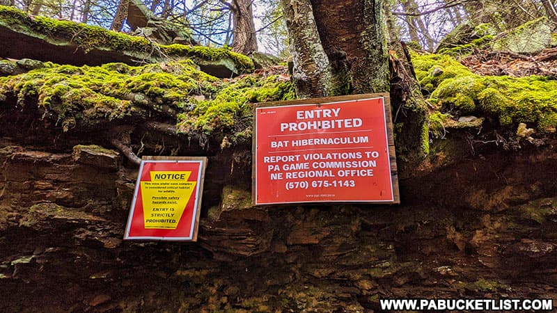
Please heed the posted signs and do not enter the cave or disturb the bats!
The Return Hike
When you’ve had your fill of sights and sounds along the Bradford Falls Trail, simply follow the forest road all the way back downhill to Schrader Creek Road where you parked.
Still not convinced you need to hike the Bradford Falls Trail?
Then check out this video!
Nearby Attractions
Holcomb Falls is a gorgeous roadside waterfall located approximately 7 miles north of the Bradford Falls Trail, near the village of Leroy.
Deep Hollow Falls is another easy-to-reach waterfall on State Game Lands 36 in Bradford County.
Thomas Run Falls is yet another outstanding Bradford County waterfall, located on State Game Lands 12 near the ghost town of Laquin.
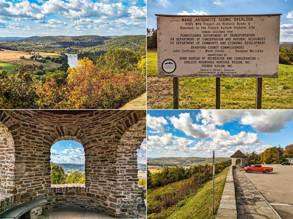
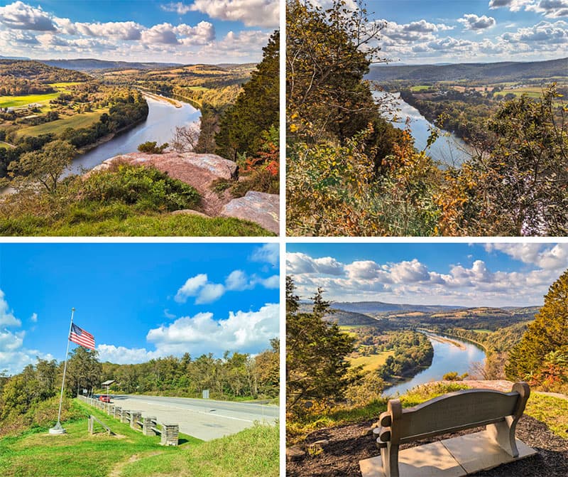
The Marie Antoinette Scenic Overlook along Route 6 in Bradford County offers breathtaking views of the Susquehanna River with a unique historical connection to French royalty.
Wyalusing Rocks is a gorgeous roadside scenic overlook sitting 500 feet above the Susquehanna River along Route 6 in Bradford County.
The McIntyre Wild Area is home to more than a dozen exceptional waterfalls, all located off-trail and south of Bradford Falls in a remote section of the Loyalsock State Forest.
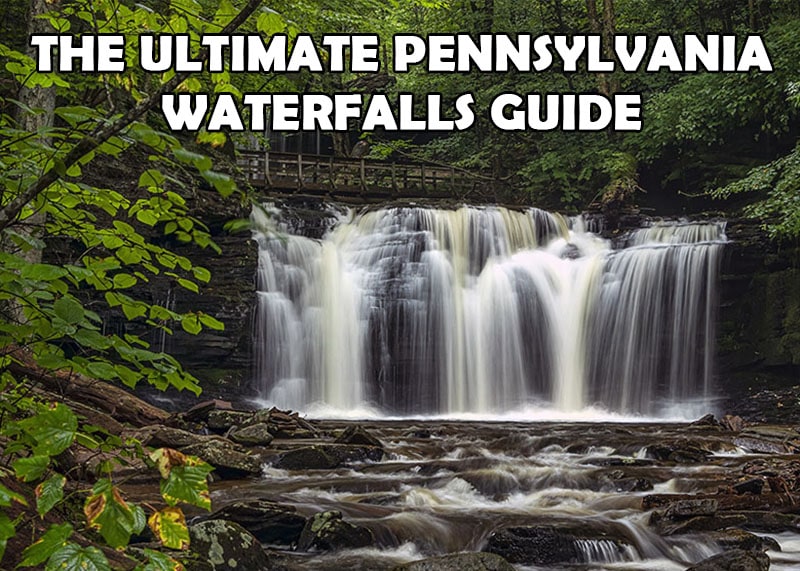
The Ultimate Pennsylvania Waterfalls Guide is your source for directions to HUNDREDS of waterfalls across the Keystone State!
Did you enjoy this article?
If so, be sure to like and follow PA Bucket List on Facebook, Instagram, and/or Pinterest to stay up-to-date on my latest write-ups.
Click on any of the icons below to get connected to PA Bucket List on social media!