
Worlds End State Park and the surrounding Loyalsock State Forest are home to some of the finest scenic overlooks in Pennsylvania!

And as I did in my 10 Must-See Waterfalls Near Worlds End State Park write-up, I’m going to provide you a map, GPS coordinates, and directions to the 8 best scenic overlooks in or near Worlds End State Park!
I’ll start with 3 scenic overlooks inside Worlds End State Park itself, then describe 5 more outstanding views in the surrounding area.
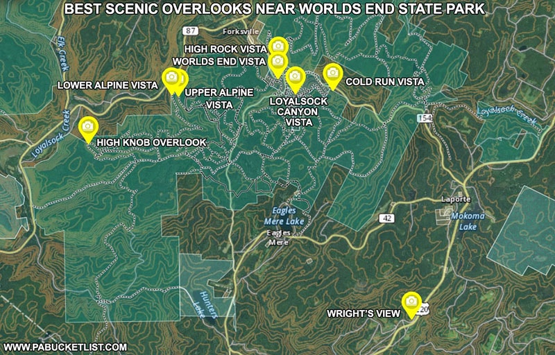
Best Scenic Overlooks Inside Worlds End State Park
Worlds End Vista
Where better to start than with the namesake Worlds End Vista, along the Worlds End Trail.
Worlds End Vista, located along the Worlds End Trail at GPS coordinates 41.46820, -76.58353, overlooks the beach along Loyalsock Creek at Worlds End State Park.
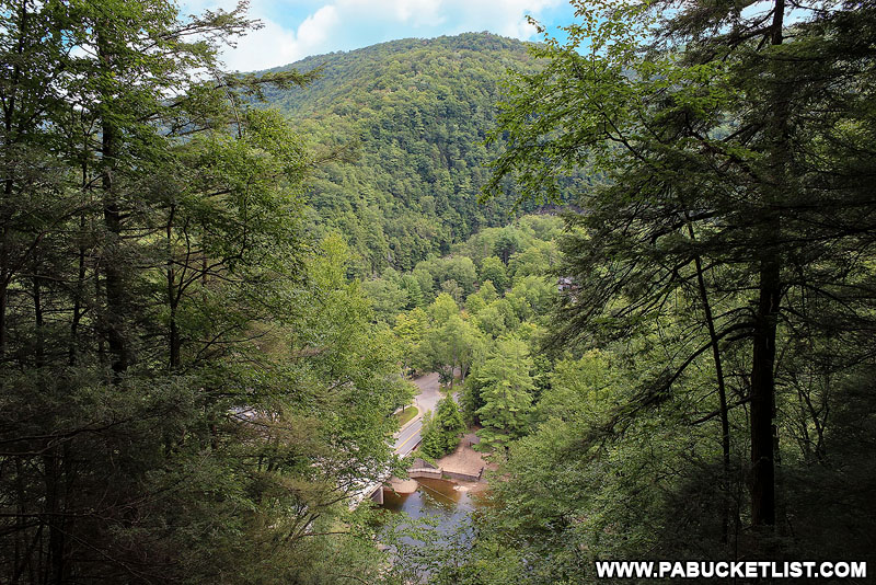
High Rock Vista
High Rock Vista is located on the opposite side of Loyalsock Creek, along the High Rock Trail.
From this vantage point you can see Loyalsock Creek, the park office, and the beach at Worlds End State Park.
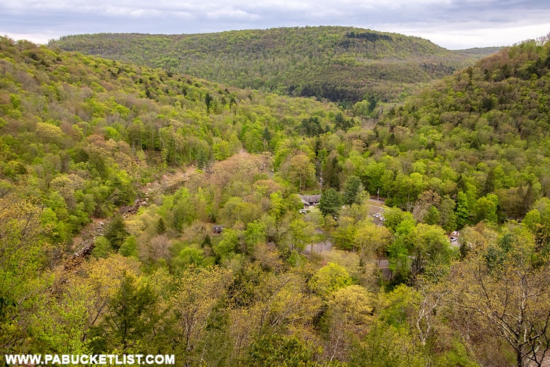
High Rock Overlook is located at GPS coordinates 41.47376, -76.58334.
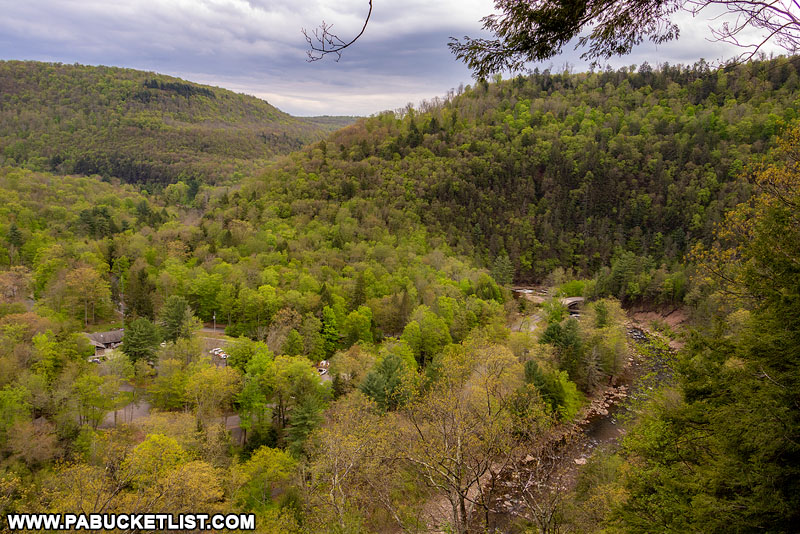
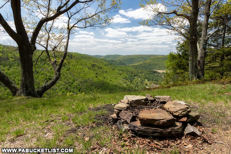
Loyalsock Canyon Vista
Loyalsock Canyon Vista (or sometimes simply called Canyon Vista) is the most famous overlook at Worlds End State Park, in large part because you can drive right up to it.
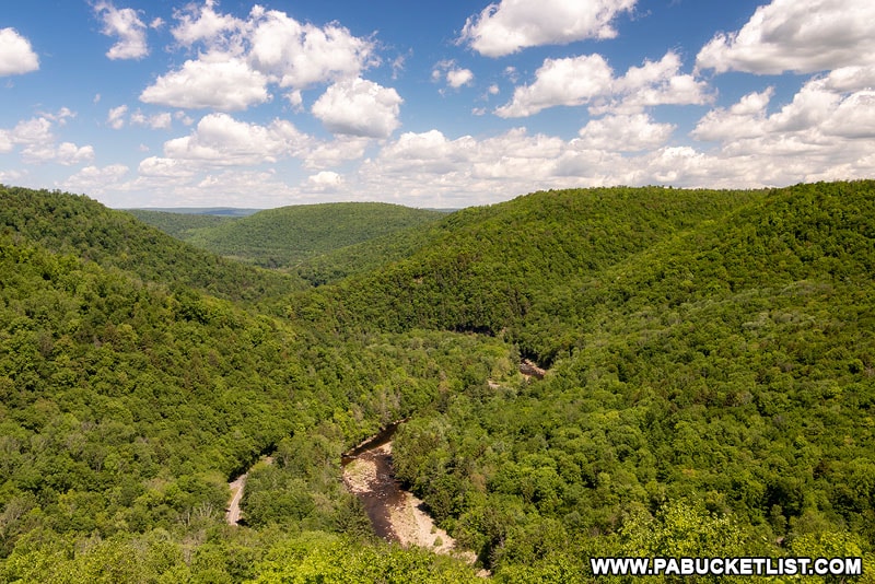
At an elevation of 1,750 feet above sea level, you can find Loyalsock Canyon Vista at GPS coordinates 41.46246, -76.57483.
Best Scenic Overlooks Near Worlds End State Park
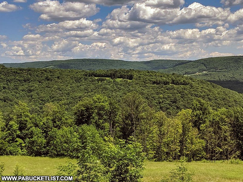
High Knob Overlook
High Knob Overlook may be one of the most spectacular roadside attractions in all of Sullivan County!
This is also one of the best spots to catch a sunset near Worlds End State Park.
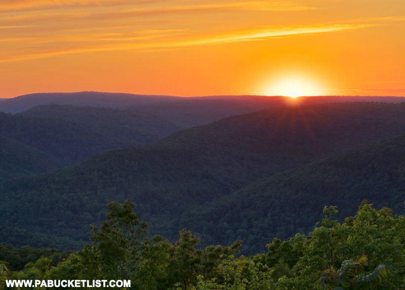
High Knob Overlook can be found at GPS coordinates 41.44377, -76.67852.
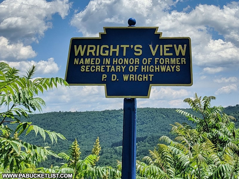
Wright’s View
Odds are if you traveled to Worlds End State Park via Route 220, you drove right past Wright’s View.
Named in honor of a former Secretary of Highways in Pennsylvania, Wright’s View can be found roadside along 220 at GPS coordinates 41.37797, -76.51655.
Cold Run Vista
Located along one of the newest trails in the Worlds End vicinity, Cold Run Vista can be found along the Cold Run Trail at GPS coordinates 41.46377, -76.55588.
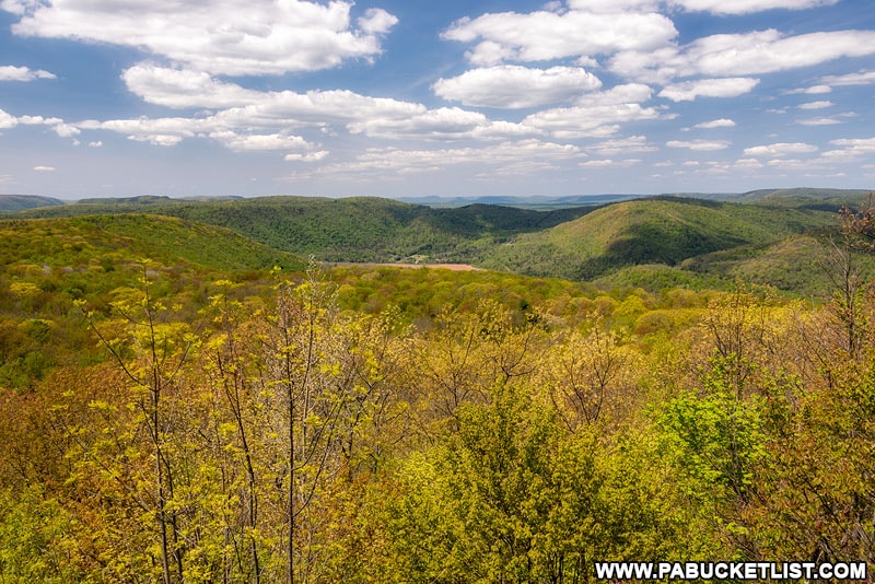
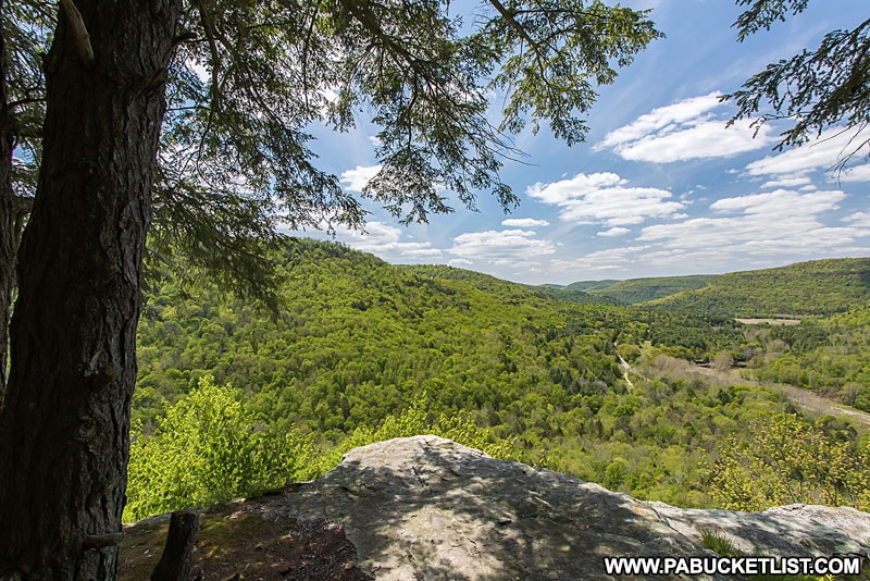
Upper Alpine Vista
Located along the Loyalsock Trail, Upper Alpine Vista is an easy hike from a parking area near the intersection of the LT and Coal Mine Road.
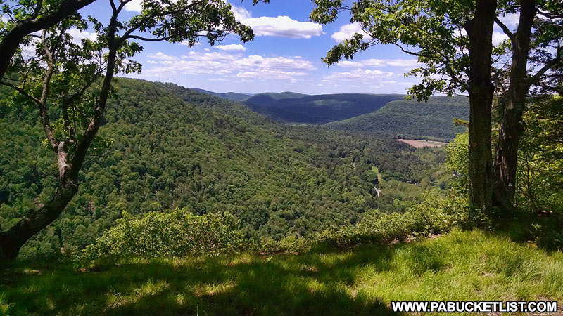
Upper Alpine Vista is located at GPS coordinates 41.46157, -76.63330, and looks out over the Ketchum Run Gorge and Route 87 in the distance.
Lower Alpine Vista
Located a bit further along the Loyalsock Trail (assuming you are hiking from the top down), Lower Alpine Vista also looks out over the Ketchum Run Gorge.
Lower Alpine Vista is located at GPS coordinates 41.46217, -76.63666.
Bonus Views
While none of these are technically scenic overlooks, they are certainly beautiful roadside spots worth seeing while in the area.
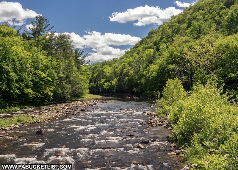
Loyalsock Creek Bridge in the heart of Worlds End State Park provides you an exceptional view of Loyalsock Creek without leaving your vehicle!
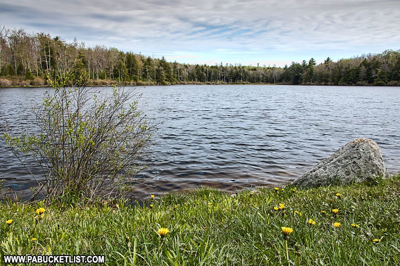
Sones Pond along Loyalsock Road is another must-see location in the Loyalsock State Forest, near Worlds End State Park.
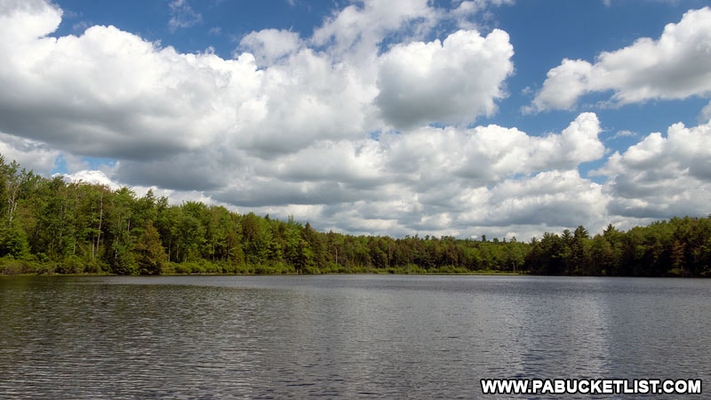
This view is completely roadside (though you certainly can hike around and explore the lake further if you choose to do so) and located at GPS coordinates 41.47157, -76.51457.
The Forksville Covered Bridge was constructed in 1850, is 152 feet long, and is still open to vehicular traffic.
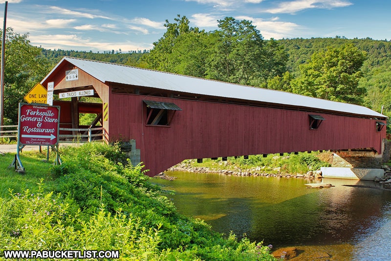
The bridge is located in the heart of Forksville at GPS coordinates 41.48854, -76.59965.
Related Articles
164 of the Best Scenic Overlooks in PA features and interactive map I created to provide you with accurate directions to over 160 of Pennsylvania’s finest scenic overlooks, making it easy for anyone to discover new adventures and breathtaking views in the Keystone State.
Nearby Attractions
9 Must-See Attractions in Sullivan County showcases more remarkable sights and experiences near Worlds End State Park.
Explore Pennsylvania like a pro with the interactive PA Bucket List Travel Map, showcasing over 1,000 memorable destinations I’ve personally visited across the Keystone State.
Did you enjoy this article?
If so, be sure to like and follow PA Bucket List on Facebook, Instagram, and/or Pinterest to learn more about the best things to see and do in Pennsylvania!
Click on any of the icons below to get connected to PA Bucket List on social media.