
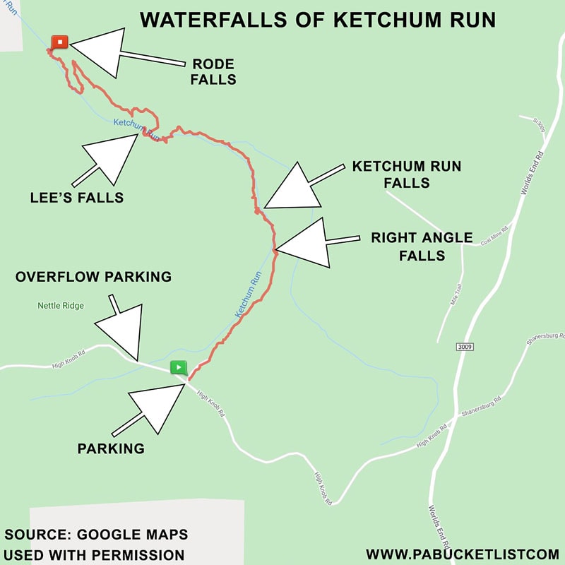
Ketchum Run in the Loyalsock State Forest is home to 4 spectacular waterfalls within a 2.3 mile span.
Rode Falls, Lee’s Falls, Ketchum Run Falls, and Right Angle Falls are the highlights of an exceptional 4.6 mile out-and-back hike that is sure to thrill lovers of nature in all seasons.
Follow along as I show you how to navigate along Ketchum Run, using the Ketchum Run Trail and a portion of the famous Loyalsock Trail.
Where to Park
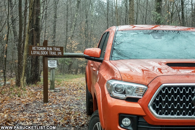
How to Find the Ketchum Run Trail
- Turn off of Worlds End Road (near Worlds End State Park) onto High Knob Road and drive 1.1 miles.
- Navigate to the Ketchum Run Trail parking area at GPS Coordinates 41.439538, -76.625294.
The parking area is large enough for 2-3 vehicles. A large overflow lot located just 1/10th of a mile further west (on the opposite side of the bridge over Ketchum Run) easily holds another dozen vehicles.
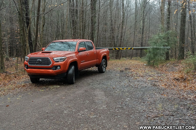
- Begin hike at the gated road.
As the sign at the trailhead indicates, the Ketchum Run Trail will eventually connect you to the Loyalsock Trail, and you’ll be utilizing both trails on this hike.
Hiking to the Waterfalls on Ketchum Run
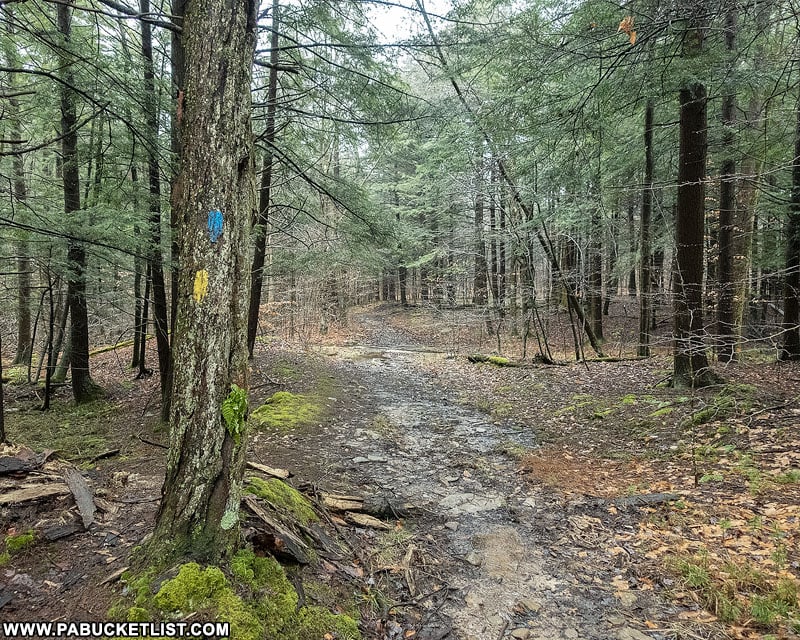
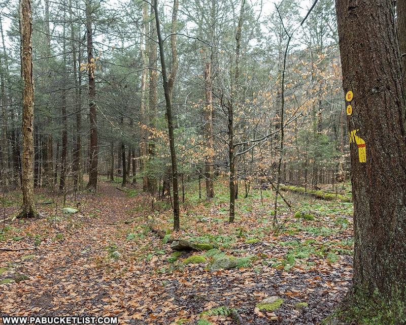
The hike begins on the remnants of a old log road, following the yellow and blue blazes shown above.
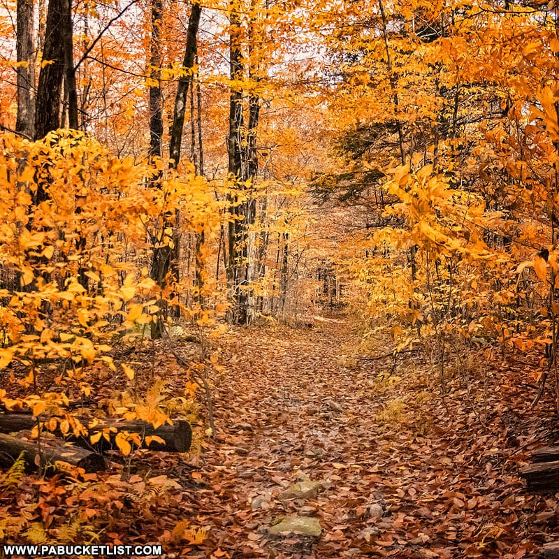
In the fall this section of the trail becomes a “yellow brick road” of sorts. Minus the bricks, of course.
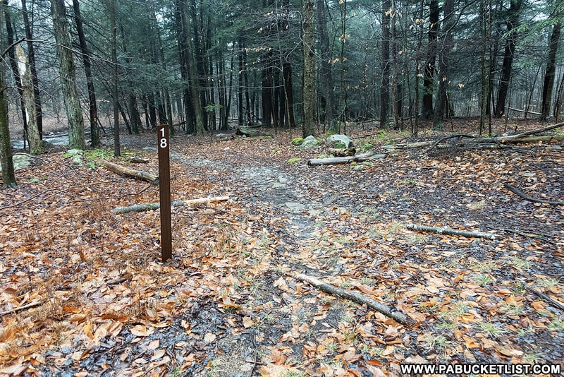
At .55 miles into the hike you’ll encounter locator post 18.
You want to bear left at the sign, and then follow an unblazed but obvious trail to the right, immediately BEFORE Ketchum Run.
REPEAT: DO NOT CROSS OVER KETCHUM RUN!
This entire hike takes place on the right hand side (when hiking downstream) of Ketchum Run.
You will follow this unblazed path down the right side of Ketchum Run another .15 miles to Right Angle Falls.
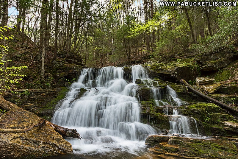
Right Angle Falls on Ketchum Run
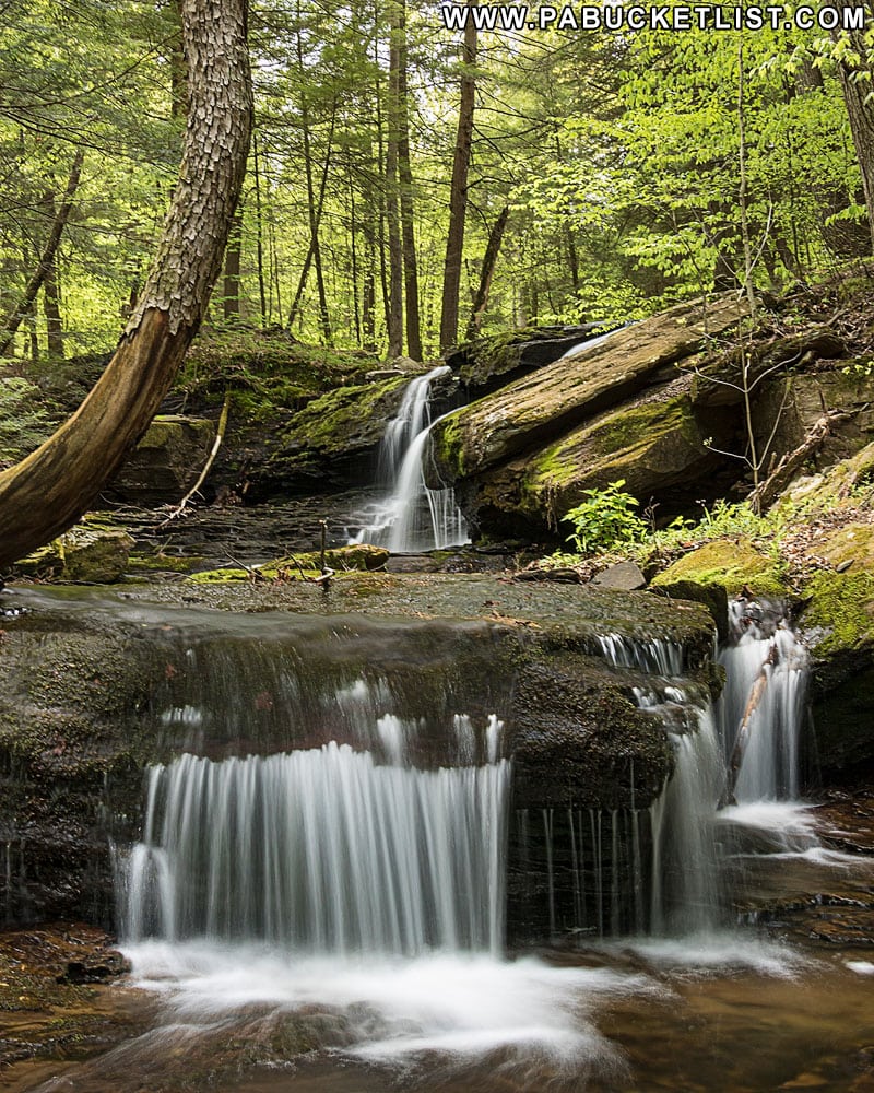
At .70 miles into the hike you’ll encounter the first of the 4 waterfalls described here – Right Angle Falls.
The GPS coordinates for Right Angle Falls: 41.447966, -76.620428
Right Angle Falls is not an official name, but I call it that here because it’s easier than saying “that unnamed waterfall on Ketchum Run that forms a near-perfect right angle to the stream”.
On closer inspection you’ll see the upper tier of this waterfall is comprised of 2 enormous slabs of stone that jut out at a right angle to the general direction of the Ketchum Run.
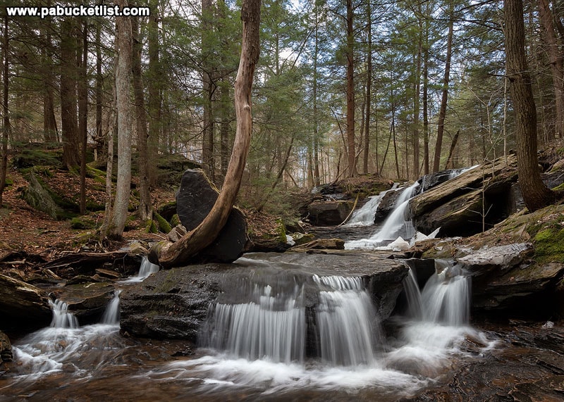
Whereas the lower tier is a single slab steering the stream in the direction you’d expect.
This is a spot of brilliant color in the fall.
But equally stunning in late winter/early spring.
Once you’ve taken in the sights at Right Angle Falls, continue down the right side of Ketchum Run a hundred yards or so to Ketchum Run Falls.
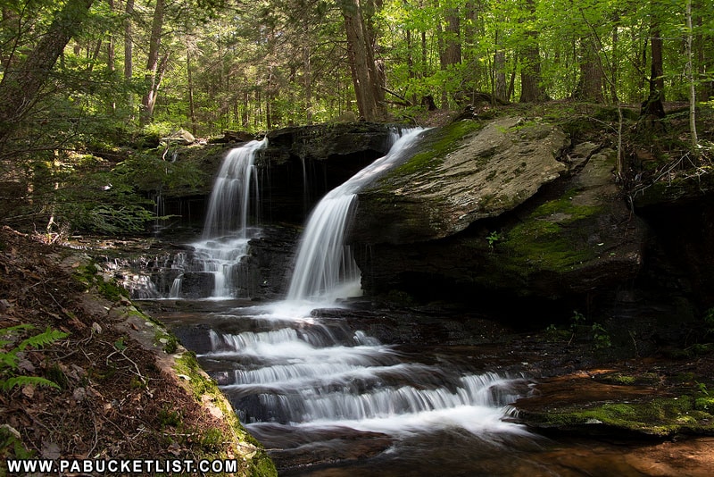
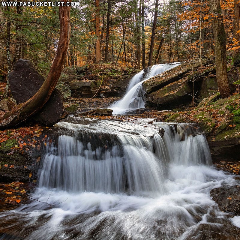
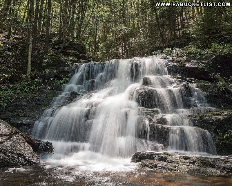
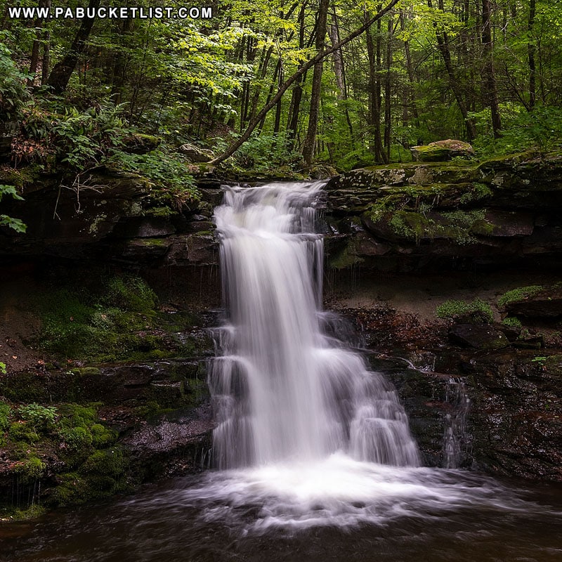
Ketchum Run Falls
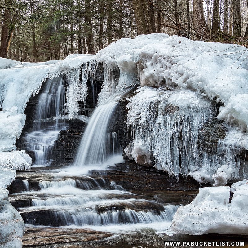
Ketchum Run Falls is, in my opinion, the most picturesque of the 4 waterfalls on Ketchum Run.
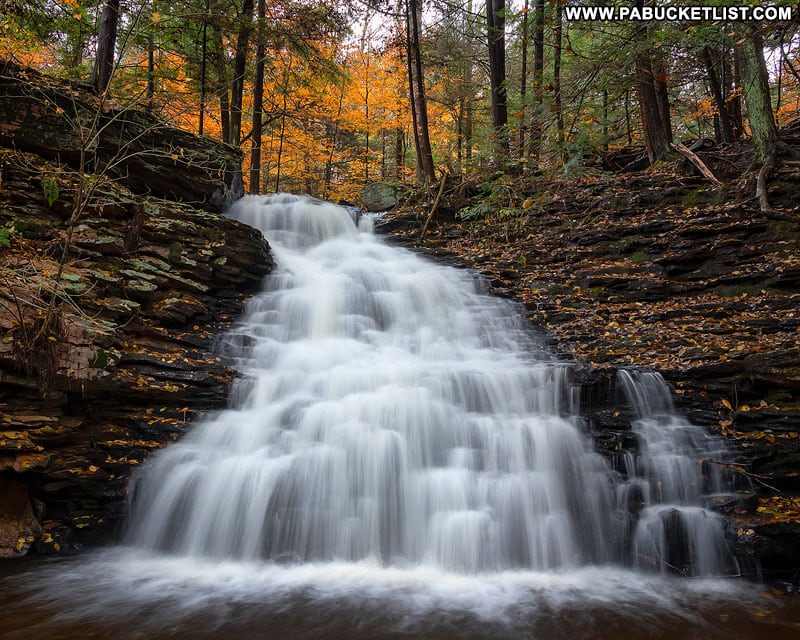
In the autumn, the area around Ketchum Run Falls explodes with color.
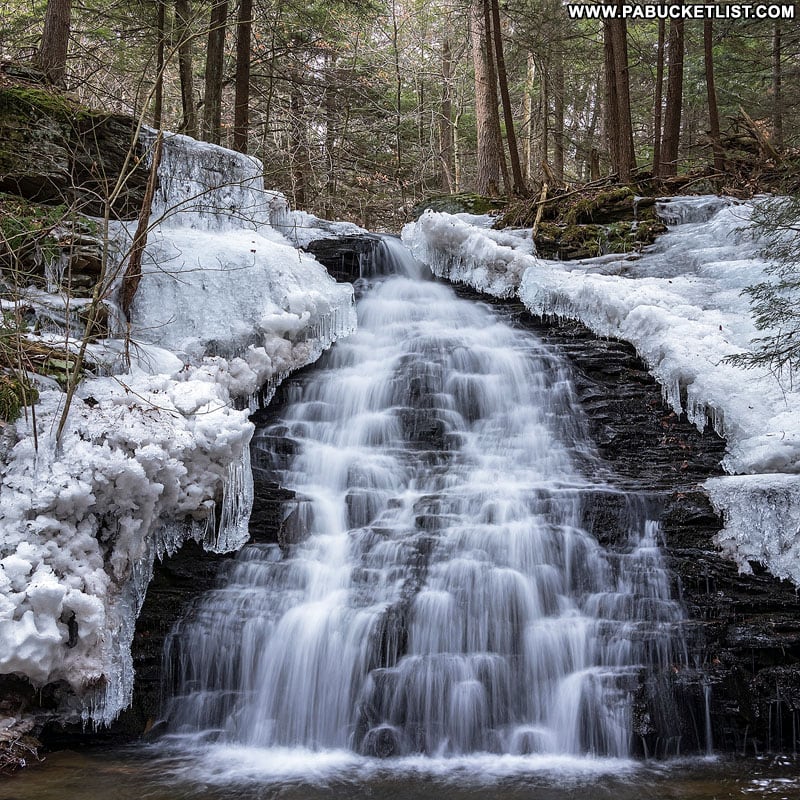
But the monotones and ice formations of winter shouldn’t be overlooked either.
The GPS coordinates for Ketchum Run Falls: 41.44924, -76.62085.
From the base of Ketchum Run Falls, continue downstream 2/10ths of a mile to the intersection of this unblazed portion of trail with the prodigiously-blazed Loyalsock Trail.
Pick up the Loyalsock Trail at .95 miles into your hike, and continue to follow it to the last 2 waterfalls on this hike.
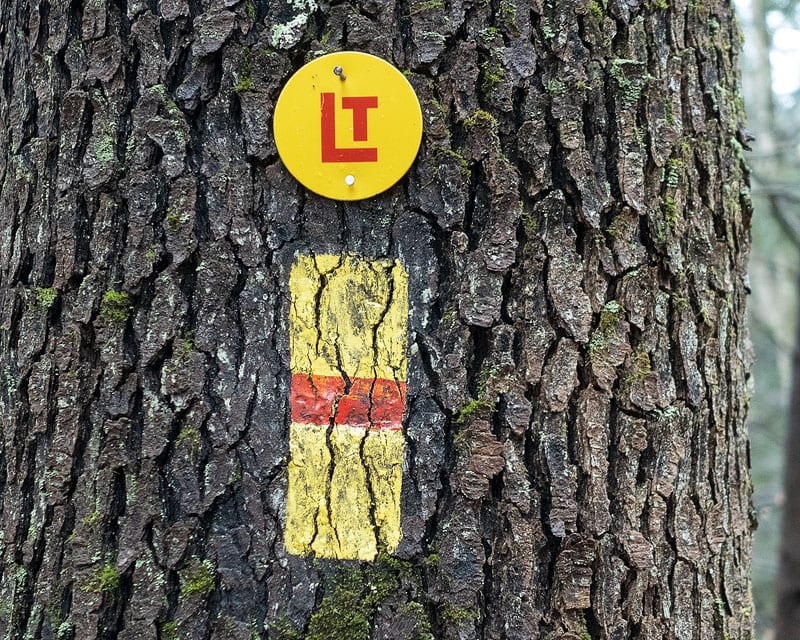
The Loyalsock Trail may be THE best blazed trail in Pennsylvania.
The iconic markers make it nearly impossible to get lost on the remainder of your downstream excursion.
At 1.46 miles into your hike, you’ll come to a point where the Loyalsock Trail makes a hard, right-hand turn uphill, away from Ketchum Run.
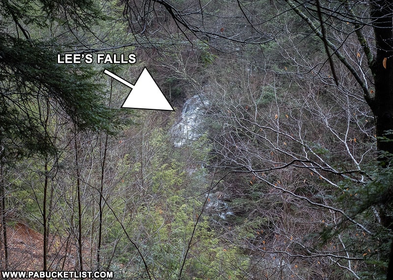
Where the trail starts uphill, away from Ketchum Run, you’ll find Lee’s Falls waiting for you on the stream right below.
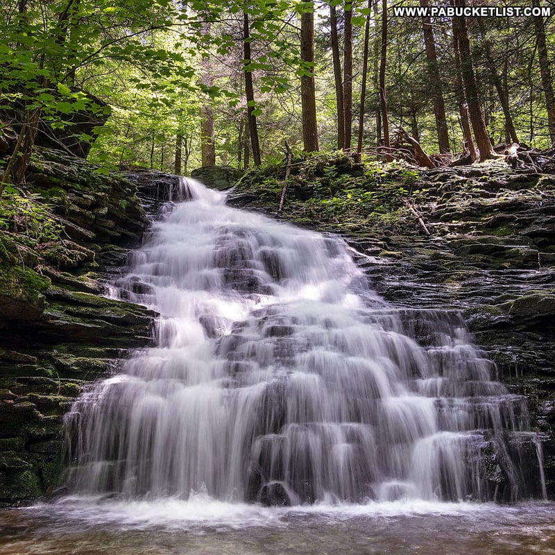
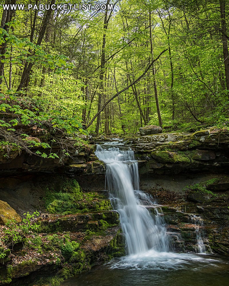
Lee’s Falls on Ketchum Run
Lee’s Falls are most easily viewed from the side, just off the Loyalsock Trail.
As with most waterfalls though, I find the best views to be from below.
No matter when you visit, Lee’s Falls is a terrific waterfall.
The GPS coordinates for Lee’s Falls: 41.451951, -76.628110
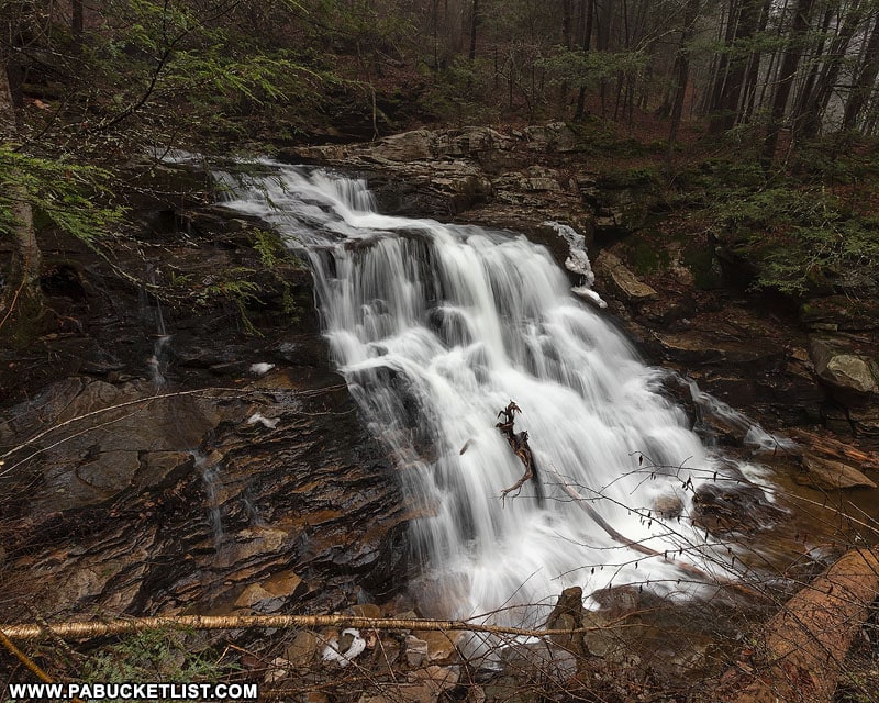
Hiking to Rode Falls
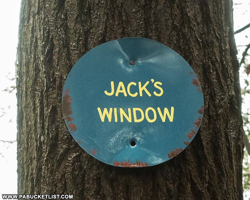
Continue down the Loyalsock Trail another 2/10ths of a mile (most of it being uphill on this portion of the hike) to Jack’s Window.
Here you have a view (somewhat obstructed) of where you just were at Lee’s Falls.
Continue past Jack’s Window as the trail begins to level out and then descend back towards Ketchum Run.
At 1.95 miles into the hike you’ll encounter this “Ladder Ahead” sign on the Loyalsock Trail.
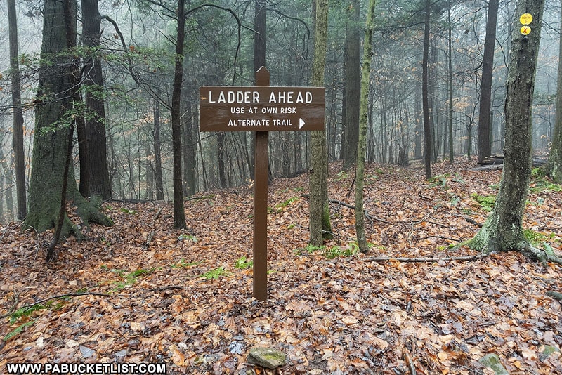
Your options here are to continue following the Loyalsock Trail to the left, or to take a bypass trail on the right, in which case you’ll have to double back (but not very far) to see Rode Falls.
If you have small kids or large dogs with you, or just a fear of ladders, you may want to consider the bypass.
Otherwise, just stay on the Loyalsock Trail (by keeping to the left) another 1/3 of a mile as it descends to Ketchum Run and puts you at the top of the ladder, right next to Rode Falls.
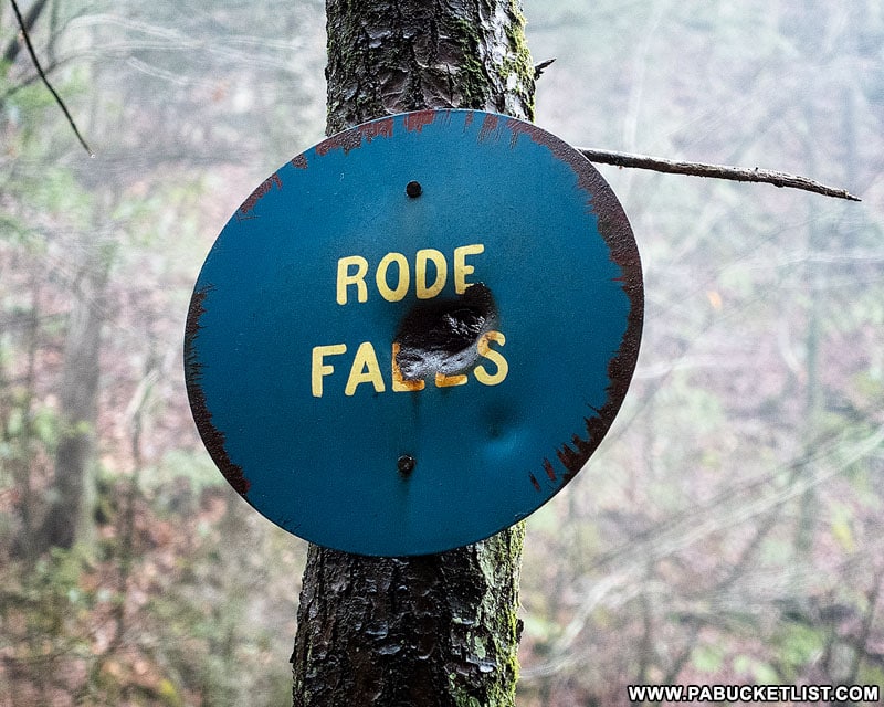
Descend the 7 rungs and you’re at the base of Rode Falls.
GPS coordinates of Rode Falls: 41.455688, -76.634185
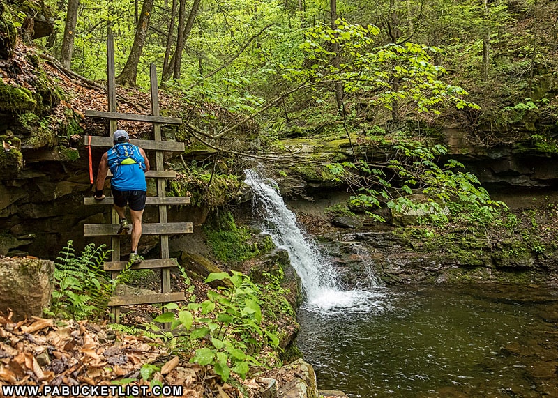
Rode Falls is a classic-looking 12 footer, with a thunder much louder than you’d anticipate as it plunges to the pool below, amplified by the amphitheatre of rocks in the gorge.
This mossy portion of the Ketchum Run Gorge is a welcome sight any time of the year.
Once you’ve finished up at Rode Falls, simply backtrack to your vehicle on High Knob Road, completing this roughly 4.6 mile out and back hike.
Still not convinced you need to visit Ketchum Run?
Then check out this video!
Related Attractions
20 Must See Pennsylvania Waterfalls highlights twenty of the most picturesque waterfalls in Pennsylvania, all personally visited and photographed during my travels across the Keystone State.

Nearby Attractions
9 Must-See Attractions in Sullivan County showcases more remarkable sights and experiences near Ketchum Run Falls.

A Smarter Way to Explore Pennsylvania
Explore Pennsylvania like a pro with the interactive PA Bucket List Travel Map, showcasing over 1,000 memorable destinations I’ve personally visited across the Keystone State.
Did you enjoy this article?
If so, be sure to like and follow PA Bucket List on Facebook, Instagram, and/or Pinterest to learn more about the best things to see and do in Pennsylvania!
Click on any of the icons below to connect with PA Bucket List on social media.