
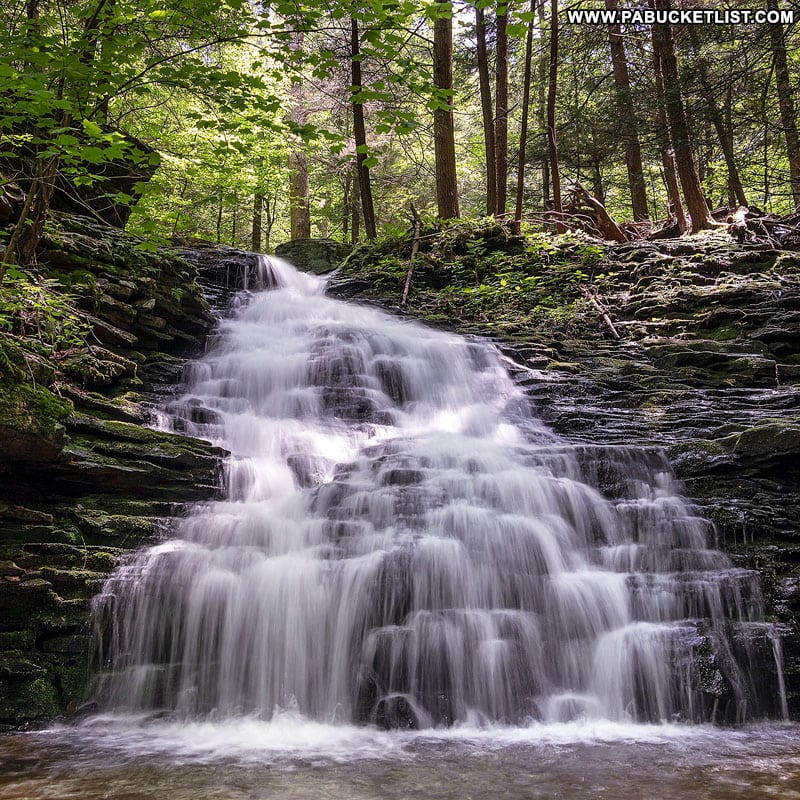
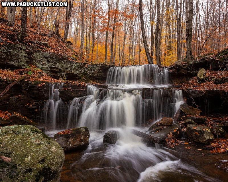
Worlds End State Park lies at the very heart of Sullivan County, one of Pennsylvania’s most fertile waterfall regions.
And while the park itself is home to only one waterfall (High Rock Falls), it is within a short distance of 10 outstanding waterfalls that’ll I’ll map out for you in this write-up.
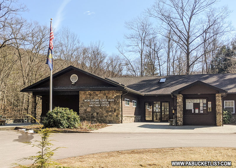
So if you’re looking for the ultimate waterfall-hunting excursion while visiting Worlds End State Park, read on!
Mapping out the Waterfalls
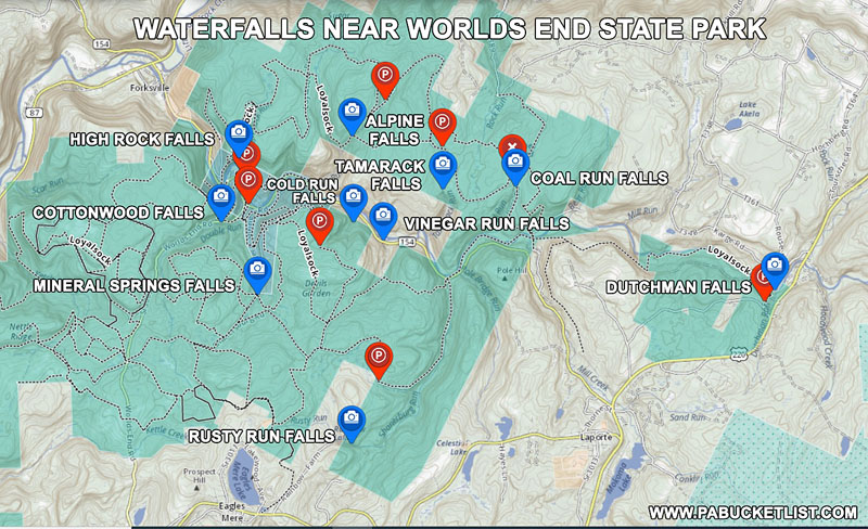
Of the ten waterfalls included in this write-up, one lies inside the boundaries of Worlds End State Park, one sits on private property (but is easily viewed from a public road), and the other eight are located in the Loyalsock State Forest which surrounds park.
High Rock Falls
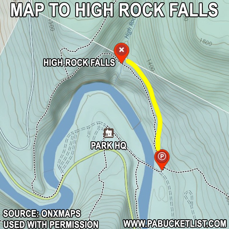
High Rock Falls is the only waterfall located within the boundaries of Worlds End State Park.
It is located along the High Rock Trail, which has its trailhead just a few minutes from the park office.
High Rock Run is an intermittent tributary of Loyalsock Creek, so don’t expect a lot during a dry spell.
But if you catch it after the spring thaw or a heavy rain, it’s a superb scene.
GPS coordinates for the High Rock Trail Head are : 41.47046 -76.57893.
GPS coordinates for High Rock Falls are: 41.47421 -76.58084 .
The hike (one way) is roughly 0.3 miles.
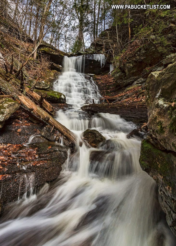
Alpine Falls
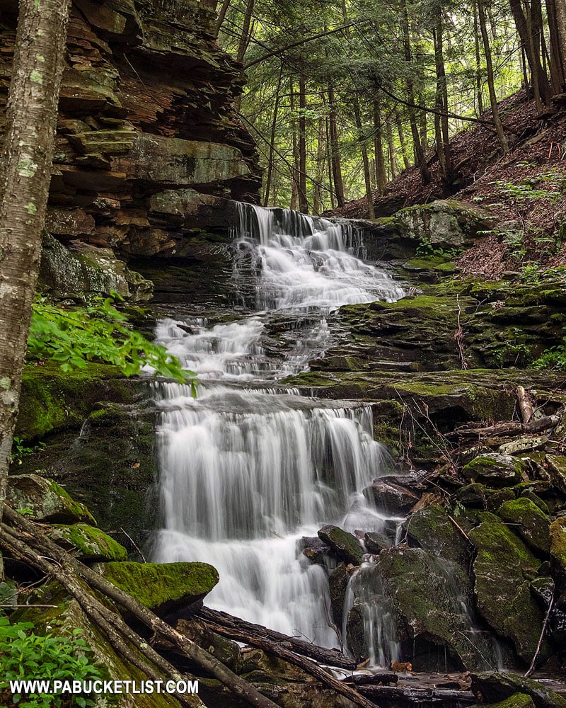
Alpine Falls is located along the Loyalsock Trail, but can be reached via an alternate trailhead on Loyalsock Road (a dirt State Forest road).
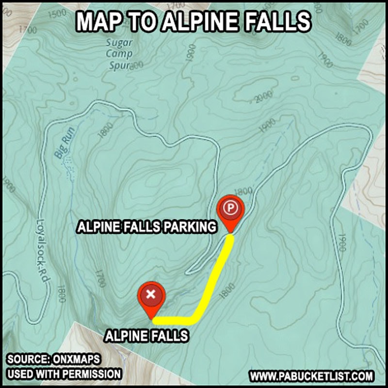
GPS coordinates for Alpine Falls parking pull-off: 41.48478 -76.54538.
GPS coordinates for Alpine Falls: 41.47822 -76.55341.
This is a pretty straight-forward hike.
Follow the Crane Spur Trail (an abandoned log road) for 0.6 miles, hang a right on the well-blazed Loyalsock Trail, and follow that for 0.1 miles to the top of Alpine Falls.
The upper tier of Alpine Falls is 7-8 feet tall.
The middle and lower tiers of Alpine Falls are the real photo-op here.
When you are finished at Alpine Falls, simply retrace your steps to the parking area along Loyalsock Road.
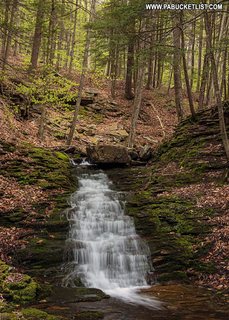
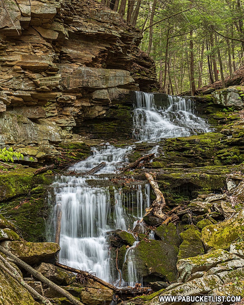
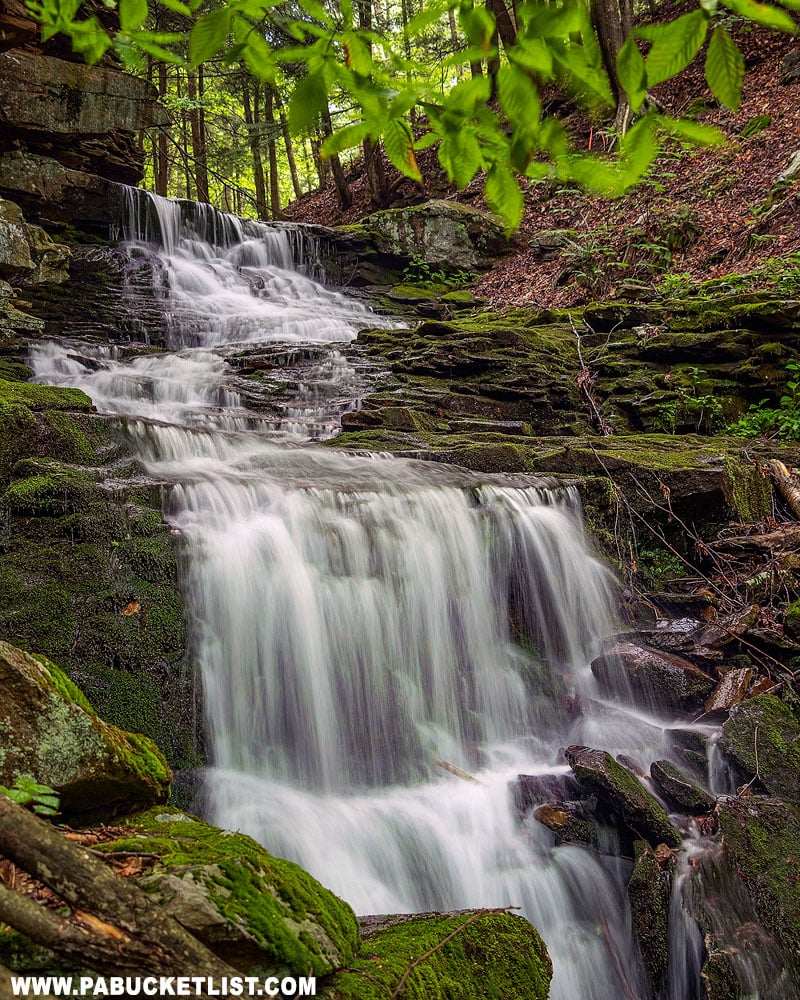
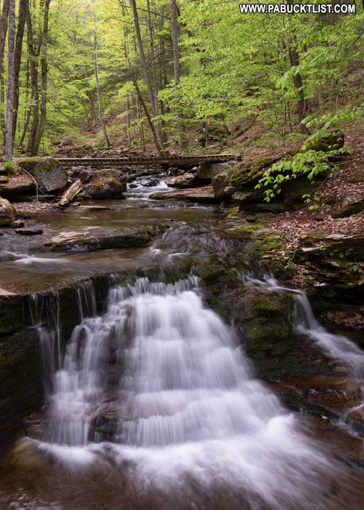
Tamarack Falls
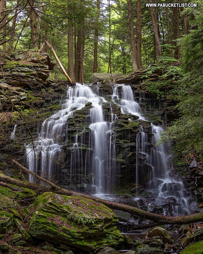
Tamarack Falls lies on another intermittent tributary of Loyalsock Creek, and so it is best to visit this one after a heavy rain / snowmelt event.
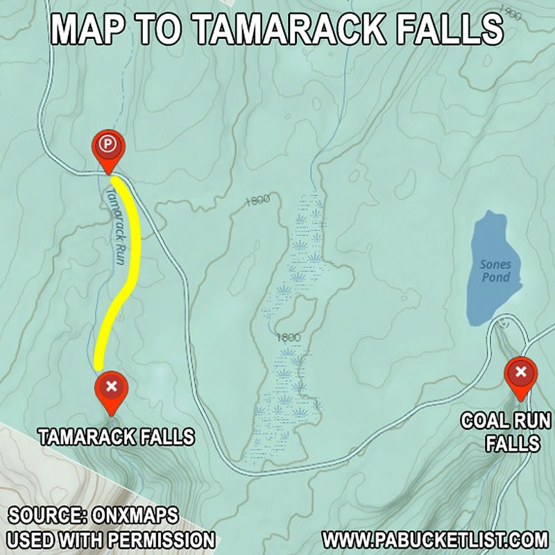
GPS coordinates for Tamarack Falls parking pull-off along Loyalsock Road: 41.47627, -76.53157.
GPS coordinates for Tamarack Falls: 41.46847, -76.53141.
This is an off-trail hike, so the best advice I can give you is use the GPS coordinates and follow the stream.
The hike is roughly 1/2 a mile (one way).
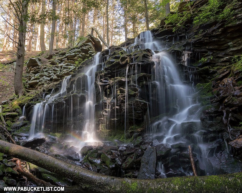
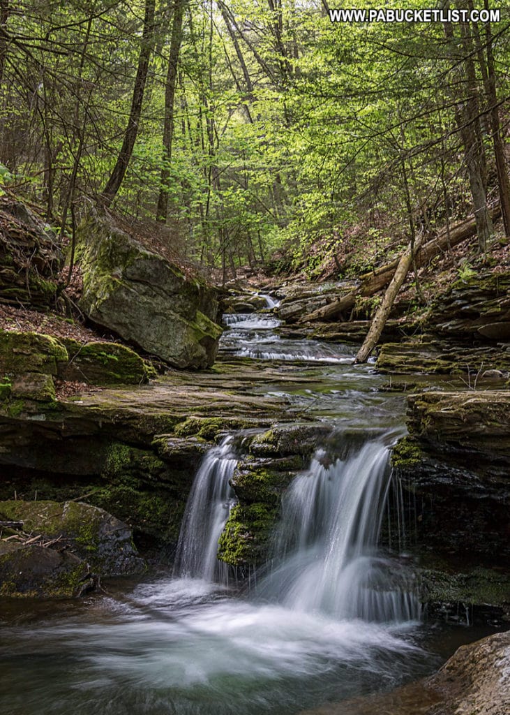
Coal Run Falls
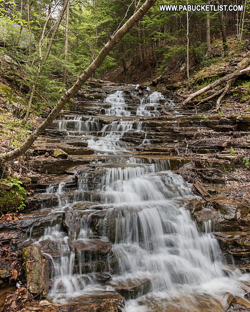
Coal Run contains a series of small, unnamed waterfalls and cascades along a 1/2 mile stretch of this stream just below Sones Pond.
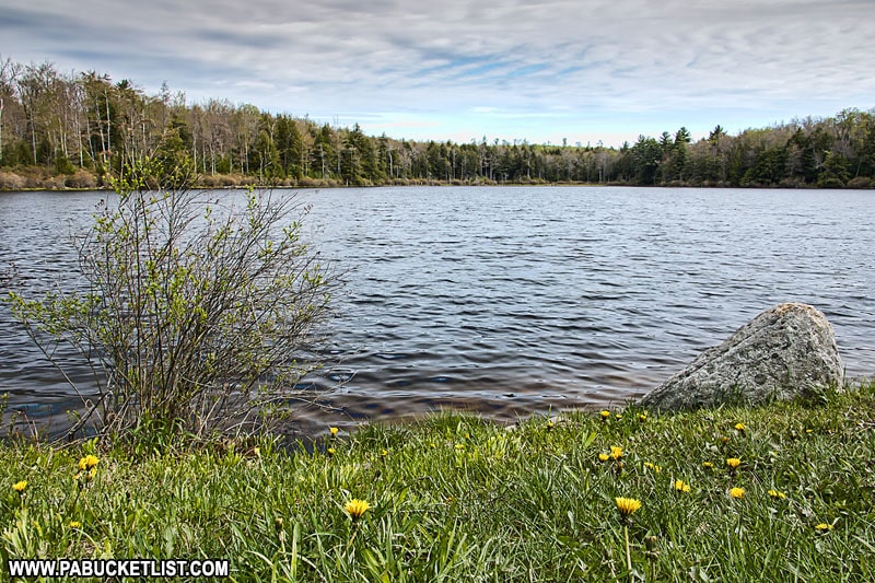
My advice is to just park at the Sones pond lot (restrooms available there as well) and hike downstream on Coal Run.
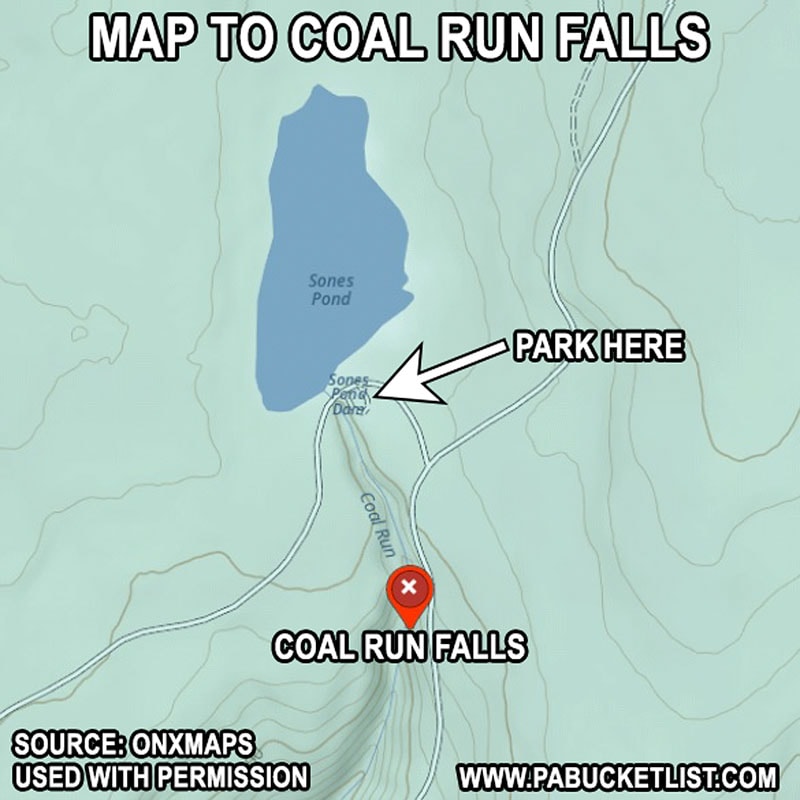
GPS coordinates for Sones Pond parking lot: 41.47157, -76.51457.
GPS coordinates for Coal Run Falls: 41.46893, -76.51380.
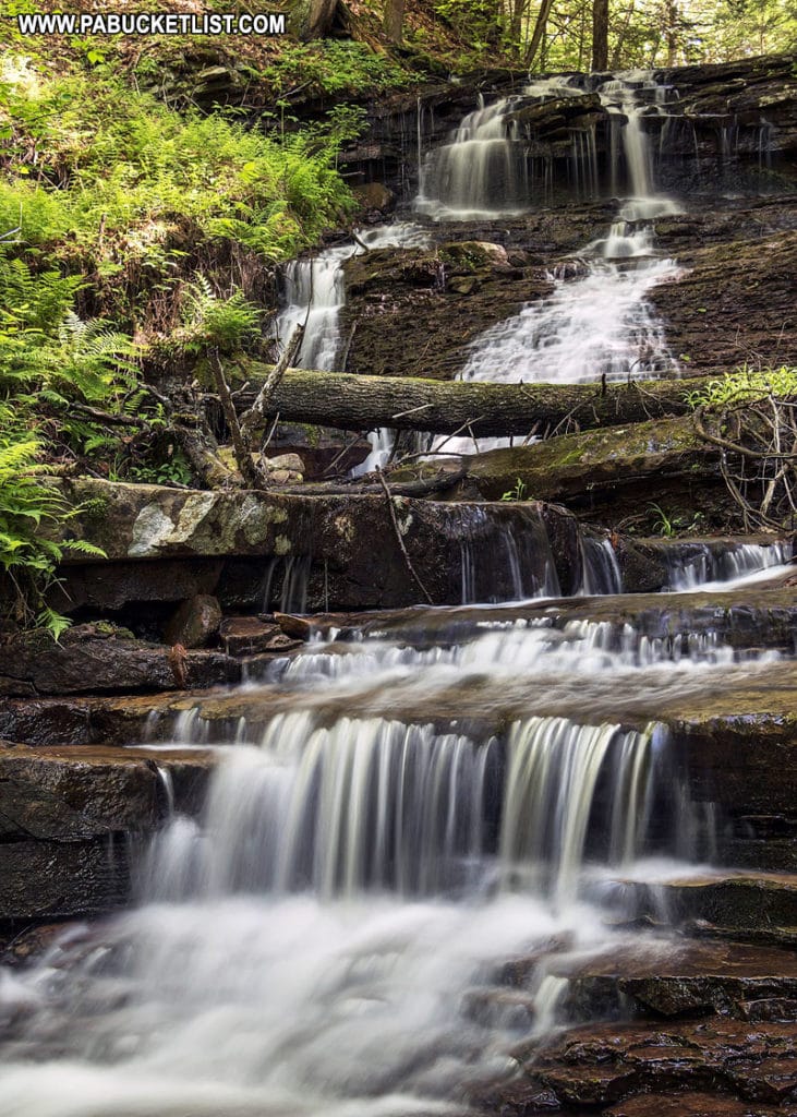
There are numerous small waterfalls along Coal Run, with the tallest ones being withing a 1/4 mile of Sones Pond.
The further downstream from the pond you get, the smaller the falls become.
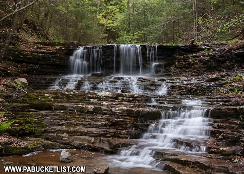
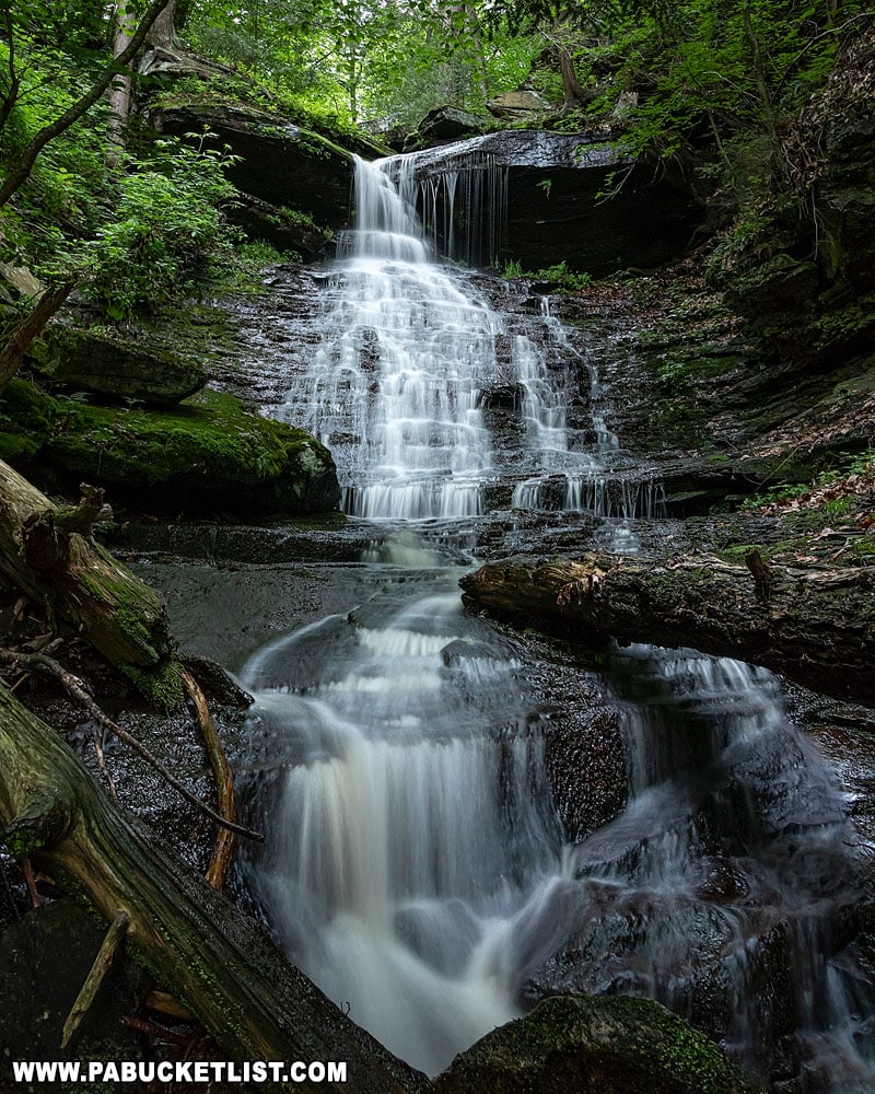
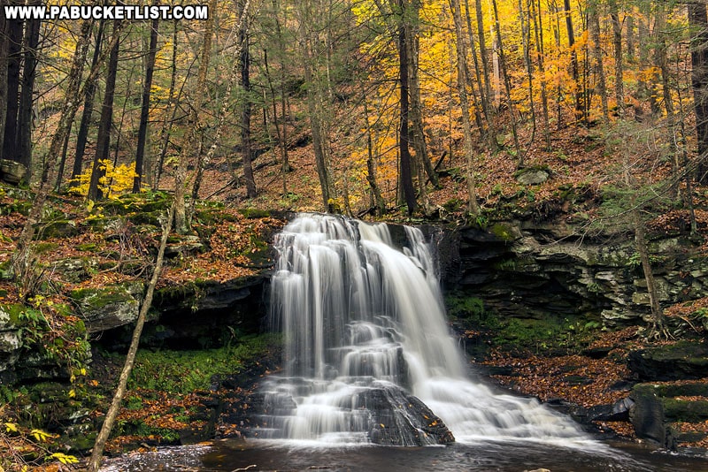
Dutchman Falls
Dutchman Falls (not to be confused with Dutchmans Run Falls) is a magnificent 27 foot tall, two-tiered waterfall located near the eastern terminus of the Loyalsock Trail.
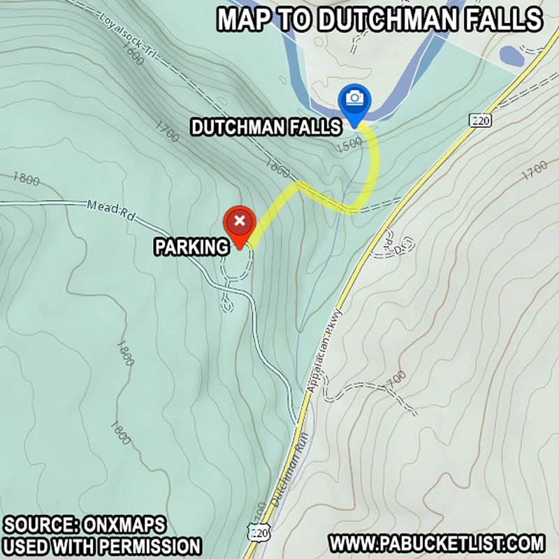
GPS coordinates for the Dutchman Falls parking area: 41.44810, -76.45342.
GPS coordinates for Dutchman Falls: 41.45014, -76.45085
The hike to Dutchman Falls is short (0.3 miles one-way) but relatively steep.
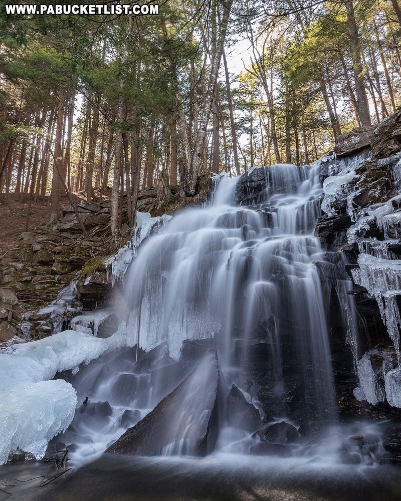
Vinegar Run Falls
Vinegar Run Falls is literally roadside along Route 154 as you loop back towards Worlds End State Park.
It is important to note: Vinegar Run Falls sits on private property!
Fortunately, there are roadside pull-offs before and after the bridge over Vinegar Run, on the state-owned right-of-way opposite the falls.
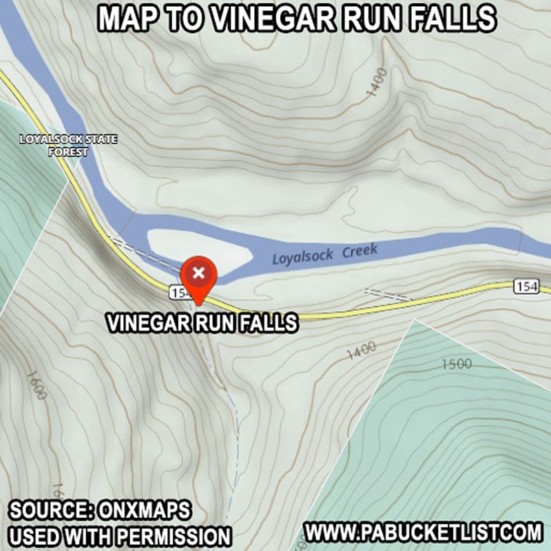
GPS coordinates for Vinegar Run Falls are: 41.45917, -76.54583.
From the curb along Route 154 you have an excellent view of Vinegar Run Falls.
Be sure to use caution when crossing the road, even though this is a lightly-travelled highway.
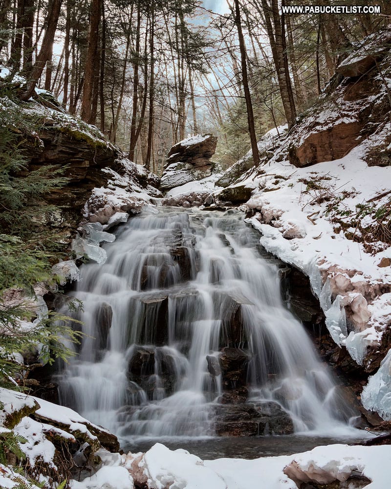
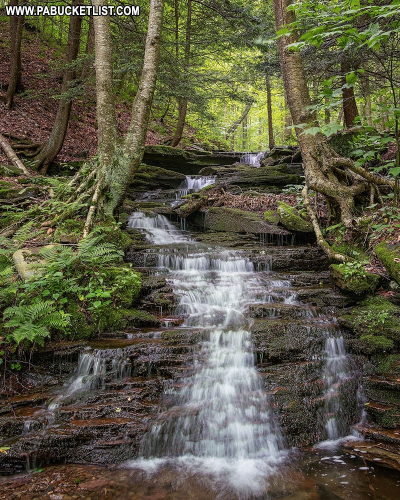
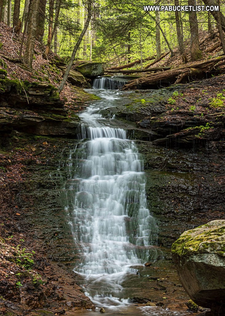
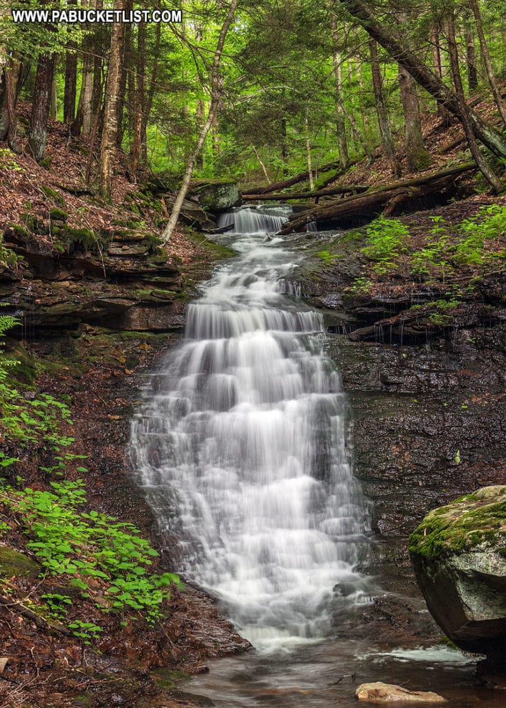
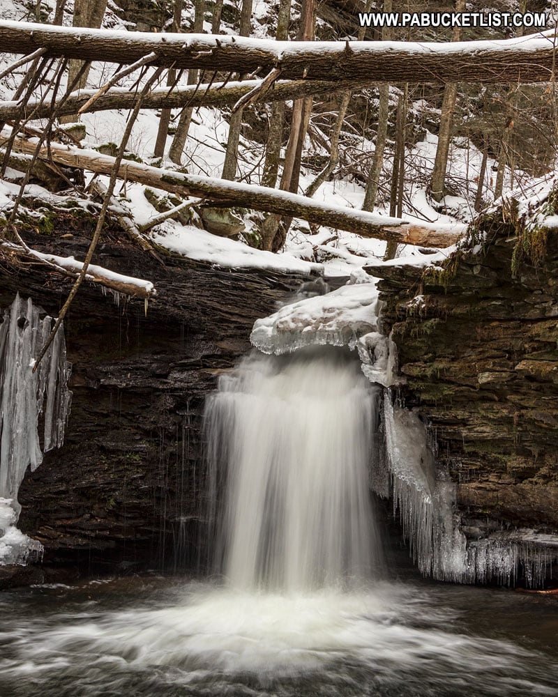
Cold Run Falls
Cold Run Falls is actually a series of small, unnamed waterfalls along the newly-created Cold Run Trail (a 1.5 mile spur of the Canyon Vista Trail).
The trail is so new it doesn’t appear on the official park maps yet, but for the purposes of seeing the waterfalls along Cold Run you have 2 options.
One is to park along Route 154 at the Canyon Vista trail head and hike in that way.
The second option is to park near the headwaters of Cold Run along Cold Run Road and hike down from the top.
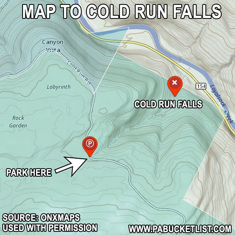
If you go with option #2, the GPS coordinates for the pull-off along Cold Run Road is 41.45822, -76.56117
The falls themselves can be found all along Cold Run and the Cold Run Trail that parallels it.
The largest falls along Cold Run are closest to the bottom, near GPS coordinates 41.46256, -76.55307.
Mineral Spring Falls
Mineral Spring Falls is truly roadside.
You can see it from your vehicle, or pull-off along Mineral Spring Road for closer inspection.
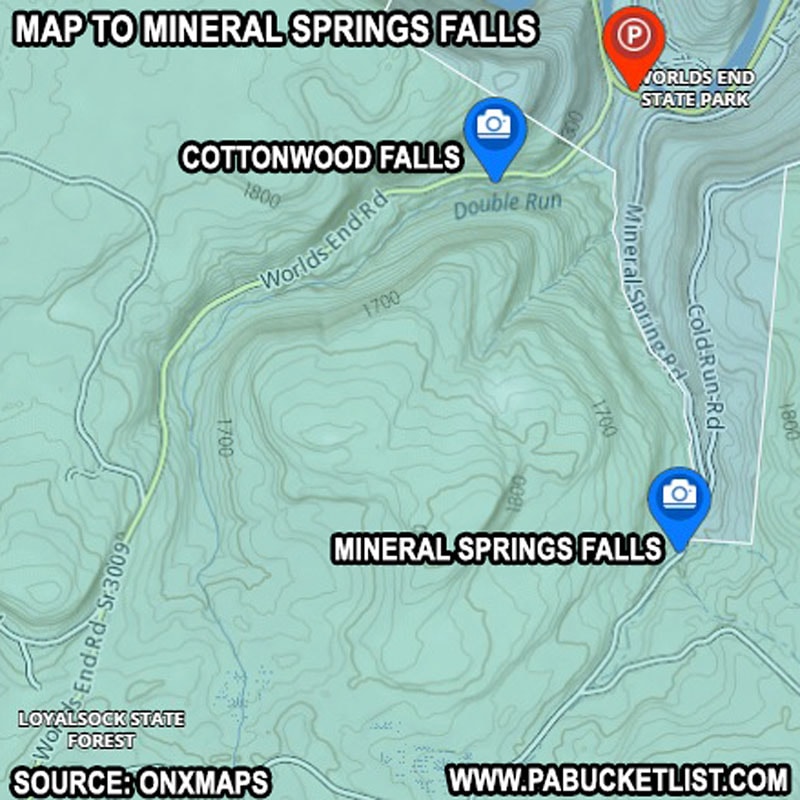
The GPS coordinates for Mineral Spring Falls in the Loyalsock State Forest: 41.44936, -76.57637.
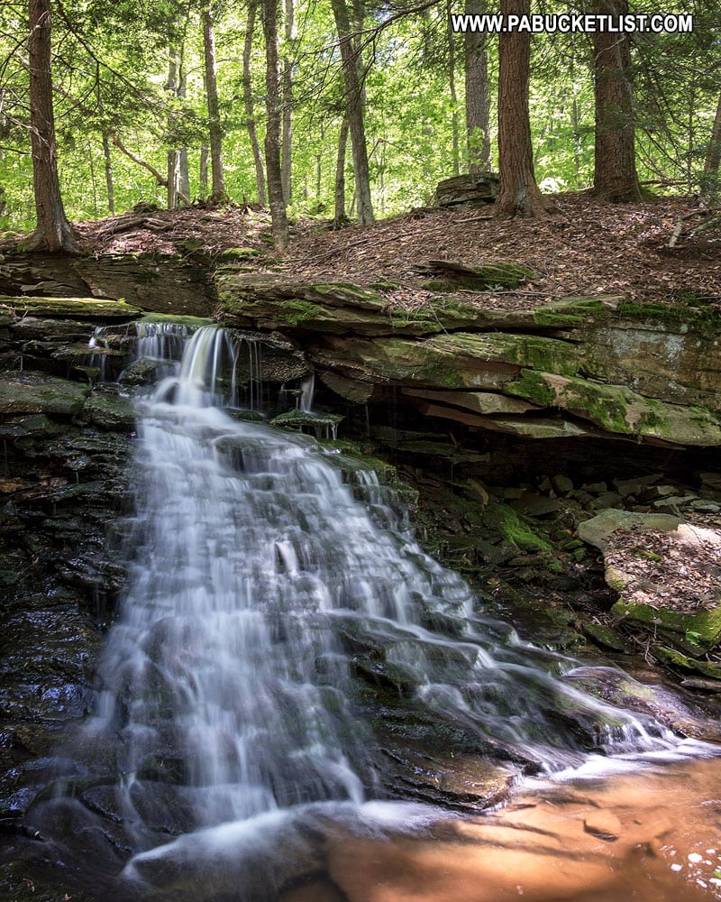
There’s also a small waterfall I refer to as Upper Mineral Spring Falls located just upstream, not visible from the road.
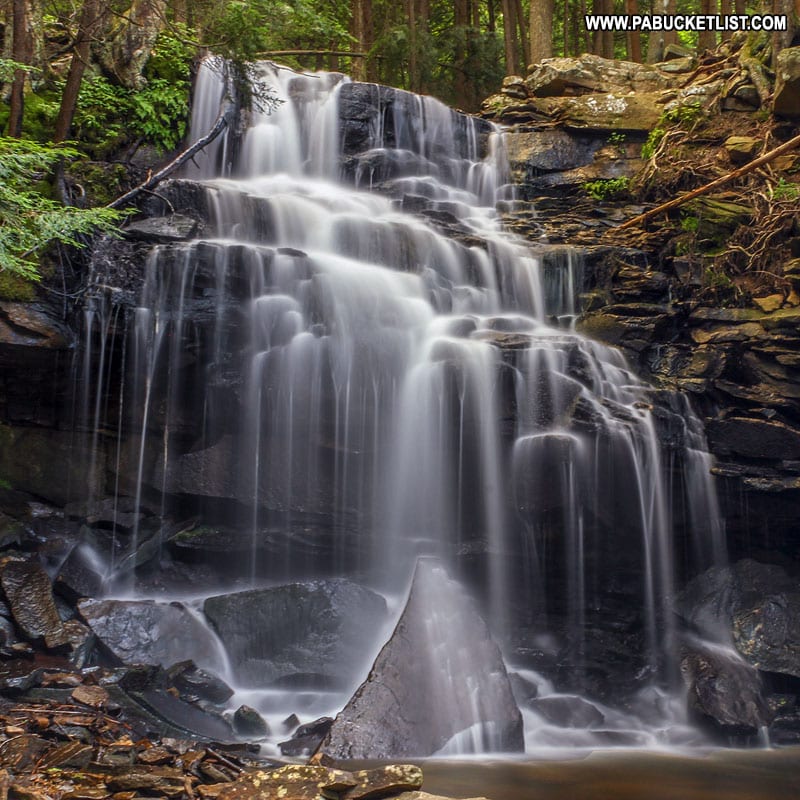
Rusty Run Falls
Rusty Run Falls can be found via a 1.2 mile hike along a bridle trail (horses allowed) in the Loyalsock State Forest.
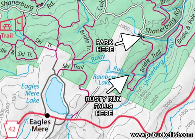
The parking area for the Rusty Run Falls hike is located along Shanerburg Road at GPS coordinates 41.433749, -76.546954.
Rusty Run Falls is located at GPS coordinates 41.42228, -76.55346.
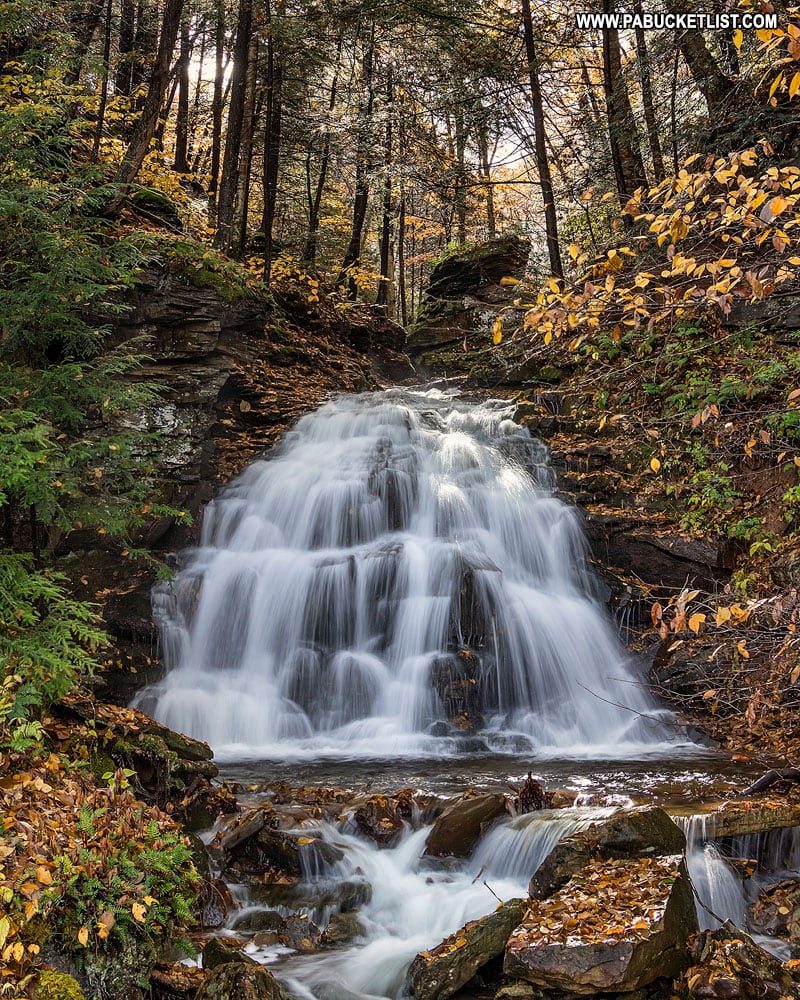
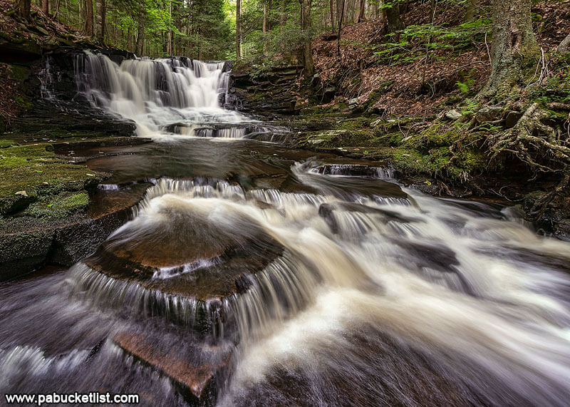
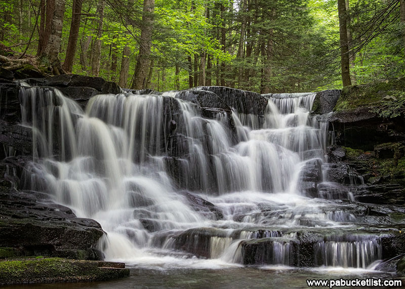
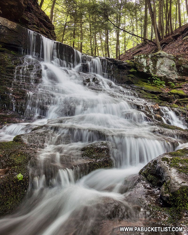
Cottonwood Falls
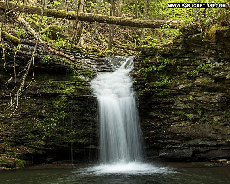
Although the hike to Cottonwood Falls starts in Worlds End State Park, the falls themselves lie outside the park boundaries in the Loyalsock State Forest.
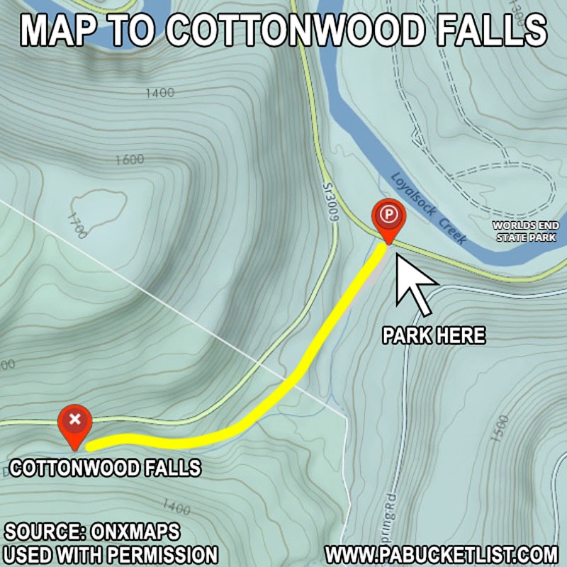
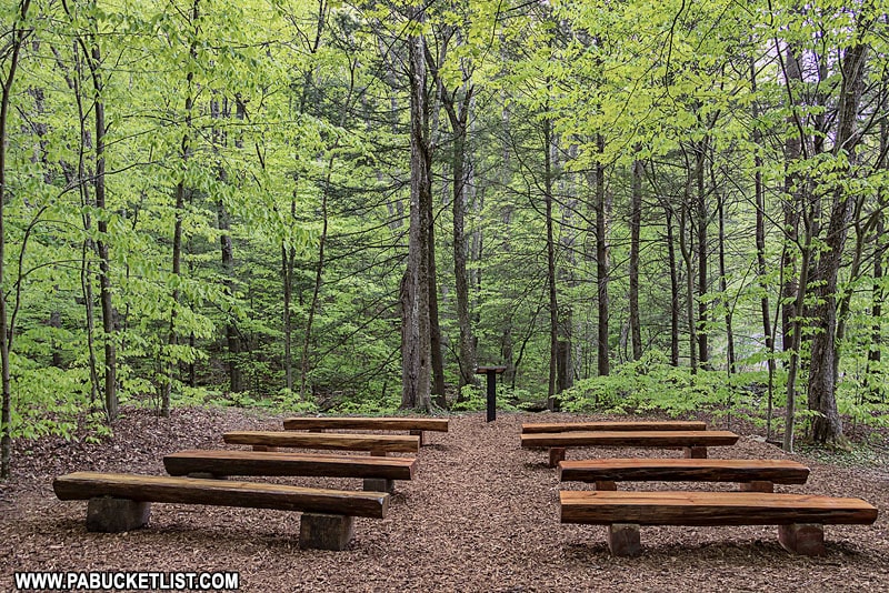
Cottonwood Falls lies along the Double Run Trail, where the trailhead is along Route 154, next to the “Chapel”.
GPS coordinates for the Double Run Trailhead: 41.46577, -76.57854.
GPS coordinates for Cottonwood Falls: 41.46252, -76.58515.
The hike itself is roughly a 1/2 mile along the Double Run Trail.
There are plenty of photo-ops at small waterfalls and cascades on the way to Cottonwood Falls.
Cottonwood Falls is a remarkable little waterfall, any time of year.
Final Thoughts
So there you have it – 10 great waterfall spots in and around Worlds End State Park!
This would make for a fine daylong excursion, or a series of visits if you want to break it up into chunks.
Want to make your trip to Worlds End State Park even MORE epic?
Rent a one-of-a-kind vacation home near Worlds End State Park through Vrbo!
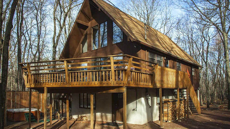
Browse HUNDREDS of awesome cabins, lodges, and chalets near Worlds End State Park at the Vrbo link below.
Nearby Attractions
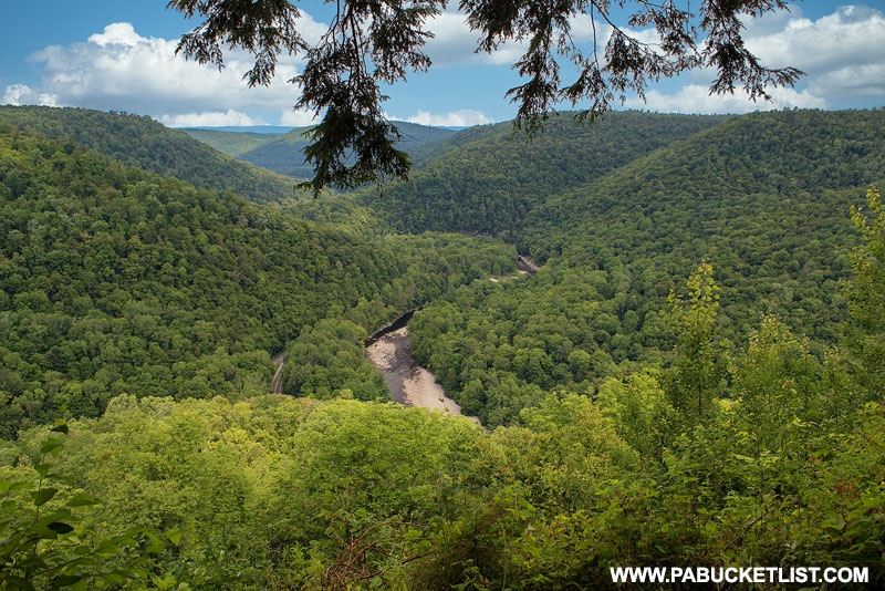
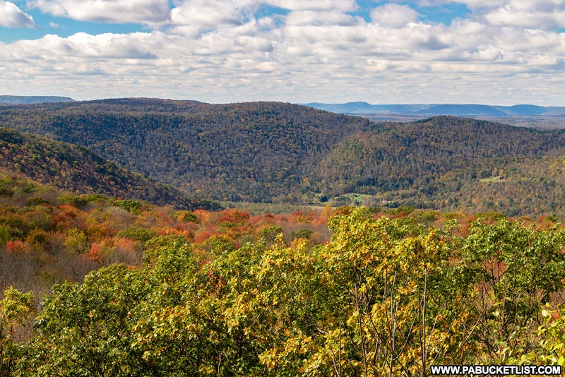
The area around Worlds End State Park is also known for incredible mountain vistas, and you’ll find directions to some of the finest in my write-up “The 8 Best Scenic Overlooks Near Worlds End State Park“.
And you won’t want to miss my write-up “The 20 Best Things to Do at Worlds End State Park” either!
Looking for even more nearby waterfalls?
Ketchum Run is home to 4 great waterfalls, and the trailhead is just minutes from Worlds End State Park, off of High Knob Road.
Dry Run Falls is close-by as well, and quite possibly the best looking roadside waterfall in Sullivan County.
And for some off-trail excitement, Dutters Run in the Loyalsock State Forest is hard to beat!
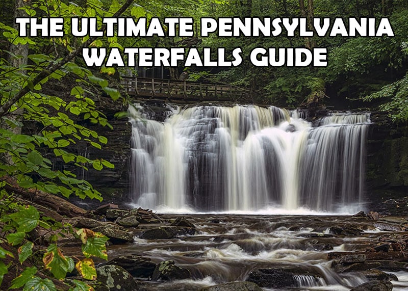
And if you’re REALLY into waterfalls, you’ll want to check out The Ultimate Pennsylvania Waterfalls Guide, with directions to HUNDREDS of PA waterfalls!
If scenic vistas are your thing, be sure to check out High Knob Overlook, easily one of the most popular roadside attractions in all of Sullivan County!
Did you enjoy this article?
If so, be sure to like and follow PA Bucket List on Facebook, Instagram, and/or Pinterest to stay up-to-date on my latest write-ups about the best things to see and do in Pennsylvania!
Click on any of the icons below to get connected to PA Bucket List on social media!