
Alpine Falls is a gorgeous three-tiered waterfall located along the world-famous Loyalsock Trail in the Loyalsock State Forest.
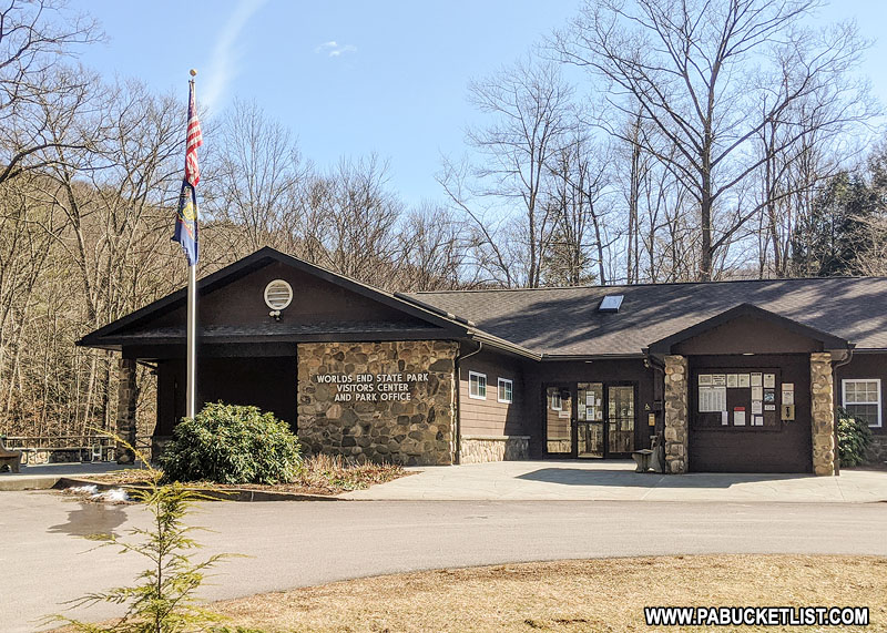
Near, but not in, Worlds End State Park.
Yet despite the fact that it is near two well-known recreational destinations in Sullivan County, lots of folks still have trouble finding this waterfall.
So that’s my mission here – to give you step-by-step directions on how to find Alpine Falls in the Loyalsock State Forest.
Getting There
How to Find Alpine Falls in the Loyalsock State Forest
- From Worlds End State Park, procede 0.5 miles north on Route 154 to intersection with Loyalsock Road.
- Turn right on Loyalsock Road (dirt State Forest road) and proceed 7.1 miles.
Park at pull-off on the right. Parking area GPS coordinates: 41.48478, -76.54538
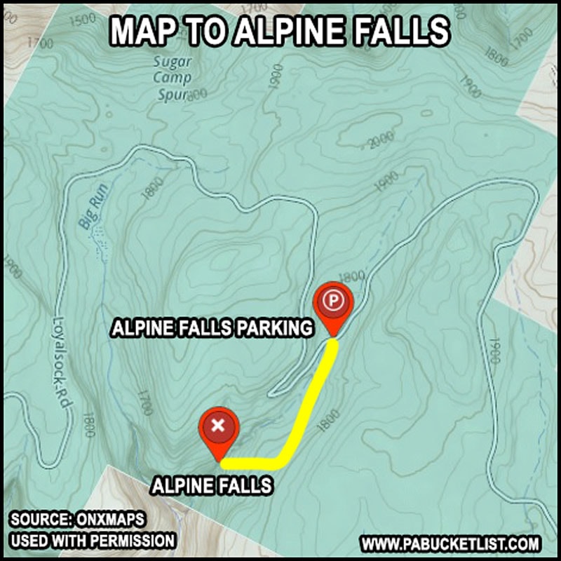
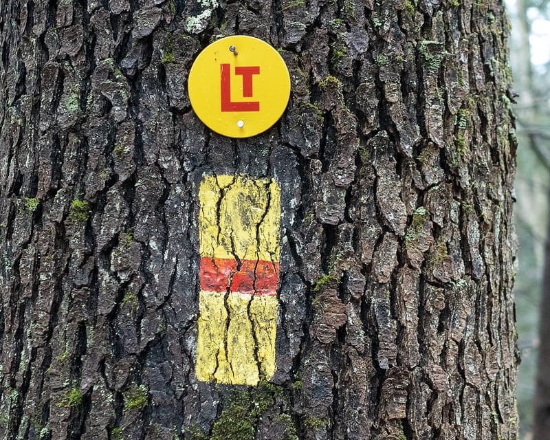
- Follow Crane Spur Trail (abandoned log road) 0.6 miles until it intersects with the Loyalsock Trail.
- Turn right on the Loyalsock Trail and follow it 0.1 miles to the top of Alpine Falls.
- Arrive at Alpine Falls.
GPS coordinates for Alpine Falls: 41.47822, -76.55341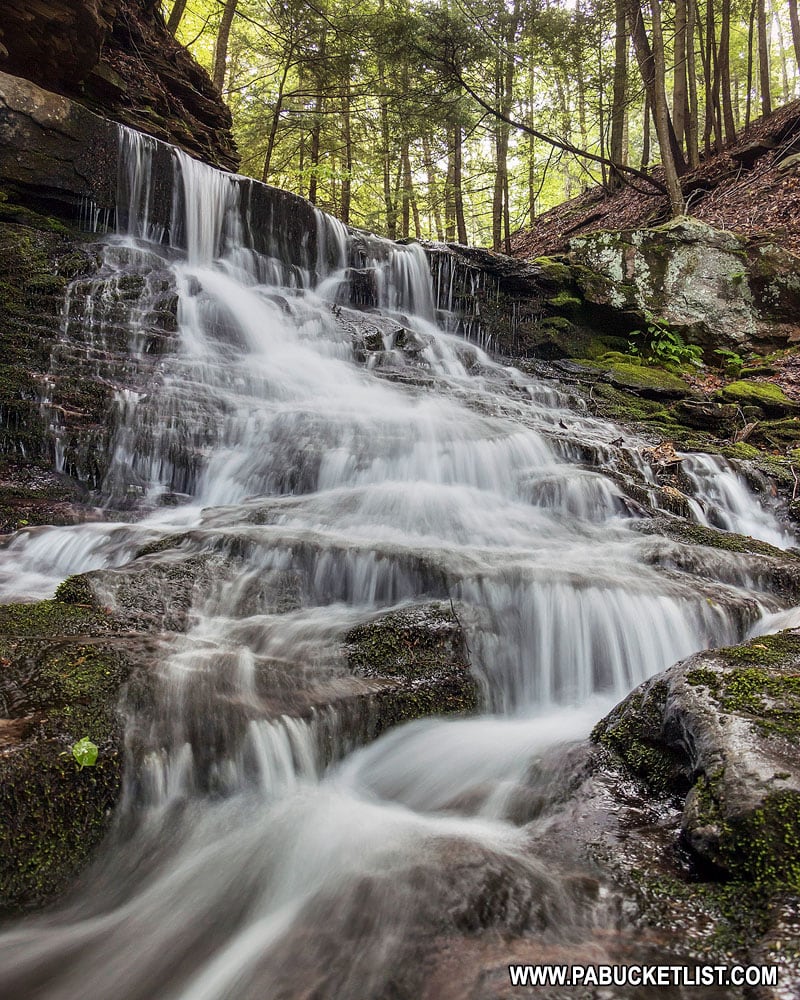
Exploring Alpine Falls
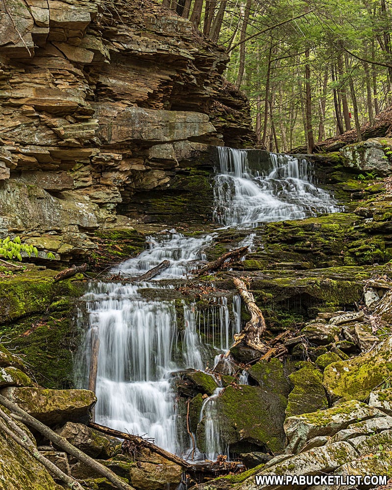
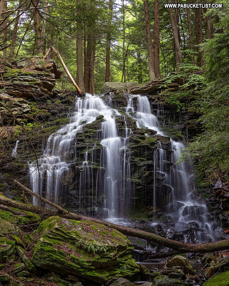
Alpine Falls is composed of three tiers.
The upper tier is maybe 7-8 feet tall.
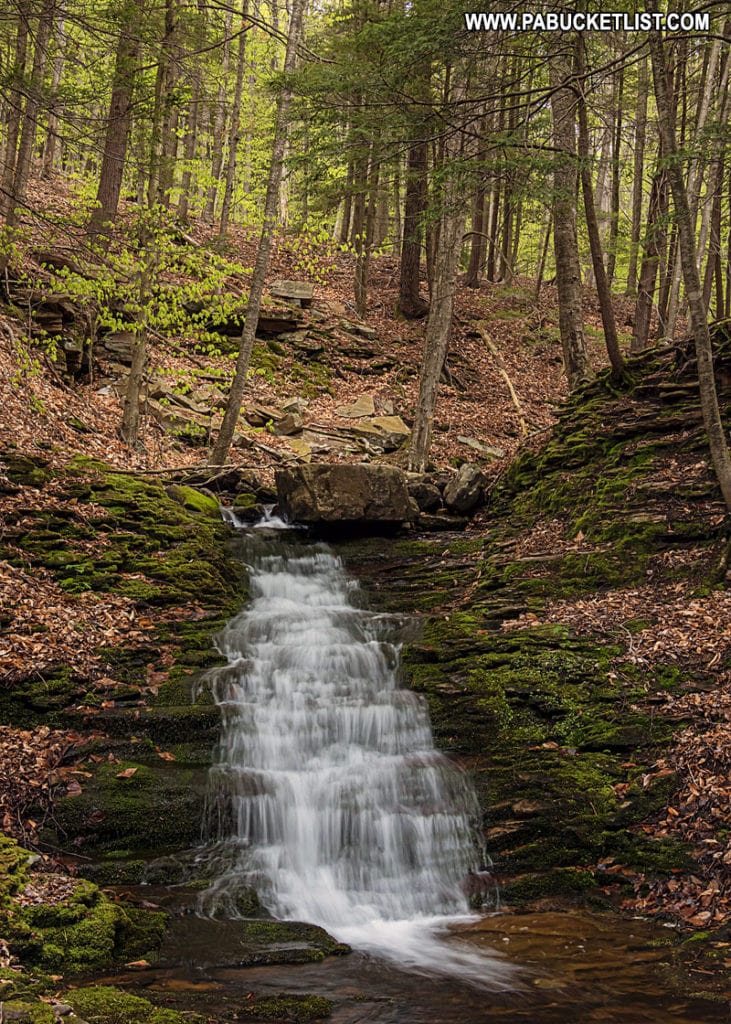
The middle and lower tiers are substantially taller and more photogenic, in my opinion.
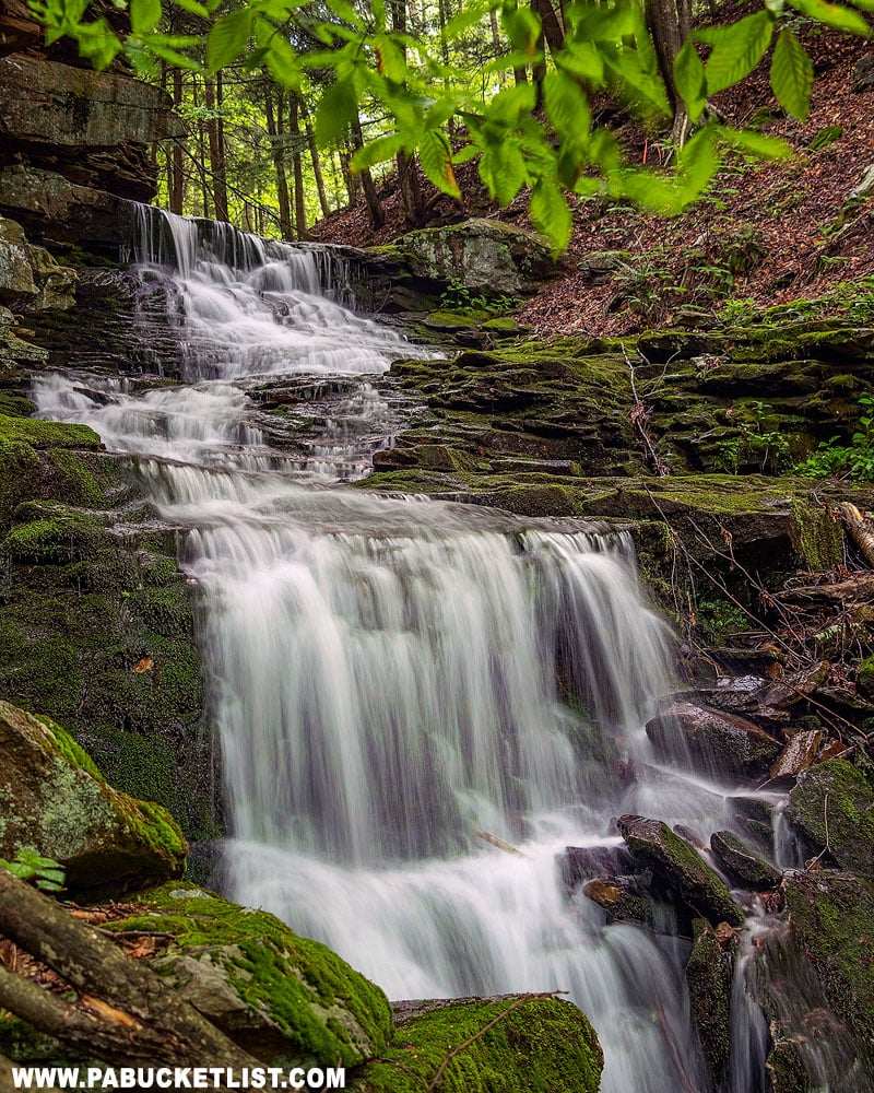
Use an abundance of caution when navigating the slick, moss-covered rocks to get to this vantage point.
When you’ve taken in the sights here, it’s a simple matter of retracing your steps 0.7 miles back to your vehicle.
Nearby Attractions
Looking for even more waterfalls in and around Worlds End State Park and the Loyalsock State Forest?
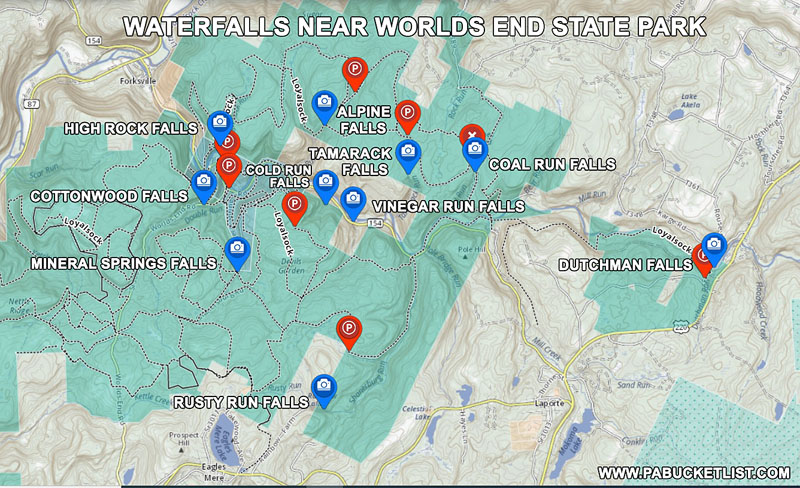
Then be sure to check out 10 Must-See Waterfalls Near Worlds End State Park.
In this guide you’ll find directions to 9 more magnificent waterfall spots in and around Worlds End State Park and the Loyalsock State Forest.