")
If you’re looking for directions to Dutchmans Run Falls in the McIntyre Wild Area, you’re in the right place!
Dutchmans Run Falls is a series of towering waterfalls along a rugged mountain stream in the McIntyre Wild Area, part of the Loyalsock State Forest in Lycoming County.
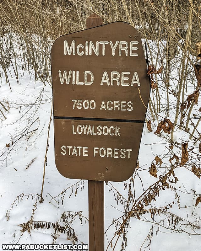
A Brief History of the McIntyre Wild Area
Long before it was a 7,279 acre hiking mecca, the McIntyre Wild Area was home to the McIntyre Coal Company and the company town of – you guessed it – McIntyre.
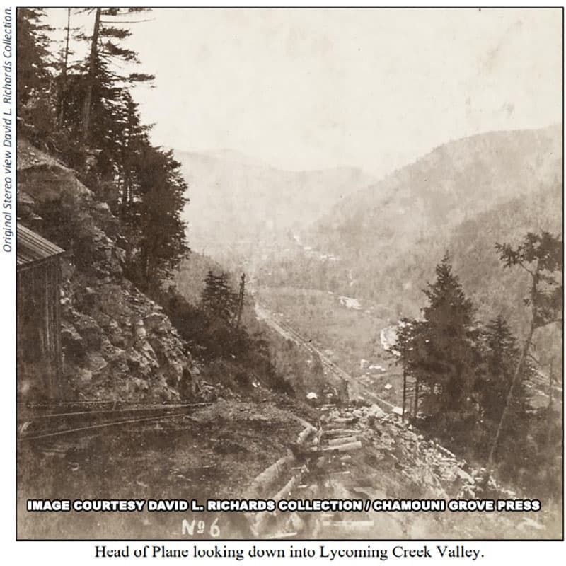
Founded in 1870 by industrialist Jervis Langdon (father-in-law of Mark Twain), the McIntyre Coal Company mined and moved coal from their mountaintop mines to waiting train cars 2,300 feet below via an inclined plane.
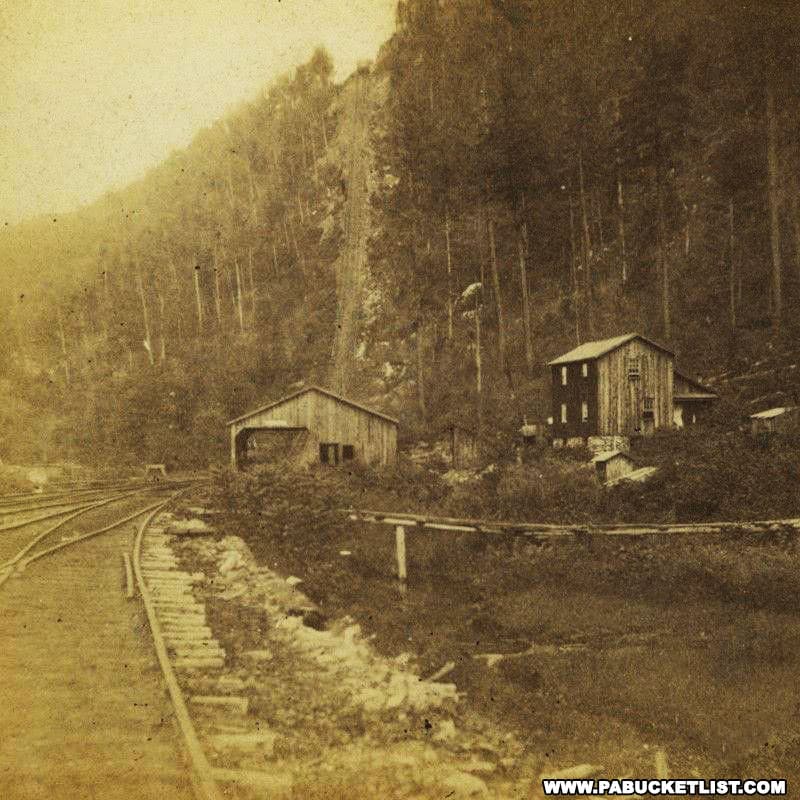
Coal was extracted from McIntyre Mountain until 1886, when mining ceased and the company town at the top of the mountain was abandoned.
I mention this history for two reasons.
First – it is remarkable how well Nature has reclaimed and restored this area to a setting of extraordinary beauty.
Second – on the hike I am going to describe you will encounter remnants and reminders of that mining history.
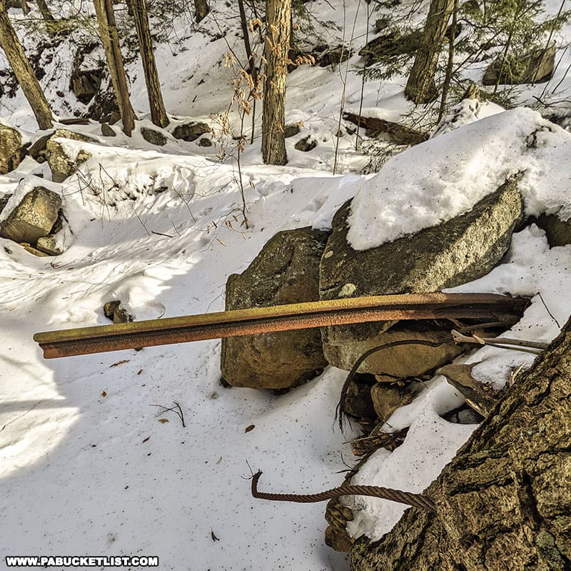
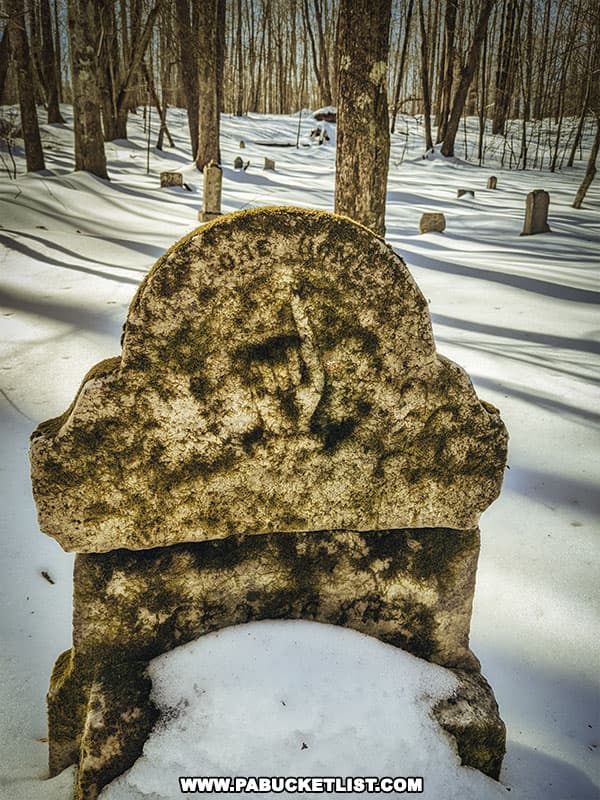
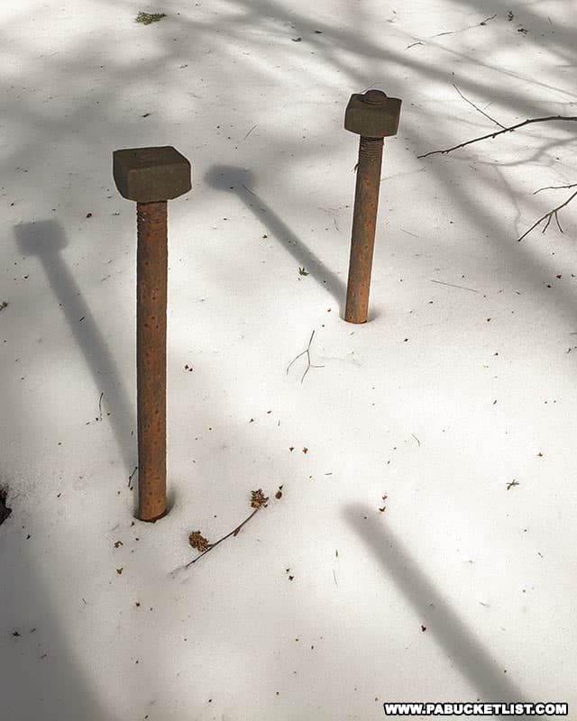
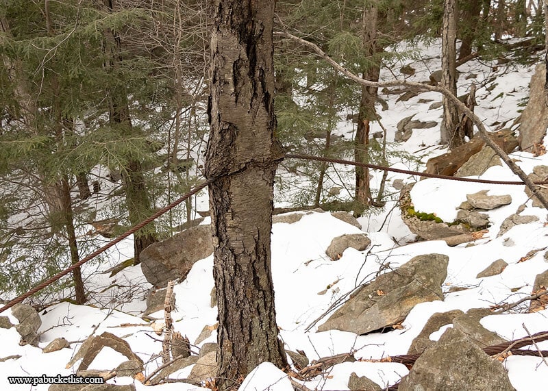
Old rail beds, timber bridges, pieces of cable from the inclined plane, building foundations, and chunks of coal still scattered about the trail and stream bed.
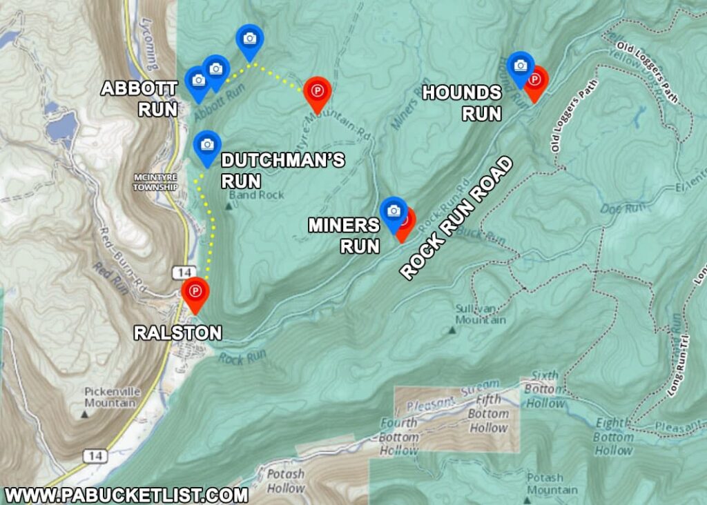
Directions to Dutchmans Run Falls
The trailhead and parking lot for the hike to Dutchmans Run Falls is located on the eastern edge of Ralston, along Thompson Street and just across the bridge over Lycoming Creek.
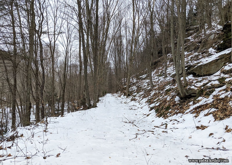
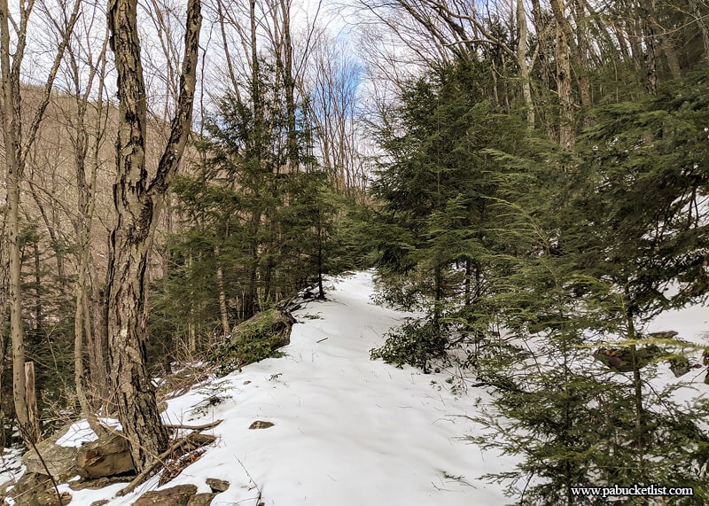
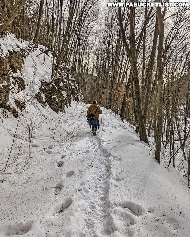
From the back of the parking lot, start down the flat and wide-open former Northern Central Railroad grade.
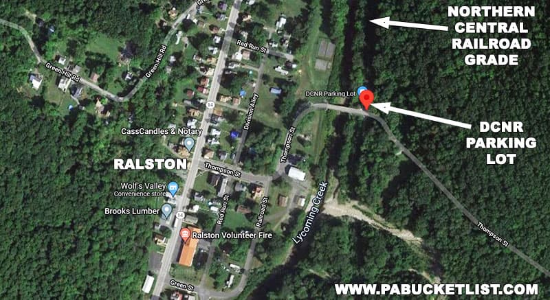
There are plenty of great rock formations on your right, and the Lycoming Creek to look at on your left as you proceed.
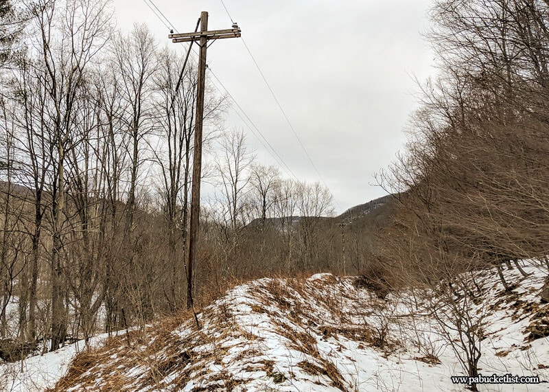
At .53 miles into the hike, power lines intersect and then run parallel to the rail bed. Continue to follow the rail bed (it stays above/ to the right of the power lines). Another couple hundred yards ahead you will pass behind a private home, but your path on the rail grade is solidly on public land. White forest boundary markers are plainly visible below you on the left.
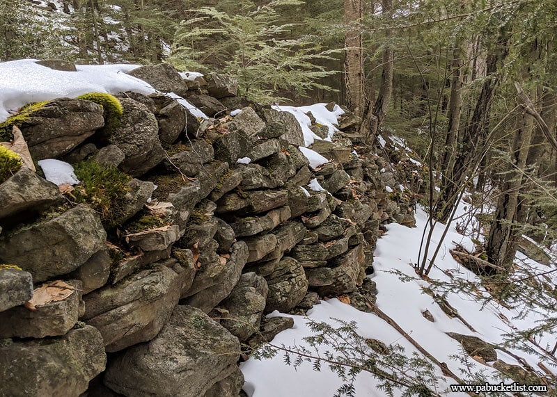
At 1.1 miles into the hike, you will encounter this stone foundation to the right of the rail grade.
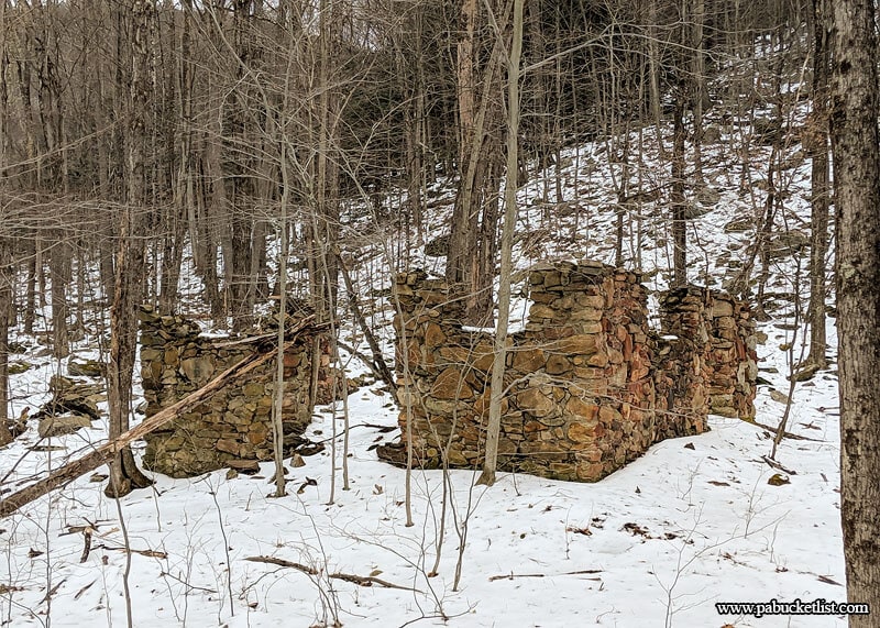
Continue past the foundation, and follow the rail grade until it hits Dutchmans Run.
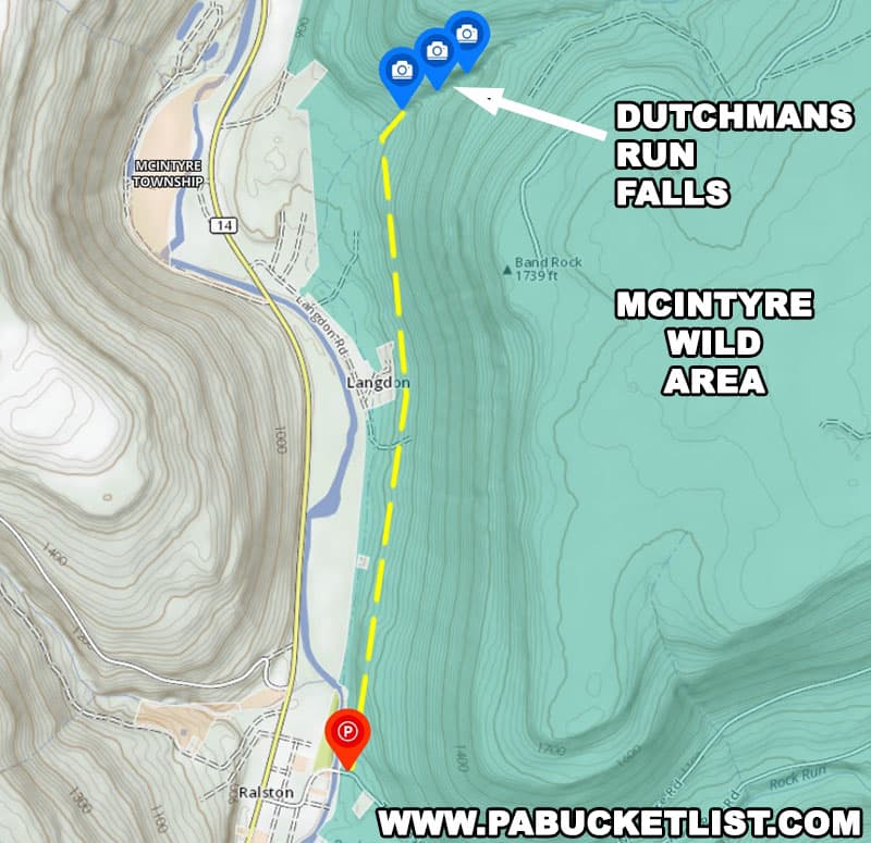
Hike upstream on the right side of Dutchmans Run for approximately 150 yards, crest a hill, and the first falls on Dutchmans Run will come into view.
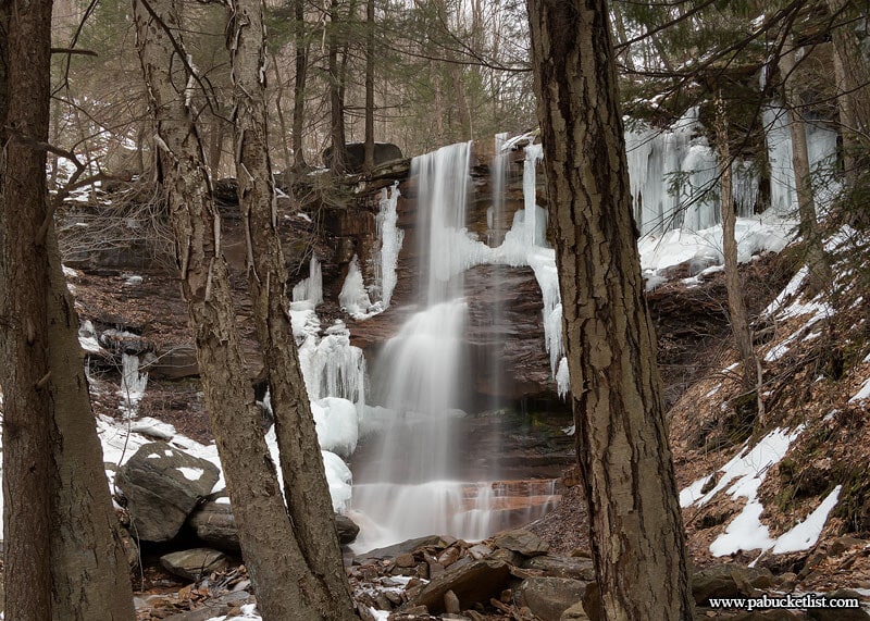
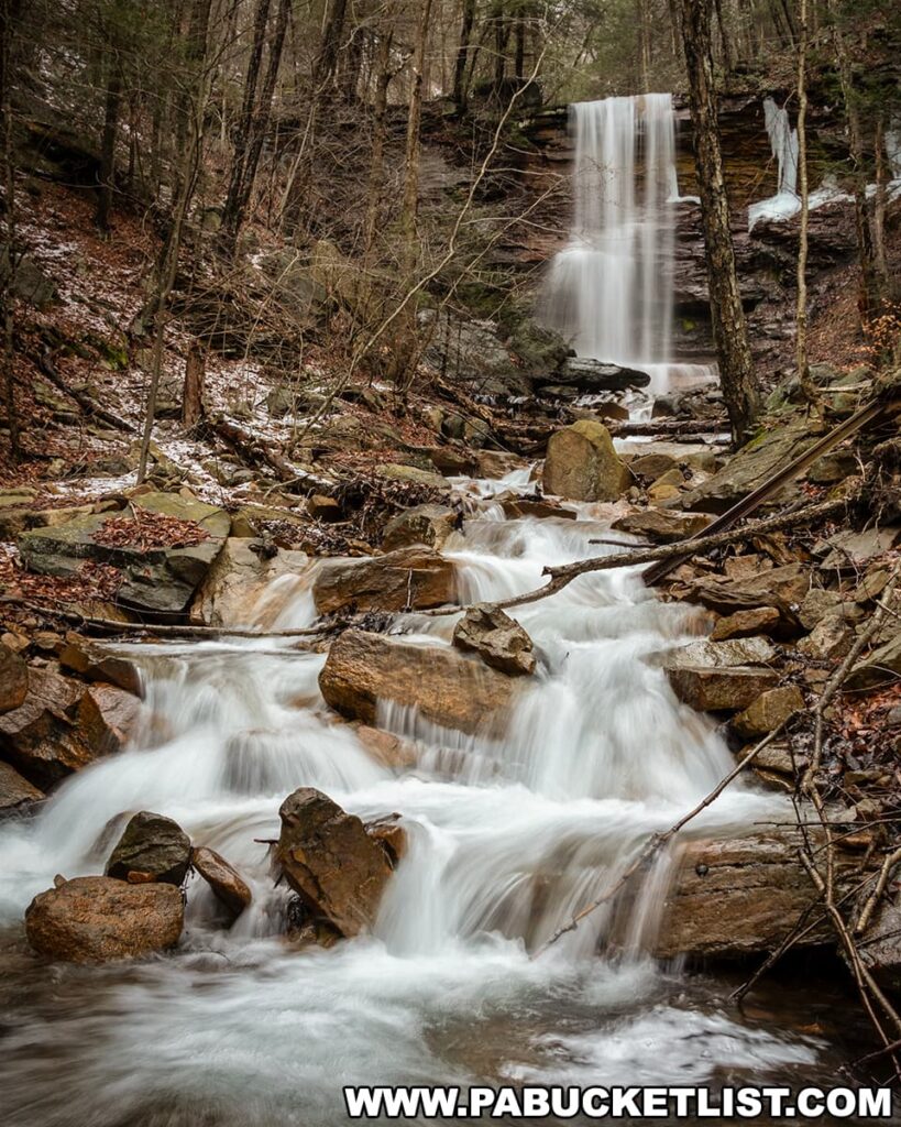
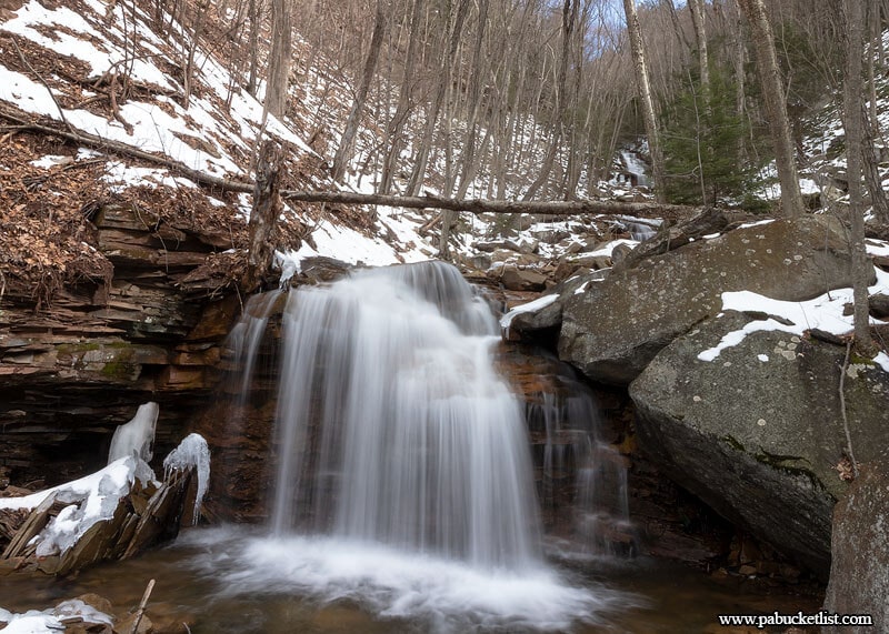
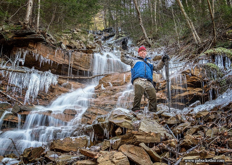
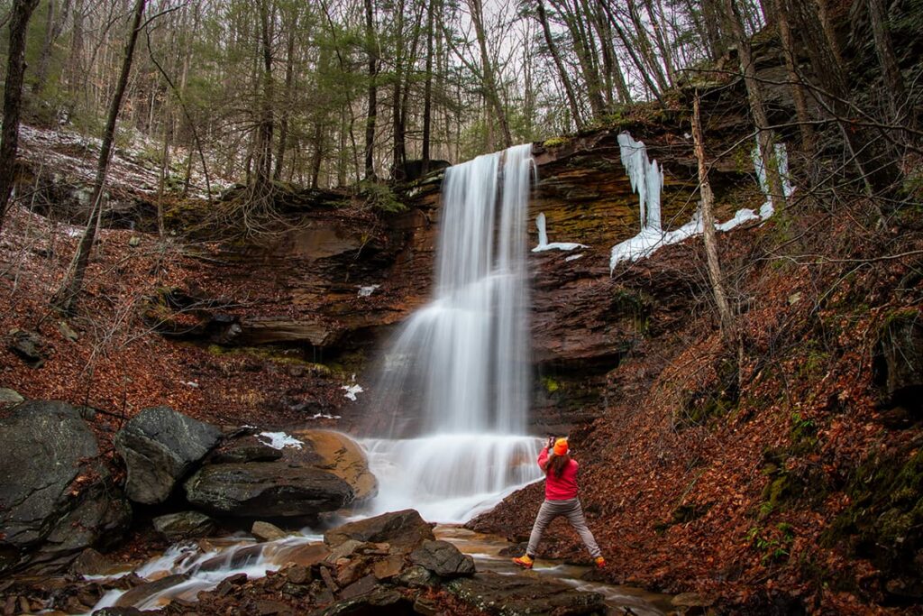
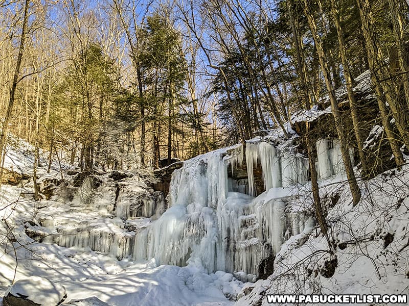
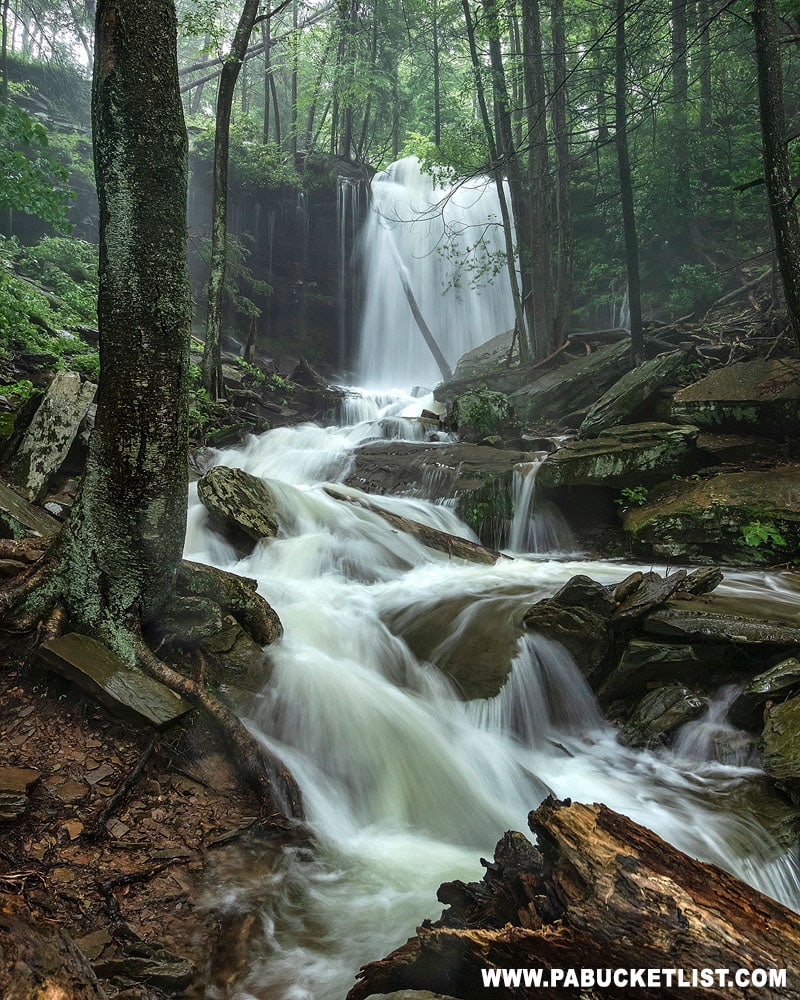
First Falls on Dutchmans Run
The GPS coordinates for the first falls on Dutchmans Run are 41.525167, -76.948933.
With my friend Steve in this image for scale, I’d feel confident saying the first falls on Dutchmans Run is a good 30 feet tall.
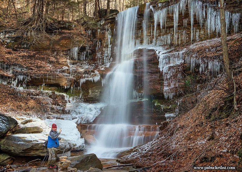
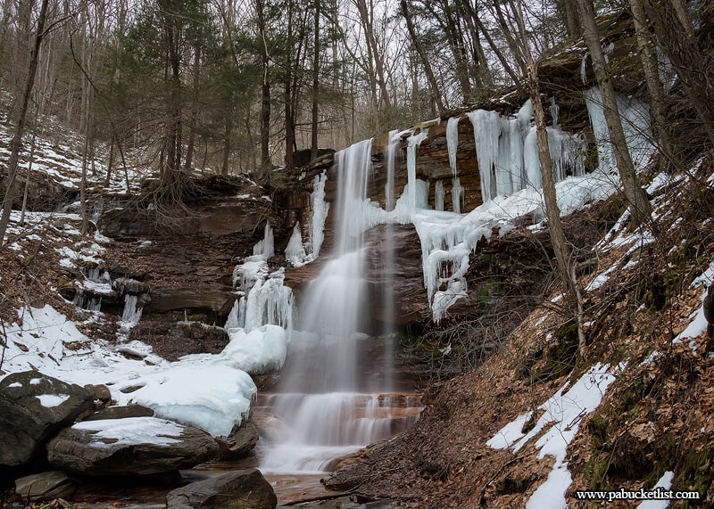
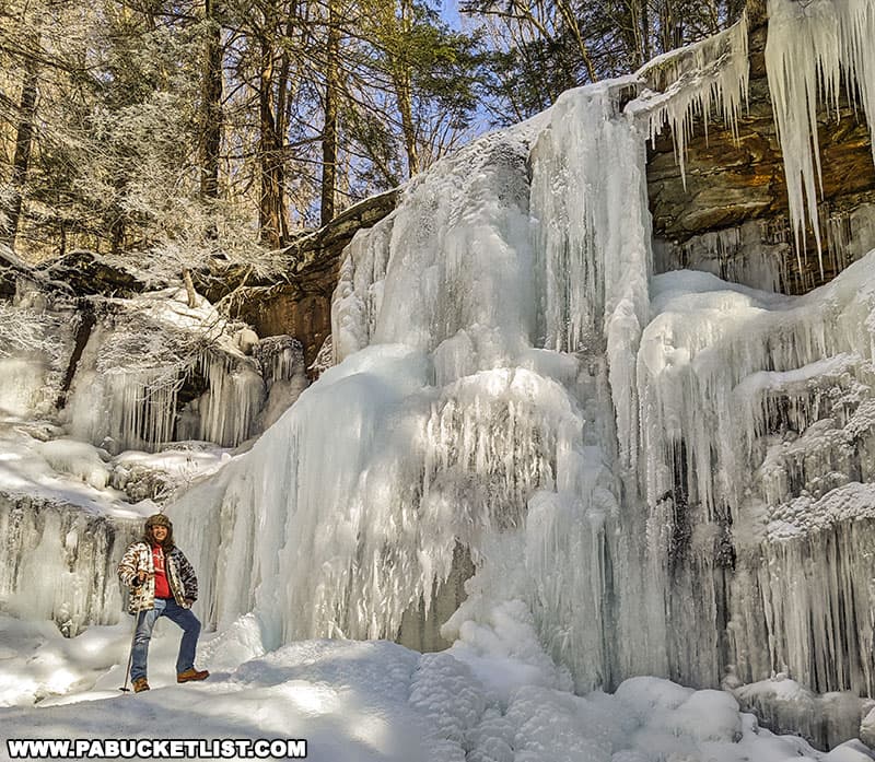
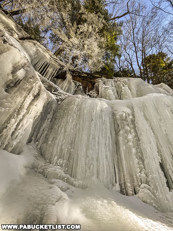
In the dead of winter, the first falls on Dutchmans Run is home to a fantastic wall of ice.
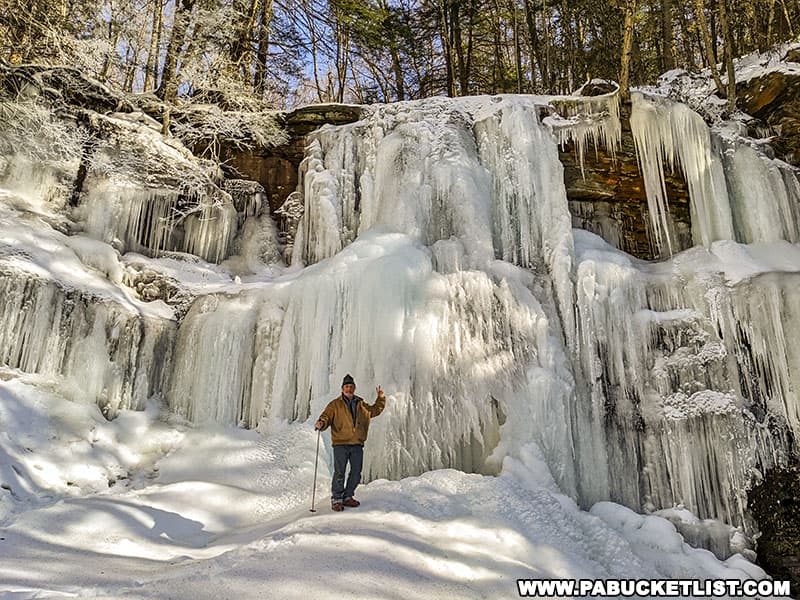
Of all the ice hiking destination in Pennsylvania, the first falls on Dutchmans Run is one of my favorites.
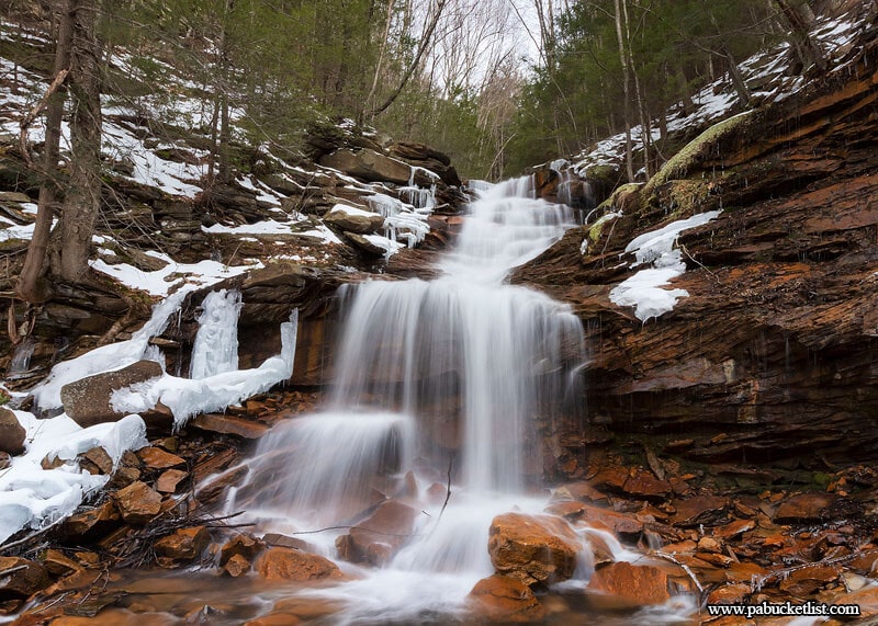
Second Falls on Dutchmans Run
Getting above the first falls to the second and third Falls on Dutchmans Run can be accomplished by hiking up and around from either side. Having done both, I’d recommend staying on the right side, slightly back-tracking and hiking up around and then descending the stream bank above the first falls.
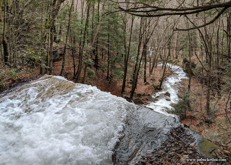
The GPS coordinates for the second falls on Dutchmans Run are 41.525650, -76.947700.
The second falls is roughly 6-7 feet tall, and would probably feel even impressive if it weren’t sandwiched in between two much larger waterfalls. But just upstream from this one lies the much larger Third Falls on Dutchmans Run.
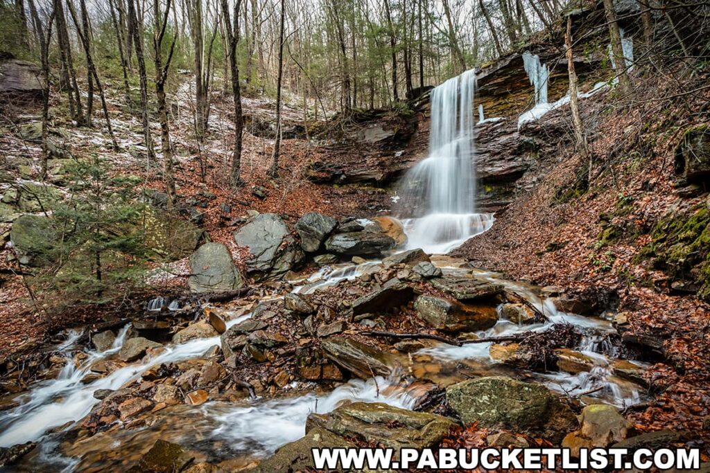
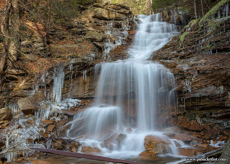
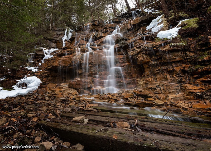
Third Falls on Dutchmans Run
The GPS coordinates for the third falls on Dutchmans Run are 41.525967, -76.946500.
The third falls is a two-tiered waterfall totaling roughly 20 feet tumbling down the tight gorge.
Just to the right of the Third Falls a small tributary flows into Dutchmans Run. If you follow my directions below you’ll be seeing this one from above in a few minutes.
Exploring Above the Falls
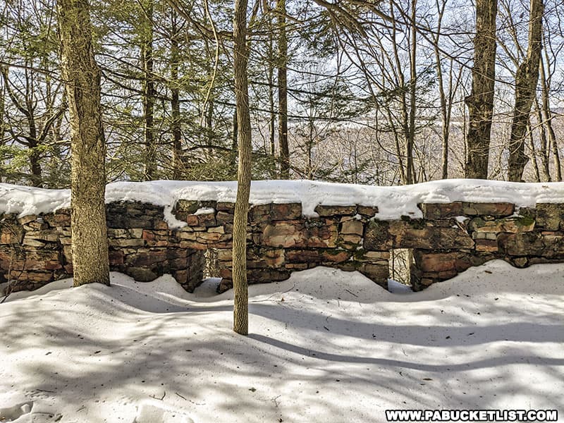
Backtrack from the third falls downstream to a point somewhere between the second falls and the top of the first falls. Look up the mountainside (still on the right side) and you’ll see a long stretch of retaining wall above you. Hike up the hillside to the retaining wall. The remnants of an old wagon road are supported by the retaining wall.
Hike uphill along the road grade, back in the direction of the third falls.
Along the way you’ll pass more remnants of mining activity from long ago.
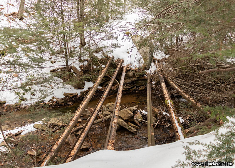
At a spot directly above the third falls, you’ll come to an old bridge over the tributary to Dutchmans Run, the same tributary you stood at the base of just a short while ago.
If you continue upstream for a few minutes longer you’ll come to this old rail crossing of Dutchmans Run. If you choose to continue past that you can wind your way up and around the mountain, eventually coming out near the ruins of McIntyre (the abandoned company town).
The Return Hike
Backtrack and follow the grade down the mountain, eventually intersecting with the flat rail grade you first hiked in on.
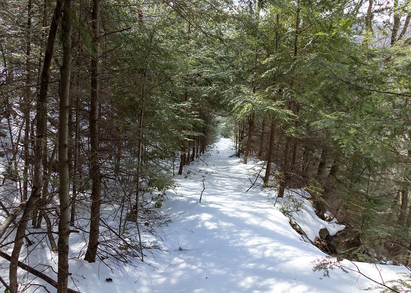
From there, hang a left and it’s smooth sailing a half mile back to the parking lot.
Final Thoughts
For years I’d heard about the waterfalls on Dutchmans Run, but conventional wisdom and most of the hiking descriptions I read said you had to take the long, windy dirt road to the top of the mountain and hike down from there.
Once I started pouring over maps and satellite images it became apparent to me that it would be an easier hike and certainly more accessible in the winter to simply come in from the bottom.
It may be a longer hike, but the use of the rail and road beds makes much of the hike out and back pretty painless.
For anyone who enjoys waterfalls and/or discovering remnants of Pennsylvania’s industrial past, I’d highly recommend adding a hike to the waterfalls on Dutchmans Run to your PA Bucket List!
Still not convinced you need to explore the waterfalls on Dutchmans Run?
Then check out this video!
Related Attractions
Be sure to check out my McIntyre Wild Area Waterfalls Guide for maps and directions to ALL of the best waterfalls in this remote section of the Loyalsock State Forest.
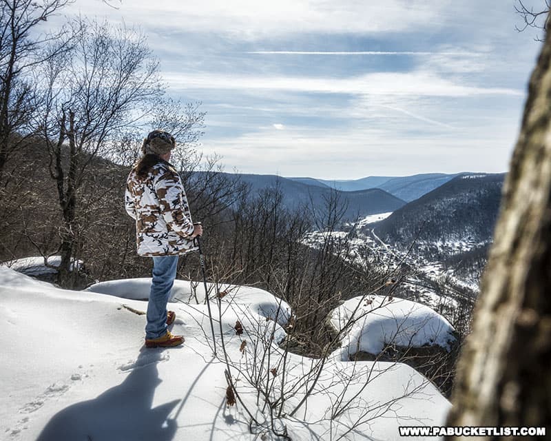
Band Rock Vista in the McIntyre Wild Area offers a stunning 180-degree view of the Lycoming Creek Valley and the town of Ralston more than 900 feet below.
Exploring Jacoby Falls in the Loyalsock State Forest highlights another great Lycoming County waterfall hike.
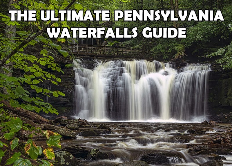
And if you haven’t already, be sure to check out The Ultimate Pennsylvania Waterfalls Guide for directions to HUNDREDS of Pennsylvania waterfalls across the state!
Did you enjoy this article?
If so, be sure to like and follow PA Bucket List on Facebook, Instagram, and/or Pinterest to stay up-to-date on my latest write-ups about the best things to see and do in Pennsylvania!
Click on any of the icons below to get connected to PA Bucket List on social media.