
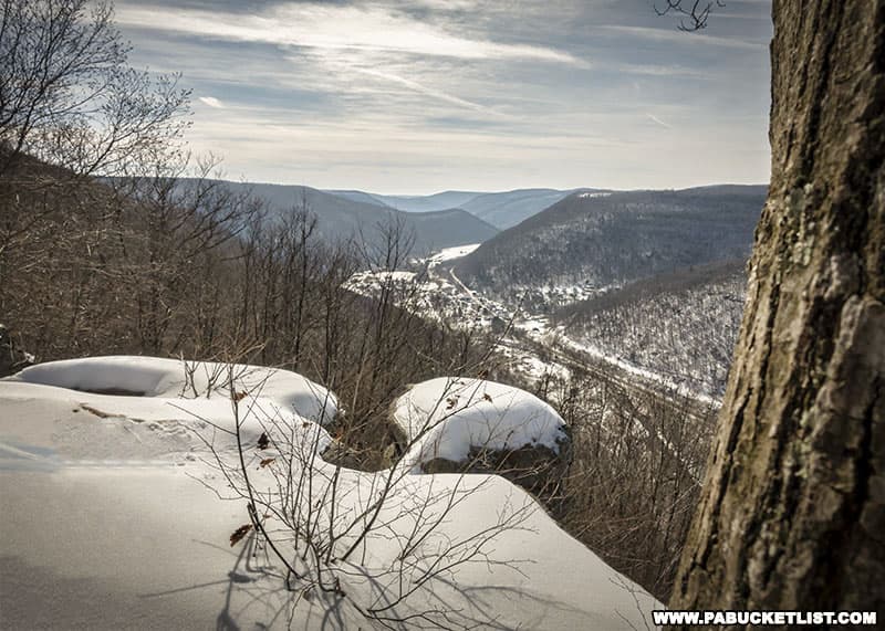
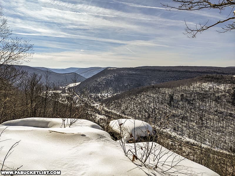
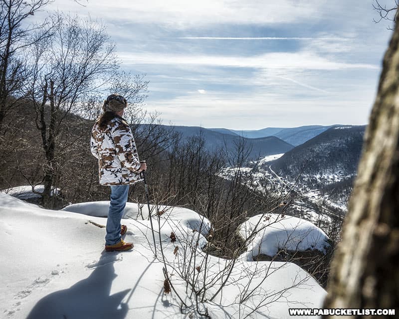
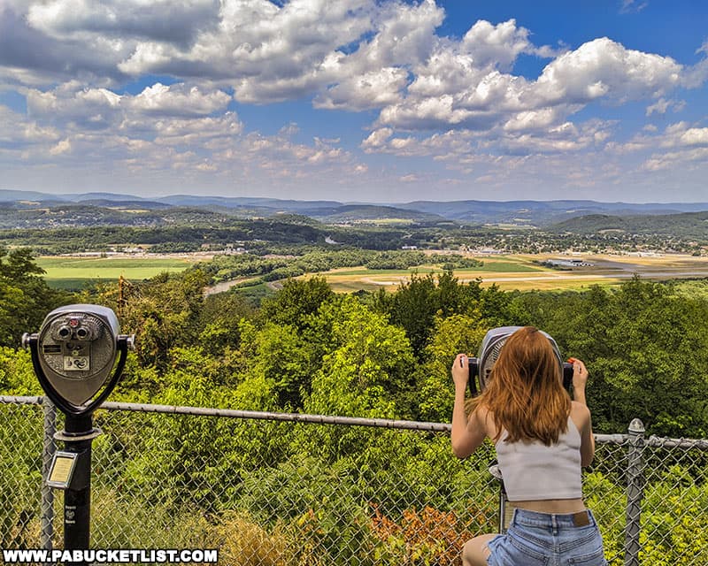
Band Rock Vista in Lycoming County offers a stunning 180-degree view of the Lycoming Creek Valley and the town of Ralston more than 900 feet below.
This scenic overlook is steeped in history, located on the edge of the ghost town of McIntyre, now part of the McIntyre Wild Area in the Loyalsock State Forest.
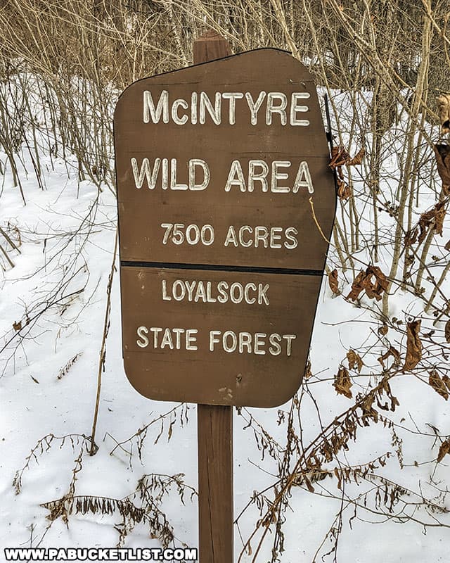
Founded in 1870, McIntyre was a mountaintop coal mining town and home to nearly 300 structures including houses, a school, a church, and a cemetery.
Band Rock Vista was a favorite spot of the town’s nearly 2,000 residents for picnics and concerts, and the name sticks even today, long after most (but not all) remains of the town of McIntyre have vanished.
How to Find Band Rock Vista
There are two ways to get to Band Rock Vista – drive there or hike there.
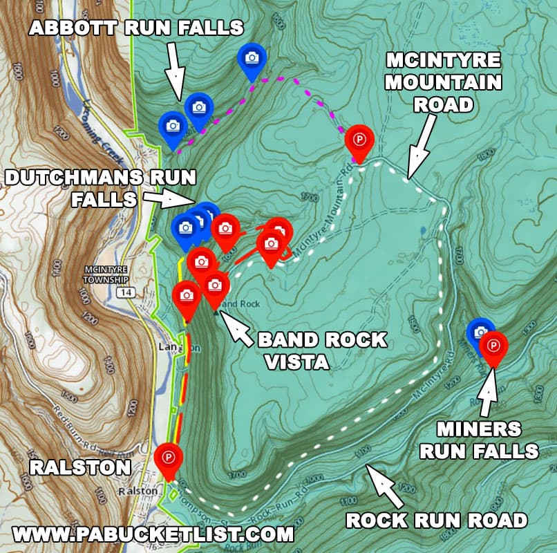
Driving to Band Rock Vista
Driving to Band Rock Vista is simple, with a few caveats.
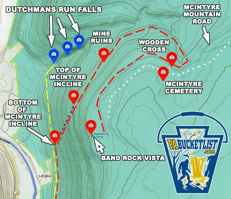
From Ralston, simply follow McIntyre Road (white dashed line on the map above) as it winds its way 4.5 miles up McIntyre Mountain and dead ends at the parking area near Band Rock Vista.
Caveat #1 – McIntyre Road is a “no winter maintenance” forest road, and the rest of the year, it is a “barely maintained” forest road.
So if you want to see Band Rock Vista in the winter, you’ll either need a snowmobile, or you’ll want to hike there (the subject of the second part of this article).
Caveat #2 – Even when McIntyre Road isn’t covered with snow, it’s a rough road and I would urge you NOT to attempt driving on it in anything other than a truck, SUV, or something with LOTS of ground clearance.
Hiking to Band Rock Vista
Hiking to Band Rock Vista is a far more scenic way to get to the overlook, but again, there are a few caveats.
Caveat #1 – there is no official/blazed trail to follow, although the hike I lay out here uses existing rail/road grades that are relatively easy to discern and follow.
Caveat #2 – this hike entails 900 feet of elevation gain over the course of its 2.4 mile length (one-way).
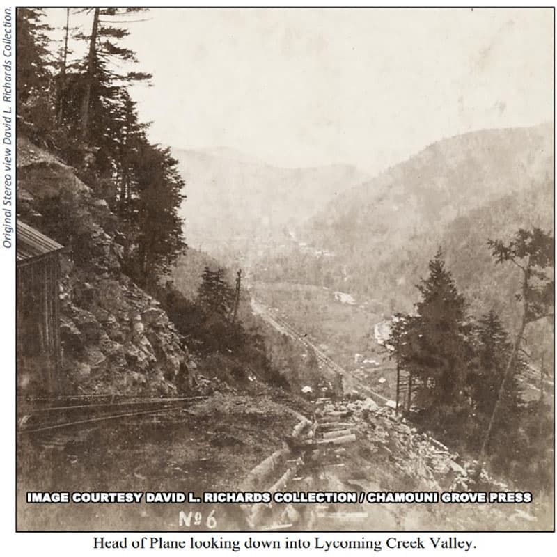
And half of that elevation gain occurs in the span of just 400 yards, as you follow the grade of the old McIntyre Inclined Plane up the mountain.
So this hike definitely is not a beginners hike, or for those faint of heart – literally!
But if you’re good with off-trail hiking and looking for a physical challenge, I’ll describe the route I take from Ralston to Band Rock Vista and back again, pointing out some of the interesting historic ruins you’ll pass along the way.
Hiking the Band Rock Vista Trail
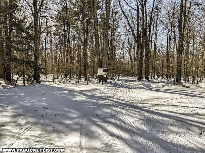
This hike starts at the DCNR parking area next to the bridge over Lycoming Creek in Ralston.
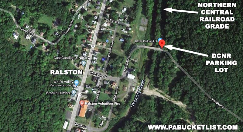
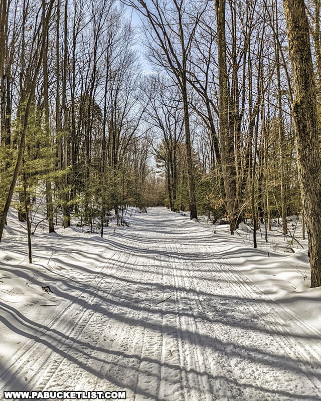
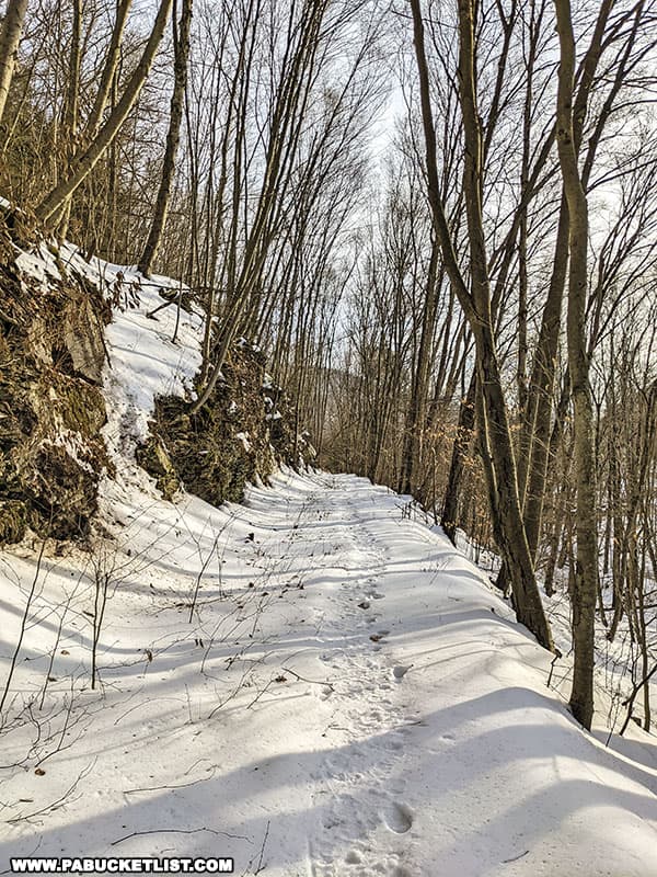
From here you’ll follow the old (and relatively flat) Northern Central Railroad grade 0.9 miles.
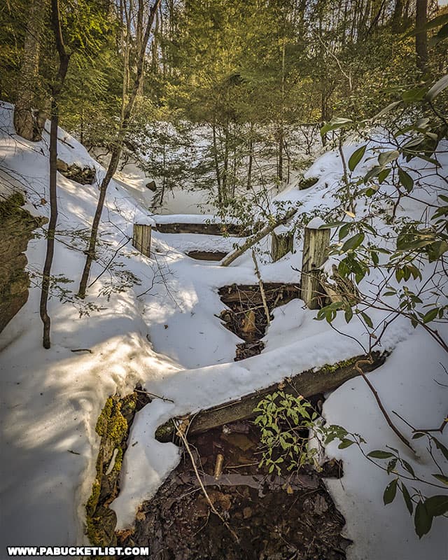
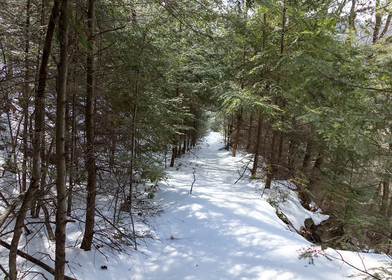
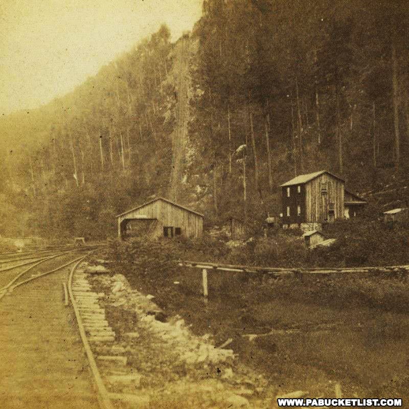
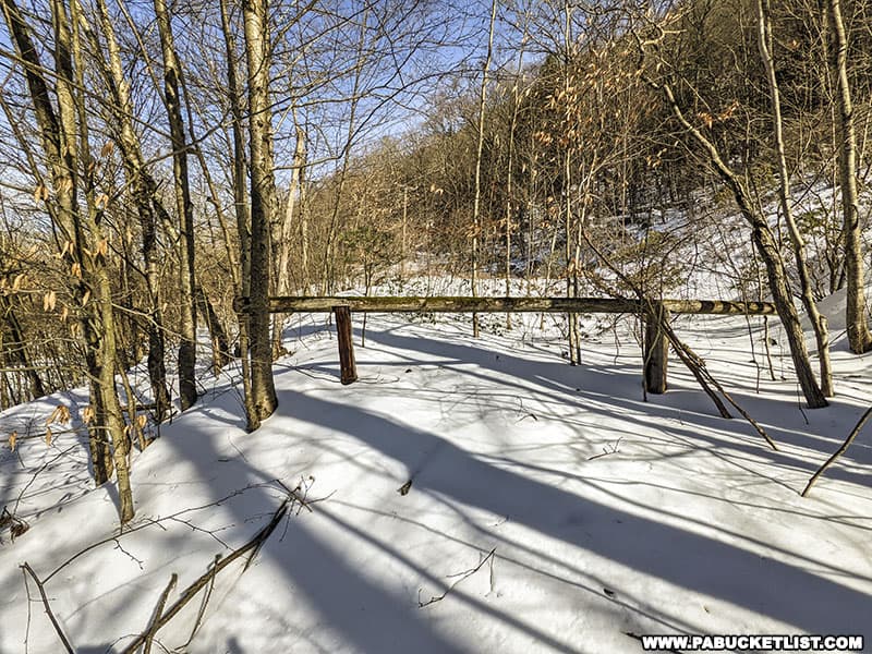
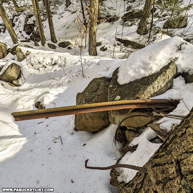
At the 0.9 mile mark, you’ll see the gate pictured below, to the right of the trail (GPS coordinates 41.51997, -76.94903) – this is the bottom of the former McIntyre Inclined Plane, where railroad cars full of coal mined on top of the mountain were lowered by means of a rail/cable system to the Northern Central Railroad below.
This will be the STEEPEST part of the entire hike – 475 feet of elevation gain over the course of 400 yards!
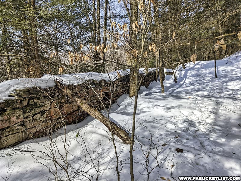
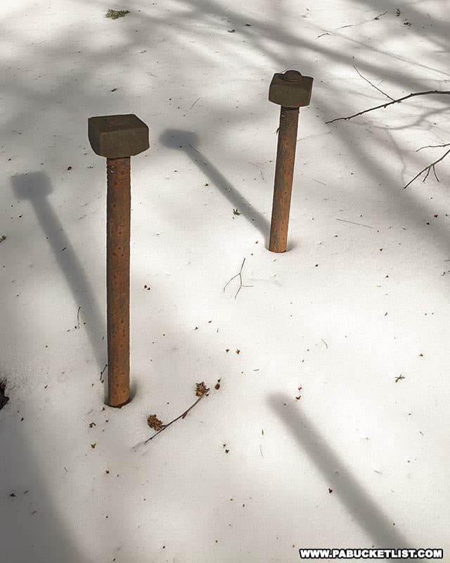
Along the way up, you’ll see remnants of the inclined plane sticking up out of the ground.
When you get to the top of the inclined plane, you’ll see the ruins of the engine house that powered this operation (GPS coordinates 41.52266, -76.94715).
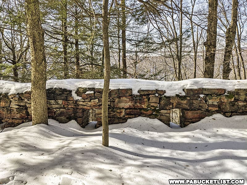
In its heyday in the late 19th century, more than 1,000 tons of coal was lowered down the McIntyre inclined plane every day.
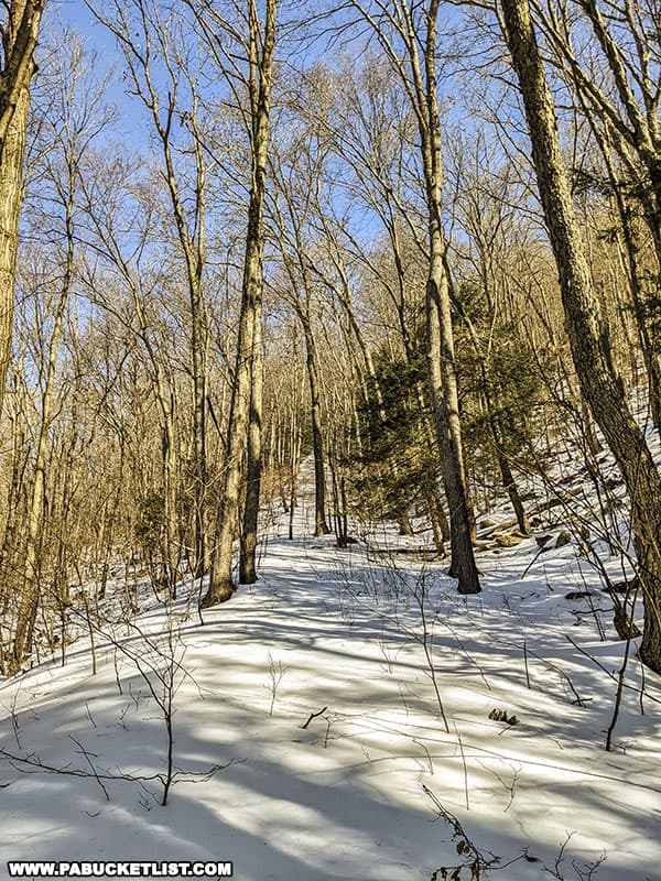
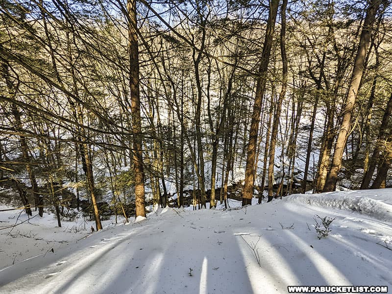
Today nature is slowly reclaiming the grade, but it is still well suited for hiking up and down McIntyre Mountain.
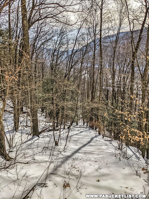
With the steepest part of the hike out of the way, the remaining 1.3 miles will seem like a pleasant stroll through the woods, which it is!
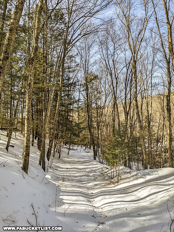
You’ll continue following the rail grade above the inclined plane in a northeasterly direction, as it passes high above Dutchmans Run below.
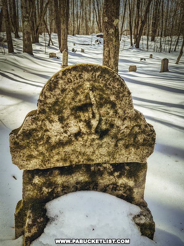
Eventually the rail grade intersects with an old wagon road and makes a dogleg right turn to the south, finally bringing you out onto McIntyre Road, near a large wooden cross (GPS coordinates 41.52498, -76.93910).
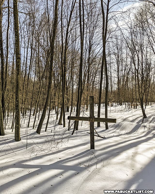
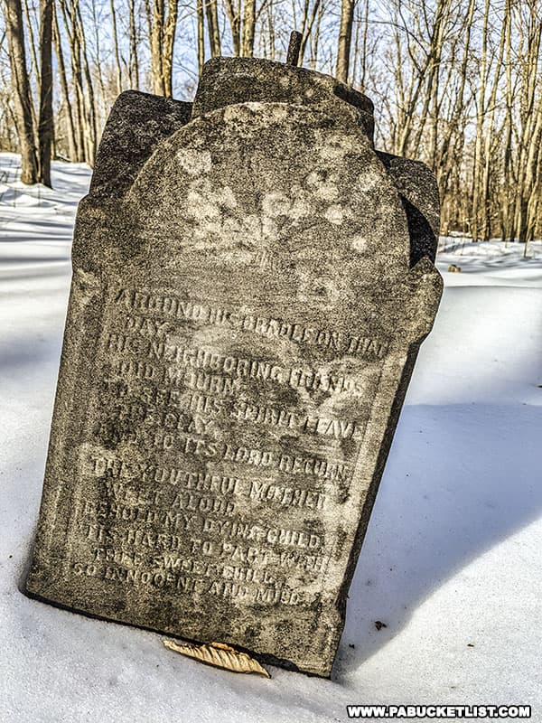
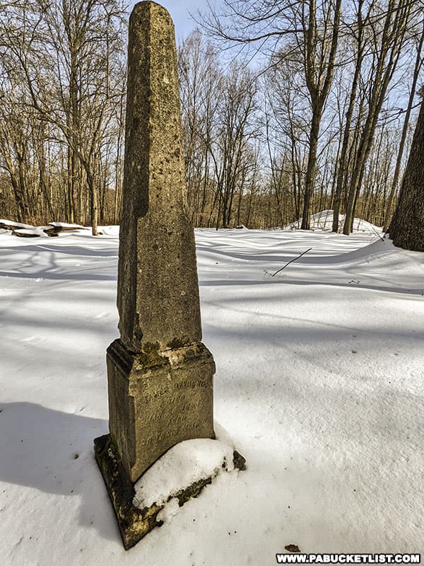
100 yards or so behind the cross is the McIntyre Cemetery, with many of the headstones dating back to the 1880s.
Follow McIntyre Road west (your right when standing on the road in front of the cross) the remaining 1/2 mile to Band Rock Vista (GPS coordinates 41.52082, -76.94555).
Views from Band Rock Vista
Band Rock Vista sits at an elevation 1770 feet above sea level, and is composed primarily of Pottsville sandstone.
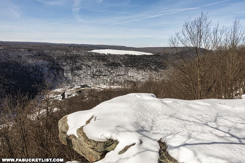
Band Rock Vista is the westernmost escarpment of McIntyre Mountain, providing a commanding view of the Lycoming Creek valley 900 feet below.
And while driving up to Band Rock Vista is certainly easier (at least spring-fall), hiking up just feels more rewarding to me personally.
Every time I hike in this area, I discover some new-to-me ruins, furthering my interest in the McIntyre coal mining story.
If you choose to take on this hike, I hope you enjoy the challenge as well as the history, and respect both the natural and man-made sights to behold in the McIntyre Wild Area, leaving them as you found them for the next hiker to enjoy.
Nearby Attractions
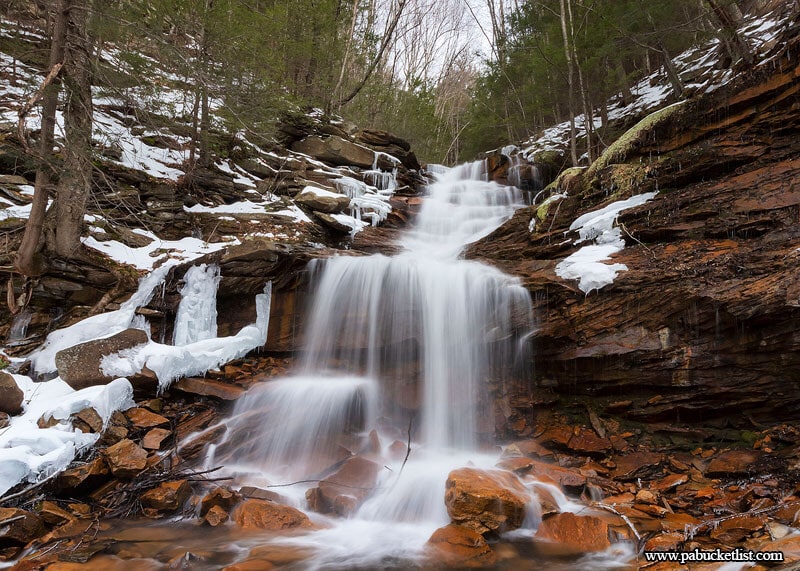
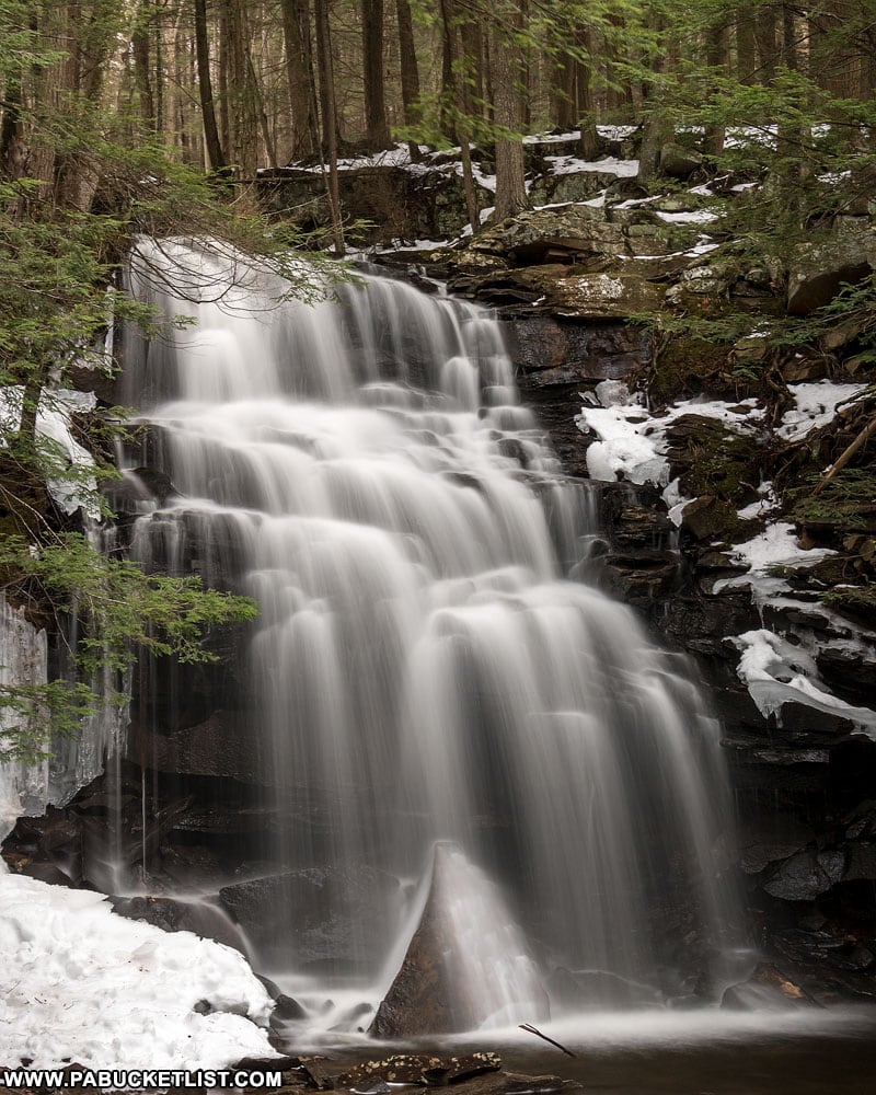
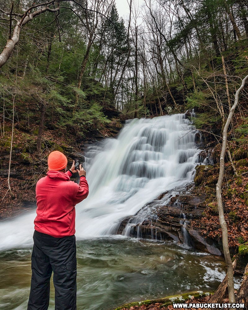
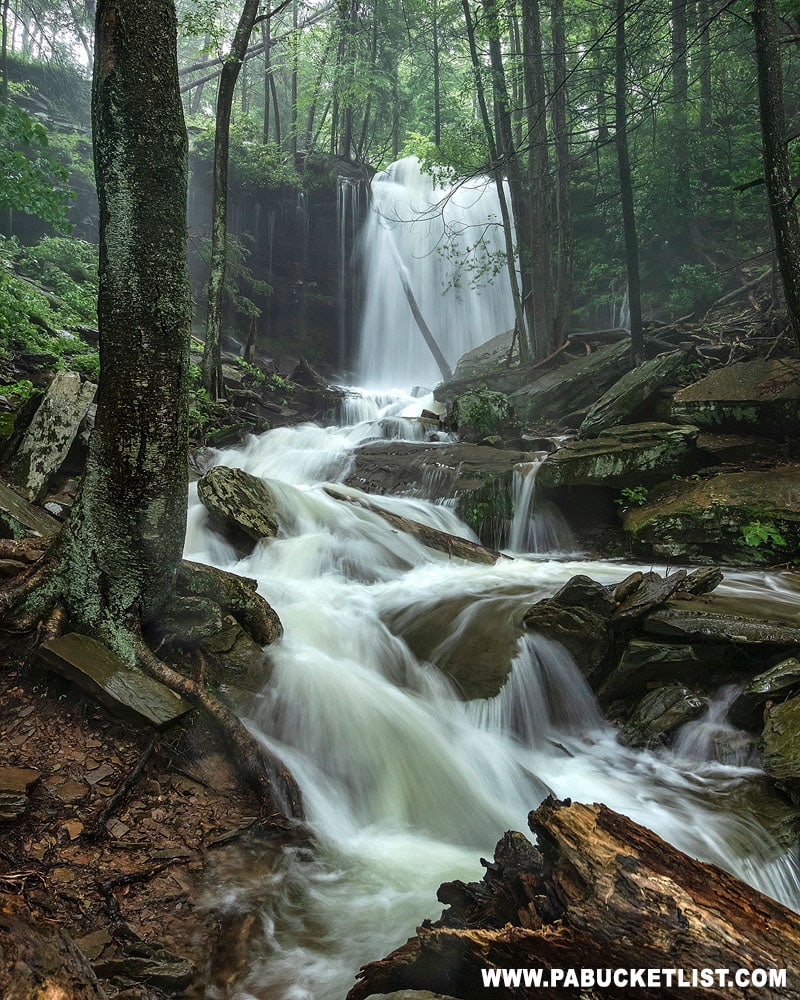
On the return hike you may want to take a side trip to see Dutchmans Run Falls.
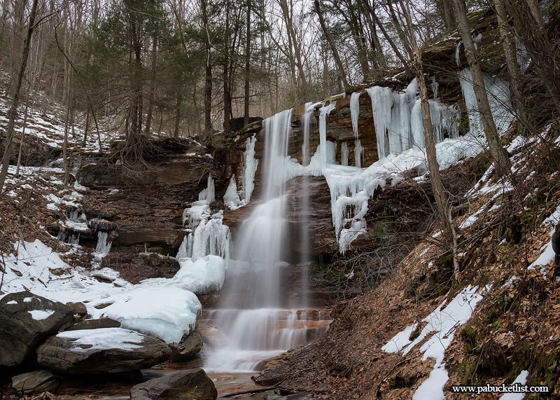
Dutchmans Run Falls is a series of towering waterfalls along the stream closest to the old McIntyre Inclined Plane.
Don’t confuse these waterfalls with Dutchman Falls in the Sullivan County portion of the Loyalsock State Forest!
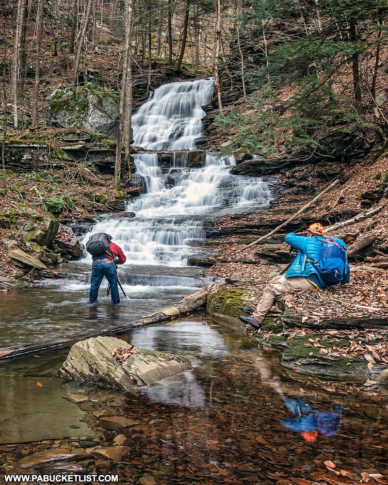
Exploring Abbott Run Falls in the McIntyre Wild Area will introduce you to yet another nearby stream with multiple waterfalls on it.
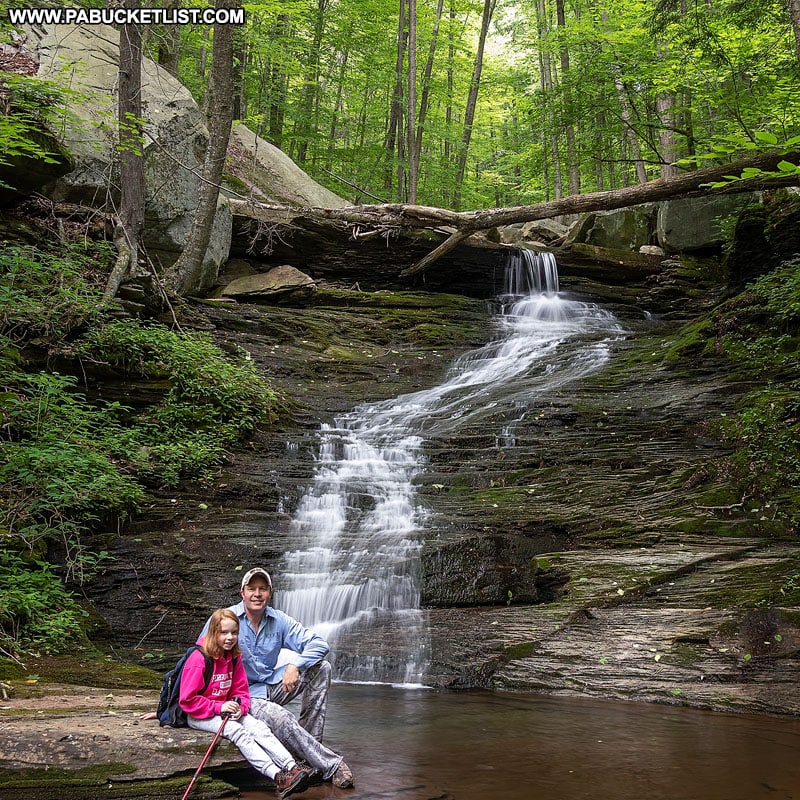
Exploring Miners Run Falls in the McIntyre Wild Area will introduce you to the most popular waterfall hike in this portion of the Loyalsock State Forest.
Exploring Hounds Run Falls in the McIntyre Wild Area will introduce you to the easiest waterfall hike nearby.
Exploring Jacoby Falls in the Loyalsock State Forest is another introduction to a great Lycoming County waterfall hike.
Montgomery Pike Scenic Overlook is a gorgeous roadside overlook and picnic spot located approximately 3.5 miles south of Williamsport along Route 15 in Lycoming County.
Did you enjoy this article?
If so, be sure to like and follow PA Bucket List on Facebook, Instagram, and/or Pinterest to learn more about the best things to see and do in Pennsylvania!
Click on any of the icons below to get connected to PA Bucket List on social media.