
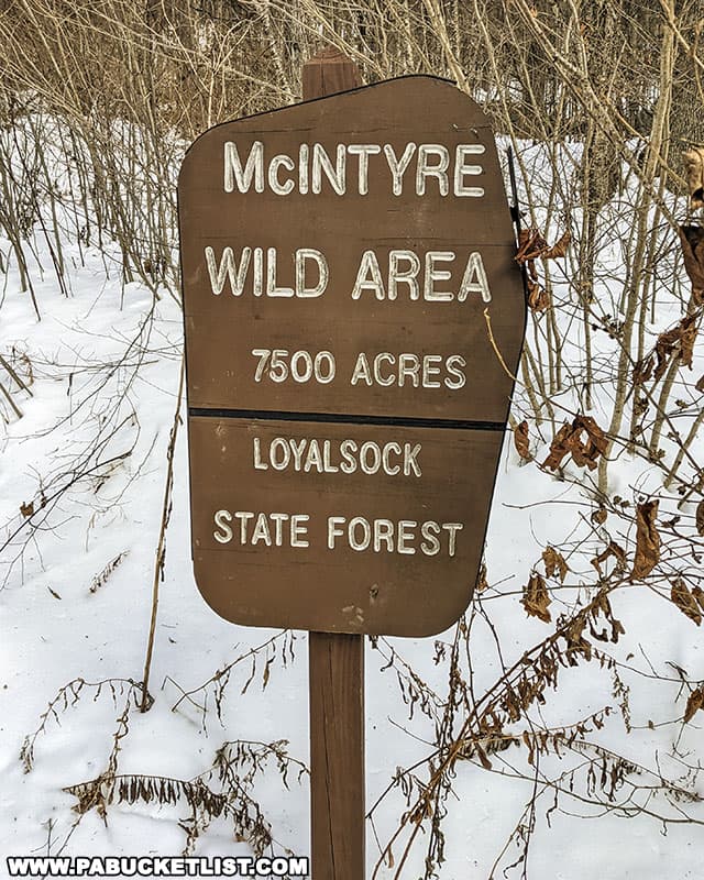
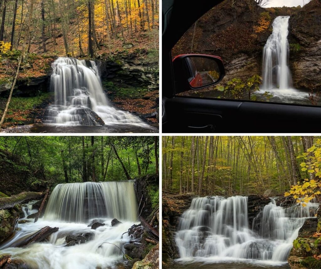
Miners Run Falls, located in the McIntyre Wild Area (Lycoming County), is a series of six magnificent waterfalls all located within 0.6 miles of Rock Run Road.
But seeing these waterfalls requires off-trail hiking, and that scares some folks away.
Relax!
I’m going to show you THE best hiking route to take to safely see all six waterfalls, as well as some other outstanding geological features in the Miners Run gorge.
Getting There
How to Find Miners Run Falls in the McIntyre Wild Area
- Turn off of Route 14 in Ralston and onto Rock Run Road.
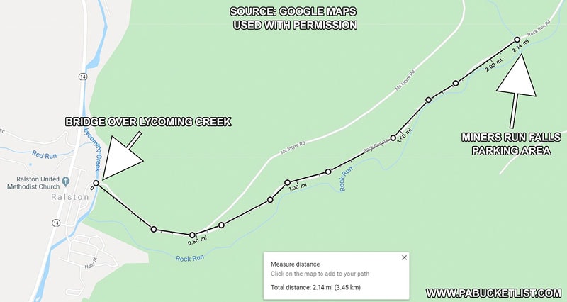
- Travel 2.2 miles on Rock Run Road
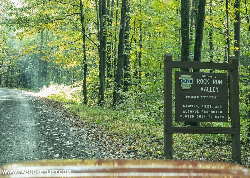
Note that Rock Run Road is a “No Winter Maintenance” State Forest Road.
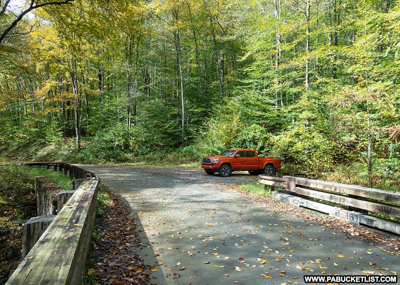
- Navigate to the parking area at GPS Coordinates 41.515868, -76.916750
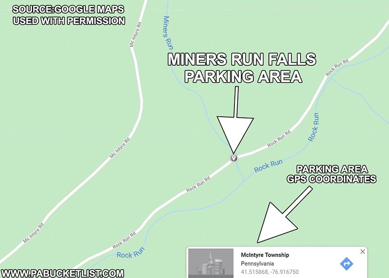
- Park in the lot on the left hand side of the road, immediately before the first bridge you come to.
This is the bridge over Miners Run.
The lot will hold 6-8 vehicles comfortably.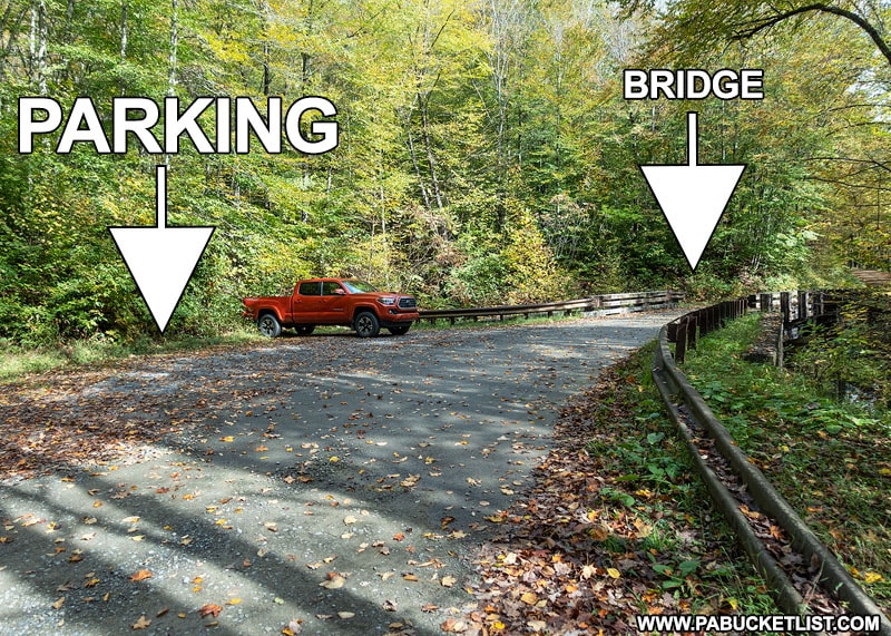
Hiking to the Falls on Miners Run
As I mentioned at the outset, there is no “official” trail leading to any of the waterfalls along Miners Run.
However, having hiked this stream many, many times, I can tell you there IS one best way to hike Miners Run, and that’s the information I’m going to share with you in the following paragraphs.
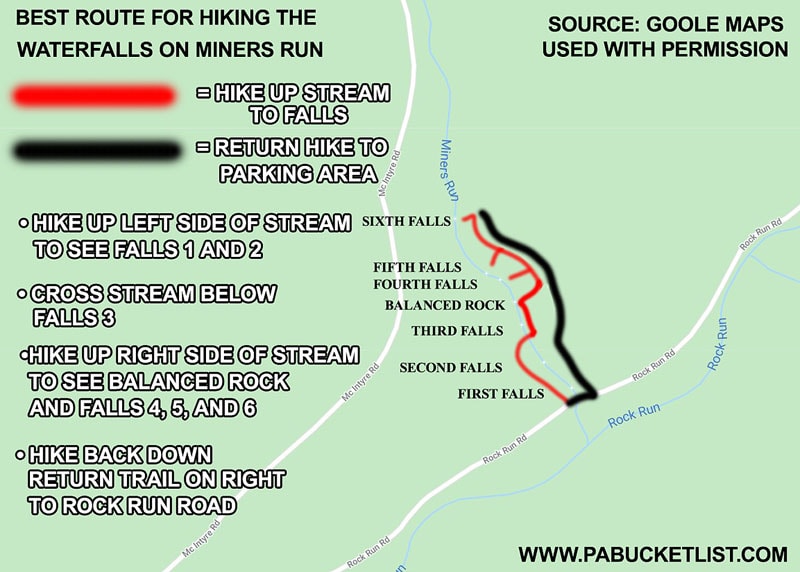
The map above is a great visual summary of the best hiking route for Miners Run, so if you take nothing else away from this write-up, save that image in your memory.
Or better yet – screenshot it!
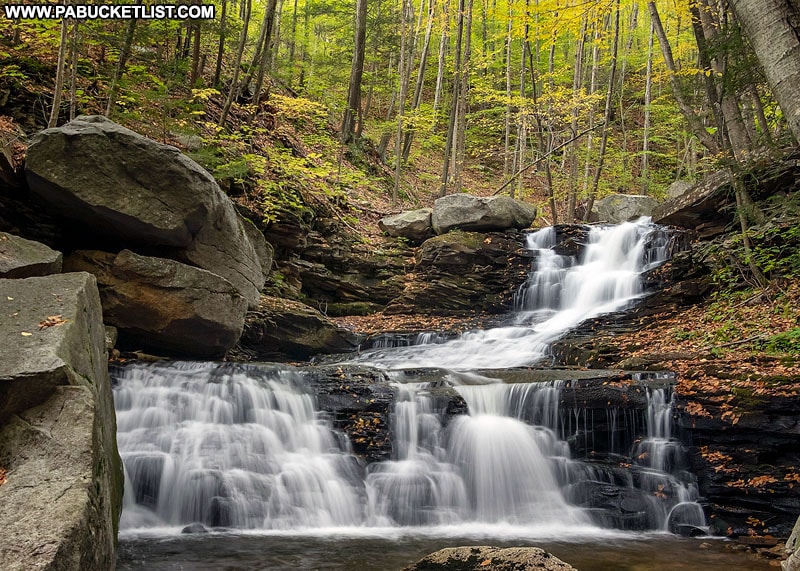
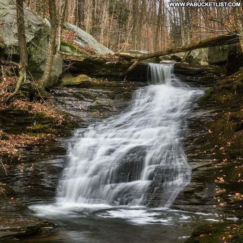
First Falls on Miners Run
The first waterfall on Miners Run is essentially a roadside waterfall.
So even if you decide off-trail hiking is not for you, this one is easily accessed from the parking area.
My advice is to hike up the left side of the stream (same side as parking area) and then drop down into the stream if you want to get an ever closer view.
The first waterfall on Miners Run is an exceptional spot for fall foliage photos.
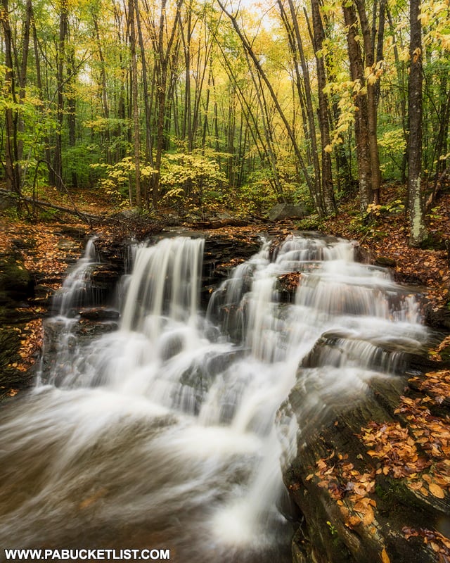
At 8-10 feet tall it’s not the largest waterfall on Miners Run, but it is the most intricate, like a diamond with many facets.
Second Falls on Miners Run
From the first falls, procede approximately 1/10th of a mile up the left side of the stream to the second falls on Miners Run.
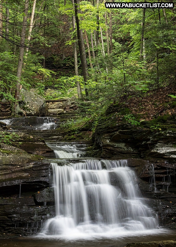
The second falls stand maybe 6 feet tall, and are the most “classical” looking of the waterfalls on Miners Run.
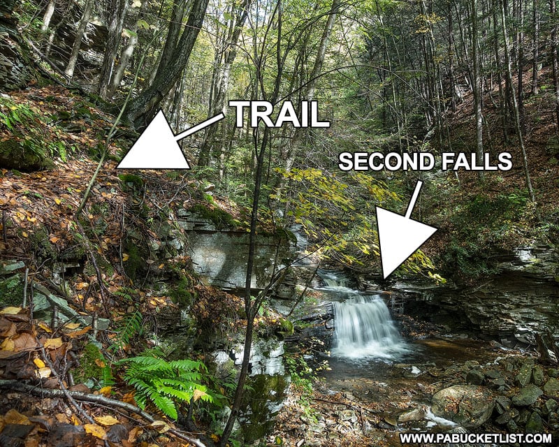
The trail around the second falls, headed upstream to the third falls, goes up, around, and to the left as shown in the image above.
This is an unblazed but obvious single-track trail, quite narrow as it pases above the falls.
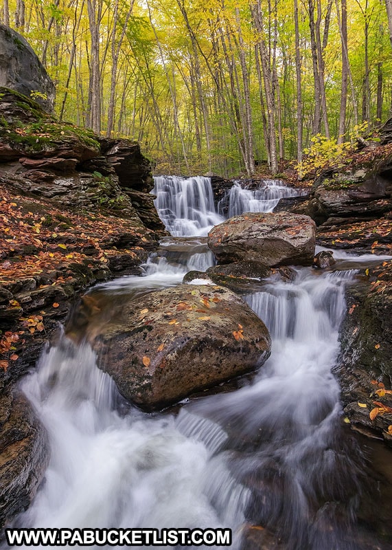
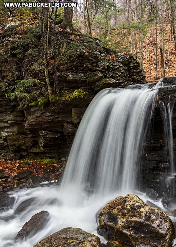
Third Falls on Miners Run
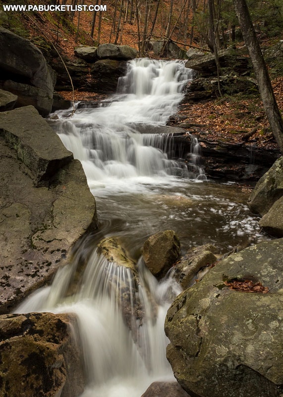
Another 1/10th of a mile above the second falls, you’ll want to cross over Miners Run to the right side, just below the spot pictured above.
Having crossed over to the right side of the stream, you’ll now be able to stand at the base of the third falls on Miners Run.
This is another fantastic spot for fall foliage photos.
Climb up the bank on the right side of the third falls and you’ll be staring at one of the truly unique geologic features of the Miners Run Gorge – the Balanced Rock!
The Balanced Rock on Miners Run
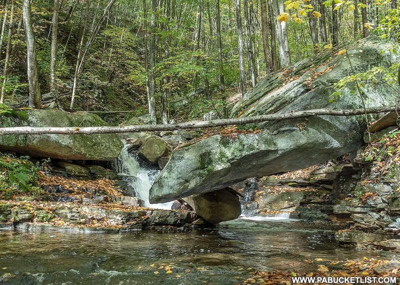
The Balanced Rock seems to defy gravity – a huge slab of boulder supported by a much, much smaller rock in the stream.
There is a 4 foot tall space to stand under the Balanced Rock, and a small cascade behind it.
Sure to be a favorite spot on this hike, especially if you have kids along with you.
Once you’ve had your fill of the Balanced Rock, climb up out of the stream bed on the right side and hike directly up the hill for approximately 75 yards.
This will put you on an old logging road grade and this is how you will reach the remaining 3 waterfalls on Miners Run.
Fourth Falls on Miners Run
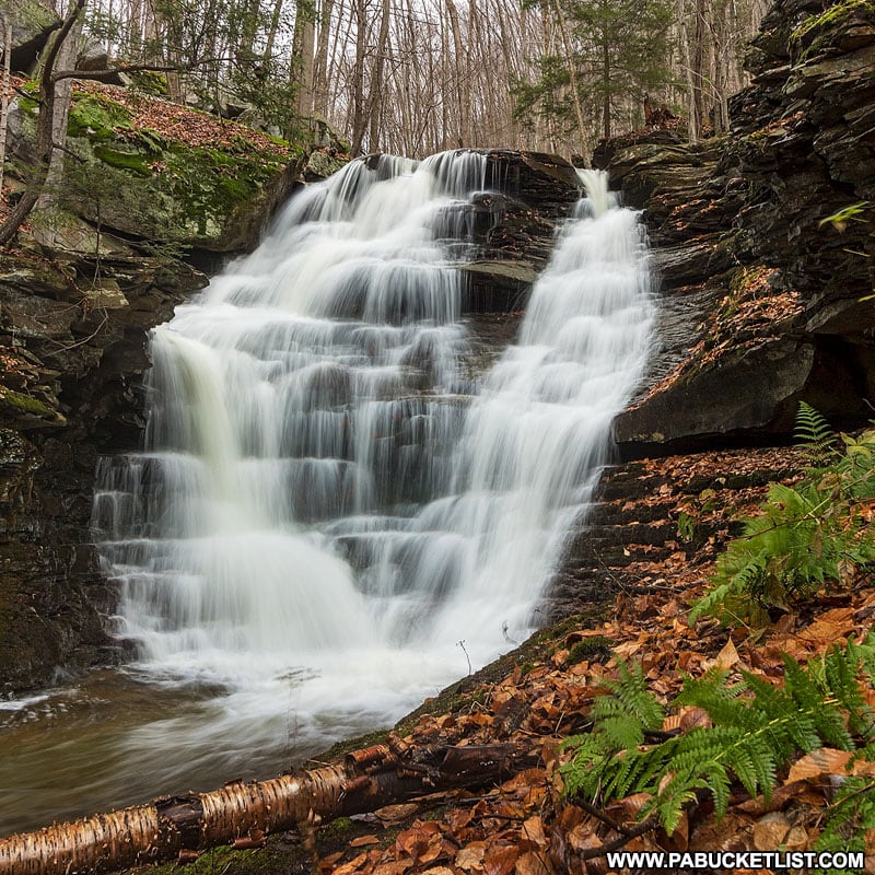
Approximately 1/10th of a mile above the balanced rock you will see/hear the largest waterfall on Miners Run, the fourth falls.
Reaching the base of this one is a simple matter of dropping down off the old logging road and following a well-worn trail to the bottom of the falls.
The fourth falls are easily the tallest along Miners Run at 20-25 feet in height.
Fifth Falls on Miners Run
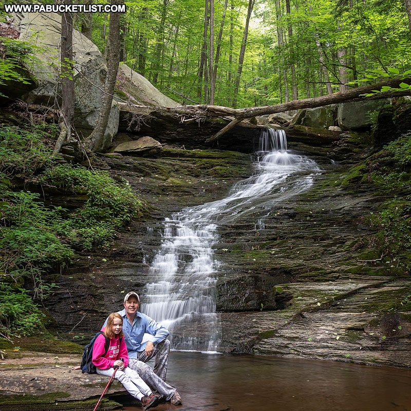
The fifth falls on Miners Run is probably the most “tranquil” spot along the stream, as the water gracefully slides down the eons-old rock face and swirls in a large pool below.
It’s a favorite spot of mine to take remote-trigger “selfies”, as I did here with my daughter a few years ago.
As with the fourth falls, access to this one is by simply dropping down off the old logging road along a well-worn path.
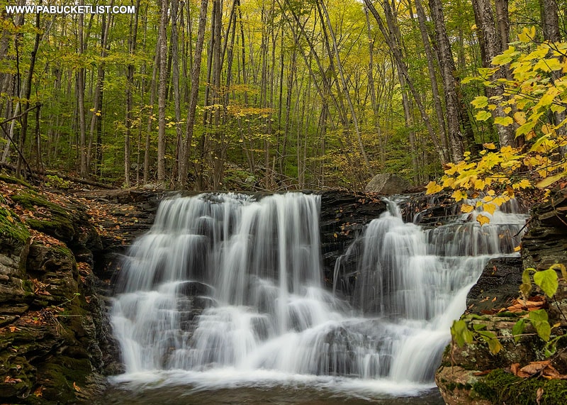
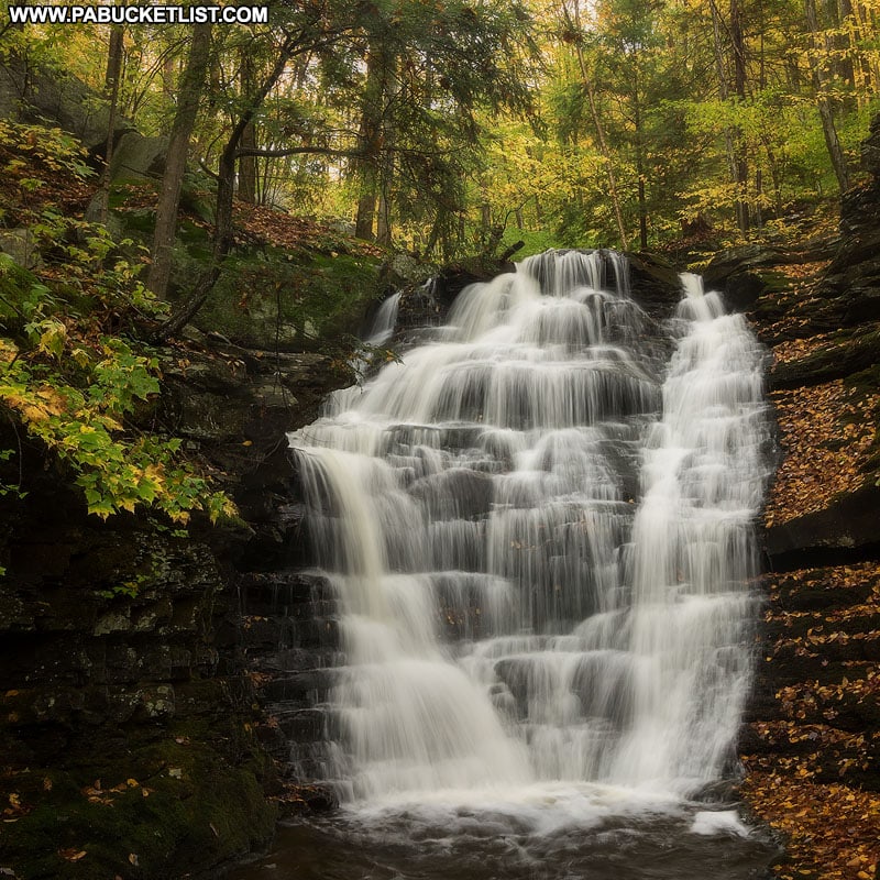
Sixth Falls on Miners Run
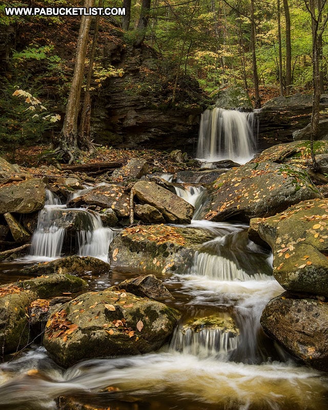
The sixth waterfall on Miners Run is also the smallest, at maybe 5 feet tall.
But the downstream view of it, incorporating many of the smaller cascades on Miners Run, makes it photo-worthy nearly every visit.
Once you’ve reached the side of this waterfall, you’ve reached the midway point of this hike.
You’ve covered 0.6 miles (as the crow flies) and 364 feet of elevation change.
Congratulations!
The return hike is a much simpler affair.
Return Hike along Miners Run
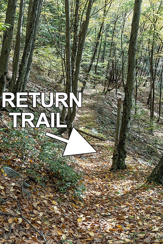
The return hike from the top of Miners Run back to your vehicle along Rock Run Road is a relatively easy one.
The first half of the hike is retracing the steps you took to reach waterfalls 4-6, along the old log road.
But rather than drop down into the streambed at the Balanced Rock, you’ll continue straight down the log road, above the stream bed.
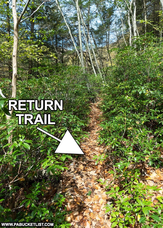
At approximately 0.4 miles into the return hike, you’ll pass through a section of dense evergreen shrubs along a narrow but well-defined single track trail.
Once you’ve made it through the shrubs, it’s a simple open-woods hike the final 0.2 miles back down to Rock Run Road.
This will bring you out on the opposite side of the bridge from where you parked, completing the loop.
Still not convinced you need to explore Miners Run Falls?
Then check out this video!
Related Attractions
20 Must See Pennsylvania Waterfalls highlights twenty of the most picturesque waterfalls in Pennsylvania, all personally visited and photographed during my travels across the Keystone State.

42 Must-See Roadside Waterfalls in Pennsylvania highlights dozens of the most scenic roadside waterfalls in Pennsylvania, all personally visited and photographed during my travels across the Keystone State.
Nearby Attractions
11 Must-See Attractions in Lycoming County showcases more remarkable sights and experiences near Miners Run Falls.
A Smarter Way to Explore Pennsylvania
Explore Pennsylvania like a pro with the interactive PA Bucket List Travel Map, showcasing over 1,000 memorable destinations I’ve personally visited across the Keystone State.
Did you enjoy this article?
If so, be sure to like and follow PA Bucket List on Facebook, Instagram, and/or Pinterest to stay up-to-date on my latest write-ups about the best things to see and do in Pennsylvania!
Click on any of the icons below to get connected to PA Bucket List on social media.