
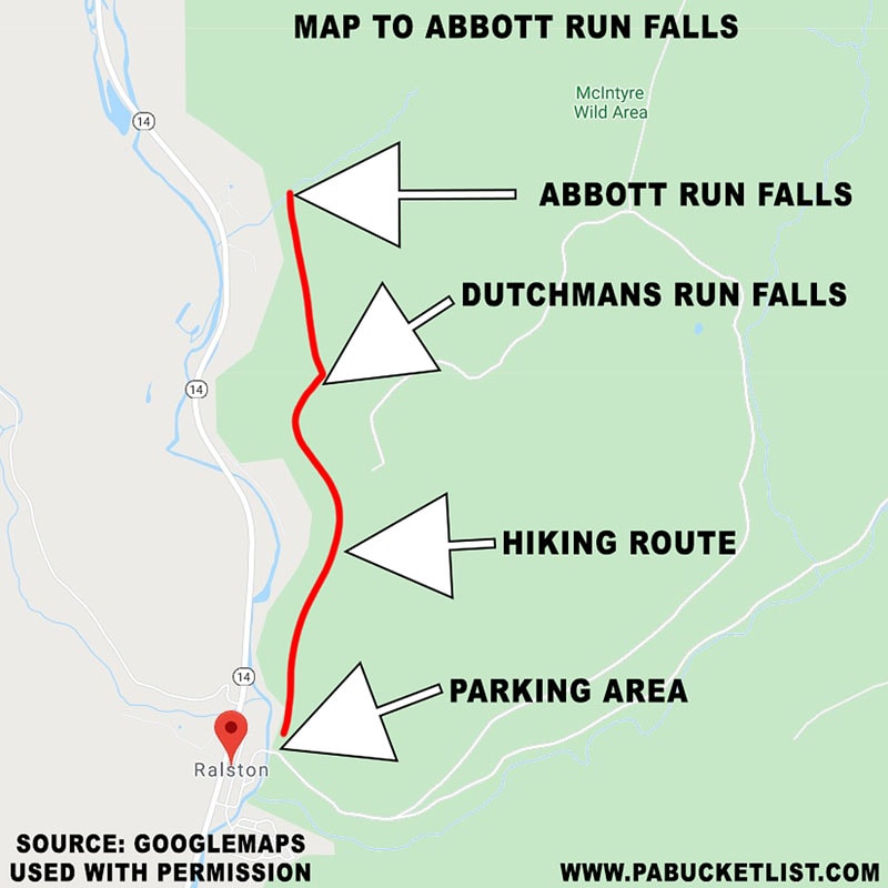
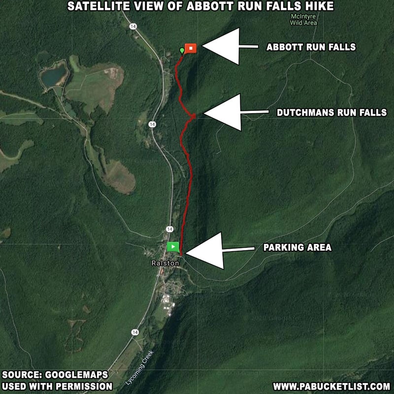
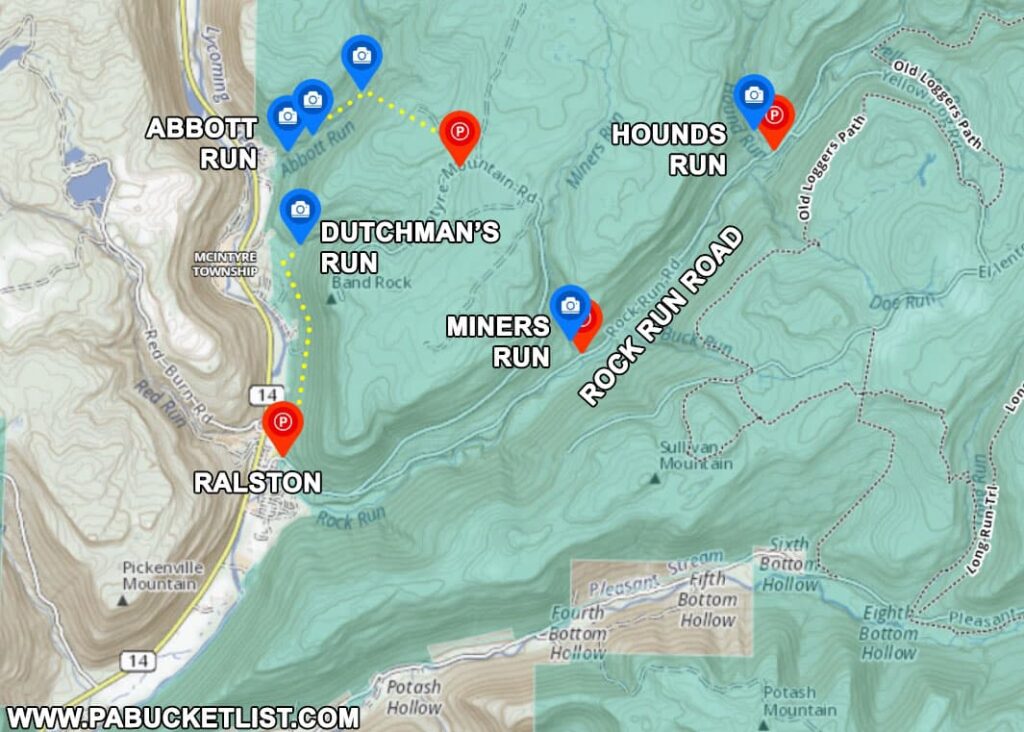
Abbott Run Falls in the McIntyre Wild Area is a series of seldom-seen waterfalls located approximately one mile north of the larger and more frequently visited Dutchmans Run Falls, also located in this Wild Area portion of the Loyalsock State Forest.
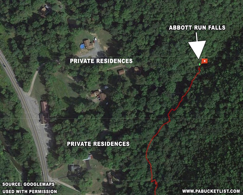
The bottom falls on Abbott Run (what I’m calling in this write up Abbott Run Falls) is tantalizingly close to Route 14 just north of Ralston, but standing between the highway and the falls is a strip of privately owned land/residences.
Meaning the only viable (and legal) way to get to the falls is via off-trail hiking, either from a trailhead near Ralston, or from the top-down on McIntyre Mountain.
As I’ve hiked it both ways, I’ll describe it both ways, starting with the 2.36 mile hike from the trailhead near Ralston.
Hiking to Abbott Run Falls from Ralston Trailhead
The first half of this hike retraces steps laid out in a previous write-up I’ve published on how to find Dutchmans Run Falls in the McIntyre Wild Area.
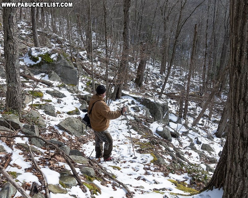
The second half is a one mile hike across some fairly rocky, uneven terrain, ultimately bringing you out at the impressive Abbott Run Falls and the towering rock formations that surround it.
Getting There
How to Find Abbott Run Falls
- Park at the DCNR lot next to the bridge over Lycoming Creek in Ralston.
GPS coordinates for the parking area: 41.507155, -76.951134.Note: this is the same parking lot used to hike to Dutchmans Run.
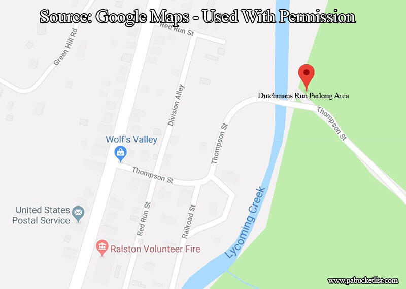
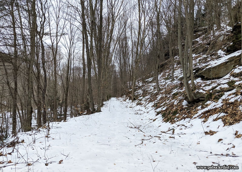
- From the back of the parking area, hike 1.1 miles along an old rail grade.
Lycoming Creek and private property will be on your left, but the entire rail grade/trail is on state forest land (at times you’ll see white blazes on trees to your left indicating the forest border).
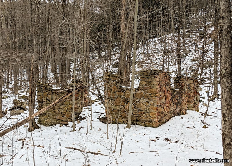
- At 1.1 miles you’ll encounter an old stone foundation.
At this point leave the rail grade and hike uphill at a roughly 30 degree angle, past the stone foundation, for another 1/3 of mile until you see/hear Dutchmans Run Falls.
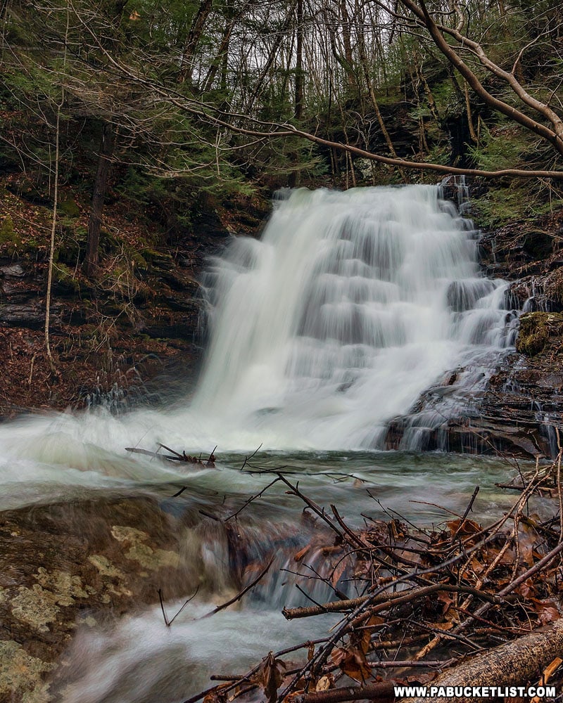
- Arrive at Dutchmans Run Falls at 1.4 miles into hike.
GPS Coordinates for Dutchmans Run Falls: 41.525167, -76.948933This is a great spot to stop for a break, take in the scenery, and grab a few photos.
- Cross Dutchmans Run and make your way due north, keeping Route 14 and the private property/forest border to your left.
The first few hundred yards will be rather steep as you climb up out of the Dutchmans Run Gorge. The next 3/4 of a mile will remain rather flat but rocky. The final descent into Abbott Run Gorge will be steep again.
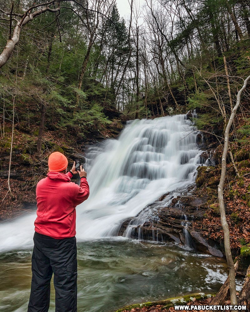
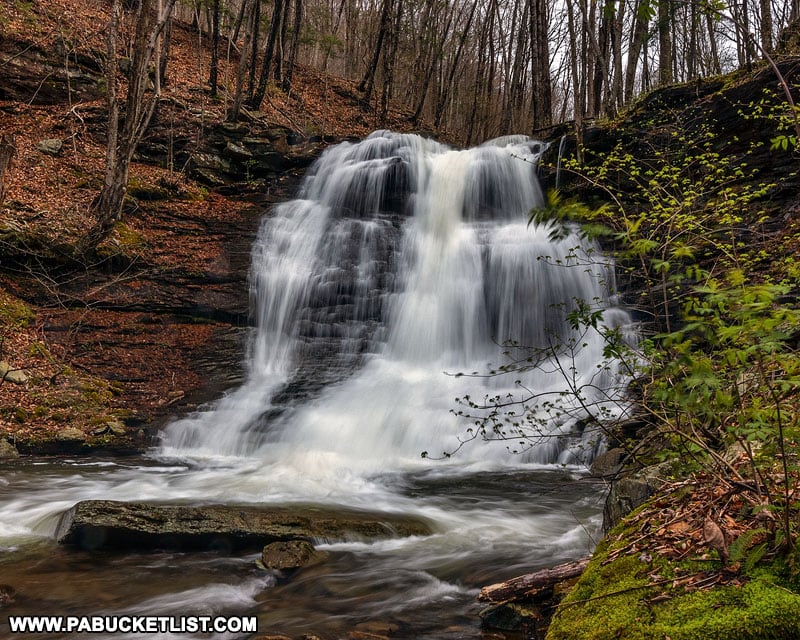
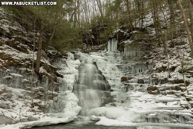
- Arrive at Abbott Run Falls at 2.36 miles into hike.
GPS Coordinates for Abbott Run Falls: 41.533439, -76.950480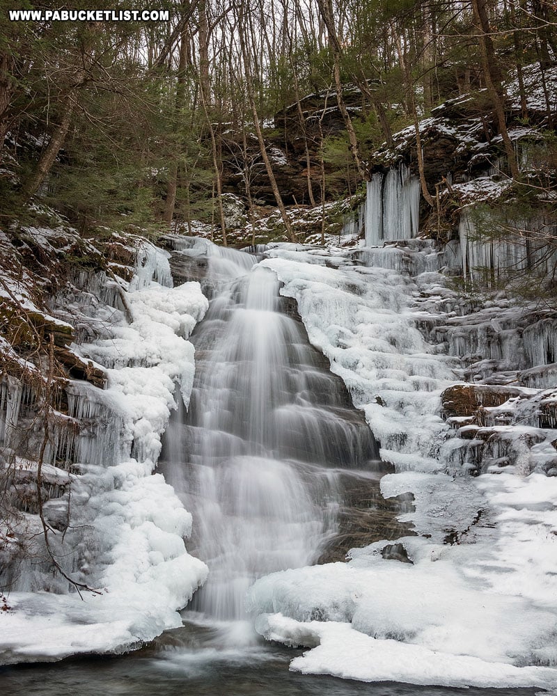
Exploring Abbott Run Falls
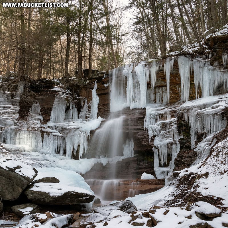
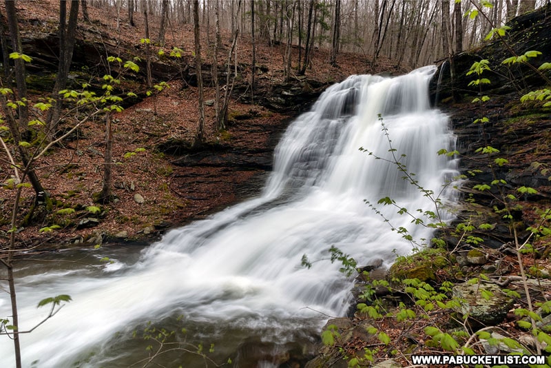
Abbott Run Falls occupies space in a rather tight gorge.
The best views are from the front and to the right of it.
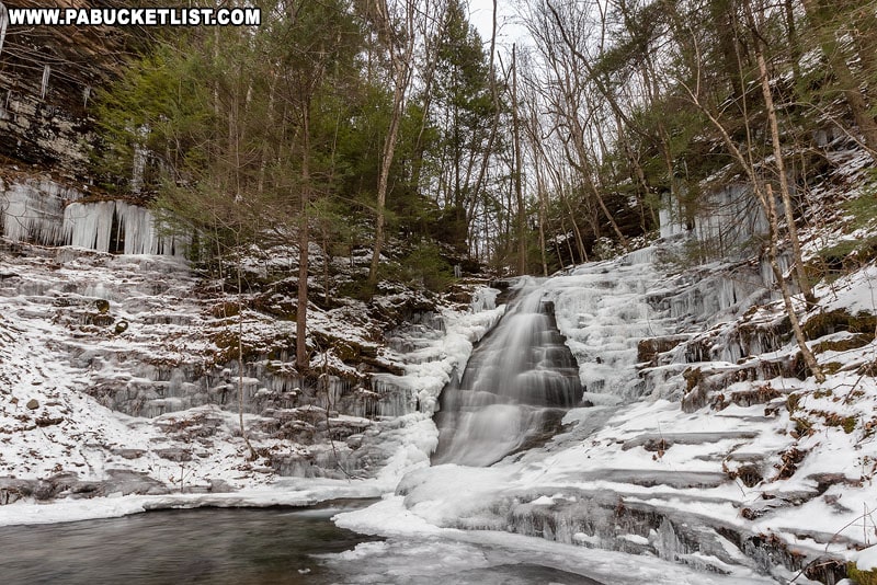
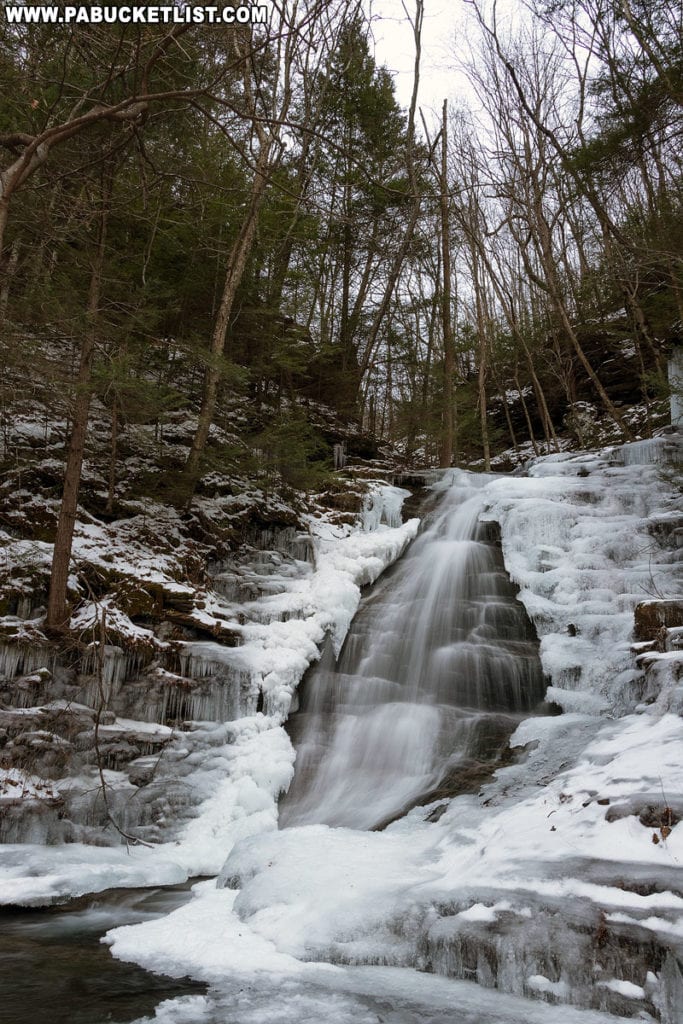
In the winter the surrounding gorge walls create an amphitheatre of ice.
While on a rainy day those same gorge walls seem to amplify the sound of rushing water tenfold.
The right side of the falls offers a bit more room to maneuver.
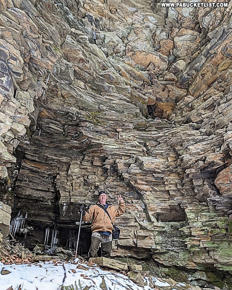
And the outlying right wall of the gorge offers an impressive look at how far out Abbott Run Falls once jutted eons ago.
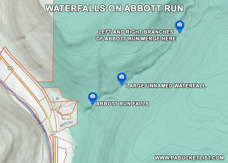
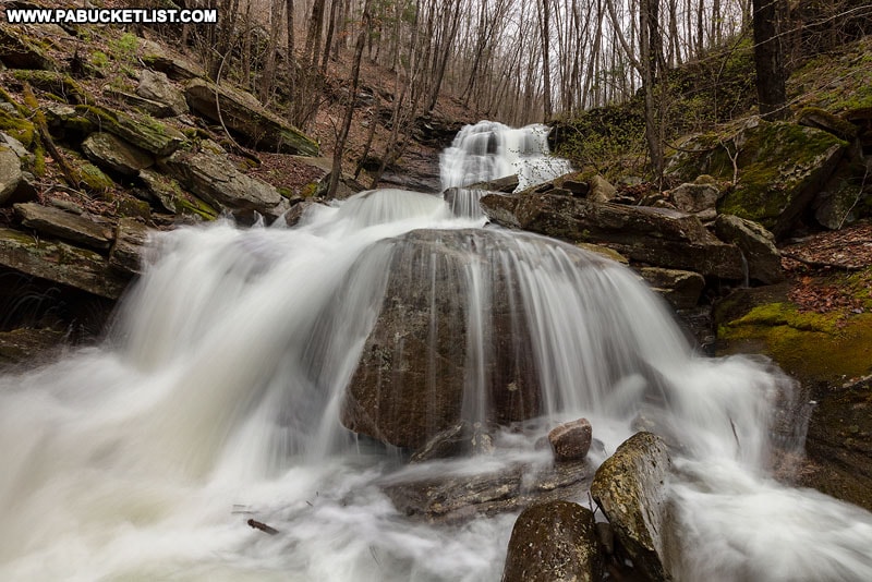
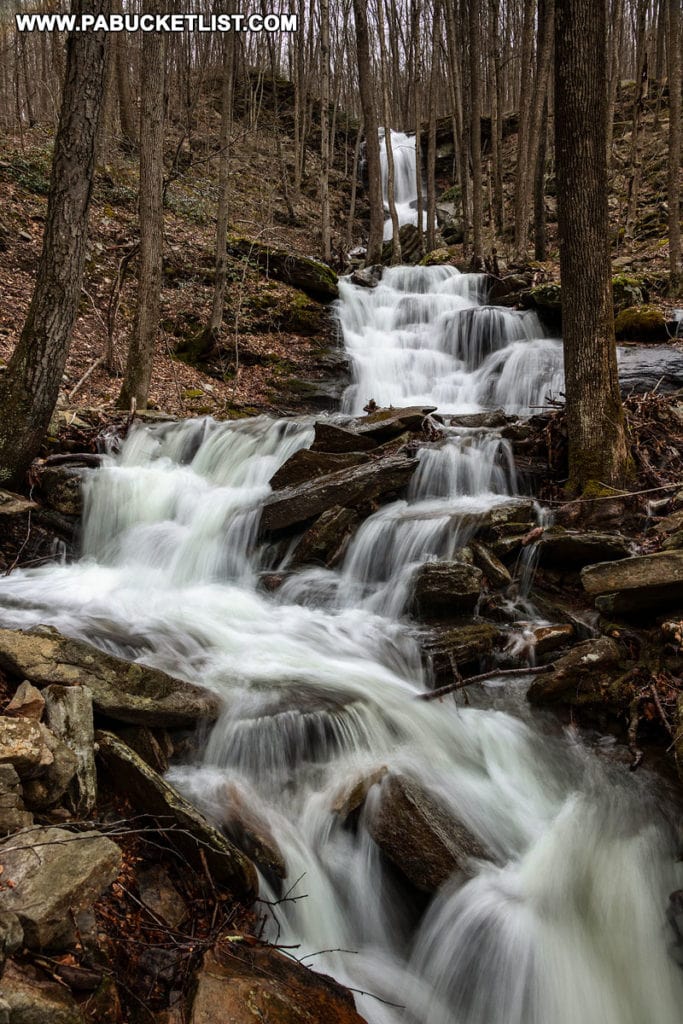
Upstream from Abbott Run Falls are several additional, unnamed waterfalls.
You can bushwack to them up around the right side of Abbott Run Falls, through some extremely dense laurel, but you’ll have a tough go of it, I can tell you from personal experience.
The tallest of these unnamed waterfalls is a solid 20-25 footer a few hundred yards upstream from Abbott Run Falls.
When Abbott Run is flowing well, this may be the most impressive waterfall on the entire stream.
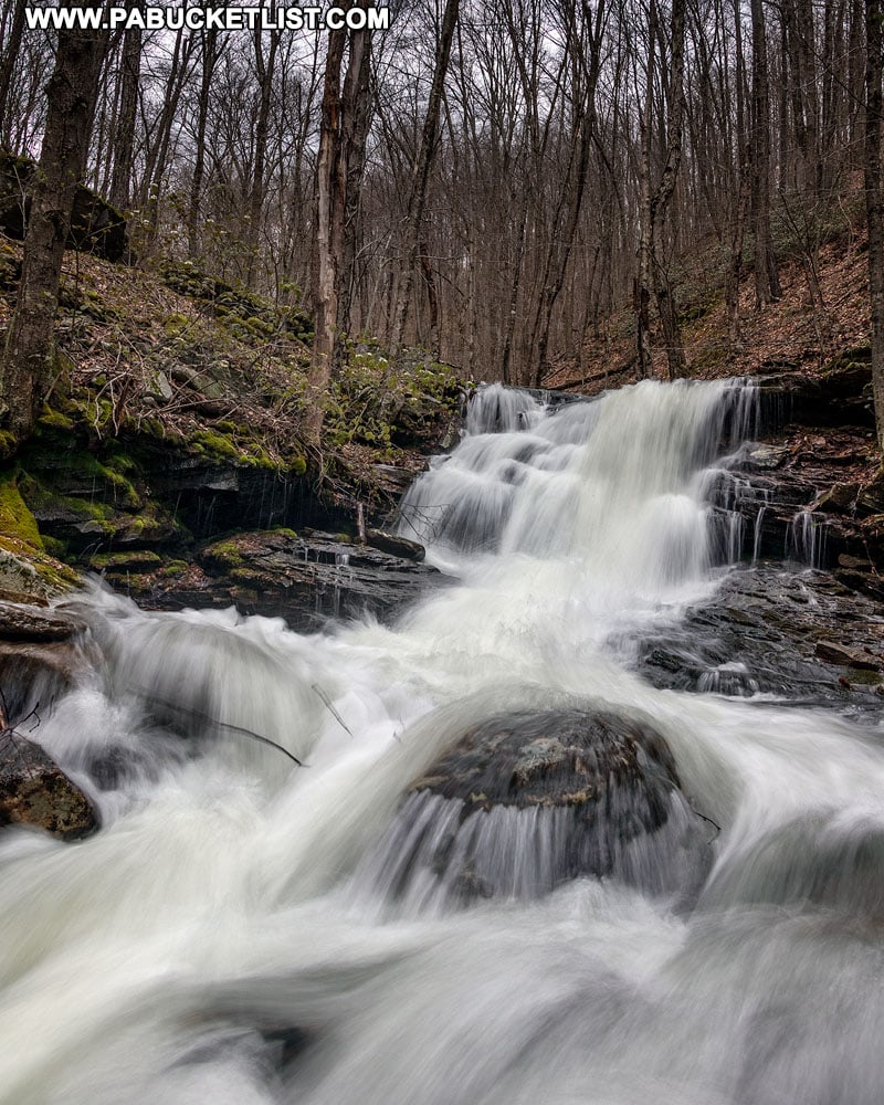
Approximately 0.4 miles upstream from the large unnamed waterfall, Abbott Run branches off into two separate streams, each with waterfalls immediately above the merge point.
The right branch (above) is at least 150 yards of continual waterfall action as it plunges towards the merge point.
The left branch waterfalls on Abbott Run are not nearly as tall, but still photogenic.
Hiking to Abbott Run Falls from the Top of McIntyre Mountain
If you were to hike to Abbott Run Falls from the top of McIntyre Mountain, this merge point is the spot I would recommend navigating to first.
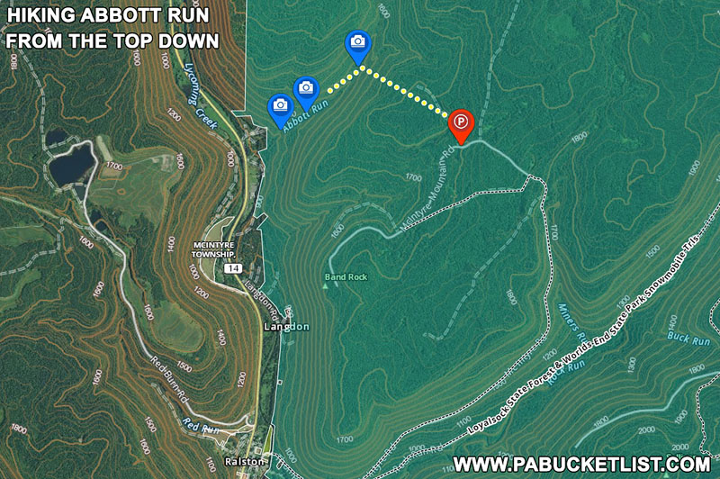
Park at an obvious pull-off along McIntyre Mountain Road at GPS coordinates 41.53215, -76.93067.
Navigate towards the merge point of the left and right branches of Abbott Run at GPS coordinates 41.53868, -76.94196.
Note – there is no trail to follow!
From there, hike the stream all the way down to Abbott Run Falls, hitting all the other unnamed waterfalls along the way.
Final Thoughts
In my book, the waterfalls on Abbott Run are absolutely worth the effort required to see them.
No matter which route you choose, these are rugged, off-trail hikes not suited for beginners, but certainly a goal to work towards.
Still not convinced you need to explore Abbott Run Falls?
Then check out this video!
Related Attractions
My McIntyre Wild Area Waterfalls Guide will give you maps and directions to ALL the biggest and best waterfalls in this remote section of the Loyalsock State Forest.
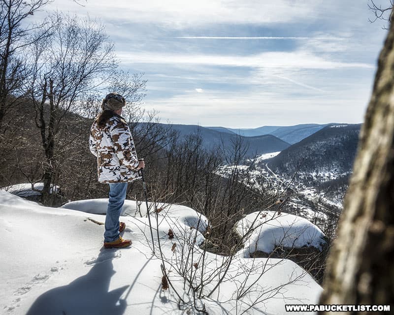
Band Rock Vista in the McIntyre Wild Area offers a stunning 180-degree view of the Lycoming Creek Valley and the town of Ralston more than 900 feet below.
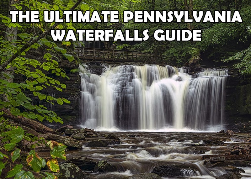
If you haven’t already, be sure to check out The Ultimate Pennsylvania Waterfalls Guide for directions to HUNDREDS of Pennsylvania waterfalls across the state!
Did you enjoy this article?
If so, be sure to like and follow PA Bucket List on Facebook, Instagram, and/or Pinterest to learn more about the best things to see and do in Pennsylvania!
Click on any of the icons below to get connected to PA Bucket List on social media.