
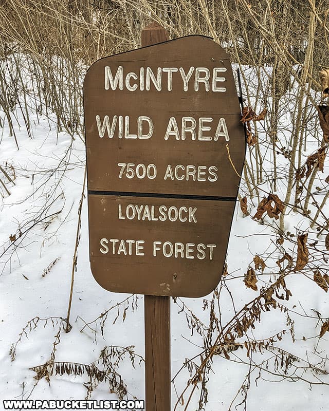
Hounds Run Falls is an outstanding triple-tiered waterfall in the storied McIntyre Wild Area, a remote portion of the Loyalsock State Forest in Lycoming County.
Getting There
How to Find Hounds Run Falls in the McIntyre Wild Area
- From Route 14 in Ralston (Lycoming County), turn onto Rock Run Road.
Travel 3.78 miles northeast on Rock Run Road, a “No Winter Maintenance” State Forest road.
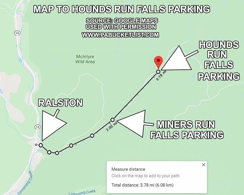
- Navigate to the Hounds Run Falls parking lot.
Use GPS Coordinates 41.533518, -76.894311
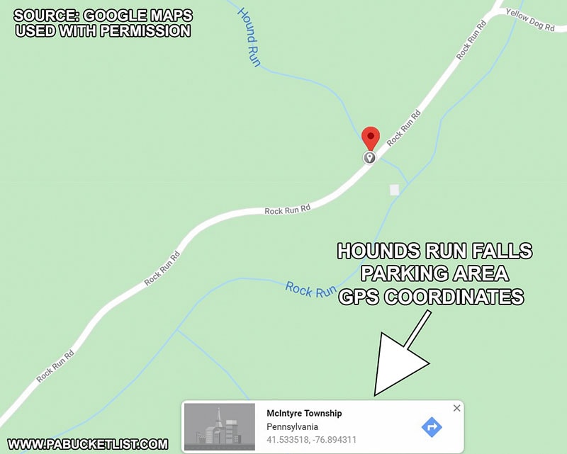
- Park in the large pull-off on the left hand side of the road, next to the bridge over Hounds Run.
The pull-off is large enough to accomodate 8-10 vehicles comfortably.
Note that this is the second bridge you come to on Rock Run Road when driving north from Ralston.
The first bridge you cross over is at Miners Run.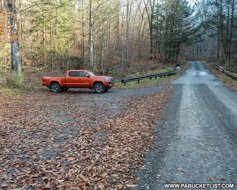
Hiking to Hounds Run Falls
Hounds Run Falls has the distinction of being the shortest and easiest waterfall hike in the McIntyre Wild Area.
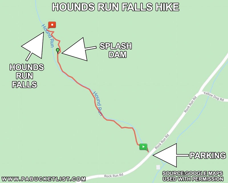
Basically a 0.33 mile hike right up the side of the stream, with one or two easy wet crossings.
As with the other waterfall hikes in the McIntyre Wild Area, there are no “official” trails, but a pretty obvious old log road grade runs up the left side of the stream for much of the way to the falls.
Use you best judgement, depending on water levels, as to whether you want to hike to road grade or the stream itself.
The Splash Dam
Approximately 0.25 miles upstream from the parking area you will encounter the splash dam, a relic from the logging days long ago.
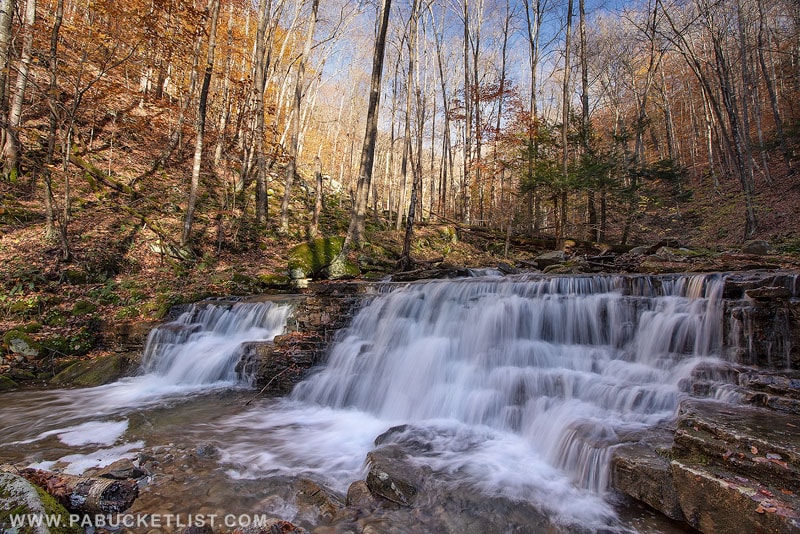
A temporary wooden dam would have been built just below this, allowing a pool of water to build up and be released whenever the timbermen had a load of logs ready to be floated downstream to Rock Run and then Lycoming Creek.
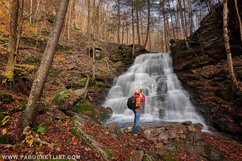
Continue upstream just past the splash dam and Hounds Run Falls will come into view, just over the next rise.
Photographing Hounds Run Falls
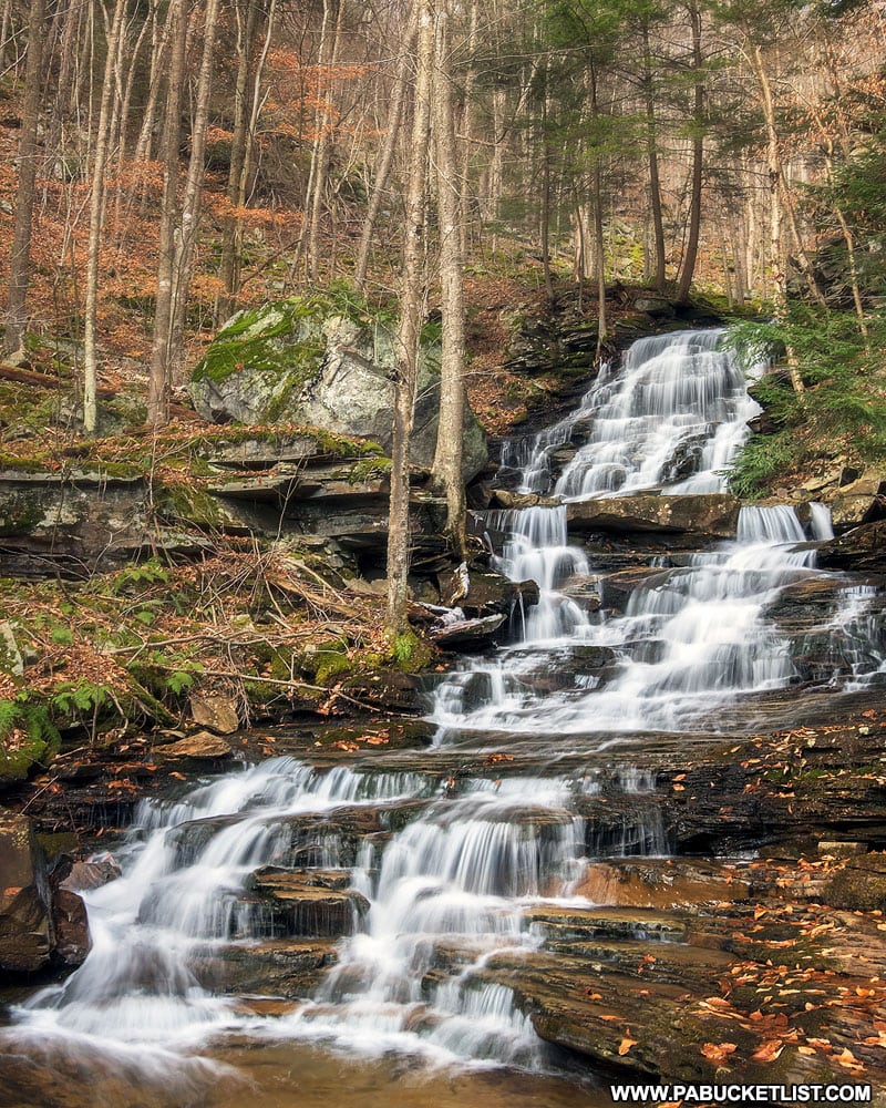
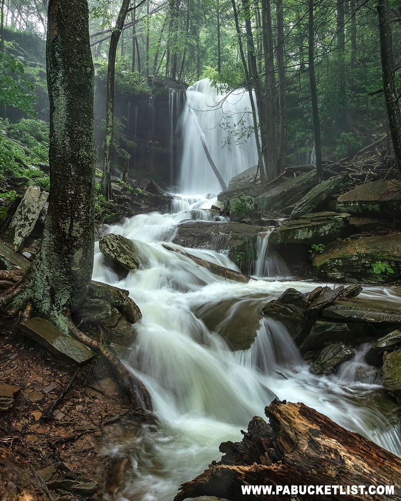
As you approach Hounds Run Falls from downstream, you’ll immediately notice three distinct tiers to it.
The water at the base of the bottom tier is shallow enough to allow you to stand in it (assuming you are wearing waterproof boots or don’t mind getting wet).
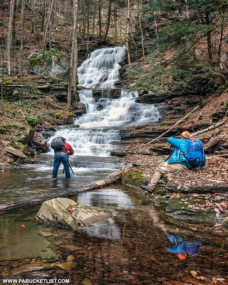
I usually start here and work my way up to the middle tier, and finally the top.
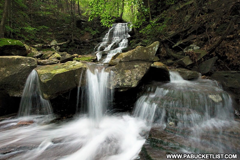
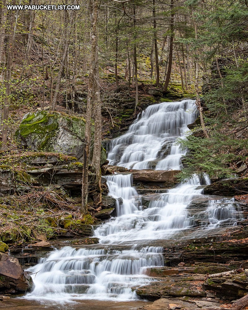
I’ve taken some of my favorite photos of Hounds Run Falls from the middle tier.
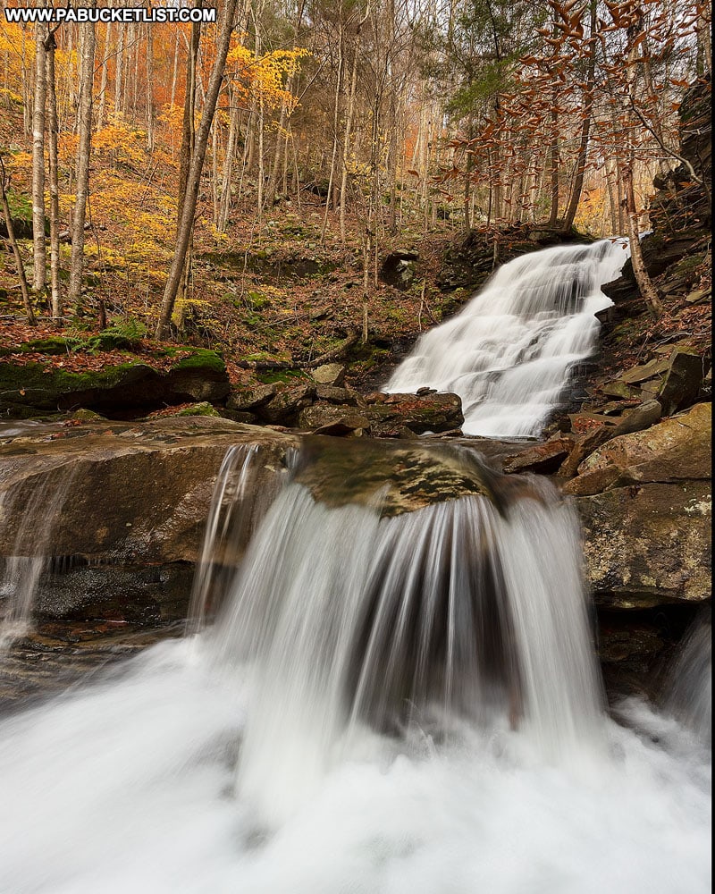
When the fall foliage is prime it’s a great vantage point.
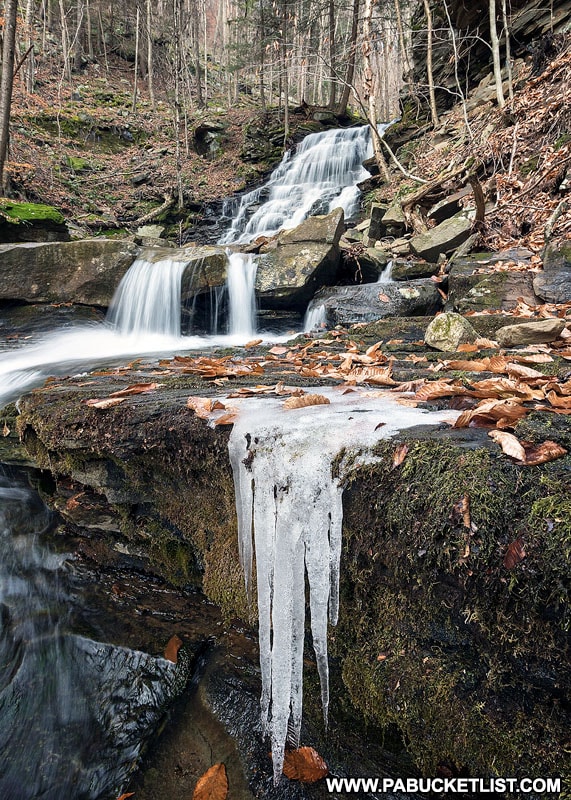
And when ice starts to form here it’s also a superb spot (although extremely slippery, so use appropriate foot gear/spikes and an abundance of caution).
The upper tier of Hounds Run Falls is a good 20-25 feet tall, and fans out to perhaps 15 feet at the bottom.
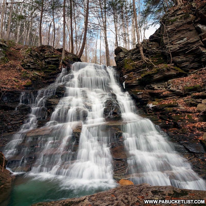
When the water levels are just right, it’s possible to pull a great deal of detail out of the water and rocks behind it, even at slow motion-blur shutter speeds.
Final Thoughts on Hounds Run Falls
As one of the easiest of the waterfall hikes in the McIntyre Wild Area, and one of the most spectacular of the waterfalls, Hounds Run Falls absolutely deserves a place on your PA Bucket List!
Still not convinced you need to explore Hounds Run Falls?
The check out this video!
Nearby Attractions
My McIntyre Wild Area Waterfalls Guide will give you maps and directions to ALL the biggest and best waterfalls in this remote section of the Loyalsock State Forest.
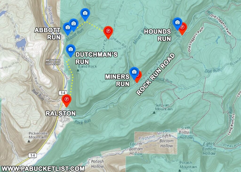
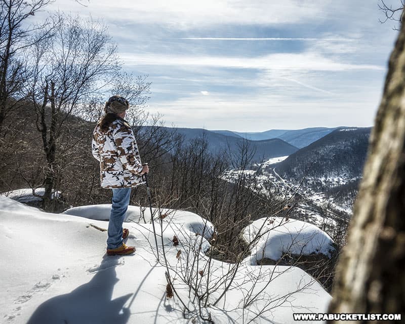
Band Rock Vista in the McIntyre Wild Area offers a stunning 180-degree view of the Lycoming Creek Valley and the town of Ralston more than 900 feet below.
Exploring Jacoby Falls in the Loyalsock State Forest is another great Lycoming County waterfall hike.
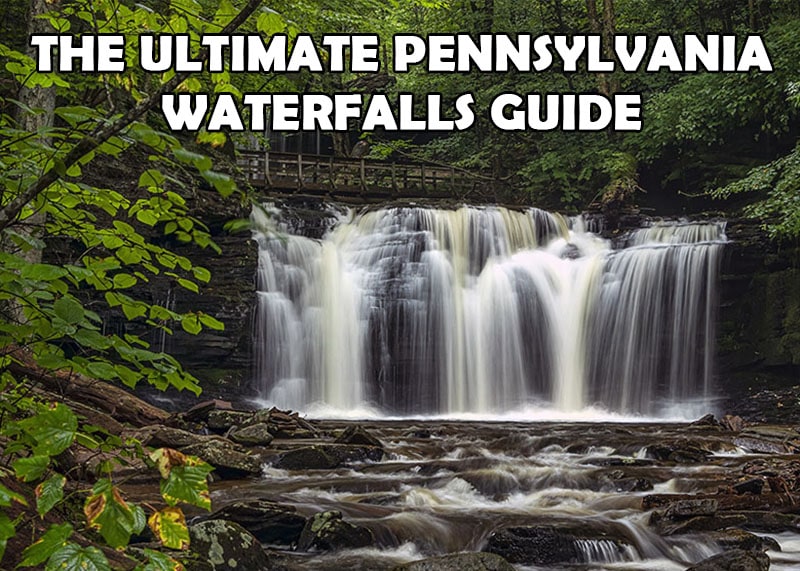
And if you haven’t already, be sure to check out The Ultimate Pennsylvania Waterfalls Guide for directions to HUNDREDS of Pennsylvania waterfalls across the state!
Did you enjoy this article?
If so, be sure to like and follow PA Bucket List on Facebook, Instagram, and/or Pinterest to learn more about the best things to see and do in Pennsylvania!
Click on any of the icons below to get connected to PA Bucket List on social media.