
Fall Brook Falls in the Tioga State Forest is a pair of easy-to-reach waterfalls in eastern Tioga County.
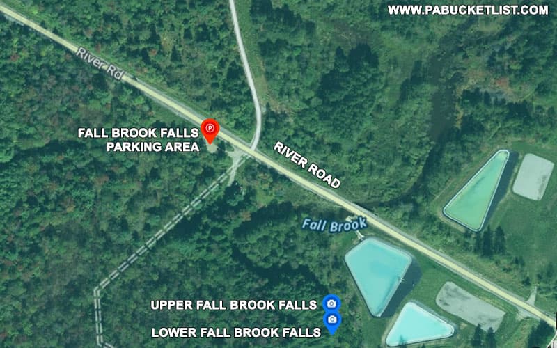
Just a 5 minute walk from a parking area along River Road, Fall Brook Falls are located near the coal mining ghost town of Fall Brook, the only reminders of which are the acid mine treatment ponds located near the falls (see satellite image above).
How to Find Fall Brook Falls
The parking area for the Fall Brook Falls hike is located at GPS coordinates 41.67900, -76.98945, along River Road and just west of the large acid mine treatment ponds along the same road.

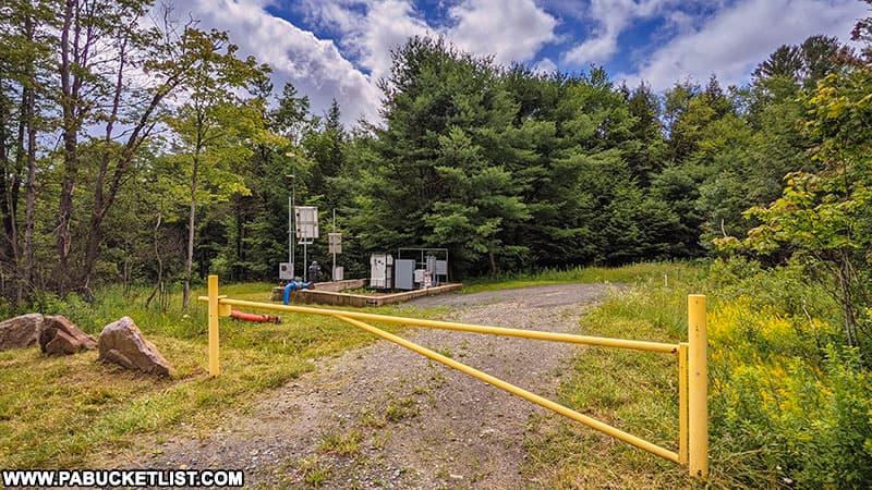
The trail begins at a gated State Forest road next to a water extraction site.
Follow the forest road past the water extraction site and across an old stone bridge (pictured below).

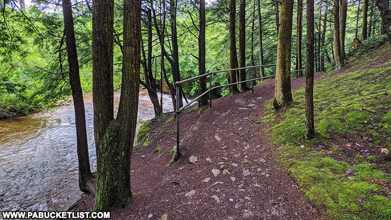
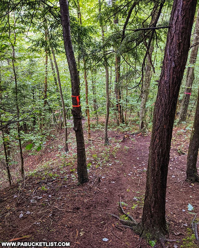
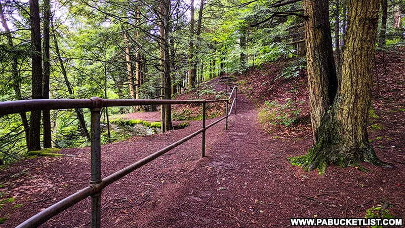
Once across the bridge, the trail veers left towards the stream, and after 5 minutes of walking you’ll see the metal railings above the falls.
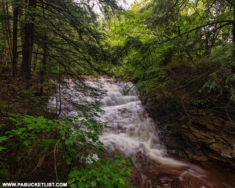
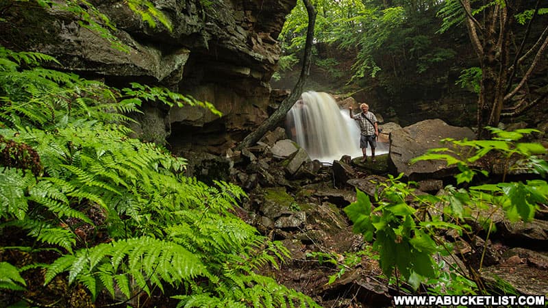
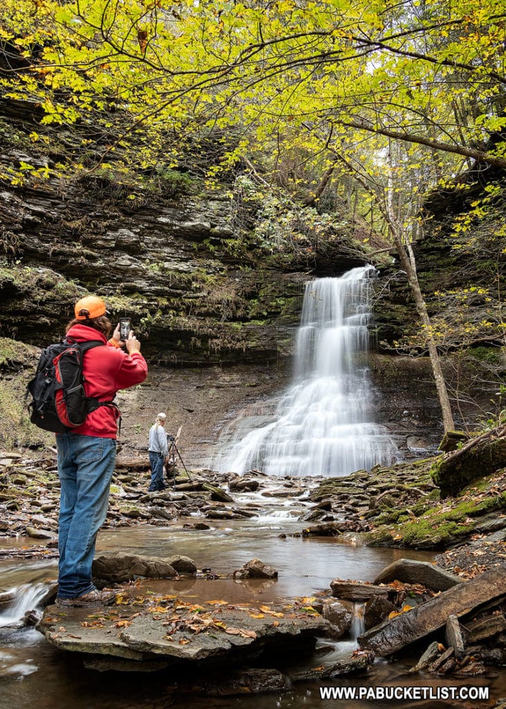
Upper Fall Brook Falls
Upper Fall Brook Falls is in the neighborhood of 10-12 feet tall and probably twice as wide.
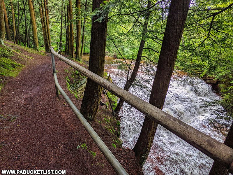
A small rock outcropping next to the railing gives you a nice wantage point to observe Upper Fall Brook Falls without descending to stream-level.
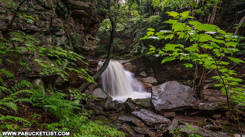
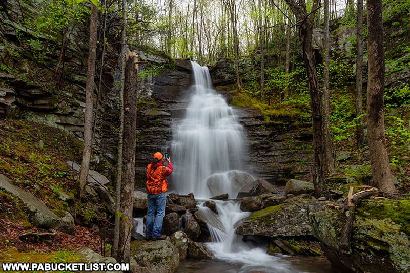
Lower Fall Brook Falls
Just a few paces from the Upper Fall Brook Falls overlook, Lower Fall Brook Falls comes into view below you.
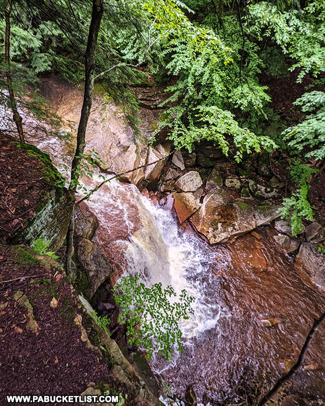
While you certainly can see and hear Lower Fall Brook Falls from this vantage point, the best views of it are to be had from stream level.
To reach this vantage point, continue hiking downstream along the trail another 200 yards, where the trail will veer downhill and even further to the left, towards the streambed.
From the streambed, simply hike back up the left side of the stream (when facing upstream) to the base of the falls.
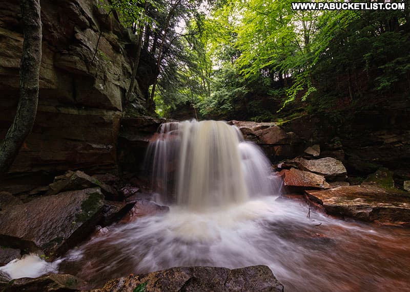
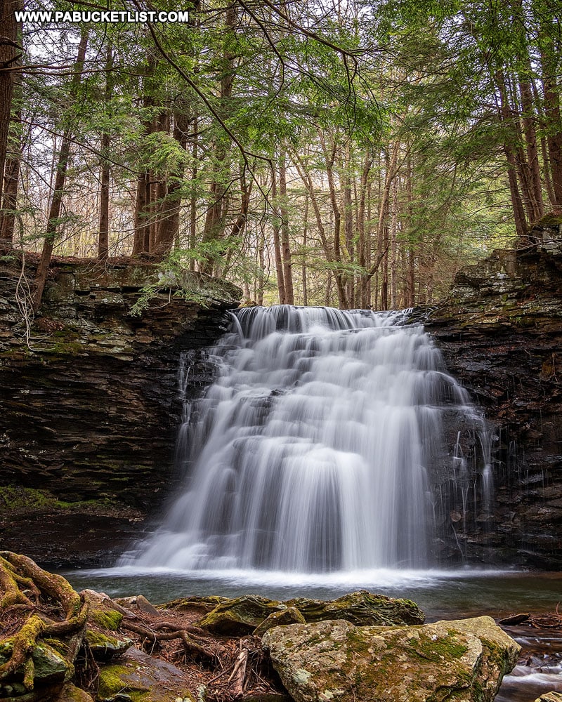
Lower Fall Brook Falls has more of the “classic” waterfall drop and photographs better than Upper Fall Brook Falls, in my opinion.
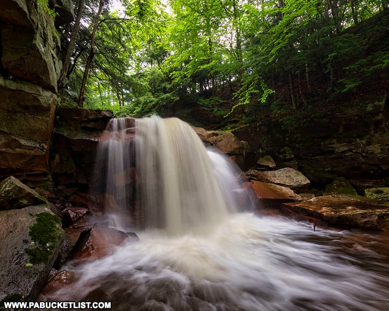
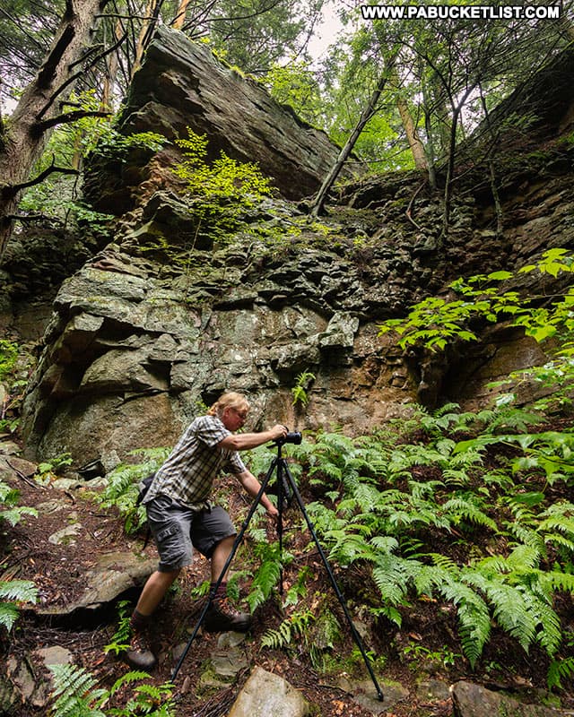
The falls are also surrounded by some impressive rock formations.
At maybe 10 feet tall, Lower Fall Brook Falls is FAR from the tallest waterfall you’ll encounter in Tioga County, but it certainly is a picturesque spot!
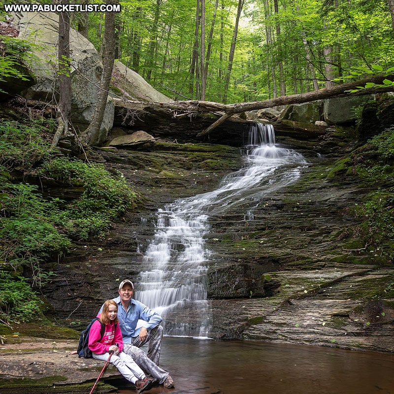
When you’ve had your fill of the pair of waterfalls on Fall Brook, simply backtrack to the parking lot along River Road.
Still not convinced you need to visit Fall Brook Falls?
Then check out this video!
Nearby Attractions
15 miles east of Fall Brook Falls, you’ll find a cluster of 6 magnificent waterfalls in Bradford County.
10 miles west of Fall Brook Falls, you’ll find Sand Run Falls, along with a few smaller waterfalls as well.
11 miles south of Fall Brook Falls, you’ll find the McIntyre Wild Area in Lycoming County, home to more than a dozen incredible waterfalls, scattered amongst a handful of magnificent mountain streams.
If you’re looking for a comprehensive guide to waterfalls in the PA Grand Canyon region, then be sure to check out “35 Must-See Waterfalls in Tioga County”.
Did you enjoy this article?
If so, be sure to like and follow PA Bucket List on Facebook, Instagram, and/or Pinterest to stay up-to-date on my latest write-ups about the best things to see and do in Pennsylvania.
Click on any of the icons below to get connected to PA Bucket List on social media!