
If you’re looking for information about visiting Mount Davis in Somerset County, the highest point in Pennsylvania, you’re in the right place!
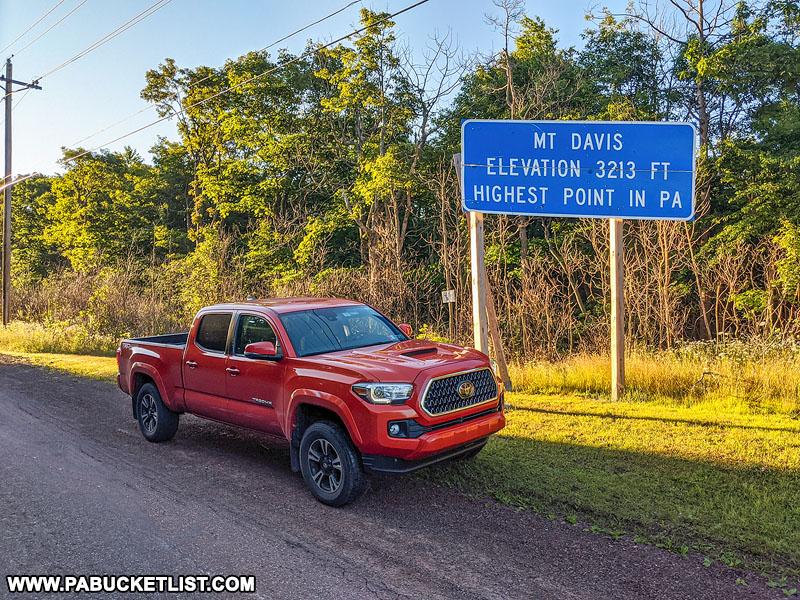
At 3,213 feet above sea level, this picturesque mountain in the Forbes State Forest is home to some incredible views of the surrounding Laurel Highlands.

In this write-up I will guide you to 4 of the most scenic overlooks on Mount Davis, as well as share some of my favorite photos and a bit of history of the area.
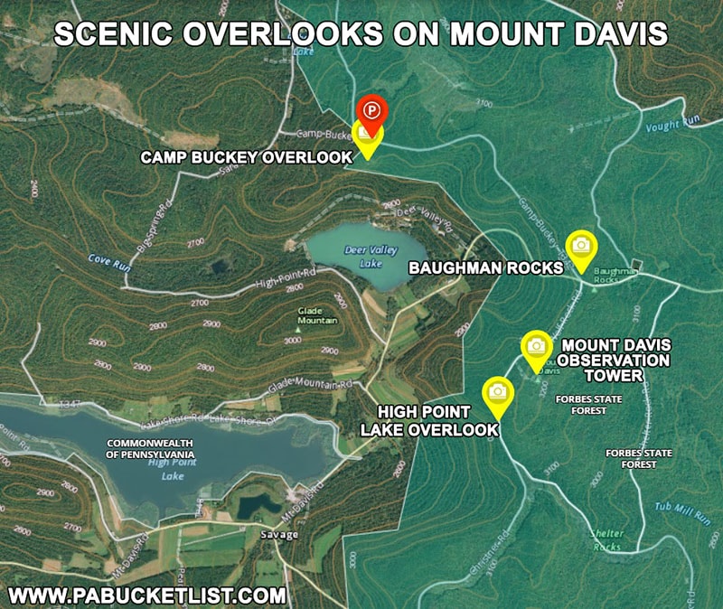
1. Mount Davis Observation Tower
We’ll start at the most popular and famous of the overlooks on Mount Davis, the Observation Tower.
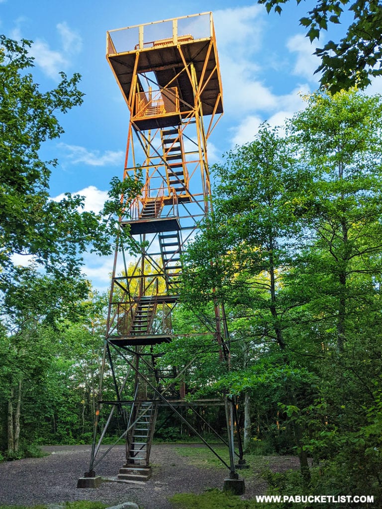
You would think that a large tower on top of Pennsylvania’s tallest point would be easy to spot, but it’s actually camouflaged well by the surrounding forest.
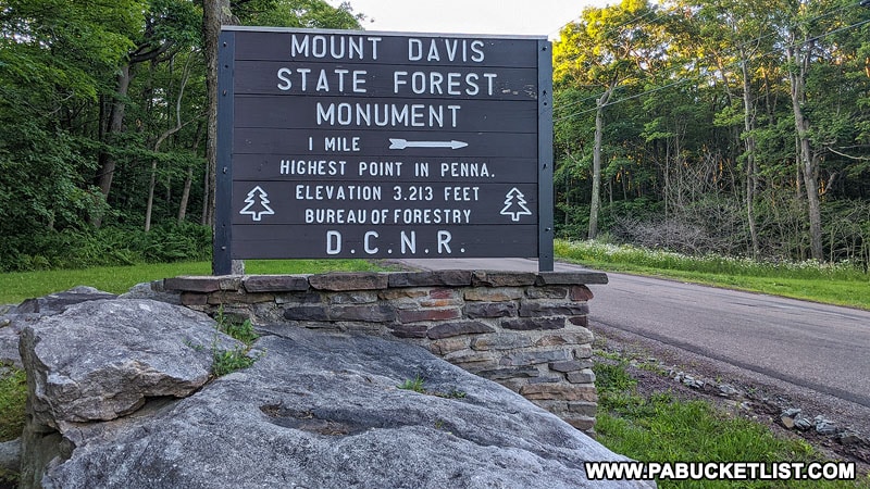
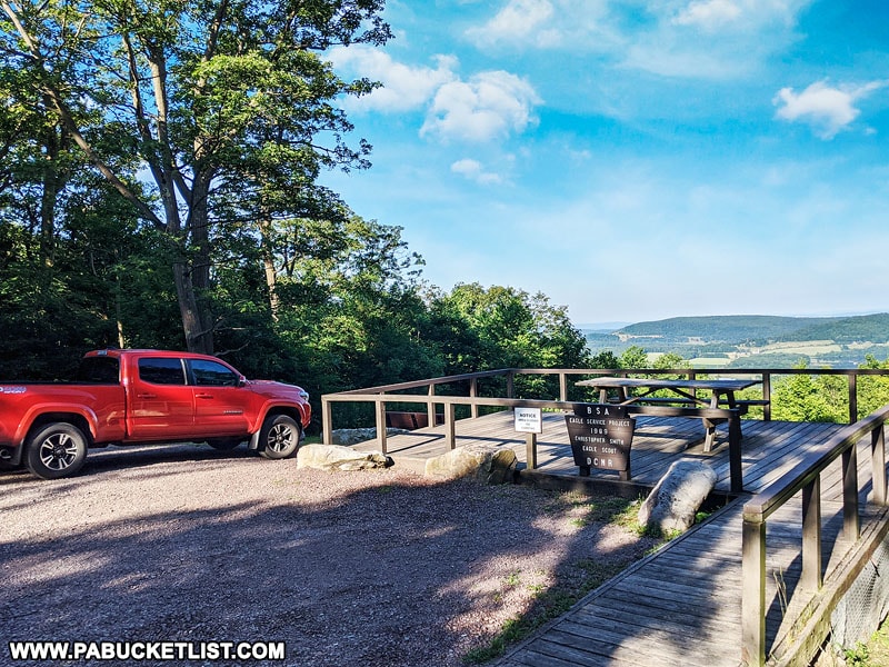
Look for signs along Mount Davis Road, then turn onto South Wolf Rock Road.
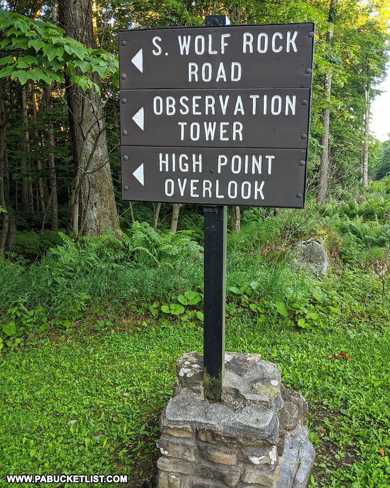
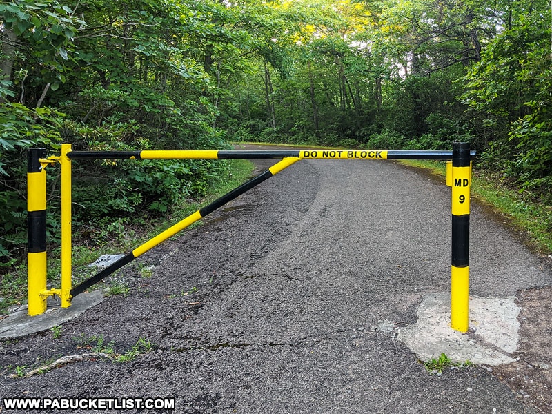
Procede approximately 1 mile, then turn into the parking area when you see the sign pictured below.
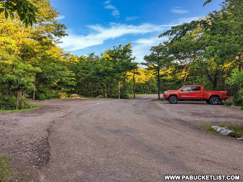
GPS coordinates for the parking lot are 39.78587, -79.17672, and it’s capable of holding several dozen vehicles.
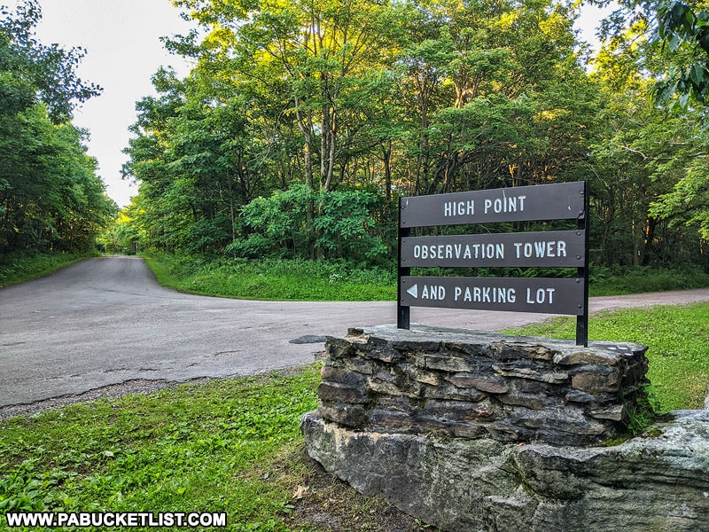
Walk towards the back of the parking lot and an informational kiosk where you can pick up a map of the area.
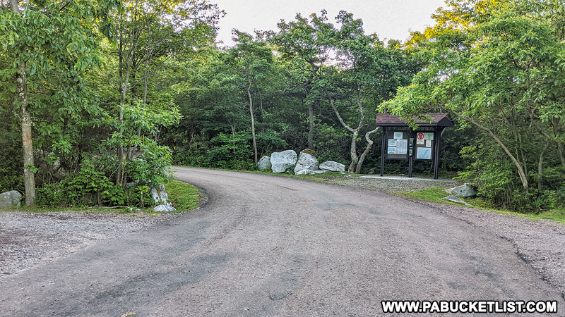
To the left of the kiosk you’ll see a gated, paved road – this is the trail to observation tower.
The tower is maybe 50 yards from the gate.
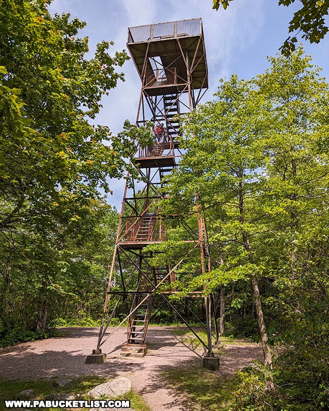
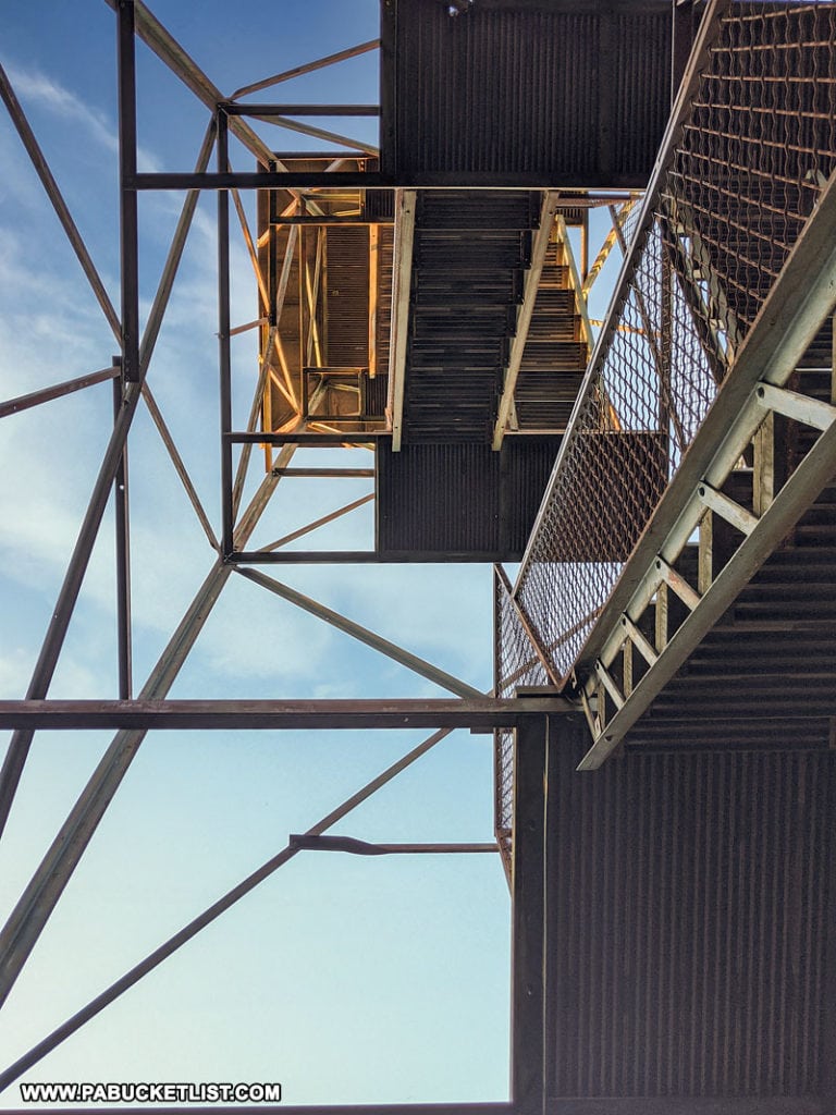
I’m not going to lie – if you don’t like heights scaling the tower can be a bit unnerving!
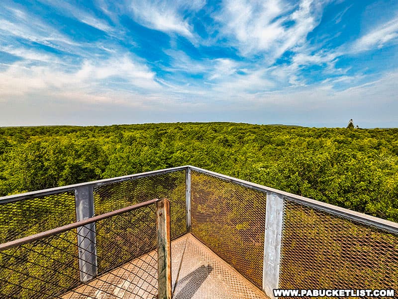
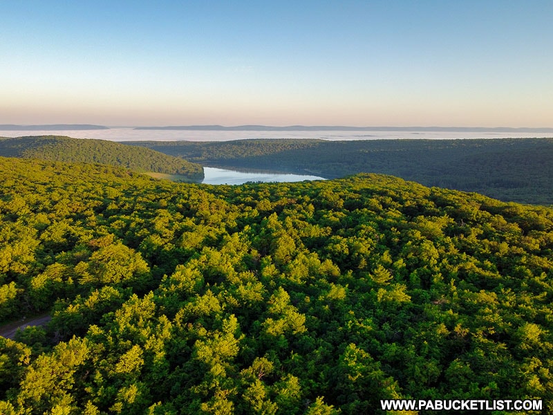
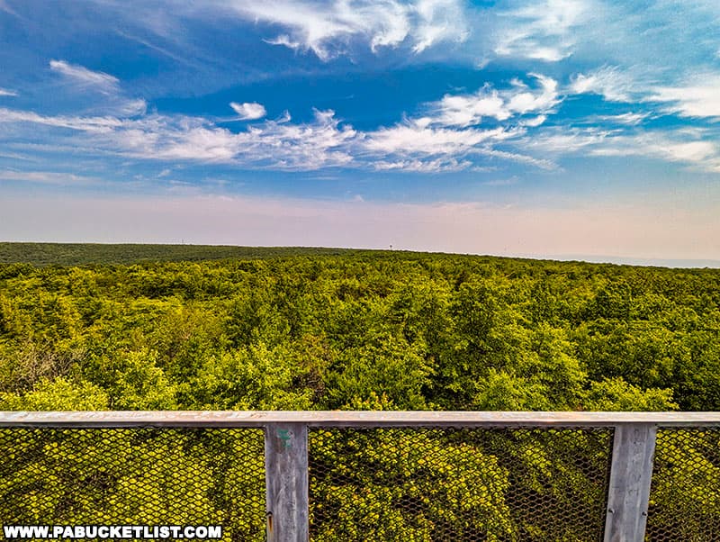
But the views from the top are outstanding!
If you have a chance to climb the observation tower at Mount Davis in October, do it!

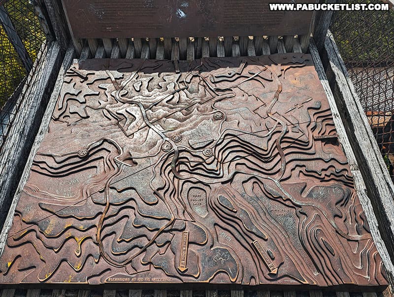
A raised relief map at the top of the platform helps you understand what you are looking at in all directions.
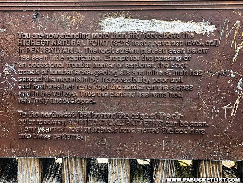
A plaque at the top of the observation tower relates a bit of the history of Mount Davis.
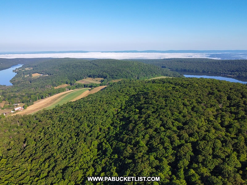
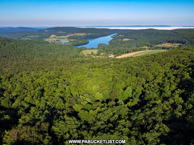
On a clear day you can make out some of the surrounding wind farms in the distance.

While fog lifting from Deer Valley Lake and the Casselman River Valley is a common sight on summer mornings.
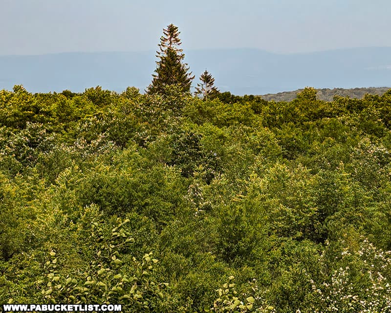
A tall pine to the west towers over the rest of the Forbes State Forest.
The barrier around the top of the observation tower is only about waist high on an average adult, which makes a trip to the top a tad more “exciting” on a windy day!
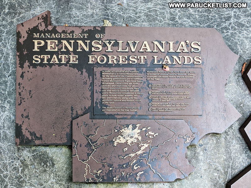
Near the base of the observation tower are several plaques detailing some of the local history and geology.
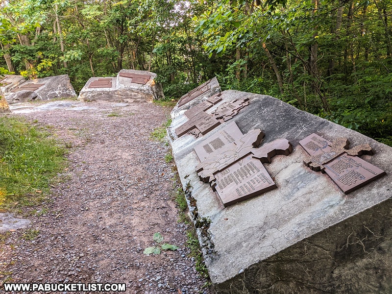
Though well-worn by the elements, the signs are easy to read and quite informative.
For those who would compare the height of Mount Davis to some of the tallest points in the western United States, keep in mind the Rockies were formed a mere 80 million years ago.
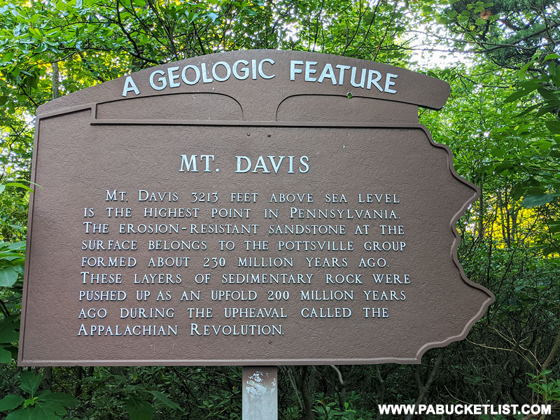
Mount Davis has been aging and eroding for nearly 200 million years!
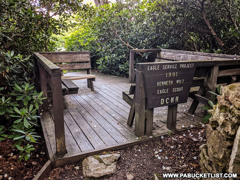
2. High Point Lake Overlook on Mount Davis
Approximately 1/3 of a mile south of the Mount Davis Observation Tower you’ll find the High Point Lake Overlook along South Wolf Rock Road.
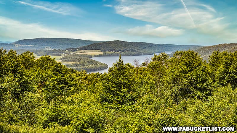
GPS coordinates for the High Point Lake Overlook area 39.78209, -79.18090.
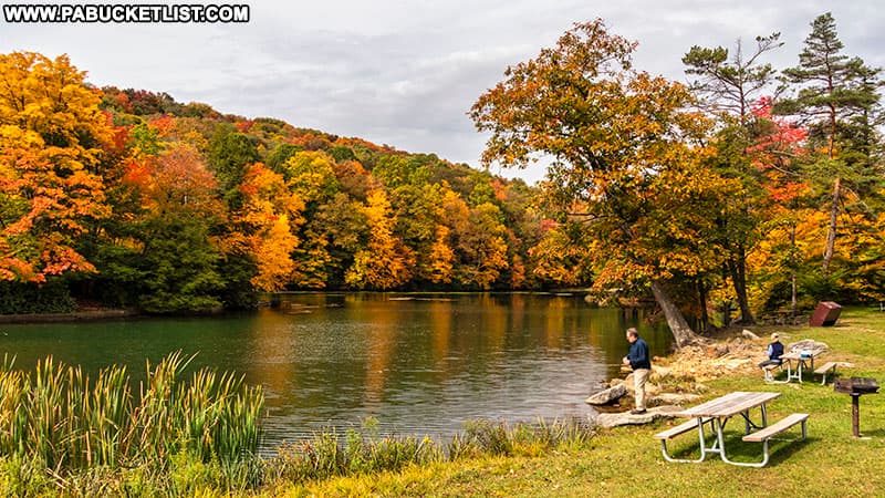
A wheelchair-accessible ramp leads from the parking area to this small deck / picnic area with a phenomenal view of High Point Lake.
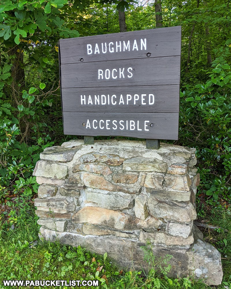
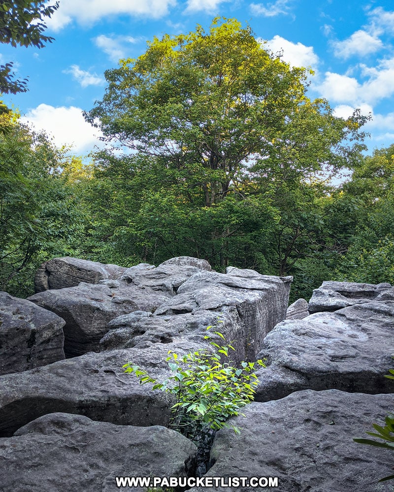
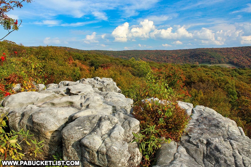
3. Baughman Rocks on Mount Davis
Backtracking on South Wolf Rock Road, two more exceptional spots are worth investigating on the opposite side of Mount Davis Road.
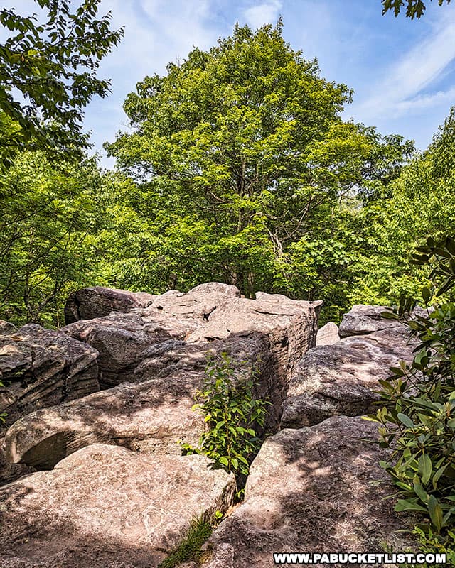
Baughman Rocks (not to be confused with Baughman Rock Overlook at Ohiopyle State Park) is a fascinating mountain top rock formation, located just off Mount Davis Road.
The GPS coordinates for the Baughman Rocks parking area along Mount Davis Road are 39.79422, -79.17189.
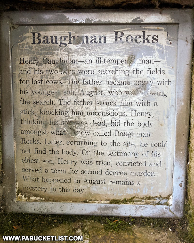
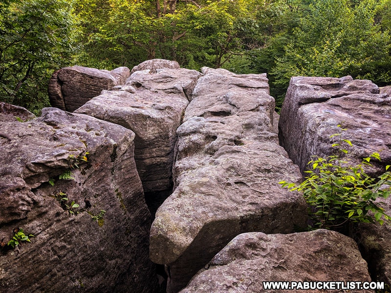
Baughman Rocks has a rather macabre history associated with it, which you can read about on an informational sign near the observation deck.
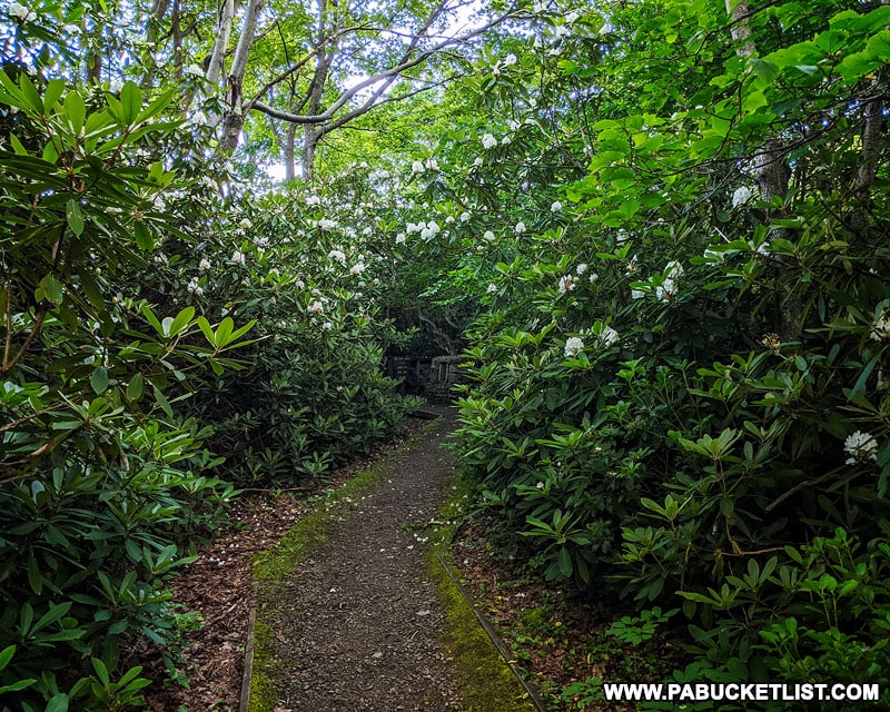
The flat gravel trail from parking area to the observation deck is approximately 50 yards long, and surrounded by spectacular growths of mountain laurel, the official state plant of PA.
Upon reaching the observation deck, you’ll quickly see that any distant views that may once have existed here are now obscured by tall trees.
That doesn’t take away from the overall beauty of the scene though.
Upon closer inspection you can certainly see how a body could “disappear” in these deep crevices between the boulders – be sure to step carefully so that you don’t become one of them!
Baughman Rocks is especially colorful in October.

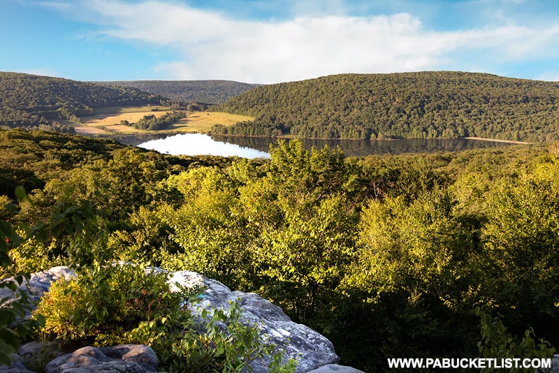
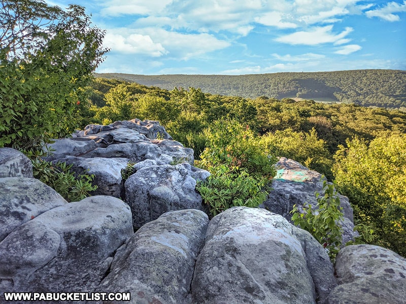
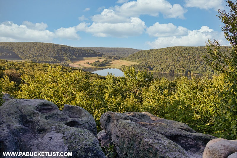
4. Camp Buckey Overlook on Mount Davis
Perhaps the best vista on Mount Davis, Camp Buckey Overlook is a favorite of locals, especially teenagers who frequent it as a party spot.
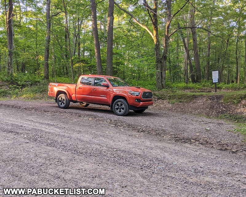
To find the overlook, turn off of Mount Davis Road onto Camp Buckey Road and follow this unpaved but relatively smooth road for 1.6 miles.
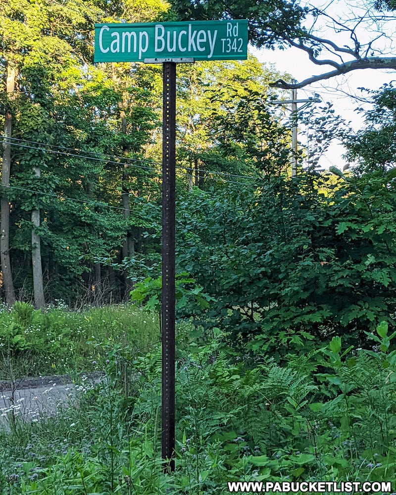
The parking area for the Camp Buckey Overlook is located at GPS coordinates 39.80546, -79.19452.
Look for this sign below at the unblazed but well-worn trailhead.
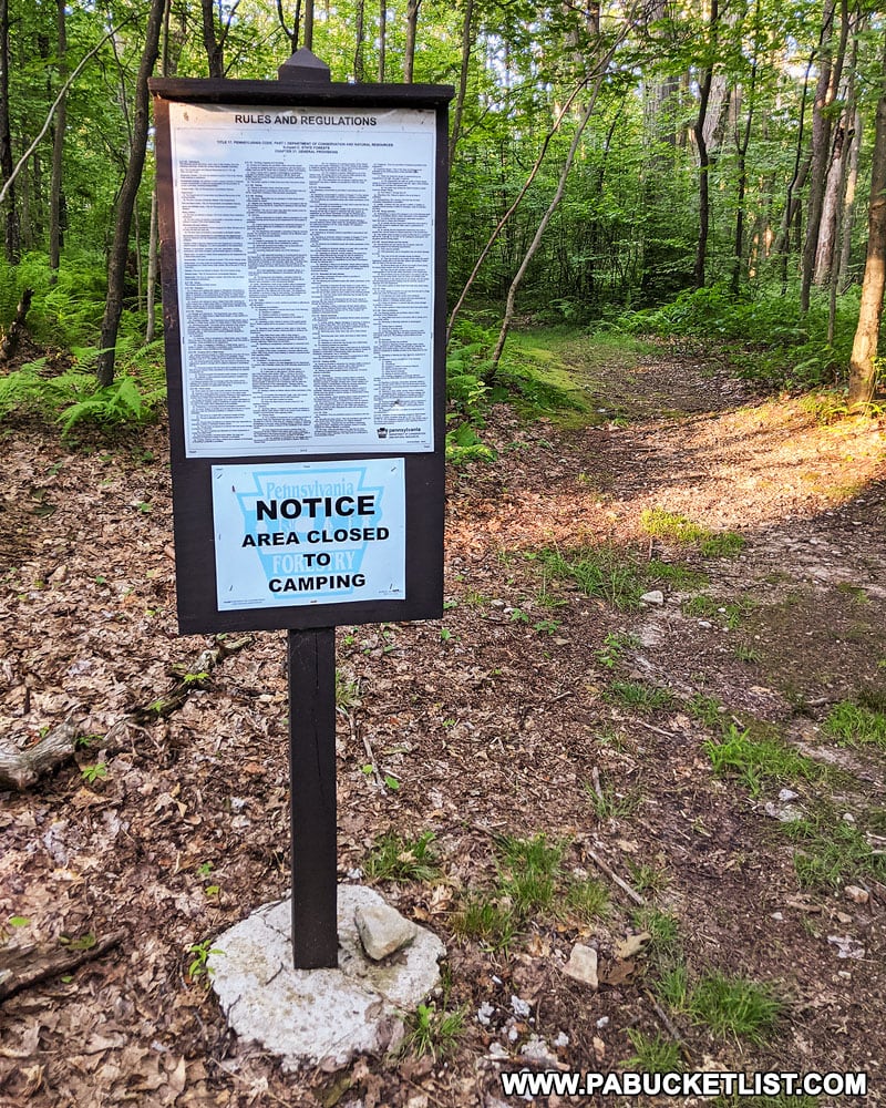
The trail is roughly 220 yards long, and while rocky, is relatively flat.
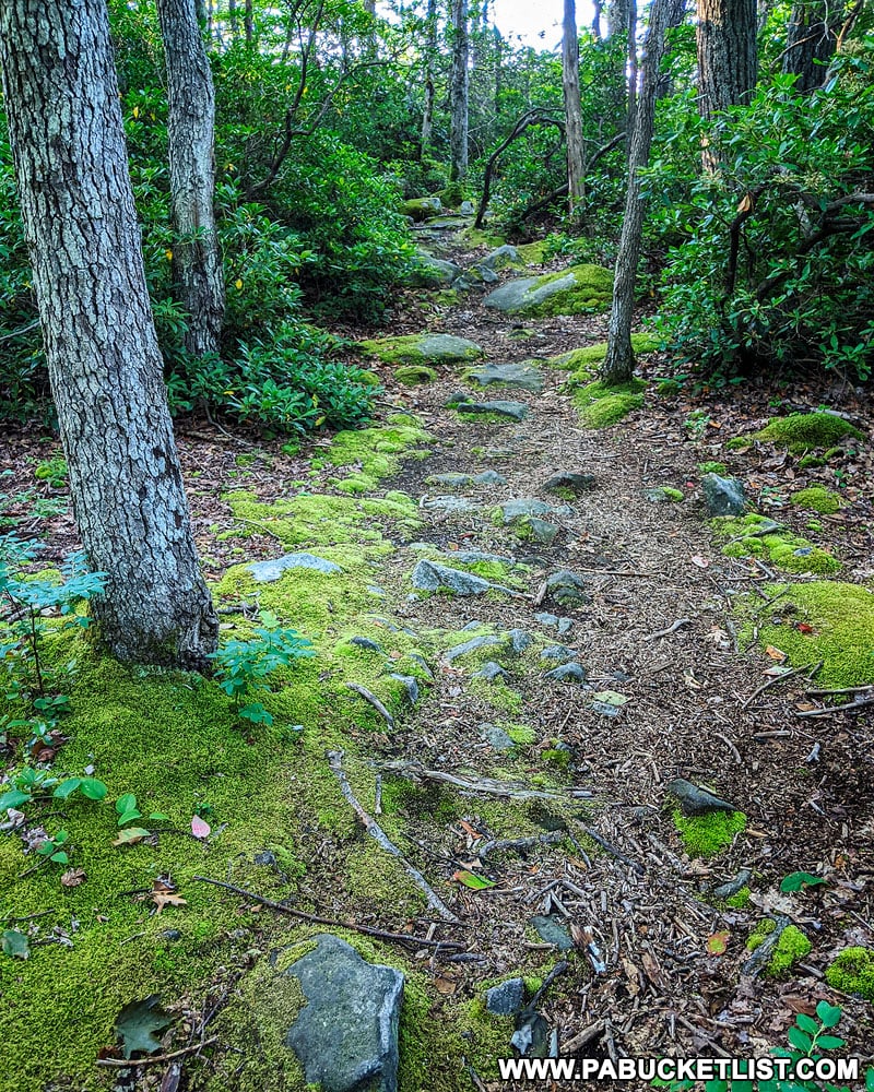
They payoff is a majestic view of massive rock formations and Deer Valley Lake far below.
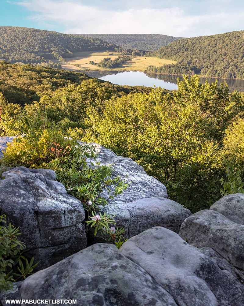
This is one of my favorite lookouts in the Forbes State Forest, rivaling those at Beam Rocks, also located on Somerset County.
Unlike Baughman Rocks, there is no observation deck at Camp Buckey Overlook, so use caution when exploring the rocks, as the crevices are every bit as deep here as they are where Henry Baughman hid the body of his son.
Camp Buckey Overlook is one of THE best spots for “leaf peeping” in Somerset County.
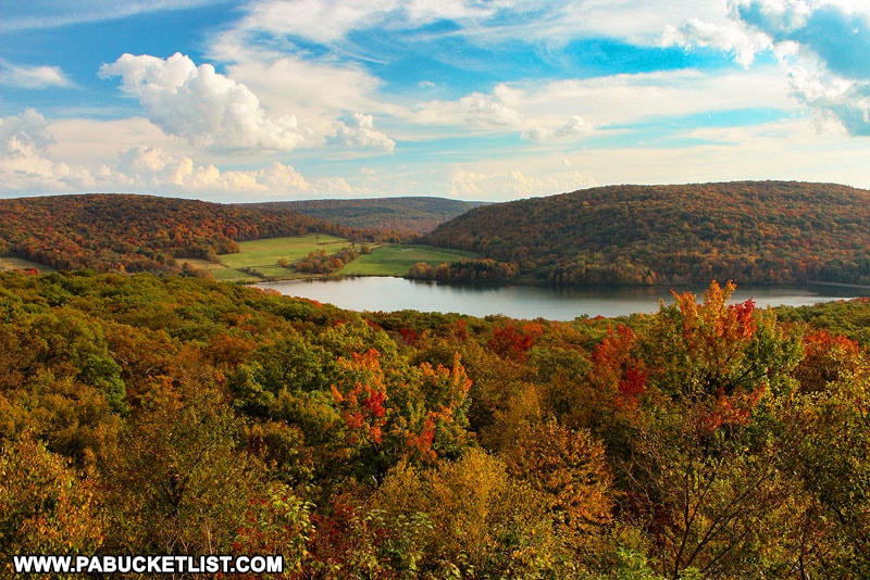
And while the entire Mount Davis area is decked out in spectacular fall foliage come October, Camp Buckey Overlook just feels a little extra special.
Nearby Attractions
Be sure to check out “The 14 Best Scenic Overlooks in the Laurel Highlands” for a list of ALL the best views in the area!

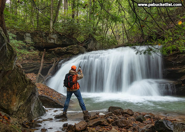
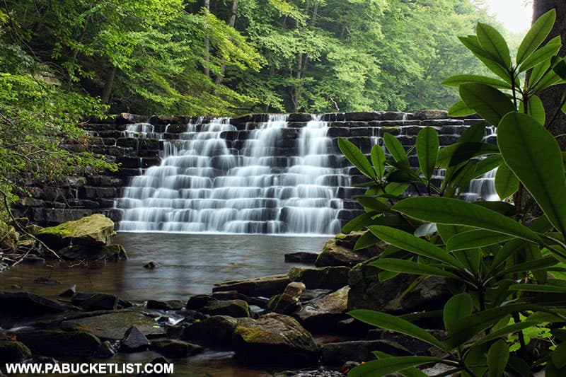
The Laurel Highlands are home to an incredible assortment of waterfalls, and you can read about some of the finest in my write-up 24 Must-See Waterfalls in the Laurel Highlands.
Exploring Laurel Hill State Park in Somerset County will introduce you to some of the best things to see and do at this iconic Laurel Highlands destination.
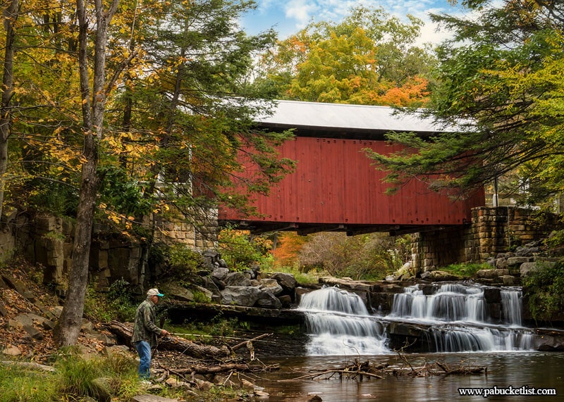
Exploring the Covered Bridges of Somerset County describes a driving tour that visits all 10 historic covered bridges in the county.
Exploring Kooser State Park in Somerset County is your guide to this 250 acre recreational area along Route 31.
Did you enjoy this article?
If so, be sure to like and follow PA Bucket List on Facebook, Instagram, and/or Pinterest to learn more about the best things to see and do in Pennsylvania!
Click on any of the icons below to get connected to PA Bucket List on social media!