
Quinn Run Falls, Shanty Run Falls, and Foundation Falls are three picturesque waterfalls located within a half-mile of each other on State Game Lands 13, yet all three are relatively unfamiliar to most hikers in Sullivan County.
Even to those who frequent State Game Lands 13 often.
So my purpose here is to give you all the information you need to find and enjoy these three superb sights.
As with all hikes on State Game Lands, wearing a blaze orange hat or vest (or both) is a prudent precautionary safety measure.
Getting There
How to Find Quinn Run Falls, Shanty Run Falls, and Foundation Falls in Sullivan County
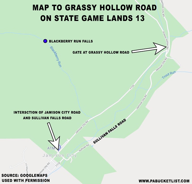
- From the intersection of Jamison City Road and Sullivan Falls Road in Jamison City, proceed 1.25 miles on Jamison City Road to the gate at Grassy Hollow Road.
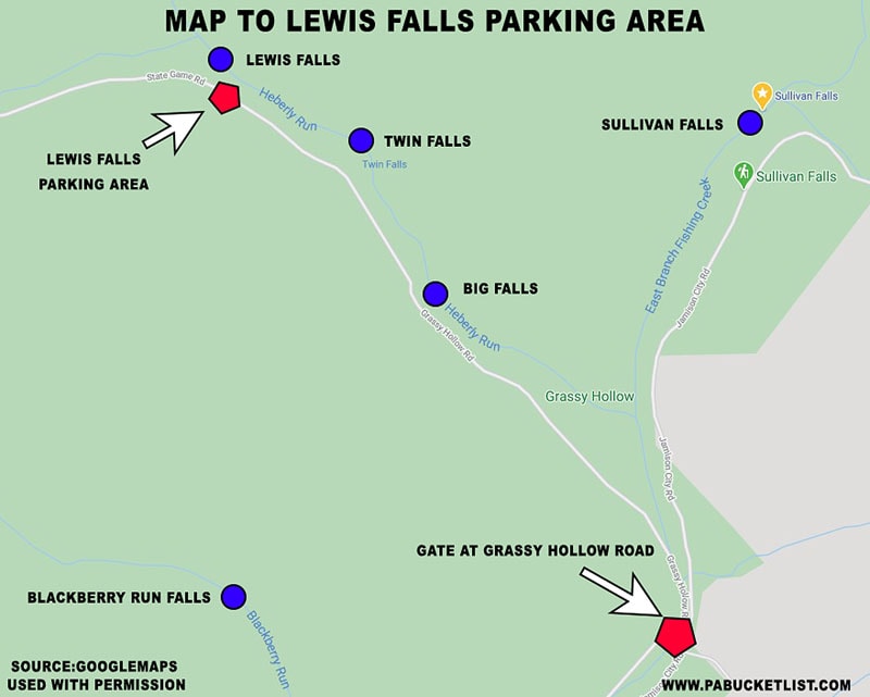
- Park at the Grassy Hollow Road parking area and hike 1.65 miles up Grassy Hollow Road to the Lewis Falls parking area.
For the purposes of this hike I’m assuming you are familiar with Big Falls, Twin Falls, and Lewis Falls, which are all located along Grassy Hollow Road as well. If you aren’t familiar with them, please read my write-up on that hike before proceeding, should you choose to add these waterfalls to your itinerary.
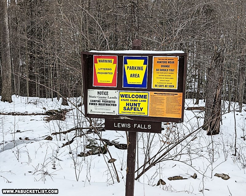
- From the back of the Lewis Falls parking area, follow the well-worn trail towards Heberly Run, to a spot just above Lewis Falls.
- Cross Heberly Run just above Lewis Falls, at whatever spot seems safest on the day you are visiting.
Note: this is a wet crossing – there is no bridge over Heberly Run. Water levels here can be anywhere from ankle deep in the summer to knee-deep after a hard rain or snow melt.
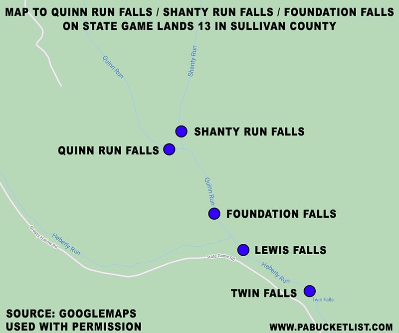
- Once across Heberly Run, proceed upstream along an old log road 0.2 miles until you see an old chimney and foundation on your left.
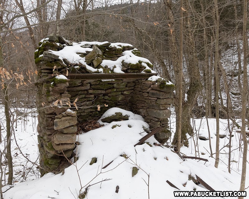
- Leave the log road and hike down to Quinn Run, past the chimney and foundation, to Foundation Falls.
GPS coordinates for Foundation Falls: 41.341030, -76.366136
- Returning to the old log road, continue hiking upstream 0.3 miles, to a point where the road/trail makes a hard right turn uphill. At this point, leave the road and descend downhill to Shanty Run Falls.
GPS coordinates for Shanty Run Falls: 41.344614, -76.368815
- From Shanty Run Falls, proceed downstream 50 yards to the merge point with Quinn Run and location of Quinn Run Falls.
GPS coordinates for Quinn Run Falls: 41.344324, -76.369008
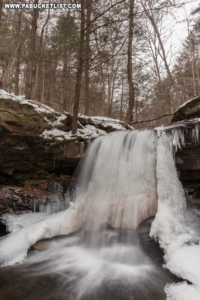
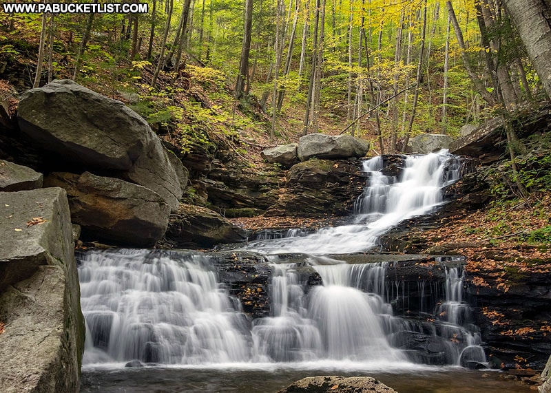
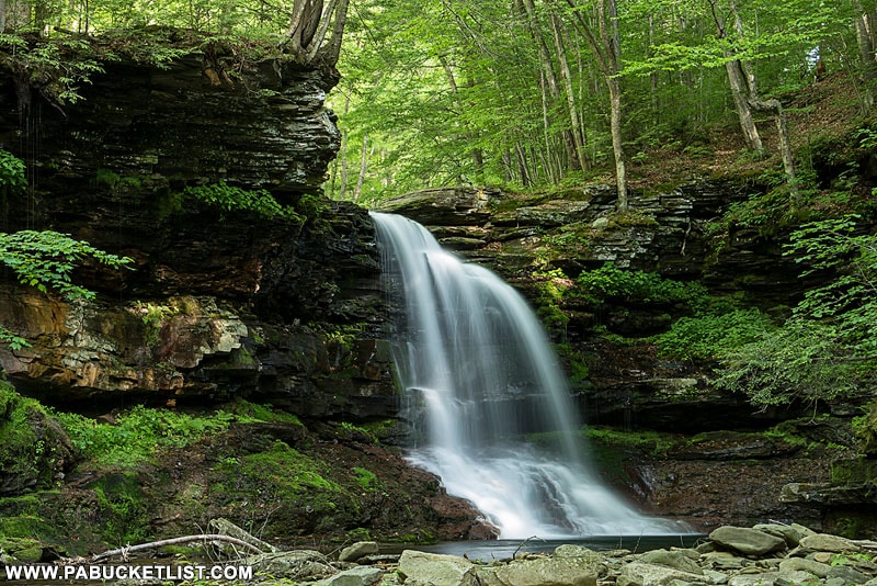
Exploring Foundation Falls
Almost immediately after crossing Heberly Run above Lewis Falls, you’ll encounter scores of photogenic cascades along Quinn Run.
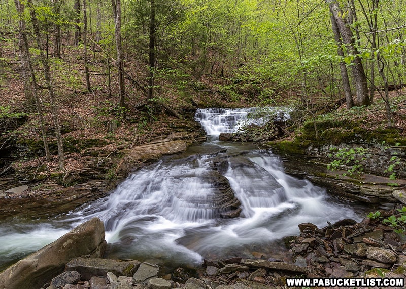
Once you arrive at Foundation Falls, you’ll have plenty of photographic options as well.
I typically start with the long view and work my way in closer.
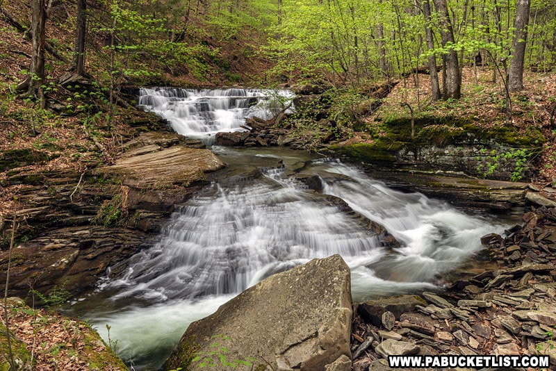
The two tiers of Foundation Falls shoot nicely with lower flow, where you can really pick out the nuances in the rocks .
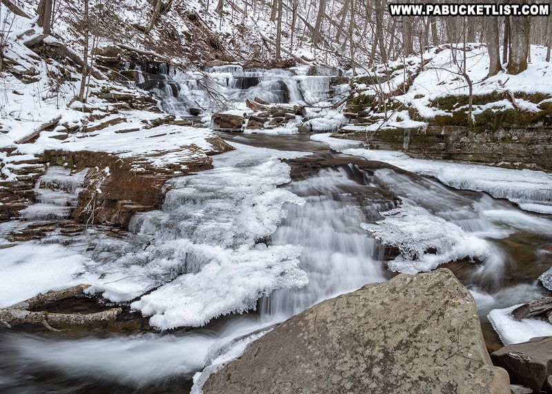
I also find it interesting to shoot from the same vantage point in different seasons.
Isolating the upper tier is a simple matter of crossing the creek between the two tiers, where the water is quite shallow.
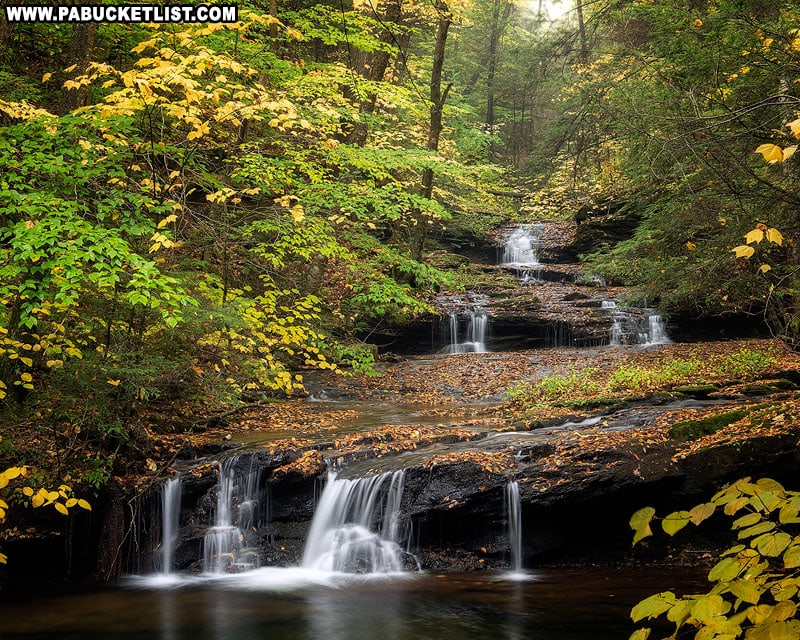
Just above Foundation Falls you’ll find more many cascades along Quinn Run.
Should you choose to hike straight up the stream instead of using the old log road that runs along the right side of Quinn Run, you’ll have a chance to shoot them as well.
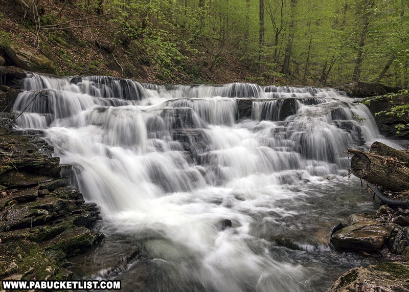
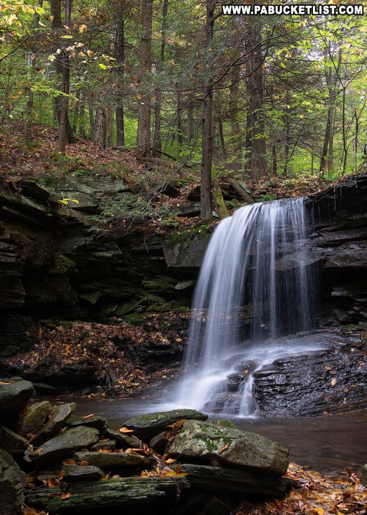
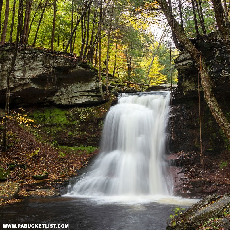
Exploring Shanty Run Falls
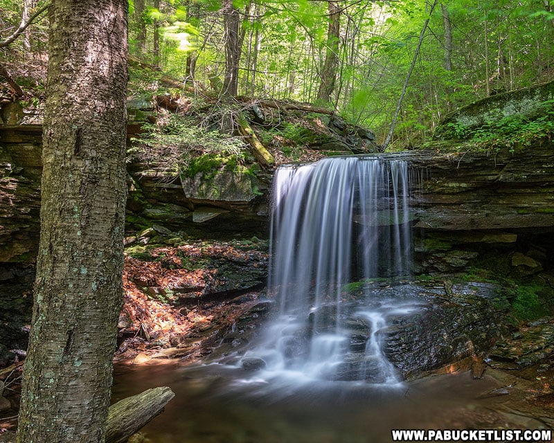
Assuming you are following the steps I laid out above, utilizing the old log road on the right side of Quinn Run, the next waterfall you’ll come to is Shanty Run Falls.
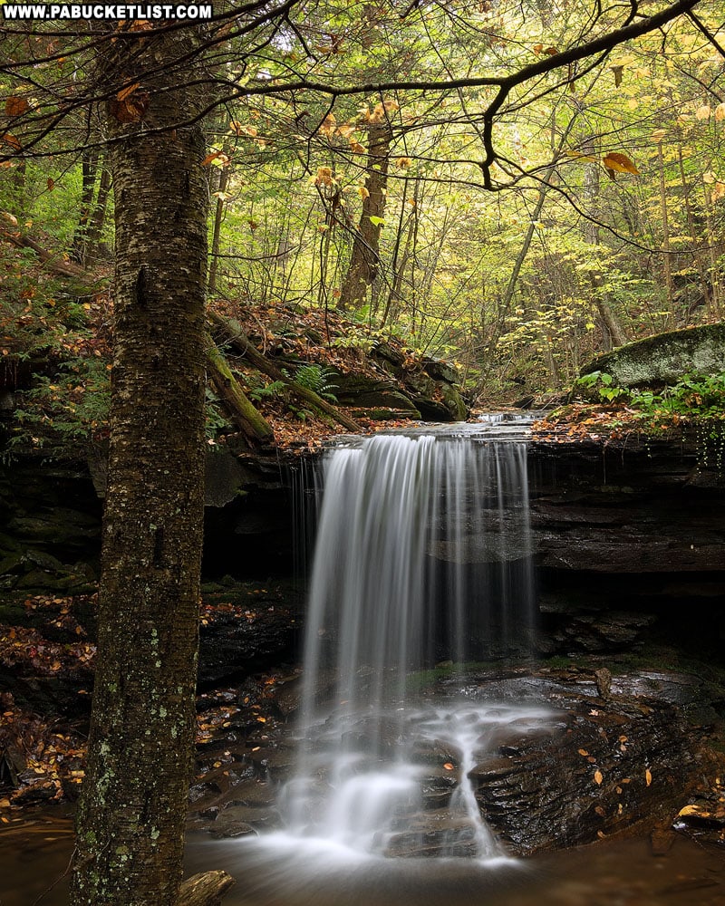
This graceful drop checks in at around 7 feet tall.
Almost a miniature version of Lewis Falls downstream.
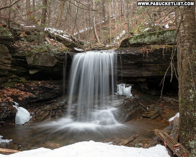
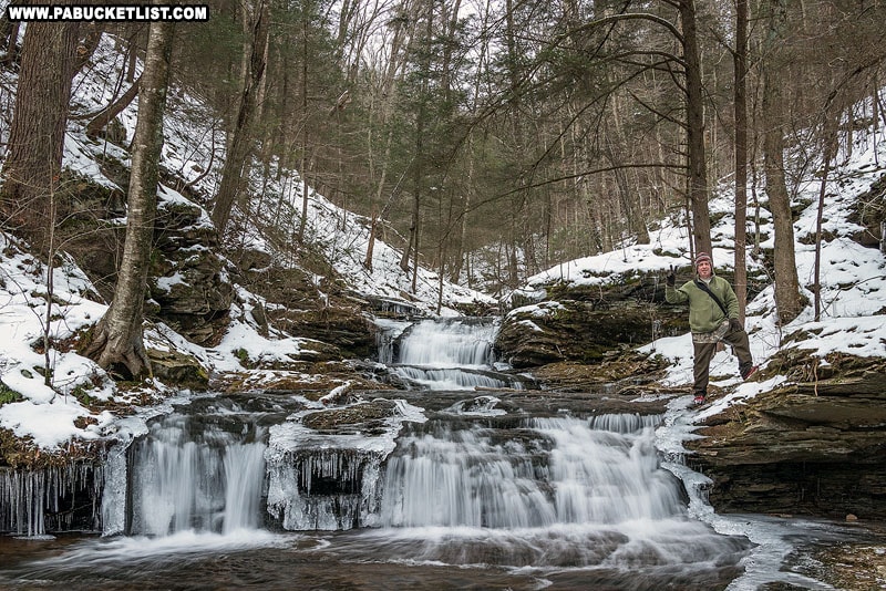
It’s a remarkable little alcove in the forest, and the ice hangs on here well after it has melted in other nearby spots.
Even with the typical low flow in the fall, the wispy veil of water arching down Shanty Run on an autumn morning makes for an outstanding photo-op.
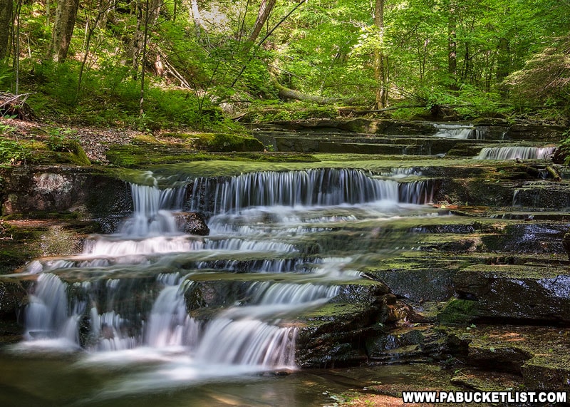
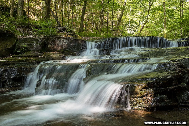
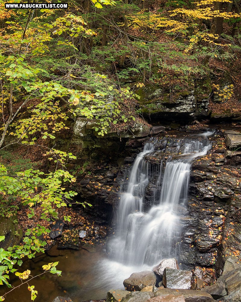
Exploring Quinn Run Falls
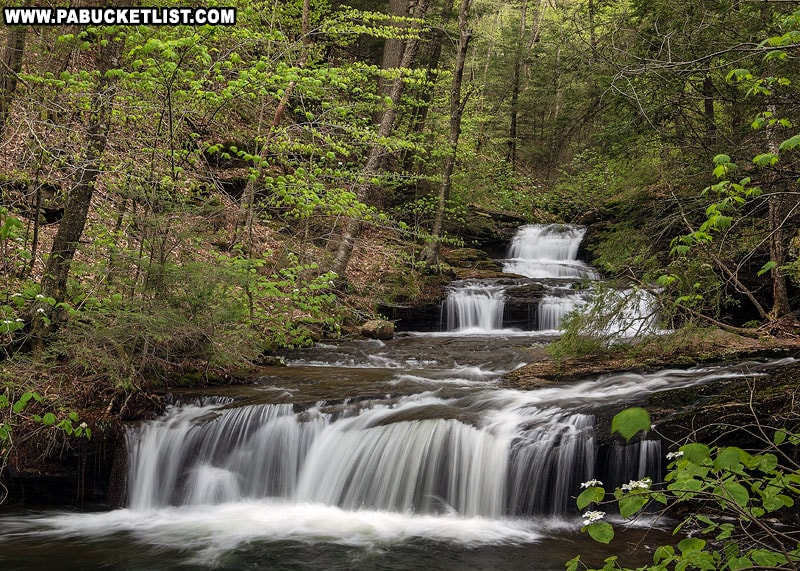
Quinn Run Falls is a series of 4-5 foot tall shelves, with a taller 7-8 foot shelf up top.
So depending on where you are standing and who’s counting, Quinn Run Falls collectively appears to be 15-18 feet tall.
With my friend Steve in this frame for scale, you can see the upper tiers are each a little better than waist-high on an adult.
The scene at Quinn Run always reminds me of a similar scene along Miners Run in Lycoming County.
Upstream from both Quinn Run Falls and Shanty Run Falls are many smaller cascades, which depending on how much daylight you have, you may wish to explore.
The return hike is a simple matter of retracing your steps back to the parking area at the bottom of Grassy Hollow Road.
Final Thoughts
While not nearly as tall as any of the waterfalls downstream on Heberly Run, the waterfalls above Lewis Falls offer a greater sense of remoteness and tranquility.
Quinn Run Falls, Shanty Run Falls, and Foundation Falls are all very photogenic and offer the intrepid hiker a rich reward for the uphill trek.
Still not convinced you need to explore Foundation Falls, Shanty Run Falls, and Quinn Run Falls?
Then check out this video!
Of course no trip to State Game Lands 13 is complete without a stop at nearby Sullivan Falls on the East Branch of Fishing Creek.
And just up the road from Sullivan Falls is a popular roadside waterfall – Big Run Falls.
There’s a reason why State Game Lands 13 is called the “waterfall wonderland” of Sullivan County.
And these are just a few of the reasons you’ll want to come back to visit again and again!