
If you’re looking for information about the Cliff Trail Overlooks in Pike County, you’re in the right place!
The Cliff Trail features 4 outstanding scenic overlooks of the Delaware River valley from its vantage point high atop Raymondskill Ridge in the Delaware Water Gap National Recreation Area.
If you’re looking for a relatively easy hike in the Poconos featuring plenty of scenic vistas, the Cliff Trail is the trail for you!
Directions to the Cliff Trail
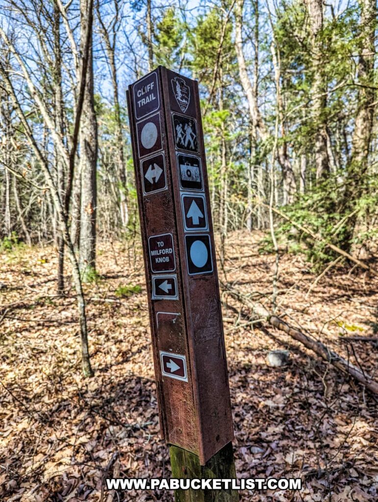
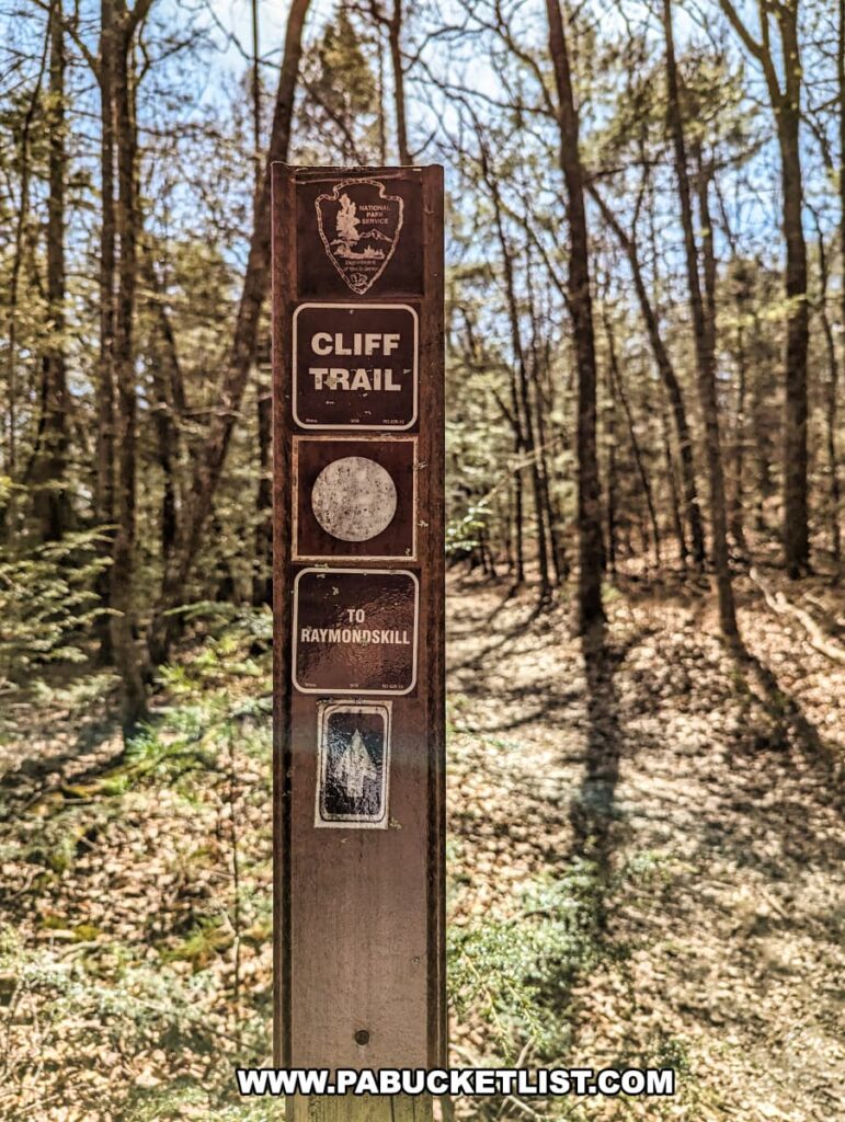
There are three trailheads you can choose from to jump on the Cliff Trail: Hackers Trailhead next to Raymondskill Falls at the southern end, Milford Knob Trailhead near the northern end, or the Cliff Park Trailhead near the center of the trail.
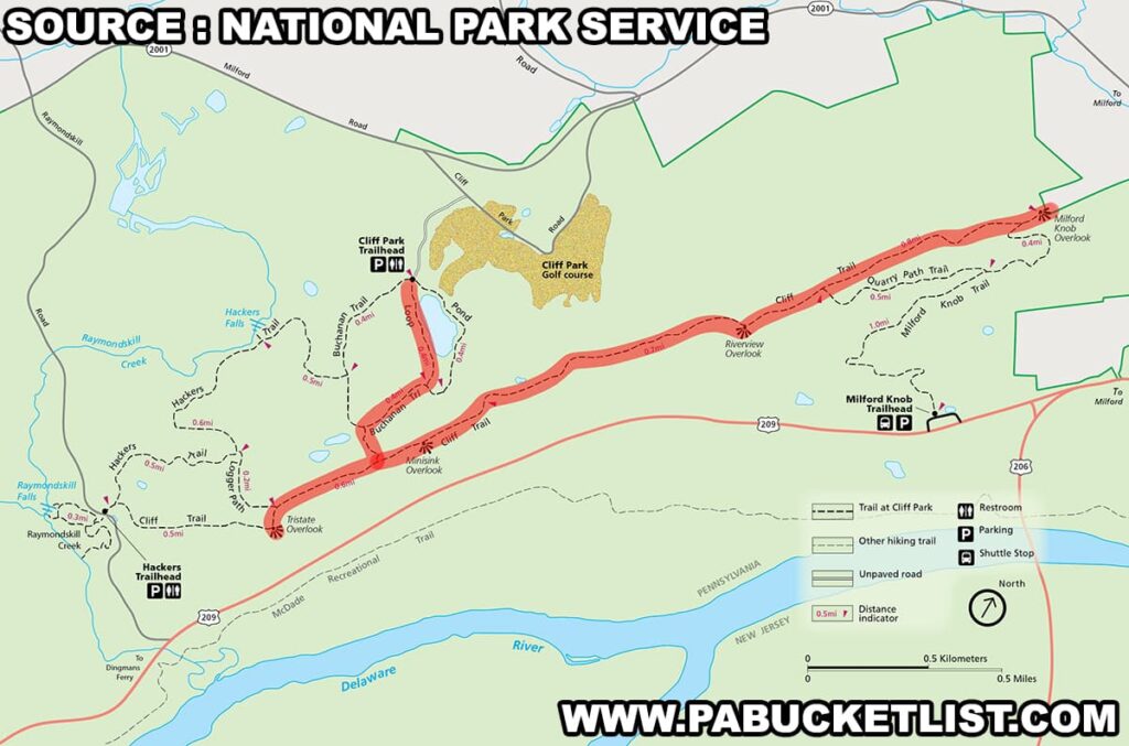
Since I had visited Raymondskill Falls earlier in the day, and I was visiting Milford the next day, I opted to jump on the trail from the Cliff Park Trailhead, and you’ll see my hike highlighted in red on the map above.
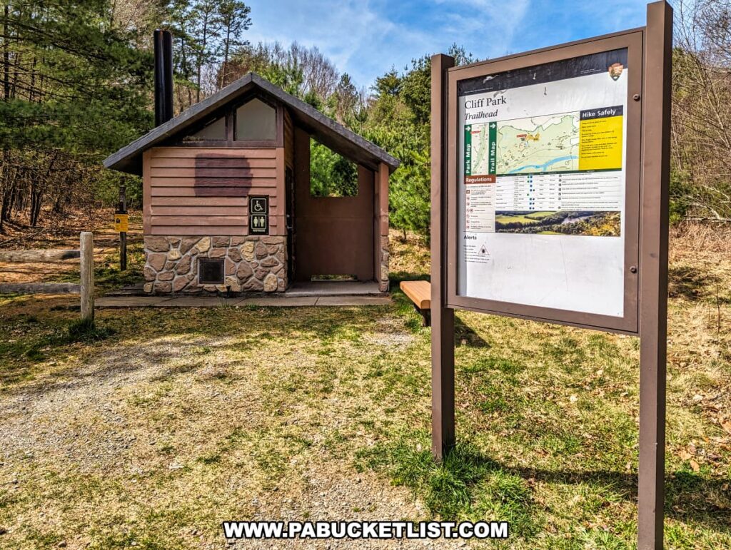
If you’re navigating by GPS coordinates, use 41.30378, -74.83283 to find the parking area at the Cliff Park Trailhead.

There are restrooms at the trailhead, as well as a kiosk featuring a map of the Cliff Trail and several shorter trails nearby.
I would recommend either taking a cell phone photo of the map at the kiosk (there are no paper copies available there), or screenshot my map above.
Hiking to the Overlooks
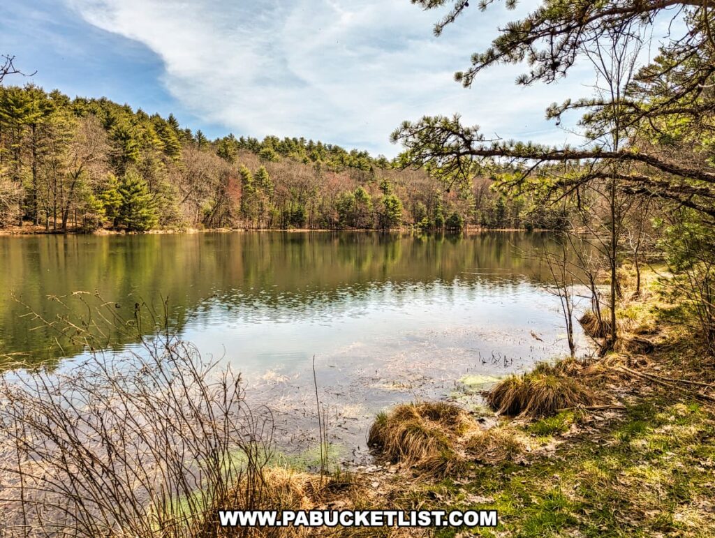
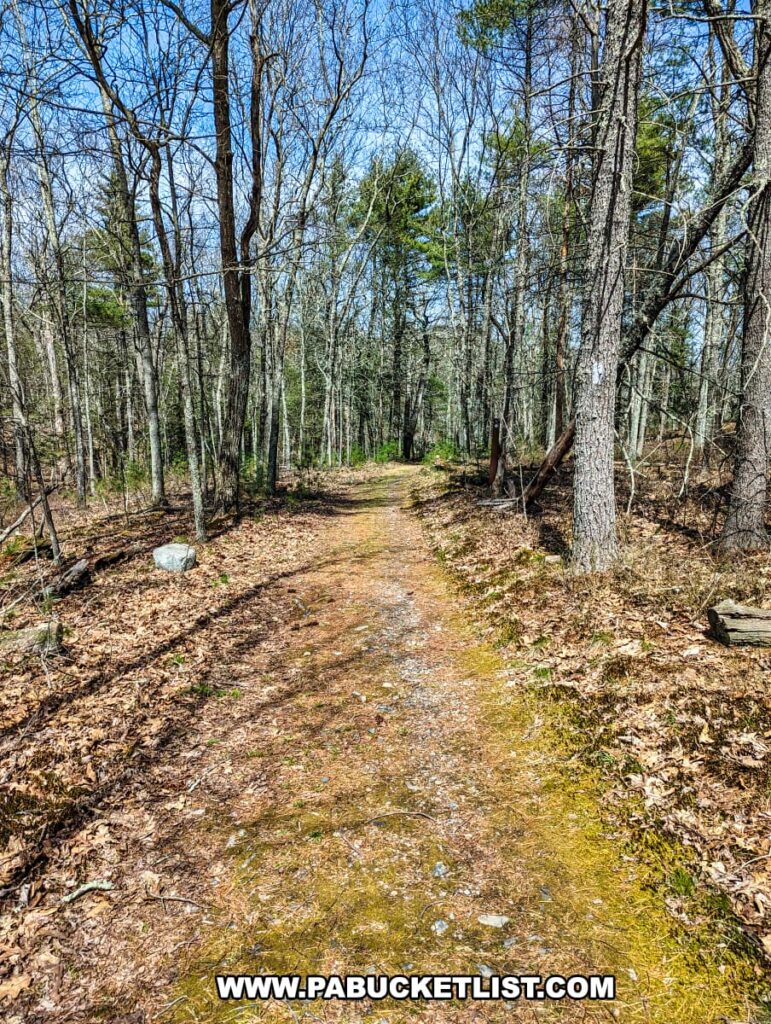
I started out by hiking southeast along the Buchanan Trail for a half-mile, past a picturesque pond near the parking area.
There is a slight uphill grade to this portion of the hike, until you come to a “T” intersection (GPS coordinates 41.29728, -74.82980) where the Buchanan Trail runs into the Cliff Trail (see the map above).
At this point you can either hike south along the white-blazed Cliff Trail to the southernmost overlook (the Tristate Overlook), or head north and visit the other three overlooks first, backtracking to the Tristate Overlook last.
I opted to visit the Tristate Overlook first (a 0.3 mile hike from the T intersection), then hiked north to visit the other three overlooks.

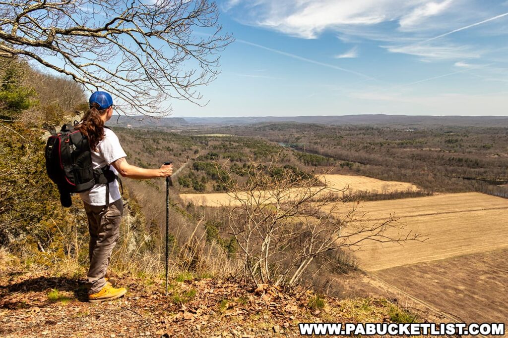
The Tristate Overlook
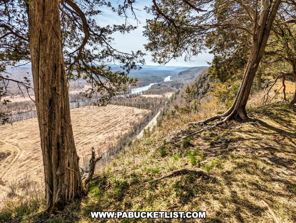
The Tristate Overlook (GPS coordinates 41.29287, -74.83248) is so named because across the Delaware River you are looking into New Jersey, to the north you are looking into New York, and immediately around and below you is Pennsylvania.
Use caution at all four overlooks, as you are standing several hundred feet above the valley floor below.
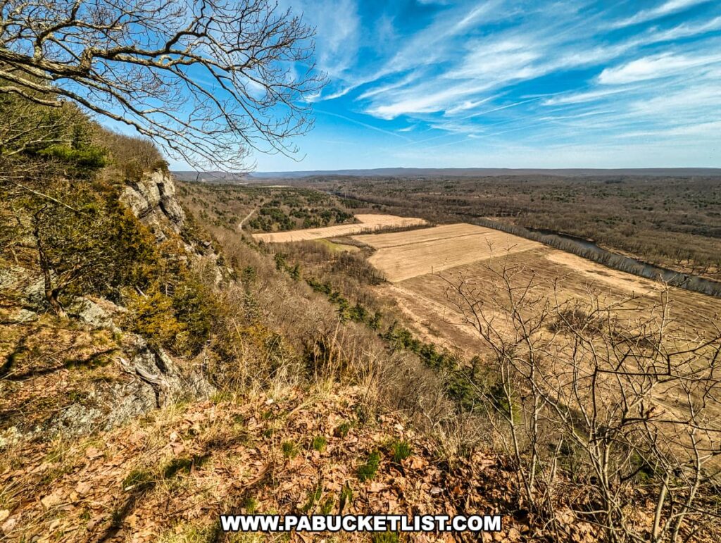
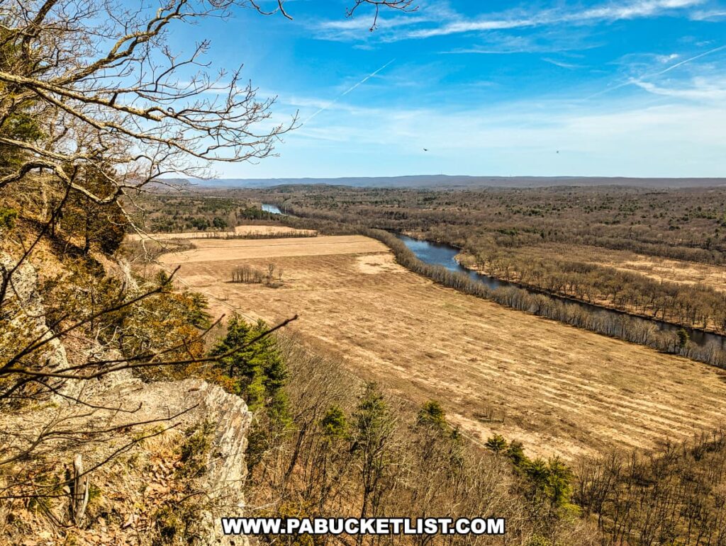
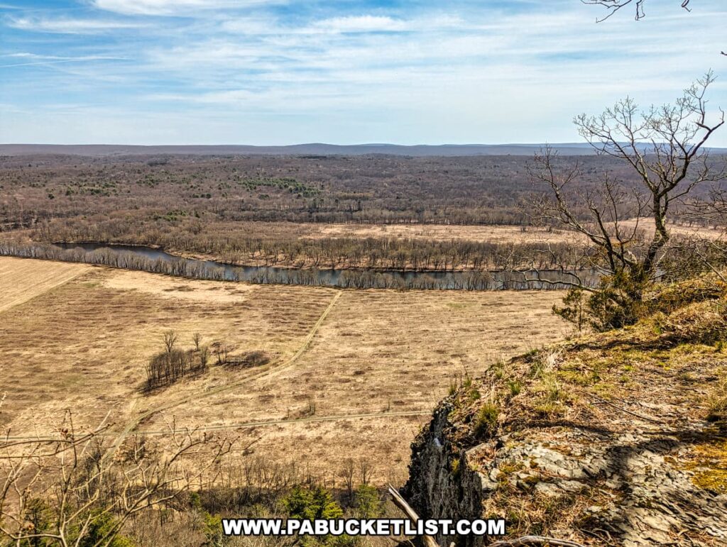
Minisink Overlook
From the Tristate Overlook I hiked north along the Cliff Trail for 0.6 miles to the Minisink Overlook (GPS coordinates 41.29820, -74.82882).
The overlook is named for Minisink Island in the center of the Delaware River below.
The word “minisink”, in turn, is derived from a Native American term meaning “at the island.”
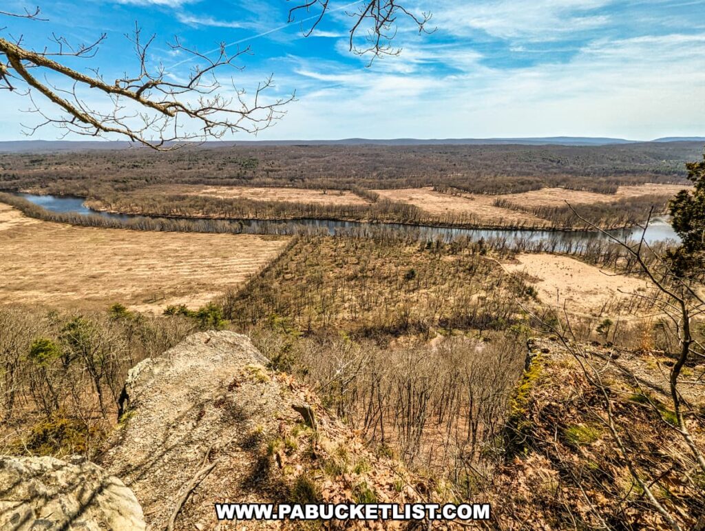
Riverview Overlook
From Minisink Overlook, I hiked north another 0.7 miles to Riverview Overlook (GPS coordinates 41.30847, -74.81763).

The name here is in reference to the views of the Delaware River below.
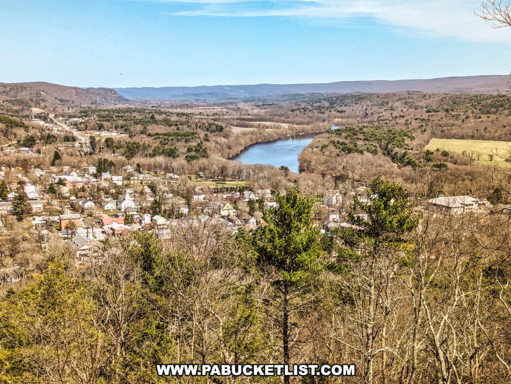
Milford Knob Overlook
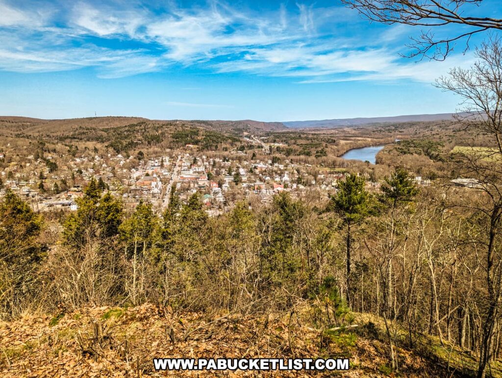
From Riverview Overlook, I hiked north another 0.8 miles to Milford Knob Overlook (GPS coordinates 41.31733, -74.80716).
From here you have an excellent view into downtown Milford, the Pike county seat.
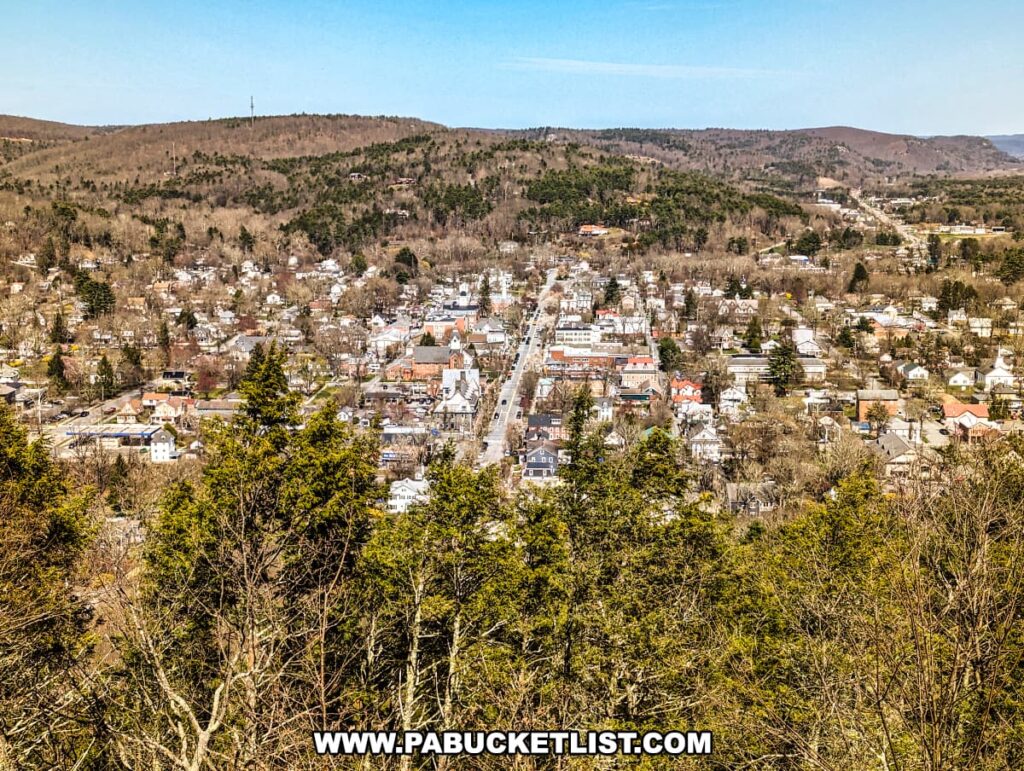
To the east of downtown you can catch a glimpse of the Delaware River.
From the Milford Knob Overlook, I simply backtracked south along the Cliff Trail for 1.6 miles until I reached the intersection with the Buchanan Trail.
I then turned right/west and hiked the final 0.5 miles back to the parking area at the trailhead, once again passing the pond.

The total distance I covered on this hike was approximately 5.2 miles, with most of that being flat to slightly undulating terrain.

It’s a great beginner to intermediate level hike, the views are outstanding, and the trails are wide and obvious.

So if you’re planning a trip to the Delaware Water Gap National Recreation Area, I highly recommend this hike to the Cliff Trail Overlooks in Pike County!

Nearby Attractions
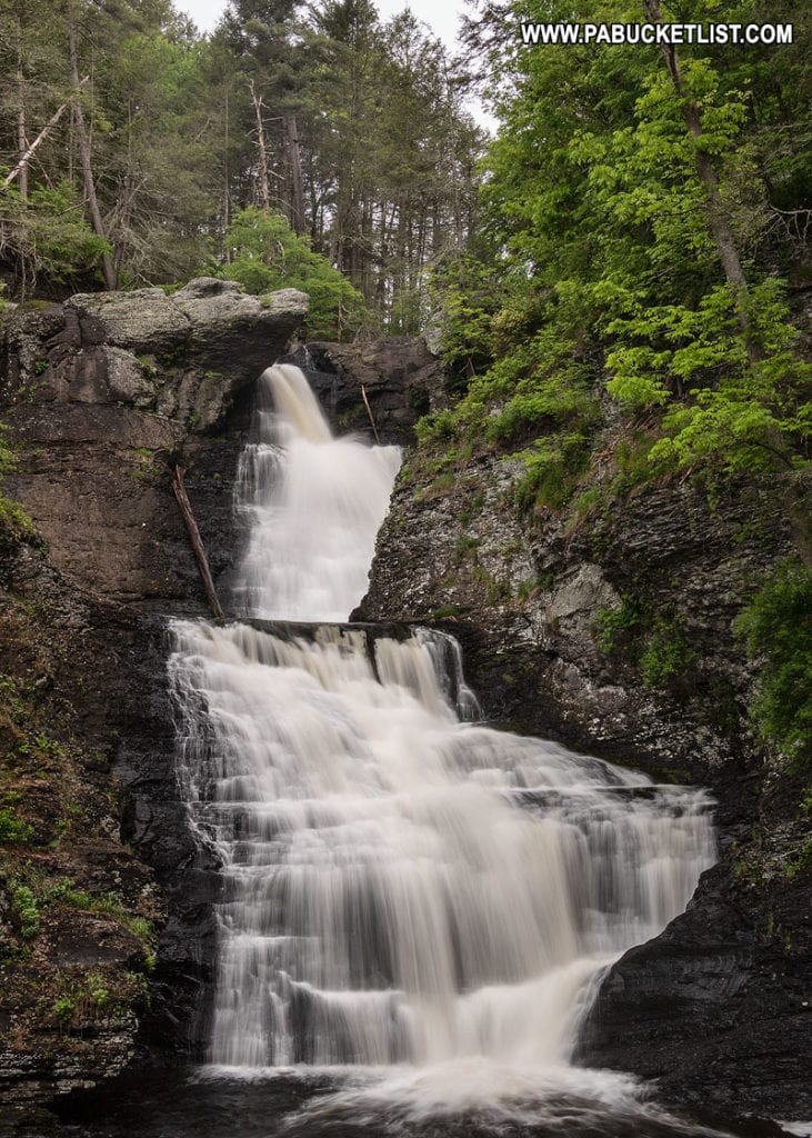
Raymondskill Falls is located at the southern end of the Cliff Trail, and at 178 feet tall, is said to be the tallest waterfall in Pennsylvania.
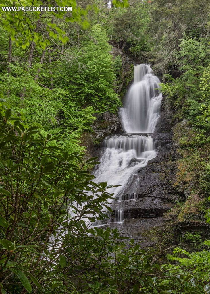
Dingmans Falls in Pike County checks in at 130 feet tall, good enough for the title of “second tallest waterfall in Pennsylvania.”
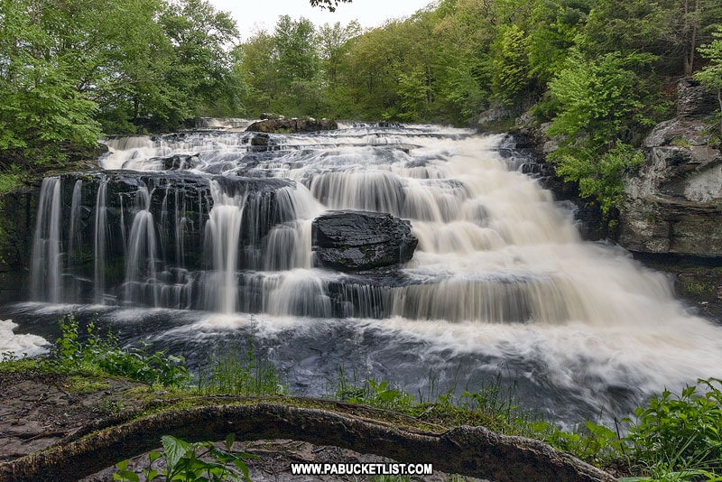
While not nearly as tall, Shohola Falls, also located in Pike County, makes for a scenic pitstop.
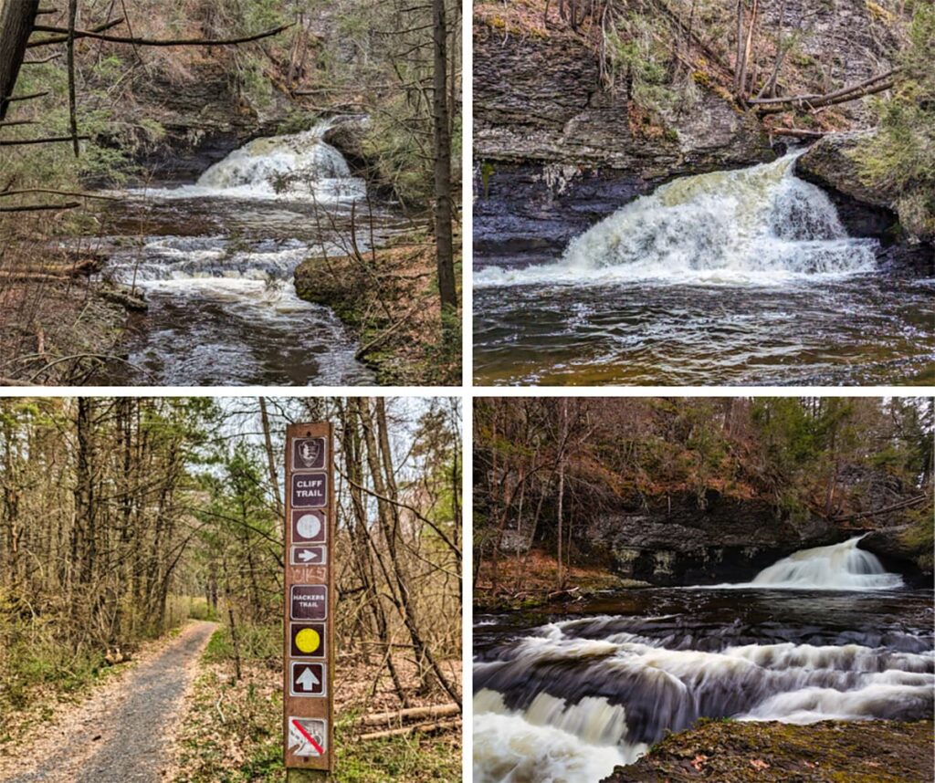
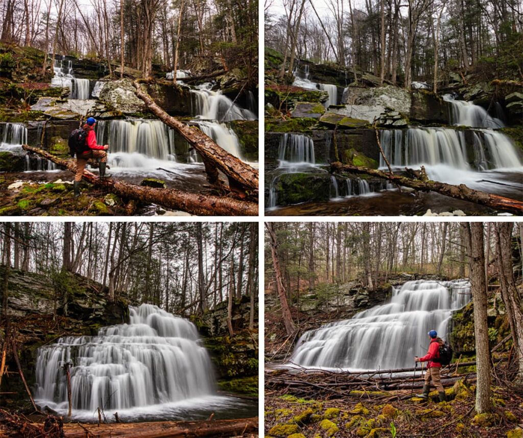
Hackers Falls is a 20 foot-tall, fan shaped waterfall located in the Delaware Water Gap National Recreation Area in Pike County.
Sawkill and Savantine Falls are a pair of picturesque but seldom-seen waterfalls in the Delaware State Forest.
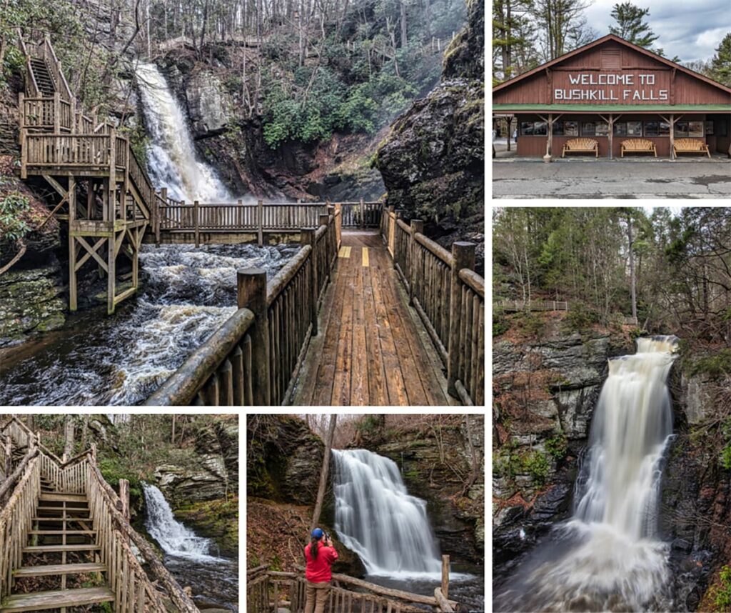
Bushkill Falls, often dubbed the “Niagara of Pennsylvania,” is a privately-owned Poconos nature park that features eight stunning waterfalls, accessible through a network of scenic trails and beautiful boardwalks that cater to all levels of hikers.
Housed in a stunning 1904 neo-classical mansion in Milford, the The Columns Museum features two floors brimming with artifacts and memorabilia that chronicle the rich tapestry of Pike County’s past.

Find even more great spots to explore in Pike County and all across Pennsylvania with the interactive PA Bucket List Travel Map!
Did you enjoy this article?
If so, be sure to like and follow PA Bucket List on Facebook, Instagram, and/or Pinterest to learn more about the best things to see and do in Pennsylvania!
Click on any of the icons below to get connected to PA Bucket List on social media.