Hiking the Flat Rock Trail at Colonel Denning State Park

The author at Flat Rock Vista.

If you’re looking for information about hiking the Flat Rock Trail at Colonel Denning State Park, you’re in the right place!

Rugged stones show what much of the Flat Rock Trail looks like.
Rugged stones show what much of the trail looks like.

The Flat Rock Trail is a challenging 5 mile out-and-back trek that rewards hikers with breathtaking views from Flat Rock, a natural vista overlooking the Cumberland Valley.

A hazy spring day at Flat Rock Vista.

How to Find the Flat Rock Trail

The trailhead for this hike is located at Colonel Denning State Park, a 273 acre gem surrounded entirely by the 96,000 acre Tuscarora State Forest.


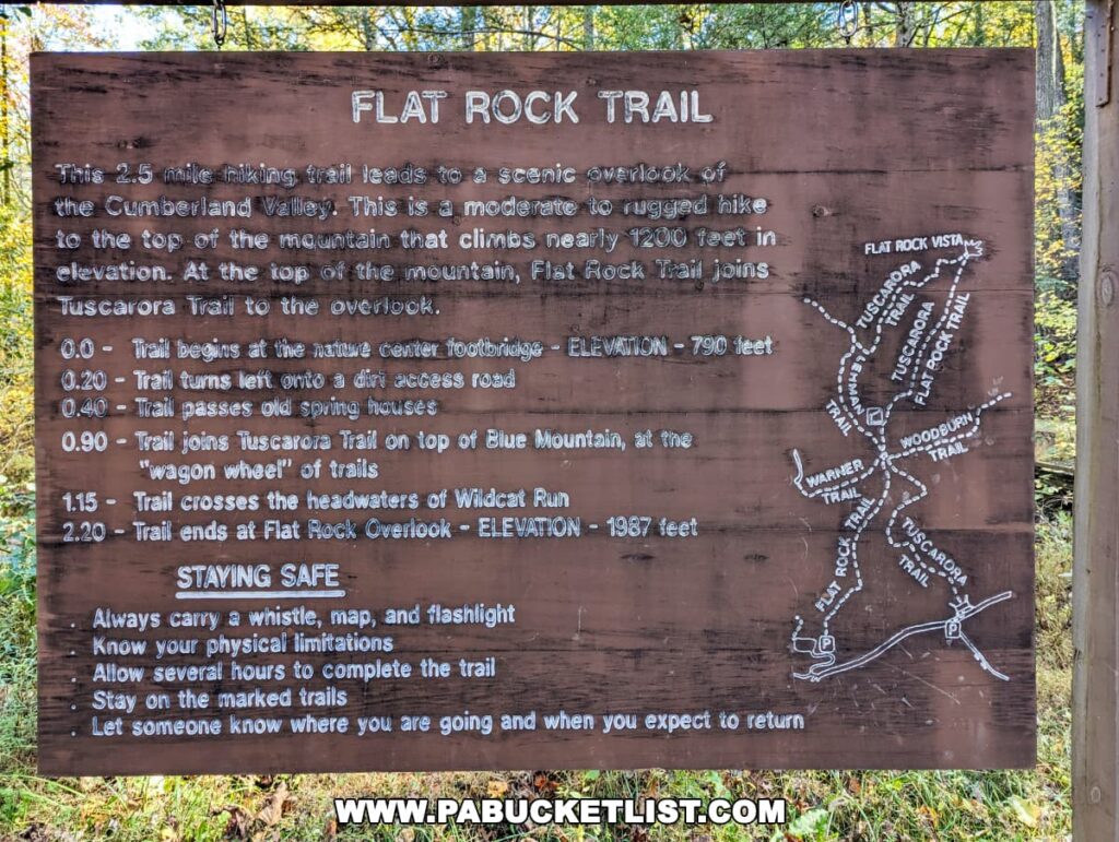
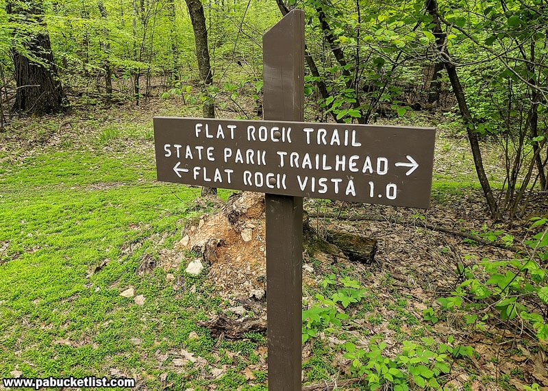
A large paved parking area and the sign pictured below are located next to the trailhead, behind and downhill from the park office.

Information sign for the Flat Rock Trail at Colonel Denning State Park in Cumberland County, PA. The brown wooden sign provides details about the 2.5-mile hike to a scenic overlook, trail markers, elevation, and safety tips such as carrying a whistle, map, and flashlight, staying on marked trails, and informing others about your hike plans. It includes a white map outline of the trail network.
Sign at the trailhead.

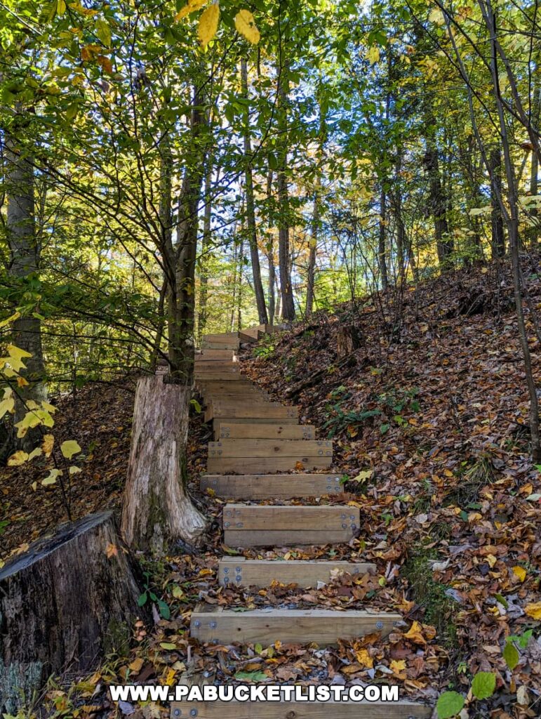
A set of wooden stairs ascends from the parking area – that’s where the hike begins.

A rustic wooden staircase winds its way up a lush green hillside in Colonel Denning State Park, Pennsylvania. Sunlight filters through the trees, casting dappled light on the path and creating a sense of tranquility.
Beginning of the trail, next to the parking area.

Hiking the Flat Rock Trail

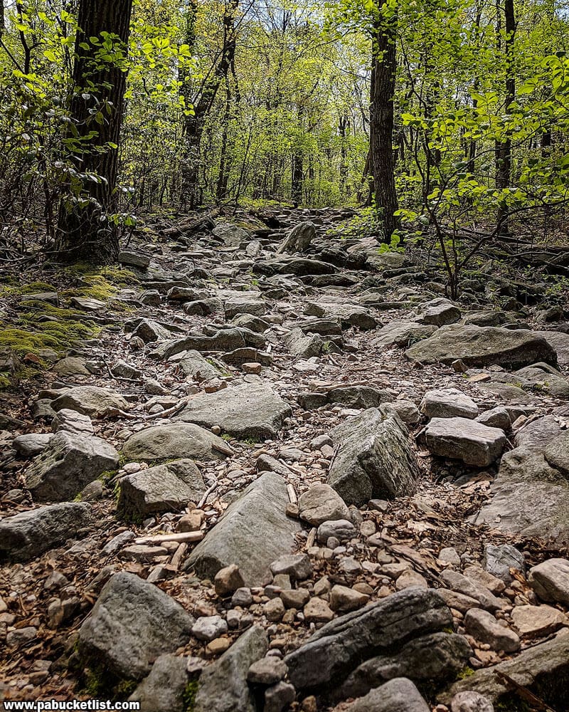
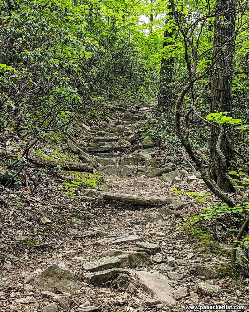
You’ll quickly realize there is nothing flat about this hike!

Stone steps along the Flat Rock Trail.

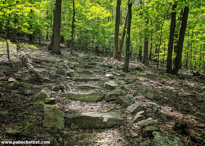
It is, however, an extremely well-blazed (yellow), well-maintained trail.

Intersection of the Flat Rock Trail and Rattlesnake Trail Loop.
Trail intersection.

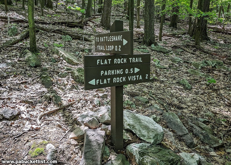
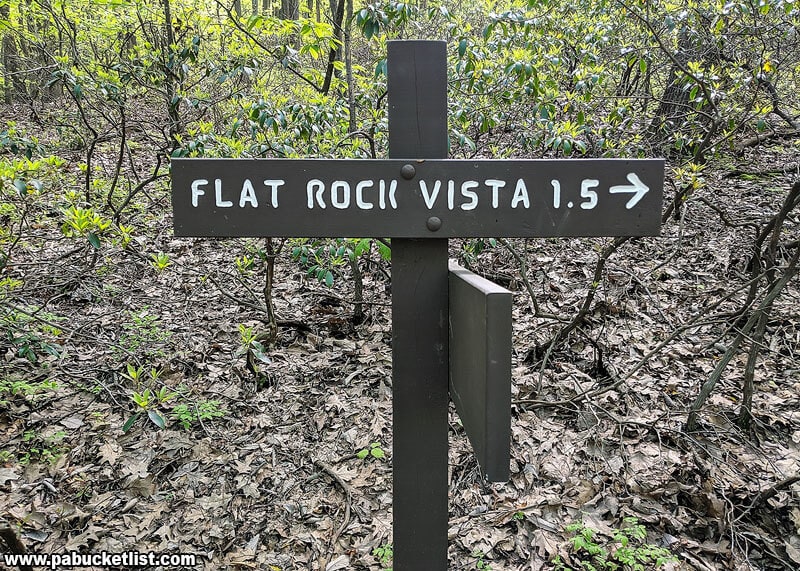
Every half mile another sign lets you know you’re on the right track.

Sign along the Flat Rock Trail indicating 1.5 miles to the vista.

This is definitely a hike where I’d recommend a good trekking pole to maintain your balance.

Another example of the rugged, rocky nature of the Flat Rock Trail.

Approximately 1.5 miles into the hike, the Flat Rock Trail finally levels off for a bit as you cross over the Tuscarora Trail.

Sign indicating 1 mile to the Flat Rock Vista.

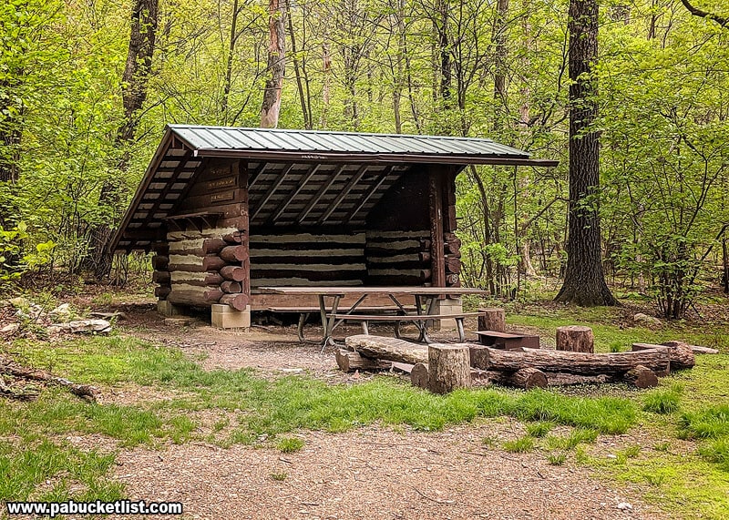
You’ll pass this trail shelter 1/10th of a mile AFTER crossing over the Tuscarora Trail.

Trail shelter near the top of Blue Mountain, along the Flat Rock Trail.
Trail shelter near the top of Blue Mountain.

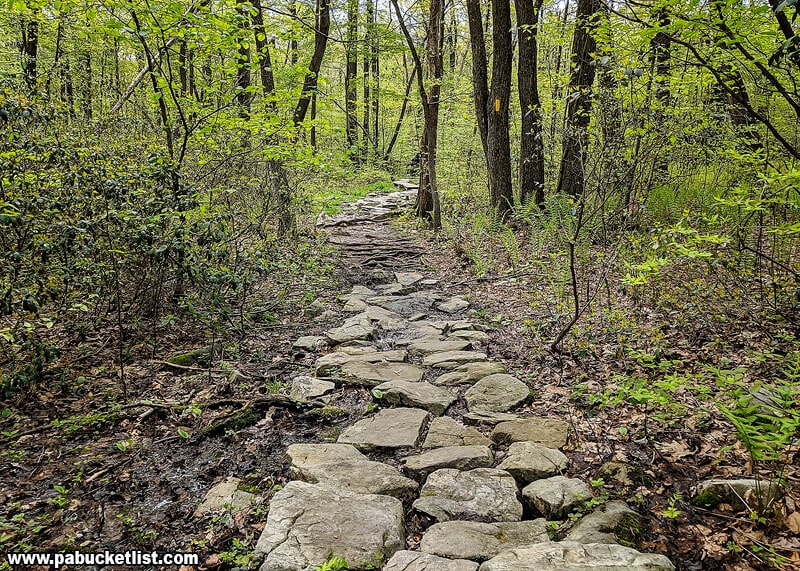
Remaining on this semi-flat portion of the mountain for another few 10ths of a mile, you’ll encounter this stone portion of the trail.

Arranged stones along one of the flatter portions of the Flat Rock Trail.

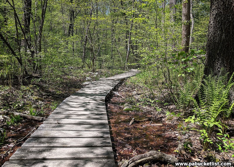
That will be followed by a windy boardwalk though a swampy area.

A boardwalk through a swampy area near the top of Blue Mountain.

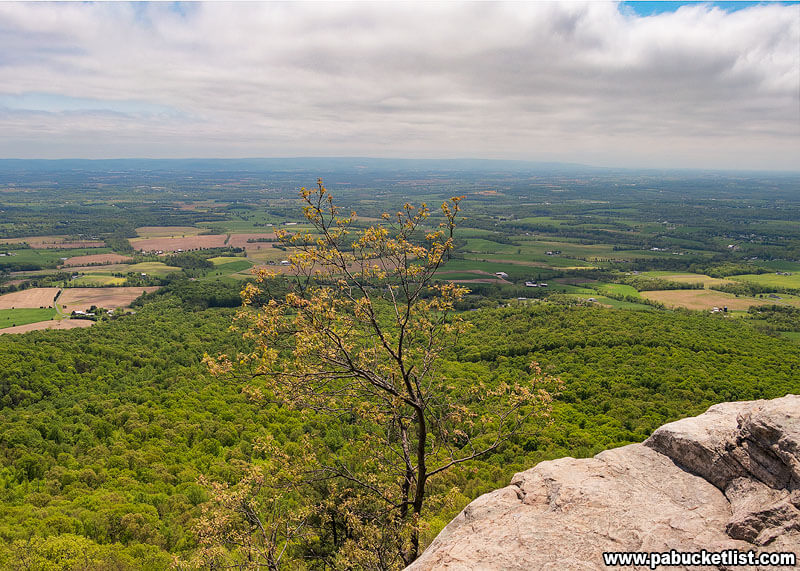
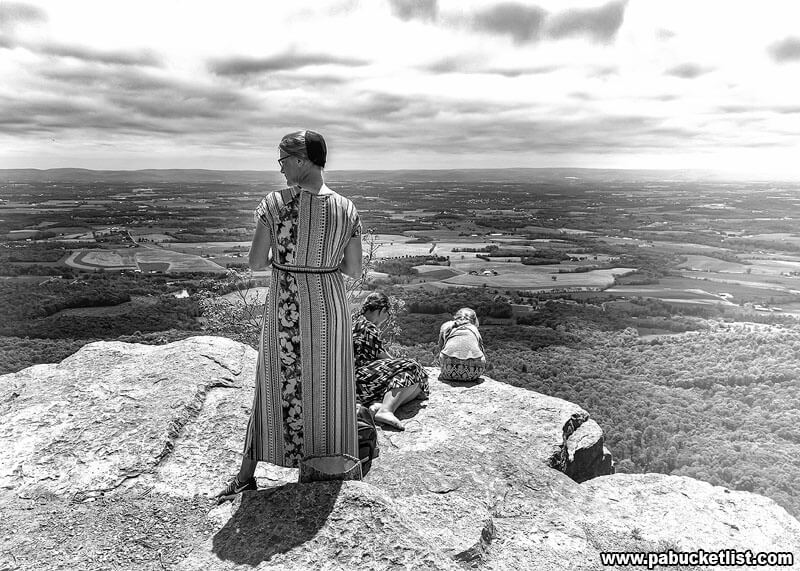
Emerging from the swampy area and following another ascent, you’ll arrive at the end of the trail and be standing at the incredible Flat Rock Vista.
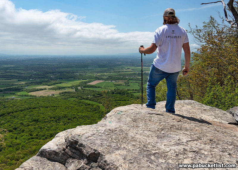
Looking out over the Cumberland Valley from Flat Rock Vista.

Taking in the Vista

On this particular day a Mennonite family was just finishing up a picnic lunch as I arrived on the scene.

A Mennonite family enjoying the view from Flat Rock Vista.

We exchanged pleasantries as they were packing up, and then I had the vista to myself.

A buzzard flying high over the Cumberland Valley, with a farm in the distance.

The panoramic view was outstanding, but what really added to the excitement was a large flock of buzzards swooping up and down the valley, right past and over the vista.

A buzzard swooping down the Cumberland Valley, viewed from Flat Rock Vista.

Birders will absolutely love Flat Rock Vista.

Watching buzzards from the Flat Rock Vista.

Still not convinced you need to hike the Flat Rock Trail?

Then check out this panoramic video I shot at Flat Rock Vista, including buzzards zipping past!


Nearby Attractions

Exploring Colonel Denning State Park in Cumberland County is your guide to even more great things to see and do near the Flat Rock Trail.

A serene viewpoint at Colonel Denning State Park in Cumberland County, PA, featuring a wooden fishing pier overlooking a calm lake reflecting the vibrant autumn colors of the surrounding foliage, with a backdrop of a clear blue sky and fluffy white clouds.
Fishing pier at Colonel Denning State Park.

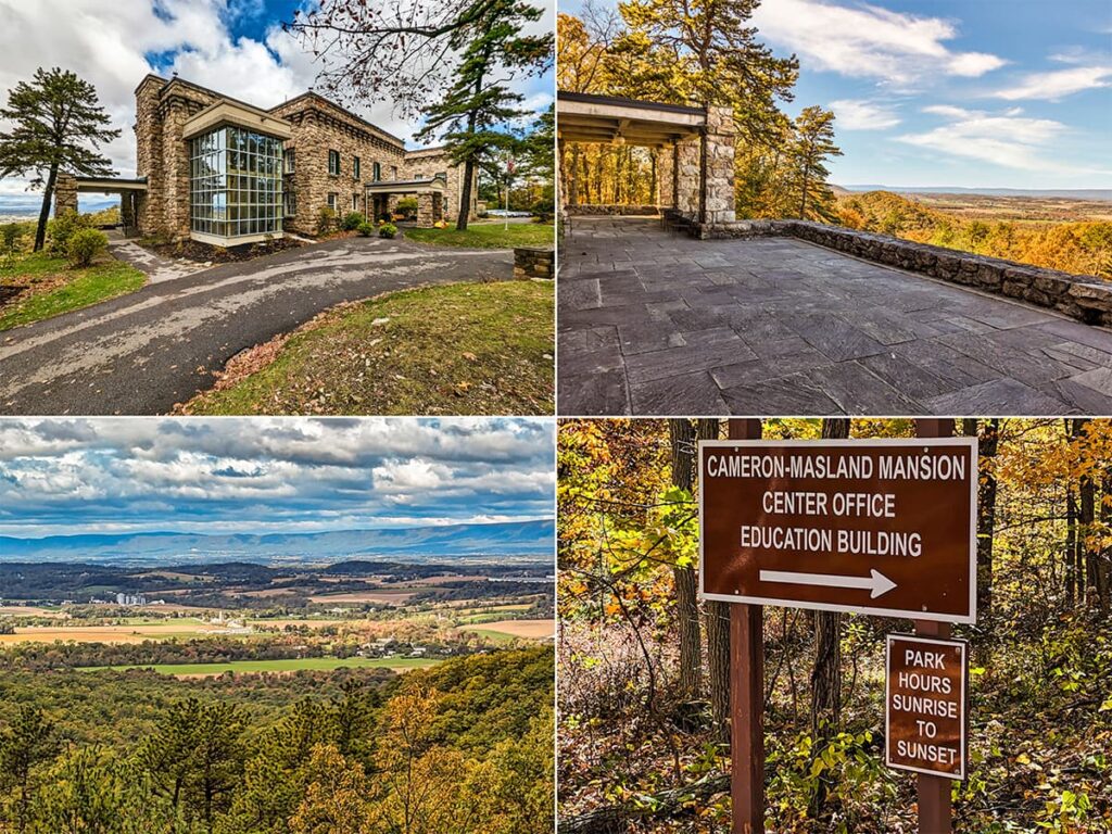
The Cameron-Masland Mansion at Kings Gap Environmental Education Center is a historic stone villa perched on a Cumberland County mountaintop, offering a scenic overlook that captures the essence of Pennsylvania’s picturesque outdoors.

A collage of photos from the Cameron-Masland Mansion Scenic Overlook at Kings Gap Environmental Center in Cumberland County PA
Scenes from the Cameron-Masland Mansion.

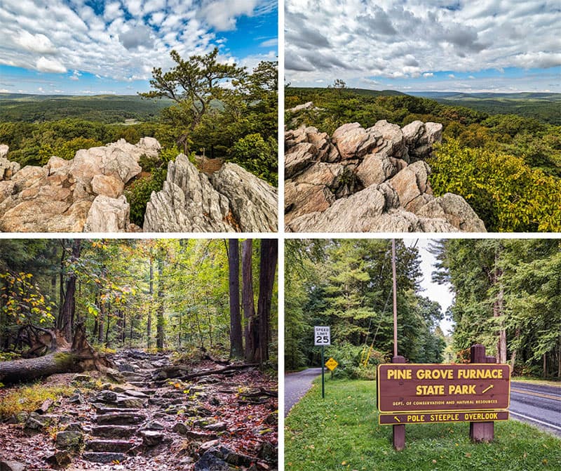
Pole Steeple Overlook is located in the Cumberland County portion of the Michaux State Forest, adjacent to Pine Grove Furnace State Park.

Exploring Pole Steeple Overlook in Cumberland County Pennsylvania.
Scenes from Pole Steeple Overlook.

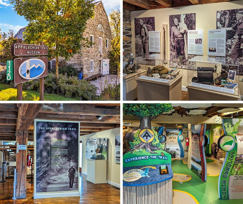
The Appalachian Trail Museum at Pine Grove Furnace State Park in Cumberland County preserves the rich history, culture, and stories of the famed Appalachian Trail (AT).

Exploring the Appalachian Trail Museum at Pine Grove Furnace State Park in Cumberland County Pennsylvania.
Scenes from the Appalachian Trail Museum.

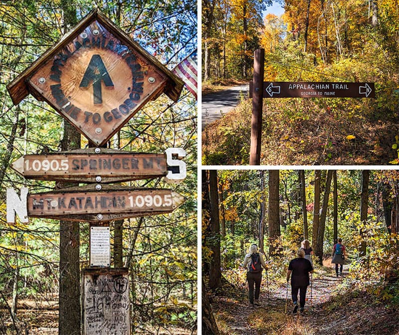
The Halfway Point of the Appalachian Trail is located in Pennsylvania’s Michaux State Forest in Cumberland County, just a short distance from Pine Grove Furnace State Park and the Appalachian Trail Museum.

Hiking to the Halfway Point of the Appalachin Trail in the Michaux State Forest in Cumberland County Pennsylvania.
Scenes from the hike to the Halfway Point along the Appalachian Trail.

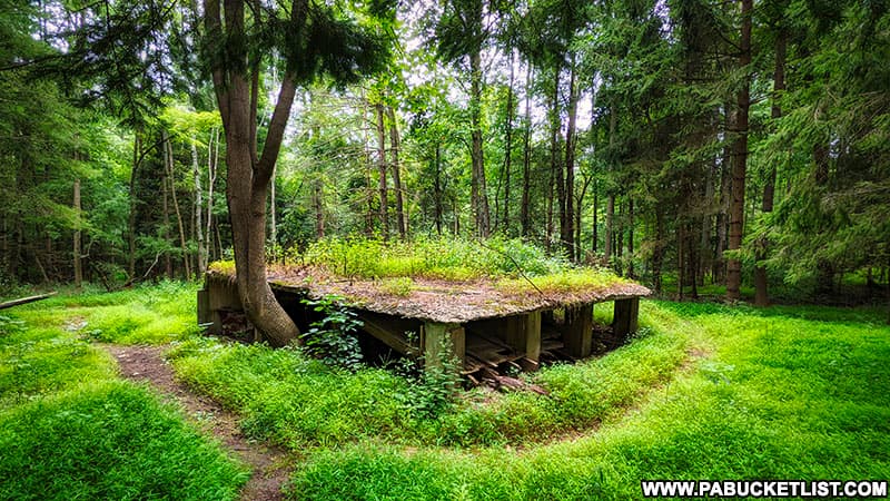
Exploring an Abandoned POW Camp in Cumberland County is your guide to a formerly-secret POW camp, used to house German and Japanese POWs during World War Two.

Ruins of the secret POW interrogation camp in the MIchaux State Forest.
Ruins of the secret POW interrogation camp in the Michaux State Forest.

Did you enjoy this article?

If so, be sure to like and follow PA Bucket List on Facebook, Instagram, and/or Pinterest to learn more about the best things to see and do in Pennsylvania!

Click on any of the icons below to get connected to PA Bucket List on social media.


PA Bucket List 2022 Sasquatch Logo

Pennsylvania’s Best Travel Blog!

Rusty Glessner
Rusty Glessner is a professional photographer, lifelong Pennsylvanian, and a frequently-cited authority on PA's best travel destinations.