
If you’re looking for detailed directions to the Throne Room along the Standing Stone Trail, you’re in the right place!
The Throne Room is a panoramic overlook often referred to as one of the finest vistas in all of Pennsylvania, and deservedly so.
Located along the Huntingdon County portion of the 85 mile-long Standing Stone Trail, what I’m going to describe here is a one-mile southbound hike to the Throne Room, the shortest possible route to the overlook.
From maps to GPS coordinates to photos of important landmarks along the hike, I’m going to provide you with all the information you need to find and enjoy to the magnificent views from the Throne Room, with as little difficulty as possible!
Where to Park When Hiking to the Throne Room
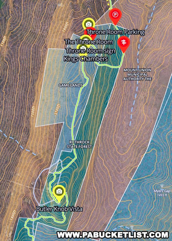
This hike starts at a parking pull-off in the Rothrock State Forest.
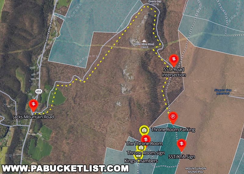
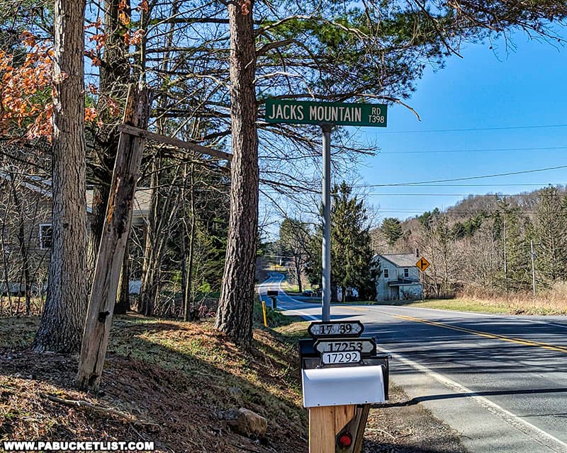
To reach the parking area, turn off of Route 655 roughly 6 miles south of Mapleton, and proceed 3.2 miles along Jacks Mountain Road.
The first half-mile of Jacks Mountain Road is paved; the remainder of the road is a “No Winter Maintenance” dirt road.
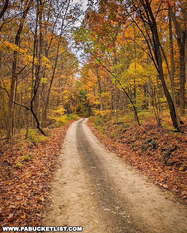
A high clearance vehicle like a truck or SUV is your best bet on any road like this, due to potholes and ruts that might cause you to bottom-out in a standard passenger car.
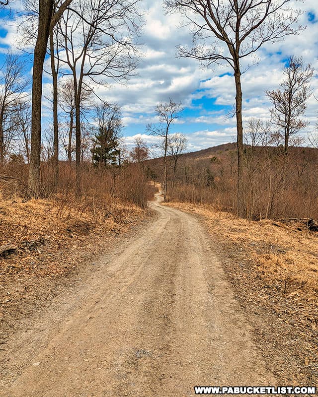
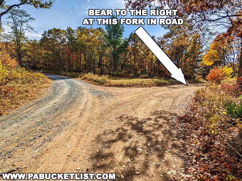
Rougly 2.6 miles into your drive up Jack Mountain Road you’ll come to the fork in the road pictured below- stay to the RIGHT.
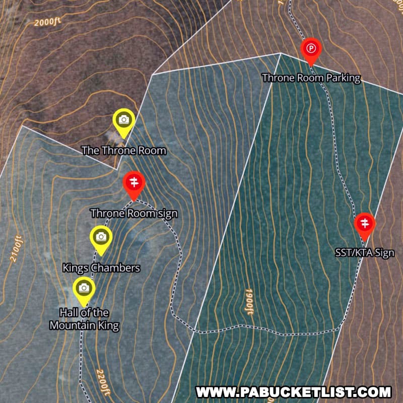
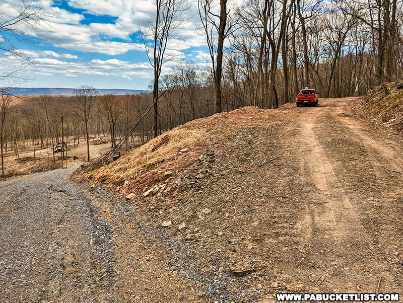
Follow that dirt road (which also doubles as the Standing Stone Trail on this stretch of the trail) another 0.6 miles to the fork in the road pictured below, and park in the pull-off along the upper road (don’t block the road) at GPS coordinates 40.31765, -77.95558.
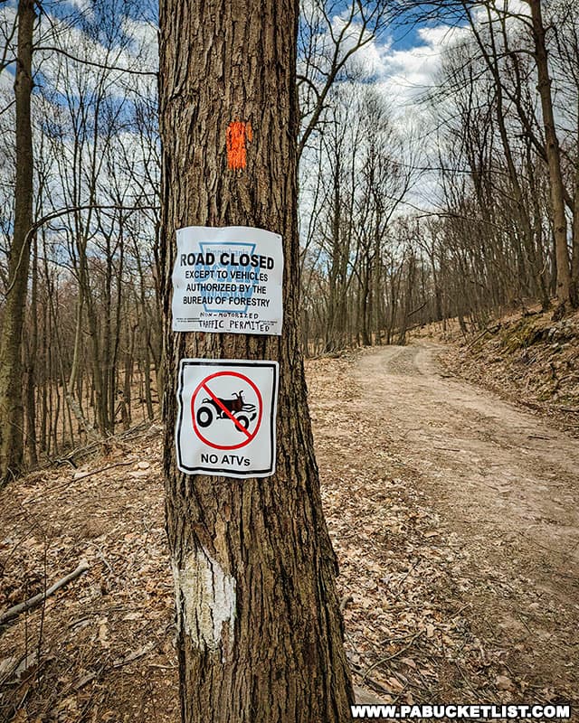
As of April 2023, you’ll see these signs pictured below near the parking area, indicating you should drive no further down the otherwise ungated road.
Hiking to the Throne Room
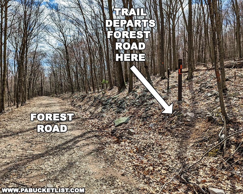
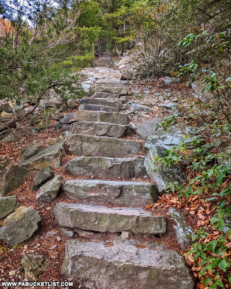
From this parking area along the dirt road/Standing Stone Trail, hike south (straight forward) for 0.3 miles, and look for the trail markers pictured below to indicate where the trail diverges from the dirt road and starts uphill towards the Throne Room.
From this point, you have a 0.7 mile hike to the Throne Room, with 660 feet of elevation gain to look forward to!
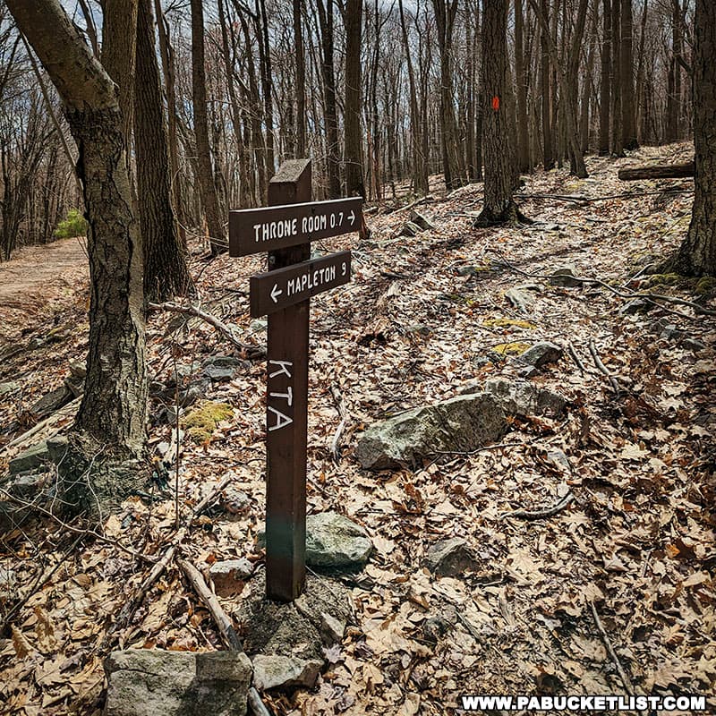
After hiking uphill for a half-mile, the remaining 0.2 miles features a slight decline to the overlook, following a yellow-blazed spur of the otherwise orange-blazed Standing Stone Trail.
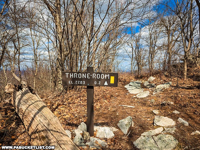
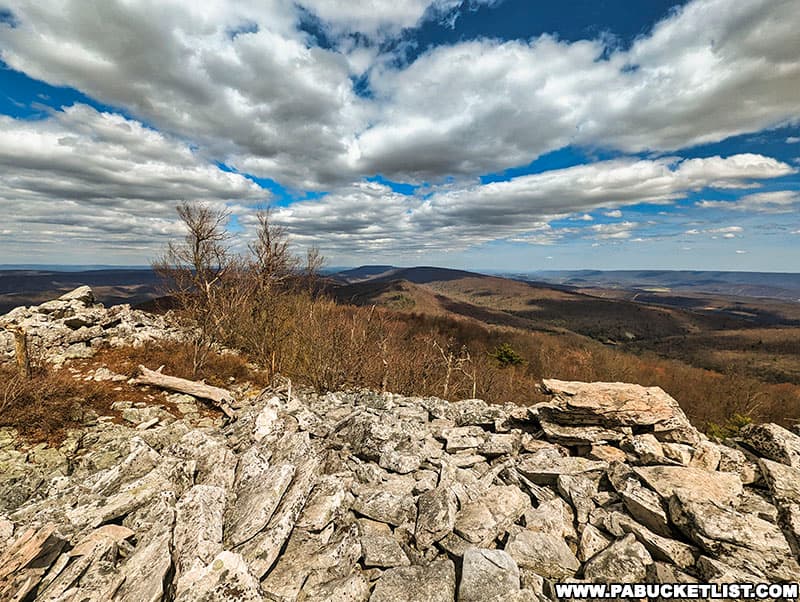
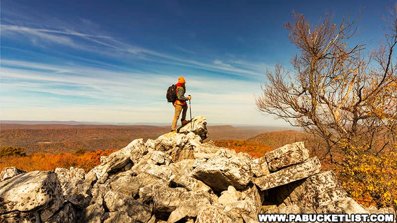
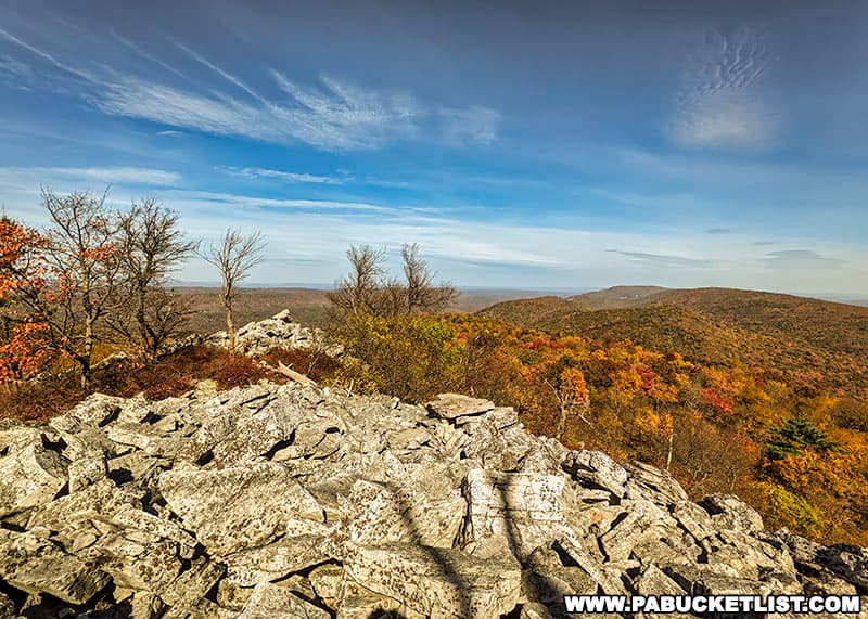
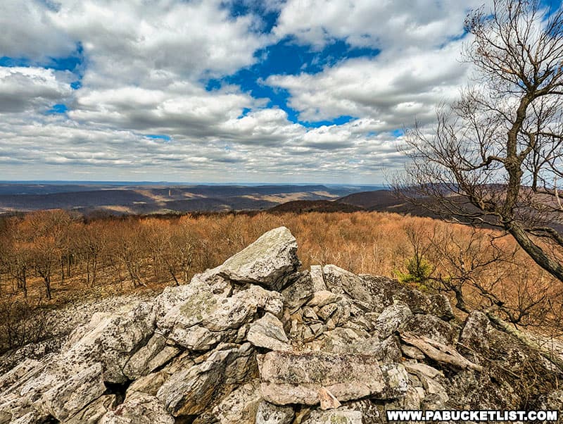
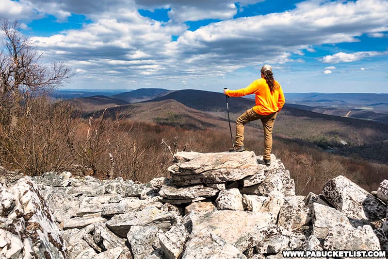
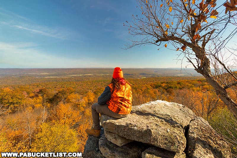
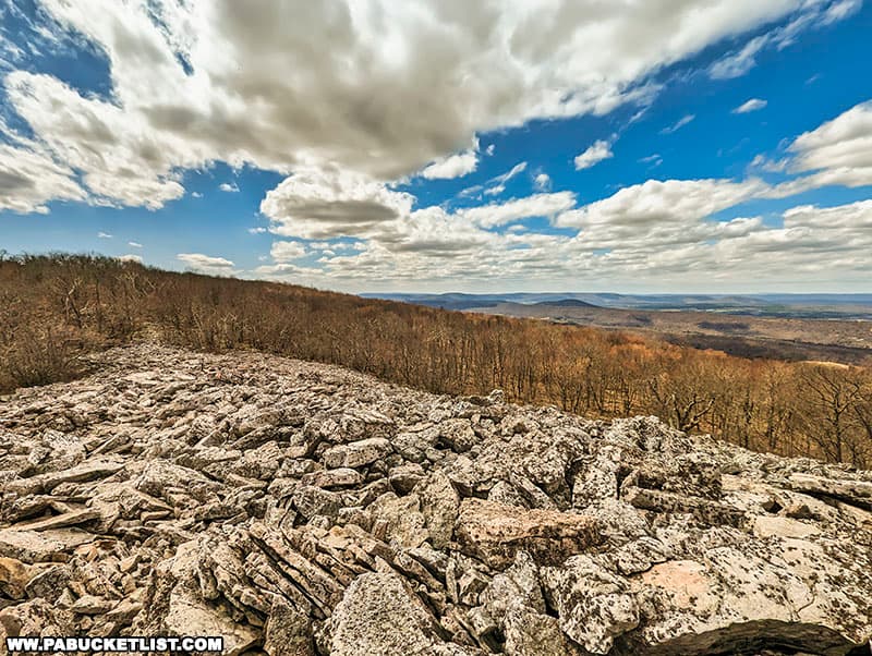
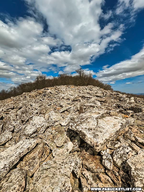
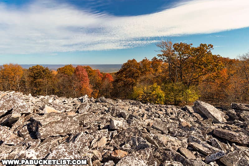
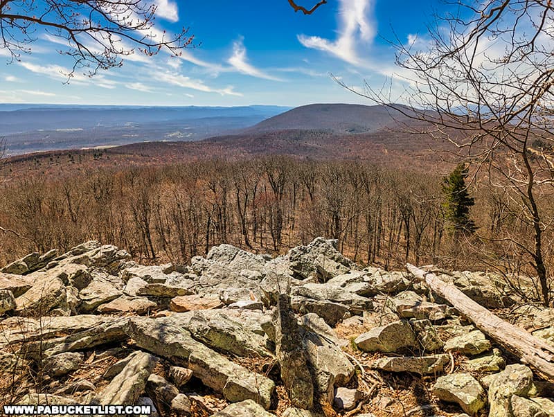
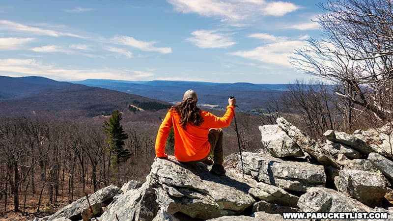
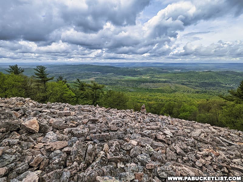
Once you step out onto the boulder field which comprises the Throne Room, the payoff for your short-but-steep climb will become apparent!
Exploring the Throne Room
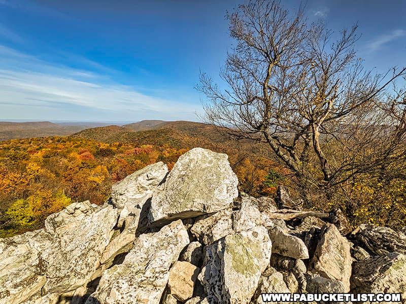
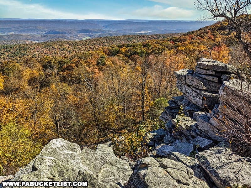
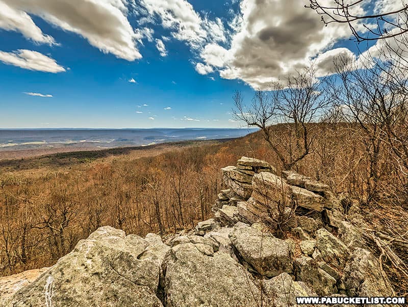
The views from the Throne Room are simply outstanding, no matter which direction you look or what season you visit it in.
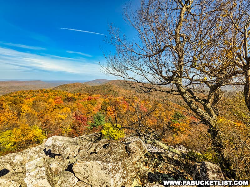
Sitting at 2283 feet above sea level, you seem to have an infinite view to the horizon.
To the west, the cobble piles slope more gently down the side of Jacks Mountain.
To the east, the boulders seem larger and the drop-off steeper.
In my opinion, the view to the north, in the direction of Mapleton, is the crème de la crème at the Throne Room.
Nearby Overlooks
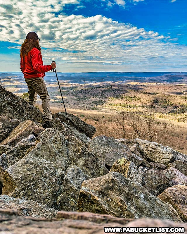
The Throne Room isn’t the only game in town when it comes to scenic overlooks on this section of the Standing Stone Trail; by hiking just a few hundred yards further south along the ridgeline you’ll encounter a pair of regal-sounding vistas sure to please as well.
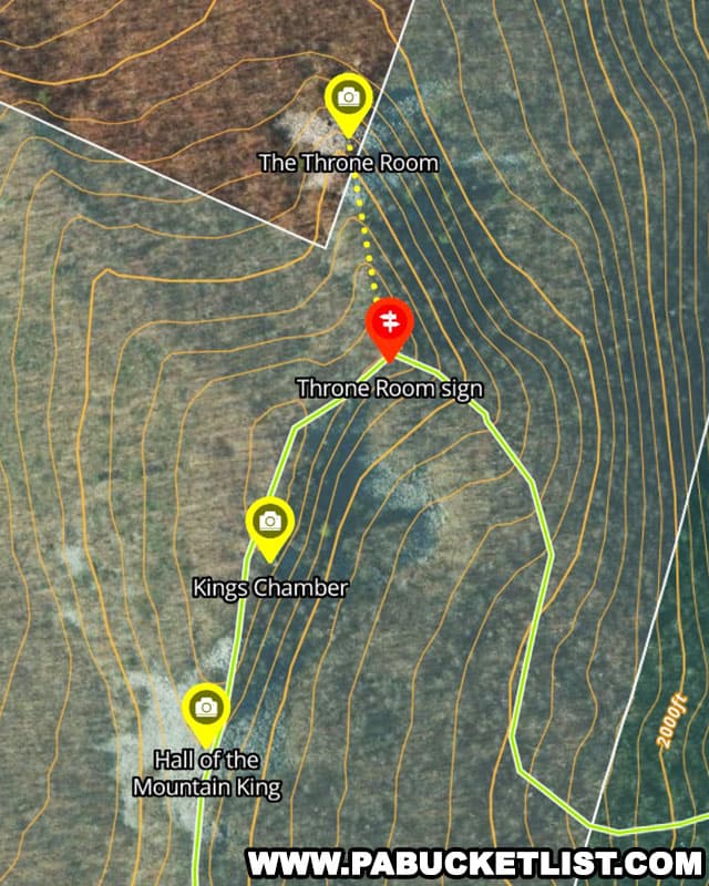
The King’s Chamber
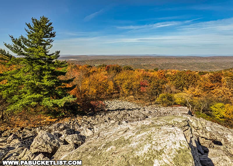
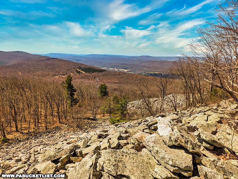
The King’s Chamber, roughly 200 yards south of the Throne Room spur, offers a “regal view” to the south and east.
The fall foliage views from the King’s Chamber are stunning.
But even on a leafless April afternoon, the view is no less impressive.
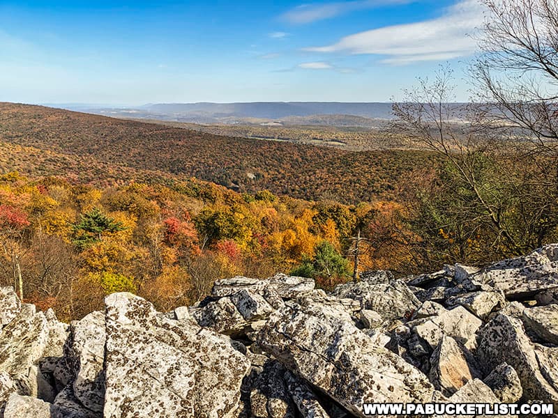
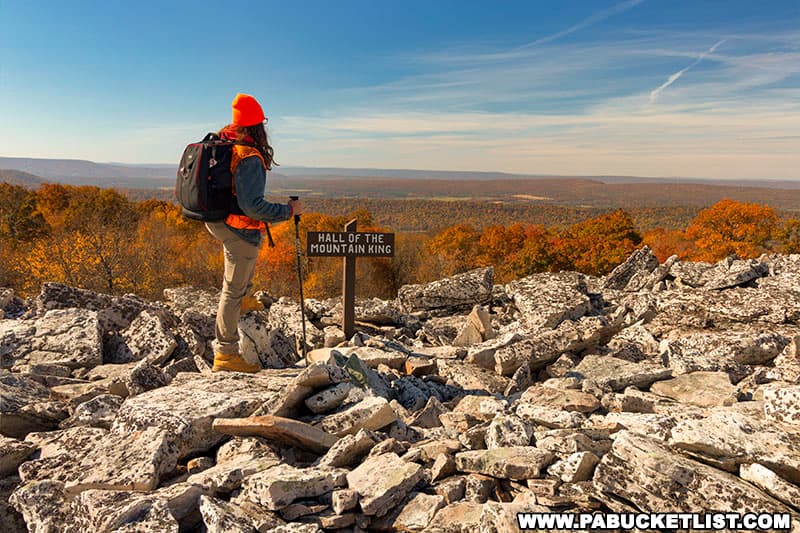
Hall of the Mountain King
150 yards beyond the King’s Chamber, you’ll find the Hall of the Mountain King, a tip of the hat to Spill the Wine by Eric Burdon and War.
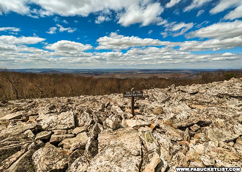
This 100 yard-long cobble pile slopes gently downhill, from north to south.
If ever you needed a good example for where trekking poles are useful, the Hall of the Mountain King is that example!
The views to both the east and west are equally good, especially on an October afternoon.
If you’re short on time or it’s late in the day, this is a good spot to turn back towards the parking area, netting you 3 fantastic vistas on an out-and-back hike of just over 2 miles in total length.
Butler Knob Vista
If you have the time, another 1.5 miles south of the Hall of the Mountain King you’ll find Butler Knob Vista.
While you can also drive to this vista (and park next to the now-defunct Jacks Mountain fire tower), since you’re already on top of the ridge, the hike from the Hall of the Mountain King to Butler Knob is relatively flat and easy.
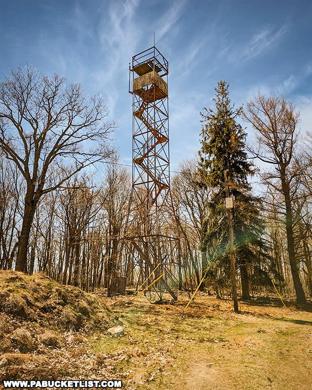
As a point of reference, the vista is roughly 175 yards south of the fire tower.
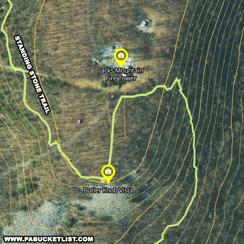
The view from Butler Knob Vista is a panoramic picture of the southern horizon.
If you choose to visit Butler Knob after first visiting the Throne Room, it makes a great midpoint spot to sit for a bit before completing a 5.5 mile out-and-back hike.
If you chose to visit Butler Knob at a later date, you can navigate to the fire tower parking area using GPS coordinates 40.29352, -77.96635 and driving up Jacks Tower Road, yet another high-clearance-recommended dirt road.
Related Attractions
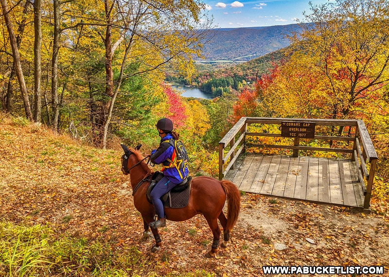
Cowans Gap State Park is the southern terminus of the Standing Stone Trail, where you’ll find the spectacular Cowans Gap Overlook along the trail.
Just north of the Throne Room you’ll find the 1000 Steps portion of the Standing Stone Trail, one of the most famous hikes in central PA.
Beyond the 1000 Steps lies Sausser’s Stone Pile, a massive rock formation in the Rothrock State Forest that also happens to be a superb scenic overlook.
Stone Valley Vista is a panoramic scenic overlook located along the Standing Stone Trail, 2.2 miles south of Greenwood Furnace State Park.
The Alan Seeger Trail is a short but beautiful loop hike through the Alan Seeger Natural Area near the northern terminus of the Standing Stone Trail.
Did you enjoy this article?
If so, be sure to like and follow PA Bucket List on Facebook, Instagram, and/or Pinterest to learn more about the best things to see and do in Pennsylvania!
Click on any of the icons below to get connected to PA Bucket List on social media.