The Rise and Fall of Centralia | PA’s Toxic Ghost Town

A collage of photos taken in Centralia, known as Pennsylvania's toxic ghost town because of an underground coal mine fire that has been burning under the town since 1962.

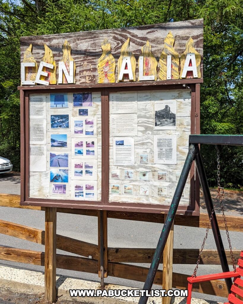
The story of Centralia in Columbia County epitomizes a tragic yet fascinating chapter in the pages of Pennsylvania history.

A desolate stretch of asphalt in Centralia, Pennsylvania, cloaked with vibrant graffiti, stands as a colorful testament to the town's ghostly status. Encroaching on both sides of the road, lush greenery hints at nature's reclaiming of the area. Shadows cast by the trees dapple the pavement, and the sky above is mostly clear, save for a few soft, white clouds, underscoring the eerie quietude that has settled over the landscape abandoned due to the persistent underground mine fire.
A desolate stretch of asphalt in Centralia.

Through a series of calamitous events, Centralia, a once-thriving settlement buoyed by the anthracite coal industry, descended into near-total abandonment and has become known as “PA’s Toxic Ghost Town.”

The image displays a worn newspaper article affixed to a wooden surface, discussing the lingering aftermath of the 1962 coal mine fire in Centralia, Pennsylvania. The headline reads "Few remain as 1962 Pa. coal town fire still burns," signaling the enduring presence of the fire and its effects on the town's population. The article recounts the experiences of the few residents who chose to stay despite the dangers, including a man who stood before the ruins of his bulldozed home, acknowledging the profound personal and community loss. The text goes on to detail the government's efforts to vacate the town, the demolition of homes, the state's negligence, and the steadfastness of the remaining elderly residents amidst the dwindling numbers of properties and the encroaching finality facing Centralia.
Excerpt from a Centralia exhibit at the Pioneer Tunnel coal mine in Ashland.

History of Centralia

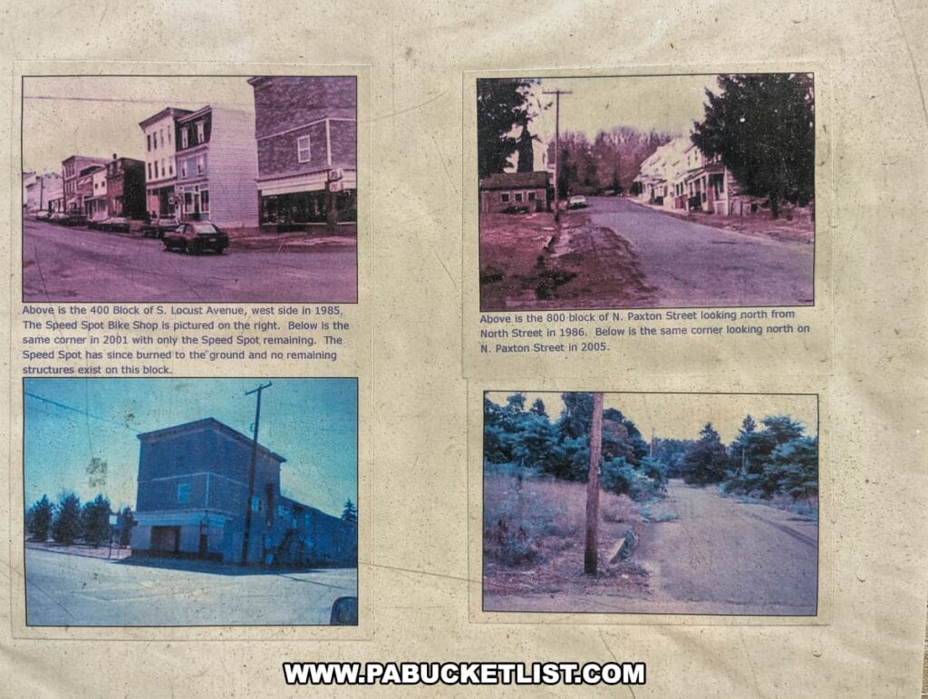
A century ago, Centralia was the quintessential bustling small town in Columbia County.

The photo displays a compilation of images from Centralia, Pennsylvania, contrasting the town's changes over time. The upper left picture shows the 400 Block of South Locust Avenue, west side in 1985, featuring the Speed Spot Bike Shop, and the upper right image captures the 800-block of North Paxton Street looking north from North Street in 1986. The lower images show the same locations in 2001 and 2005 respectively, revealing the significant transformation from a populated area to one with no remaining structures, illustrating the effects of the prolonged coal mine fire on the town's landscape and built environment.
Scenes from the town in the 1980s.

Its economy was robust, fueled by the rich veins of anthracite coal that lay beneath the earth.

Interior view of the Museum of Anthracite Mining in Ashland, PA, featuring the exhibit 'COAL: THE ROCK THAT BURNS.' The room has educational panels on anthracite and its history, with a wall dedicated to 'PROSPECTING FOR ANTHRACITE.' A large piece of coal is on display next to a backlit image of a prehistoric forest, illustrating coal's origins. Samples of coal and related fossils are mounted on a beige display with descriptive labels. A seating area with a table and chairs offers a space for visitors to rest or read additional material.
A scene from the the Museum of Anthracite Mining in nearby Ashland, Schuylkill County.

The town’s 1,200 inhabitants were a close-knit community, with shops and homes dotting the landscape.

This image displays a collection of faded photographs depicting various scenes from Centralia, Pennsylvania, during the 1980s. The top left photo shows a view looking north on Route 61, circa 1981, with a vibrant, retro-looking gas station sign. To the right, there's a shot of Railroad Street looking west from Locust Avenue in 1986, where the tracks were removed in 1967. Below, there are two more images: another view of Route 61 looking north from approximately the same era, with homes lining the street, and the last picture captures Railroad Street looking west from Locust Avenue in 2005, featuring a grassy median where railroad tracks once lay. These images document the town before it became known as a "toxic ghost town" due to the ongoing coal mine fire.
Centralia was once a thriving small town.

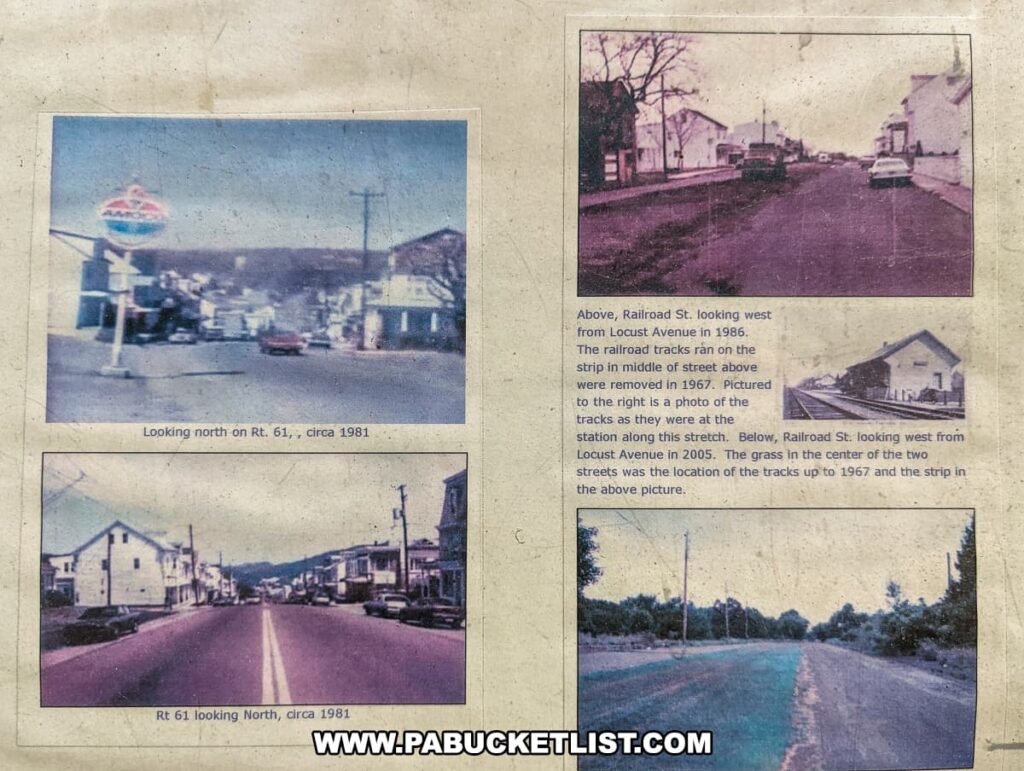
Today, however, Centralia stands as a somber relic of its former self, with empty streets serving as a silent testament to its decline.

The photo depicts a desolate street in Centralia, Pennsylvania, with an overcast sky. Overgrowth flanks the cracked asphalt roadway, displaying nature's reclamation of the area. In the foreground, a tilted utility pole, still connected by wires, angles precariously over the road, symbolizing the decay and abandonment of the once-thriving town due to the devastating underground mine fire that has been burning since 1962.
A street once lined with homes.

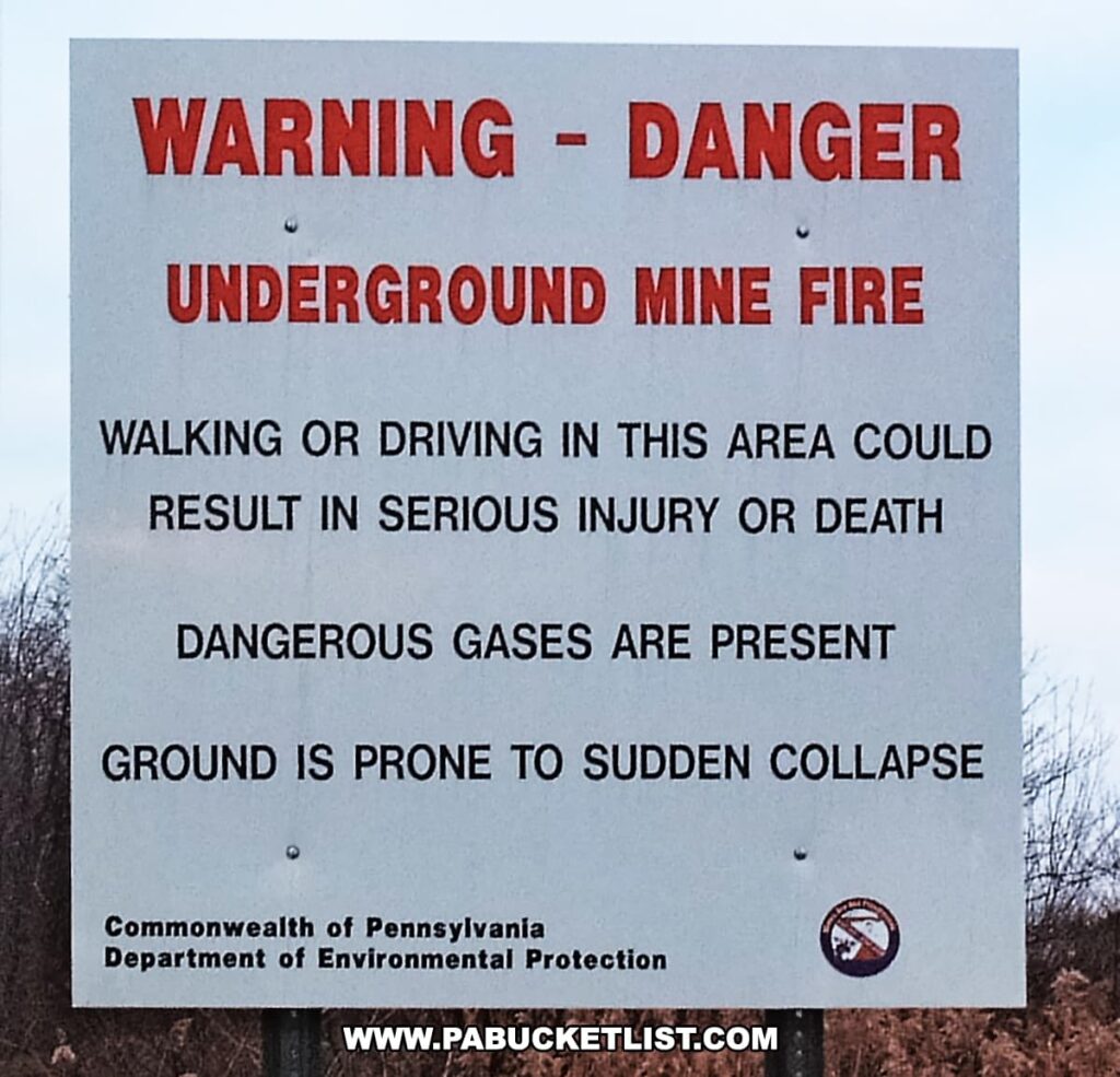
The catalyst for this transformation was not a natural disaster or economic downturn but a devastating mine fire that has raged beneath Centralia’s streets for over six decades, erasing nearly all traces of the community that once thrived above.

An informative display at Pioneer Tunnel coal mine near Centralia, Pennsylvania, providing visitors with a glimpse into the town's history and the ongoing underground coal mine fire. The weathered wooden board at the top, adorned with the word "CENTRALIA" in stylized, flame-themed letters, hints at the fire that has been burning since 1962. Below, protected behind a clear covering, are numerous pages filled with text and photos, likely detailing the town's past, the fire's impact, and the resultant ghost town status. This outdoor exhibit offers a tangible connection to Centralia's unique and tragic narrative under the open sky.
Centralia exhibit at Pioneer Tunnel coal mine in Ashland.

Origins of the Centralia Mine Fire

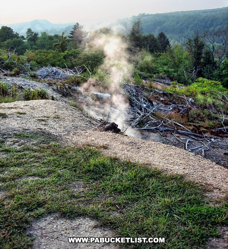
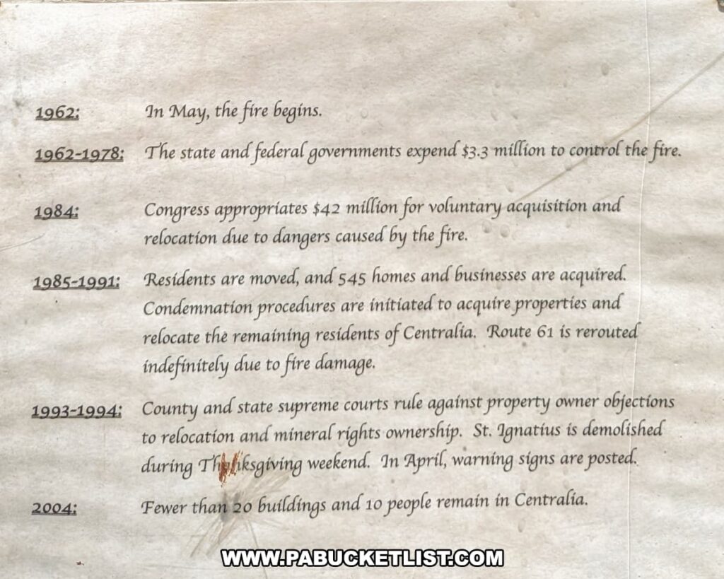
The origin of Centralia’s undoing dates back to May 1962, when a seemingly innocuous act of burning residential trash in an abandoned strip mining pit inadvertently ignited a coal seam.

The photo shows the exterior of the municipal building in Centralia, Pennsylvania, set against a partly cloudy sky. The building has a simple architectural style with a tan upper facade and dark brown tiles below. A single flagpole with the American flag stands at the left, and the building is accessible via a small set of stairs leading to dark tinted doors. In the foreground, there's a street, and surrounding the structure is a quiet atmosphere with no visible human activity, reflecting the town's status as largely abandoned due to the long-standing mine fire beneath it.
The Municipal Building is one of the few building still standing in the town.

This fire found its way into the labyrinth of abandoned coal mines beneath the town, setting the stage for a disaster of unprecedented scale.

A dimly lit mine shaft, labeled "Buck Mtn. Vein," plunges into the earth at Pioneer Tunnel coal mine near Centralia, Pennsylvania. Wooden beams support the tunnel, showing signs of age and the strenuous work once performed here. An antique light illuminates the path, casting a warm glow that reflects off the damp walls, highlighting tools and remnants of a mining era long passed. The image captures the essence of Centralia's legacy, where the aftermath of a decades-long underground coal mine fire has led to the town's haunting abandonment.
The Buck Mountain vein of coal seen here during my tour of Pioneer Tunnel coal mine is the same vein burning under Centralia a few miles to the north.

Early attempts to extinguish the blaze were futile, ranging from pumping water into the old mine shafts to filling the shafts with non-combustible materials like sand.

The image displays a close-up of the Centralia Borough Police Department sign affixed to a dark wooden wall next to a glass window, reflecting a red truck parked outside. The sign features a badge shape with an eagle on top, indicating the authority of the small town's police force in Centralia, Pennsylvania, a place known for the coal mine fire that has been burning beneath it since 1962.
Former home of the Borough Police.

As the fire continued to burn, it transformed the ground beneath Centralia into an inferno, with temperatures in some areas exceeding 900 degrees Fahrenheit.

The photo shows two mounted images depicting the damage caused by the underground mine fire in Centralia, Pennsylvania. The top image captures a deserted road with deep cracks and buckling, evidence of the intense heat beneath the surface, while wisps of smoke hint at the fire still smoldering below. In the bottom image, two individuals stand by a large, heat-induced fissure in the asphalt, the darkened, charred edges of the pavement and the stark, barren landscape around them illustrating the severity of the damage and the ghostly emptiness of the area.
The fire below the town is hot enough to cause asphalt to buckle and split.

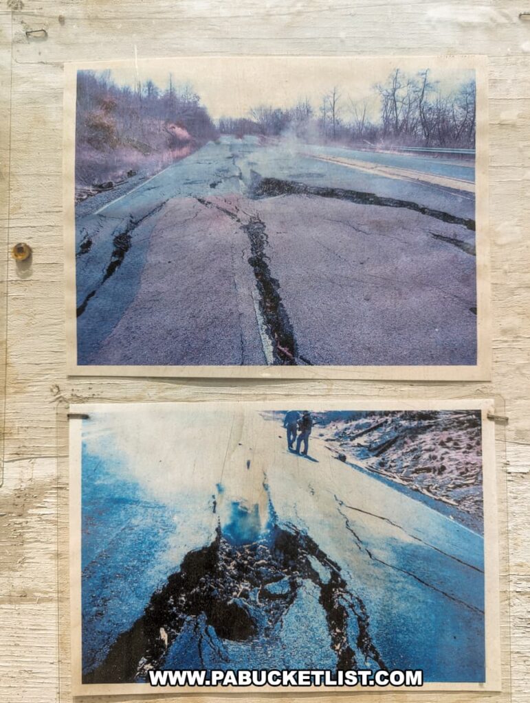
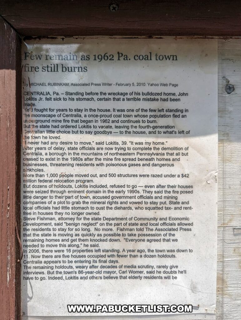
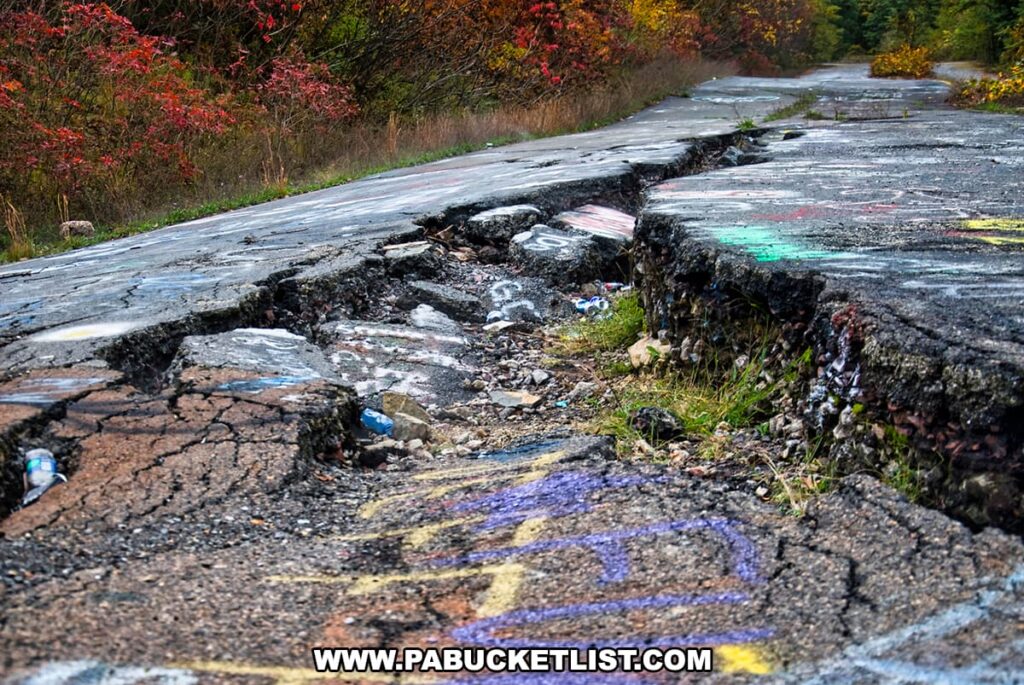
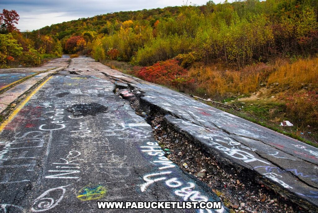
The human toll of the fire soon became apparent, with residents reporting health issues, homes beginning to tilt from the shifting ground, and sinkholes emitting toxic gases becoming a common hazard.

The image shows a haunting scene from Centralia, Pennsylvania, where smoke rises from a large crack in the ground—a visible sign of the underground coal mine fire that has been burning since 1962. The foreground features a grassy area leading to barren soil, reflecting the heat's impact. Dead, white trees and shrubs are scattered around the fissure, emphasizing the desolation caused by the fire. In the background, the lush, undisturbed forest on the rolling hills stands in contrast to the scorched earth, underscoring the destructive intersection of natural beauty and environmental catastrophe in this ghost town.
Sinkholes and toxic fumes are why people are encouraged NOT to visit Centralia (public domain image/Wikipedia).

Because of the cost and complexity of trying to extinguish the fire, the decision was made to instead let the fire burn and relocate Centralia’s residents.

A close-up view of the damaged asphalt in Centralia, Pennsylvania, reveals the destructive power of the underground fire. The road is buckled and split, with chunks of concrete displaced and strewn about, some pieces partially covered in graffiti. Vegetation pokes through the cracks, contrasting with the fall foliage in the background. Discarded items, including water bottles, lie amidst the rubble, highlighting the abandonment. The damage done by the long-burning coal mine fire is evident in the deformed and deserted state of the once-functional road.
A scene from the famed “Graffiti Highway” in Centralia (photo credit: iStock/weible1980).

In 1983, Congress allocated over $42 million for this purpose, and in 1992, the state took further measures to invoke eminent domain on the town and evacuate the remaining holdouts.
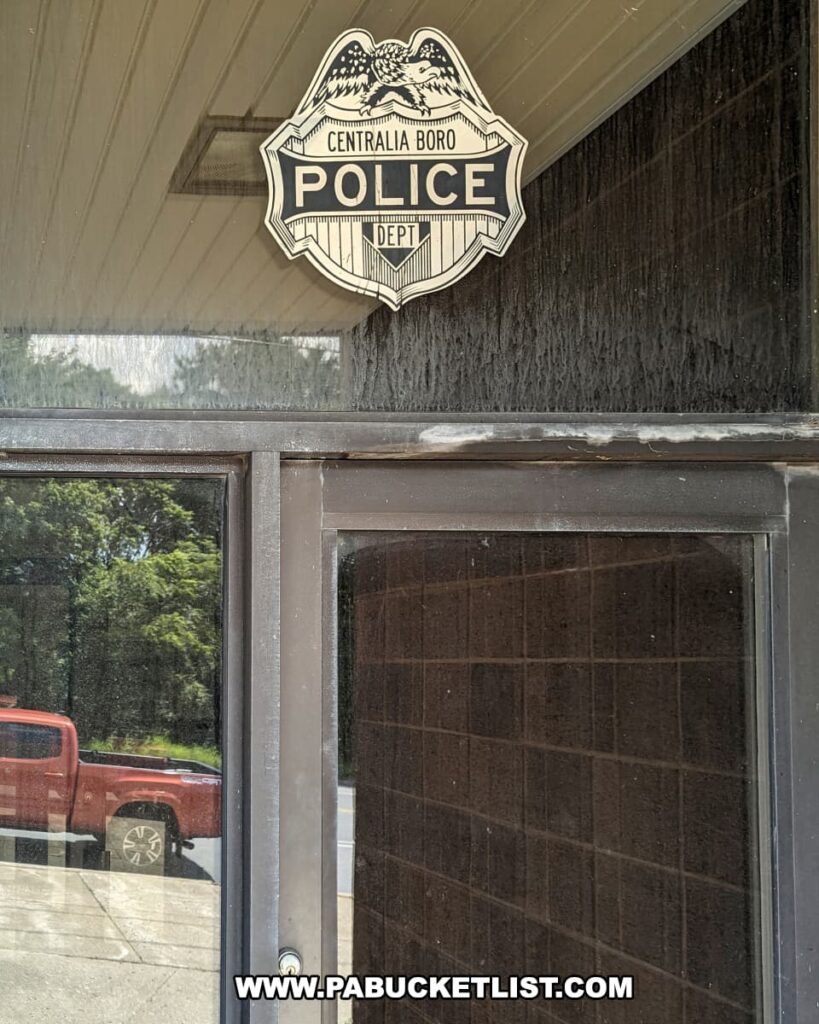
The image is of a document providing a timeline of significant events in Centralia, Pennsylvania, related to the coal mine fire that started in 1962. It outlines the government's financial efforts to control the fire from 1962 to 1978, Congress's appropriation for relocation in 1984, the movement and acquisition of properties between 1985-1991, the supreme court rulings in 1993-1994, and the status of the town in 2004, by which time fewer than 20 buildings and 10 people remained. This timeline encapsulates the ongoing saga of Centralia's struggle with the underground fire and its impact on the community.
Centralia mine fire timeline as displayed at Pioneer Tunnel coal mine.

Centralia Today

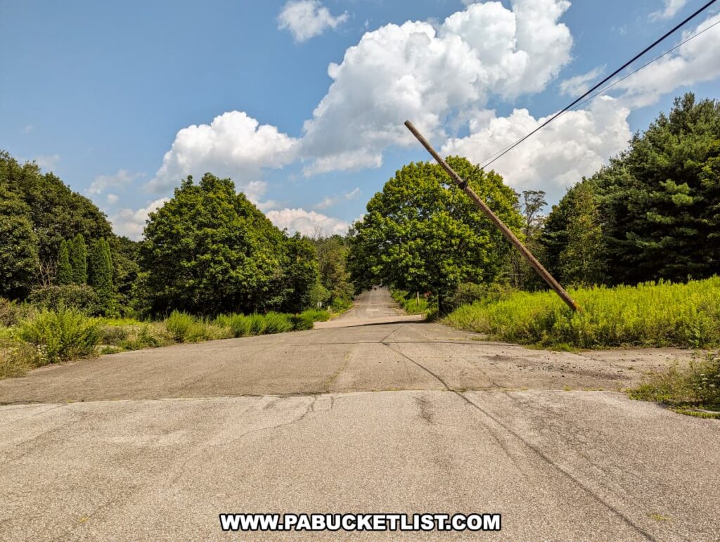
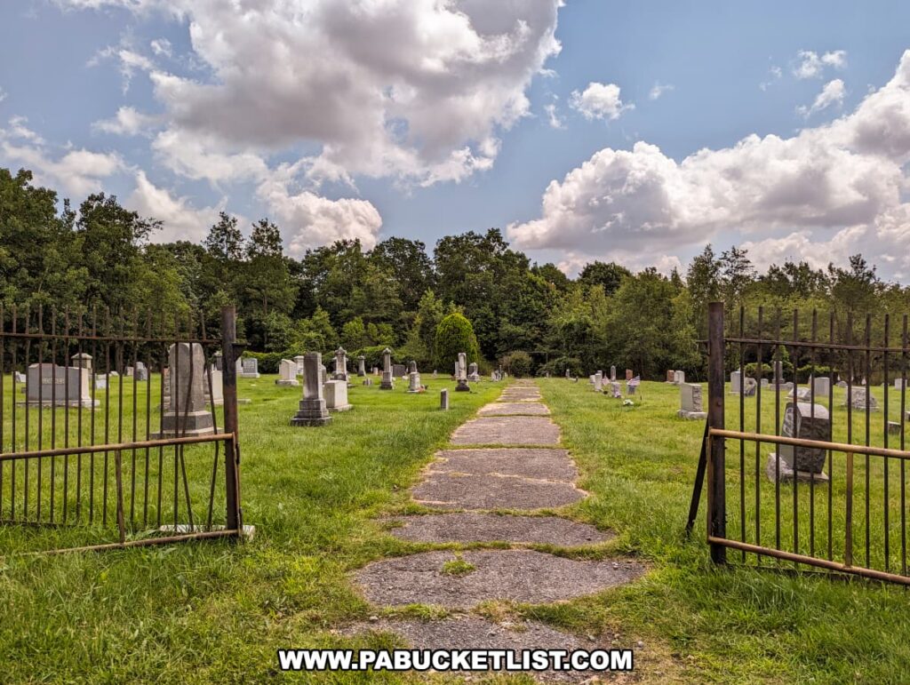
Today, only a handful of residents remain (5 as of the 2020 census) in a town that has been all but erased from the map.

A desolate road stretches through a scene of overgrown grass and untamed foliage in Centralia, Pennsylvania. Once bustling with life, the area now lies abandoned, a victim to the relentless underground coal mine fire that has been burning since 1962. The sky is partially covered with fluffy white clouds, casting shadows on the road, enhancing the eerie stillness of this toxic ghost town. The greenery encroaches on the pavement, nature reclaiming its territory, a stark reminder of the town’s tragic fate.
Railroad Avenue in Centralia in 2023.

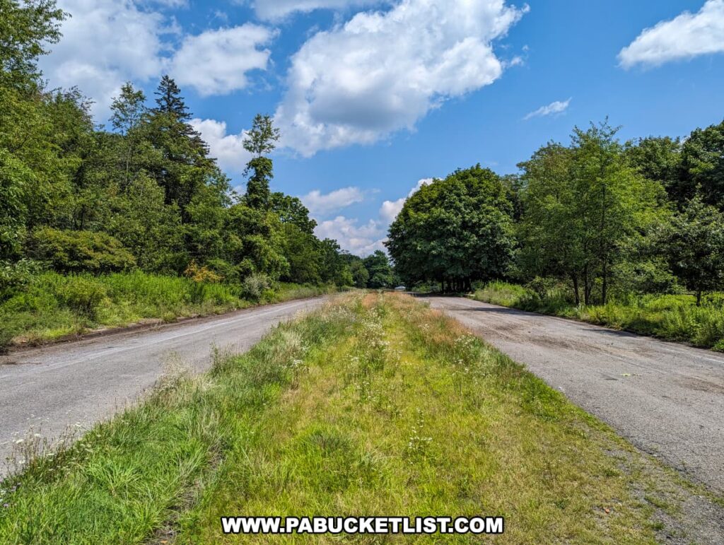
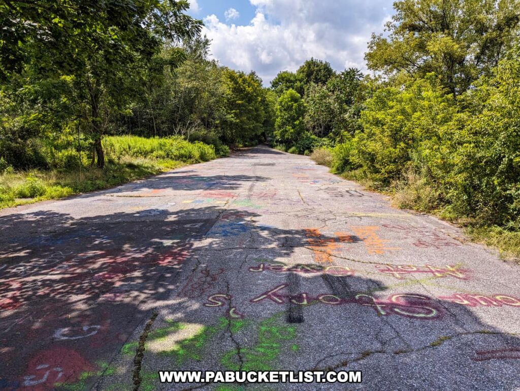
The “Graffiti Highway”, Centralia’s biggest “tourist attraction”, is now buried under mounds of dirt to discourage trespassing.

An image captures the severe damage of an abandoned road in Centralia, Pennsylvania, with large cracks and buckled asphalt creating a rugged terrain. The road is heavily adorned with graffiti, which adds a spectrum of colors to the otherwise grey pavement. In the background, autumn colors the trees with red, orange, and yellow hues, contrasting the greyness of the road and the overcast sky. The scene conveys a mix of urban decay and natural beauty, with scattered litter emphasizing the neglect of this once-traveled highway, affected by the ongoing underground fire.
The Graffiti Highway in Centralia is now covered in dirt (photo credit: iStock/weible1980).

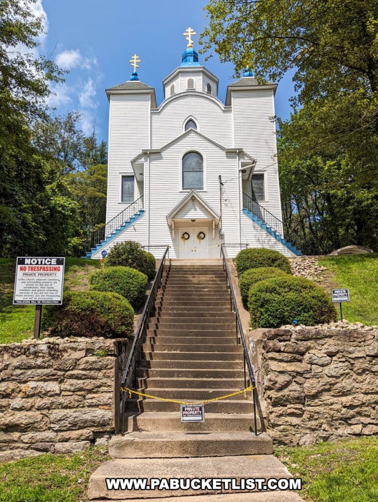
Yet, amidst the desolation, life persists in the form of new-growth forests and the remaining church, St. Mary’s, which continues to hold weekly services.

In Centralia, Pennsylvania, a striking white church with blue trim stands in sharp contrast to its solemn surroundings. The building is crowned with three gold crosses atop blue domes, a traditional feature of Ukrainian Catholic churches. A set of concrete stairs, cordoned off by yellow caution tape and flanked by 'No Trespassing' signs, leads up to the closed doors, indicating the area's isolation and abandonment. Despite the desolate backdrop of this toxic ghost town, the church remains a poignant symbol of faith and resilience amid the lingering underground coal mine fire that has ravaged the town since 1962.
This church is one of the very few structures remaining in Centralia.

Final Thoughts

According to the Pennsylvania Department of Environmental Protection, visitation to Centralia is not recommended due to the many hazards associated with the underground mine fire; the State calls the program “Stay Out – Stay Alive”.

The image shows a warning sign from the Commonwealth of Pennsylvania Department of Environmental Protection, cautioning against the dangers of the underground mine fire in Centralia, Pennsylvania. It states that walking or driving in the area could result in serious injury or death due to dangerous gases and the potential for sudden ground collapse, reflecting the hazardous conditions created by the long-burning coal mine fire in this area known as a "toxic ghost town."
The State encourages you NOT to visit Centralia (public domain image).

But the story of Centralia is worth knowing, for it serves as a stark reminder that the consequences of our actions can extend far beyond our immediate intentions, echoing for generations in profound and unexpected ways.

The photo captures the Odd Fellows Cemetery in Centralia, Pennsylvania, on a day where the sky is a dramatic mix of fluffy white clouds and blue. The image is taken from the entrance, looking down a central path flanked by neatly arranged gravestones. The cemetery is surrounded by a rusty metal fence, and the open gate invites visitors in. Lush green trees encircle the perimeter, providing a serene backdrop to this resting place, standing in quiet contrast to the town's reputation as a ghost town over an underground mine fire.
Cemetery near where the Centralia mine fire first started in 1962.

While there is really nothing left to see in Centralia, Concrete City is a historic ghost town in neighboring Luzerne County with plenty to see.

Exploring Concrete City in Nanticoke Pennsylvania.
Scenes from Concrete City.

Yellow Dog Village in Armstrong County has been called PA’s best-preserved ghost town, and you can explore it legally during paid tours and photo excursions offered by the owner.

Yellow Dog Village is Pennsylvania's Best Ghost Town.
Scenes from Yellow Dog Village.

Nearby Attractions

7 Must-See Attractions in Schuylkill County is your guide to the best things to see and do just south of Centralia.

A collage of four images featuring notable attractions in Schuylkill County, Pennsylvania. The top left picture shows the iconic D.G. Yuengling & Son brewery building, a red brick structure with white trim windows, decorated with American flags and a church spire in the background. The top right image displays a large stone with a plaque commemorating Muhammad Ali as a three-time heavyweight champion, set in a serene wooded area. The bottom left photo captures a classic car garage with shiny vintage cars, including a green 1950s convertible, surrounded by automotive memorabilia. The bottom right image depicts tourists on a coal mine tour, seated in a mine car as they descend into the dimly lit depths of the earth.
Scenes from Schuylkill County.

Did you enjoy this article?

If so, be sure to like and follow PA Bucket List on Facebook, Instagram, and/or Pinterest to learn more about the best things to see and do in Pennsylvania!

Click on any of the icons below to get connected to PA Bucket List on social media.


PA Bucket List 2022 Sasquatch Logo

Pennsylvania’s Best Travel Blog!

Rusty Glessner
Rusty Glessner is a professional photographer, lifelong Pennsylvanian, and a frequently-cited authority on PA's best travel destinations.