Exploring Hackers Falls in Pike County

A collage of four photos highlighting different aspects of Hackers Falls in Pike County, Pennsylvania. The top left image shows the waterfall flowing through a forested area, framed by trees. The top right image captures a close-up of the main waterfall cascading over a rocky ledge into a pool below. The bottom left image features a gravel trail with a signpost indicating the Cliff Trail and Hackers Trail, set within dense woodland. The bottom right image displays the waterfall from a wider angle, showcasing the cascading water over multiple rocky steps, surrounded by lush greenery.

If you’re looking for directions to Hackers Falls in Pike County, you’re in the right place!

A serene view of Hackers Falls in Pike County, Pennsylvania, featuring cascading waters over rocky ledges surrounded by dense forest. The water flows energetically down a series of steps, creating a dynamic and picturesque scene amidst the natural greenery.
Hackers Falls in Pike County.

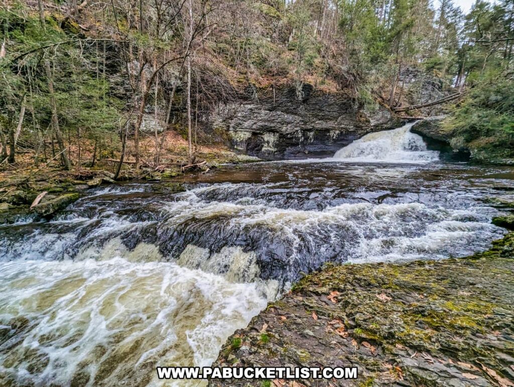
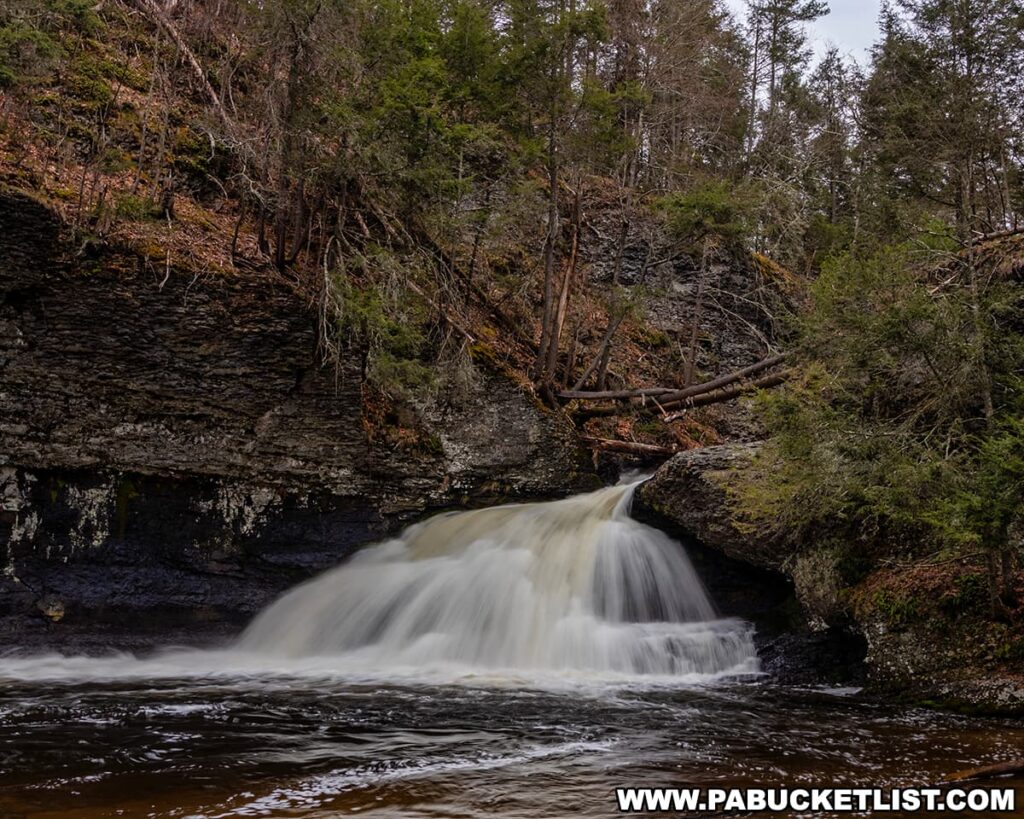
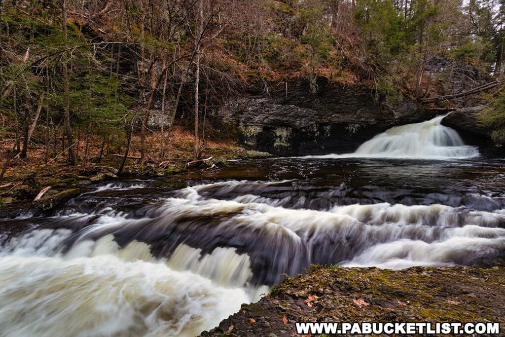
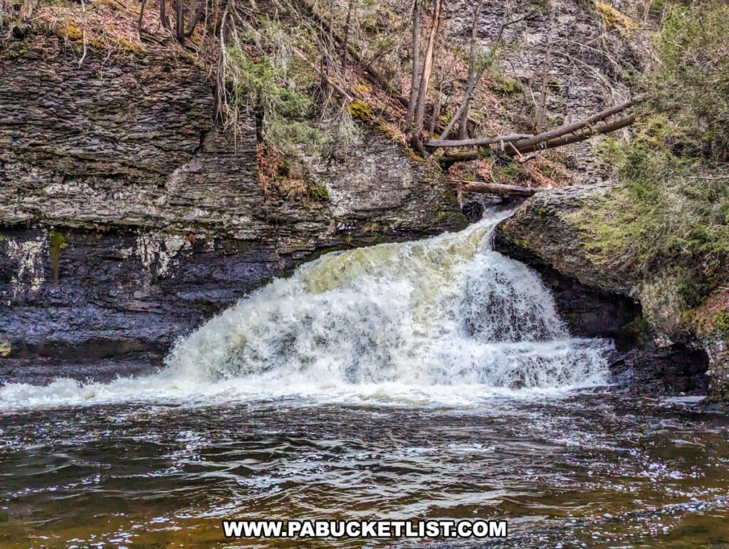
Hackers Falls is a 20 foot-tall, fan shaped waterfall located in the Delaware Water Gap National Recreation Area in Pike County.

A front view of Hackers Falls in Pike County, Pennsylvania, within the Delaware Water Gap National Recreation Area. The image captures a powerful waterfall cascading over a rocky ledge into a calm pool. Surrounding the falls are steep, rocky cliffs adorned with moss and sparse vegetation, as well as tall trees with both green and bare branches, creating a picturesque and natural landscape.
The falls after heavy April showers.

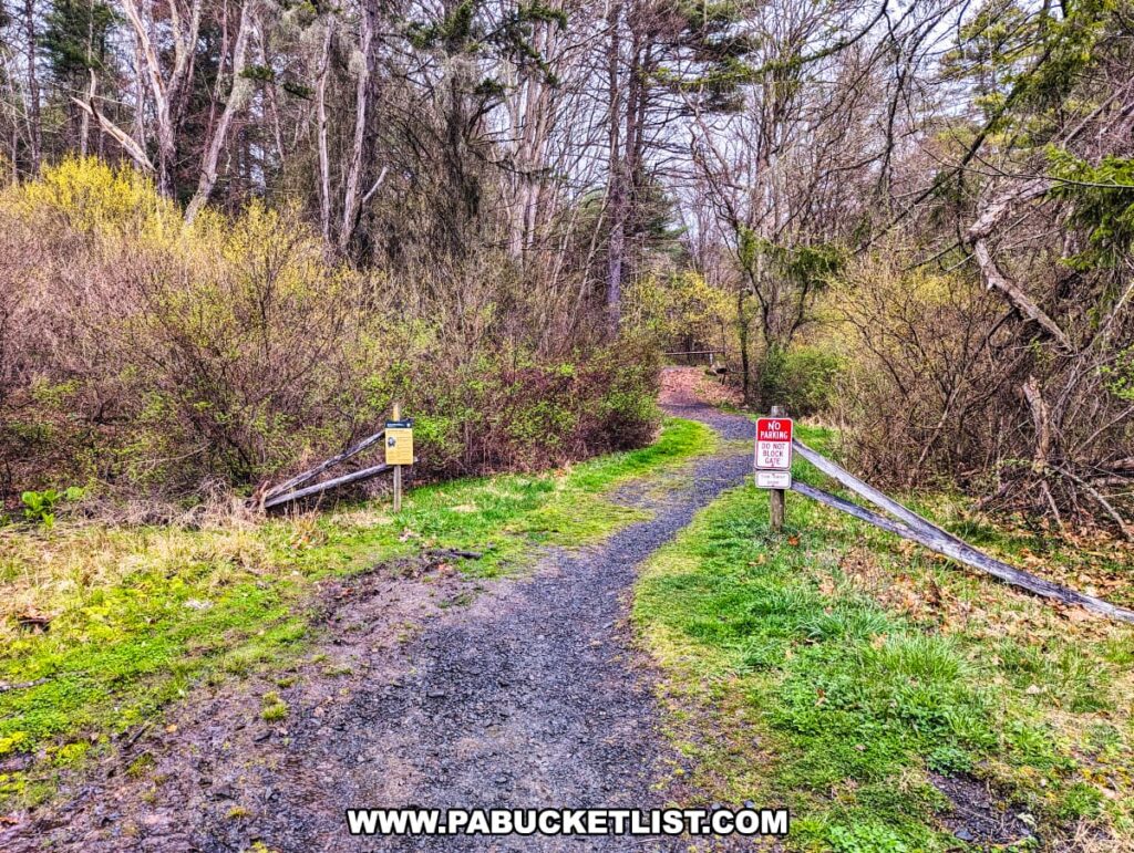
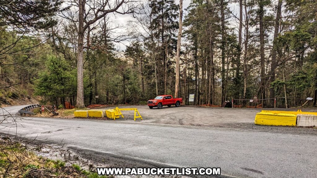
The trailhead for the hike as described here is located along Raymondskill Road, close to Raymondskill Falls.

A view of the trailhead at Hackers Falls in Pike County, Pennsylvania, featuring a gravel path leading into a densely wooded area. Signs marking the trail and parking regulations are visible at the entrance. The path is bordered by lush greenery and shrubs, creating a welcoming starting point for hikers. The surrounding vegetation is vibrant and varied, adding to the natural beauty of the scene.
Trailhead for hike to Hackers Falls.

If navigating by GPS coordinates, use 41.29016, -74.84120 to locate this parking area across the road from the trailhead.

A view of the parking area for Hackers Falls in Pike County, Pennsylvania, located along Raymondskill Road. The area features a small gravel lot with a single red truck parked. Yellow concrete barriers and a sign mark the entrance to the trailhead, surrounded by tall trees and dense forest, creating a secluded and inviting starting point for hikers.
Parking area along Raymondskill Road.

The trek to Hackers Falls as shown on the map below is a 1.6 mile out-and-back hike (0.8 miles out, 0.8 miles back).

A topographic map showing the hiking routes to Hackers Falls, Raymondskill Falls, and various overlooks in Pike County, Pennsylvania. The map highlights the trails with dashed lines, marking key points of interest such as Hackers Falls, Minisinik Overlook, and Tristate Overlook. Raymondskill Road runs through the area, providing access to the trailheads. The elevation contours and key landmarks, like parking areas, are clearly indicated to help hikers navigate the terrain.
The hike to Hackers Falls covers 0.8 miles one-way.

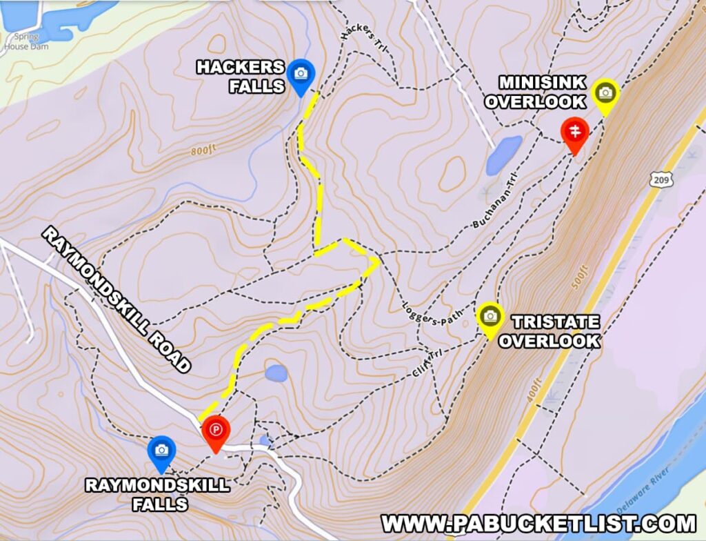
The hike follows the yellow-blazed Hackers Trail.

A trail signpost at Hackers Falls in Pike County, Pennsylvania, marking the intersection of the Cliff Trail and Hackers Trail. The signpost features various trail markers, including directional arrows and a yellow blaze for Hackers Trail. The gravel path winds through a dense forest, with fallen leaves covering the ground and trees lining the trail, creating a scenic and well-marked route for hikers.
The yellow-blazed Hackers Trail.

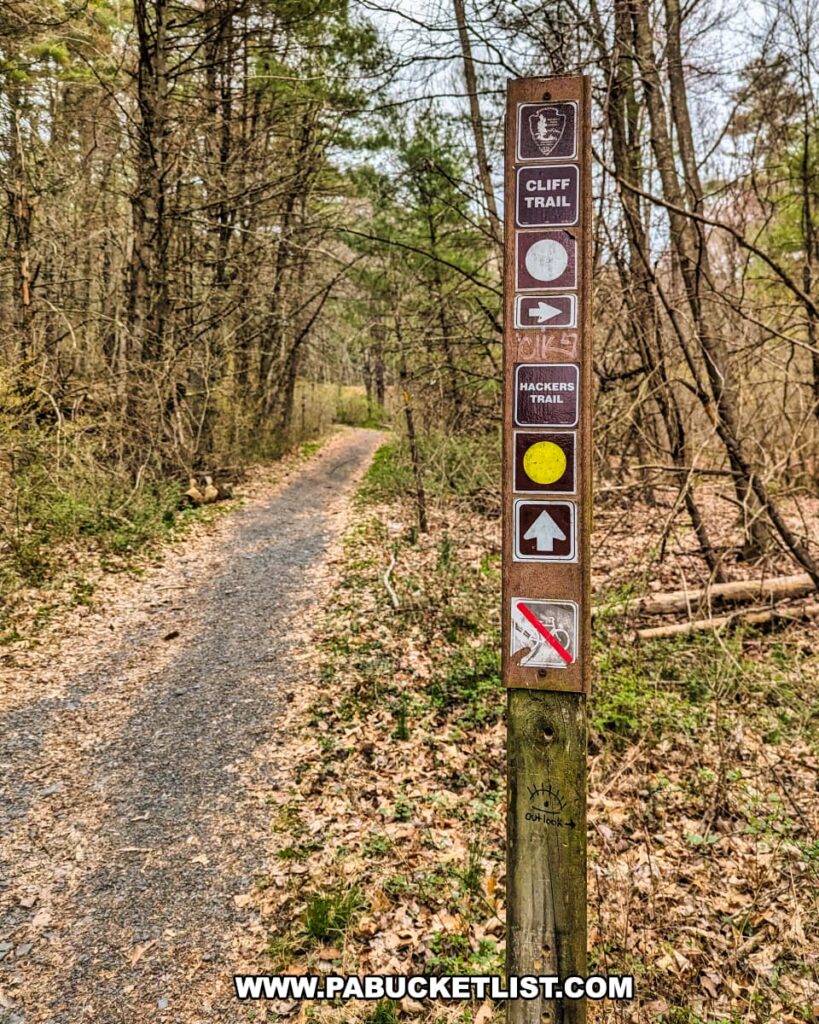
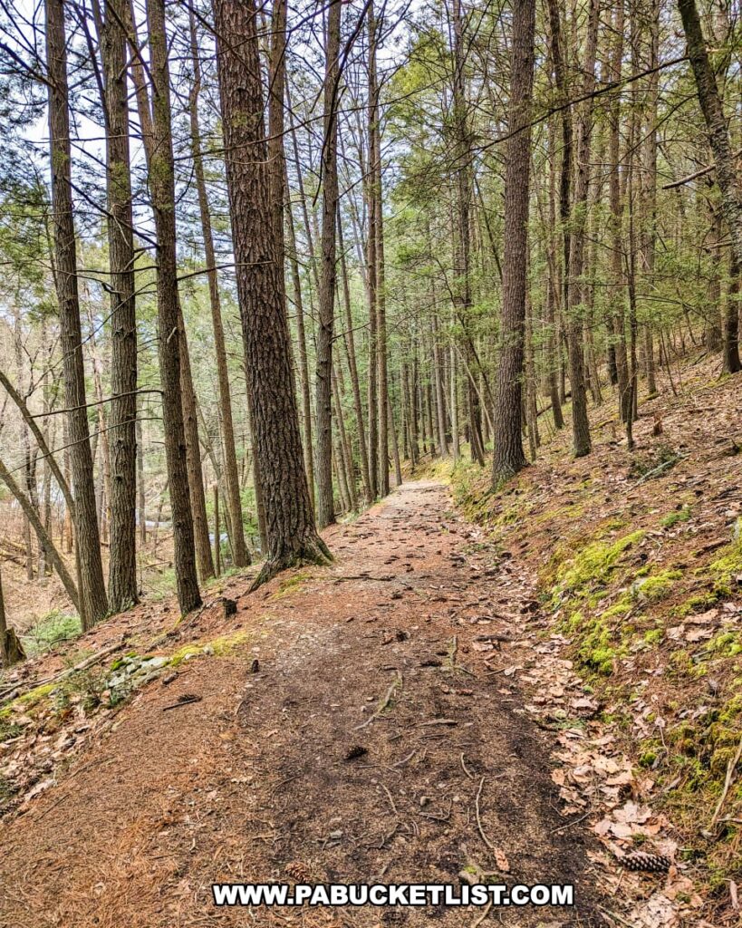
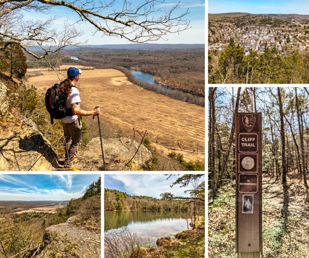
The trail is well-worn and obvious, but it does intersect with other trails, including the Cliff Trail, so be sure to pay attention at these intersections and continue to follow the yellow-blazed Hackers Trail to the falls.

A scenic view of a forest trail near Hackers Falls in Pike County, Pennsylvania, lined with tall, straight trees and covered with a carpet of fallen leaves and pine needles. The path gently slopes downhill, winding through the dense woodland with patches of green moss adding color to the earthy tones. The serene atmosphere is perfect for a tranquil hike surrounded by nature.
Hackers Trail approaching the falls.

Your first views of Hackers Falls will be from downstream.

A downstream view of Hackers Falls in Pike County, Pennsylvania, within the Delaware Water Gap National Recreation Area. The image captures the waterfall flowing over rocky ledges into a winding stream. The surrounding area is densely wooded with tall trees, some of which have bare branches, and the forest floor is covered with fallen leaves and moss. The scene is serene, with the waterfall framed by the natural beauty of the forest.
Downstream view of the falls.

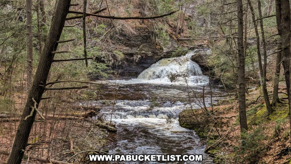
The trail continues up the right side of Raymondskill Creek (the body of water that Hackers Falls lies on), allowing closer inspection of the falls (located at GPS coordinates 41.29866, -74.83850).

A scenic view of Hackers Falls in Pike County, Pennsylvania, captured in the Delaware Water Gap National Recreation Area. The image showcases a multi-tiered waterfall cascading over moss-covered rocks into a tranquil pool below, surrounded by dense, leafless trees and rugged cliff faces. The water flows rapidly, creating a dynamic and serene natural scene.
Hackers Falls with cascades in the foreground.

When you’ve had your fill of Hackers Falls, simply retrace your steps back to the parking area.

A close-up view of Hackers Falls in Pike County, Pennsylvania, showcasing the waterfall plunging over a rock ledge into a shallow pool. The falls are framed by dark, textured rock formations and surrounded by a mix of green vegetation and fallen tree branches, highlighting the rugged and natural beauty of the area. The water cascades energetically, creating white foam and ripples as it hits the pool below.
Hackers Falls on an April morning.

Nearby Attractions

The Cliff Trail features 4 outstanding scenic overlooks of the Delaware River valley from its vantage point high atop Raymondskill Ridge in the Delaware Water Gap National Recreation Area.

This collage showcases five photos from the Cliff Trail in Pike County, Pennsylvania. The large image on the left depicts a hiker observing the landscape from a high vantage point, looking out over the winding Delaware River and brown fields, indicative of the changing seasons. The hiker is equipped with a backpack and walking stick, emphasizing the adventurous nature of the trail. The top right image provides a scenic view of a small town nestled among hills and trees, highlighting the trail’s proximity to local communities. The middle right photo features a trail marker, denoting the Cliff Trail and directing towards Raymondskill, set against a background of a typical forest scene on the trail. The bottom left image captures another section of the trail with a rocky outcrop and a distant view of the river and fields, while the bottom right picture shows a serene lake bordered by evergreens and bare trees, reflecting the tranquility found along the trail. The collage as a whole encapsulates the variety of natural beauty along the Cliff Trail.
Scenes from the Cliff Trail in Pike County.

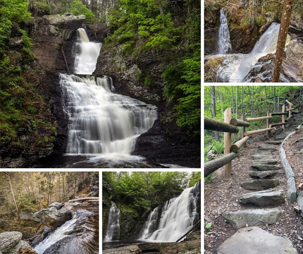
Raymondskill Falls in the Delaware Water Gap National Recreation Area is billed by the National Park Service as the “tallest waterfall in Pennsylvania” at 178 feet tall.

A collection of five images showcasing Raymondskill Falls in Pike County, Pennsylvania. Top left: A dynamic view of the waterfall with water streaming over a rocky cliff into a serene pool. Top right: A separate section of the falls where water splits into two paths amid dense trees. Bottom left: The rocky creek bed upstream, dotted with large stones and autumn leaves. Bottom center: A downward angle on the falls, highlighting the cascading water and mist. Bottom right: The hiking trail leading to the falls with rough-hewn stone steps and a wooden handrail, bordered by leaf-strewn ground and forest greenery.
Scenes from Raymondskill Falls in Pike County.

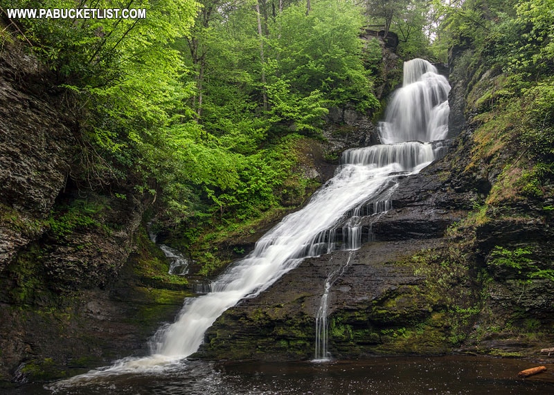
Dingmans Falls in in the Delaware Water Gap National Recreation Area checks in at 130 feet tall, good enough for the title of “second tallest waterfall in Pennsylvania.”

Dingmans Falls in eastern Pennsylvania.
Dingmans Falls in Pike County.

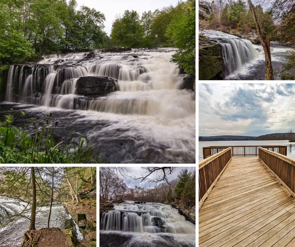
Shohola Falls, located along Route 6 in Pike County, is what I would call “almost-roadside” – a 5 minute walk from the parking area.

This collage showcases five distinct perspectives of Shohola Falls and its surroundings in Pike County, Pennsylvania. The top left photo captures the falls from a distance, emphasizing their width and the surrounding greenery. The top right image offers a view through a tree’s branches, highlighting the falls' vertical drop. The middle image is a close-up that blurs the rushing water, conveying its movement. The bottom left shows a tree with intricate roots beside the waterfall, illustrating the interplay between flora and water. Lastly, the bottom right photo features a wooden observation deck extending toward a lake, providing a peaceful vantage point against a backdrop of overcast skies. Each photo collectively portrays the diverse beauty of the falls and the serene landscape.
Scenes from Shohola Falls.

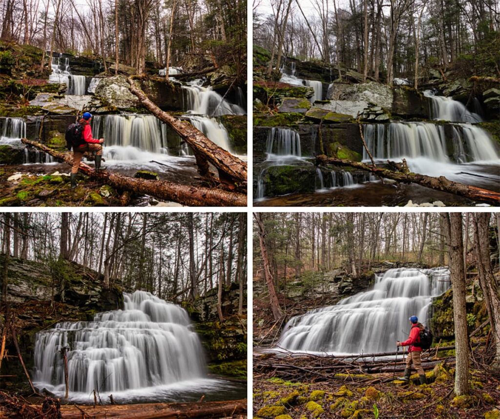
Sawkill and Savantine Falls are a pair of picturesque but seldom-seen waterfalls in the Pike County portions of the Delaware State Forest.

Collage of four images featuring a hiker at Sawkill and Savantine Falls in the Delaware State Forest, Pike County, Pennsylvania. The images depict the hiker at various viewpoints of the cascading waterfalls. The top left and right photos show him observing the falls from different angles, with the water spilling over rocky terraces amidst a forest setting. The bottom left photo captures the hiker in front of a broad, flowing curtain of water, and the bottom right shows him from behind, looking out at a wide, multi-tiered waterfall. Each scene is framed by the rugged beauty of the forest, showcasing the tranquil and picturesque environment of these waterfalls.
Scenes from Sawkill and Savantine Falls.

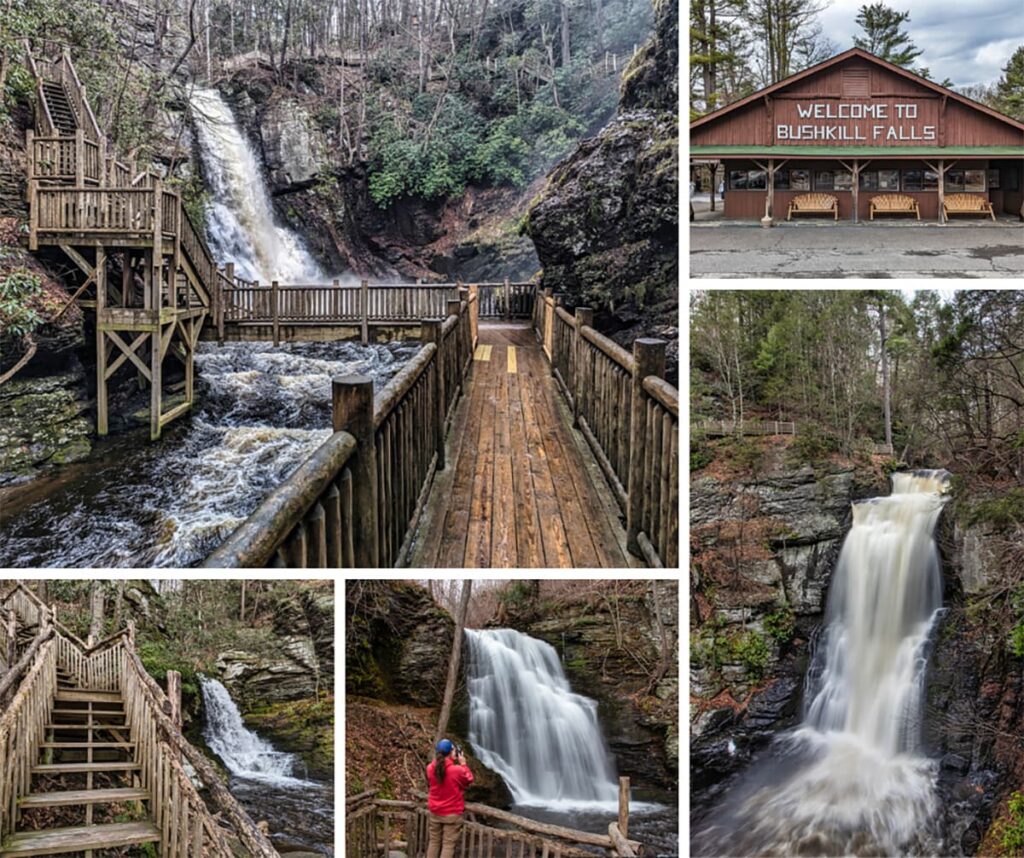
Bushkill Falls, often dubbed the “Niagara of Pennsylvania,” is a privately-owned Poconos nature park that features eight stunning waterfalls, accessible through a network of scenic trails and beautiful boardwalks that cater to all levels of hikers.

A collage of five images encapsulates the diverse experiences at Bushkill Falls, Pike County, Pennsylvania. The top left image displays a robust observation deck overlooking a cascading waterfall. Adjacent to it on the right, the park's entrance building welcomes visitors with a large "Welcome to Bushkill Falls" sign. Below, a wooden walkway stretches over rushing waters, leading visitors through the tranquil environment. The bottom left shows a set of wooden stairs winding through the forest, offering a rustic path for exploration. Finally, a visitor in red, centered in the bottom right, photographs one of the park’s majestic waterfalls, highlighting the picturesque beauty and recreational opportunities available in this section of the Pocono Mountains, all embraced by the park's well-crafted wooden structures.
Scenes from Bushkill Falls.

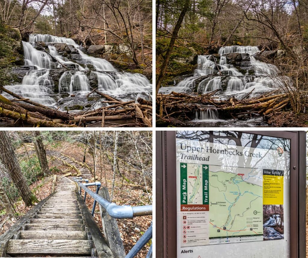
Upper Indian Ladders Falls in Pike County is a 30 foot-tall, multi-tiered waterfall along Upper Hornbecks Creek, located within the 77,000-acre Delaware Water Gap National Recreation Area.

A collage of four photos capturing the beauty and experience of visiting Upper Indian Ladders Falls in Pike County, Pennsylvania. The top left and top right images showcase the stunning waterfall with water cascading over rocky tiers, surrounded by a dense forest with scattered fallen branches. The bottom left image features a steep wooden staircase with metal railings, leading down through the forest to the falls. The bottom right image shows the trailhead sign for Upper Hornbecks Creek, displaying a detailed map and safety information for hikers exploring the area.
Scenes from Upper Indian Ladders Falls.

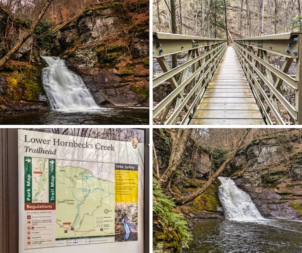
Lower Indian Ladders Falls is a 25 foot-tall waterfall along Lower Hornbecks Creek, also located within the Delaware Water Gap National Recreation Area.

A collage of four photos related to Lower Indian Ladders Falls in Pike County, PA. The top left image shows the 25-foot-tall waterfall cascading over moss-covered rocks into a pool below. The top right image features a wooden and metal footbridge crossing Hornbecks Creek, part of the trail leading to the falls. The bottom left image depicts the trailhead information board for Lower Hornbecks Creek, displaying a detailed map, regulations, and safety tips. The bottom right image is another view of Lower Indian Ladders Falls, highlighting the lush greenery and rocky cliffs surrounding the waterfall within the Delaware Water Gap National Recreation Area.
Scenes from Lower Indian Ladders Falls.

Did you enjoy this article?

If so, be sure to like and follow PA Bucket List on Facebook, Instagram, and/or Pinterest to learn more about the best things to see and do in Pennsylvania!

Click on any of the icons below to get connected to PA Bucket List on social media.


PA Bucket List 2022 Sasquatch Logo

Pennsylvania’s Best Travel Blog!

Rusty Glessner
Rusty Glessner is a professional photographer, lifelong Pennsylvanian, and a frequently-cited authority on PA's best travel destinations.