
Poe Paddy State Park is a 23 acre recreational area in Centre County, located 4 miles east of Poe Valley State Park.
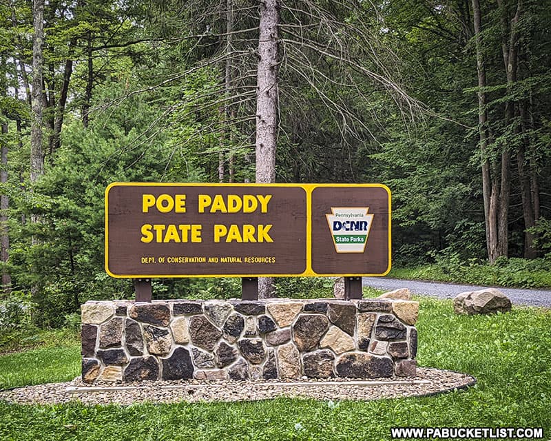
Poe Paddy State Park sits in a valley between Poe Mountain to the west and Paddy Mountain to the east, thus the name.
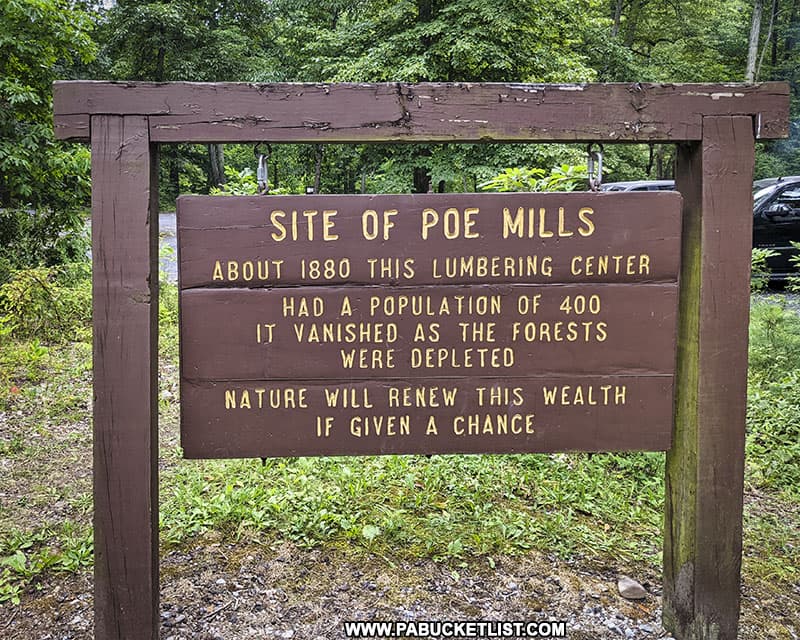
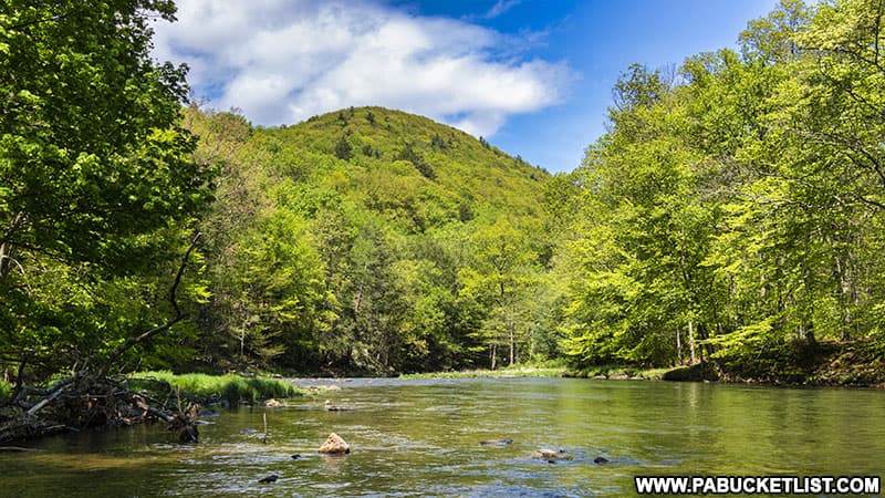
Poe Paddy State Park is situated at the confluence of Big Poe Creek and Penns Creek, and was the site of a lumbering boomtown in the 1880s-1890s.
As with nearby Poe Valley State Park, there are multiple ways to access Poe Paddy State Park, but ultimately all of them involve “No Winter Maintenance” state forest roads, so keep that in mind once the snow starts to fly.
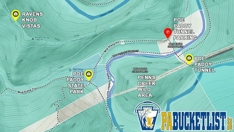
If navigating by GPS, use coordinates 40.83375, -77.41809 to navigate to the main parking area next to Big Poe Creek.

The Best Things to See and Do at Poe Paddy State Park
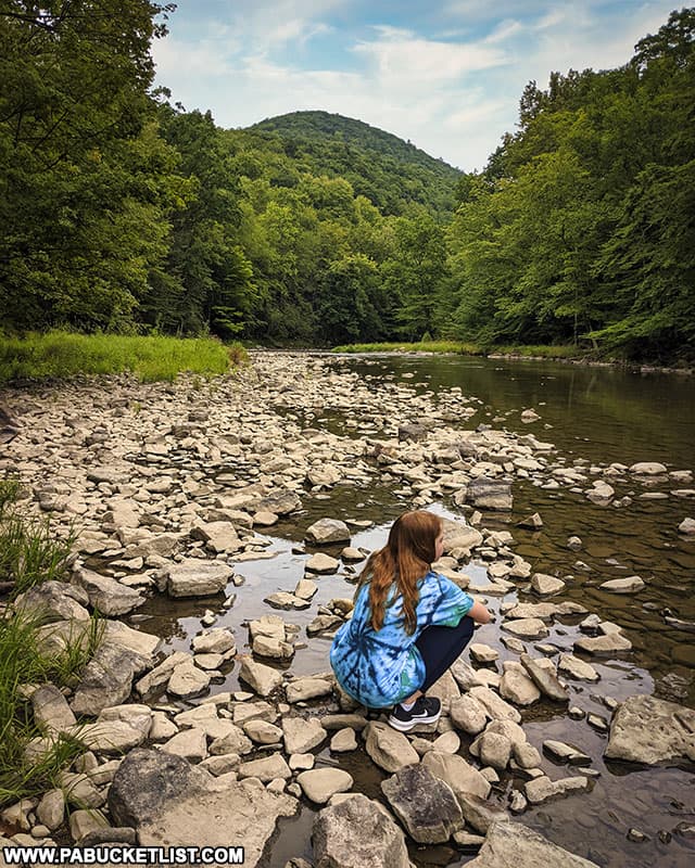
Most of the activities at Poe Paddy State Park and the adjacent Penns Creek Wild Area involve the waters of Big Poe Creek and Penns Creek.
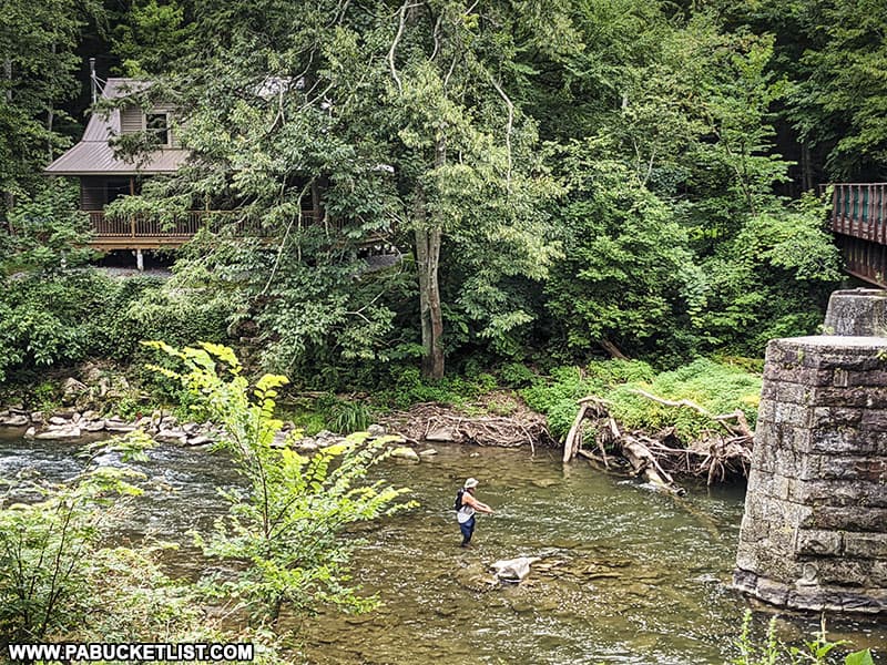
Fishing at Poe Paddy State Park
Perhaps the biggest draw to Poe Paddy State Park is fishing, as Penns Creek is a nationally-known wild trout stream.
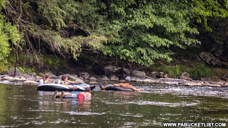
Tubing at Poe Paddy State Park
Tubing on Penns Creek is another popular pastime at Poe Paddy State Park in the summer months.
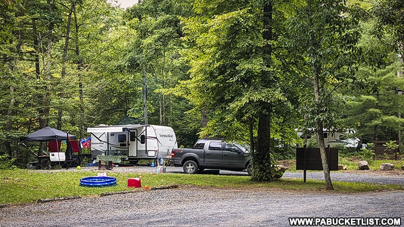
Camping at Poe Paddy State Park
Five small Adirondack-style lean-tos and 34 tent and trailer campsites are available at Poe Paddy State Park from from mid-April until mid-December.
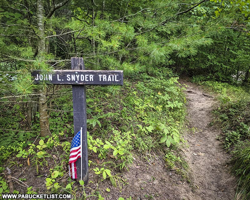
Hiking at Poe Paddy State Park
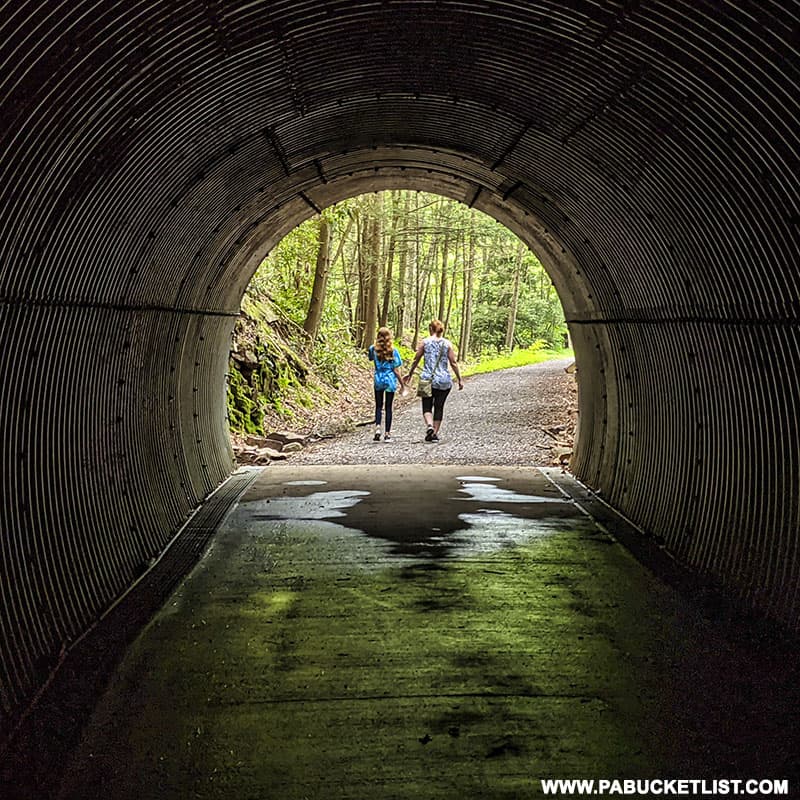
The John Snyder Trail along Penns Creek is a popular hiking trail at Poe Paddy State Park, and can be used to access Poe Paddy Tunnel.
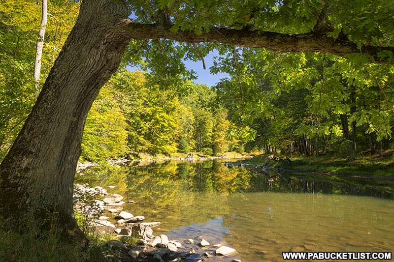
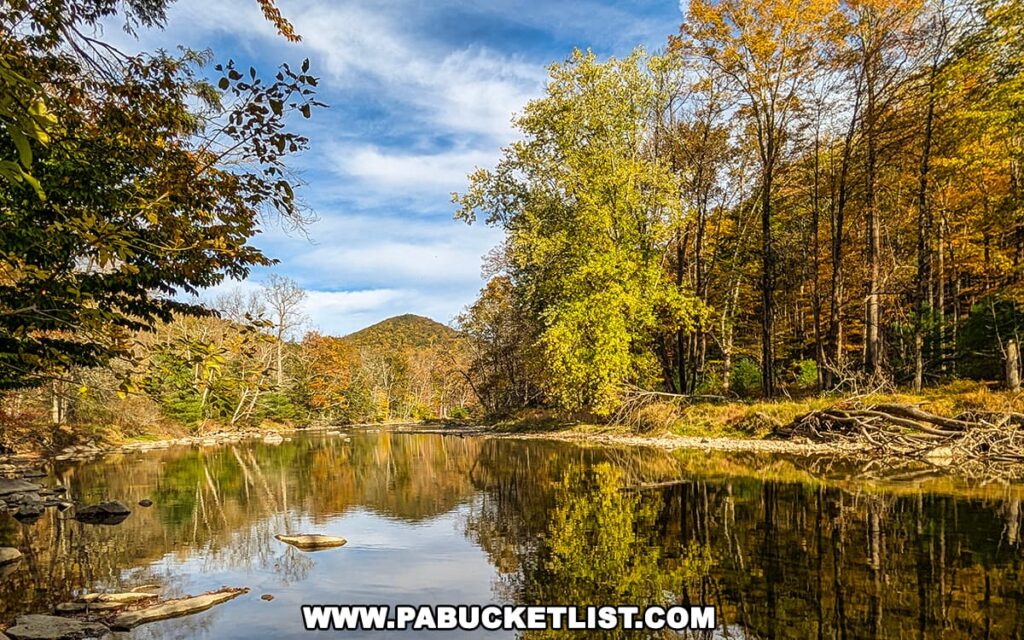
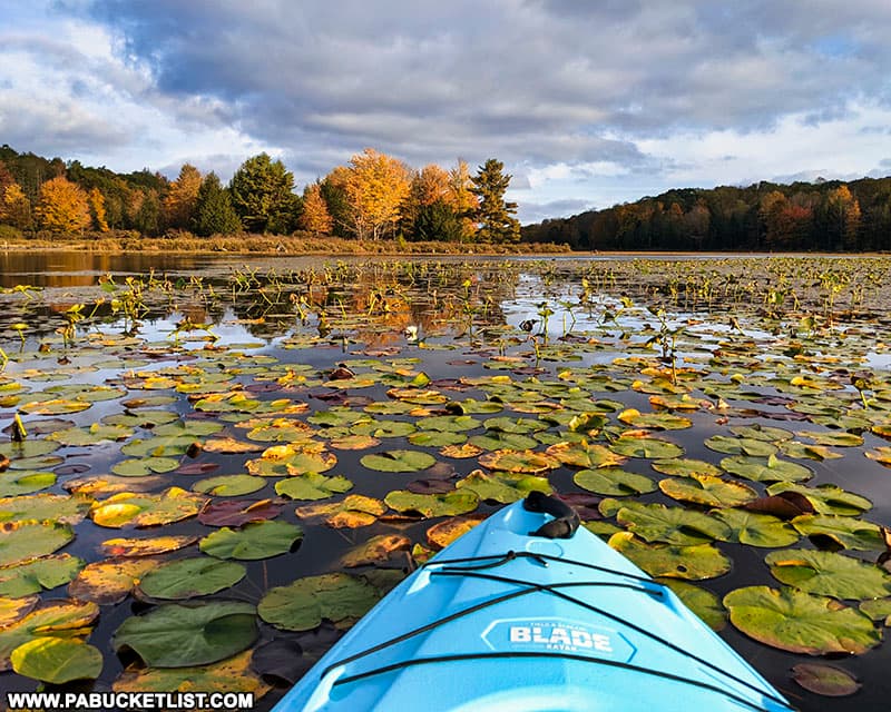
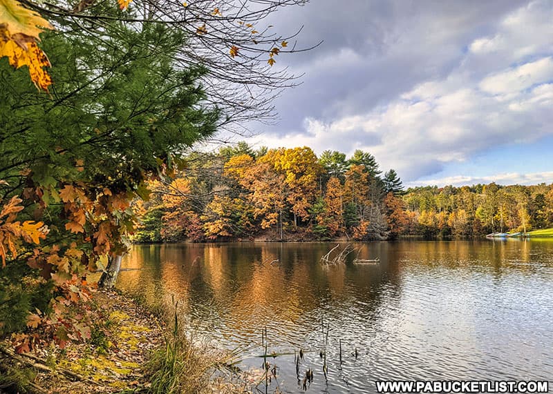
Fall Foliage at Poe Paddy State Park
Poe Paddy State Park offers some of the most serene fall foliage views in Centre County, with vibrant autumn colors mirrored perfectly in the calm waters of Penns Creek.
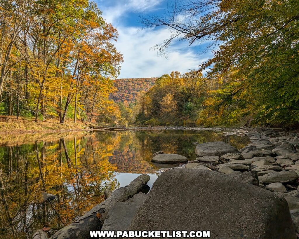
Visitors can enjoy these reflections from the rocky shoreline or while exploring the peaceful forest trails that follow the creek’s edge.
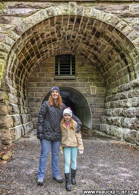
Exploring Poe Paddy Tunnel
Poe Paddy Tunnel was a railroad tunnel built in the late 1800s and abandoned in the 1970s.
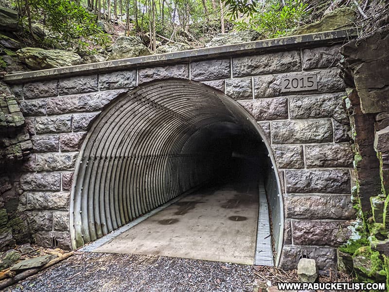
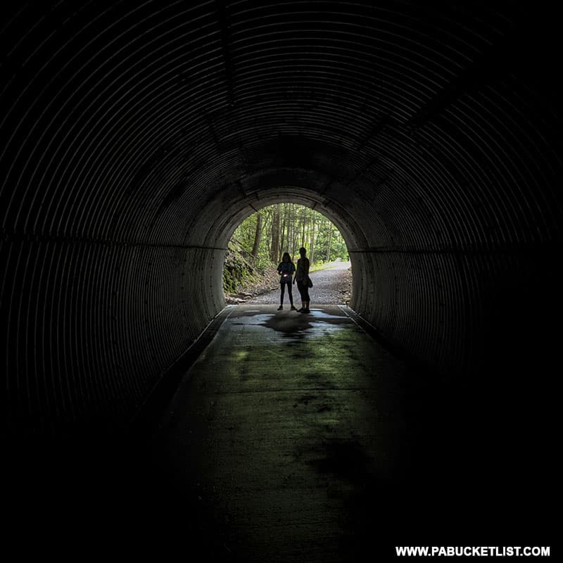
The tunnel was rehabilitated in 2015 for use as part of the Penns Creek Rail Trail.
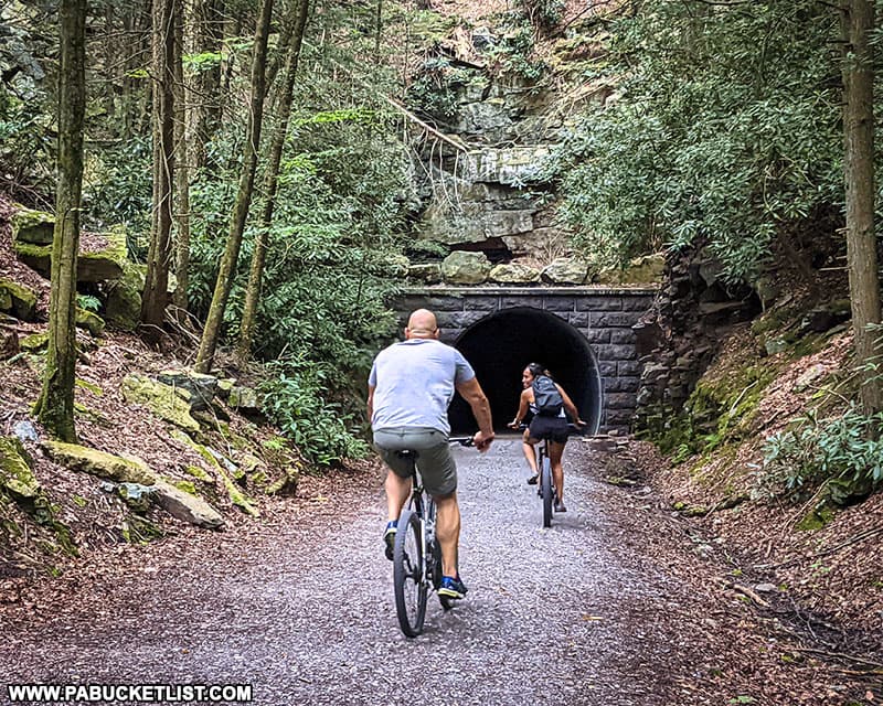
The tunnel is unlit, but has a smooth concrete floor and corrugated steel sides, so it illuminates well with even a cell phone light.
How to Find the Poe Paddy Tunnel
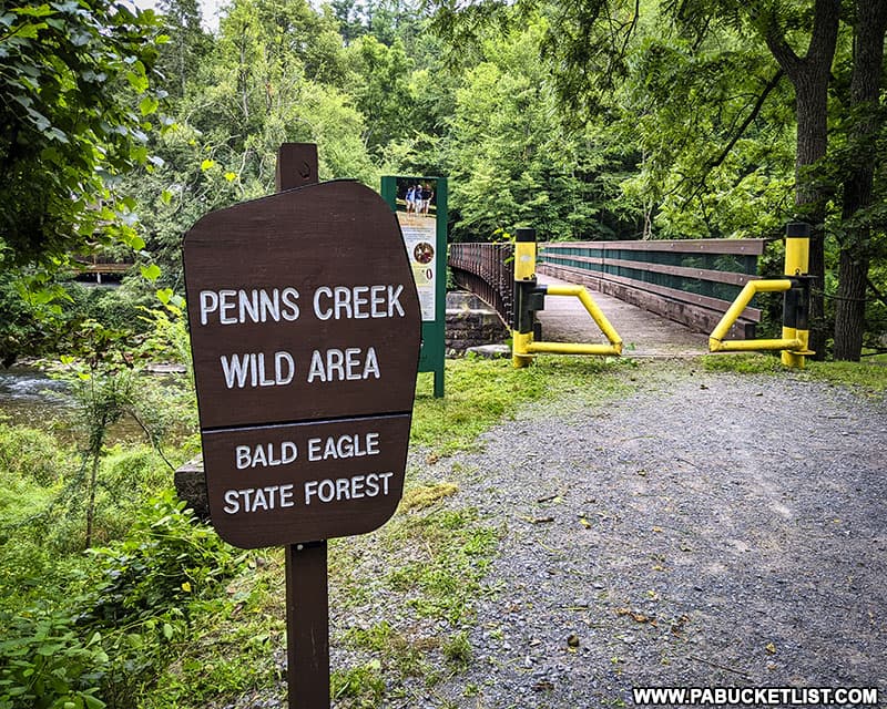
If you’d like to drive to the closest possible access point to Poe Paddy Tunnel, navigate to GPS coordinates 40.83732, -77.40927 and park in the obvious roadside pull off, near the sign below.
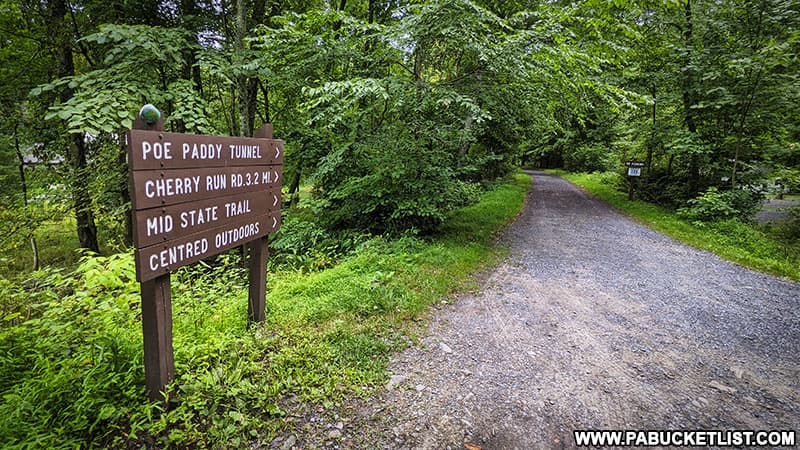
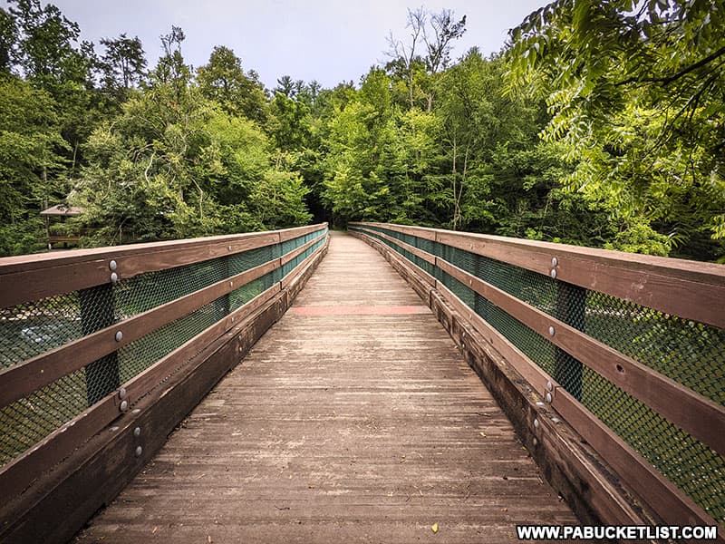
From the parking area you’ll cross a bridge over Penns Creek and arrive at Poe Paddy Tunnel approximately 330 yards from where you parked.
You’ll notice a grated entrance above the bike trail entrance at the southeastern portal – this upper portion of the Poe Paddy Tunnel is now preserved as a bat hibernaculum.
Final Thoughts on Poe Paddy State Park
At 23 acres, Poe Paddy is one of the smallest state parks in Pennsylvania.
But when you add in the nearby 6,000 acre Penns Creek Wild Area, 620 acre Poe Valley State Park, and the 194,000 acre Bald Eagle State Forest, suddenly you’re talking about an almost infinite number of recreational possibilities!
Poe Paddy State Park and Poe Paddy Tunnel are some of my favorite off-the-beaten-path spots in Centre County – be sure to check them out if you haven’t already!
Nearby Attractions
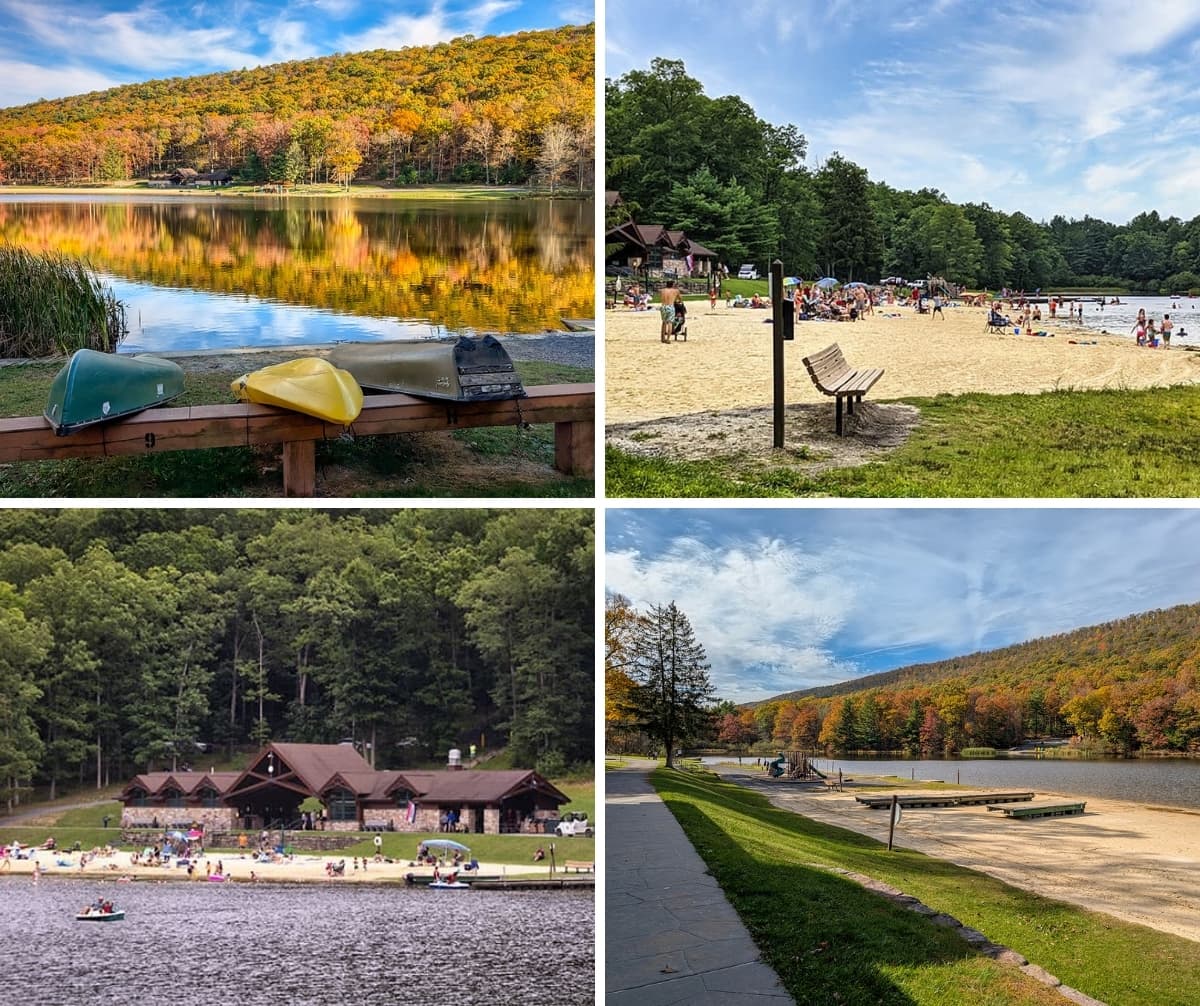
Poe Valley State Park sits 4 miles west of Poe Paddy State Park, with 25 acre Poe Lake at the heart of it all.
The 10 Best Scenic Overlooks in the Bald Eagle State Forest gives you a map and directions to 10 fantastic ROADSIDE scenic overlooks near Poe Paddy State Park that require no hiking whatsoever!

The 7 Best State Parks Near State College is a valuable guide whether you are a Penn State student, Centre County local, or simply a visitor seeking outdoor adventure in Happy Valley!
The 13 Best Scenic Overlooks in Centre County gives you maps and directions to some of the finest scenic vistas in Centre County.

Hobie’s Trail is a scenic and relatively easy to hike 2.6 mile trail that loops around the PA Fish and Boat Commission’s Colyer Lake in Centre County.
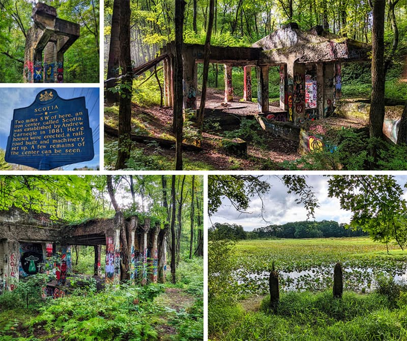
Exploring the Ghost Town of Scotia Near State College takes you inside the remains of a Centre County iron-mining boomtown gone bust.
Did you enjoy this article?
If so, be sure to like and follow PA Bucket List on Facebook, Instagram, and/or Pinterest to learn more about the best things to see and do in Pennsylvania!
Click on any of the icons below to get connected to PA Bucket List on social media.