
To most people Centre County is synonymous with one thing – Happy Valley!

But the thing about valleys is you have to have mountains on either side, and the mountains of Centre County are home to some amazing scenic overlooks!

So what I’m going to show you here are 13 of the best scenic overlooks in Centre County.
Some close to State College (we’ll start with those), some further away, but all well worth a visit.
Scenic Overlooks Near State College
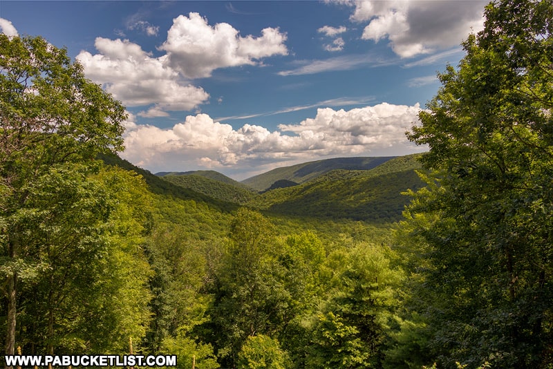
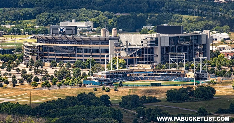
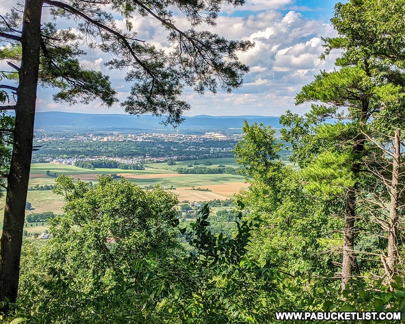
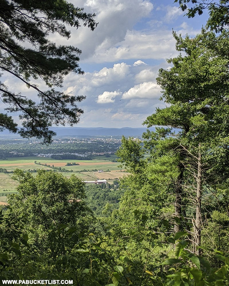
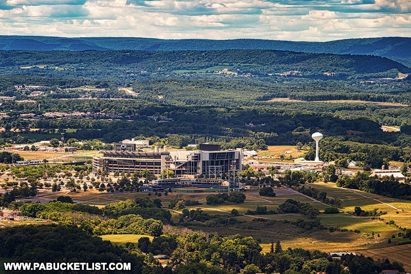
Mike Lynch Overlook on Mount Nittany
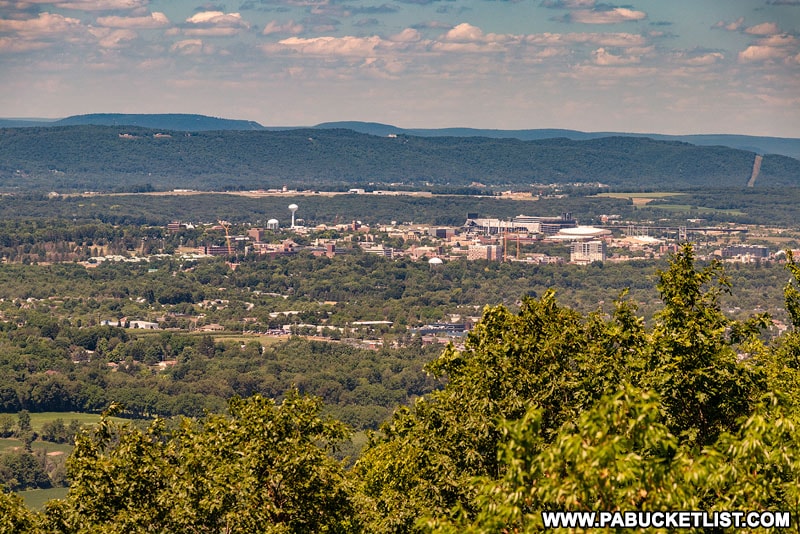
The Mike Lynch Overlook on Mount Nittany is arguably the most famous scenic overlook in Centre County.
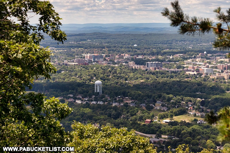
When most people say they are “hiking Mount Nittany”, what they mean is that they are hiking to the Mike Lynch Overlook, where you can take in the views of State College and Penn State University far below.
The Mike Lynch Overlook is accessed via a trail head in Lemont.
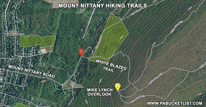
There is parking along Mount Nittany Road at the base of the mountain at GPS coordinates 40.81146, -77.80702.
Jo Hays Vista
Jo Hays Vista is the easiest scenic overlook to get to near State College.
Jo Hays Vista is literally roadside along Route 26 near Pine Grove Mills.
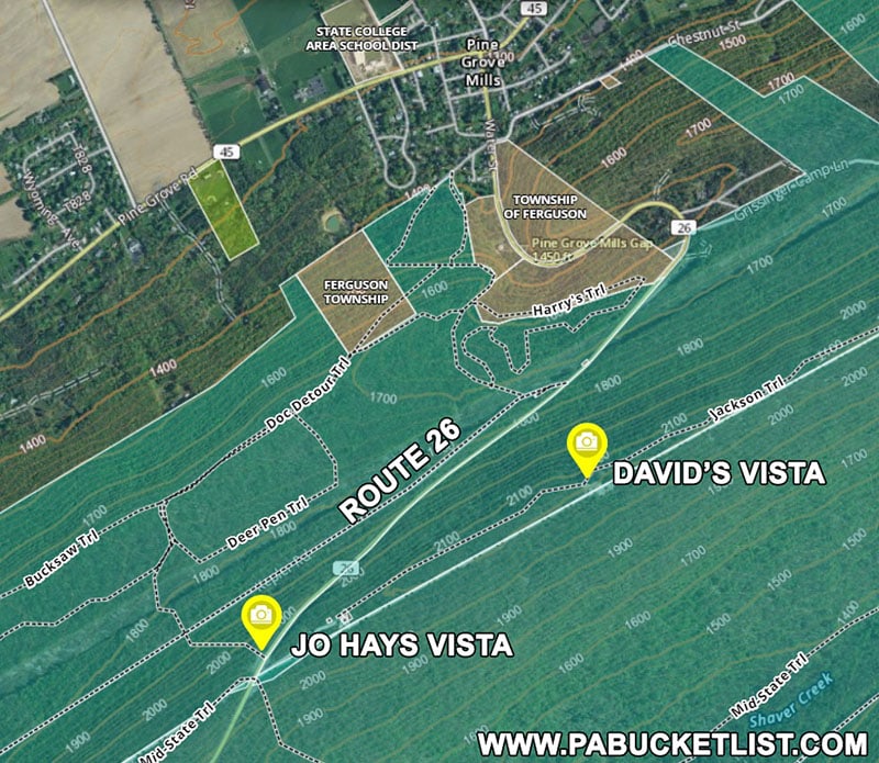
David’s Vista
David’s Vista is accessed via the same parking lot as Jo Hays vista, albeit in the opposite direction along the Jackson Trail.
The 180 degree views at David’s Vista are outstanding!
The GPS coordinates for David’s Vista are 40.72172, -77.88182.
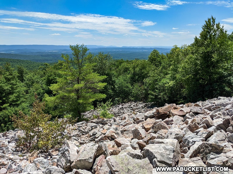
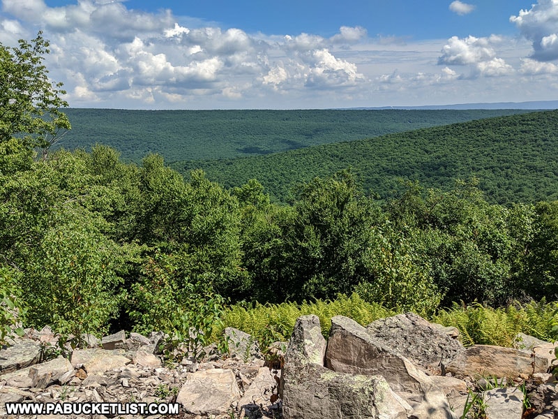
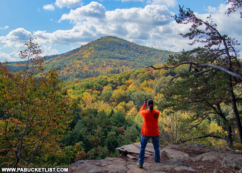
Hubler Gap Vista
Hubler Gap Vista near State College offers exceptional views of the Rothrock State Forest.
Hubler Gap Vista requires a 1.5 mile hike with 900 feet of elevation gain over the course of the hike along the Musser Gap Trail.
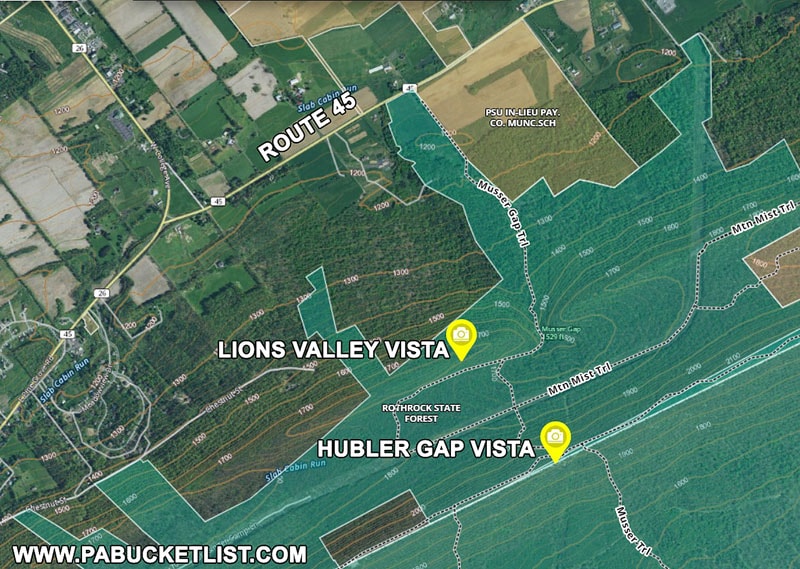
Trailhead parking can be found just off of Route 45 at GPS coordinates 40.75476, -77.85309.
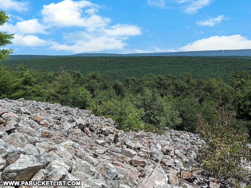
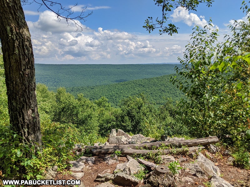
Lion’s Valley Vista
A terrific side destination on the return hike from Hubler Gap Vista is Lion’s Valley Vista, just off the Musser Gap Trail at GPS coordinates 40.74142, -77.84998.
The view from Lion’s Valley Vista is of the farmland of Ferguson Township in the foreground, and the ever-expanding State College and Penn State in the background.
Scenic Overlooks in Northern Centre County
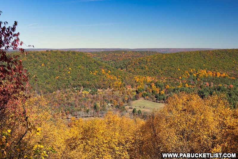
Fields Ridge Road Overlook
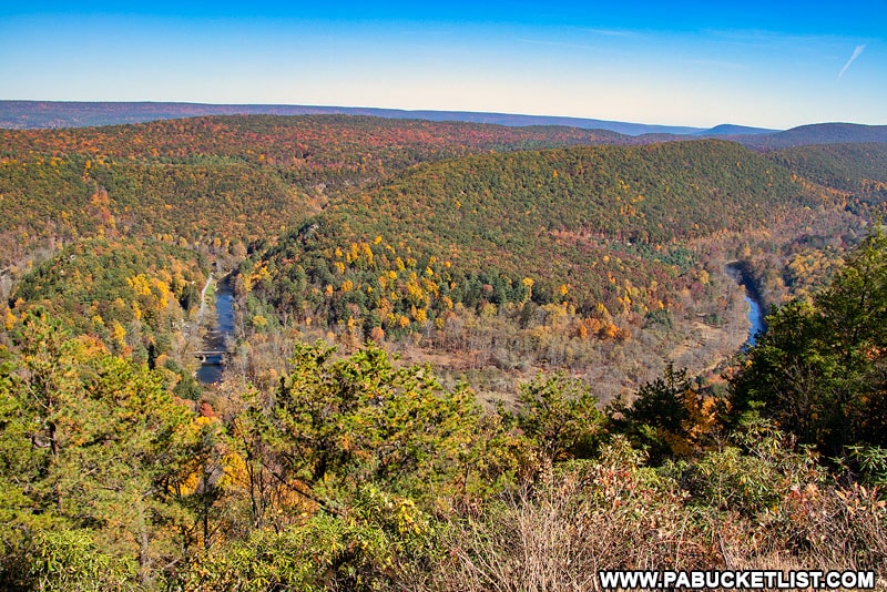
Fields Ridge Road Overlook is an impressive roadside vista offering a commanding view of the West Branch of the Susquehanna River as it passes through the Sproul State Forest in northern Centre County.
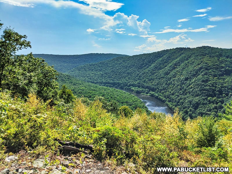
Located at the end of Fields Ridge Road, use GPS coordinates 41.20921, -77.95906 to navigate to this scenic view at the end of a 5 mile-long and relatively smooth state forest road.
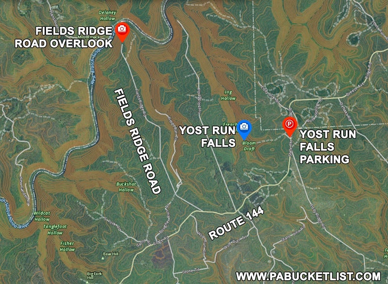
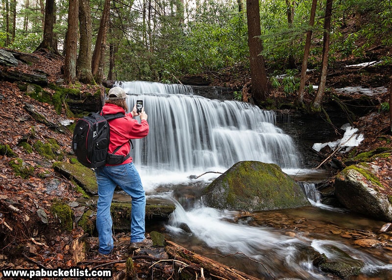
Fields Ridge Road Overlook is close to Yost Run Falls, arguably the best waterfall hike in Centre County.
Scenic Overlooks in Southern Centre County
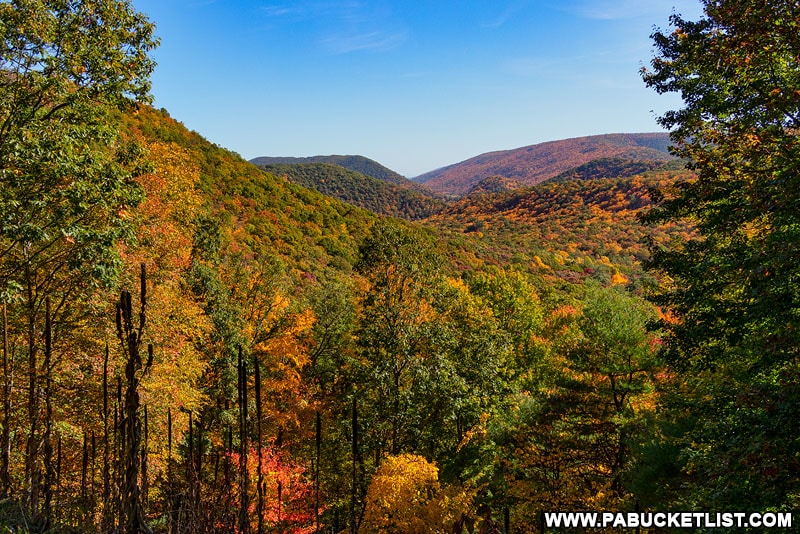
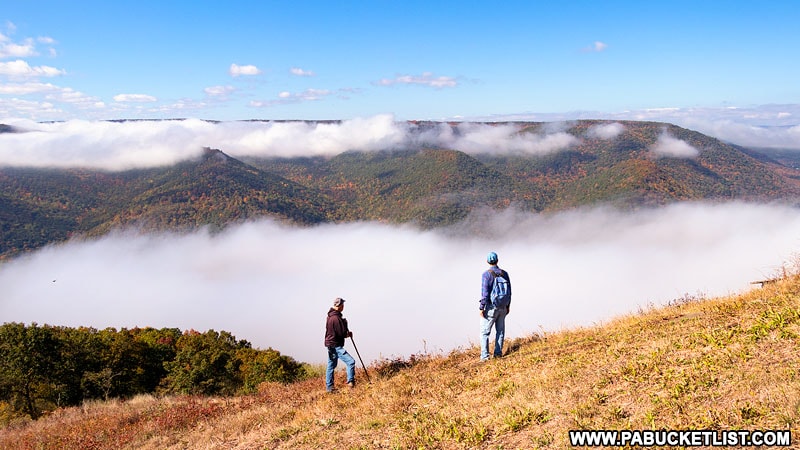
Bear Meadows Overlook
Bear Meadows Overlook is actually a series of overlooks along the Mid State Trail in the Rothrock State Forest.
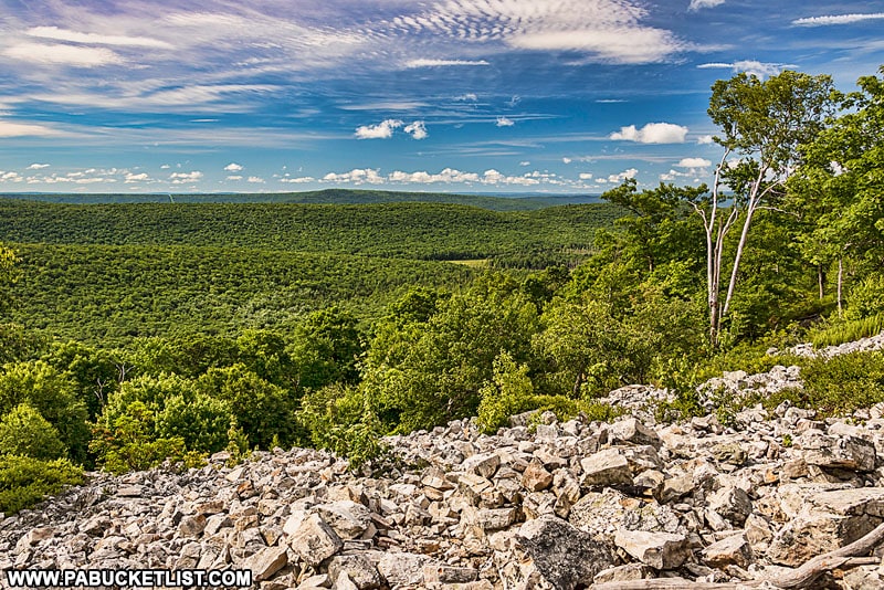
Use GPS coordinates 40.75240, -77.75578 to navigate to the parking area along Little Flat Tower Road, then follow the Mid State Trail approximately 500 yards to the first of several views out over Bear Meadows.
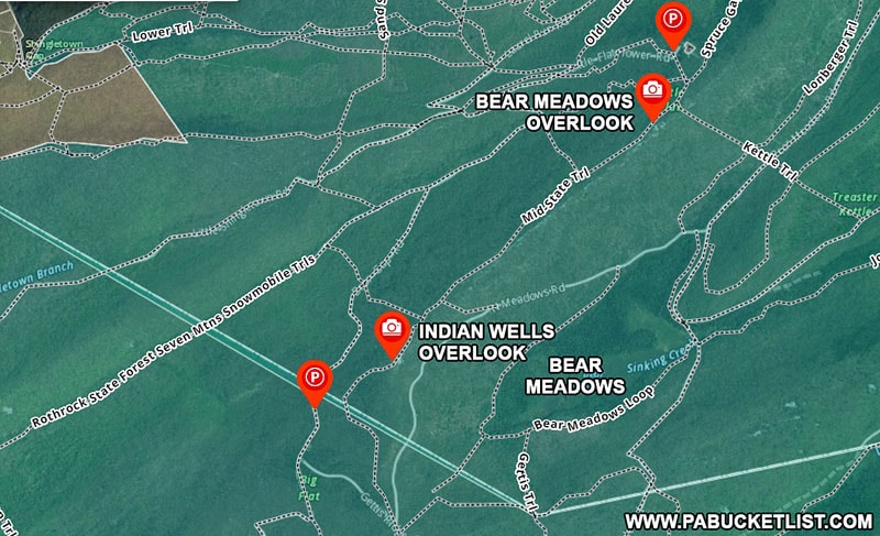
Each overlook offers a slightly different view of the Bear Meadows Natural Area below, a bog formed at the end of the last glacial period and a National Natural Landmark.
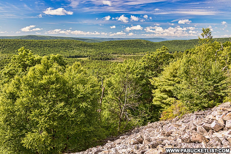
Indian Wells Overlook
Indian Wells Overlook is located roughly 1.5 miles southwest of the Bear Meadows Overlooks along the Mid State Trail.

Certainly you can hike to Indian Wells Overlook from the same parking area you used for the Bear Meadows Overlooks, or you can park along Bear Gap Road at GPS coordinates 40.72674, -77.78964 and hike directly to Indian Wells Overlook if you’re looking for a quick out-and-back hike.
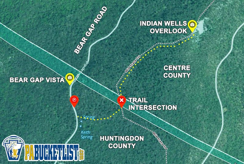
Indian Wells Overlook is located along the Mid State Trail at GPS coordinates 40.73023, -77.78235.
Scenic Overlooks in Eastern Centre County
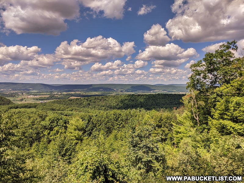
Bells Majestic View
Bells Majestic View lives up to its name!
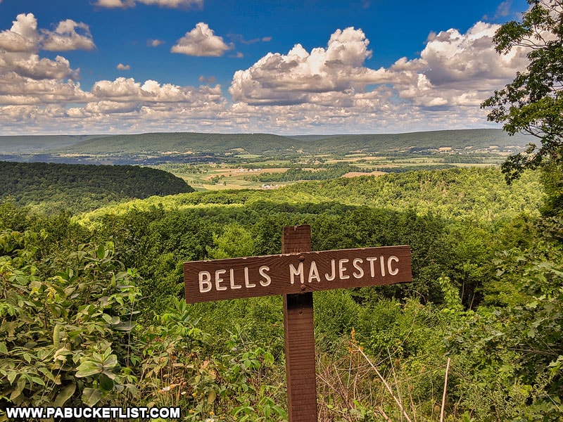
This roadside attraction in the Bald Eagle State Forest can be found at GPS coordinates 40.82967, -77.50880.
Bells Majestic View is particularly “majestic” in the fall.
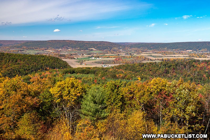
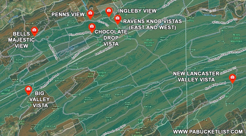
Penns View
Penns View offers a remarkable roadside view of Penns Creek and the village of Coburn along its banks.
Penns View is located along Poe Paddy Drive at GPS coordinates 40.84247, -77.45271.
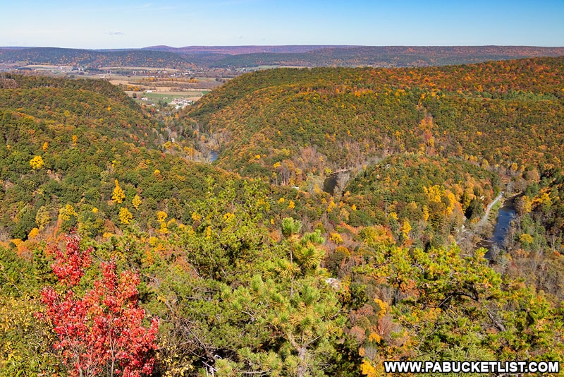
Ingleby View
Ingleby View is located along Poe Paddy Drive, just minutes from Penns View, at GPS coordinates 40.84435, -77.43404.
Chocolate Drop Vista
Chocolate Drop Vista is located along Pine Swamp Road in the Bald Eagle State Forest.
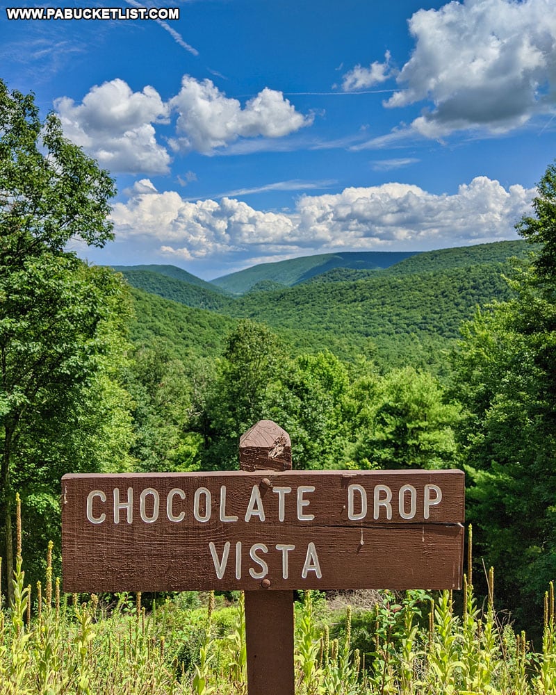
This roadside overlook is located at GPS coordinates 40.83228, -77.45111, not far from Poe Valley State Park.
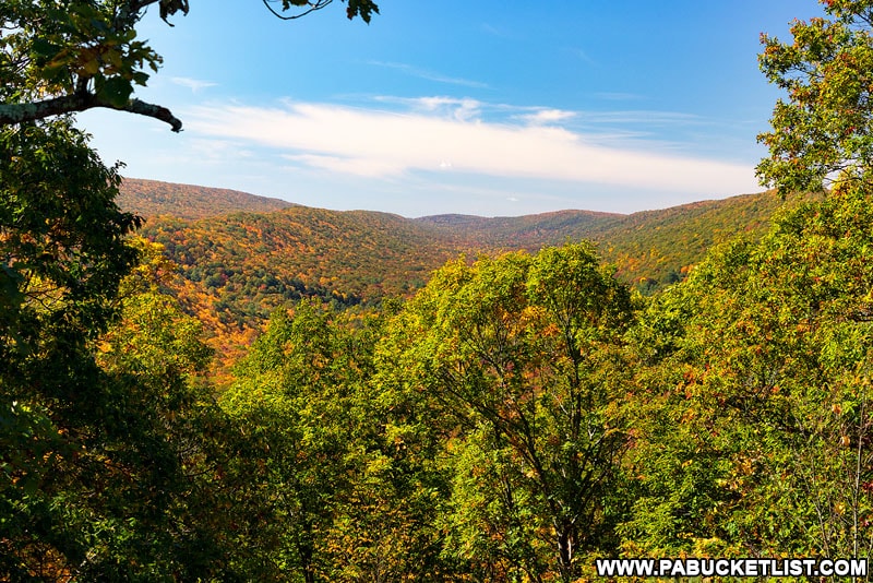
Ravens Knob Vistas
Ravens Knob Vistas is really two vistas in one.
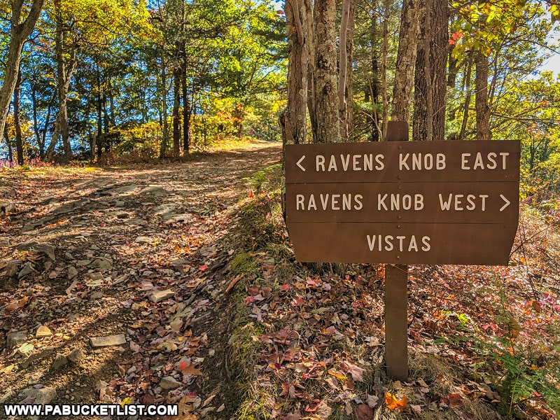
To the east the view is in the direction of Penns Creek and Sawmill Knob.
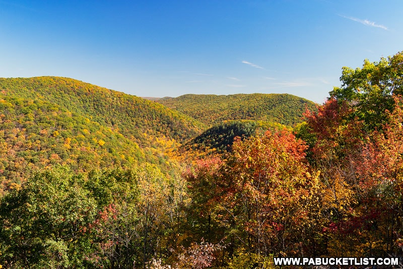
To the west, the view is of the Big Poe Creek Valley.
So there you have it – 13 of the best scenic overlooks in Centre County!
And while this list is by no means all-inclusive, it gives you a solid overview of some of the sights that await you when you begin to explore the scenic overlooks of Centre County.
Related Articles
If scenic overlooks are your passion, be sure to check out 50 of the Best Scenic Overlooks in PA for directions to the finest views in all of Pennsylvania!
Nearby Attractions
“The 5 Best State Parks Near State College” will introduce you to a number of excellent state parks in Centre County.

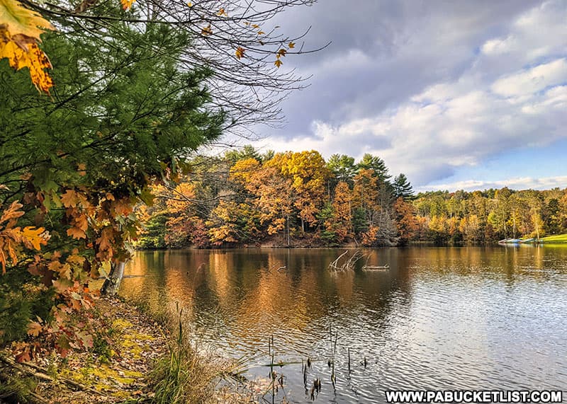
Hiking the Colyer Lake Trail Near State College shows you what to expect from this beautiful 2.6 mile lakeside-loop trail just minutes from downtown State College and Penn State.
“The 12 Best Scenic Overlooks in Huntingdon County” will introduce you to a dozen impressive vistas in neighboring Huntingdon County.
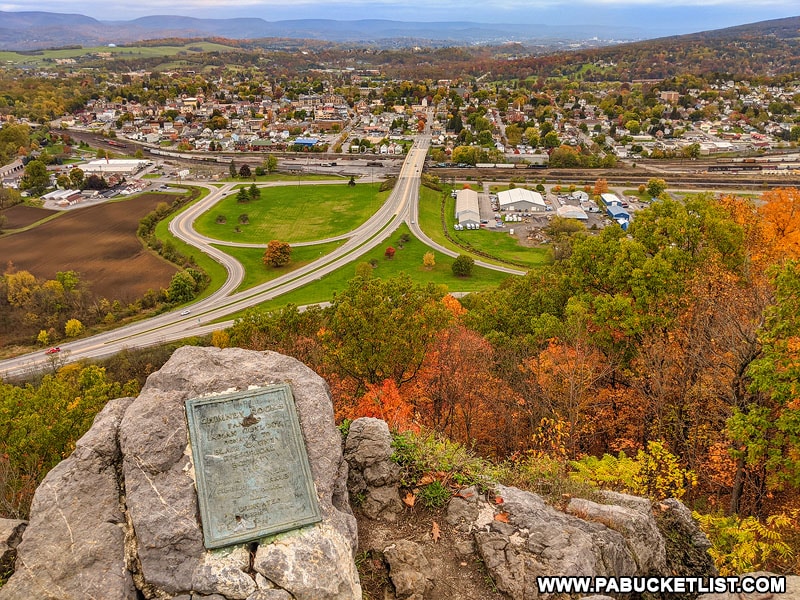
Chimney Rocks Park offers a trio of great scenic overlooks in neighboring Blair County.
Did you enjoy this article?
If so, be sure to like and follow PA Bucket List on Facebook, Instagram, and/or Pinterest to stay up-to-date on my latest write-ups.
Click on any of the icons below to get connected to PA Bucket List on social media!