Exploring Indian Wells Overlook in Centre County

A panoramic view of Indian Wells Overlook along the Mid State Trail in the Rothrock State Forest.

Indian Wells Overlook is an exceptional scenic vista located right along the Mid State Trail near the Centre-Huntingdon county line.

Indian Wells Overlook in Centre County.

So if you’re already thru-hiking the Mid State Trail, you’re literally going to follow the orange blazes right to and through Indian Wells.

The orange-blazed Mid State Trail at Indian Wells Overlook.
The orange-blazed Mid State Trail pases through Indian Wells Overlook.

But if you’re simply looking to visit Indian Wells Overlook as a quick out-and-back hike, then I’ve got the map, directions, and GPS coordinates you need to make that happen!

Indian Wells Overlook along the Mid State Trail in Centre County
Fall foliage views for miles.

How to Find Indian Wells Overlook in the Rothrock State Forest

The hike I’m going to describe here is roughly 0.5 miles one-way to reach Indian Wells Overlook, from a parking area along Bear Gap Road in the Rothrock State Forest.

A map to Indian Wells Overlook along the MId State Trail in the Rothrock State Forest.
How to find Indian Wells Overlook along the Mid State Trail in the Rothrock State Forest.

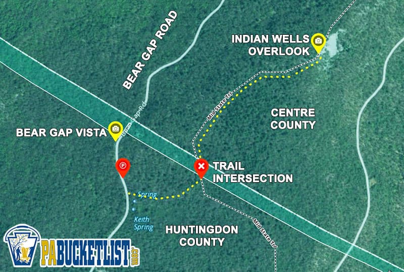
The parking area for the Indian Wells hike is located roadside at GPS coordinates 40.72674, -77.78964.
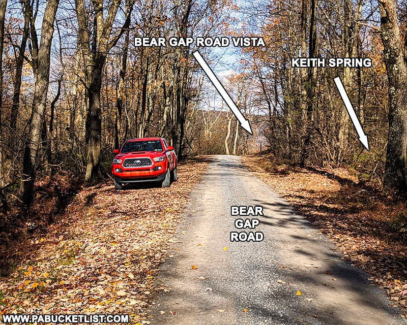
The parking area for Indian Wells Overlook along Bear Gap Road in the Rothrock State Forest.
The parking area for Indian Wells Overlook hike along Bear Gap Road in the Rothrock State Forest.

Bear Gap Vista

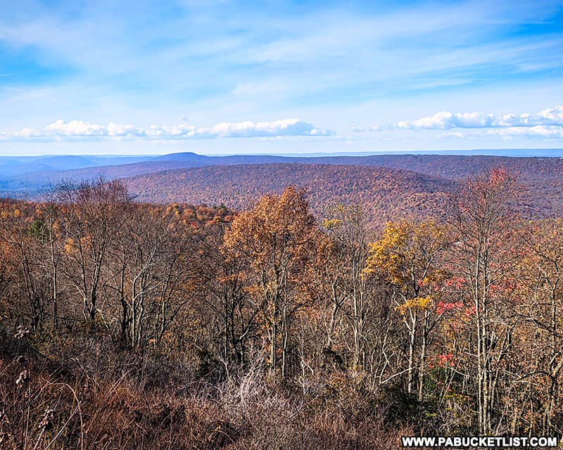
Just to the north of the parking area is Bear Gap Vista (GPS coordinates 40.72780, -77.78994).

Bear Gap Road Vista in the Rothrock State Forest, Huntingdon County, PA.
Bear Gap Vista in the Rothrock State Forest, Huntingdon County, PA.

Bear Gap Vista offers you a wide-open western view of the Rothrock State Forest in Huntingdon County.
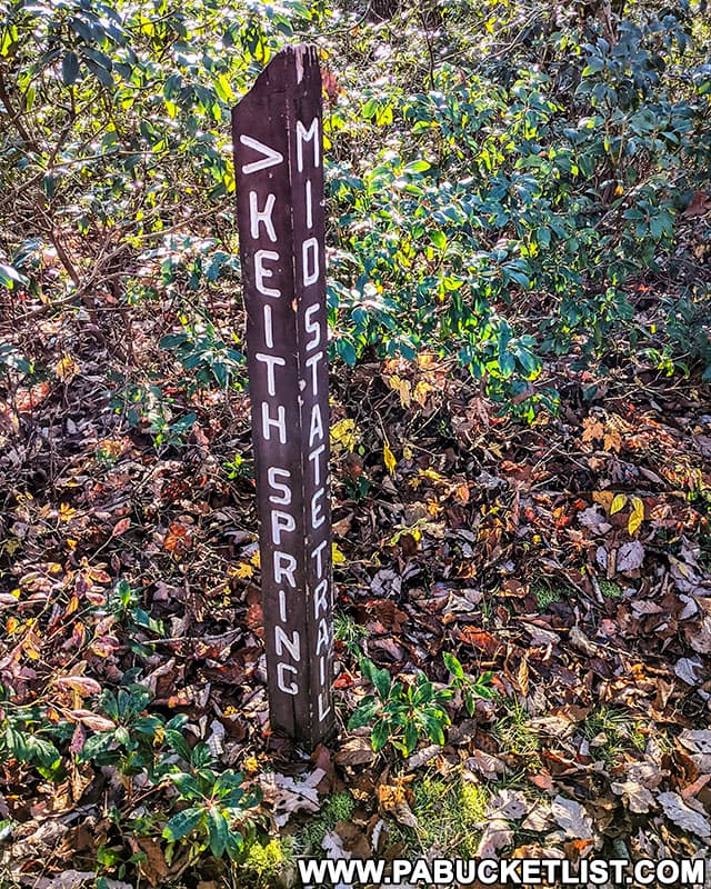
Bear Gap Road Vista in Huntingdon County, Pennsylvania.
Bear Gap Vista in Huntingdon County, Pennsylvania.

Keith Spring

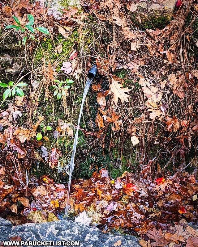
Just to the south of the parking area, marking the trailhead for this hike, is Keith Spring.

Keith Spring along Bear Gap Road in the Rothrock State Forest.

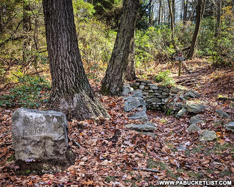
Keith Spring is a freshwater spring that is now a piped for modern convenience and sanitary purposes, but the old stone cistern is still there and the Keth Spring Trail starts right behind it.

The roadside pipe from Keith Spring in the Rothrock State Forest.

Hiking to Indian Wells Overlook

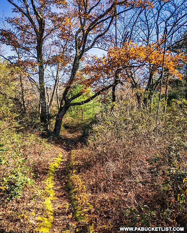
From the trailhead at Keith Spring, follow the obvious path approximately 300 yards to an intersection with the Mid State Trail, at GPS coordinates 40.72675, -77.78660.

The intersection of Keith Spring Trail and the Mid State Trail in the Rothrock State Forest.

From this intersection, turn left and follow the Mid State Trail approximately 0.3 miles.

The Mid State Trail approaching Indian Wells Overlook in the Rothrock State Forest.

Just before you get to Indian Wells, you’ll reach a large campsite.

Campsite along the Mid State Trail near Indian Wells Overlook in Centre County.

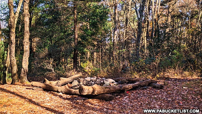
The trail bears right at the campsite at proceeds slightly uphill to the overlook.

The Mid State Trail near Indian Wells Overlook in the Rothrock State Forest.

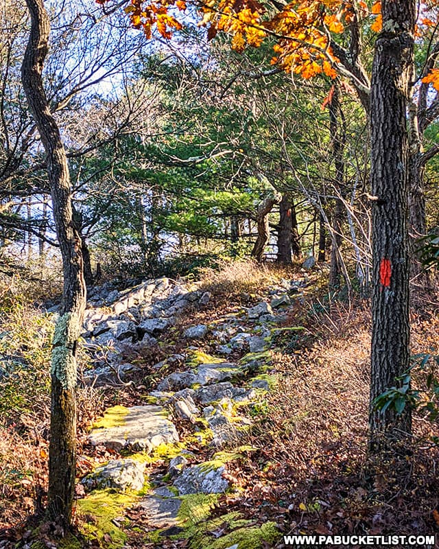
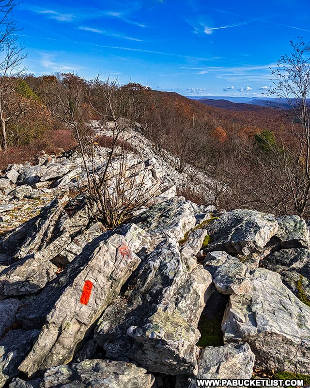
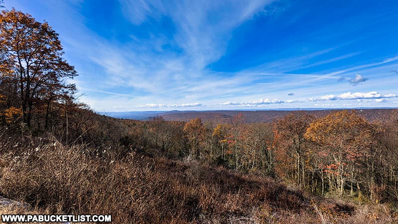
You’ll find the southwestern edge of Indian Wells Overlook at GPS coordinates 40.73030, -77.78223.

Indian Wells Overlook in Centre County, PA on a November morning.

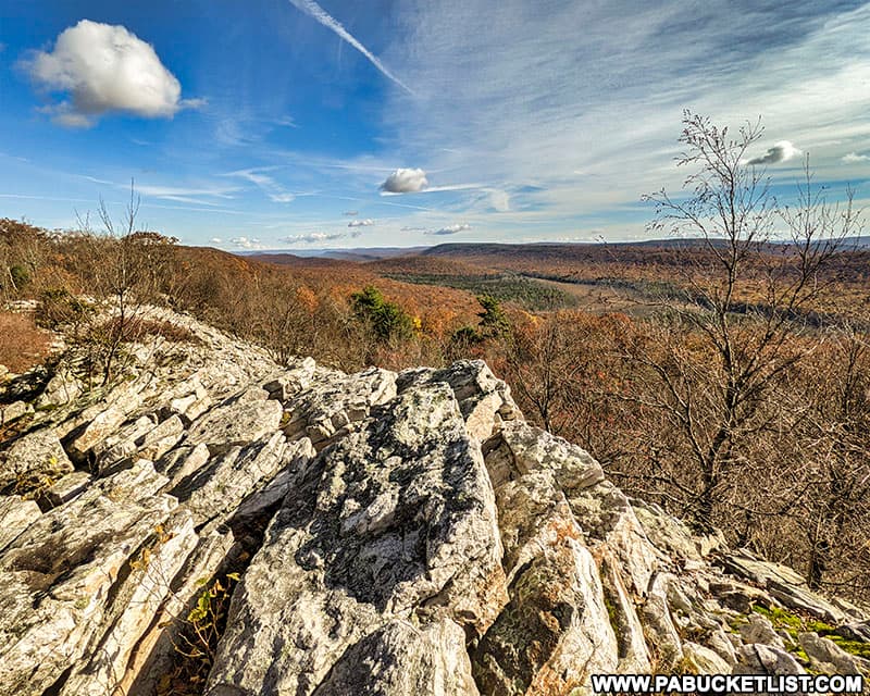
The overlook itself is nearly 130 yards wide.

Indian Wells Overlook along the Mid State Trail in Centre County, Pennsylvania.

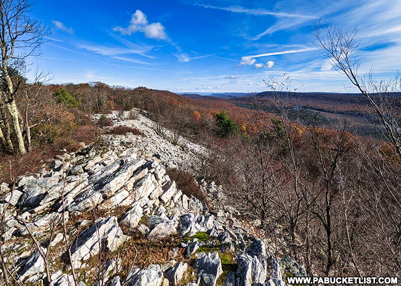
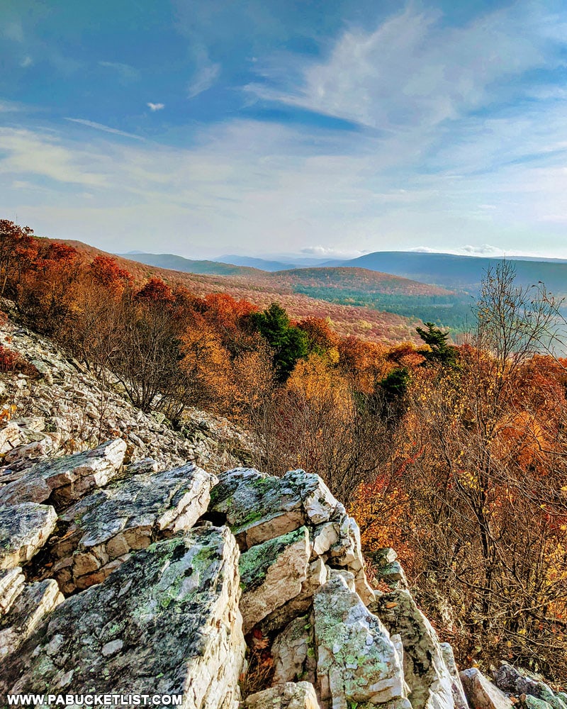
Indian Wells is perched high above Bear Meadows Natural Area, an 890 acre parcel of forest surrounding a fen wetland that is classified as a National Natural Landmark.

Looking out over Bear Meadows from Indian Wells Overlook in the Rothrock State Forest.
Looking out over Bear Meadows Natural Area from Indian Wells Overlook in the Rothrock State Forest.

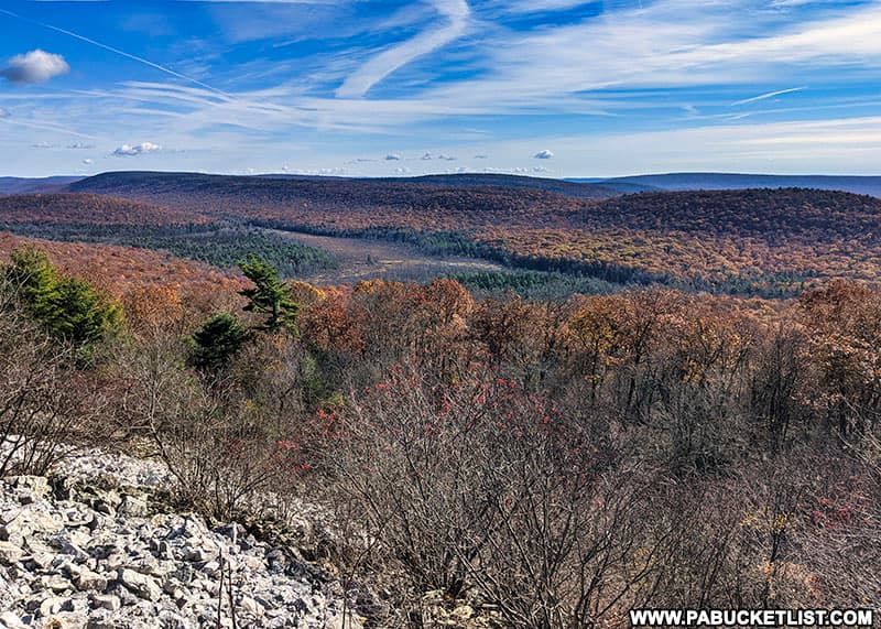
The views from Indian Wells in October are some of the finest in Centre County.

Rusty Glessner at Indian Wells Overlook in Centre County Pennsylvania
The author at Indian Wells Overlook in October.

Nearby Attractions

Just to the south of Indian Wells, near the intersection of Bear Meadows Road and Wampler Road, you’ll find Wampler Road Vista.

Directions to Wampler Road Vista in Huntingdon County Pennsylvania
Other scenic overlooks near Indian Well.

You can read more about how to find this vista in my write up The 13 Best Scenic Overlooks in Huntingdon County.

Wampler Road Vista in Huntingdon County Pennsylvania
Wampler Road Vista in Huntingdon County, Pennsylvania.

Just to the north of Indian Wells, also along the Mid State Trail, you’ll find several additional Bear Meadows Overlooks.

Bear Meadows Overlook along the Mid State Trail in Centre County
Bear Meadows Overlook along the Mid State Trail in Centre County.

You can read more about how to find these vistas in my article The 13 Best Scenic Overlooks in Centre County.

Bear Meadows Overlook in Centre County Pennsylvania
One of several Bear Meadows Overlooks along the Mid State Trail in Centre County, Pennsylvania.

Whipple Dam State Park is a 256 acre recreational area in Huntingdon County, 12 miles south of State College.

Sunrise at Whipple Dam State Park.

Greenwood Furnace State Park is a 423 acre recreational paradise in the mountains of Huntingdon County.

A winter view of the spillway on Greenwood Lake at Greenwood Furnace State Park.

The Alan Seeger Trail is a short but beautiful loop hike through the Alan Seeger Natural Area in the Rothrock State Forest.

Long shadows along the Alan Seeger Trail in Huntingdon County Pennsylvania.
Long shadows along the Alan Seeger Trail in Huntingdon County.

Shaver’s Creek Environmental Center in Huntingdon County is a Penn State-owned wildlife center, with the aviary there being the big draw.

The Aviary at Shaver's Creek Environmental Center in Huntingdon County, PA.
The Aviary at Shaver’s Creek Environmental Center in Huntingdon County.

Here you’ll find many of Pennsylvania’s birds of prey, including some magnificent bald eagles.

A bald eagle at Shaver's Creek in Huntingdon County.
A bald eagle at Shaver’s Creek in Huntingdon County.

If you’re looking for additional scenic overlooks across the Keystone State, check out 65 of the Best Scenic Overlooks in PA.

Hikers taking on the view at Hyner Run State Park.

Did you enjoy this article?

If so, be sure to like and follow PA Bucket List on Facebook, Instagram, and/or Pinterest to learn more about the best things to see and do in Pennsylvania!

Click on any of the icons below to get connected to PA Bucket List on social media.


PA Bucket List 2022 Sasquatch Logo

Pennsylvania’s Best Travel Blog!

Rusty Glessner
Rusty Glessner is a professional photographer, lifelong Pennsylvanian, and a frequently-cited authority on PA's best travel destinations.