
If you’re looking for information about exploring the Abandoned Pennsylvania Turnpike, you’re in the right place!
Officially known as “The Old PA Pike Trail” (or TOPP Trail), no trail in the Keystone State delivers post-apocalyptic vibes quite like the Abandoned Pennsylvania Turnpike.
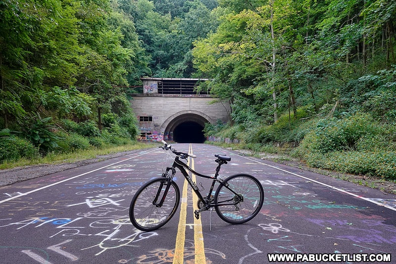
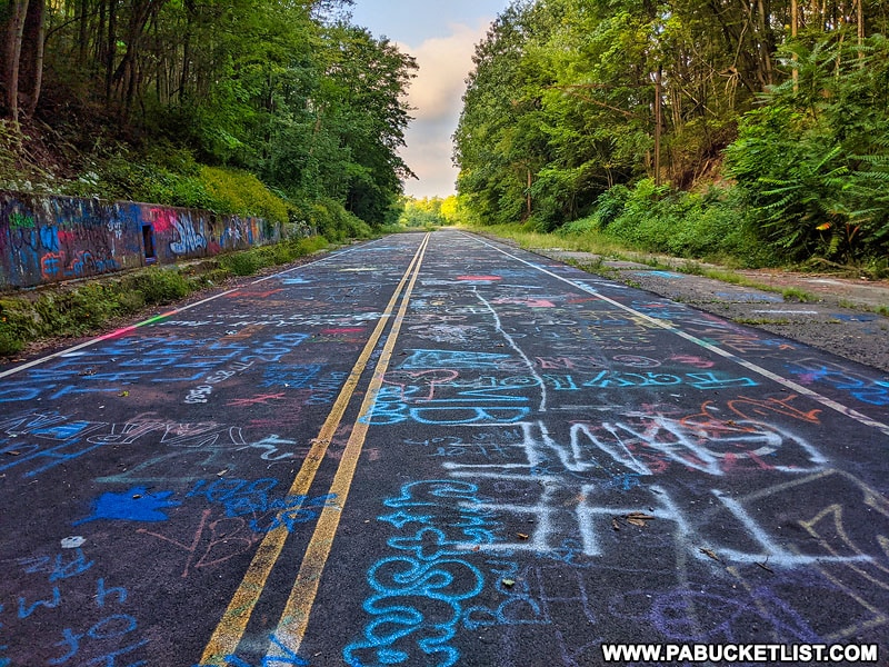
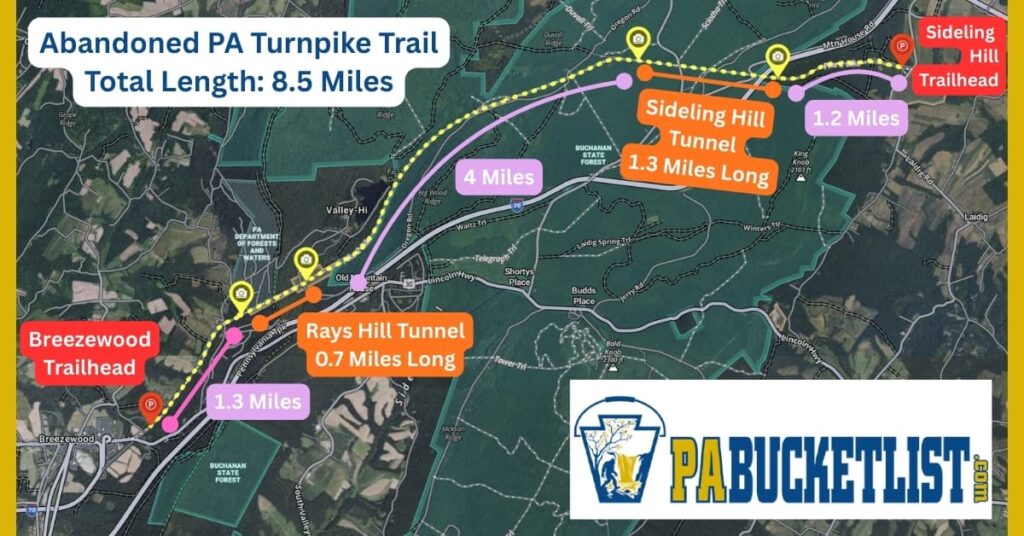
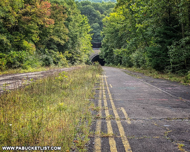
Eight and a half miles of abandoned superhighway, last open to normal vehicle traffic in 1968.
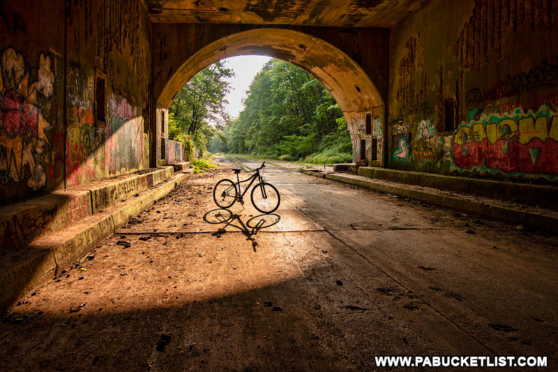
Two eerily dark tunnels along the route, one more than a mile long.
Relics of the nation’s first superhighway, now a hauntingly desolate hiking and biking trail in Bedford and Fulton counties.
If all of this sounds appealing to you, follow along as I explain exactly how to find the Abandoned Pennsylvania Turnpike, and what awaits you when you arrive!
Legal Disclaimer
This property is not maintained or monitored for safety conditions, and therefore this is strictly a VISIT AT YOUR OWN RISK DESTINATION!
By voluntarily exploring this location, YOU assume the risk of any personal injury or damage to personal property, and shall not hold the author liable for any injuries, loss, or damages that may occur while visiting this location.
Directions to the Abandoned PA Turnpike
There are two main trailheads for the Abandoned PA Turnpike – one is just outside of Breezewood in Bedford County, while the other sits near Sideling Hill in Fulton County.
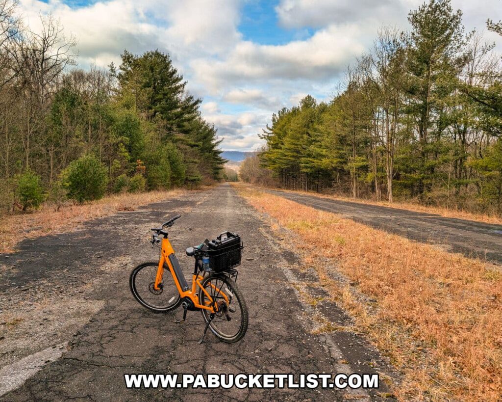
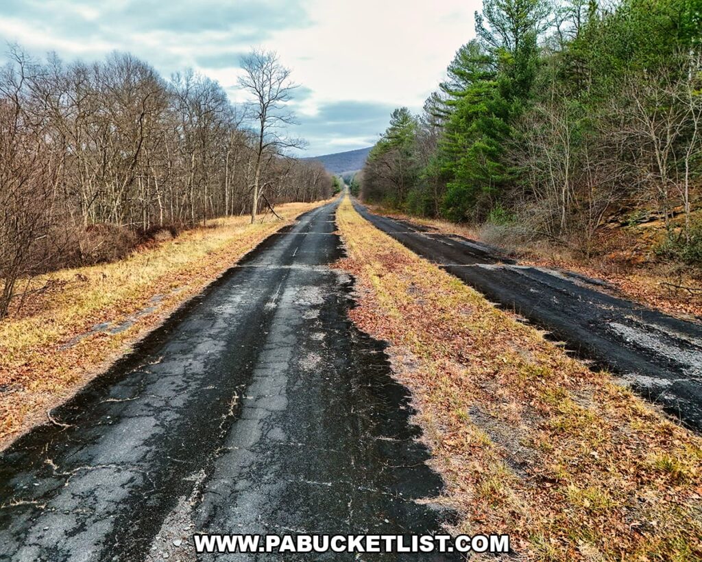
Stretching 8.5 miles, the trail forms a near mirror image from either end, featuring a tunnel roughly a mile in at both trailheads and a four-mile span of flat forested highway between them (see segment map below.)
Directions to the Breezewood Trailhead
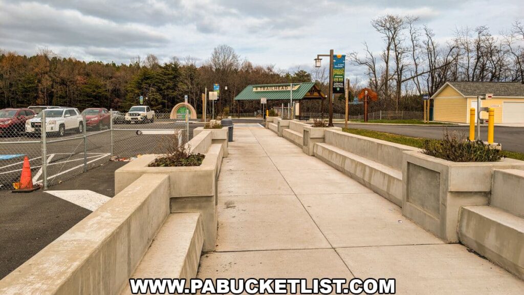
The Breezewood trailhead and parking area is located near the intersection of Route 30 and Tannery Road, at GPS coordinates 40.00154, -78.22511.
If you’ve been visiting the Abandoned PA Turnpike as long as I have, you probably remember when the only parking option was a small dirt lot off Route 30 that held just a few dozen cars (shown as Old Parking Area on the map below.)
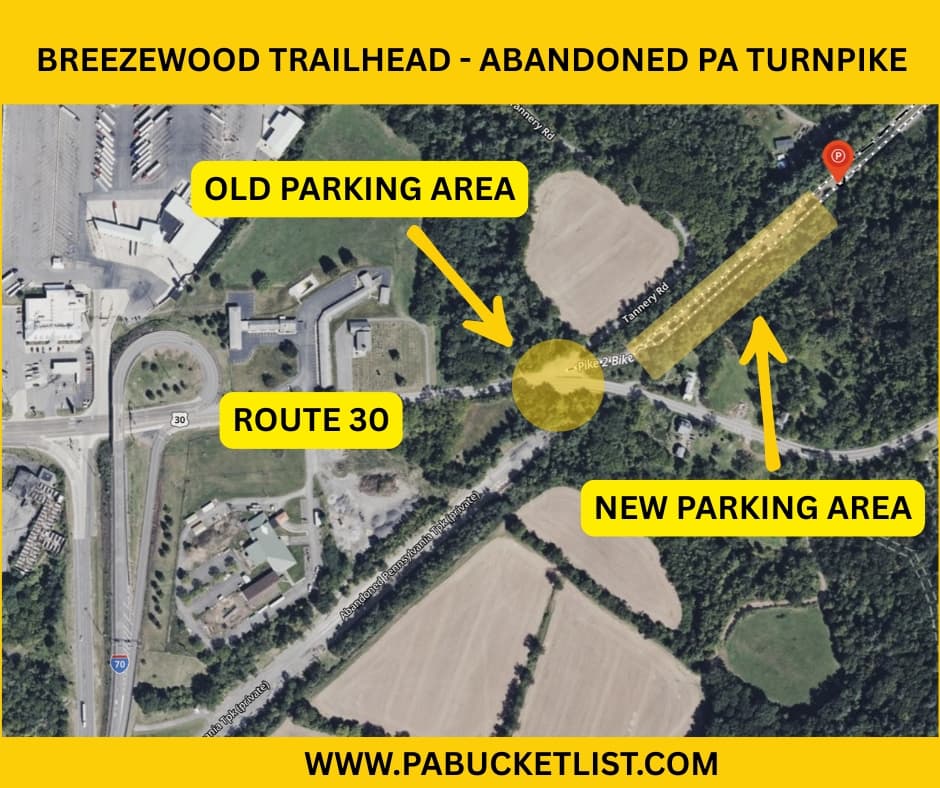
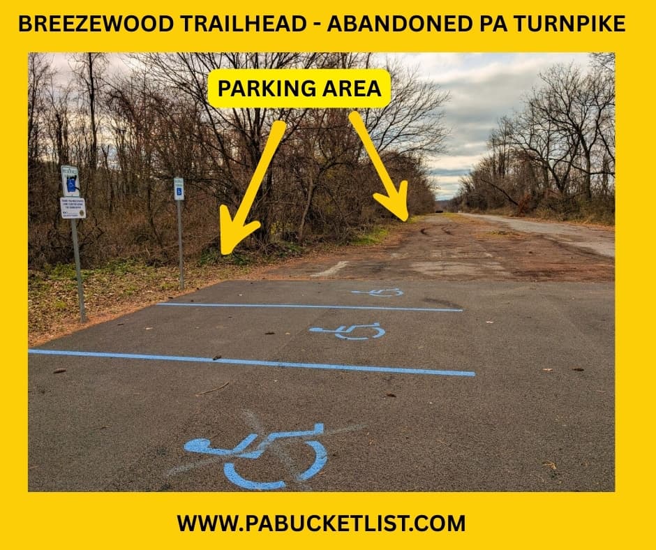
As of 2025, you simply pass through the former dirt lot, drive up the little hill, and park right on the Abandoned PA Turnpike next to the trailhead, a massive improvement with space for well over a hundred vehicles (see photo below.)
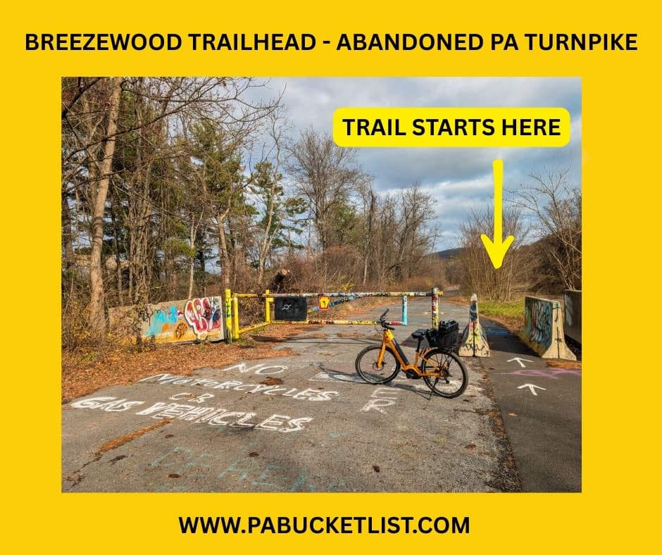
From the Breezewood trailhead, you’ll be hiking/biking east, where you’ll encounter Rays Hill Tunnel in 1.3 miles.
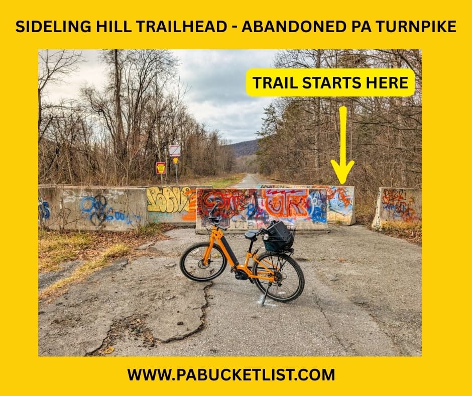
Directions to the Sideling Hill Trailhead
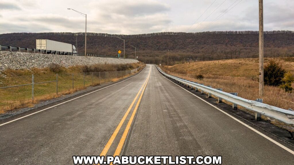
The Sideling Hill trailhead and parking is located just off of Pump Station Road in Fulton County, at GPS coordinates 40.04878, -78.09578.
As of December 2025, there’s still no signage along Pump Station Road marking the trailhead entrance, but the photo below shows exactly what to look for.
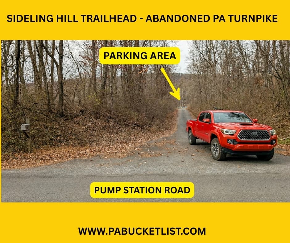
Parking at Sideling Hill works the same way as at Breezewood – you’ll pull right onto the old Turnpike before starting your trek.
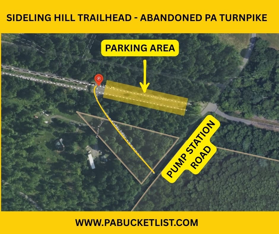
Check out the photo below for a visual of the Sideling Hill parking area and trailhead.

From the Sideling Hill trailhead, you’ll be hiking/biking west, where you’ll encounter Sideling Hill Tunnel in 1.2 miles.
Abandoned Pennsylvania Turnpike FAQs
Ground was broken for the Pennsylvania Turnpike in October 1938, and it opened to traffic in October 1940.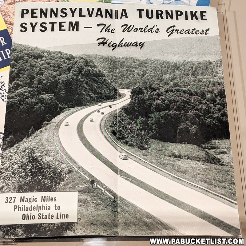
Because the two 2-lane tunnels along this stretch of the turnpike caused severe traffic back-ups as vehicles on the 4-lane highway had to merge to pass through them.
Information below from PA Turnpike exhibit at the State Museum in Harrisburg.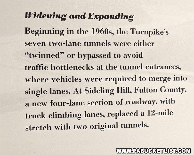
A bypass around the tunnels and up over the mountains was opened in 1968.
Information below from PA Turnpike exhibit at the State Museum in Harrisburg. 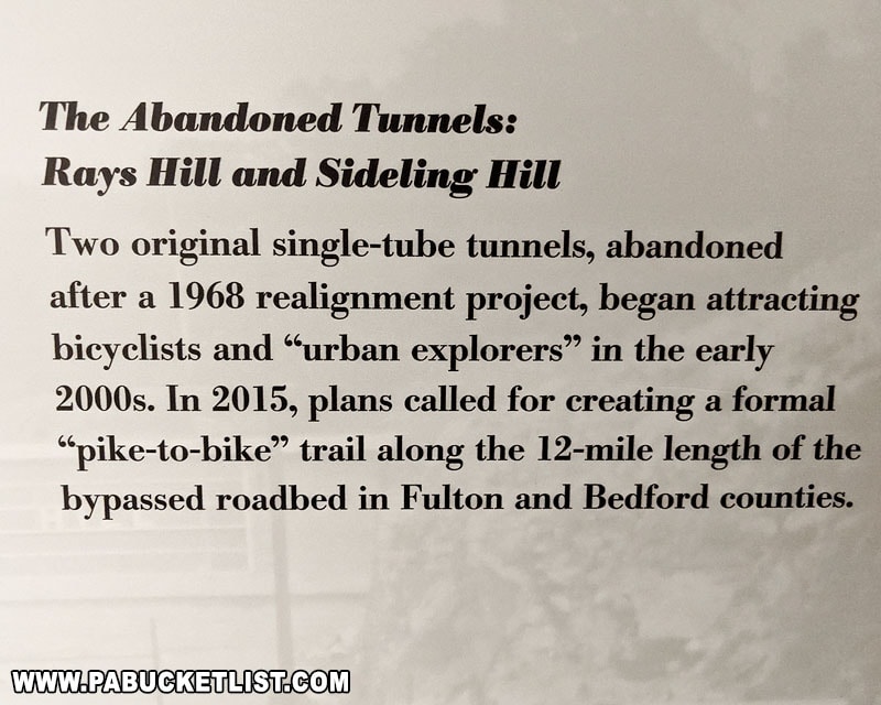
Yes – this section of road is officially known as “The Old PA Pike Trail” (or TOPP Trail for short), with a number of improvements planned pending availability of funds.![]()
Yes it was – the Pennsylvania Turnpike was built on top of the started-but-never-completed South Pennsylvania Railroad, which was a joint partnership between famous businessmen of the day William Vanderbilt, Andrew Carnegie (pictured below in front of the Rays Hill Tunnel in 1884), Henry Clay Frick, and J.P. Morgan.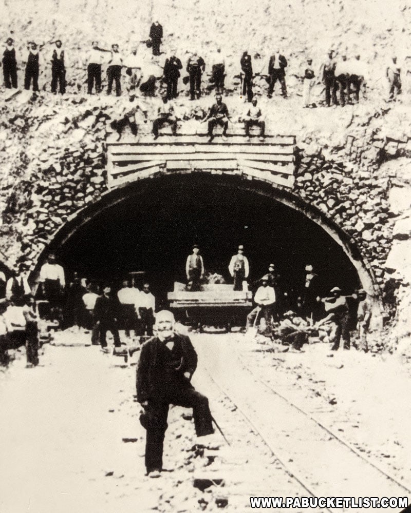
Yes – the 2009 post-apocalyptic survival flick “The Road” was filmed at several locations along the abandoned PA Turnpike, including the Rays Hill Tunnel.
Yes – even in the winter you can enjoy hiking along this unique trail.
Exploring the Abandoned Pennsylvania Turnpike
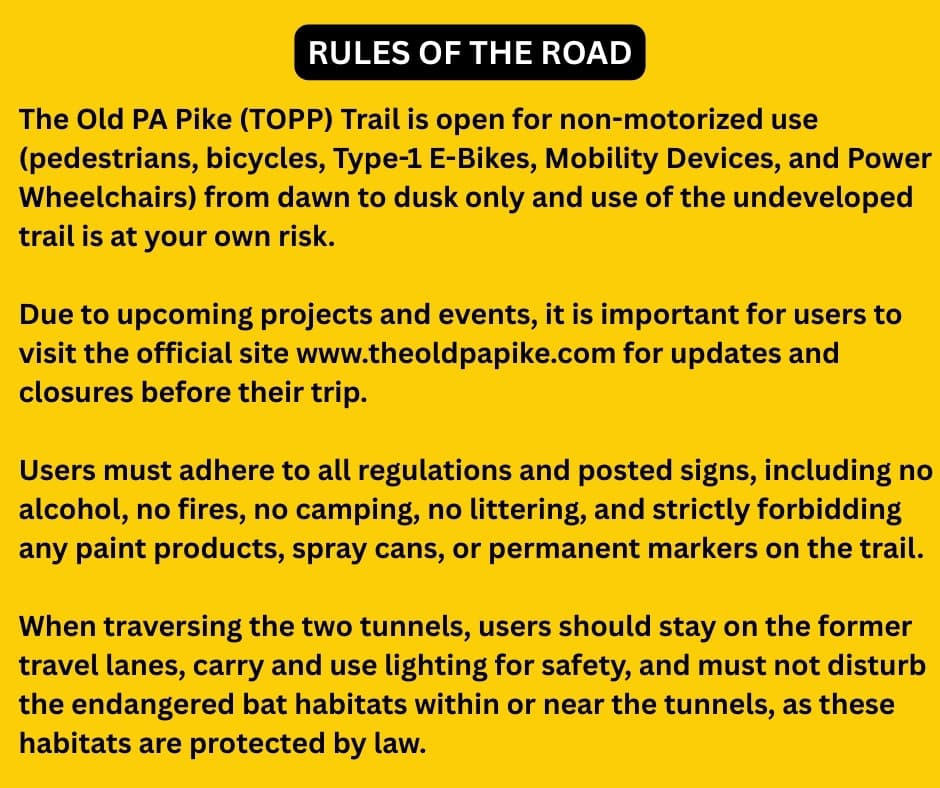
Before you set out to explore the Abandoned PA Turnpike, you should familiarize yourself with “The Rules of the Road.”
If you plan to tackle the entire 8.5 mile trail, the choice of starting point is completely up to you – both ends work equally well.
If you only have time to explore a portion of the trail, I personally recommend starting at the Sideling Hill trailhead, as the Sideling Hill tunnel is nearly twice as long as the Rays Hill tunnel and delivers the most impressive photos and experience, in my opinion.
Though the 4-mile stretch of trail between the tunnels is relatively uneventful, a few side trails leave the old highway and take you to some fascinating spots in Buchanan State Forest; I’ll mention those at the end of this article.
Practical Tips For Exploring the Abandoned PA Turnpike
I’ve covered this trail on foot and by bike many times, so here are some helpful tips to ensure your Abandoned PA Turnpike adventure is safe and enjoyable.
Tip #1 – Pay Attention!
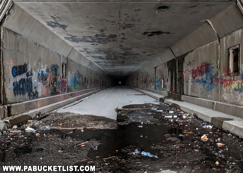
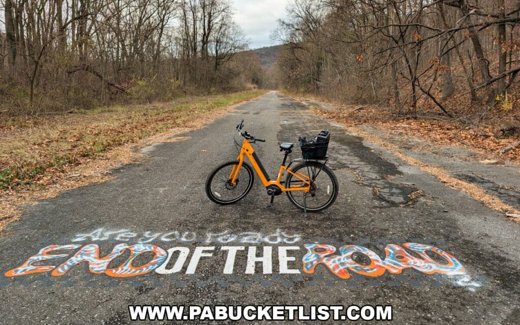
The trail surface is nothing like the smooth rail trails or paved suburban greenways you may be used to. This is a half-century-old roadway slowly crumbling back into the earth. Expect potholes, loose gravel, scattered rocks, and exposed roots along the way. Stay alert – it’s easy to twist an ankle or wipe out on a bike if you’re not paying attention.
Tip #2 – Bring A Flashlight
If you plan on exploring one or both tunnels, keep in mind that they are completely unlit and pitch black inside. Be sure to bring a flashlight or headlamp – your cellphone’s flashlight simply won’t cut it.
Tip #3 – Bring a Jacket or Hoodie
The temperatures inside the tunnels can be dramatically colder than the air outside, even in the middle of summer. If you tend to get chilly, consider bringing a hoodie or light jacket to stay comfortable during your exploration.

Tip #4 – Bring Snacks and Drinks
There are no amenities along the trail – no water, no restrooms, no services of any kind. Your best bet is to make a pit stop at the Sheetz in Breezewood or the Sideling Hill Turnpike Plaza near that trailhead before heading out onto the Abandoned PA Turnpike.
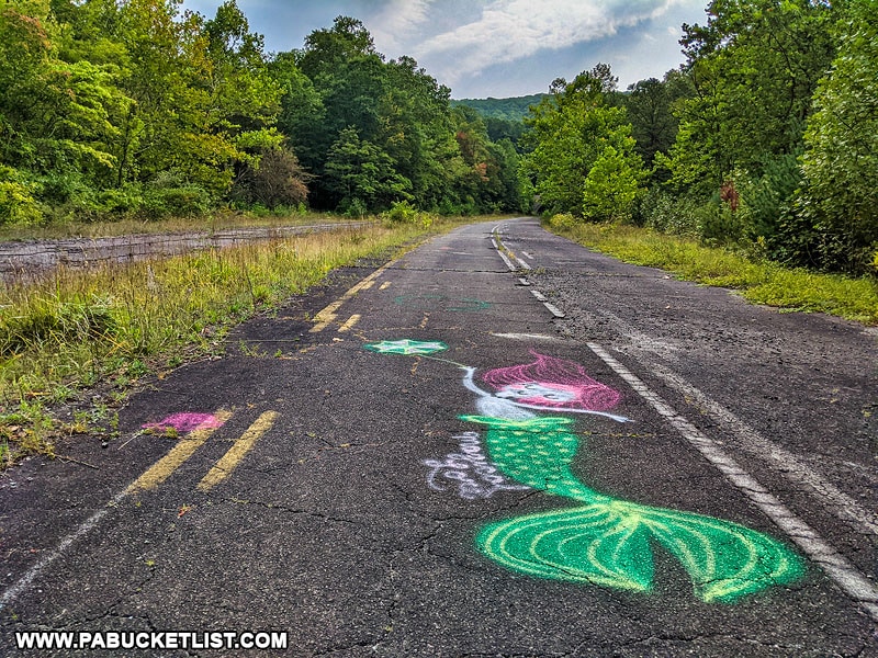
Tip #5 – Be Prepared for the Graffiti
There is a lot of graffiti out there – some of it juvenile, some of it artistic, and some of it definitely not kid-friendly. If you’re bringing little ones along, be prepared for a few unexpected (and possibly awkward) questions as you make your way down the trail!

Highlights of the Abandoned PA Turnpike
The two main highlights of the Abandoned PA Turnpike are the two tunnels; I’ll describe each of them in detail in this section.

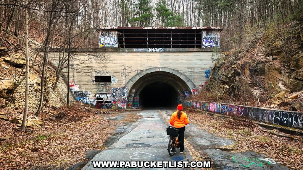
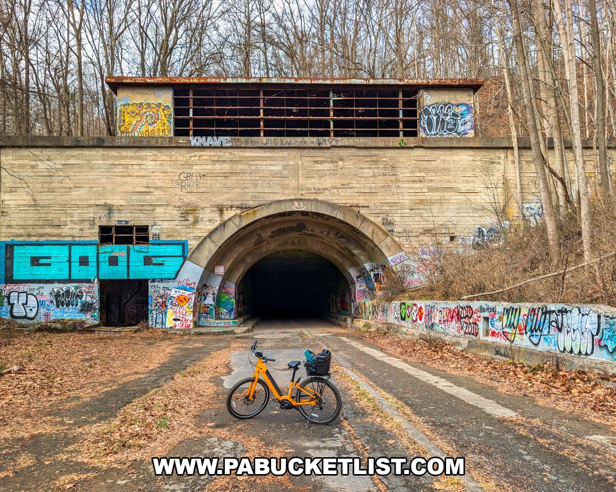
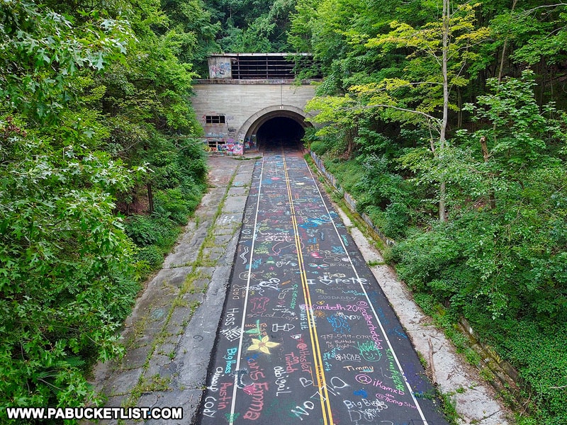
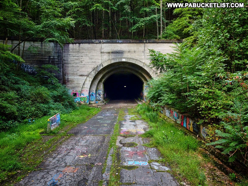
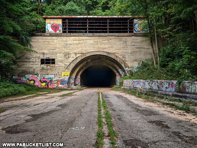
1. Rays Hill Tunnel
At 0.7 miles long, the Rays Hill Tunnel was the shortest of the 7 original Pennsylvania Turnpike Tunnels.
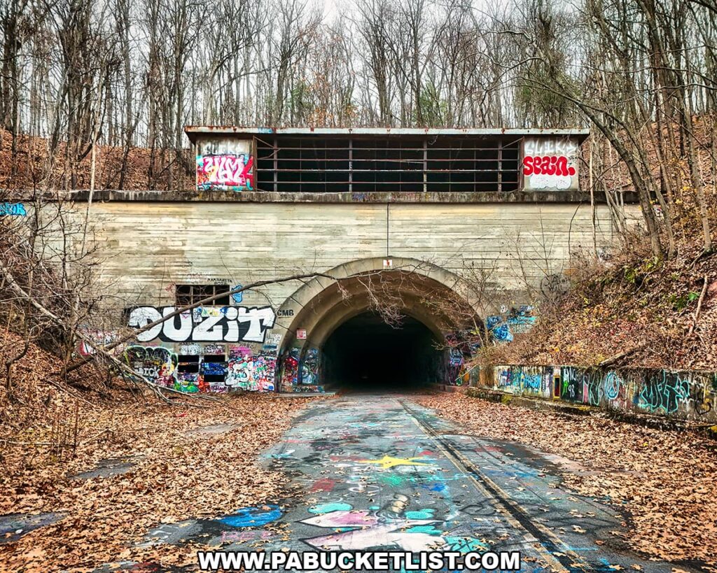
Rays Hill Tunnel straddles a county line – its eastern portal sits in Fulton County, while its western portal lies in Bedford County.
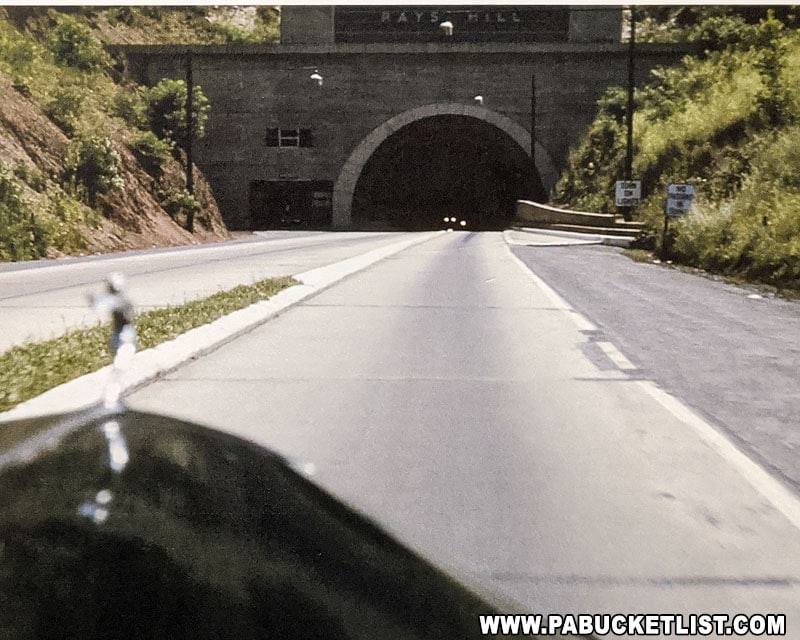
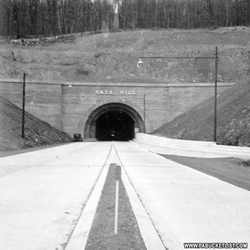
The image below, from the State Museum in Harrisburg, is what drivers would have seen approaching the tunnel from Breezewood in the 1940s.
Fast forward to today, and here’s what you can expect.
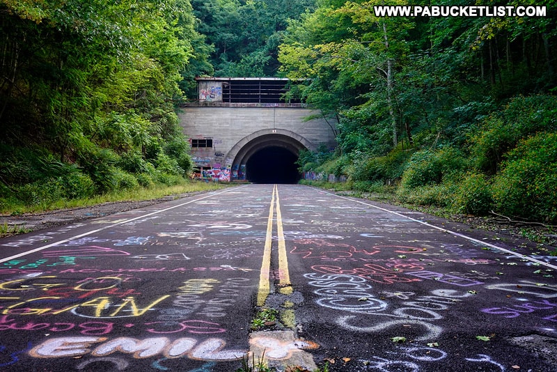
You’ll notice the asphalt and paint around the western tunnel entrance look much fresher because, years after this section was abandoned, PennDOT used the roadway to train employees on paving, line-painting, rumble-strip installation, and road-reflector testing.
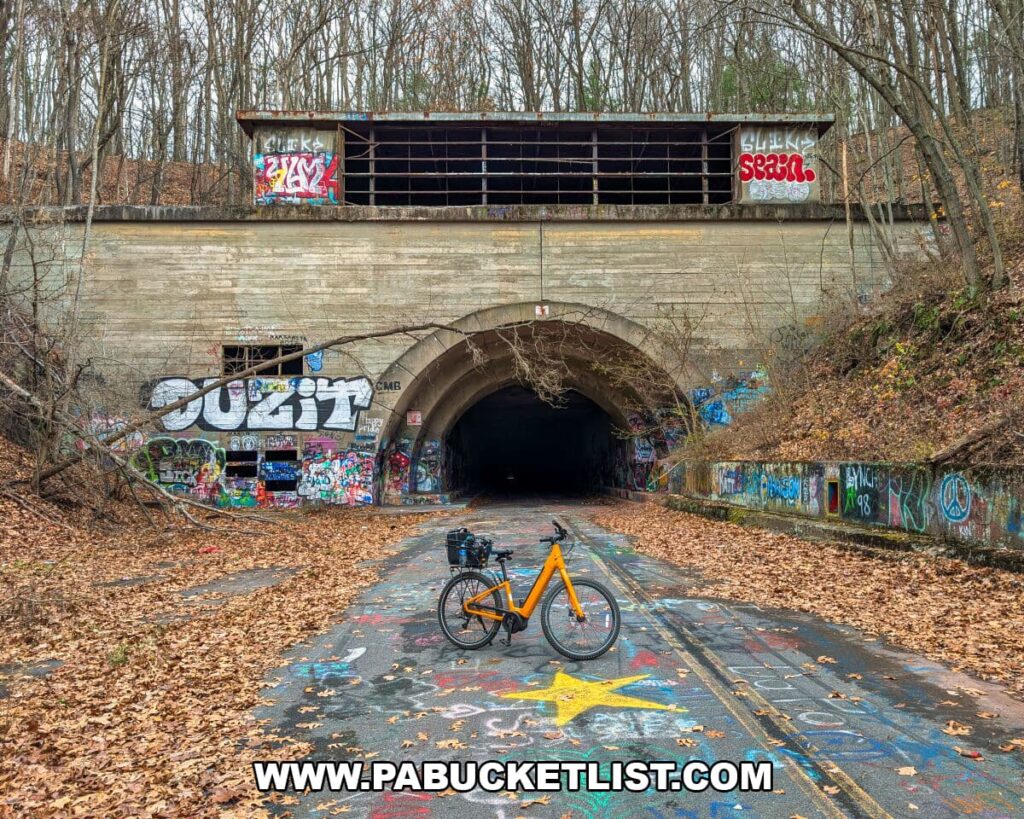
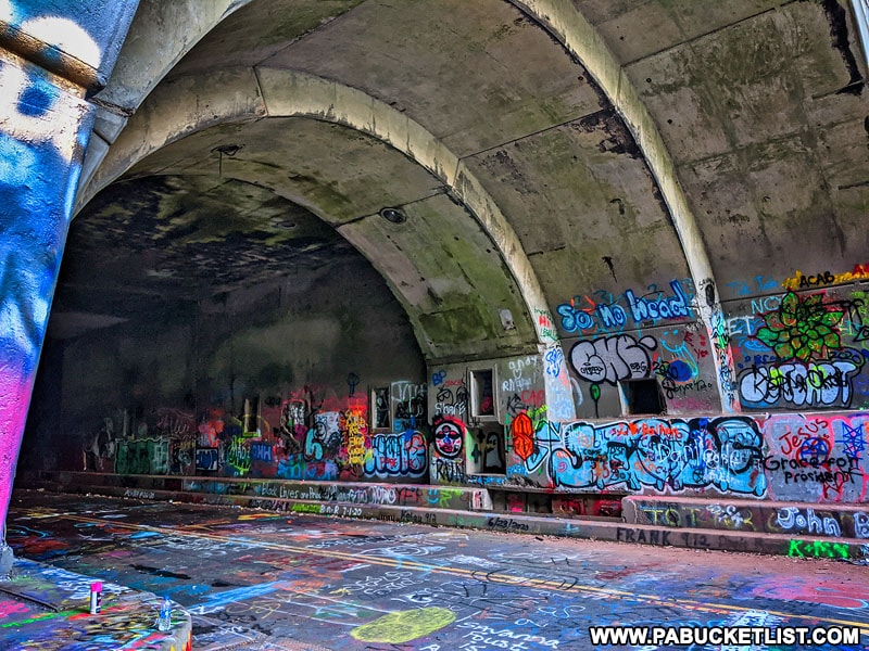
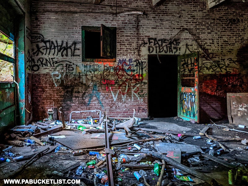
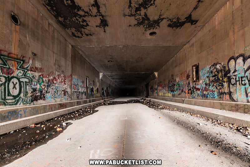
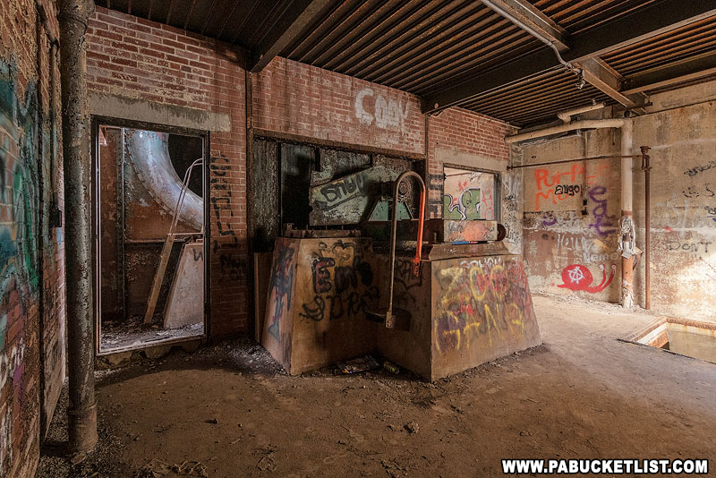
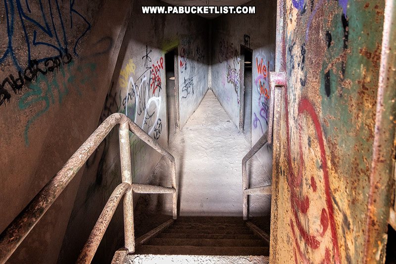
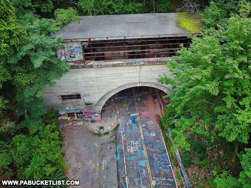
Each tunnel has small offices at its eastern and western portals, but aside from graffiti and piles of trash, there’s not much worth exploring.
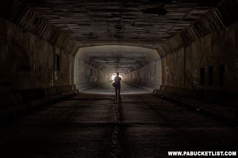
There is no artificial light inside either tunnel along the trail, but at Rays Hill Tunnel you can see one end from the other.

One interesting feature of the eastern portal of Rays Hill Tunnel is that it is the only portal on any of the original Turnpike tunnels that does not have a ventilation fan on top of it.
Here’s the same view in 1940, shortly after the completion of the Pennsylvania Turnpike.
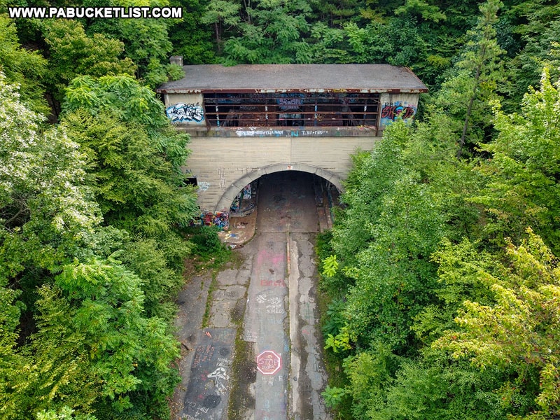
2. Sideling Hill Tunnel
The Sideling Hill Tunnel was the longest of the original seven Turnpike tunnels, at 1.3 miles in length.

Because of the tunnel’s length and the slight arc in the tunnel (to allow for proper drainage and prevent ponding water in the center), it is impossible to see one end from the other.
That means that the Sideling Hill Tunnel is VERY dark inside, the closer you get to the center – bring a strong flashlight!
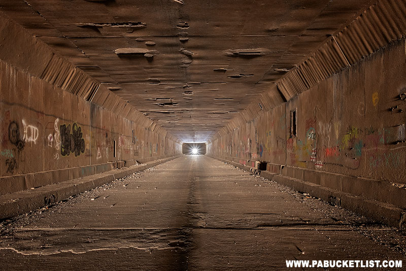
As with the Rays Hill Tunnel, the walls of Sideling Hill Tunnel are a virtual museum of ever-changing graffiti, ranging from the mild to the wild to the downright profane.

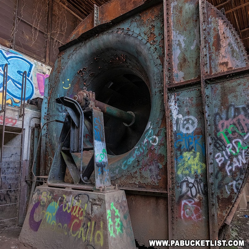
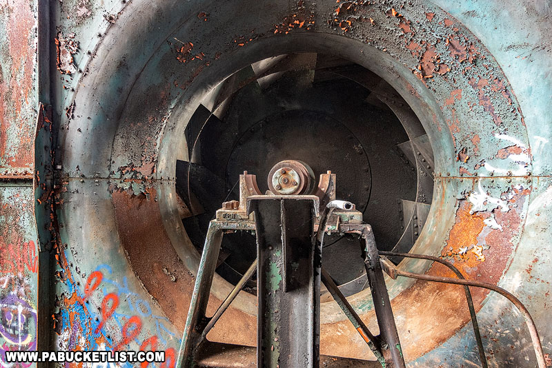
An obvious trail up the left side of the eastern portal of Sideling Hill tunnel leads to the entrance of the ventilation room on top.

Massive fans on top of the tunnels helped force fresh air in and exhaust fumes out.

As with the tunnel walls, the ventilation room is heavily graffitied and quite popular with urban explorers looking to leave their mark.
Just off to the side of the ventilation room is the old control room.
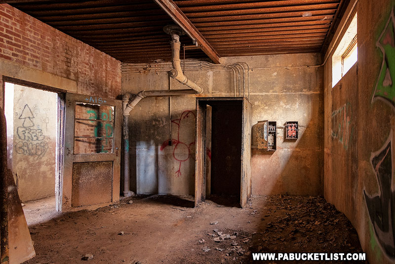
From here operators monitored the carbon monoxide levels in the tunnel and adjusted the airflow and fans accordingly.
Holes in the roof mean that even indoors, the floor can be quite muddy.

A stairway behind the fans leads to the ventilation shafts above the tunnel.
These fans have been silent for more than 50 years, but the roar must have been deafening up close.
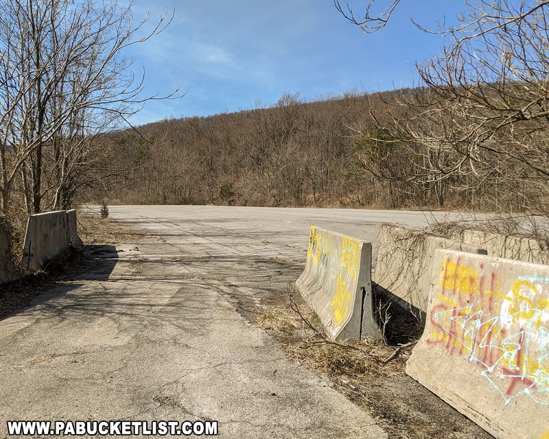
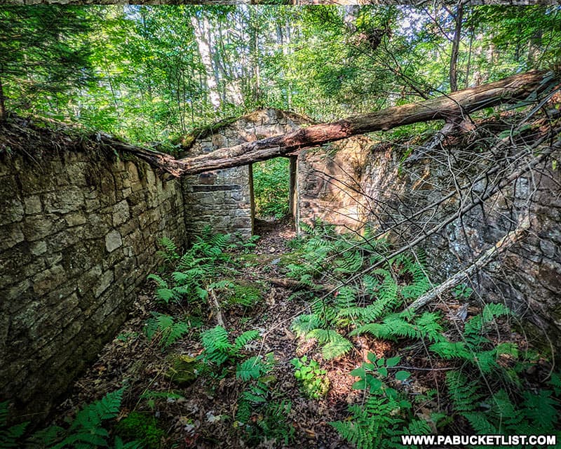
3. Cove Valley Service Plaza
Just a few yards from the Sideling Hill trailhead you’ll find the former Cove Valley Service Plaza, now just a large paved area that was used for a time after the closure of this section of the Turnpike as a State Police shooting range.
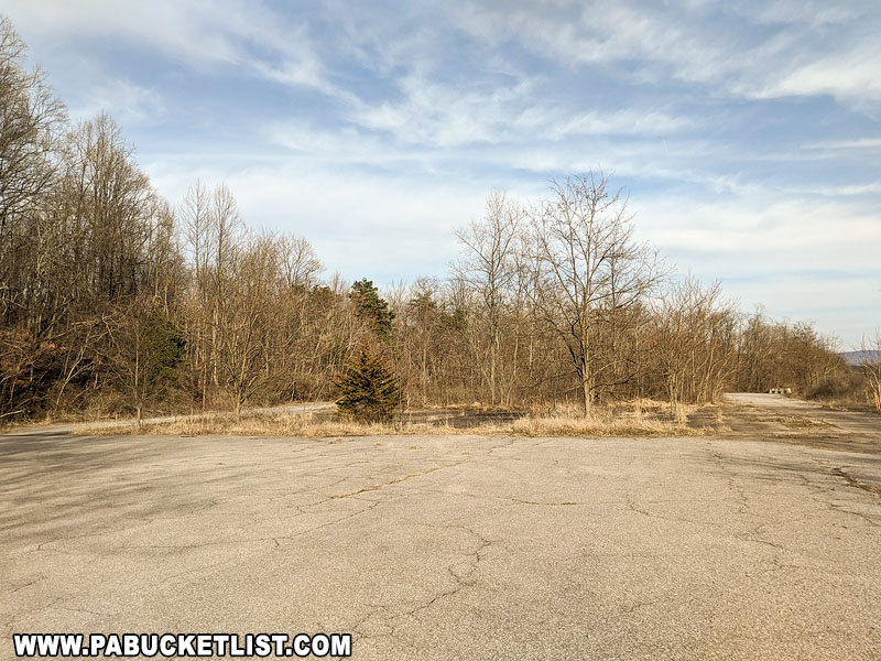
The old buildings and gas pumps at Cove Valley have vanished, their foundations seemingly reclaimed by the earth.
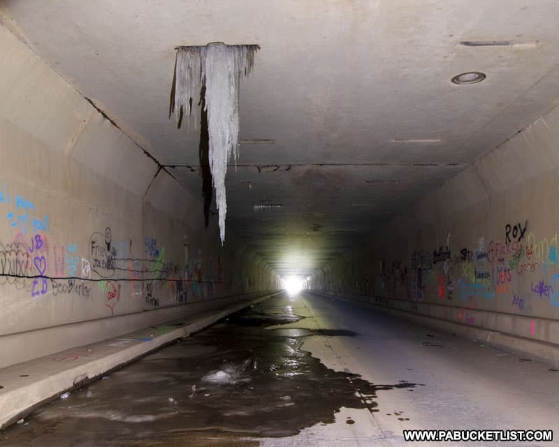
Exploring the Abandoned PA Turnpike in the Winter
For a truly unique experience, try hiking (or cross-country skiing) the Abandoned PA Turnpike in the winter!

The starkness of the snow-covered landscape adds an even more post-apocalyptic vibe to the trail.

Be sure to dress warmly – the tunnels are quite chilly in the winter.

So chilly, in fact, that you may even encounter ice formations hanging from the roof!
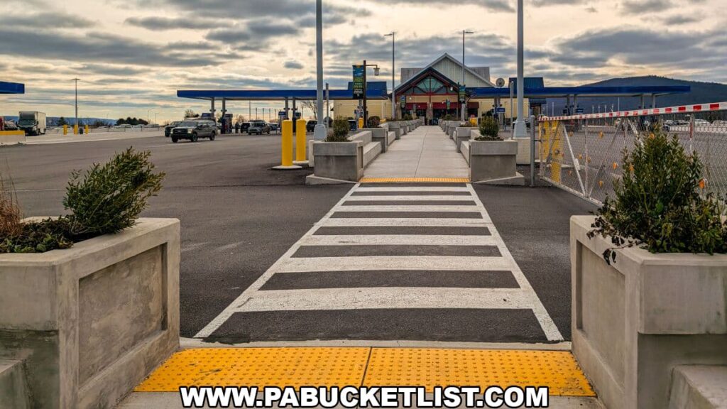
The Sideling Hill Service Plaza “Trailhead”
In 2025 the state opened what they are calling the “Sideling Hill Trailhead” at the rear of the Sideling Hill Service Plaza along the modern-day PA Turnpike.

Essentially an extension of the employee parking lot at the plaza, it features a nice picnic pavilion and a replica of a turnpike tunnel portal that highlights some local attractions, including the Abandoned PA Turnpike.
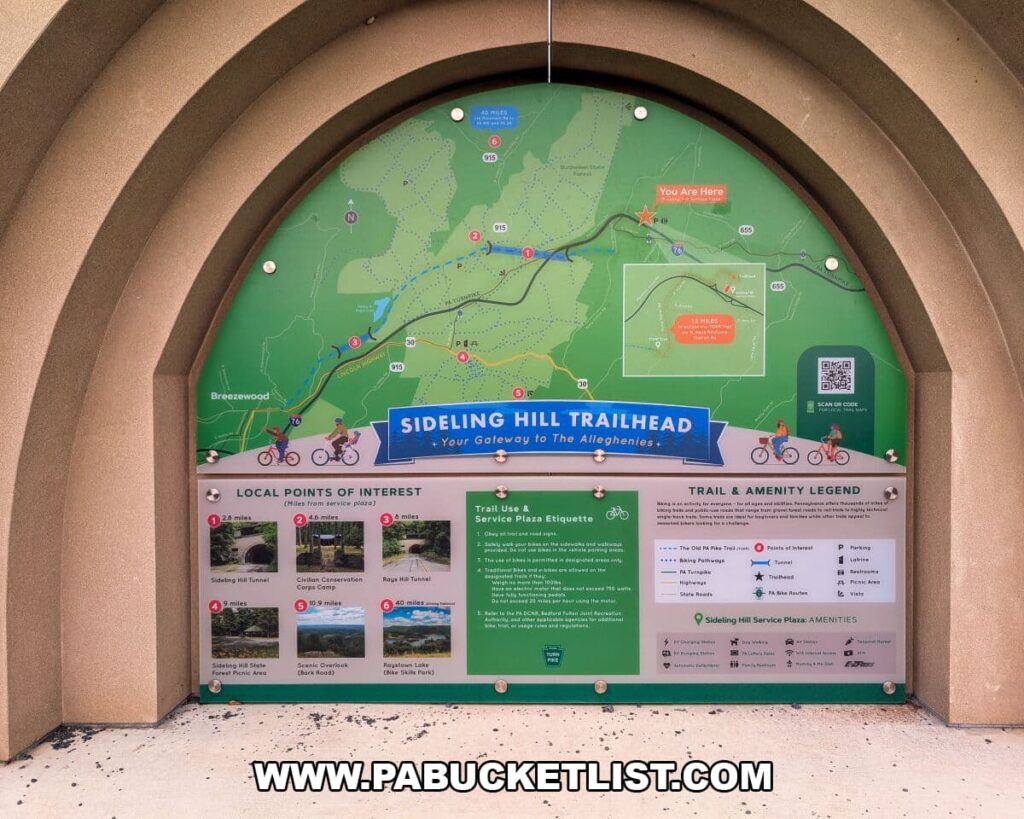
Do not confuse this service plaza trailhead with the ACTUAL Abandoned PA Turnpike Sideling Hill trailhead!
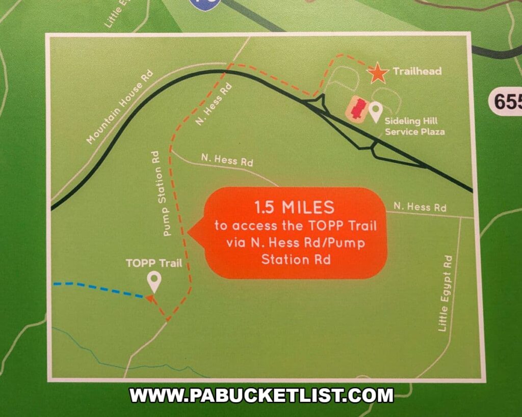
The ACTUAL Sideling Hill trailhead for the Abandoned PA Turnpike trail is 1.5 miles away, and you’d have to walk or ride your bike on a series of windy two-lane roads with no berms or separate bike lanes to get there from the service plaza.
In my opinion, the new service plaza trailhead is best used as a quick pitstop before or after your Abandoned PA Turnpike adventure, thanks to its convenient restrooms and plentiful food and drink options.
But to be clear, I would NEVER recommend riding a bike or walking along those 1.5 miles of two-lane road between the service plaza and the actual Sideling Hill trailhead of the Abandoned PA Turnpike – that’s an accident just waiting to happen.

If you want to drive to the service plaza trailhead before or after you check out the Abandoned PA Turnpike trail, you’ll find it where Mountain House Road dead-ends in the employee parking area behind the service plaza.
Final Thoughts on the Abandoned PA Turnpike
The Abandoned Pennsylvania Turnpike trail absolutely lives up to the hype!
It is arguably the most famous abandoned attraction in Pennsylvania, and certainly the largest at 8.5 miles long.
Whether or not any of the planned improvements to “The Old PA Pike Trail” / TOPP Trail ever come to pass, only time will tell.

In the meantime, you can enjoy biking or hiking the Abandoned Pennsylvania Turnpike just the way it is!

Want to see a cool video about the Abandoned PA Turnpike?
Check this out!
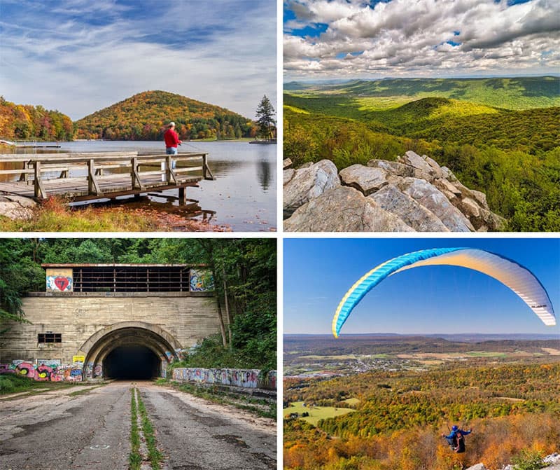
Looking for more nearby abandoned sites?
The Abandoned Sideling Hill POW Camp in Fulton County is literally within a few hundred yards of the western portal of Sideling Hill Tunnel along the Abandoned PA Turnpike, and the two share a common thread you’ll want to read about.
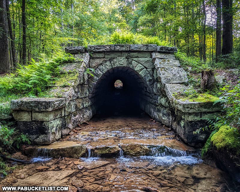
The Abandoned South Penn Railroad Aqueduct in Fulton County was built close to and at the same time Sideling Hill Tunnel was first being bored as a proposed railroad tunnel, in the 1880s.
Related Articles
38 Abandoned Places in PA You Can Legally Explore highlights 38 abandoned places in PA that continue to fascinate visitors decades after they outlived their intended purposes.

Nearby Attractions
30 Must-See Attractions in Bedford County is your guide to some of the best things to see and do on the western side of the Abandoned PA Turnpike.

9 Must-See Attractions in Fulton County is your guide to some of the best things to see and do on the eastern side of the Abandoned PA Turnpike.
A Smarter Way to Explore Pennsylvania
Explore Pennsylvania like a pro with the interactive PA Bucket List Travel Map, showcasing over 1,000 memorable destinations I’ve personally visited across the Keystone State.
Did you enjoy this article?
If so, be sure to like and follow PA Bucket List on Facebook, Instagram, and/or Pinterest to stay up-to-date on my latest write-ups about the best things to see and do in Pennsylvania!
Click on any of the icons below to get connected to PA Bucket List on social media.