
If you’re looking for directions to the Clear Shade Creek swinging bridge, you’re in the right place!
The Clear Shade Creek swinging bridge serves as a connector between the 2 loops that make up the John P. Saylor Trail in the Gallitzin State Forest.
This Somerset County trail system is named after a longtime western Pennsylvania congressman and conservationist who helped pass the 1964 Federal Wilderness Act and the 1968 National Scenic Trails Act.
How to Find the Clear Shade Creek Swinging Bridge
What I’m going to share with you here is the shortest and easiest way to reach the Clear Shade Creek swinging bridge.
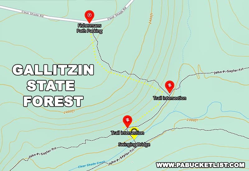
The trailhead parking lot is located along Clear Shade Road, a gravel state forest road in good condition as of October 2022.
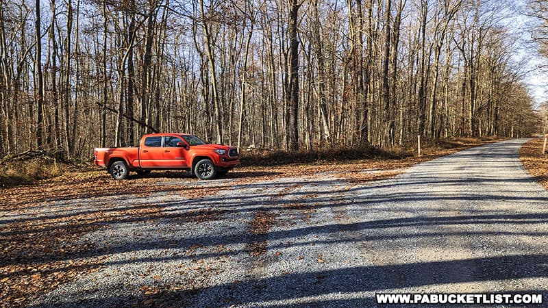
The parking area is located at GPS coordinates 40.19649, -78.73898.
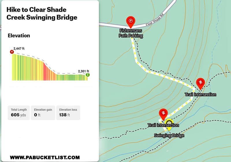
This hike covers a little over a third of a mile, with an elevation change of 138 feet between the parking area and the swinging bridge.
The Fishermans Path
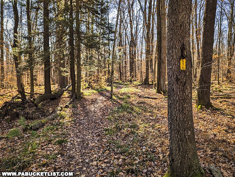
The first portion of the hike to the Clear Shade Creek swinging bridge utilizes the Fishermans Path, a yellow-blazed trail that begins at the parking area described above, and terminates at an intersection with the John P. Saylor Trail 400 yards southeast of the parking area.
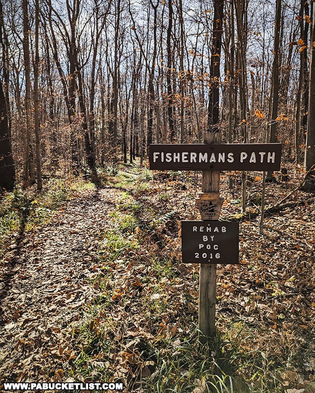
The Fishermans Path is well blazed and easy to follow.
Virtually all of the elevation change on this hike to the suspension bridge takes place along the Fishermans Path – downhill on the way to the bridge, uphill on the return trip to the parking area.
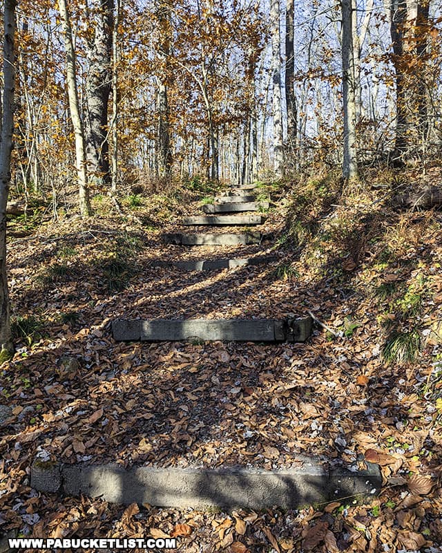
At the bottom of the hill, the Fishermans Path dead-ends into the John P. Saylor Trail.
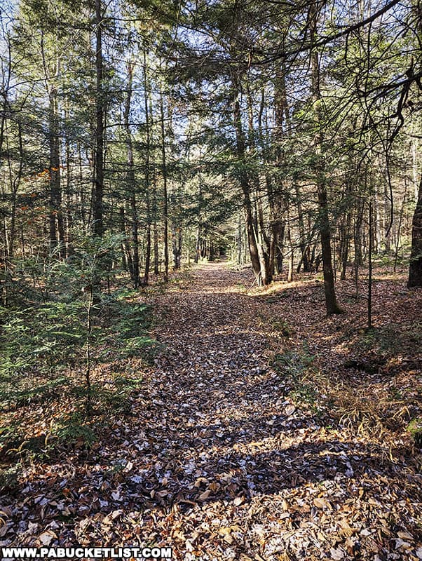
The John P. Saylor Trail
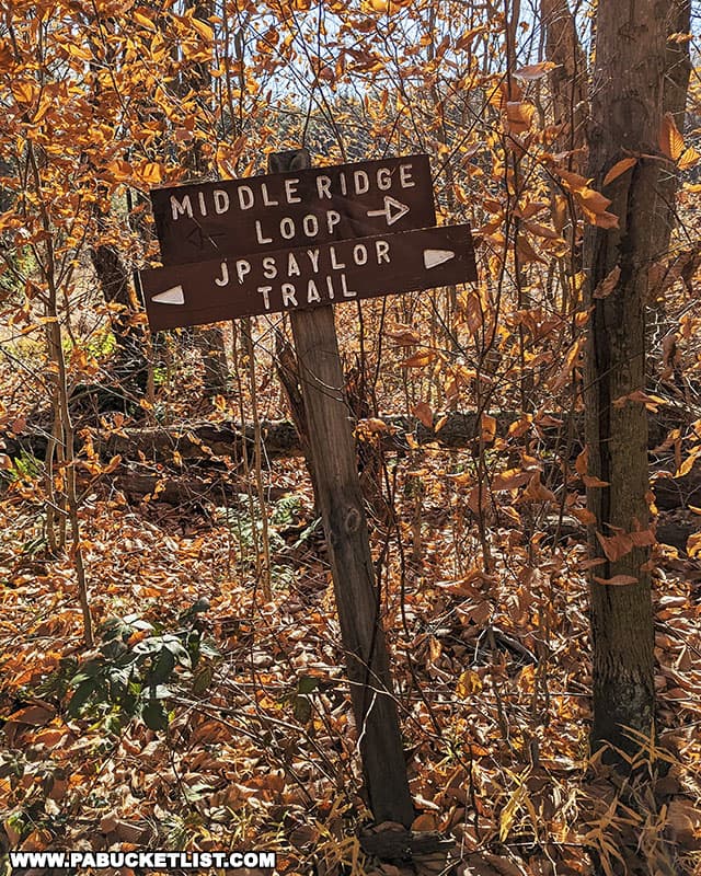
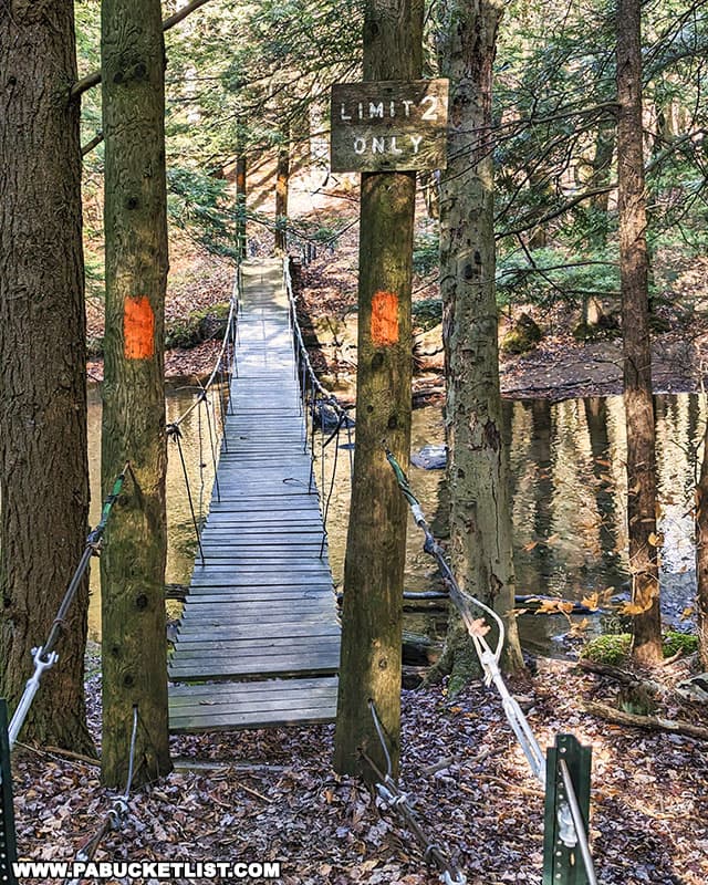
Once you reach the John P. Saylor Trail, take a right and follow this orange-blazed trail southwest for roughly 200 yards.
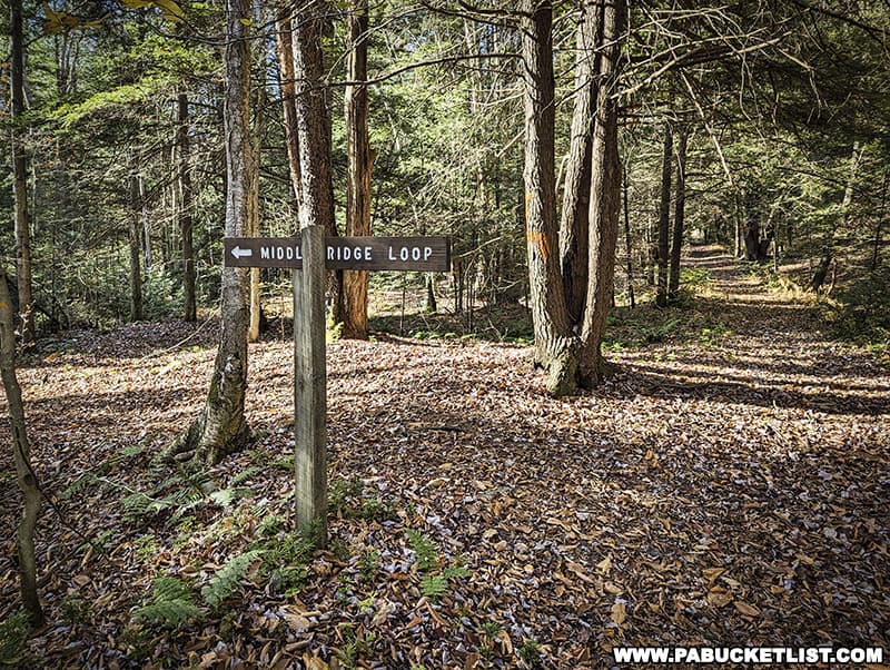
When you reach the sign pictured below, pointing you in the direction of the Middle Ridge Loop, turn left and follow that connector trail 50 yards to the swinging bridge, located at GPS coordinates 40.1931, -78.73738.
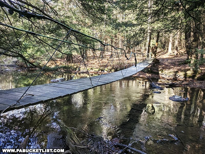
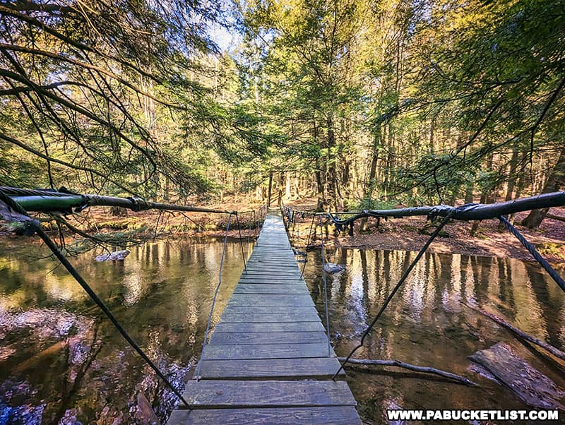
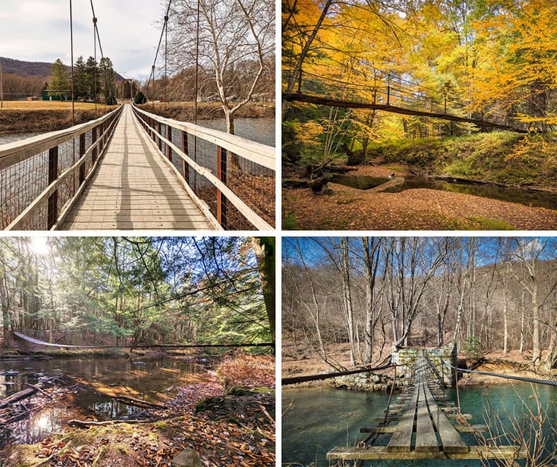
The Clear Shade Creek Swinging Bridge
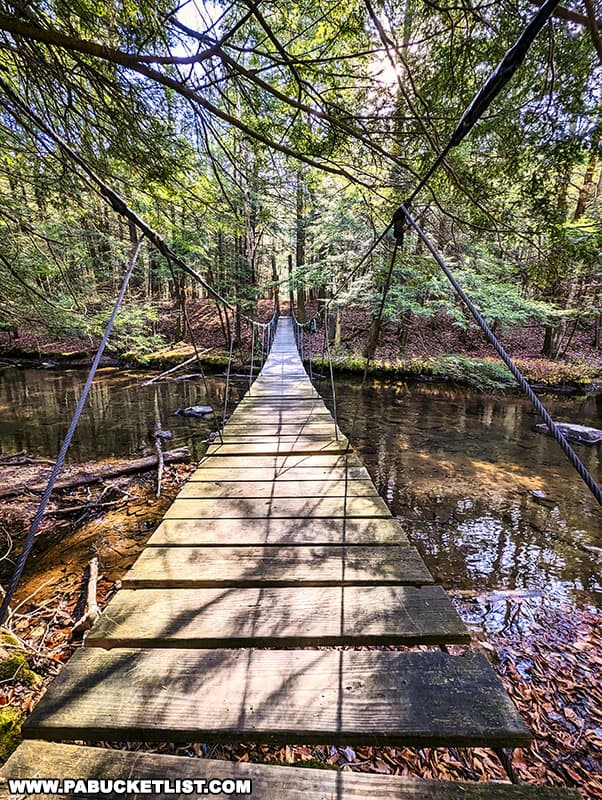
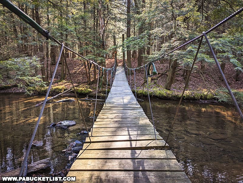
Let me first say that the Clear Shade Creek suspension bridge truly is a “swinging bridge”, with nothing more than wire “handrails” to hang onto as you cross it.
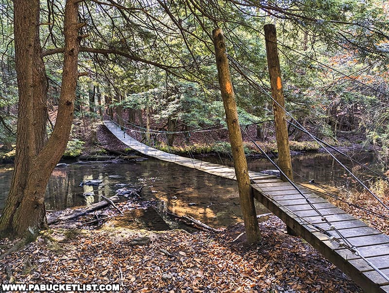
It’s roughly 60 feet from end to end, and maybe 4-5 feet above the surface of Clear Shade Creek in the center.
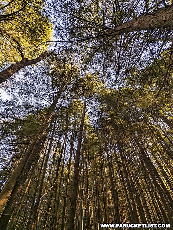
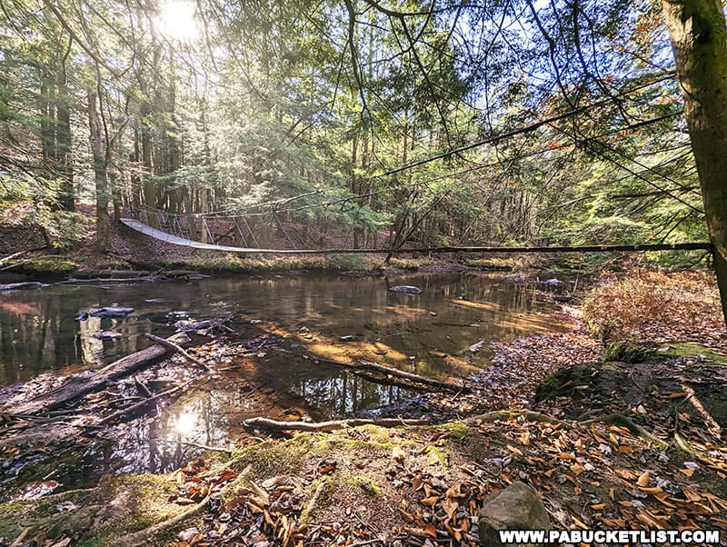
The bridge is surrounded by tall pines that have regenerated after much of this area was clear-cut in the PA logging boom era.
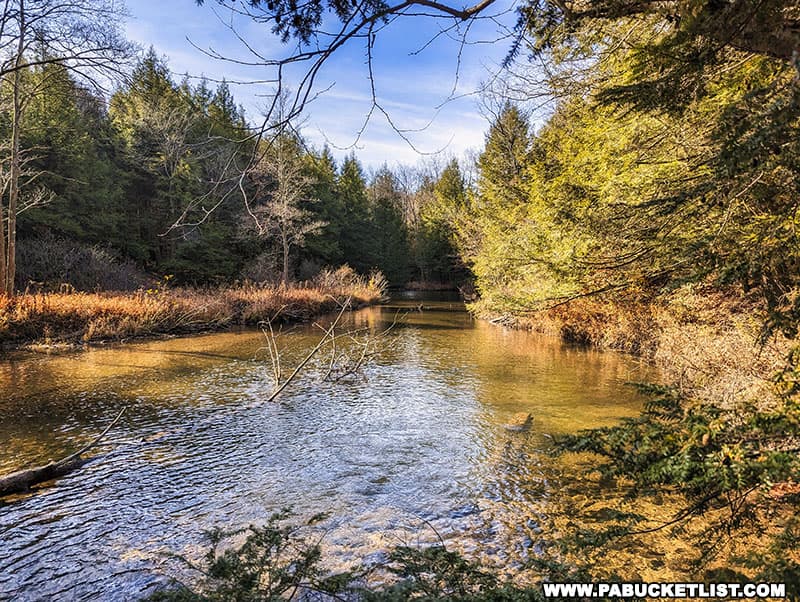
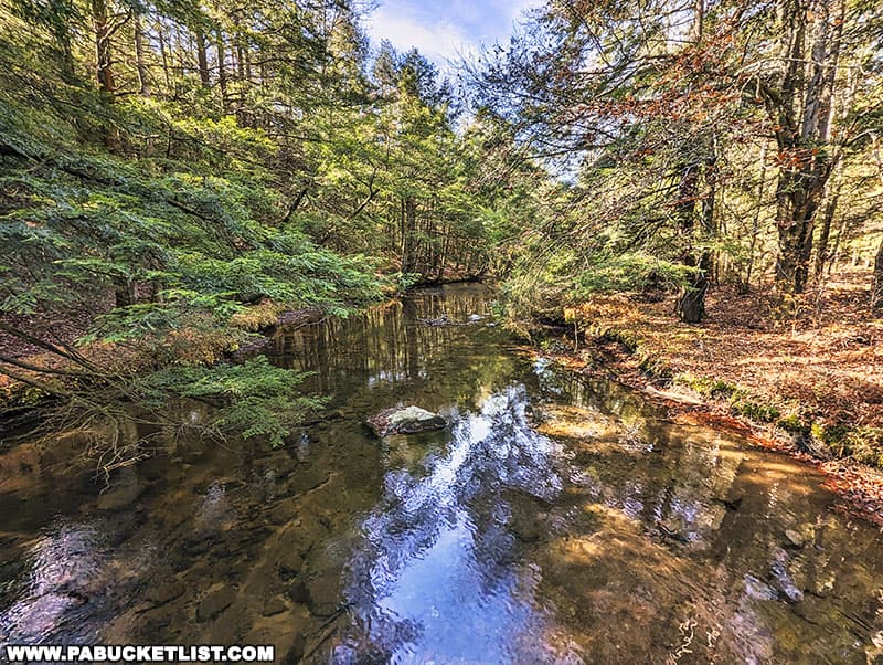
From the center of the suspension bridge you have beautiful views of Clear Shade Creek.
The bridge has a posted limit of 2 people at a time – I’d go ahead and heed that warning!
From the southern side of the bridge, you can pick up the 5-mile Middle Ridge Loop portion of the John P. Saylor Trail, or you can simply backtrack to your vehicle if you were only interested in checking out the bridge.
The Gallitzin State Forest is full of many wonderful sights, and the Clear Shade Creek swinging bridge is certainly one of them!
Nearby Attractions
County Line Vista is located right along the Somerset-Bedford county line in the Gallitzin State Forest.
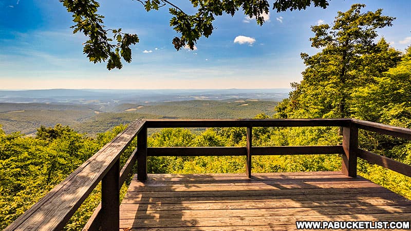
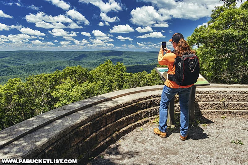
Skyline Drive Vista is a picturesque roadside overlook in the Gallitzin State Forest.

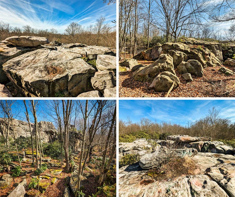
Wolf Rocks is a beautiful geological formation located along the orange-blazed John P. Saylor Trail in the Somerset County portion of the Gallitzin State Forest.
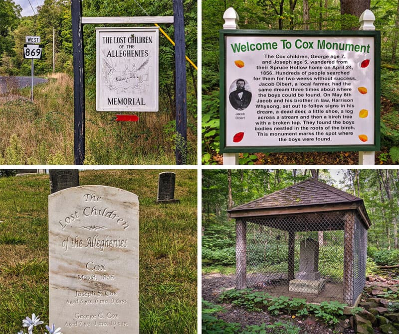
The Lost Children of the Alleghenies Monument preserves the tale of the tragic disappearance of 2 young brothers and the mysterious circumstances by which they were found.
Pavia Overlook at nearby Blue Knob State Park is located atop the second-highest mountain in Pennsylvania!
Exploring the Best Swinging Bridges in Pennsylvania is your guide to some of the best swinging bridges in PA!
Did you enjoy this article?
If so, be sure to like and follow PA Bucket List on Facebook, Instagram, and/or Pinterest to learn more about the best things to see and do in Pennsylvania!
Click on any of the icons below to get connected to PA Bucket List on social media.