
If you’re looking for directions to Breakneck Falls at McConnell’s Mill State Park, you’re in the right place!
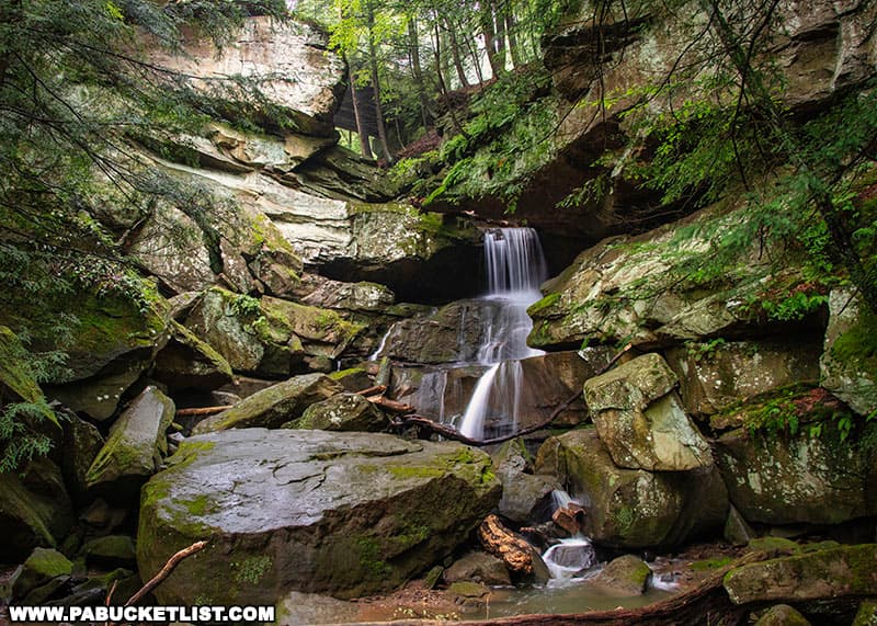
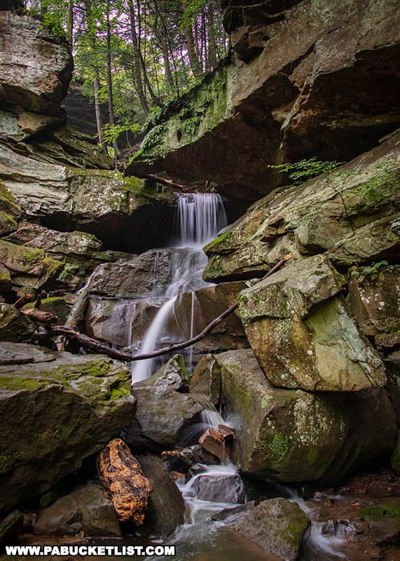
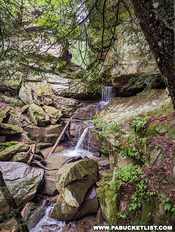
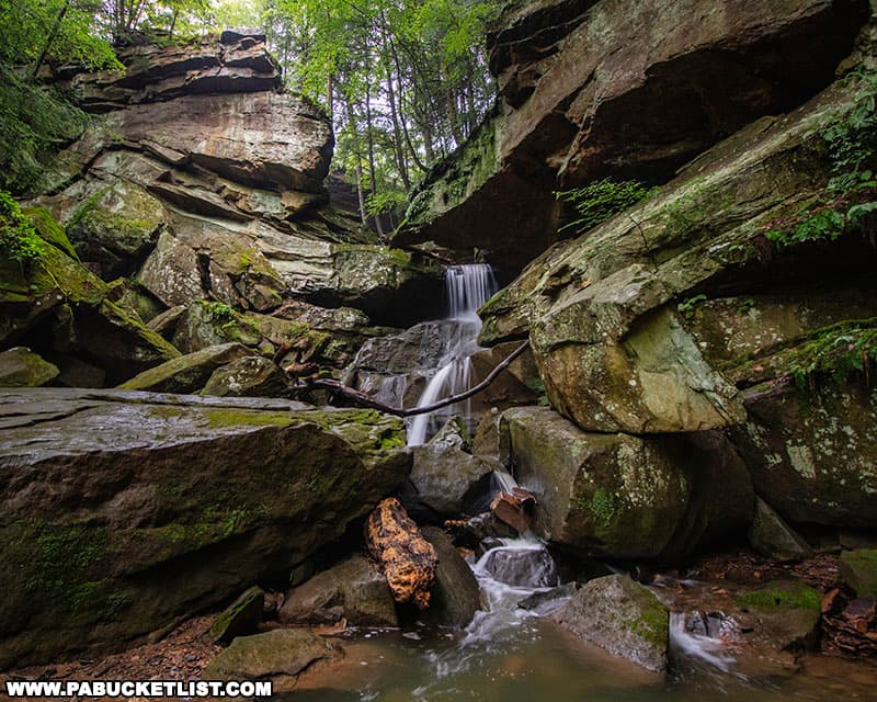
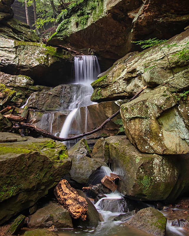
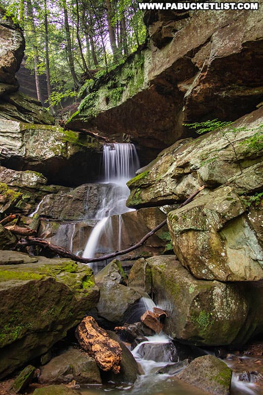
Breakneck Falls is a 25 foot-tall, multi-tiered waterfall located along Cheeseman Run, a tributary of Slippery Rock Creek.
What follows is a step-by-step guide on how to find Breakneck Falls at McConnell’s Mill State Park, complete with a trail map and directions to various parking areas near the trailhead.
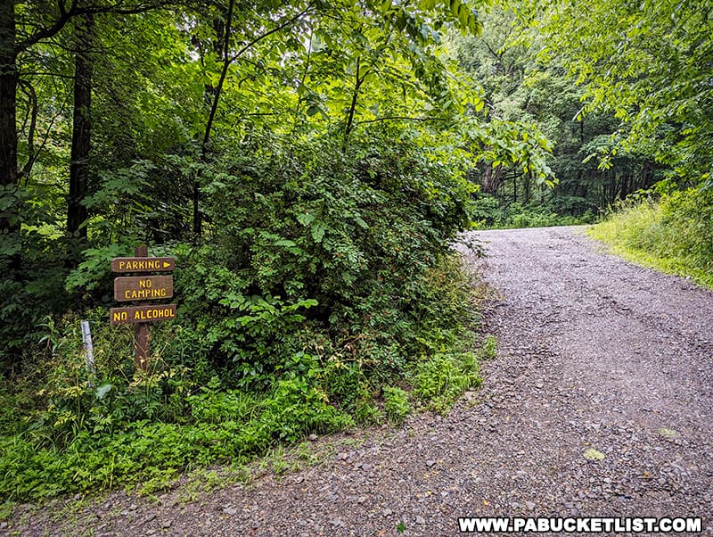
Parking Near Breakneck Falls
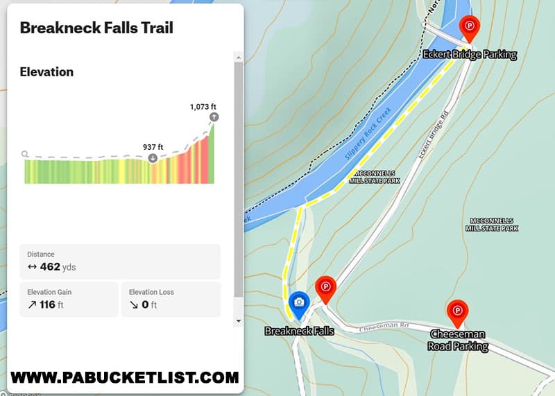
There are 3 parking areas close to Breakneck Falls, all of which are pictured on the map below.
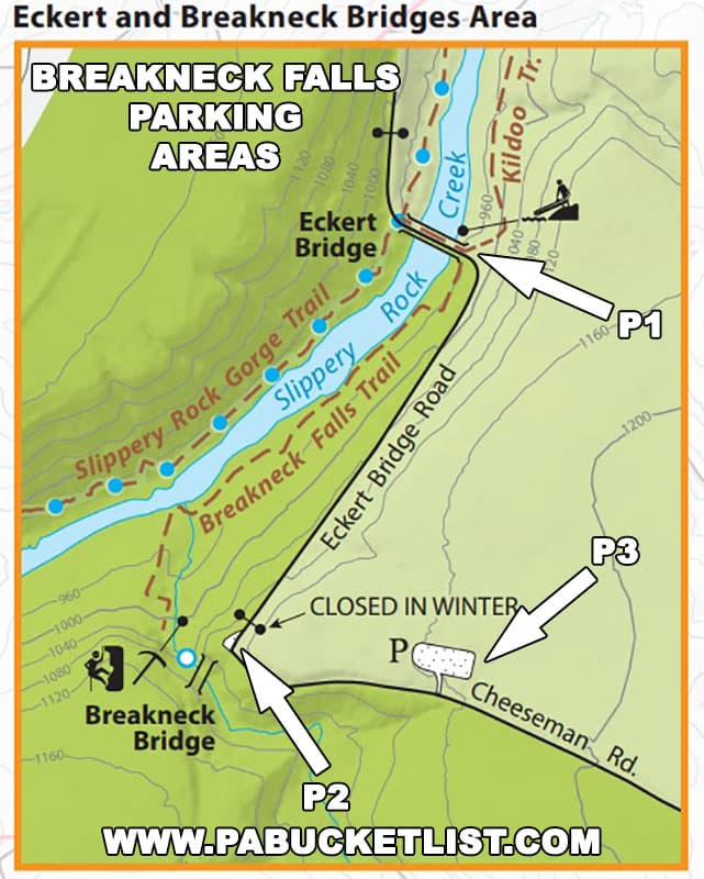
The parking area closest to the Breakneck Falls trailhead is located right next to Eckert Bridge (shown as P1 on the map above); this is also the smallest lot as it only holds 2-3 vehicles.
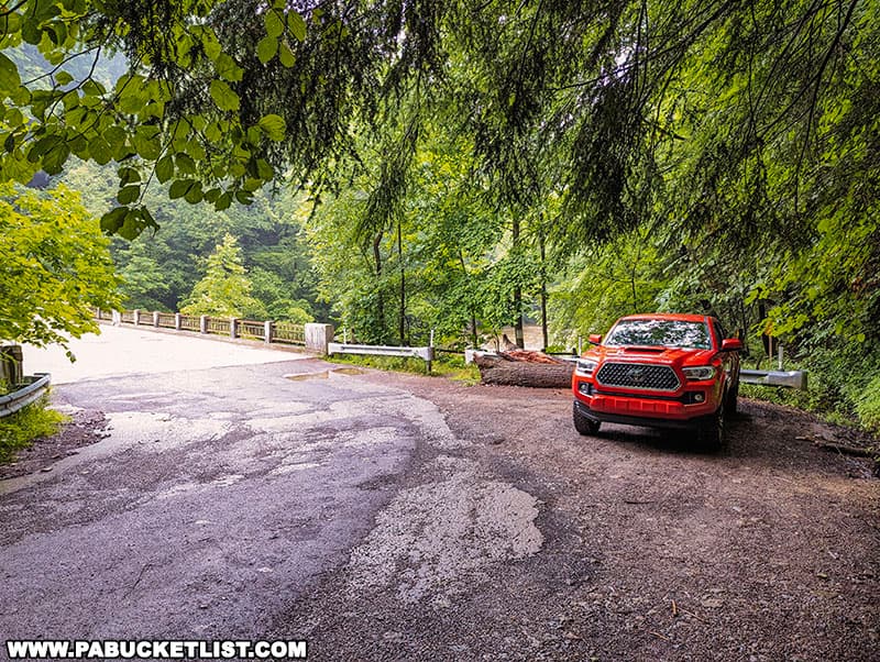
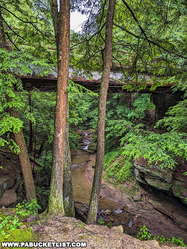
The next-closest parking area to the trailhead is right next to Breakneck Bridge (P2 on map above); this lot will hold 8-10 vehicles but you do have to walk down the hill to reach the trailhead.
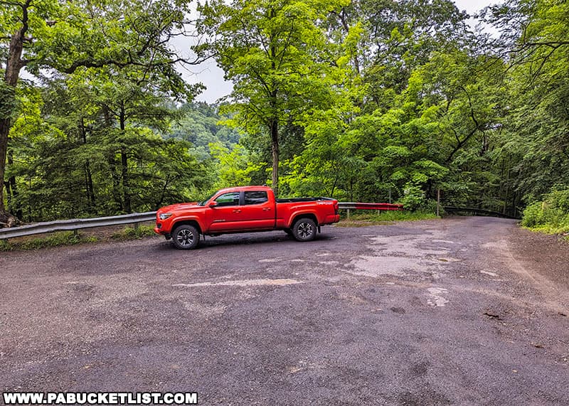
The third parking area, located along Cheeseman Road (P3 on the map above), is the largest but also involves the longest walk to the trailhead.
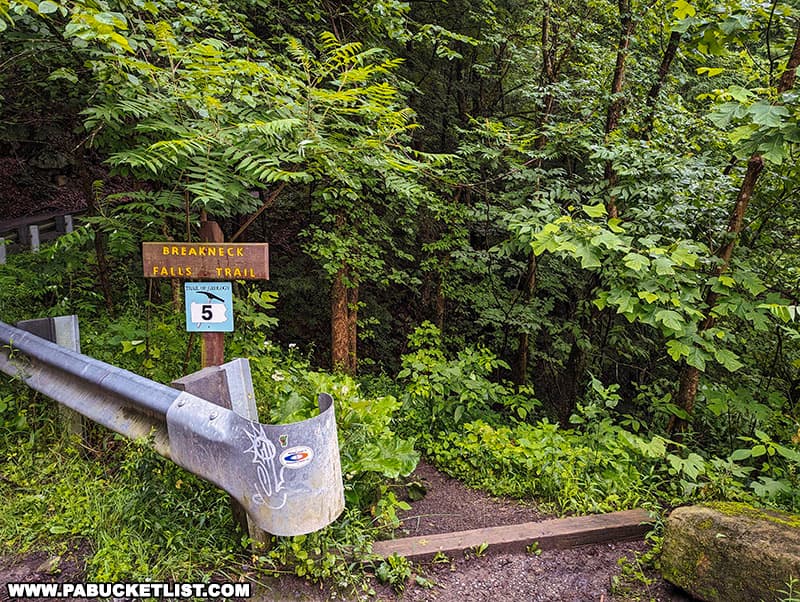
Hiking to Breakneck Falls
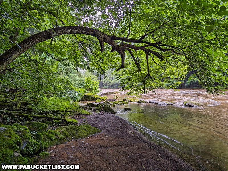
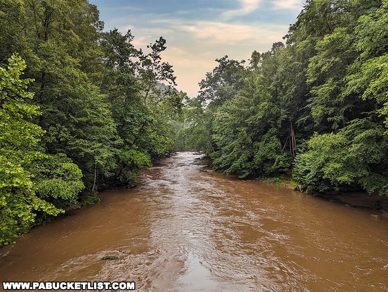
No matter where you end up parking at, the hike begins at the trailhead next to Eckert Bridge, on the eastern side of Slippery Rock Creek.
The hike is covers roughly 1/3 of a mile, with 116 feet of elevation gain at the end as you hike up the western bank of Cheeseman Run.
The first two-thirds of the hike is essentially flat as you follow the eastern bank of Slippery Rock Creek downstream.

300 yards into the hike, you’ll make a wet crossing (no bridge) of Cheeseman Run at a shallow spot in the stream.
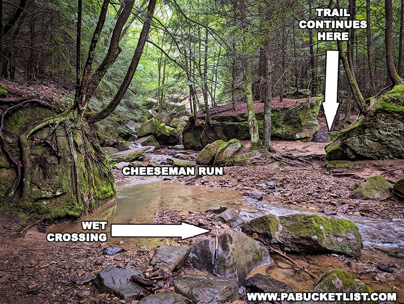
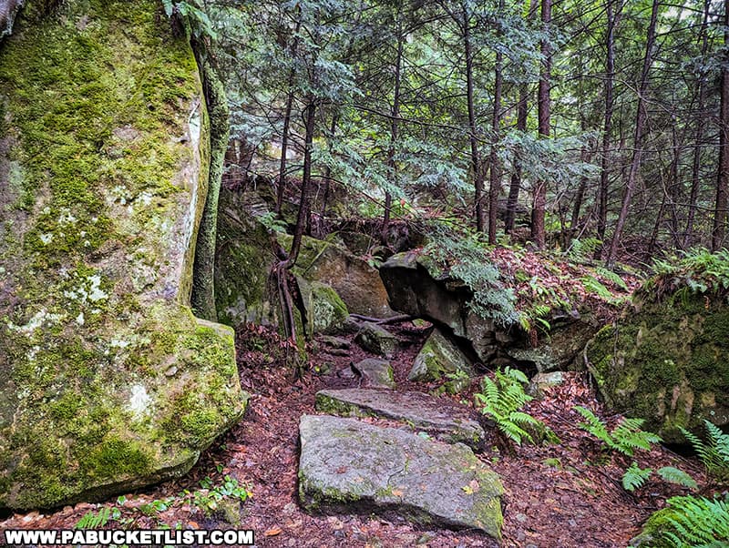
The last third of the hike follows the western bank of Cheeseman Run upstream, weaving its way through some massive boulders along the way.
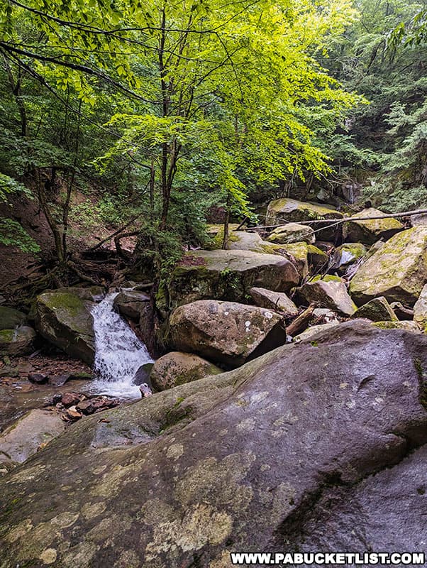
You’ll also pass some smaller cascades on Cheeseman Run, downstream from Breakneck Falls.
Roughly 160 yards upstream from Slippery Rock Creek, you’ll catch your first glimpse of Breakneck Falls.
Viewing Breakneck Falls
Breakneck Falls is best viewed after a hard rain, as Cheeseman Run is a small stream.
Breakneck Falls gets its name from the steep, slippery nature of the rocks it flows over and the gorge it resides in; use an abundance of caution if you try to get any closer than the official trail allows.
Speaking of caution, you may be tempted to simply park at Breakneck Bridge and climb down to the falls from above – DO NOT ATTEMPT THIS UNLESS YOU ARE A PROPERLY EQUIPPED AND EXPERIENCED ROCK CLIMBER!
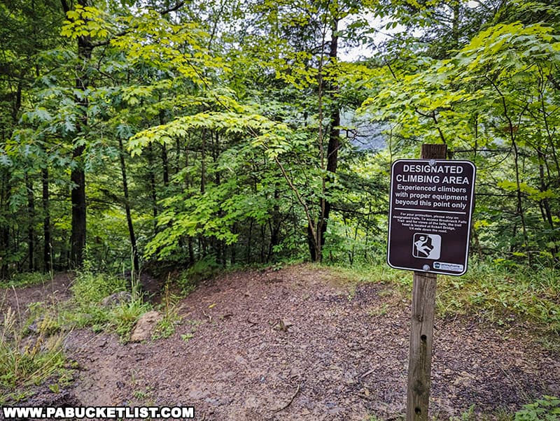
Breakneck Bridge sits a good 50 feet above Cheeseman Run – people have been seriously injured trying to take this “shortcut” to the falls.
Not only is the shortcut dangerous and unnecessary, but you’d be missing out on all the scenery from Eckert Bridge and along Slippery Rock Creek in the process.
Breakneck Falls is certainly not the tallest or “most-reliable” of all the waterfalls at McConnell’s Mill State Park, but the nature of the hike and the setting it resides in makes it a favorite of many park visitors.
Nearby Attractions
McConnell’s Mill State Park is home to a slew of outstanding hikes, overlooks, waterfalls, and historic structures.
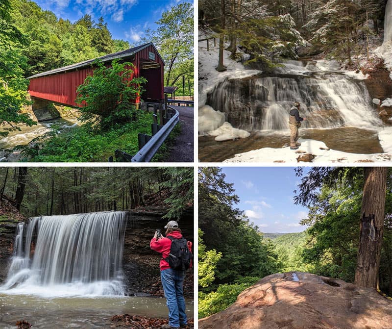
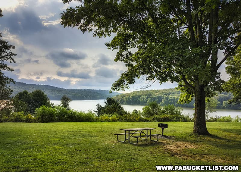
Moraine State Park is a 16,725-acre recreational area located in neighboring Butler County.
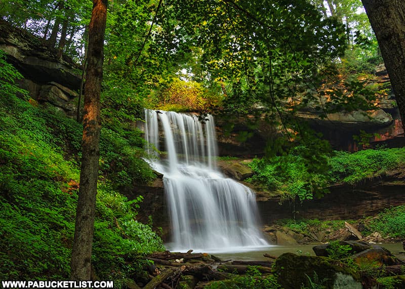
Quaker Falls is a 50 foot-tall waterfall in the newly-created Quaker Falls Recreation Area in Lawrence County.
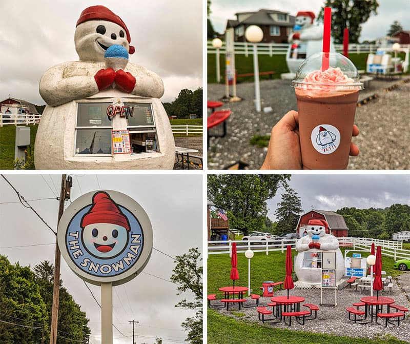
The Snowman is a one-of-a-kind, 13 foot-tall concession stand in Butler County that dispenses delicious frozen treats from his round white belly!
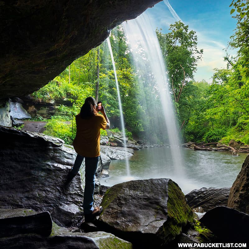
Buttermilk Falls is located in neighboring Beaver County, and is one of a handful of Pennsylvania waterfalls that you can stand BEHIND!
Did you enjoy this article?
If so, be sure to like and follow PA Bucket List on Facebook, Instagram, and/or Pinterest to learn more about the best things to see and do in Pennsylvania!
Click on any of the icons below to get connected to PA Bucket List on social media.