
Laurel Run Overlook is one of several exceptional scenic vistas along the Fayette County portion of the Laurel Highlands Hiking Trail.
This 70 mile-long hiking trail stretches along Laurel Mountain from the Youghiogheny River at Ohiopyle State Park to the Conemaugh River Gorge near Johnstown.
What I’m going to share with you here are a few different routes to reach Laurel Run Overlook, as well as photos of what to expect when you visit it yourself!
How to Find Laurel Run Overlook
Located between mile markers 21 and 22 on the official DCNR Laurel Highlands Hiking Trail map below, Laurel Run Overlook is a rougly 2.5 mile hike from the Route 653 trail head.
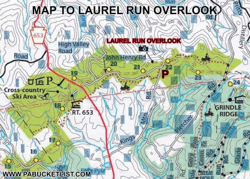
There is also a second parking area, much closer to Laurel Run Overlook, within the boundaries of Laurel Ridge State Park.
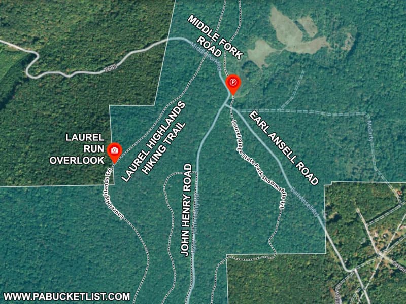
Located near the intersection of John Henry Road and Earl Ansell Road (shown as Kings Mountain Road on some maps), this parking area is situated in a large mountaintop meadow, close to a snowmobile trail.

The GPS coordinates for the Earl Ansell Road parking area are 39.98494, -79.34656.
Please note – the forest roads within Laurel Ridge State Park are not maintained in the winter, and this route is not advisable if there is significant snow on the ground.
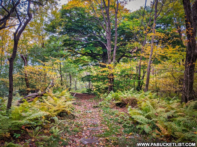
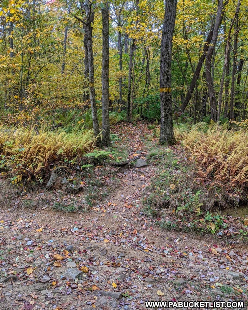
From the meadow, hike Middle Branch Road north for 0.2 miles until it intersects with the yellow-blazed Laurel Highlands Hiking Trail.
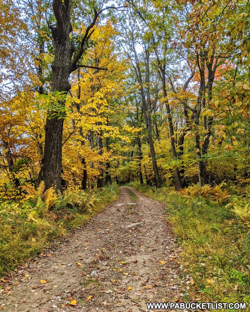
Hang a left onto the Laurel Highlands Hiking Trail and follow it 0.33 miles to Laurel Run Overlook.
No matter which route you take to get there, Laurel Run Overlook is located along that Laurel Highlands Hiking Trail at GPS coordinates 39.98265, -79.35174.
Viewing Laurel Run Overlook
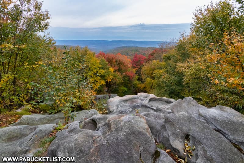
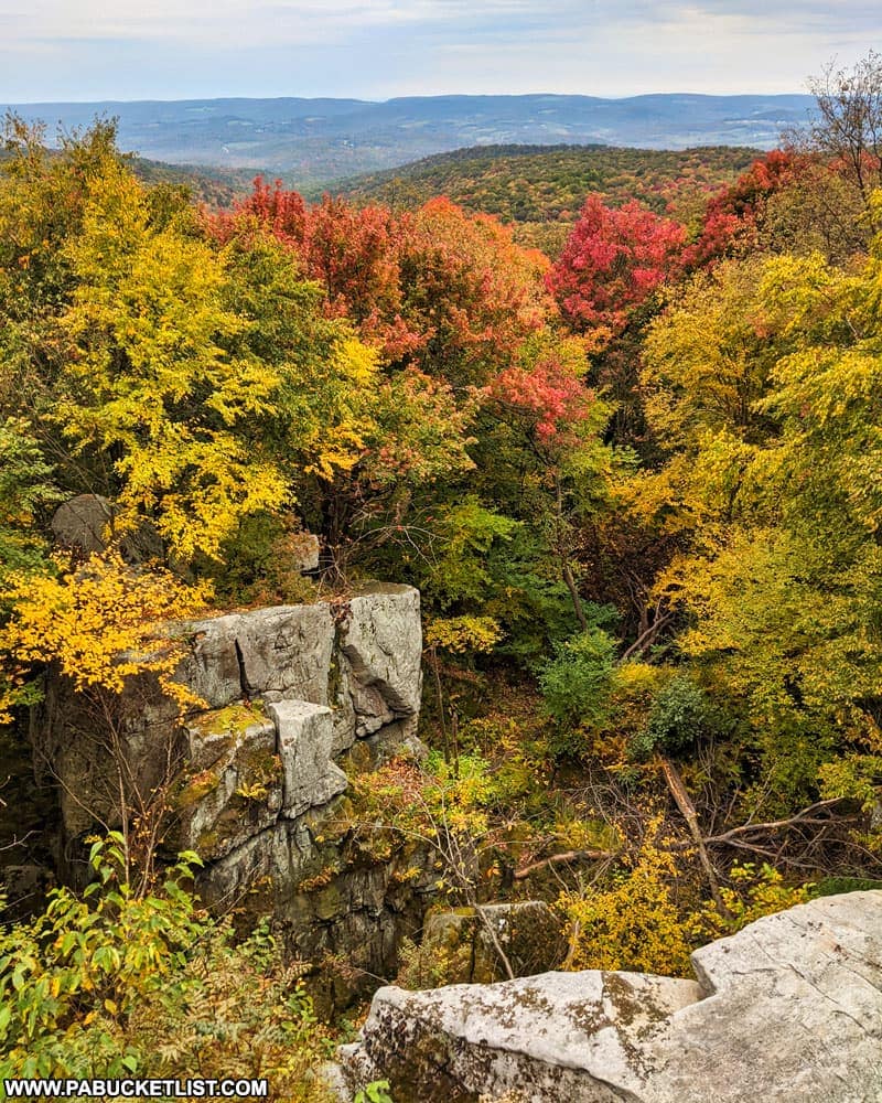
For first time visitors, it’s important to mention from the outset that there are TWO viewing areas at Laurel Run Overlook, situated rougly 50 yards apart.
The northernmost viewing area is easily identified by the many bowl-shaped depressions in the rock surface.

The southernmost viewing area features more elongated depressions in the rock surface.

Either way, both areas are extremely photogenic!

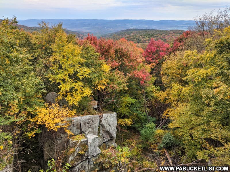
Those seeking a phenomenal vantage point to take in the famous Laurel Highlands fall foliage would be hard pressed to find a better location that Laurel Run Overlook.

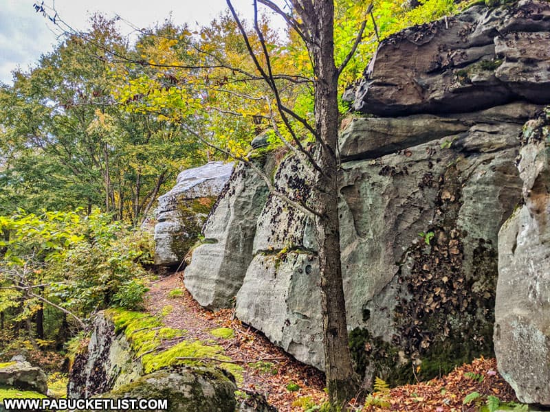
The size of the rock formations that make up the two viewing areas at Laurel Run Overlook is perhaps best appreciated by viewing them from the sides.
As the name implies, this vista overlooks the Middle Fork of Laurel Run, although catching a glimpse of the stream is virtually impossible, given all the tree canopy.
Whether you are hiking in from the north or south, the Laurel Highlands Hiking Trai leading to Laurel Run Overlook makes for a very enjoyable trek to a spectacular scenic view!

Nearby Attractions
21 Must-See Attractions in Fayette County is your guide to even more great destinations near Laurel Run Overlook.
The Youghiogehny River Overlook is also located along the Laurel Highlands Hiking Trail in Fayette County, at Ohiopyle State Park.
Exploring the Haunted Quaker Church in Fayette County will take you to a rural hilltop church where history and urban legend combine for one incredible supernatural tale!

Beam Rocks Overlook is located north of Laurel Run Overlook, just off the Laurel Highlands Hiking Trail in Somerset County.

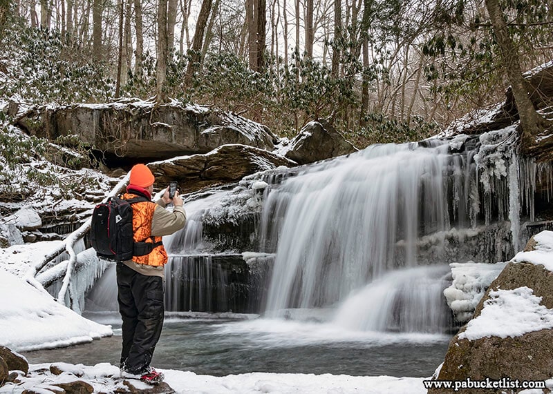
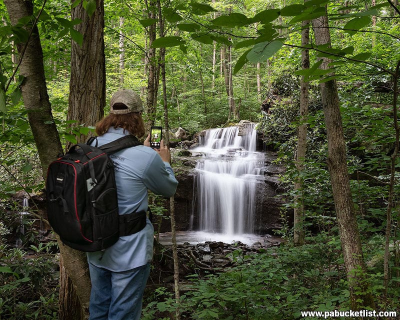
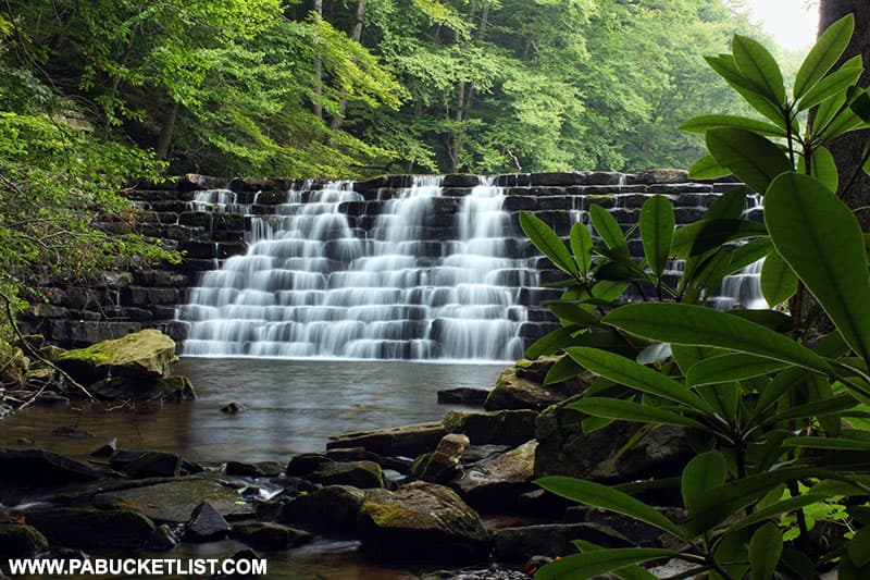
Cole Run Falls is located approximately 5 miles from Laurel Run Overlook, in the Forbes State Forest.

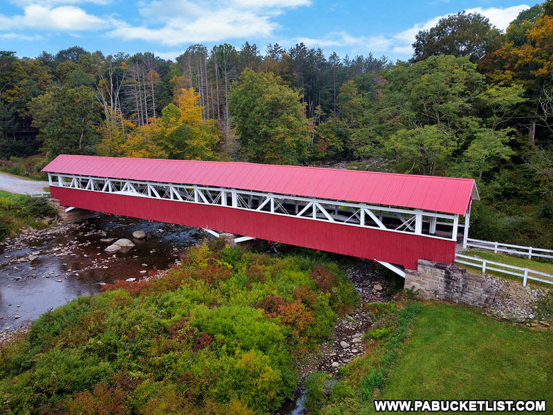
The Barronvale Covered Bridge is located roughly 4 miles from Laurel Run Overlook.
24 Must-See Waterfalls in the Laurel Highlands introduces you to some of the best waterfalls in the region.
The 14 Best Scenic Overlooks in the Laurel Highlands shows you where to find the most stunning vistas in the region.

10 of the Best Hiking Trails at Ohiopyle State Park will introduce you to some of the premier hiking trails in the Laurel Highlands.
Exploring Laurel Hill State Park in Somerset County will show you some of the best things to see and do at this iconic Laurel Highlands destination.
Did you enjoy this article?
If so, be sure to like and follow PA Bucket List on Facebook, Instagram, and/or Pinterest to stay up-to-date on my latest write-ups.
Click on any of the icons below to get connected to PA Bucket List on social media!