
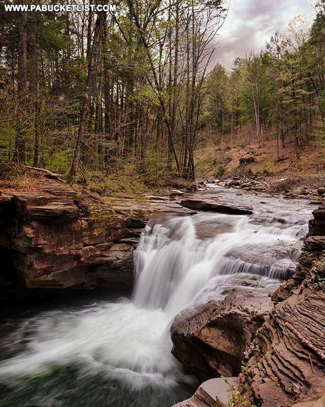
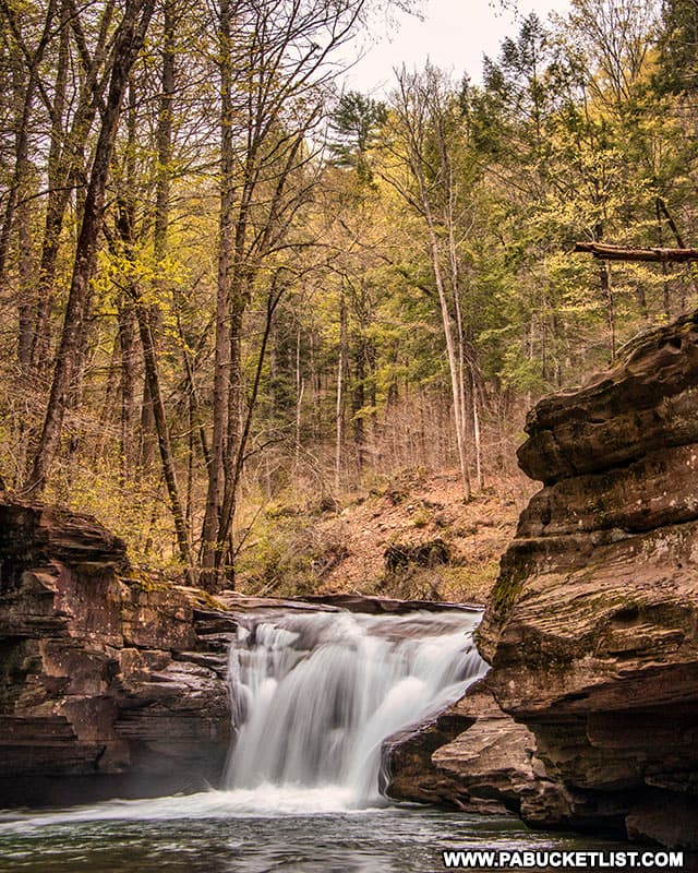
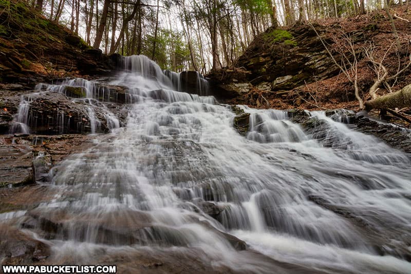
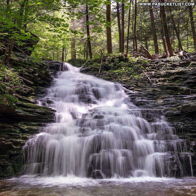
Mill Creek Falls is an idyllic 12-foot tall waterfall located just minutes from Hillsgrove in Sullivan County.
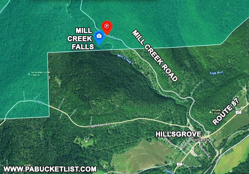
How to Find Mill Creek Falls in the Loyalsock State Forest
Time needed: 10 minutes
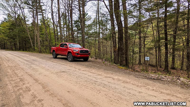
- From Route 87 in Hillsgrove turn onto Mill Creek Road (a dirt forest road) and travel 1.5 miles to an unmarked but obvious parking area on your right.
If navigating by GPS, use coordinates 41.45748, -76.72368 to find the parking area for Mill Creek Falls.
- Look for the Mill Creek Falls trailhead, marked by a faint yellow blaze and an “Area Closed to Camping” sign.
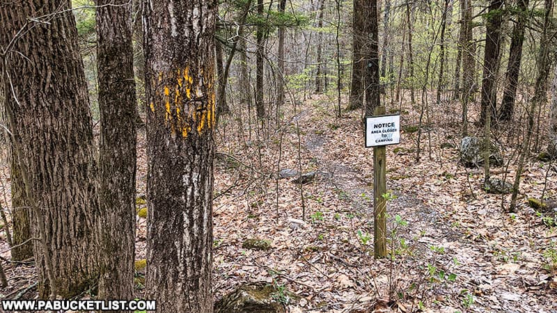
- Follow the Mill Creek Falls trail downhill for 200 yards to the top of Mill Creek Falls.
Viewing Mill Creek Falls
Mill Creek is a picturesque tributary of Loyalsock Creek.
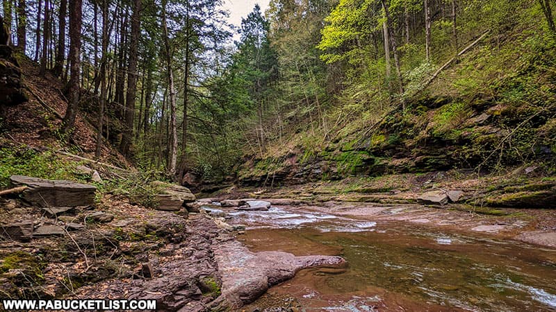
And while Mill Creek Falls is certainly not the tallest waterfall in the area, the rocky grotto around makes it quite photogenic.
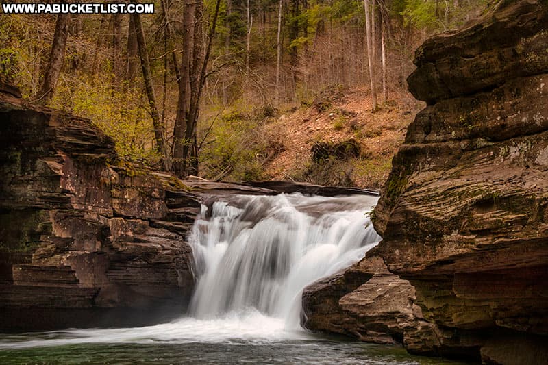
Mill Creek Falls is a popular swimming hole in the summer months, so get there early in the day if you want to see it in relative solitude.
Still not convinced you need to visit Mill Creek Falls?
Then check out this video!
Nearby Attractions
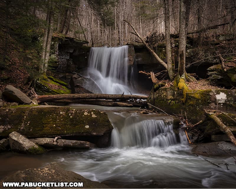
East Branch Falls is located just a few minutes further up the road, alongside Walker Road in the Loyalsock State Forest.
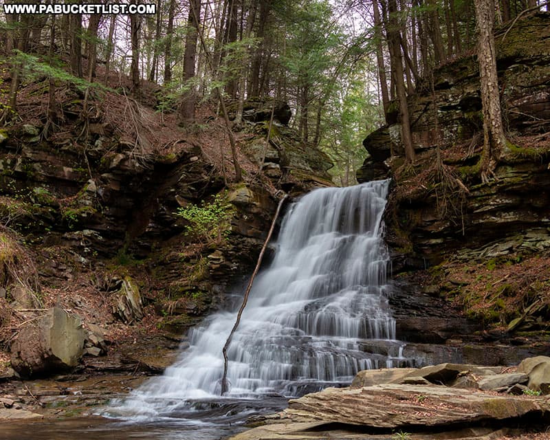
Middle Branch Falls is another almost-roadside waterfall located close by along Camels Road in the Loyalsock State Forest.
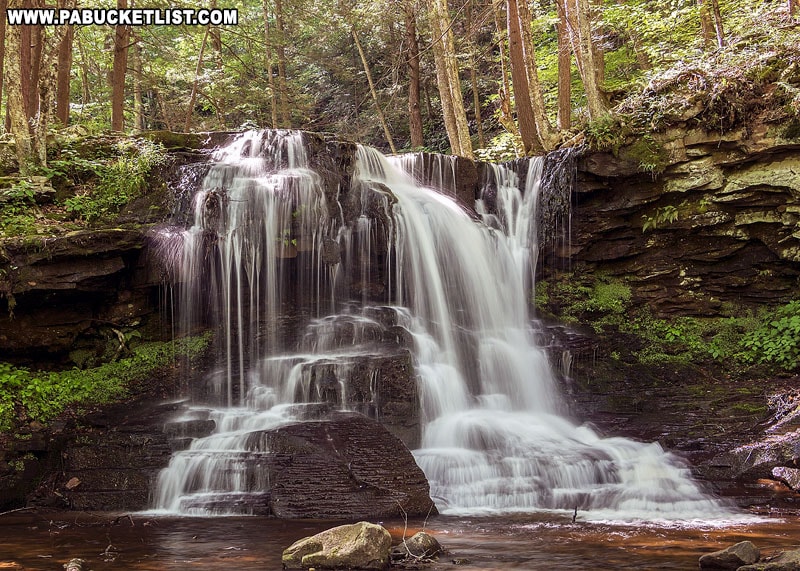
Emerald Falls is a picturesque 15 foot-tall waterfall in the Sullivan County portion of the Loyalsock State Forest.
Dry Run Falls is another excellent roadside waterfall, located just east of Hillsgrove in the Loyalsock State Forest.
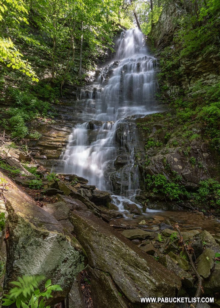
Angel Falls is located close by as well, and is one of the tallest waterfalls in the Loyalsock State Forest.
Ketchum Run Falls is located off of High Knob Road, between Hillsgrove and Worlds End State Park, along the Ketchum Run Trail.
Did you enjoy this article?
If so, be sure to like and follow PA Bucket List on Facebook, Instagram, and/or Pinterest to learn more about the best things to see and do in Pennsylvania!
Click on any of the icons below to get connected to PA Bucket List on social media!