
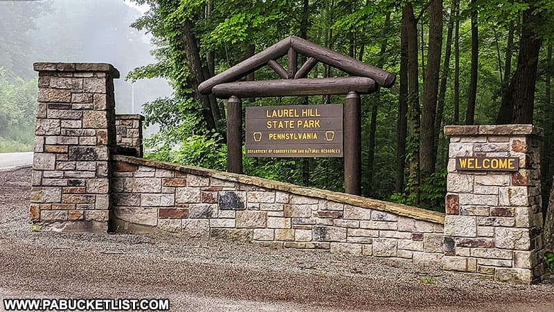
The scenic overlook tower at Laurel Hill State Park offers visitors stunning 360-degree views of the Pennsylvania Laurel Highlands!
This overlook and a 184 acre parcel of land around it was previously known as Penn Scenic View and was privately owned until 2016.
It was acquired by the Western Pennsylvania Conservancy and then transferred to the state, to become a permanent addition to Laurel Hill State Park.
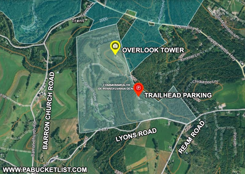
How to Find the Scenic Overlook Tower at Laurel Hill State Park
There is no direct driving route through Laurel Hill State Park to the overlook tower – the parking area is located just off of Lyons Road, which in turn can be accessed by either Barron Church Road or Ream Road.
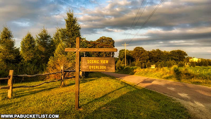
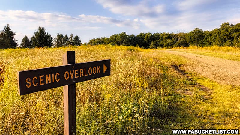
Look for this sign (below) along Lyons Road to direct you to the parking area for the scenic overlook tower.
If navigating by GPS, use coordinates 39.97735, -79.23607 to reach the large gravel parking lot near the scenic overlook tower trailhead.

Hiking to the Scenic Overlook Tower at Laurel Hill State Park
The trailhead for the 0.3 mile hike to the scenic overlook tower begins at the gated dirt road pictured below.
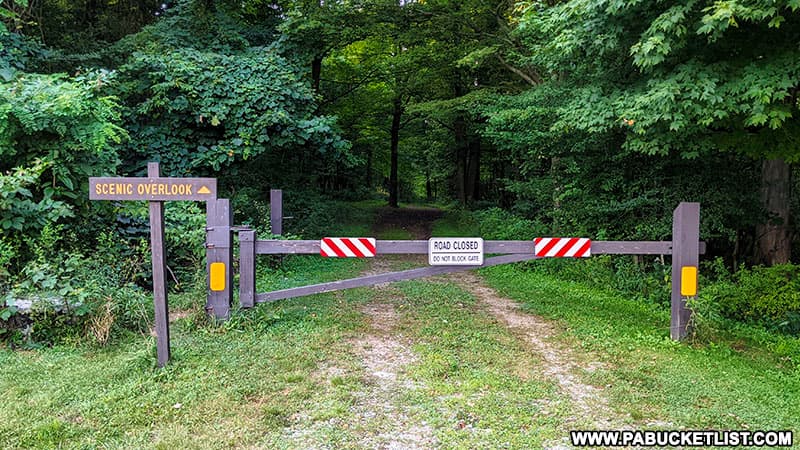
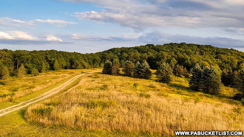
The entire hike takes place on this old dirt road, hearkening back to when this was still privately-owned Penn Scenic View and you could drive right up to the tower.
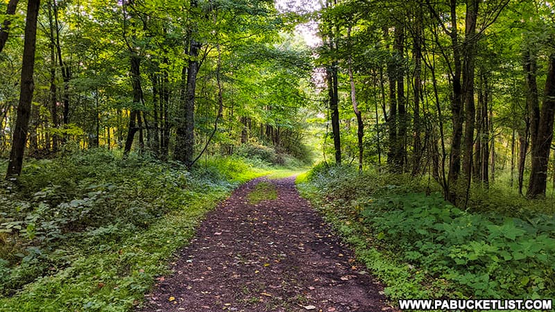
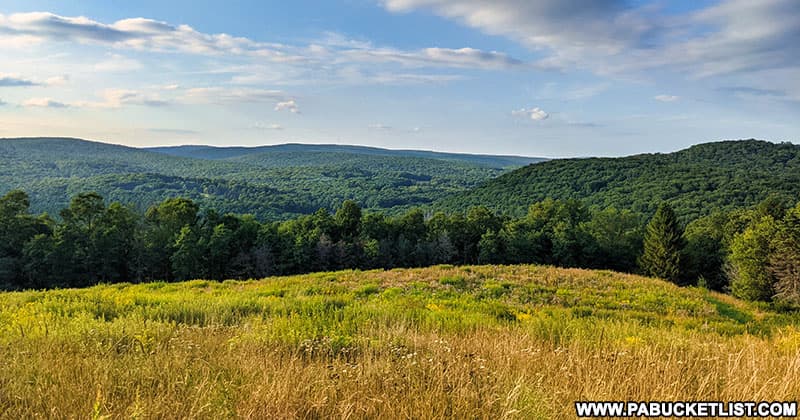
The first half of the hike is through a wooded portion of land, the second half has you emerging into a wildflower meadow and hiking slightly uphill the remainder of the way to the observation tower.
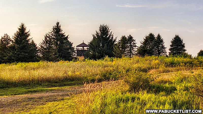
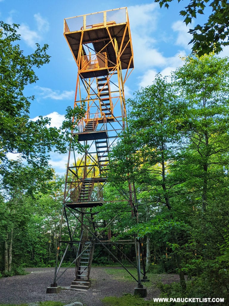
As you crest the hill in the meadow, the scenic overlook tower at Laurel Hill State Park will come into view.
The Views from the Scenic Overlook Tower at Laurel Hill State Park
Unlike climbing the observation tower at Mount Davis, the highest point in Pennsylvania (and also located in Somerset County), climbing the observation tower at Laurel Hill State Park is a LOT less nerve-wracking!
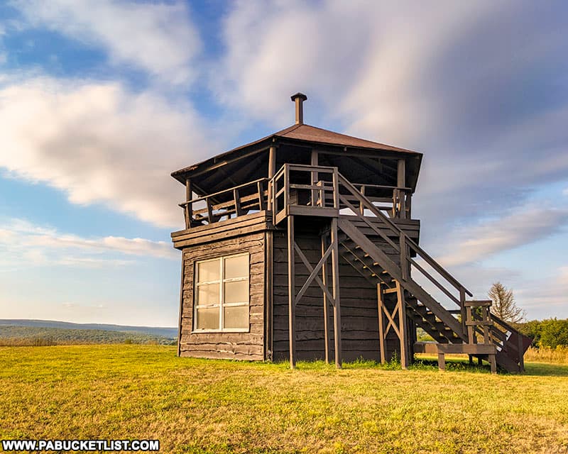
A single flight of stairs leads you to a covered, circular platform with views in all directions.
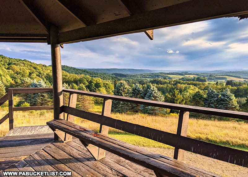
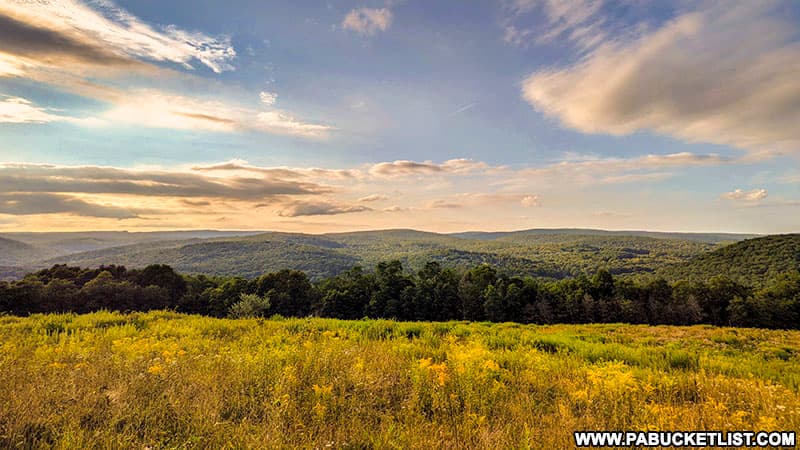
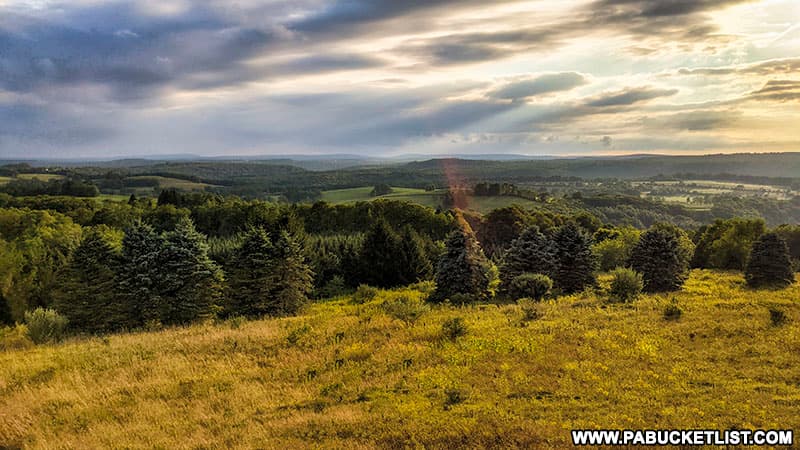
To the south, rolling farmland extends as far as the eye can see.
To the east, you’re looking back in the direction of the parking area (note the road you hiked in on).
The northwestern view from the scenic overlook tower is my personal favorite.
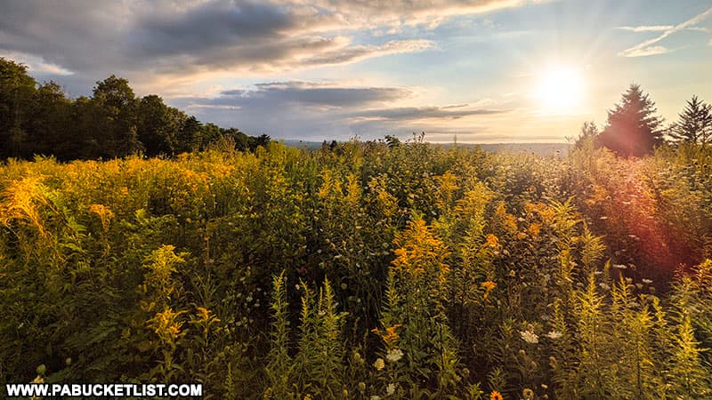
The ground-level views are also amazing, as the scenic overlook tower at Laurel Hill State Park is surrounded by a spectacular meadow of wildflowers.
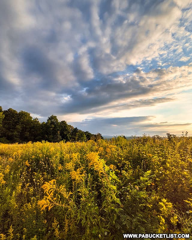
This is definitely one of the best spots in all the Laurel Highlands to catch a gorgeous sunset!
Nearby Attractions
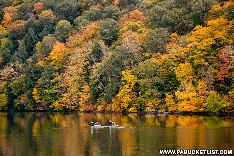
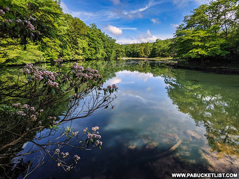
Laurel Hill State Park is comprised of 4,062 acres of mountainous, wooded terrain, including the 63 acre Laurel Hill Lake, a fantastic spot for swimming, boating, fishing, and bird-watching.
Kooser State Park occupies 250 wooded acres along Route 31 in Somerset County, the focal point of the park being 4-acre Kooser Lake.
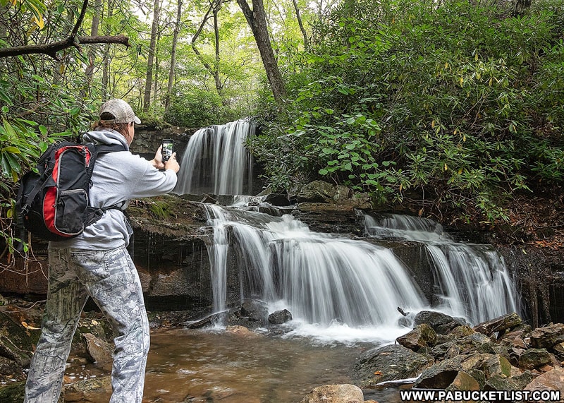
Cole Run Falls is just minutes from the scenic overlook at Laurel Hill State Park, in the Forbes State Forest.
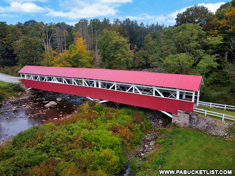
The nearby Barronvale Covered Bridge isn’t just the longest covered bridge in Somerset County – it’s one of the longest covered bridges in all of Pennsylvania!
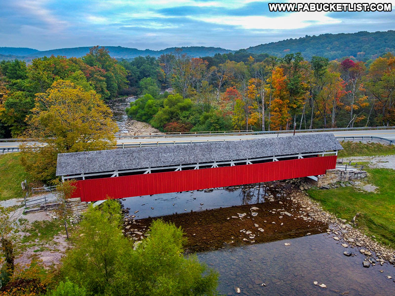
Kings Covered Bridge is just a mile downstream from the Barronvale Covered Bridge, and features a small creekside picnic pavilion in addition to the historic bridge.
If manmade observation towers tickle your fancy, then the one at Mount Davis – the highest point in Pennsylvania – is sure to get your heart pumping!
Did you enjoy this article?
If so, be sure to like and follow PA Bucket List on Facebook, Instagram, and/or Pinterest to stay up-to-date on my latest write-ups about the best things to see and do in Pennsylvania.
Click on any of the icons below to get connected to PA Bucket List on social media!