
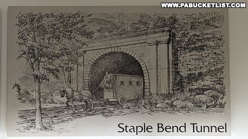
The Staple Bend Tunnel in Cambria County has the distinction of being the first railroad tunnel built in the United States!
Constructed as part of the Allegheny Portage Railroad, this 901 foot-long tunnel was built between November 1831 and June 1833, progressing 18 inches each day, with crews working simultaneously on both sides eventually meeting in the center.
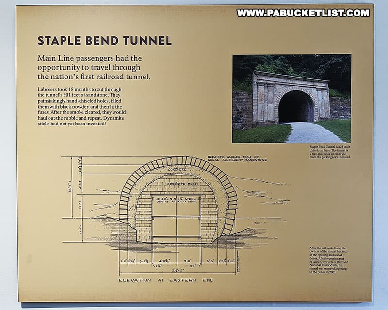
Today, the tunnel is operated by the National Park Service as a unit of the Allegheny Portage Railroad National Historic Site.
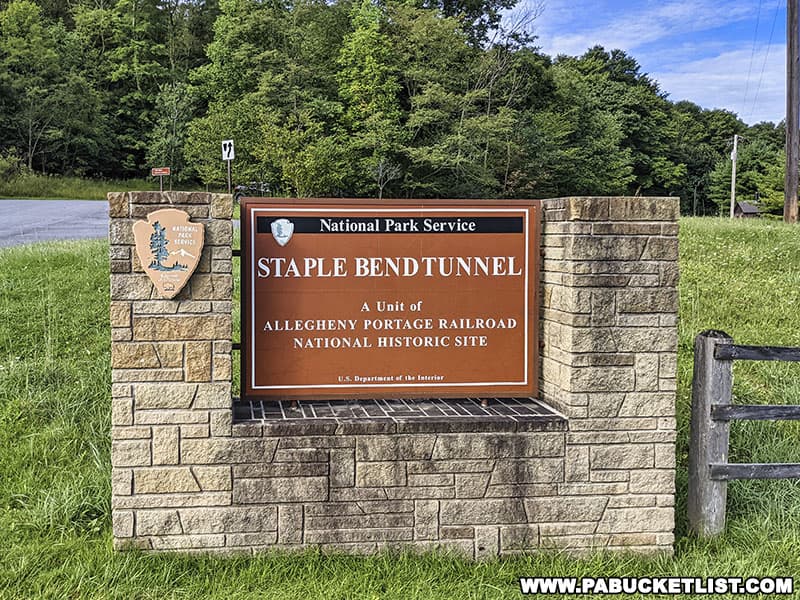
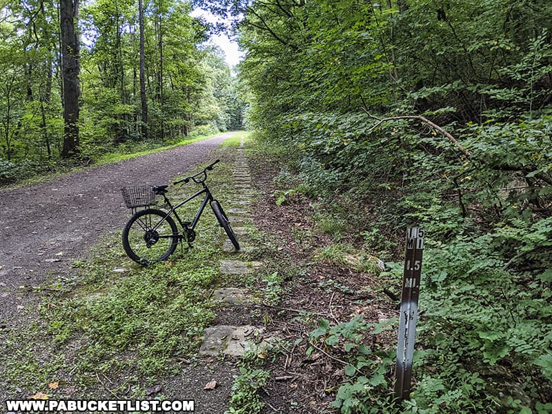
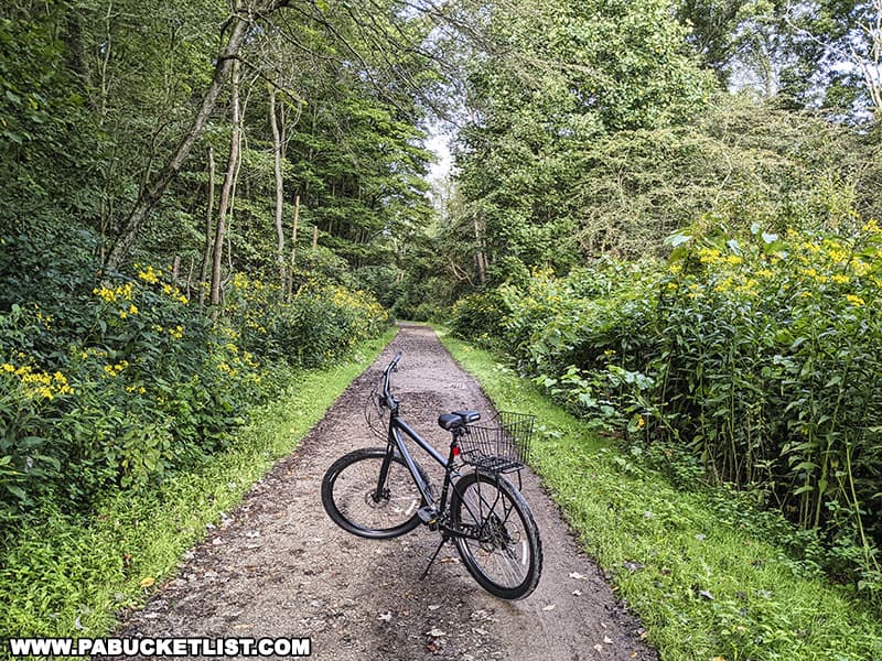
Visitors can hike or bike the 2.5 mile-long (one-way) Staple Bend Tunnel Trail from a parking area along Beech Hill Road in Mineral Point westward to the tunnel.
History of the Staple Bend Tunnel
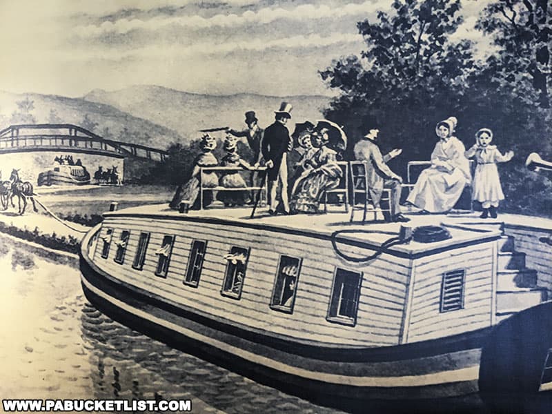
The Staple Bend Tunnel was just one part of the larger Allegheny Portage Railroad, the first railroad to cross the Allegheny Mountains.
This 36 mile-long track allowed for canals on the eastern and western sides of the state to be connected, cutting the travel time between Pittsburgh and Philadelphia from weeks to just days.
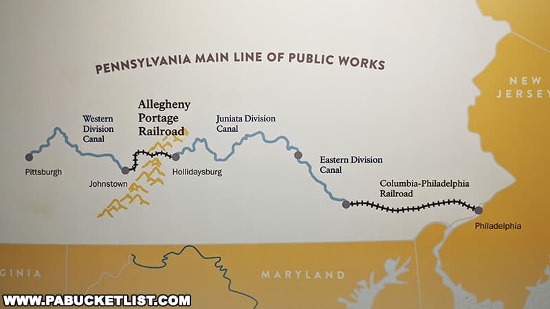
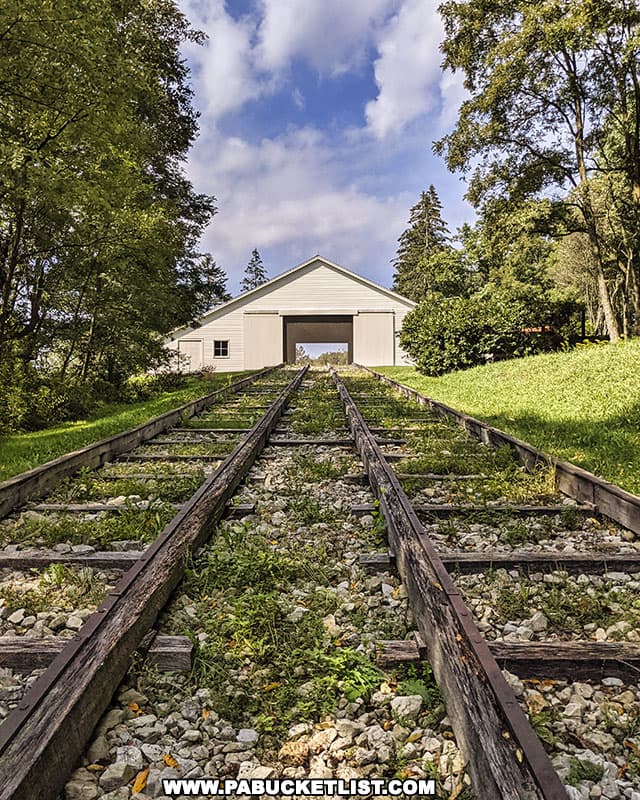
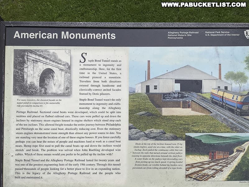
Using an ingenious system of 10 inclined planes, 10 stationary steam engines, and a series of rails, cables, and pulleys, canal boats carrying freight and/or passengers could be loaded on flatbed train cars and winched up and down over the mountains, similar to how a modern day ski lift operates.
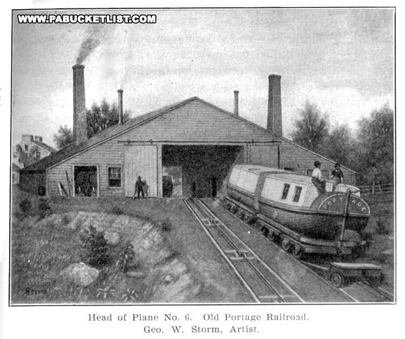
Between these 10 inclined planes were areas known as “levels” – literally flat sections of the railroad where the rail cars could be pulled by mules (and in later years by small steam locomotives).
Once across the Allegheny Mountains, the canal boats could be put back into the water to continue on their journey east or west.
The Staple Bend Tunnel exists on the “level” between the top of Incline 1 and the bottom of Incline 2, which makes for a nice flat hike or bike ride.
The Staple Bend Tunnel Trail
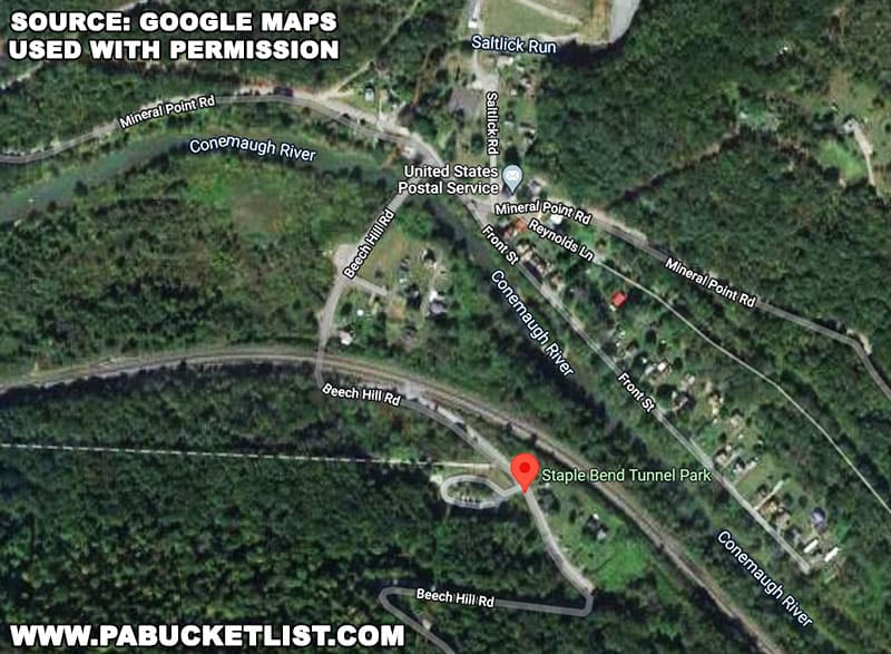
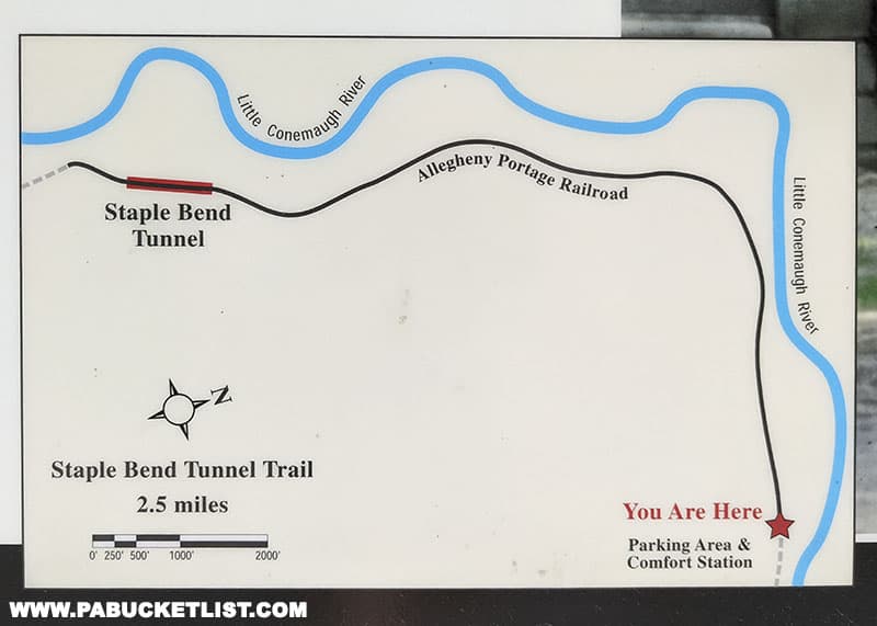
This historic rail trail starts at a parking area along Beech Hill Road near Mineral Point, 5 miles northeast of Johnstown.
The trail covers 2.5 miles, to and through the Staple Bend Tunnel.
The parking area along Beech Hill Road is located at GPS coordinates 40.376299, -78.835081.
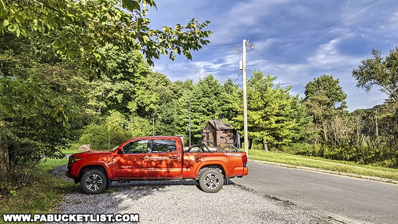
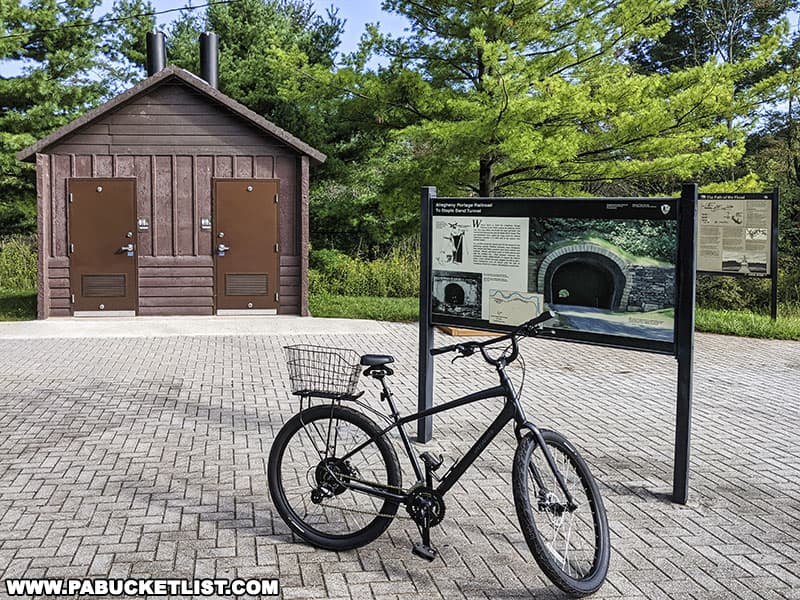
You’ll find informational kiosks and restrooms at the trailhead.
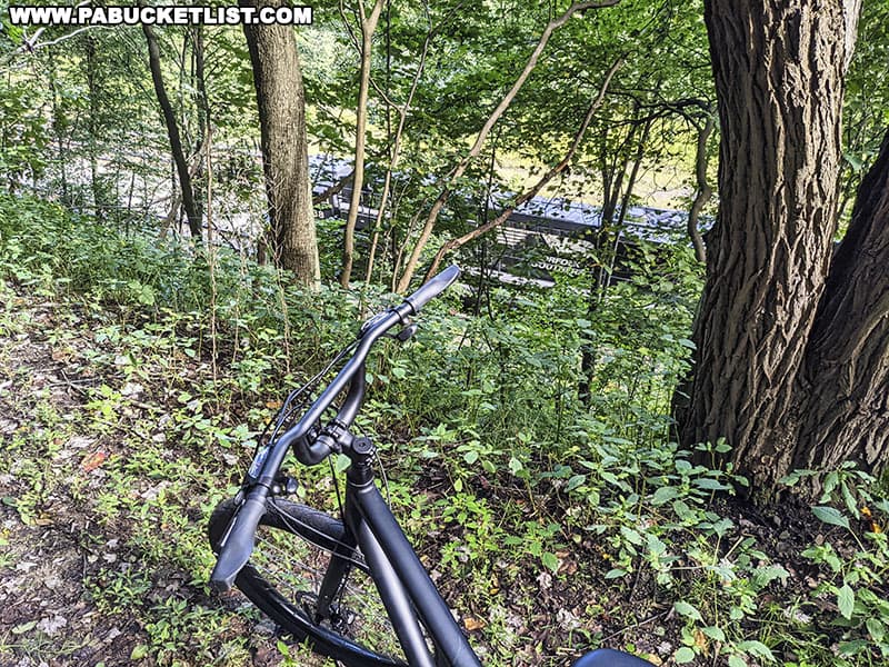
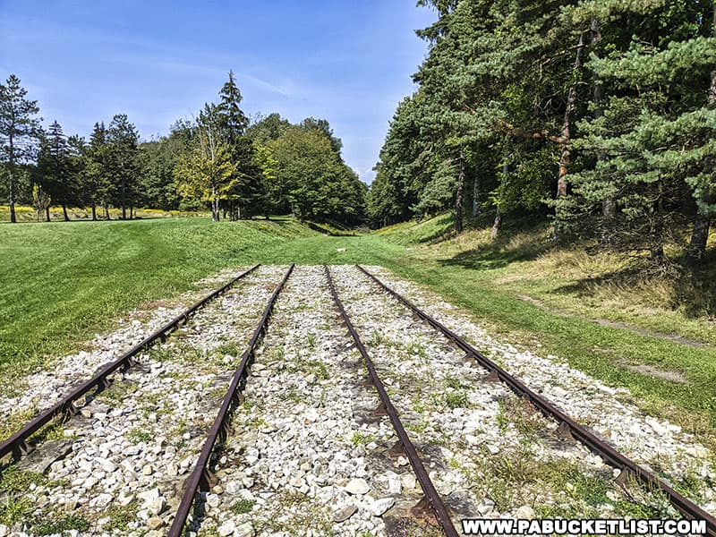
The trail runs parallel to (and slightly above) both the Little Conemaugh River and the modern Norfolk Southern rail line, and it’s common to see a train pass by on your way to/from the tunnel.
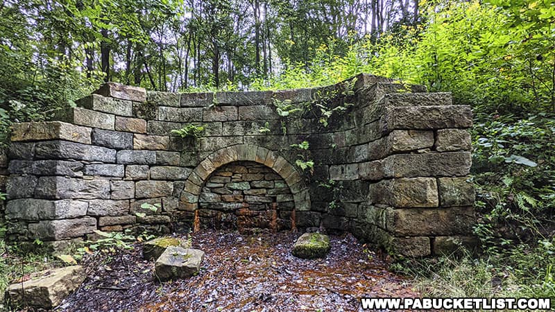
You’ll also pass several elaborate culverts that were dug beneath the Allegheny Portage Railroad, so water would flow under the railbed and not over it, preventing washout or other damage to the rails.
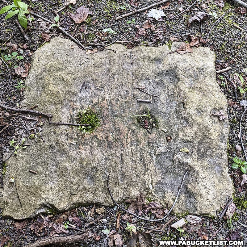
At several points along the trail you’ll pass rows of “sleeper stones”, upon which the rails would have been mounted.
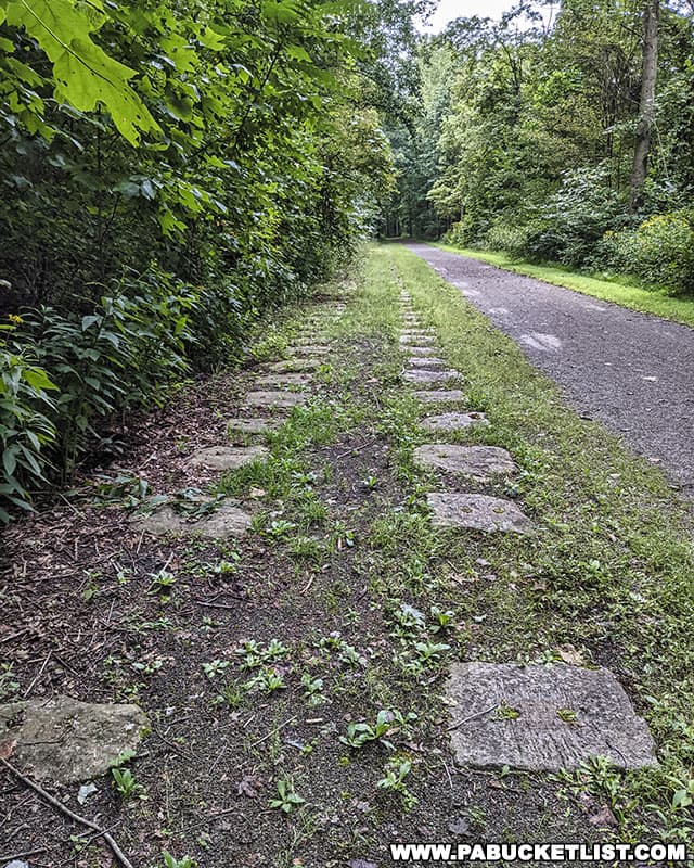
These large, square-cut stones were embedded in the ground so they were flush with the surface.
Since the rail cars on the “levels” were originally pulled by mules, not locomotives, sleeper stones were used instead of traditional wooden railroad ties so that no obstructions ran between the rails and the mules were less likely to stumble.
Each sleeper stone took an average of 24 hours of labor to cut and shape, and workers created approximately 200,000 stones for the Allegheny Portage Railroad!
Visiting the Staple Bend Tunnel
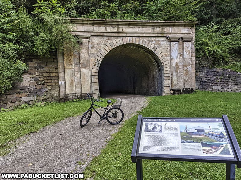
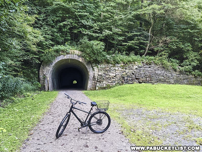
The eastern portal of Staple Bend Tunnel is decidedly less ornate than its western counterpart.
At the time of its construction, BOTH portals of the Staple Bend Tunnel were decorated with a Romanesque façade.
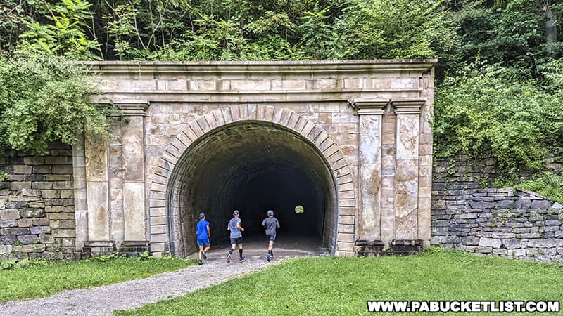
At some point after the Allegheny Portage Railroad ceased operations in the 1850s, the east entrance façade was removed and reportedly reused on another building.
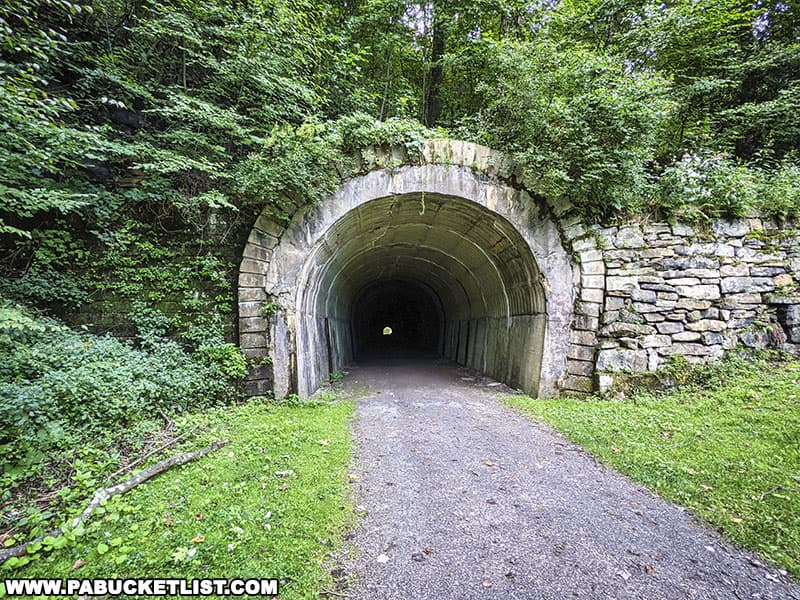
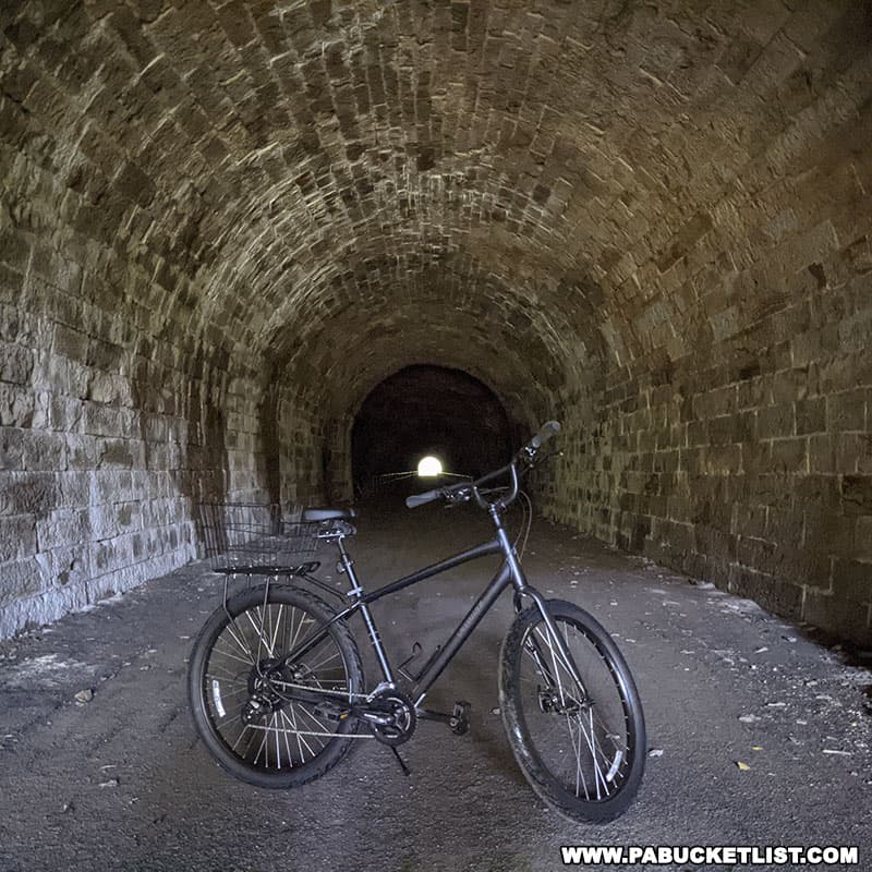
Both ends of the Staple Bend Tunnel were lined with cut stone for safety, as weather conditions near the open ends might cause rocks and dirt to fall on the train or the tracks.
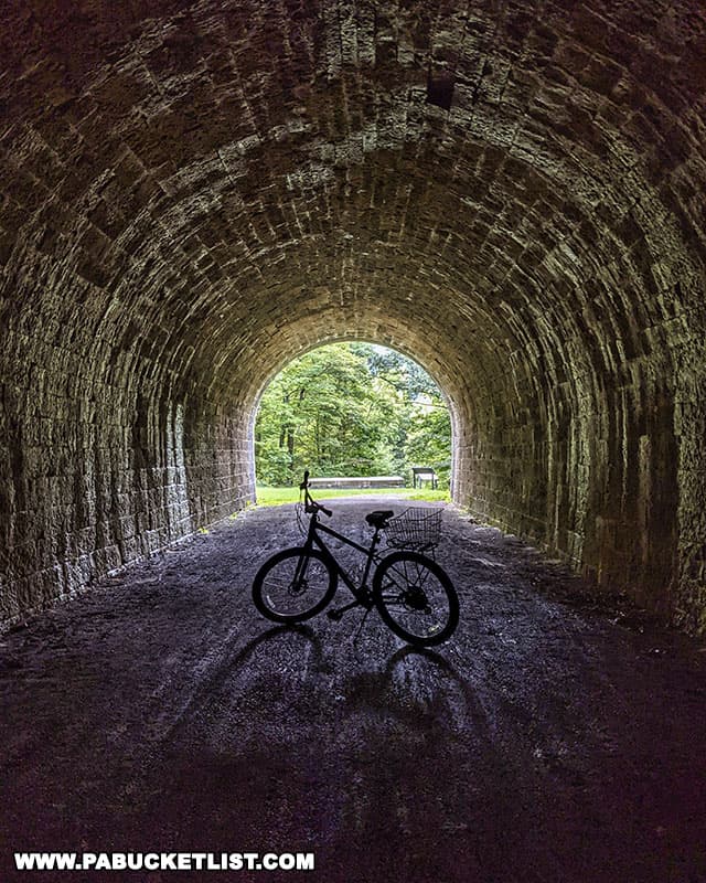
The center of the tunnel still has the original hand-hewn appearance.
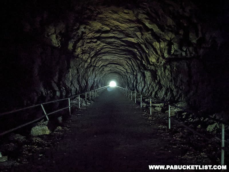
There is no artificial lighting inside the tunnel, and bicyclists should dismount and walk through, even if you have a headlamp.
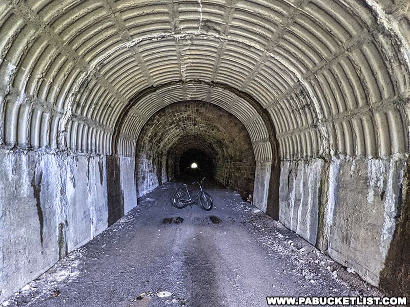
An informational kiosk outside the western portal of the tunnel tells you more about the tunnel and the Allegheny Portage Railroad in general.
If you want to connect with history and enjoy an easy and beautiful hike or bike ride in the process, I highly recommend exploring the Staple Bend Tunnel in Cambria County!
Related Attractions
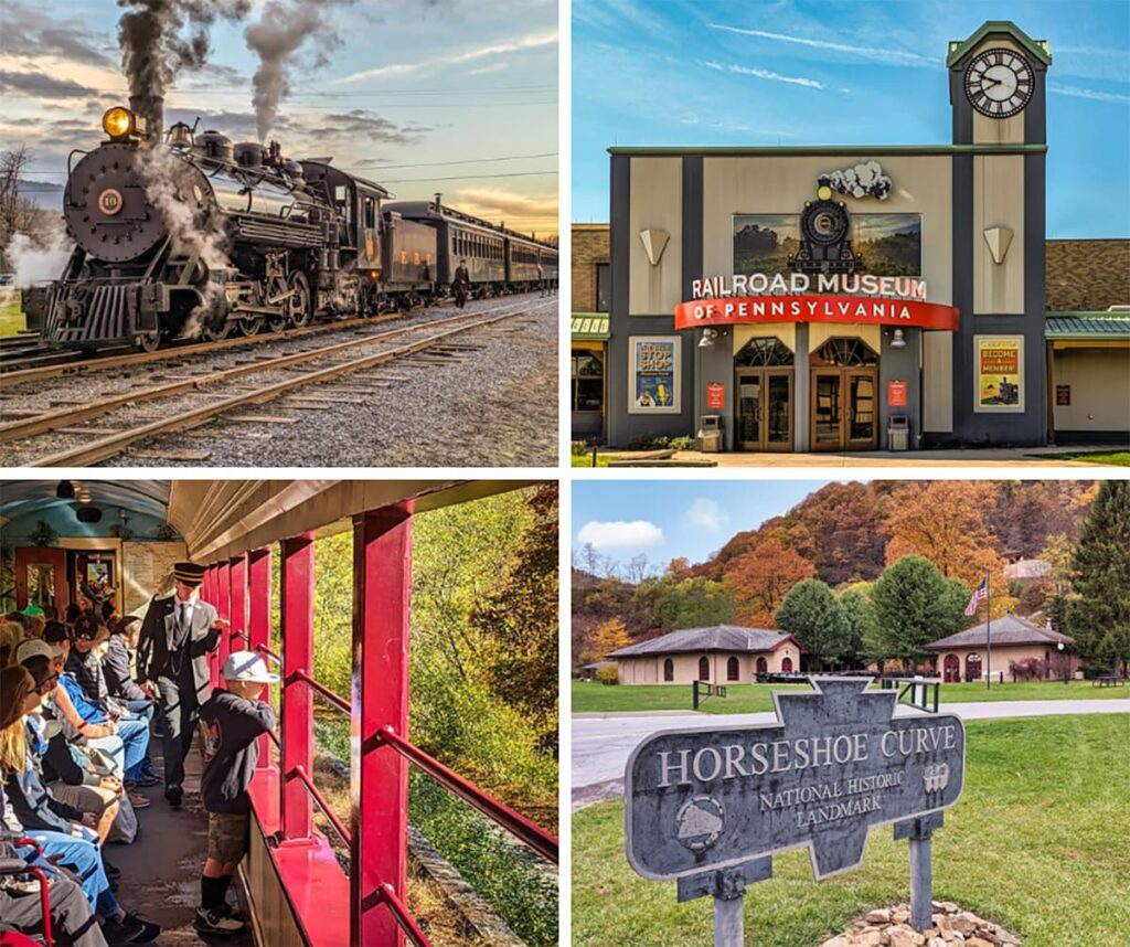
PA’s Top Railroad-Themed Attractions | A Visitor’s Guide highlights the best train rides in Pennsylvania, railroad museums, model railroads, and historic rail sites across Pennsylvania, all based on my firsthand visits.
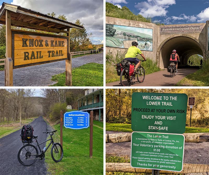
16 PA Rail Trails Anyone Can Enjoy is your guide to some of the best rail trail across Pennsylvania!
Nearby Attractions
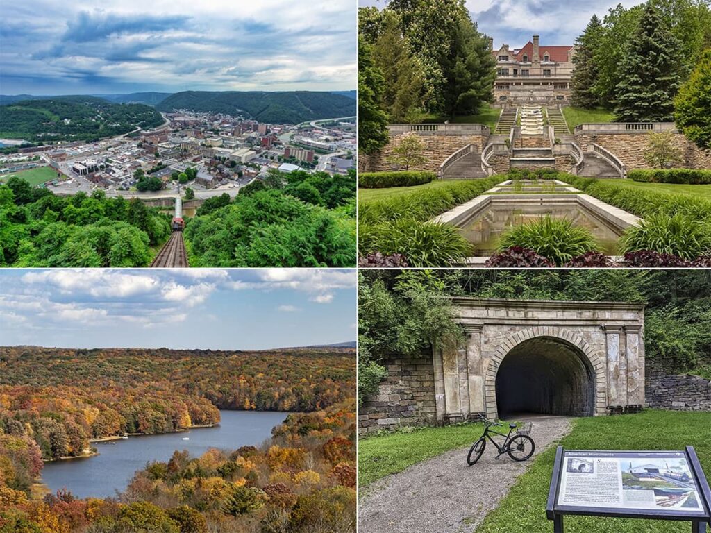
17 Must-See Attractions in Cambria County showcases more remarkable sights and experiences near the Staple Bend Tunnel.
Did you enjoy this article?
If so, be sure to like and follow PA Bucket List on Facebook, Instagram, and/or Pinterest to learn more about the best things to see and do in Pennsylvania!
Click on any of the icons below to get connected to PA Bucket List on social media.