
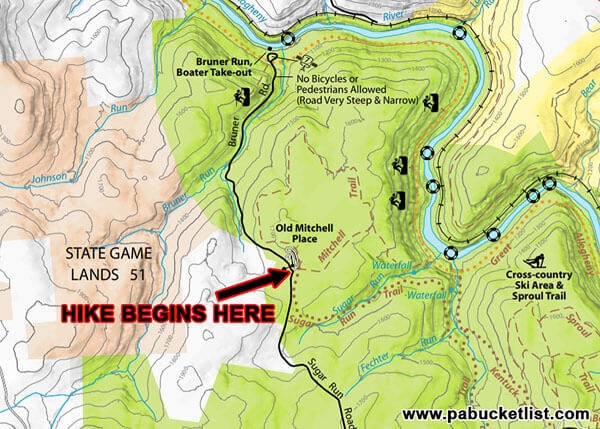
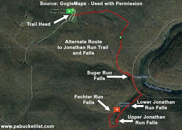
The Mitchell Trail at Ohiopyle State Park is a scenic and lesser-traveled trail at the park, and an alternate route to the waterfalls on Jonathan Run, Sugar Run, and Fechter Run.
What follows is an illustrated, step-by-step guide to finding and hiking the Mitchell Trail, visiting the waterfalls mentioned above.
How to Find the Mitchell Trail at Ohiopyle State Park
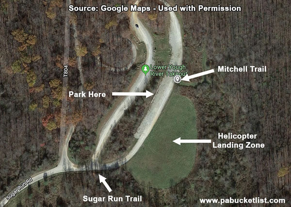
The Mitchell Trail begins at the Old Mitchell Place parking area along Sugar Run Road.
GPS Coordinates for the Old Mitchell Place Parking Area:
39.913918, -79.500453
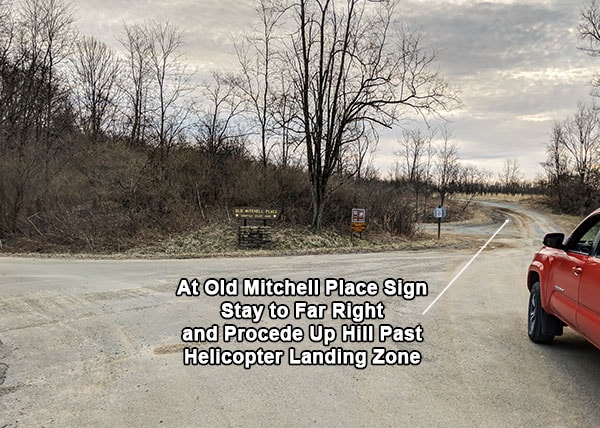
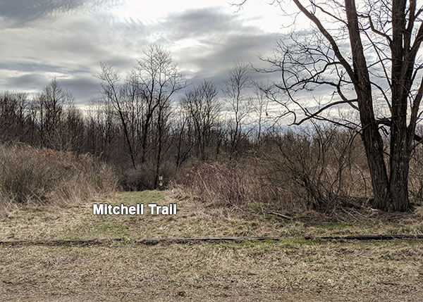
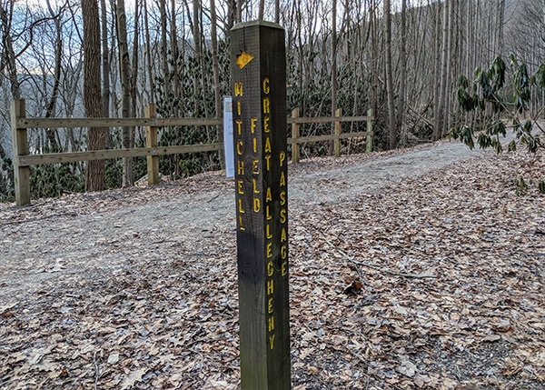
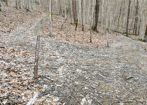
When you see the sign for the Old Mitchell Place, stay to the far right and proceed up the hill. You’ll pass the Sugar Run Trail sign (see photo below). This IS NOT the trail you will be using for this hike, although I will mention it again later.
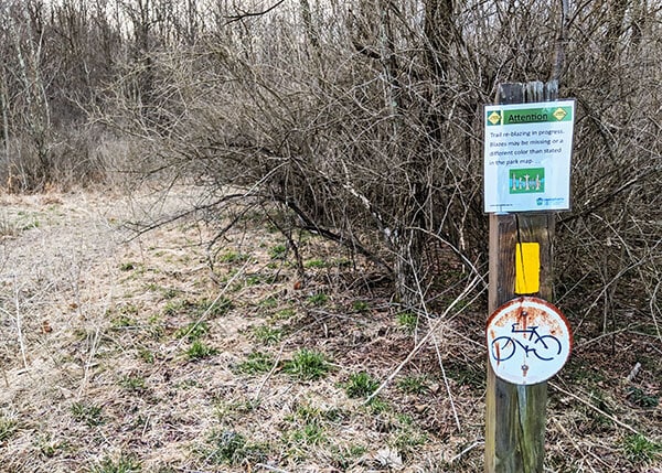
Just past the Sugar Run Trail will be the helicopter landing zone.
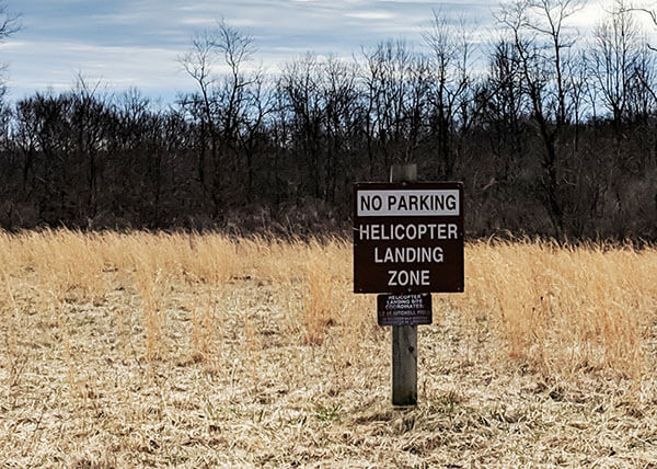
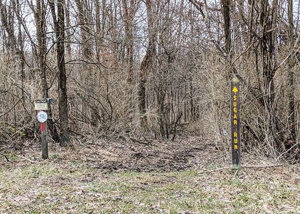
And just past the landing zone, on the same side of the road, will be a clump of trees and what looks like a wide, mowed ATV path (see photo below). THAT is the start of the Mitchell Trail.
Here’s a satellite view to sum things up.
Hiking the Mitchell Trail
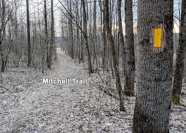
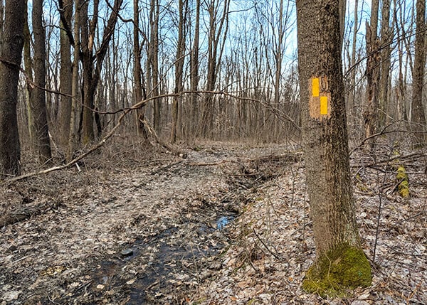
From the parking area proceed to the unmarked trail head. Although there is nothing here to indicate this is the Mitchell Trail, trust me – it is. The trail is freshly blazed with yellow paint and easy enough to follow.
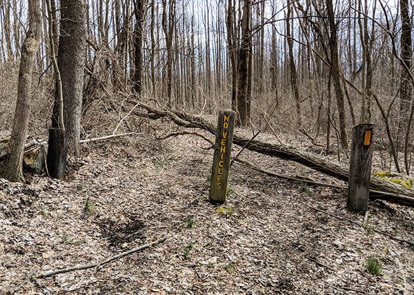
At .15 miles into the hike you’ll encounter and pass this “No Vehicles” sign.
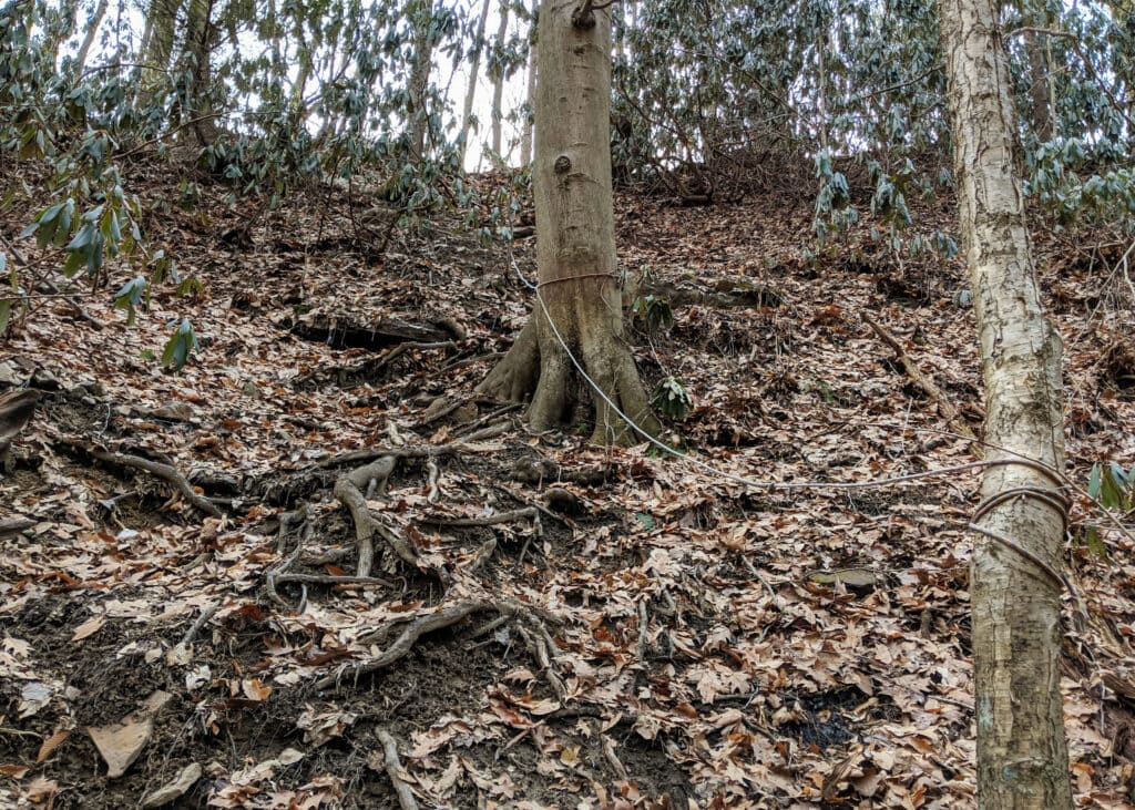
Just past this sign, the trail passes though Mitchell Field, an old farm field slowly being reclaimed by the forest. At certain points you can make out old fence posts and barbed wire among the trees.
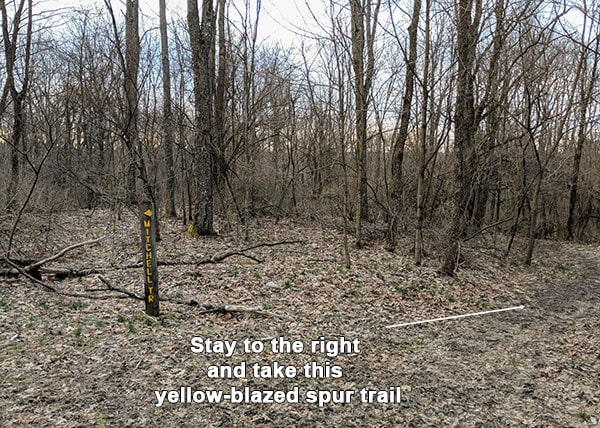
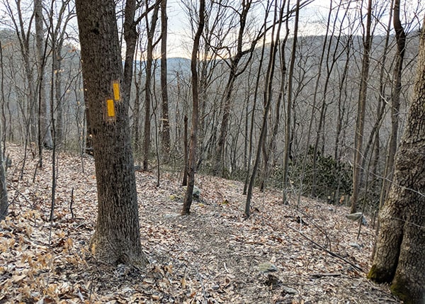
At .52 miles into the hike you’ll come to the “Y” intersection pictured below. STAY TO THE RIGHT to continue on the yellow-blazed Mitchell Trail Spur. If you follow the Mitchell Trail sign to the left, you’ll make a big loop and end up back at the parking lot.
At .66 miles into the hike, stay to the LEFT at this double yellow blaze.
At 1.1 miles into the hike, stay to the RIGHT at this double yellow blaze.
At 1.15 miles you’ll come to the top of a “staircase” built into the hillside you’ve been descending.
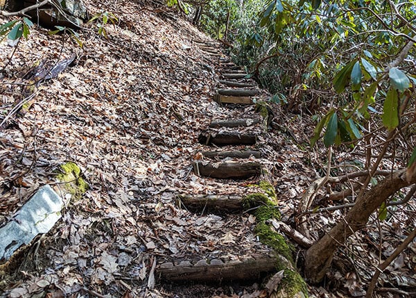
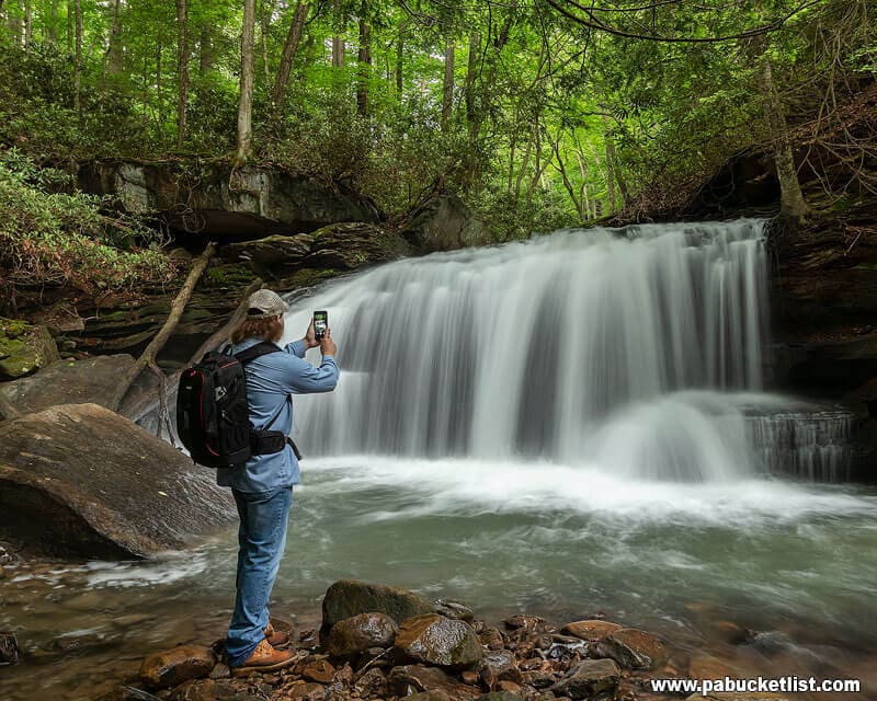
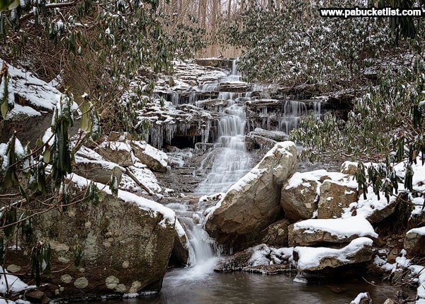
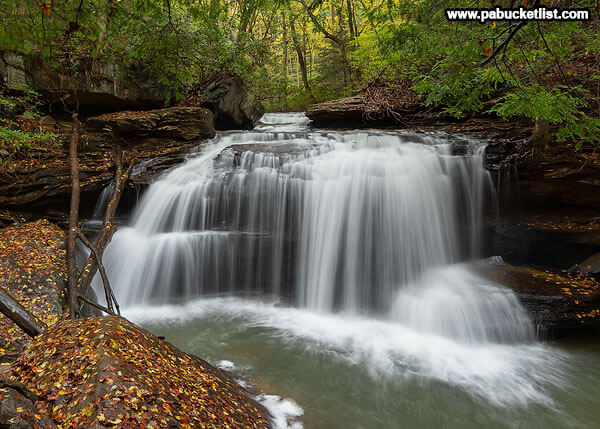
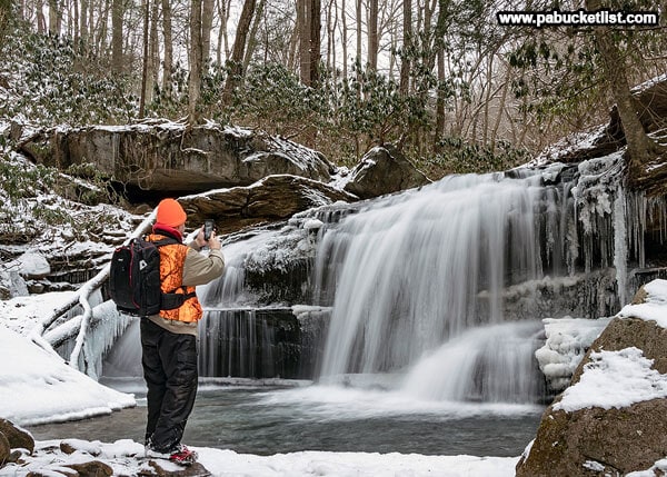
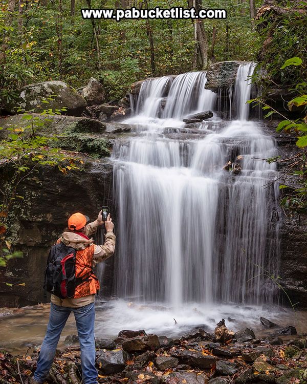
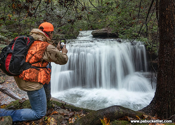
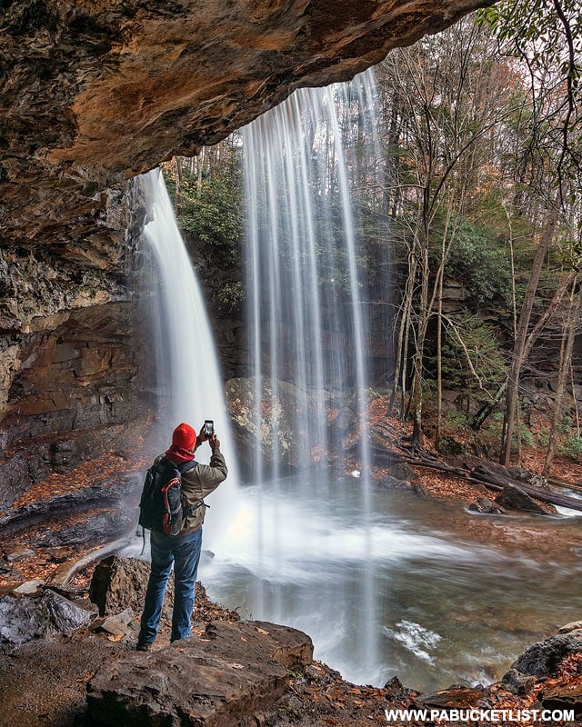
At the bottom of the staircase you’ll come face to face with the first waterfall on this hike – Sugar Run Falls.
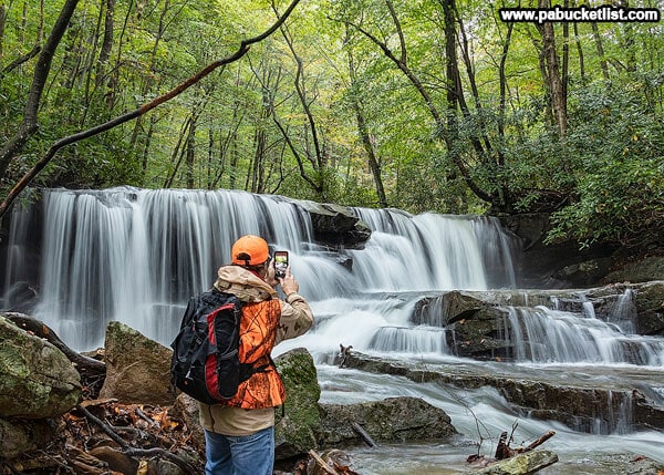
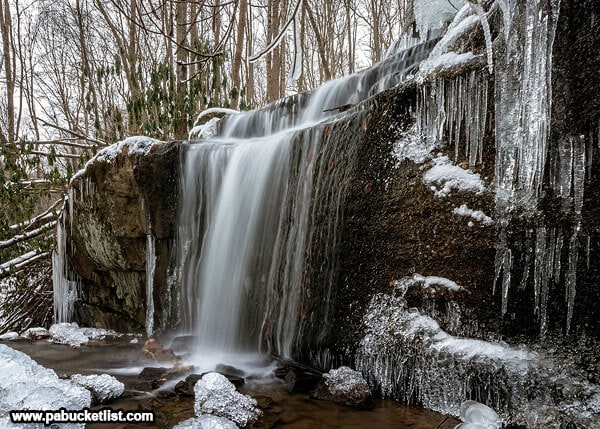
Sugar Run Falls
Sugar Run Falls is an intricate staircase of rock and water, somewhere in the neighborhood of 25-30 feet tall. It doesn’t always have exceptional flow, being on a smaller stream, but when it does it is something to behold.
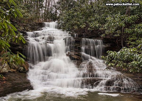
Sugar Run Falls makes for one of the more interesting winter waterfalls at Ohiopyle State Park.
Next Stop: Jonathan Run
Another 1/10th of a mile down the Mitchel Trail Spur you’ll step foot onto the Great Allegheny Passage. From here you’ll hang a right on the GAP and hike the smooth, flat bike trail for 2/10ths of a mile.
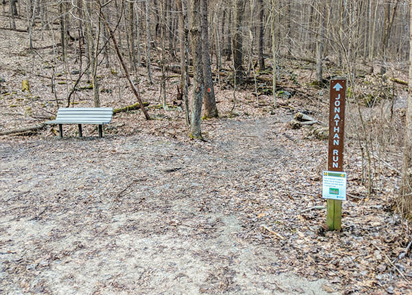
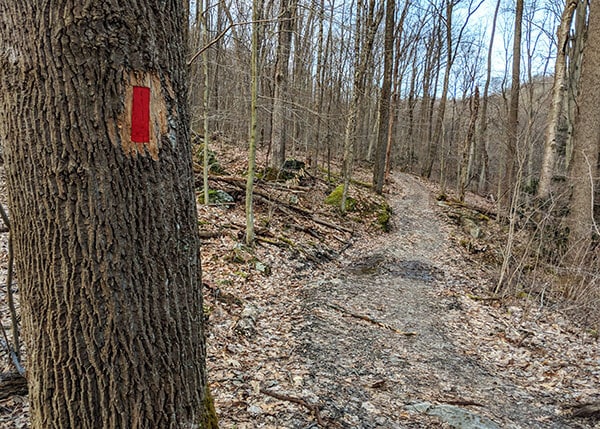
At 1.41 miles into the hike, you’ll arrive at the intersection of the Great Allegheny Passage and the Jonathan Run Trail. Proceed up the Jonathan Run Trail, and take note that it was recently re-blazed in RED (used to be blue).
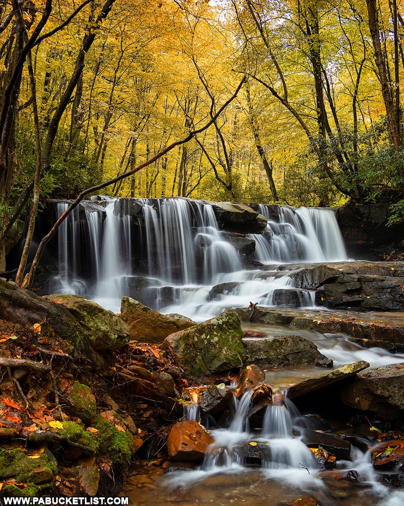
At 1.5 miles into the hike, you’ll arrive at/above Lower Jonathan Run Falls.
Lower Jonathan Run Falls
Without a doubt, Lower Jonathan Run Falls is the most difficult waterfall in the park to access. An unofficial “user trail” leads you from the Jonathan Run Trail down to stream level.
If you have any doubts about your ability to ascend/descend this steep stream bank, DO NOT ATTEMPT THIS PORTION OF THE HIKE! You can still see and hear the waterfall from the top of the stream bank.
If you do make the descent, you’ll be treated to sights like this.
Lower Jonathan Run Falls is remarkable in the winter. But use extreme caution getting down to stream level. Personally, I always hike with microspikes on my boots this time of year.
Next Stop: Upper Jonathan Run Falls
Continuing up the Jonathan Run Trail, you’ll arrive at an intersection with Kentuck Trail at 1.77 miles. Kentuck Trail will be on your left, Jonathan Run Trail will continue straight, and an unmarked but obvious user trail will be to your right, directly opposite the Kentuck Trail. TAKE THE UNMARKED USER TRAIL TO YOUR RIGHT. This will lead you down the stream bank to Upper Jonathan Run Falls.
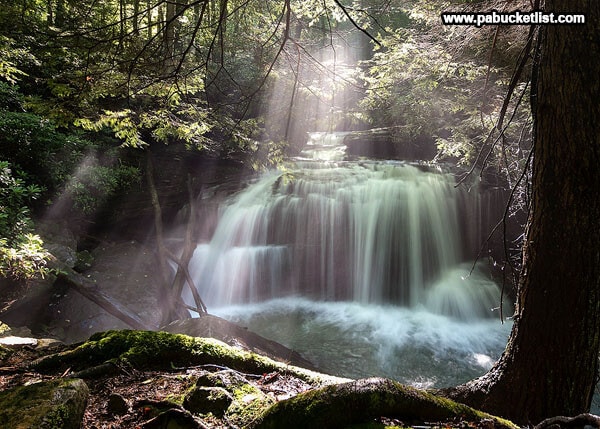
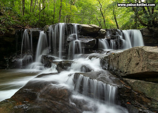
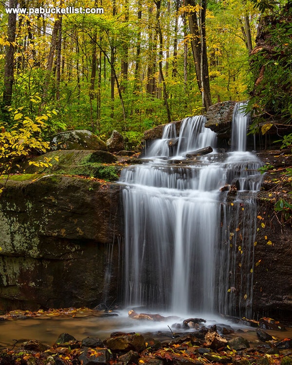
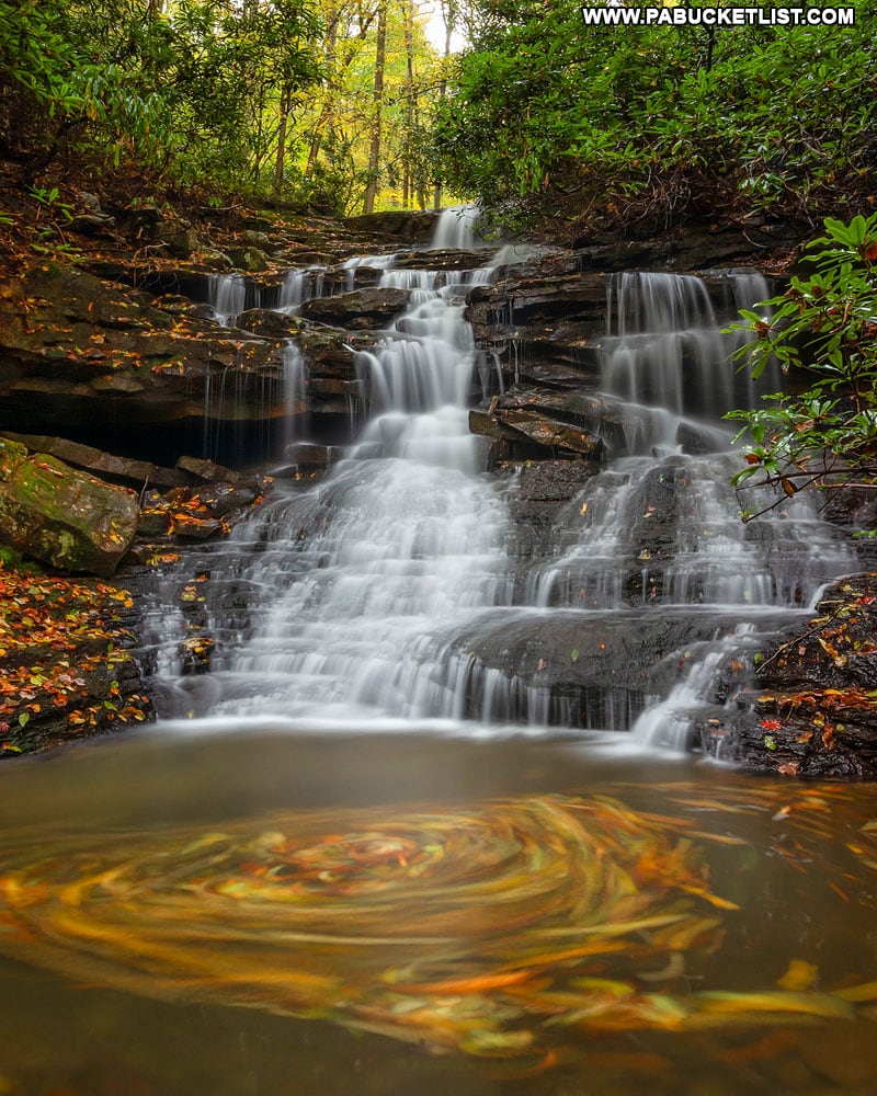
Upper Jonathan Run Falls
At best, Upper Jonathan Run Falls is a 10-footer, but the sheer intricacy of it makes it a superb subject for photography.
Be cautious when visiting Upper Jonathan Run Falls in the winter – a thin but invisible glaze of ice usually coats most of the rocks downstream.
Next Stop: Fechter Run Falls
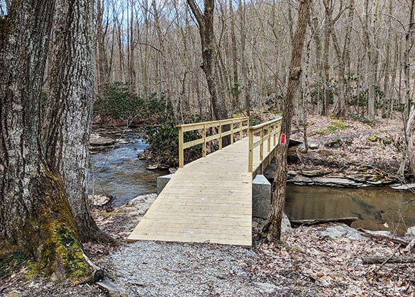
Continuing up the Jonathan Run Trail, you’ll encounter a newly-rebuilt footbridge over Jonathan Run (this one completed fall of 2018) at 1.83 miles into the hike.
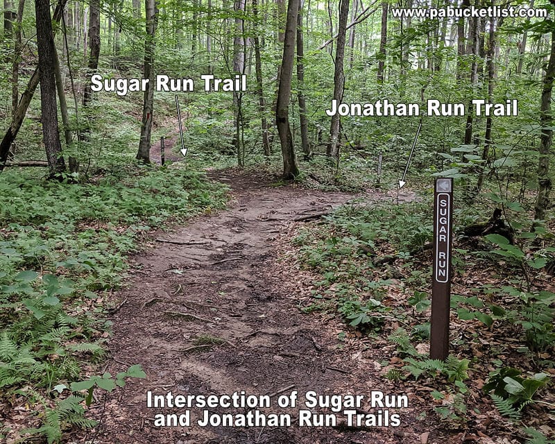
At 1.89 miles into the hike, you’ll come to the intersection of Jonathan Run Trail and Sugar Run Trail. TAKE SUGAR RUN TRAIL TO YOUR RIGHT.
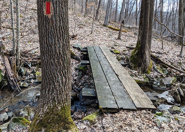
At 2 miles into the hike, you’ll encounter this small footbridge over Fechter Run.
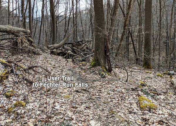
Just past the footbridge, Sugar Run Trail passes through a large blow down that has been chain-sawed to allow passage through it. A user trail JUST BEFORE the blow down leads you to the base of Fechter Run Falls.
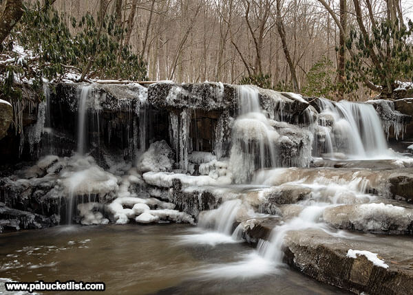
Fechter Run Falls
Fechter Run Falls is probably the least-visited waterfall at Ohiopyle State Park, and it takes a lot of rain or snow melt to make it look like much of anything. But when it gets going, it’s an exquisite waterfall that you can get right up next to.
Some of my favorite fall foliage shots at Ohiopyle have been at Fechter Run Falls.
And it’s a fine spot for ice formations in the winter.
The Return Hike
By the time you reach Fechter Run Falls, you’ve covered a little over 2 miles, and seen the 4 waterfalls that make this such a gratifying hike.
So what’s the best way to get back to your vehicle?
You could simply back-track and make this a 4 mile hike. The upside of that is that you’ve already traversed the trail and everything will be familiar to you.
Or you could continue along the Sugar Run Trail, and it will bring you out back at the Mitchell Place parking lot (remember the Sugar Run Trail sign you saw when you first pulled into the lot?). This option will shave a little less than a mile off the return hike, but the trade-off is it’s a steeper trail. So the choice is yours.
Personally, I usually retrace my steps so that I can get another look/listen at the waterfalls.
Nearby Attractions
Hiking the Ferncliff Trail at Ohiopyle State Park will introduce you to a 1.8 mile loop hike around the historic Ferncliff Peninsula, along the banks of the mighty Youghiogheny River.
10 of the Best Hiking Trails at Ohiopyle State Park will show you even more exciting hiking opportunities inside the confines of the park.
10 Must-See Waterfalls at Ohiopyle State Park will introduce you to even more sights and sounds along nearby creeks, streams, and rivers.
Baughman Rock Overlook is one of the finest scenic overlooks in the Laurel Highlands.

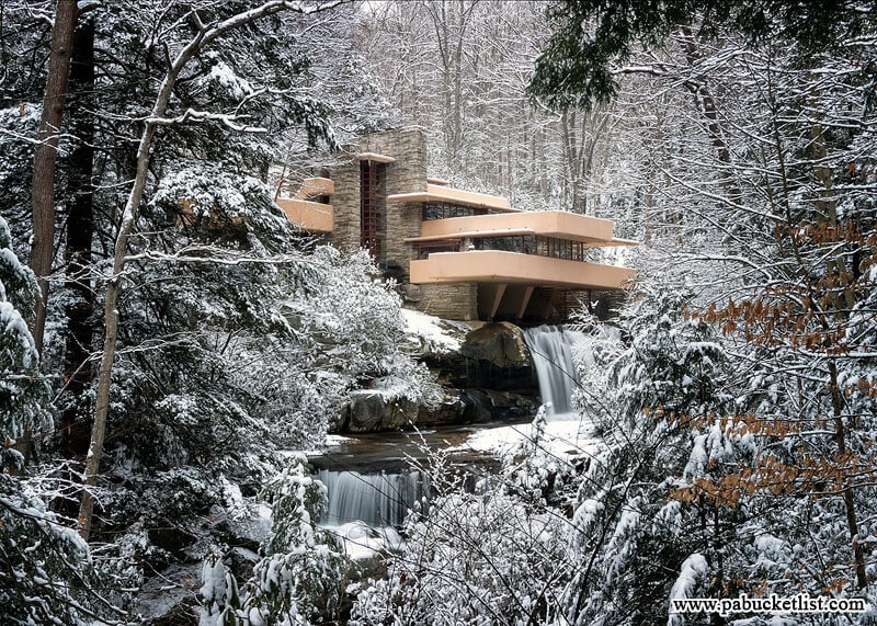
Fallingwater, located just a few miles from Ohiopyle, was designed by Frank Lloyd Wright and was voted by the American Institute of Architects as “the best all-time work of American architecture”.
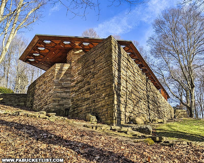
Kentuck Knob in Fayette County is another nearby Frank Lloyd Wright-designed home, built in 1954 for Isaac and Bernardine Hagan, founders of the Hagan Ice Cream company in nearby Uniontown, PA.
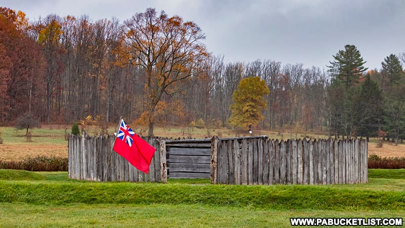
Fort Necessity in Fayette County is the site of the first battle in what would become known in North America as the French and Indian War.
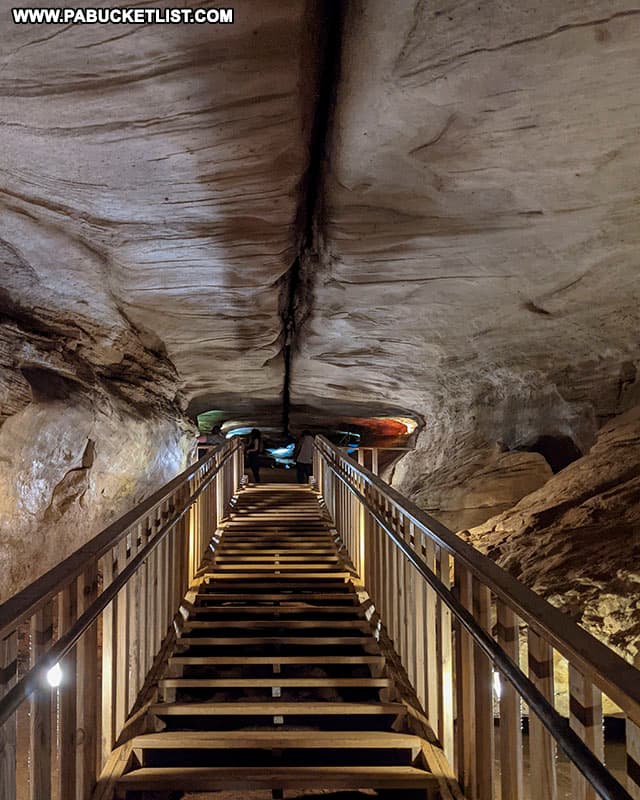
Laurel Caverns in Fayette County is billed as “Pennsylvania’s Largest Cave”, and is a great way to spend an hour or two BENEATH the Laurel Highlands!
Still Not Convinced You Need To Hike the Mitchell Trail?
Then check out this video!
Did you enjoy this article?
If so, be sure to like and follow PA Bucket List on Facebook, Instagram, and/or Pinterest to learn more about the best things to see and do in Pennsylvania!
Click on any of the icons below to get connected to PA Bucket List on social media.