The 5 Best Roadside Attractions in the Quehanna Wild Area

Roadside fall foliage at the Marion Brooks Natural Area

The Quehanna Wild Area is one of the largest unpopulated areas in Pennsylvania, perfect for those looking to escape the daily grind of civilization!

75 square miles of forest, streams, and mountain meadows, crisscrossed by hundreds of miles of trails and forest roads.

Fall foliage along Paige Run in the Quehanna Wild Area.
Fall foliage along Paige Run above Table Falls in the Quehanna Wild Area.

So where do you begin exploring, especially if you haven’t got a lot of time?

Teaberry Loop Trail Vista in Elk County PA
Teaberry Loop Trail Vista in the Quehanna Wild Area.

Follow along as I share with you 5 of the best roadside attractions in the Quehanna Wild Area, all requiring little to no hiking.

All 5 of these can easily be seen within a few hours, and I’ll include a few more short hikes at the end of the write-up for those looking to make a full day of it in the Quehanna Wild Area!

Sun rays beaming down on Wykoff Run Falls in the Quehanna Wild Area

Directions to the Best Roadside Attractions

in the Quehanna Wild Area

The first four destinations are all literally within minutes of each other, and I’ll describe them moving from west to east.

A map to the best roadside attractions in the Quehanna Wild Area.

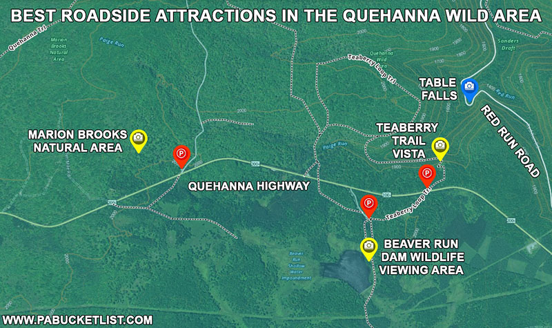
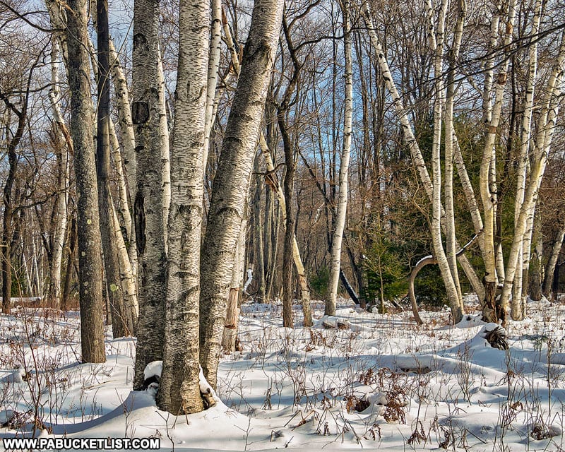
1. Marion Brooks Natural Area

October in the Marion Brooks Natural Area Elk County PA
October in the Marion Brooks Natural Area Elk County, PA.

The Marion Brooks Natural Area is 975 acre portion of the Quehanna Wild Area, named in honor of local environmental activist Marion Brooks.

Marion Brooks Natural Area Memorial in the Quehanna Wild Area.

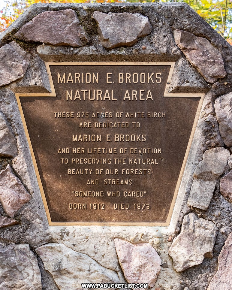
The Marion Brooks Natural Area is located at the intersection of the Quehanna Highway and Losey Road, at GPS coordinates 41.26519, -78.27818.

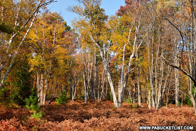
The big draw here is a 22 acre roadside portion of the Natural Area that is composed largely of white birch trees, making it the largest stand of white birch in the eastern United States.
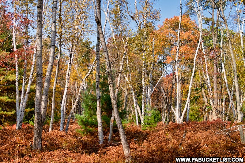
Marion Brooks Natural Area white birch in October.

No matter what season you visit, the Marion Brooks Natural Area is a magnificent sight to see!

Winter scene at the Marion Brooks Natural Area in the Quehanna Wild Area.

2. Beaver Run Dam Wildlife Viewing Area

The wildlife viewing blind at Beaver Run Dam in the Quehanna Wild Area.

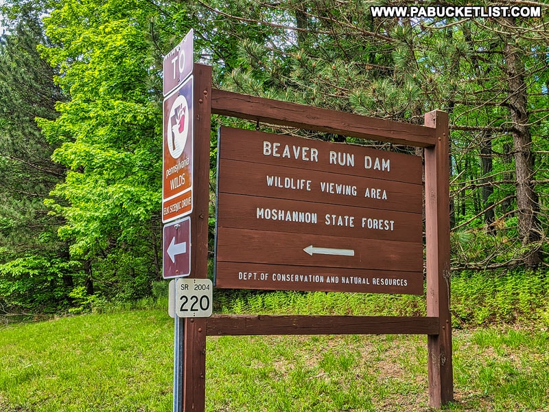
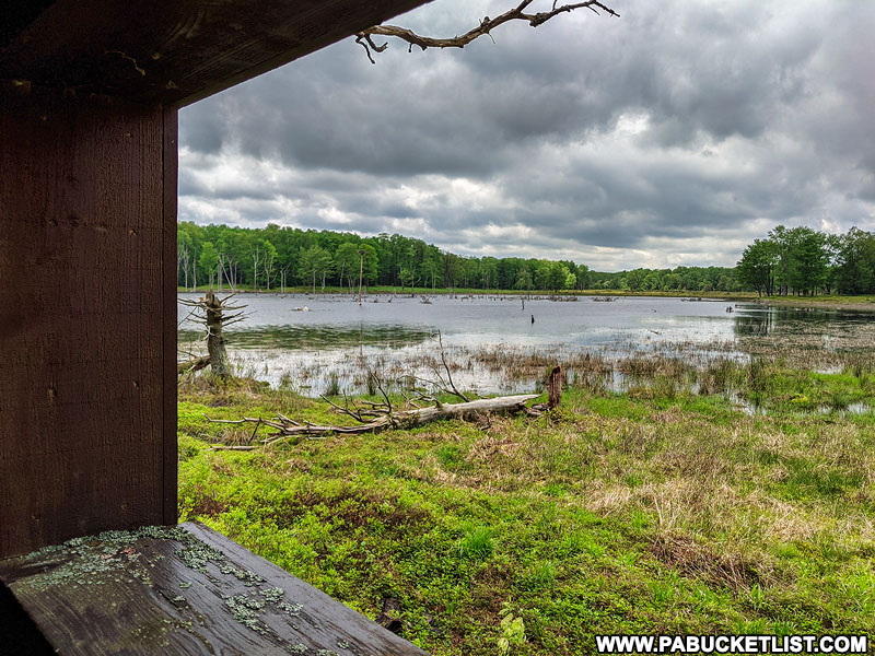
The Beaver Run Dam Wildlife Viewing Area is located near the intersection of Quehanna Highway and Beaver Run Road, with the parking lot located at GPS coordinates 41.26117, -78.25802.

Beaver Run Dam Wildlife Viewing Area sign in the Quehanna Wild Area.

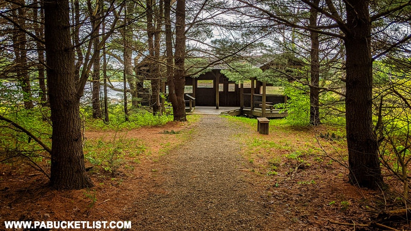
350 yards from the parking area, down a flat, forested trail, you’ll find a waterfront viewing blind where it’s not uncommon to see wild birds of all sorts, including nesting osprey in the spring.

Nesting osprey pair at Beaver Run Dam in the Quehanna Wild Area.

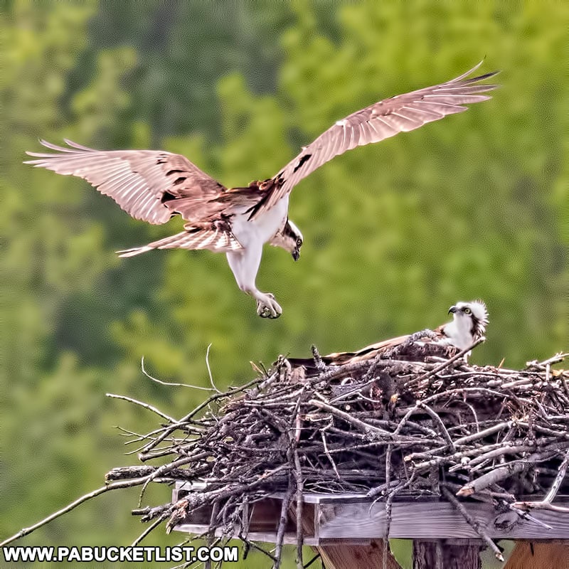
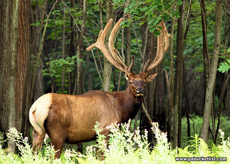
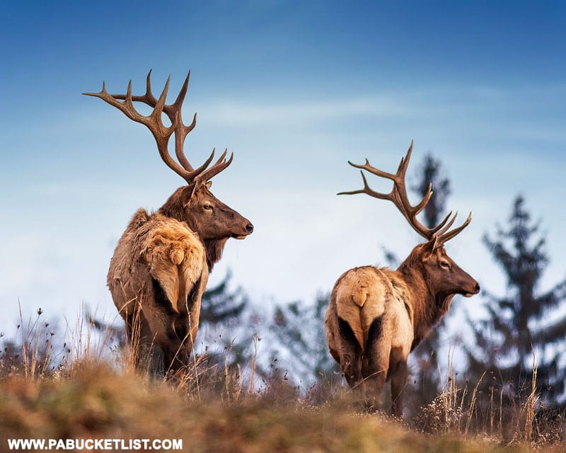
And of course there’s always a chance to see elk feeding near the breast of the dam, which is what draws people from around the northeast to this region of Pennsylvania.

In fact, I included this spot on my list of the 15 Best Elk Viewing Destinations in Pennsylvania.

An elk smelling the air at the Visitor Center in Benezette.

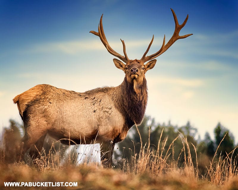
For these wildlife viewing opportunities, as well as the overall scenery, Beaver Run Dam is certainly a worthwhile roadside pitstop in the Quehanna Wild Area.

View from the Beaver Run Dam wildlife viewing blind.

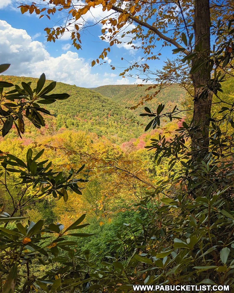
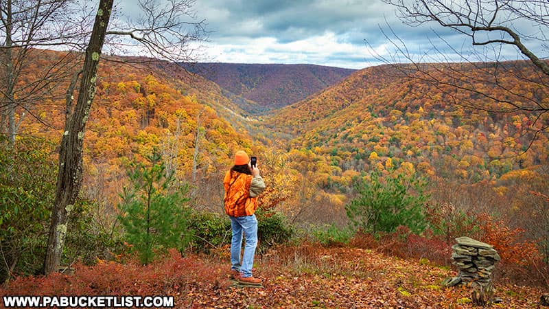
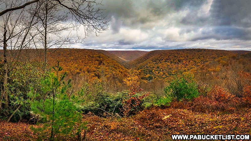
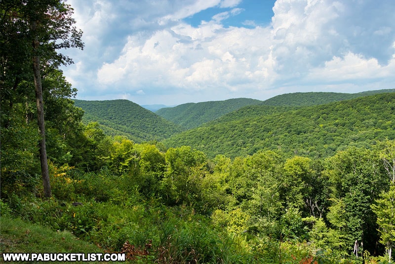
3. Teaberry Loop Trail Vista

Springtime view from Teaberry Loop Trail Vista in the Quehanna Wild Area.

The Teaberry Loop Trail Vista sits approximately 330 yards from an unmarked but obvious roadside pull-off along the Quehanna Highway, located at GPS coordinates 41.26361, -78.25174.

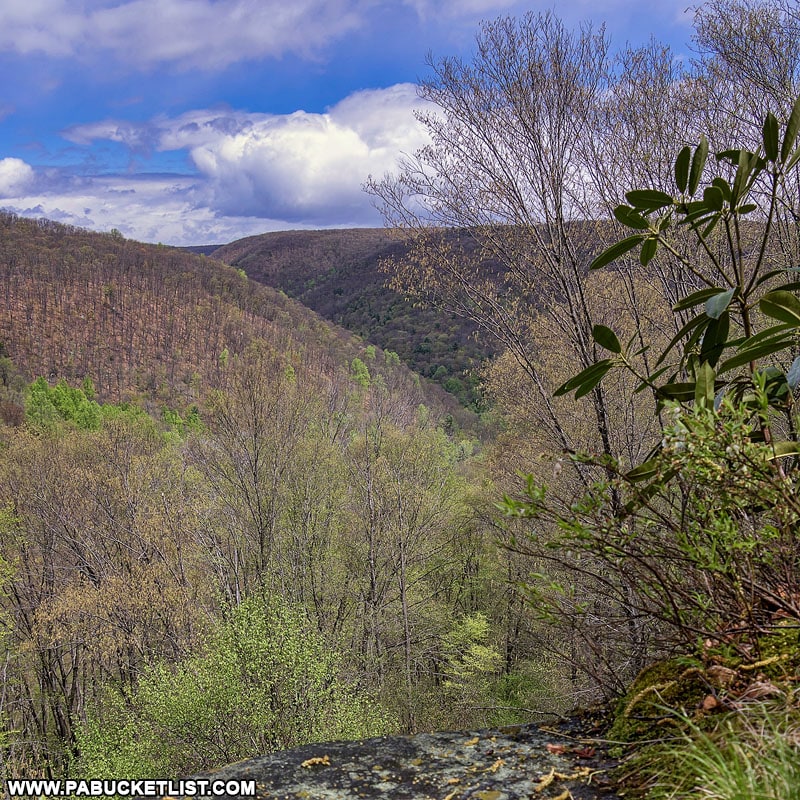
A well-worn and yellow-blazed trail leads you from the pull-off to this remarkable vista overlooking the Paige Run and Red Run valleys.
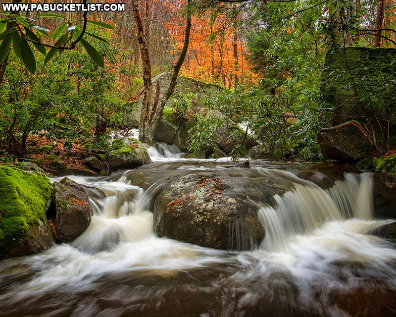
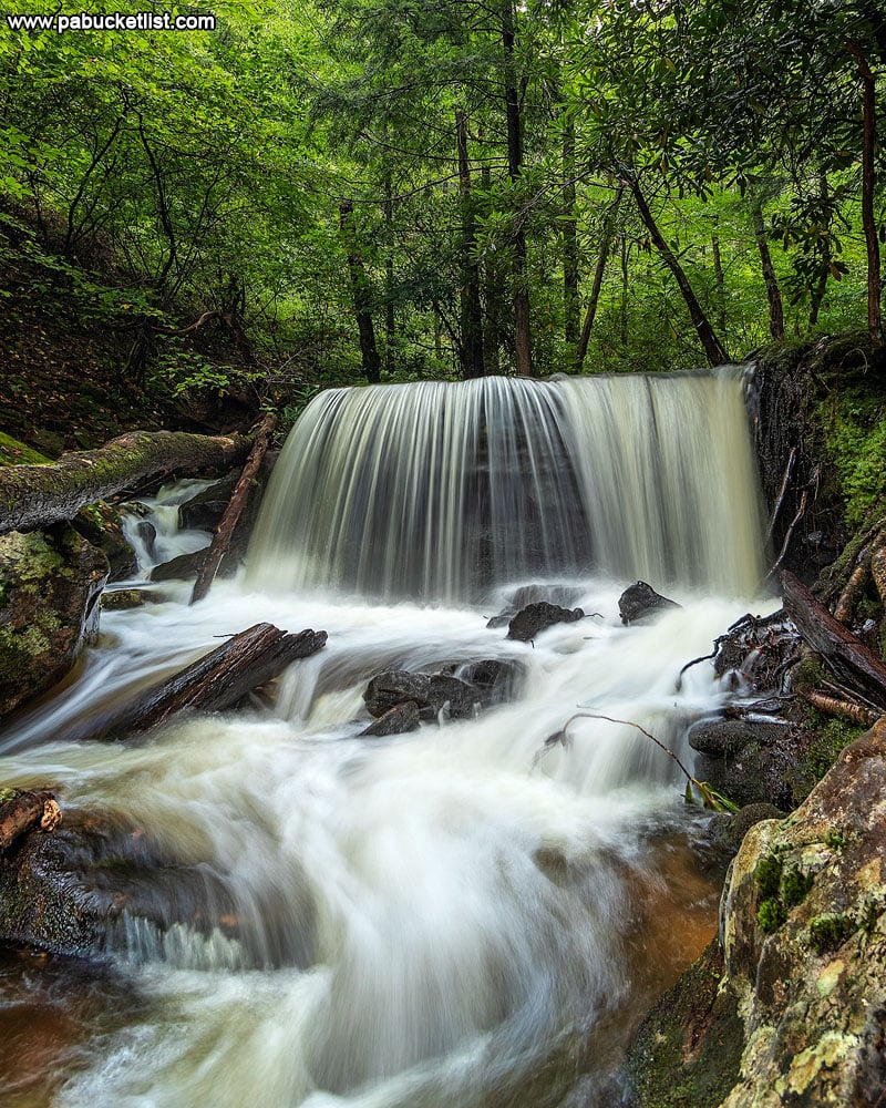
Teaberry Loop Trail Vista in the Quehanna Wild Area.
Autumn view from the Teaberry Loop Trail Vista in the Quehanna Wild Area.

4. Table Falls

A September view of Table Falls, flowing high and clear on Paige Run.
A September view of Table Falls, flowing high and clear on Paige Run in the Quehanna Wild Area.

Table Falls is one of the prettiest little waterfalls in the Quehanna Wild Area, and it is located just a few yards from a marked parking area along Red Run Road.

The parking area for Table Falls, located next to the bridge over Paige Run along Red Run Road.

If you’re navigating by GPS, use coordinates 41.27051, -78.24738 to guide you to the Table Falls parking area.

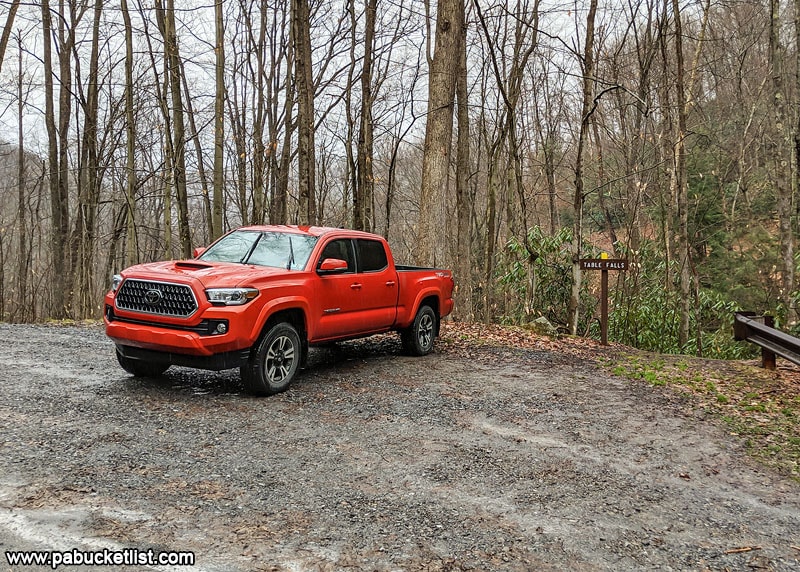
From there, follow the obvious trail downhill from the back of the parking area, along the stream, to Table Falls 50 yards downstream.

Table Falls in the Elk County portion of Quehanna Wild Area

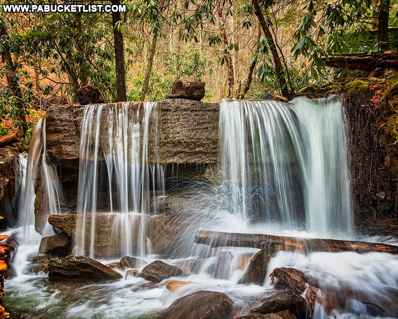
This waterfall looks best after the spring thaw or a heavy rain, so if you’re visiting during a dry spell don’t expect it to look nearly as full as it does here.
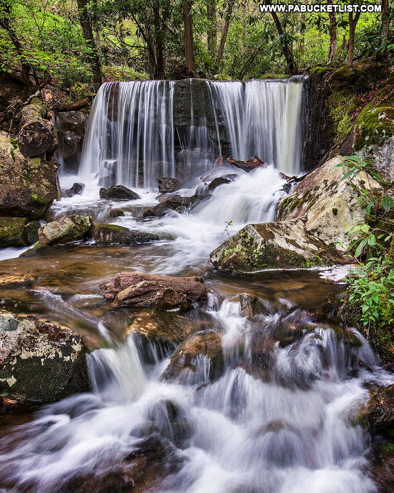
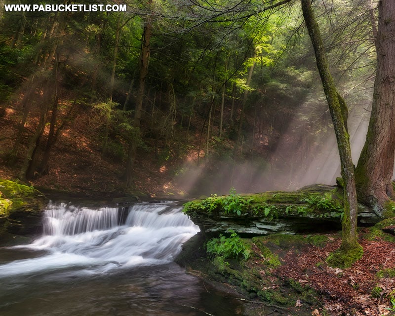
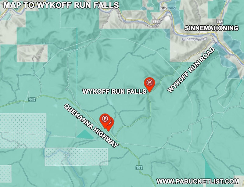
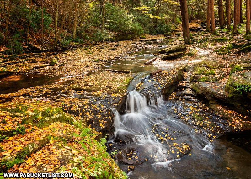
Table Falls along Red Run Road in the Quehanna Wild Area.

5. Wykoff Run Falls

A fisherman at Wykoff Run Falls in Cameron County
A fisherman at Wykoff Run Falls in the Quehanna Wild Area.

Wykoff Run Falls is located right along Wykoff Run Road, midway between the Quehanna Highway and the town of Sinnemahoning.

How to find Wykoff Run Falls in the Quehanna Wild Area
A map to Wykoff Run Falls in the Quehanna Wild Area.

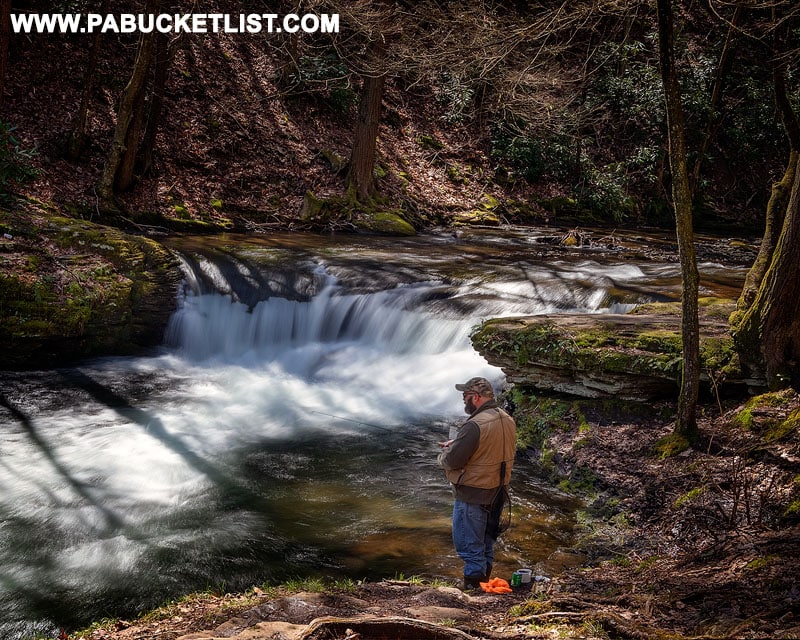
If you’re navigating by GPS, use coordinates 41.26783, -78.15288 to guide you to the roadside pull-off next to Wykoff Run Falls.

Winter at Wykoff Run Falls in Cameron County PA
Winter at Wykoff Run Falls in the Quehanna Wild Area.

While it looks good in any season, the same caveat applies here as at Table Falls.

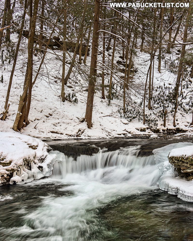
Namely, if you are visiting during a dry spell, don’t expect it to look nearly as full!

Fall foliage at Wykoff Run Falls in the Quehanna Wild Area.
Fall foliage and low water at Wykoff Run Falls in the Quehanna Wild Area.

Nearby Attractions

If you’re looking for a few more easy hikes to some intriguing Quehanna Wild Area destinations, have I got some recommendations for you!


The Abandoned Nuclear Jet Engine Testing Bunkers

Abandoned nuclear jet engine testing bunker entrance.
One of the abandoned nuclear jet engine testing bunkers in the Quehanna Wild Area.

The first one is a flat, half-mile hike along the remnants of a paved road to a secretive Cold War testing facility that indirectly gave birth to the Quehanna Wild Area.

Nature reclaiming the road to the abandoned nuclear jet engine testing bunkers in the Quehanna Wild Area.

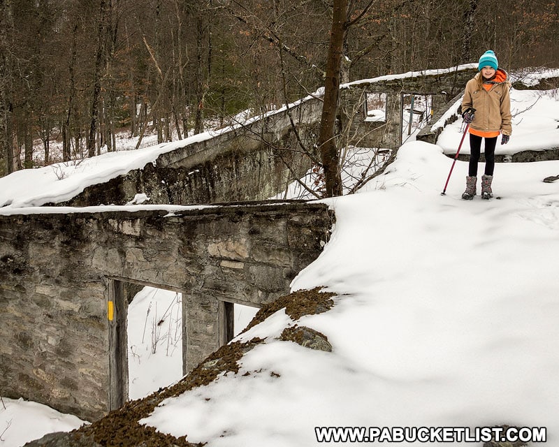
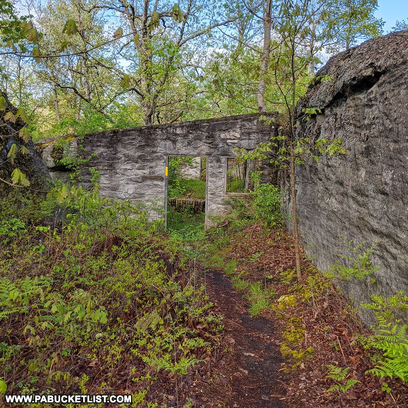
The Abandoned Nuclear Jet Engine Testing Bunkers are all that remains of a government-sponsored attempt to build nuclear jet engines at this facility hidden away in what is now the Quehanna Wild Area.

Observation windows in the nuclear jet engine testing bunkers.

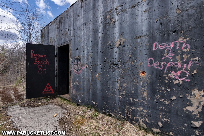
Eventually the project was scrapped, the radioactive contamination cleaned up, and the area was turned into the Quehanna Wild Area, as it is know today.
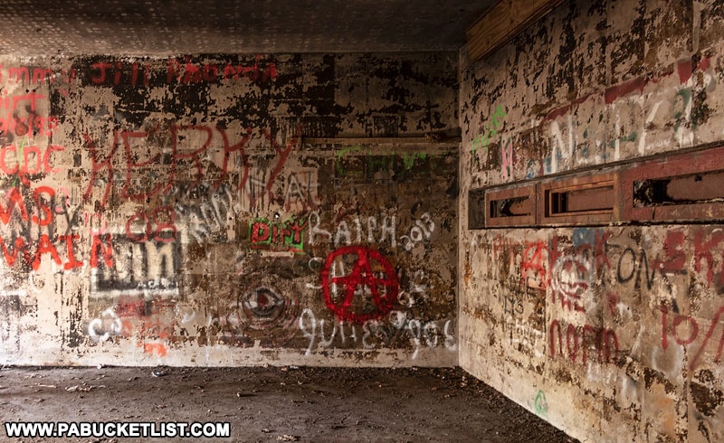
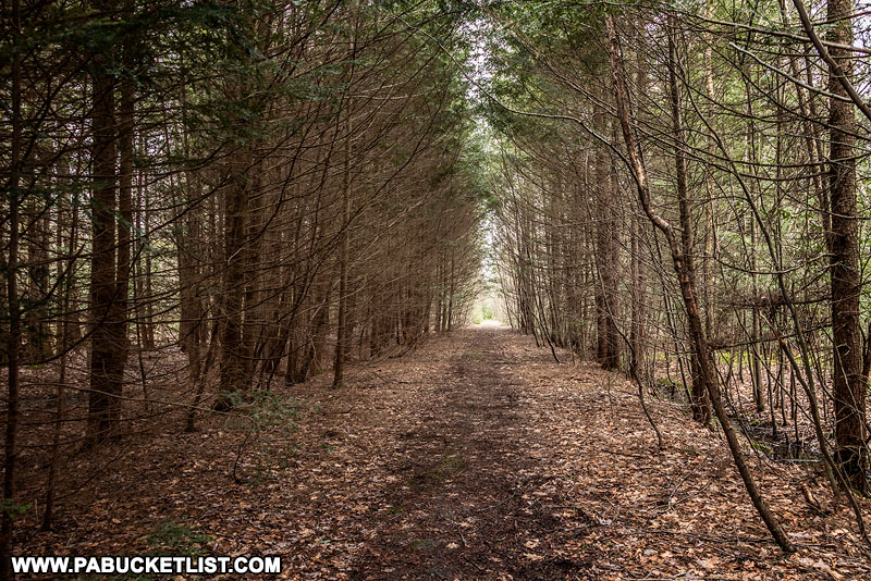
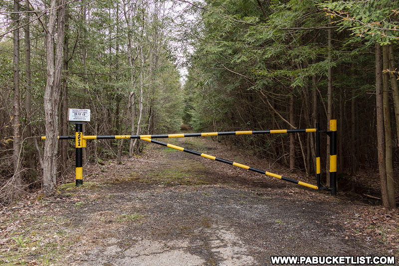
Parking for this hike is right along the Quehanna Highway near gate 251 (don’t block the gate!) at GPS coordinates 41.23694, -78.20354.

Gate 251 guarding the road to the abandoned northern nuclear jet engine testing facility in the Quehanna Wild Area.

You can read a much more in-depth report on the nuclear jet engine testing program, as well as view LOTS more photos in my write-up “Exploring the Abandoned Nuclear Jet Engine Testing Bunkers in the Quehanna Wild Area”.

Interior of the abandoned nuclear jet engine testing bunker built by Curtiss-Wright Corporation.
Interior of the abandoned nuclear jet engine testing bunker built by Curtiss-Wright Corporation in what is now the Quehanna Wild Area.

The Abandoned Kunes Camp Trail

My second recommendation is a flat, one mile hike to the remains of the ingeniously-crafted Kunes Camp, built in the early 1900s between two massive boulders in what is now the Quehanna Wild Area.

A young hiker at Kunes Camp in the Quehanna Wild Area.

My write-up “Exploring the Ruins of Kunes Camp in the Quehanna Wild Area” goes into much more detail, but the short version is that you can hike an easy, yellow-blazed trail for one mile through the forest to reach the boulder field where Kunes Camp was constructed.

The abandoned Kunes Camp in early spring.

For sheer ingenuity, and practical natural beauty, the abandoned Kunes Camp is well worth the hike to see it!

View from the top of Kunes Camp in the Quehanna Wild Area.

Park at a marked roadside pull-off along the Quehanna Highway at GPS coordinates 41.21636, -78.17210 and follow the yellow-blazed Kunes Camp Trail 1 mile to the remains of the cabin.

Kunes Camp Trail sign near the Quehanna Highway.

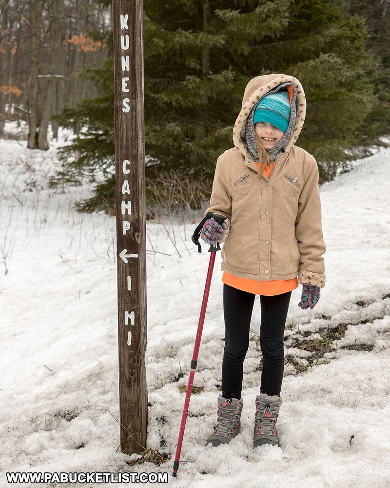
And as always while in the Quehanna Wild Area, keep your eyes peeled for possible elk sightings along the trail!
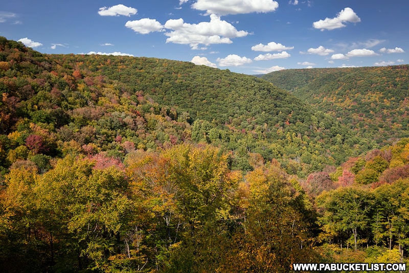
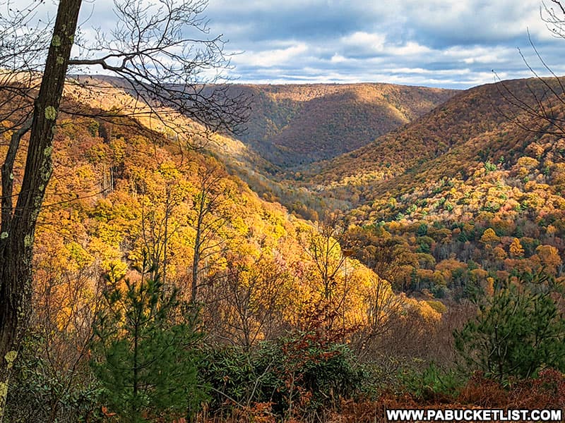
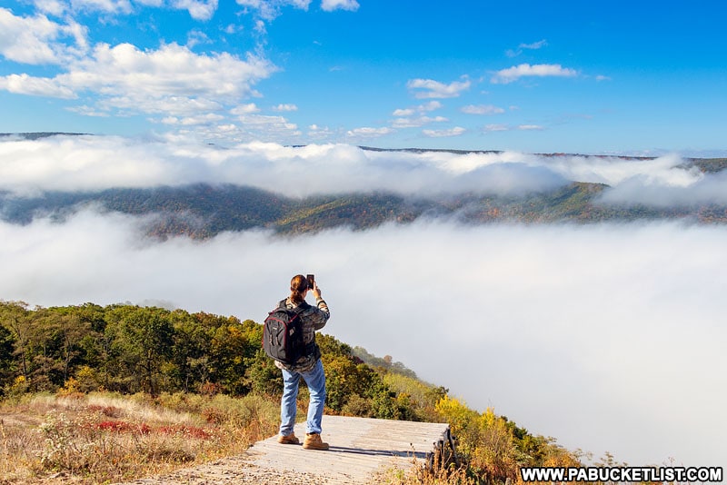
Elk standing near the parking area for Yost Run Falls.

Red Run Gorge Vista

Panoramic view of Red Run Gorge Vista in early November, 2021.

Red Run Gorge Vista is one of the best off-trail scenic overlooks in the Quehanna Wild Area.

Red Run Gorge Vista in the Quehanna Wild Area.

Elk Country Visitor Center

Sunrise at the Elk Country Visitors Center in Benezette Pennsylvania
Sunrise at the Elk Country Visitors Center in Benezette

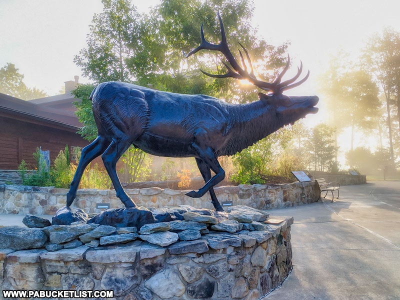
Speaking of elk, if you’re in the Quehanna Wild Area you’re only 30-40 minutes away from the unofficial Elk Capitol of Pennsylvania – the Elk Country Visitor Center in Benezette!

Entrance to the Elk Country Visitors Center in Benezette.

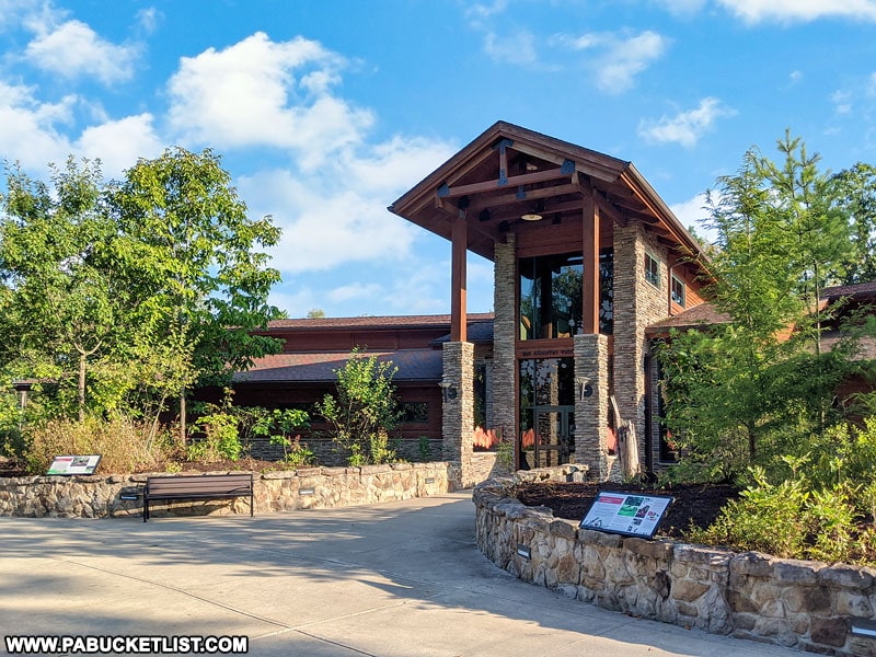
This lodge-like facility is free to visit and offers a wealth of opportunities to learn all about Pennsylvania’s thriving elk herd, as well as to see real live elk grazing on some of the food plots on the property.

Elk Country Visitor Center food plot.

Hyner View State Park

Hyner View State Park in neighboring Clinton County is home to one of the finest roadside scenic vistas in all of PA!

Fall foliage views for miles at Hyner View State Park.

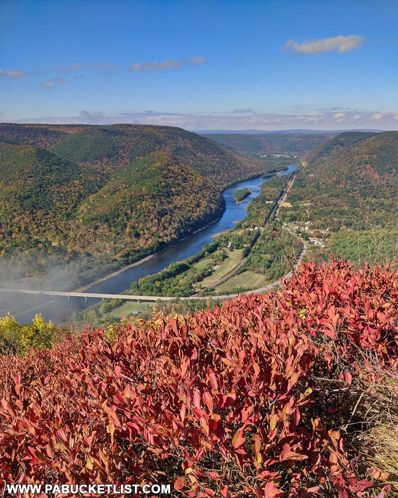
This mountaintop state park allows you to drive right up to a stunning lookout over the West Branch of the Susquehanna River.

View from the hang glider launch at Hyner View State Park.

20 Fantastic Roadside Scenic Overlooks

Pennsylvania Elk Country is home to some incredible views, and you’ll find the best ROADSIDE ones to reach in “The 20 Best Scenic Overlooks in PA Elk Country”.

Square Timber Vista along Ridge Road in Cameron County.
The roadside Square Timber Vista in the Elk State Forest.

Kinzua Bridge State Park

Kinzua Bridge State Park in McKean County is home to what was once the longest and tallest railroad bridge in the world!

View from the debris field, looking up towards the Kinzua Bridge skywalk and the surrounding fall foliage.

Did you enjoy this article?

If so, be sure to like and follow PA Bucket List on Facebook, Instagram, and/or Pinterest to stay up-to-date on my latest write-ups.

Click on any of the icons below to get connected to PA Bucket List on social media!


Pennsylvania’s Best Travel Blog!

Rusty Glessner is a professional photographer, lifelong Pennsylvanian, and creator of the PA Bucket List travel blog.