Exploring the Abandoned Nuclear Jet Engine Bunkers in the Quehanna Wild Area

Abandoned nuclear jet engine testing bunker entrance.

The abandoned nuclear jet engine testing bunkers in the Quehanna Wild Area are a fascinating Cold War-era remnant of Pennsylvania history, now slowly being reabsorbed by the surrounding forest of Cameron County.

The Cold War-looking northern nuclear jet engine testing bunker in the Quehanna Wild Area.

Constructed and used between 1955-1960, these bunkers continue to fascinate visitors to this day, as well as serving as cautionary reminders of how quickly public lands can be co-opted by politicians and private companies for “the greater good”.

Interior of one of the abandoned Quehanna nuclear jet engine testing bunkers.

Brief History of the Quehanna Nuclear Jet Engine Testing Bunkers

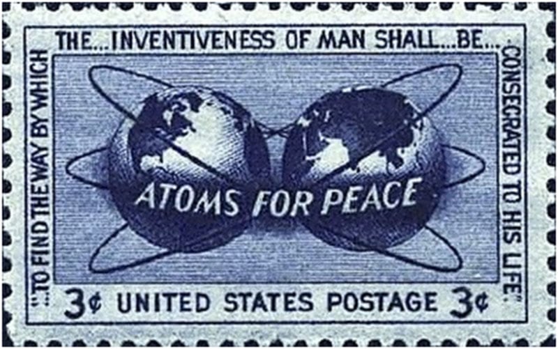
The nuclear jet engine testing complex at Quehanna was born out of the euphemistically-named “Atoms for Peace” program, proposed by President Dwight D. Eisenhower in 1953 and created by the United States Congress in 1954.

Atoms for Peace symbol

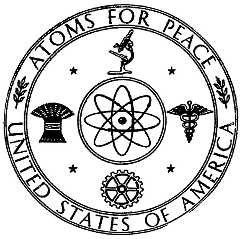
In theory, the program was designed to find peaceful uses for nuclear technology.

Atoms for Peace promotional bus.

In the case of the Quehanna jet engine project, the goal was to develop nuclear-powered jet engines for the United States Air Force, so that fighter planes and bombers could stay airborne indefinitely, without refueling.

The Curtiss-Wright Corporation, at the time the largest aircraft manufacturer in the United States, was awarded the contract to develop the engines.

They sought out a remote parcel of land where the project could be worked on in relative secrecy, and without endangering a large population center should the project go awry.

The State of Pennsylvania, looking to create jobs and promote industrial investment, offered Curtiss-Wright a sweetheart deal on 80 square miles of public land (State Forest Land at the time) in rural Cameron County, and a deal was struck.

However, the promise of jobs and prosperity for the entire region turned out to be just that – promises.

Steel door to the abandoned nuclear jet engine testing facility in Cameron County PA
Steel door to the abandoned nuclear jet engine testing facility in Cameron County

By 1960, the Air Force had cancelled the contracts and the nuclear jet engine bunkers were literally abandoned, becoming a party spot for teenagers and a source of scrap metal for locals.

Observation windows in the nuclear jet engine testing bunkers.

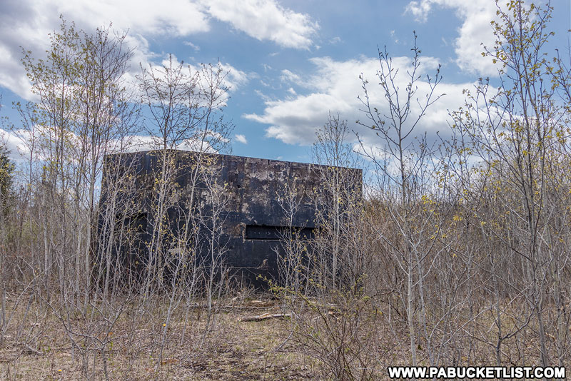
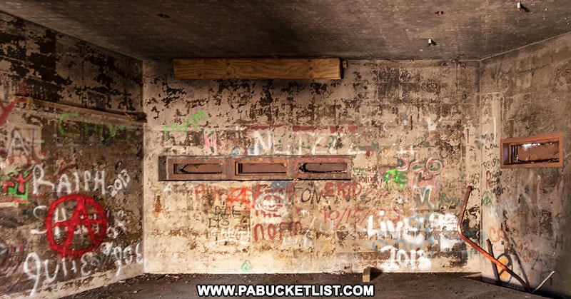
All that remains today are the bunkers themselves – large boxes of concrete and steel with tiny slit windows once covered by thick layers of blast-resistant glass, where engineers and technicians would have monitored the engines undergoing testing.

Trees growing up around one of the abandoned nuclear jet engine testing bunkers in the Quehanna Wild Area.

How to Find the Abandoned Nuclear Jet Engine Testing Bunkers in the Quehanna Wild Area

Directions to the nuclear jet engine testing bunkers in the Quehanna Wild Area

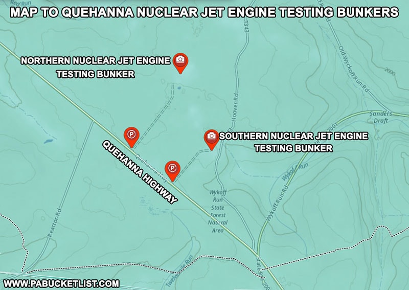
The two nuclear jet engine testing bunkers are located approximately half a mile northwest of the intersection of the Quehanna Highway and Wykoff Run Road.


This property is not maintained or monitored for safety conditions, and therefore this is strictly a VISIT AT YOUR OWN RISK DESTINATION!

By voluntarily exploring this location, YOU assume the risk of any personal injury or damage to personal property, and shall not hold the author liable for any injuries, loss, or damages that may occur while visiting this location.


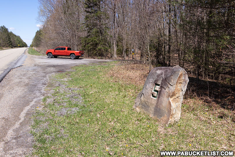
Parking for the southern nuclear jet engine testing bunker is right along the Quehanna Highway, next to a large stone mile marker with a “5” carved into it.

GPS coordinates for this parking area are 41.23472, -78.19974.

Parking Area along the Quehanna Highway for the southern nuclear jet engine testing bunker.

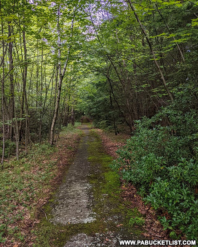
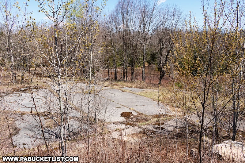
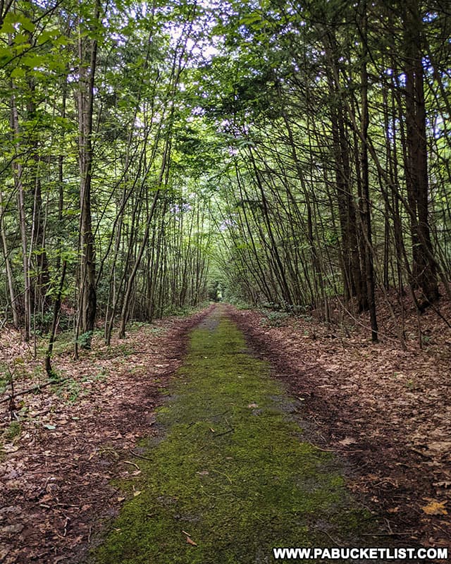
The hike to the southern bunker is only 1/4 mile along the remnants of a flat, paved road (making this a popular spot for cross-country skiers in the winter).

Gate 252 blocking the road to the southern nuclear jet engine testing bunker in the Quehanna Wild Area.

Of course the road, after nearly 60 years without maintenance, is being swallowed up by the forest, a sight to see in and of itself.

Abandoned road leading to the Quehanna nuclear jet engine testing bunkers in Cameron County Pennsylvania.
Abandoned road leading to the Quehanna nuclear jet engine testing bunkers in Cameron County.

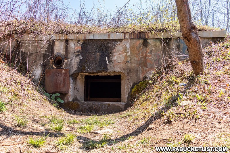
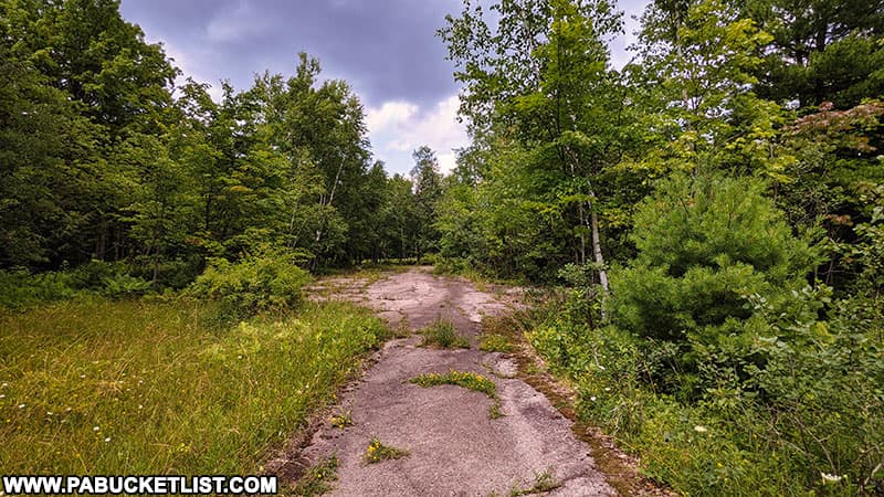
Upon hiking the 1/4 mile back the road to the bunker complex (once a 3 acre clearing but now partially covered with trees), a large mound of dirt rises up from the asphalt.

GPS coordinates for the southern nuclear jet engine testing bunker are 41.23691, -78.19612.

The southern Curtiss-Wright nuclear jet engine testing bunker in the Quehanna Wild Area.

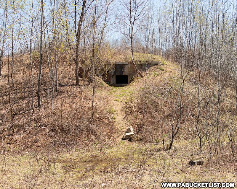
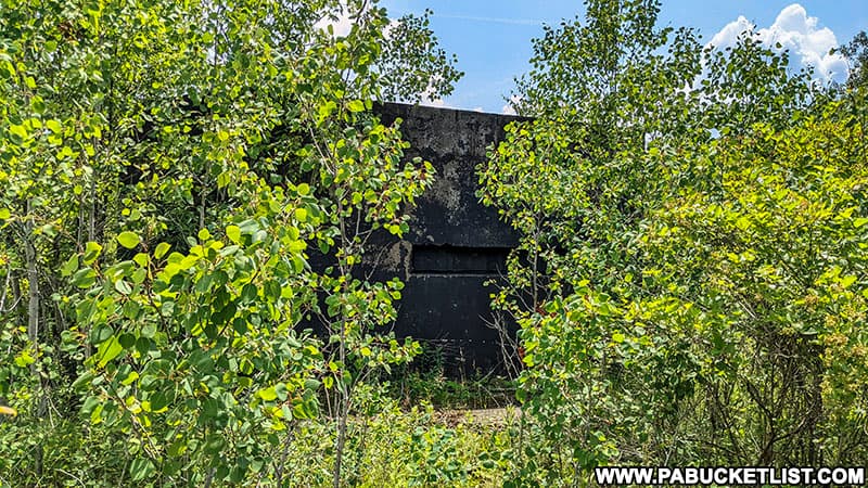
Of course when it was in use, this bunker was not covered with dirt – that was done later by the State in an attempt to turn the bunker into a bat habitat, an effort that appears to have been abandoned years ago.

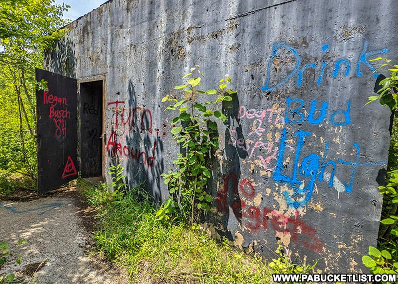
What now serves as the only opening to this bunker would have at one time been a ventilation port. A tight squeeze, but an entrance that countless people have used over the years.

Exposed entrance to the southern nuclear jet engine testing bunker, now buried under a mound of dirt.

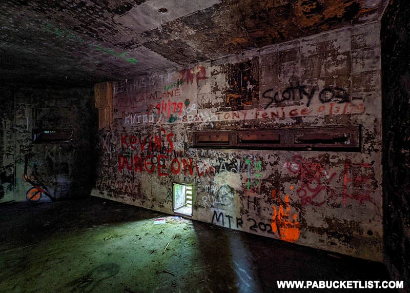
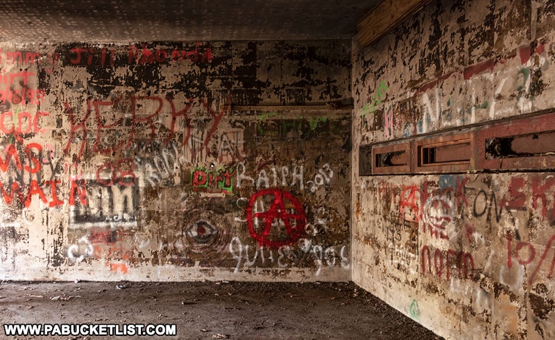
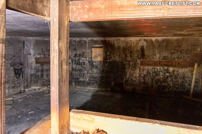
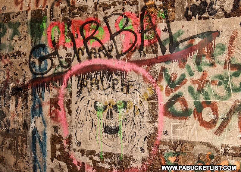
All that remains to be seen inside the southern bunker is 4 graffiti-covered walls and the remnants of some bat boxes.

No instrumentation, signage, or other clues to its former life are to be found anymore.

Inside the southern nuclear jet engine testing bunker in the Quehanna Wild Area.

Standing on top of the mound you can survey the scene and try to imagine what sort of testing went on here in the late 50s.

Remains of the nuclear jet engine testing complex in the Quehanna Wild Area.

Some folks say only conventional jet engines were tested here – that the nuclear jet engines never even got to the testing phase.

Infrastructure from the nuclear jet engine testing complex in the Quehanna Wild Area.

Others say the nuclear jet engines did in fact exist, but emitted too much radiation to be safely put into use.

One local I ran into, who claimed to know people who had worked at the facility, swore that reverse-engineered alien technology was being tested at the site!

Whatever did or didn’t happen there, it was all shrouded in a veil of secrecy, high fences, and manned security posts, making the hike all the more interesting if you’re a history or conspiracy buff.


Exploring the Northern Nuclear Jet Engine Testing Bunker

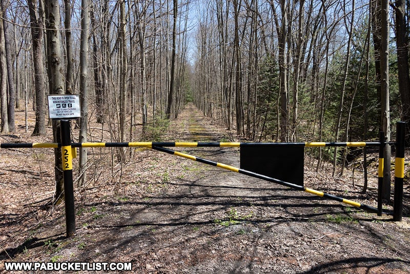
The parking area for the northern nuclear jet engine testing bunker is located a quarter mile further down the Quehanna Highway, next to Gate 251 (the Area 51 of the Quehanna Wild Area perhaps???).

Gate 251 in the Quehanna Wild Area protecting the road to the abandoned nuclear jet engine testing bunkers.

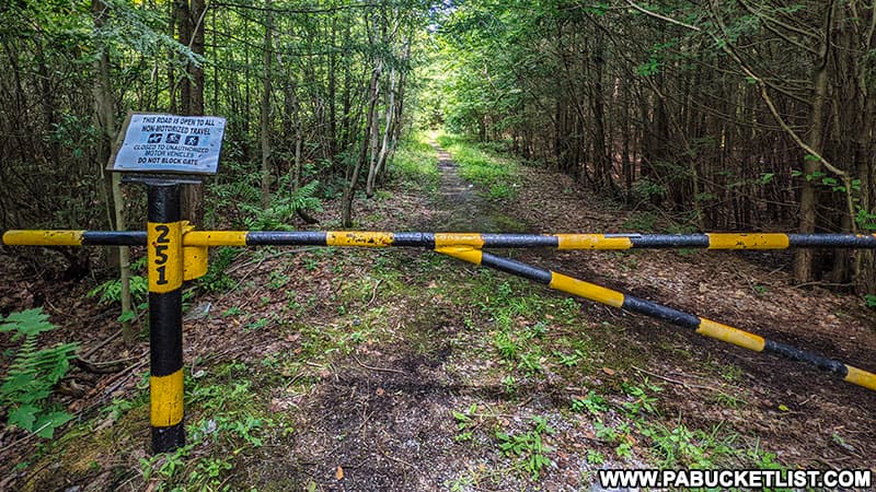
GPS coordinates for this parking area are 41.23706, -78.20351.

Even from satellite imagery the northern bunker complex is easy to see.

Satellite view of the northern abandoned nuclear jet engine testing complex in the Quehanna Wild Area.

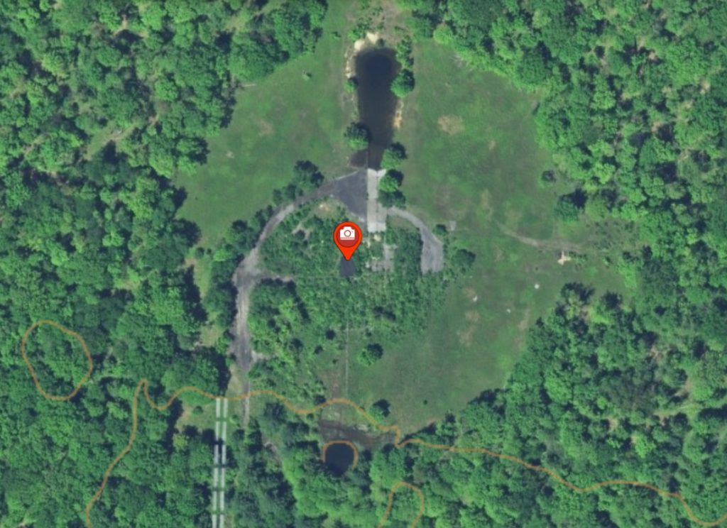
As with the road to the southern bunker, Nature is slowly reclaiming the paved road back to the northern bunker.

The Quehanna abandoned nuclear jet engine bunker trail in the Quehanna Wild Area.

A 0.4 mile hike brings you out into the large opening where the testing complex was.

The asphalt pad around one of the abandoned nuclear jet engine testing bunkers in the Quehanna Wild Area.

GPS coordinates for the northern bunker are 41.24221, -78.19901.

Remnants of pathway to the northern nuclear jet engine bunker in the Quehanna Wild Area.

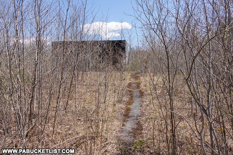
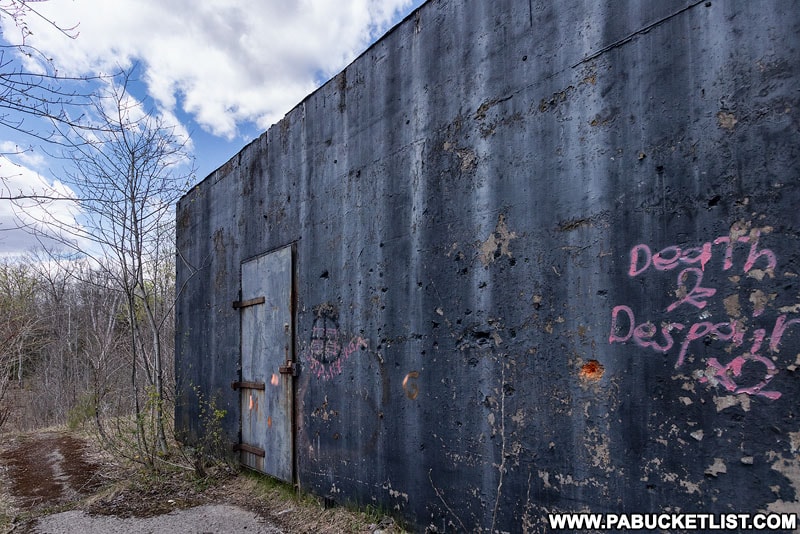
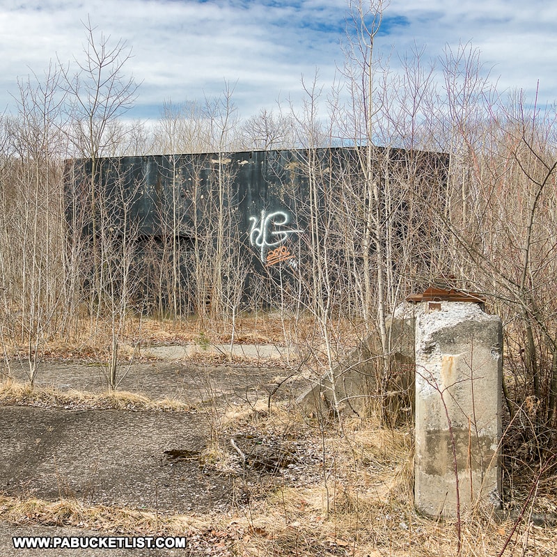
The biggest difference here, compared to the southern bunker, is that the northern bunker is still plainly visible, looking like a machine gun nest from a war movie.

Exterior view of the northern abandoned nuclear jet engine testing bunkers in the Quehanna Wild Area.

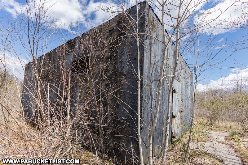
A large, steel door protects the opening to the bunker, and it creaks with an ominous sound right out of a horror movie as you open it.

Entering one of the abandoned nuclear jet engine testing bunkers in the Quehanna Wild Area.

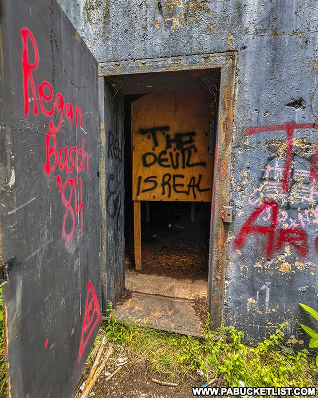
Inside you’ll find a scene similar to the southern bunker – walls covered in graffiti and the remnants of a bat habitat gone bust.

Interior of the abandoned nuclear jet engine testing bunker built by Curtiss-Wright Corporation.

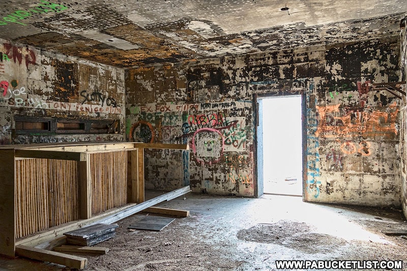
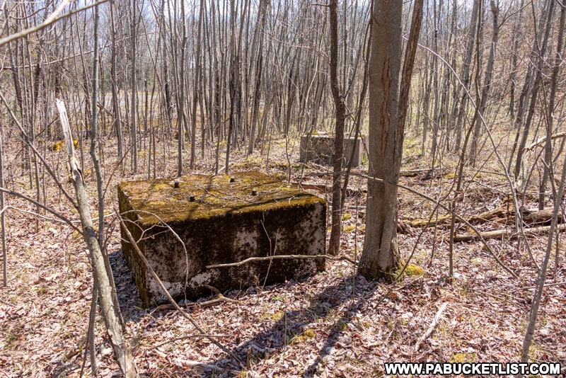
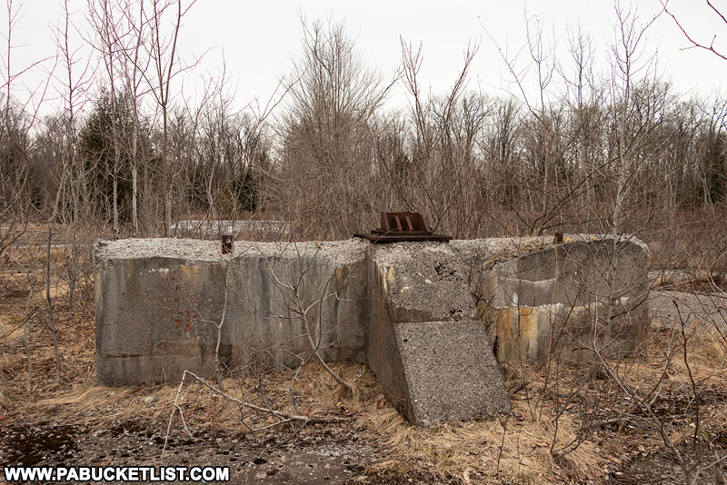
The windows (now covered in plates of steel) are on the walls opposite the door, and the engines would have been strapped to mounts visible through the windows and away from the door.

Interior of the northern nuclear jet engine testing bunker in the Quehanna Wild Area.

The remnants of the engine mounts are still present outside the northern bunker.

Engine mounts where nuclear-powered jet engines were fastened for testing.

Did nuclear jet engines really rest on these mounts at some point in the late 50s?

The western Curtiss-Wright nuclear jet engine testing bunker in the Quehanna Wild Area.

Or were some sort of reverse-engineered alien technologies being tested here, as locals claim?

Graffiti inside the northern nuclear jet engine bunker in the Quehanna Wild Area.

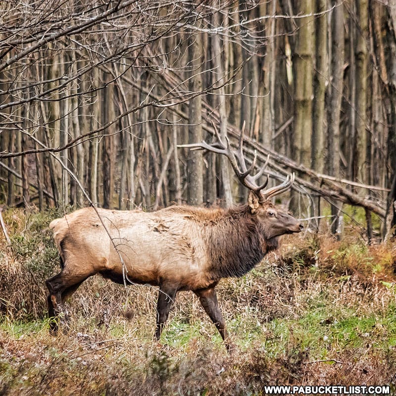
If the local elk population know, they’re not talking!

Bull elk near the nuclear jet engine bunkers in the Quehanna Wild Area.

We may never know, and the real story will someday be completely swallowed up by the Quehanna plateau.

Outside one of the Quehanna nuclear jet engine testing bunkers in Cameron County.

What is certain is that this is an easy hike to a historic but seemingly forgotten footnote to the Cold War arms race of the 1950s.

Atoms for Peace Stamp
“Atoms for Peace” Stamp

All of it occurring in rural Cameron County, Pennsylvania!


Nearby Attractions

The abandoned Kunes Camp is an easy 2 mile out-and-back hike to the ruins of a hunting camp built BETWEEN massive boulders on the Quehanna plateau.

Kunes Camp in the spring of 2020.

Table Falls is located just a few miles from the abandoned nuclear jet engine bunkers, further west along the Quehanna Highway, then 1.6 miles down Red Run Road.

A September view of Table Falls, flowing high and clear on Paige Run.

Wykoff Run Falls is located a few miles north of the nuclear jet engine bunkers, right along Wykoff Run Road.

A fisherman at Wykoff Run Falls in Cameron County
Wykoff Run Falls in the Quehanna Wild Area.

Red Run Gorge Vista is one of the best off-trail scenic overlooks in the Quehanna Wild Area.

Brilliant fall foliage at Red Run Gorge Vista in Elk County, Pennsylvania.
The author at Red Run Gorge Vista in the Quehanna Wild Area.

Hiking the Fred Woods Trail in Cameron County introduces you to a 4.57 mile-long hike that takes you past two fantastic vistas, as well as one of Pennsylvania’s finest rock formations.

Hiking through the rock formations along the Fred Woods Trail in Cameron County
Rock formations along the Fred Woods Trail in Cameron County.

Round Island Run Falls is located just beyond the border of the Quehanna Wild Area, in the Sproul State Forest.

The three tiers of Round Island Run Falls, or Three Falls as it is sometimes called.

9 Must-See Attractions in Cameron County is your guide to the best things to see and do in PA’s LEAST populous county!

Whitehead Vista along Ridge Road in Cameron County.

The abandoned Bayless Paper Mill is a fascinating part of the Austin Dam Memorial Park in Potter County.

Looking down on the ruins of the Bayless Paper Mill in Potter County.

The ruins of Austin Dam are remnants of Pennsylvania’s second-deadliest flood.

Freeman Run passing through the ruins of Austin Dam in Potter County PA.
Freeman Run passing through the ruins of Austin Dam in Potter County.

Kinzua Bridge State Park in McKean County is home to what was once the longest and tallest railroad bridge in the world!

The remains of the Kinzua Viaduct at Kinzua Bridge State Park in McKean County Pennsylvania.
The remains of the Kinzua Viaduct at Kinzua Bridge State Park in McKean County

Looking for more abandoned sites to explore in Pennsylvania?

There isn’t a larger one in the state than the Abandoned Pennsylvania Turnpike, stretching from Bedford to Fulton counties.

The western portal of Rays Hill Tunnel on the abandoned Pennsylvania Turnpike.

The highlights of this 13 mile-long site are two abandoned tunnels – the Sideling Hill Tunnel and the Rays Hill Tunnel.

A photographer illuminated by a spotlight inside the Sideling Hill Tunnel.

Concrete City in Luzerne County is an abandoned early-1900s industrial housing complex.

Back side of the homes on the eastern edge of Concrete City.

Now owned by the city of Nanticoke, Concrete City is equally fascinating and forlorn.

4 of the 20 duplexes in Concrete City in Luzerne County.

Privately owned and legally accessible by invitation-only, the Windber Trolley Graveyard in Somerset County is another apocalyptic scene right out of a sci-fi movie!

Scenes like this are why finding the Windber Trolley Graveyard are on the bucket list of so many urban explorers.
Scenes like this are why the Windber Trolley Graveyard are on the bucket list of so many urban explorers.

Exploring the Ghost Town of Scotia Near State College takes you inside the remains of a iron-mining boomtown gone bust.

The ruins of Scotia are a popular destination for hikers and mountain bikers near State College.

The abandoned Alvira munitions bunkers in Union County are a series of 149 concrete, dome-shaped structures used to store TNT manufactured for the war effort during WWII.

Inside one of the abandoned Alvira bunkers.
One of the 149 abandoned Alvira bunkers in Union County.

Residing on what is now State Game Lands 252, the abandoned Alvira bunkers can legally be visited 365 days a year!

Entrance to one of the bunkers on State Game Lands 252 along Alvira Road.

Did you enjoy this article?

If so, be sure to like and follow PA Bucket List on Facebook, Instagram, and/or Pinterest to stay up-to-date on my latest write-ups about the best things to see and do in Pennsylvania!

Click on any of the icons below to get connected to PA Bucket List on social media!


PA Bucket List 2022 Sasquatch Logo

Pennsylvania’s Best Travel Blog!

Rusty Glessner
Rusty Glessner is a professional photographer, lifelong Pennsylvanian, and a frequently-cited authority on PA's best travel destinations.