
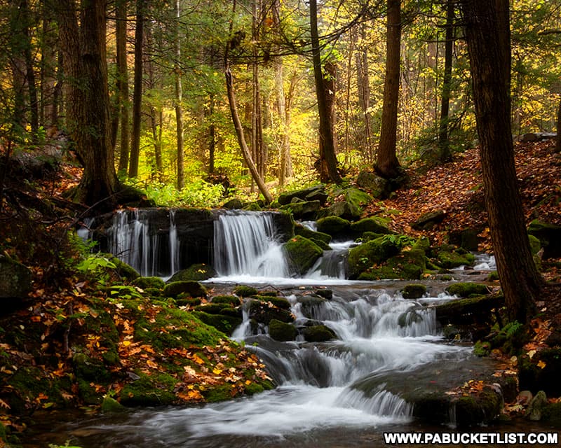
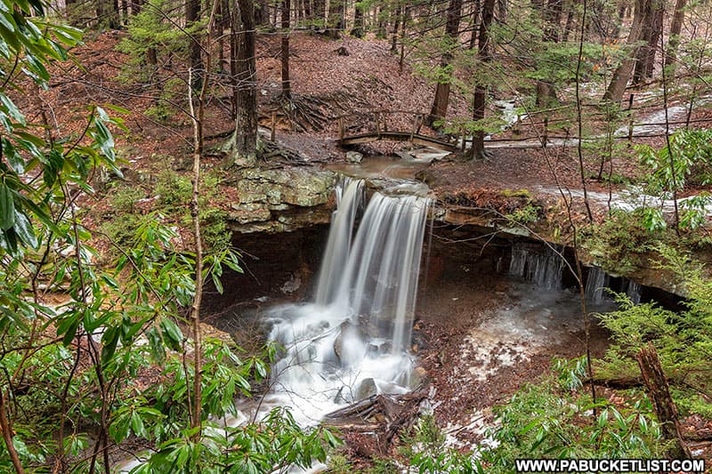
Mill Creek Falls is a picturesque, cascading waterfall on an idyllic mountain stream in Westmoreland County, Pennsylvania.
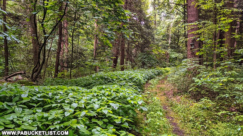
Located on State Game Lands 42, it’s an easy 1/2 mile walk along 2 forest roads to reach the falls.
As with any hike on State Game Lands, be sure to wear the required amount of blaze orange when hiking to Mill Creek Falls.
How to Find Mill Creek Falls on State Game Lands 42
Time needed: 15 minutes
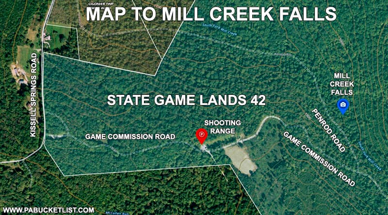
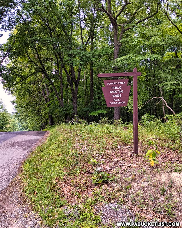
- Turn off of Kissell Springs Road onto the Game Commission Road at the shooting range sign shown below.
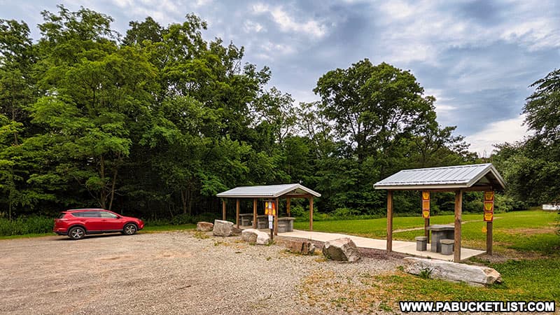
- Proceed 0.3 miles to the shooting range parking area.
Park here. GPS coordinates for the parking area: 40.23046, -79.14312.
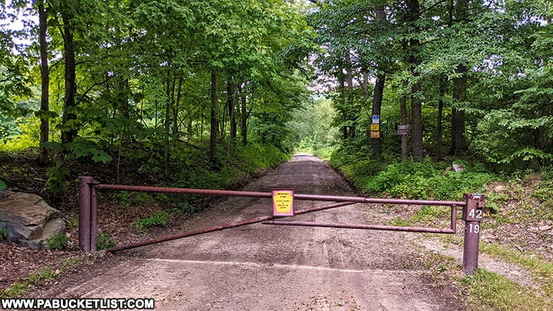
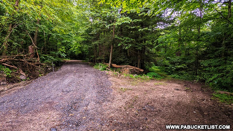
- Follow the gated road immediately to the right of the shooting range (shown below) towards Mill Creek Falls.
- Continue along the Game Commission Road for 700 yards
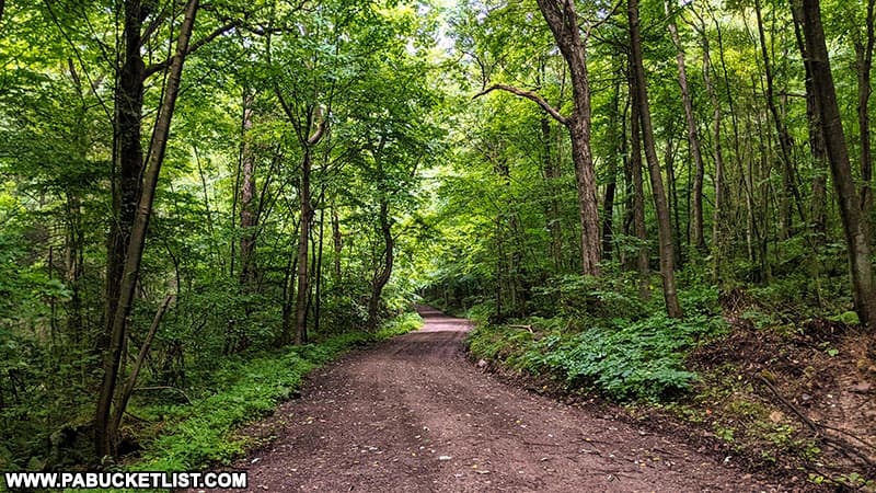
- Make a HARD LEFT onto Penrod Road, another forest road.
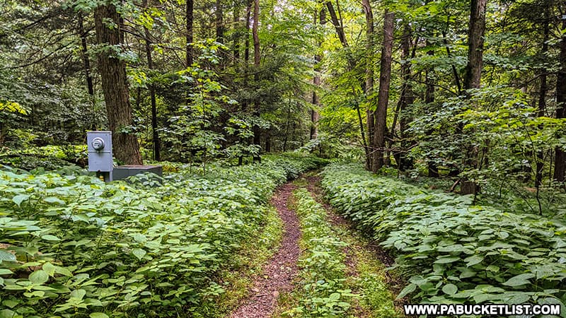
Penrod Road is show here on the right, looking back towards the intersection.
- Pass an area of above-ground utilities as you make your way down Penrod Road alongside Mill Creek.
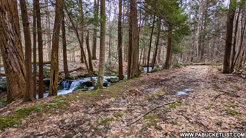
- Arrive at Mill Creek Falls 200 yards past the utilities area along Penrod Road.
GPS coordinates for Mill Creek Falls: 40.23139, -79.13739.
Photographing Mill Creek Falls
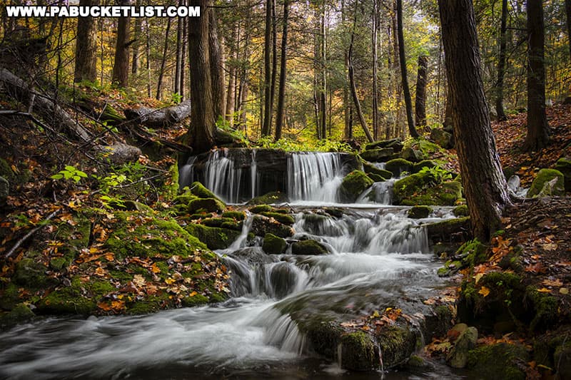
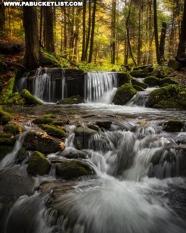
No one tier of Mill Creek Falls is more than 4 feet tall.
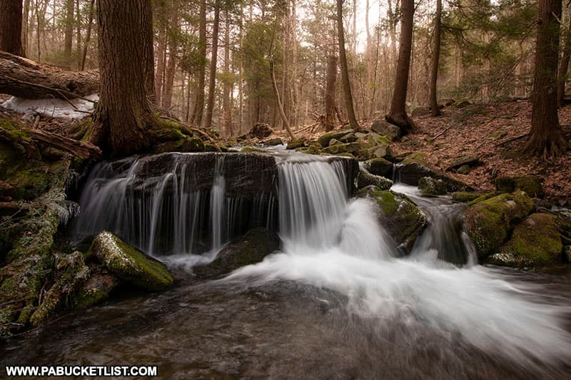
But when you view the tiers collectively from down steam, the falls are extremely photogenic.
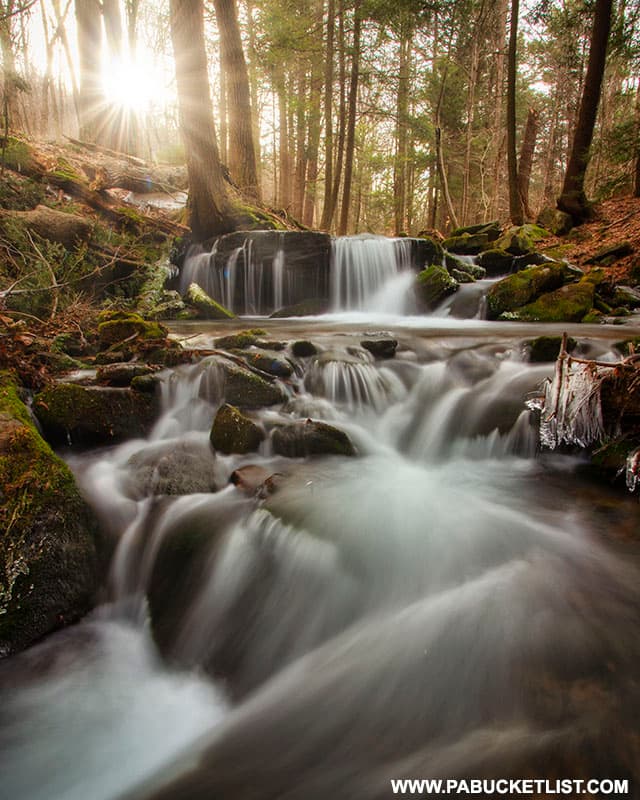
The sunrise aligns well behind Mill Creek Falls, and doesn’t crest the mountains until nearly 2 hours after the “official” sunrise, meaning you can hike to the falls in full daylight and still catch the “sunrise” behind them.
Mill Creek is not a large waterway, but even in drier conditions with less flow, Mill Creek Falls is still a pleasant scene to photograph and an enjoyable hike.
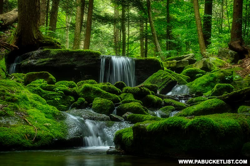
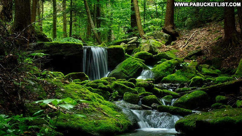
It’s hard to imagine a greener, “mossier” spot in western PA than Mill Creek Falls in mid-summer.
Nearby Attractions
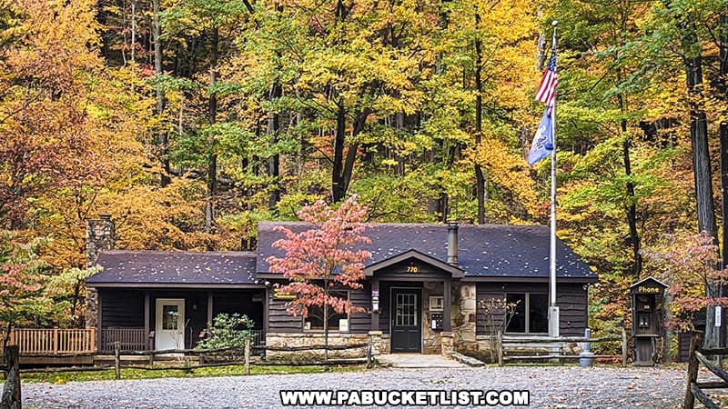
Linn Run State Park is a 612 acre park in Westmoreland County, popular with hikers, campers, and picnickers.
Adam Falls at Linn Run State Park is another easy-to-get-to waterfall in Westmoreland County, and only minutes from Mill Creek Falls.
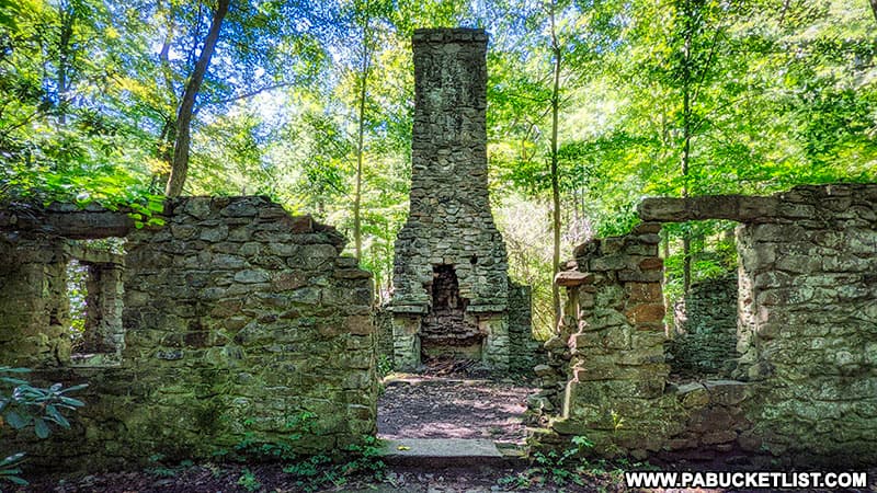
The abandoned hunting lodge at Linn Run State Park is a remarkable set of ruins from the early days of “retreat camping” in western Pennsylvania.
Fort Ligonier in Westmoreland County is a historically accurate reproduction of a British fort originally constructed in 1758 during what would become known as the French and Indian War.

Wolf Rocks offers sweeping views of Westmoreland County from a perch high above Linn Run State Park in the Forbes State Forest.
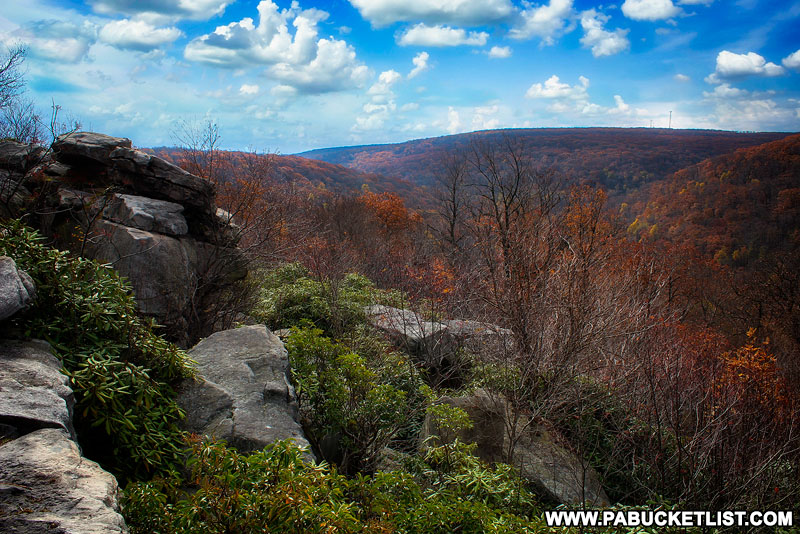
Beam Rocks Overlook is another magnificent vista in the nearby Forbes State Forest.

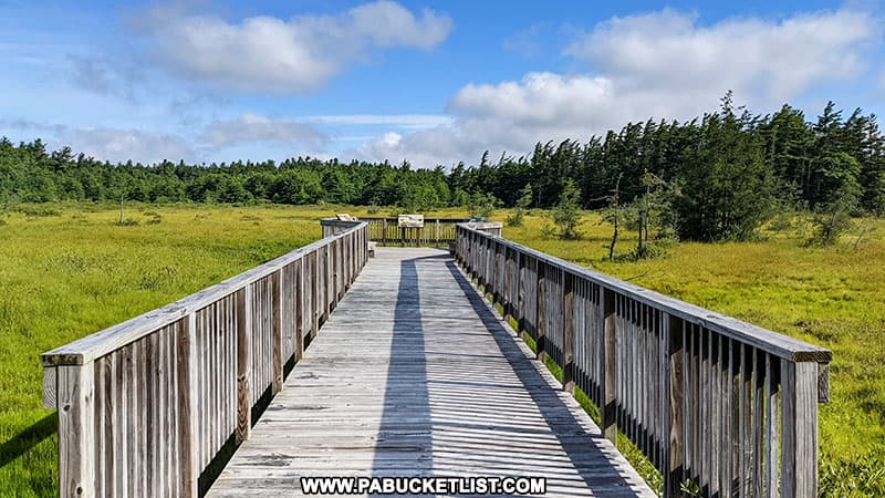
Spruce Flats Bog is a unique high-altitude bog located near the trailhead for the Wolf Rocks hike.
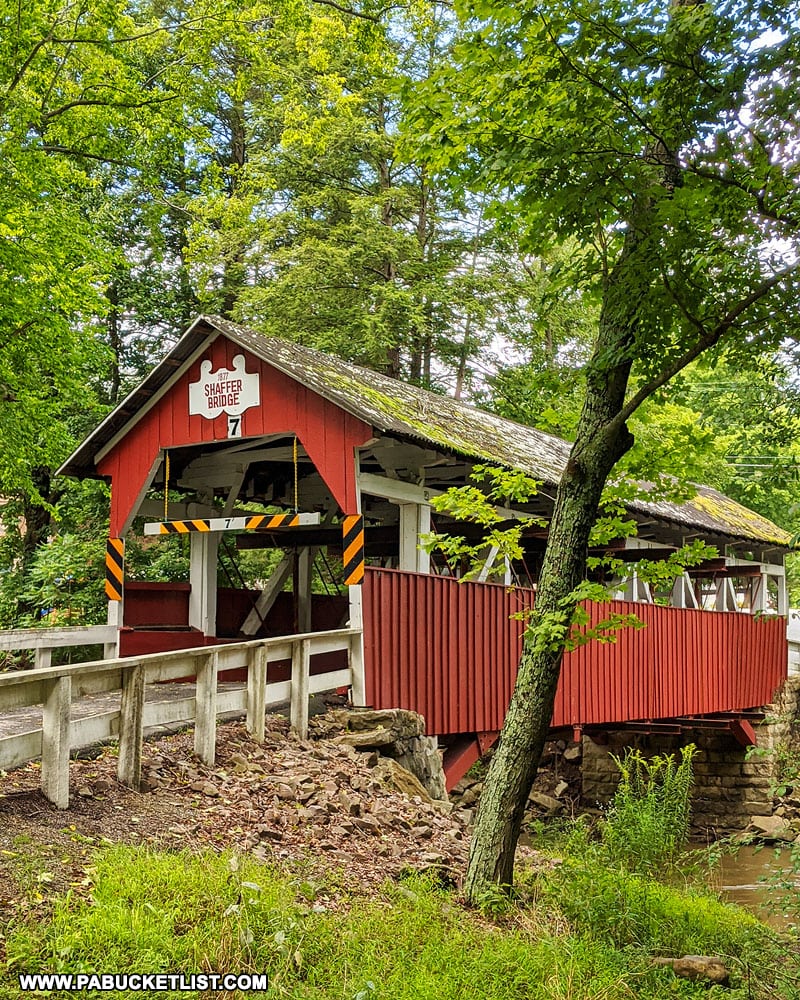
Shaffer Covered Bridge is located nearby in neighboring Somerset County, one of 10 historic covered bridges in this county.
Did you enjoy this article?
If so, be sure to like and follow PA Bucket List on Facebook, Instagram, and/or Pinterest to stay up-to-date on my latest write-ups about the best things to see and do in Pennsylvania!
Click on any of the icons below to get connected to PA Bucket List on social media.