
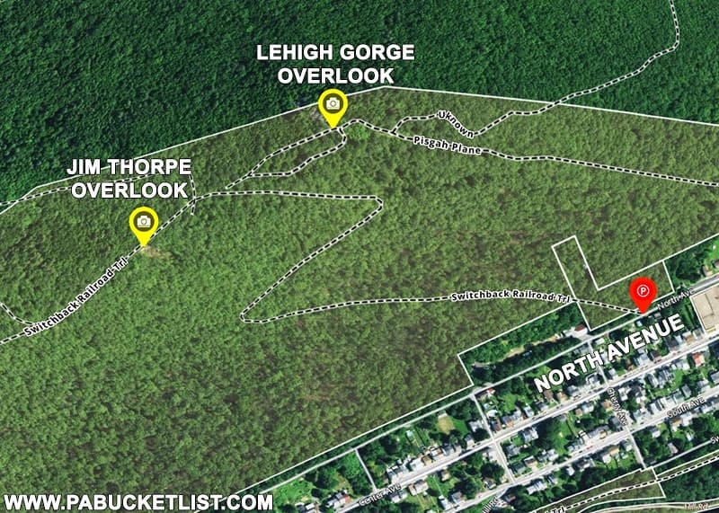
The Mount Pisgah Trail in Jim Thorpe is a steep but easy-to-follow trail leading up Mount Pisgah to a pair of fantastic Carbon County vistas.
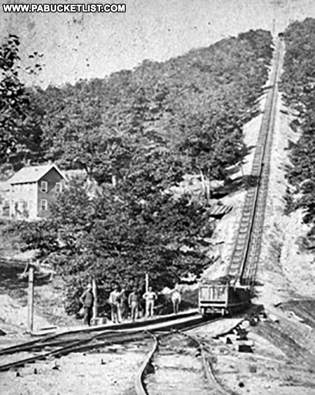
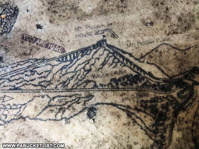
The trail utilizes former right-of-ways from the Switchback Railroad, built in the early 1800s to carry coal from mines in the mountains to the Lehigh Canal below.
How to Find the Mount Pisgah Trail
The Mount Pisgah Trail Head is located along North Avenue in Jim Thorpe at GPS coordinates 40.86733, -75.74552.

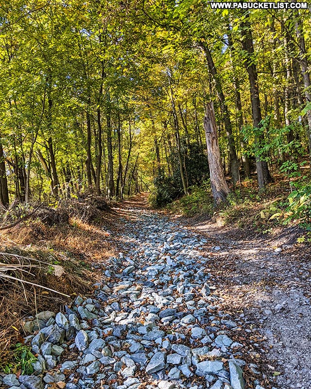
The trail looks like a steep, rocky ATV trail, and that’s pretty much how it remains the entire way up the mountain.
The distance from the parking area to the summit is roughly 0.7 miles, with 500 feet of elevation gain along the way.
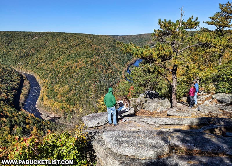
Once you reach the summit, you can either bear right to the Lehigh Gorge Overlook, or bear left to the Jim Thorpe Overlook.
The Lehigh Gorge Overlook
Bearing right, you’ll hike approximately 75 yards before coming to some ruins and a weathered sign that tells you about those ruins.

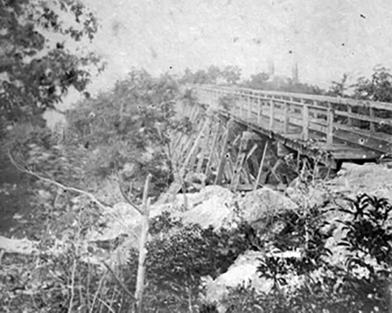
At one time a “bridge in the clouds” stood here, part of the Switchback Railway.
Today these bridge supports are covered in leaves and moss.
In their prime they would have been covered in soot and coal dust.
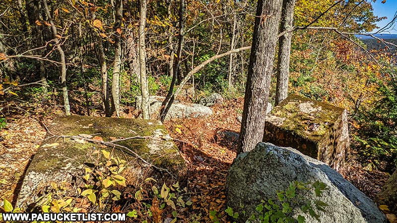
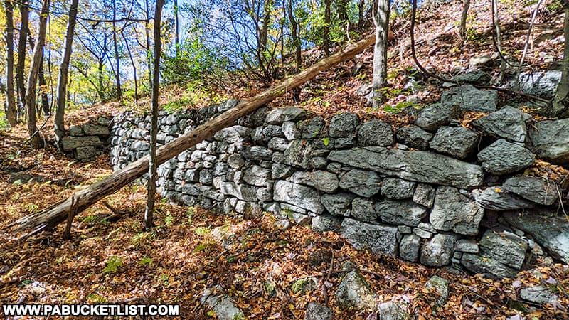
Another 100 yards past the bridge ruins, you’ll come upon the remnants of the Mount Pisgah engine house, which powered this portion of the Switchback Railroad.
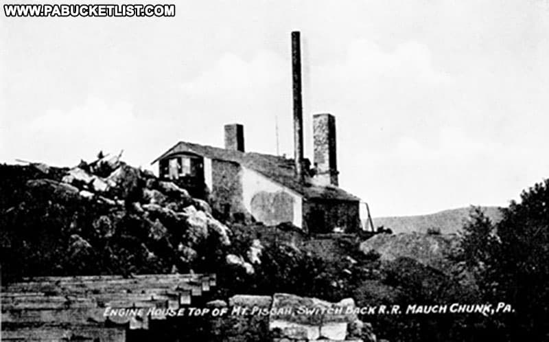
Today, all that remains of the engine house and surrounding support structures are some stone foundations.
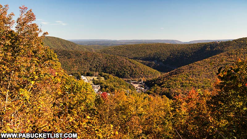
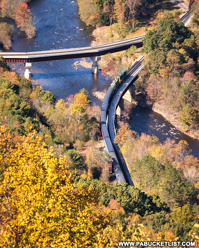
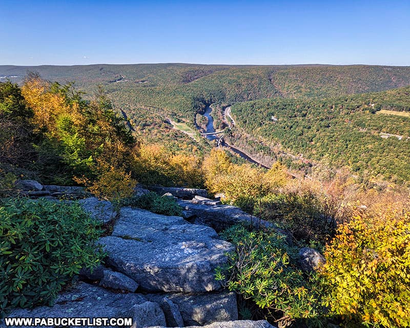
The Lehigh Gorge Overlook is just a few yards north of the old engine house, facing in the direction of Lehigh Gorge State Park.
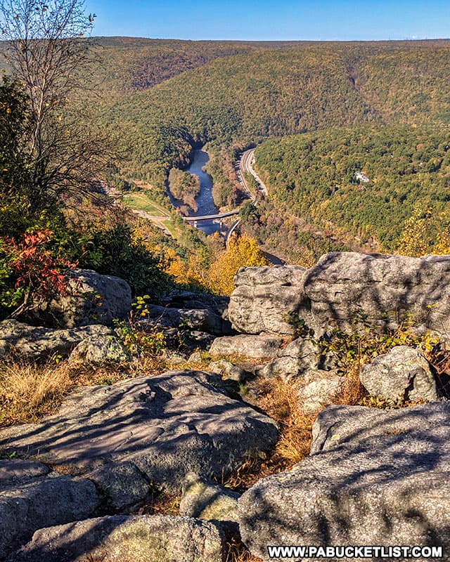
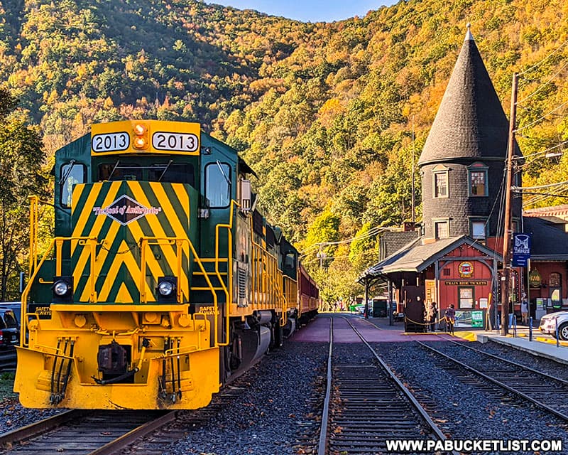
If you’re lucky (or planned well like I did on this afternoon), you’ll catch the Lehigh Gorge Scenic Railway passing through the valley far below.
If navigating by GPS, use coordinates 40.86936, -75.74998 to find the Lehigh Gorge Overlook and the ruins of the old engine house.
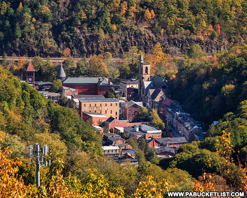
The Jim Thorpe Overlook
Backtracking past the bridge historical sign and following the trail in the opposite direction will bring you to the Jim Thorpe Overlook along the Mount Pisgah Trail, located at GPS coordinates 40.86815, -75.75254.
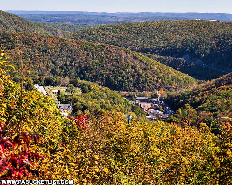
From this vantage point, it’s easy to see why Jim Thorpe was often referred to in the 1800s as “the Switzerland of America”.
On this October afternoon the air was clear and cool and the views from Mount Pisgah were exceptional!

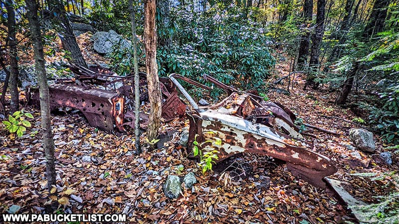
To get back to your vehicle, simply retrace your steps down the mountain, past this abandoned car you no doubt noticed along the way, wondering like I did how in the world it got to the top of Mount Pisgah!
Nearby Attractions
While the Switchback Railroad is just a memory, the Lehigh Gorge Scenic Railway is still very real, and riding it is one of the best things to do when visiting Jim Thorpe.
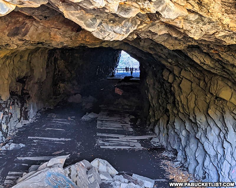
Turn Hole Tunnel is an abandoned railroad tunnel located near the Glen Onoko access to Lehigh Gorge State Park.
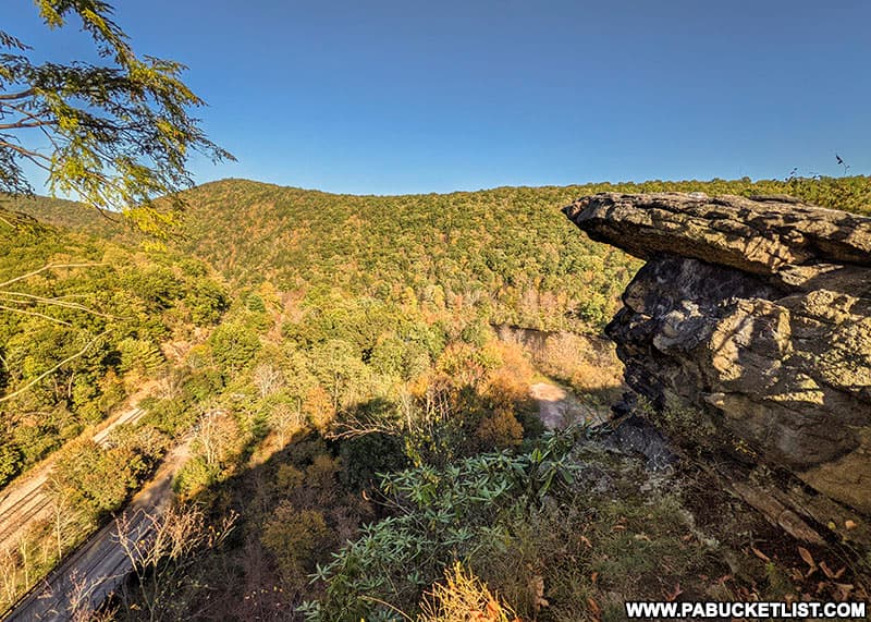
And directly above Turn Hole Tunnel you’ll find Moyer’s Rock Overlook, offering a commanding view of the Lehigh Gorge.
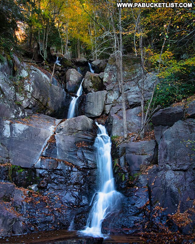
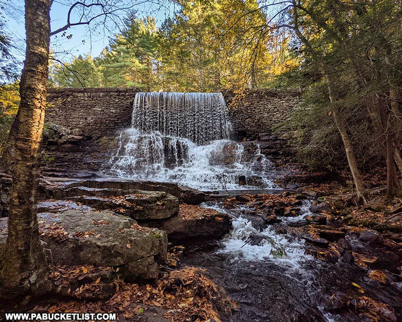
Buttermilk Falls at Lehigh Gorge State Park is a cascading waterfall along the Lehigh Gorge Rail Trail, 1/4 mile north of the Rockport Access to the park and rail trail.
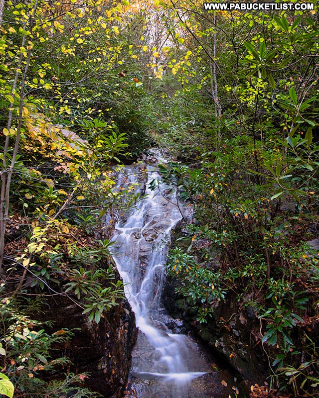
Luke’s Falls at Lehigh Gorge State Park is an easy 1/4 mile hike/bike ride south of the Rockport Access along the Lehigh Gorge Rail Trail.
Tank Hollow Overlook in Carbon County offers visitors a stunning view of a bend in the Lehigh River in the western Poconos.
Exploring Hickory Run State Park is an in-depth guide to the best things to see and do at this 15,990-acre park in Carbon County, just north of Jim Thorpe.
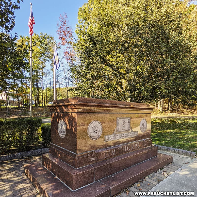
The Jim Thorpe Memorial in Carbon County is the final resting place of the man voted “The Greatest Athlete of the First Half of the 20th Century” by the Associated Press.
Did you enjoy this article?
If so, be sure to like and follow PA Bucket List on Facebook, Instagram, and/or Pinterest to stay up-to-date on my latest write-ups about the best things to see and do in Pennsylvania!
Click on any of the icons below to get connected to PA Bucket List on social media.