
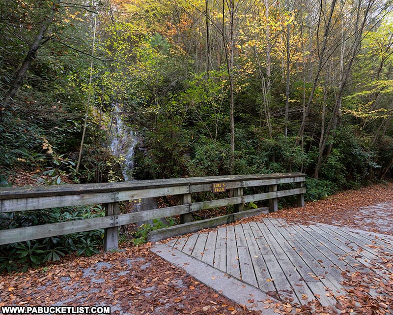
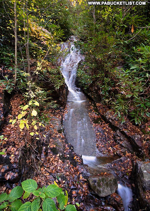
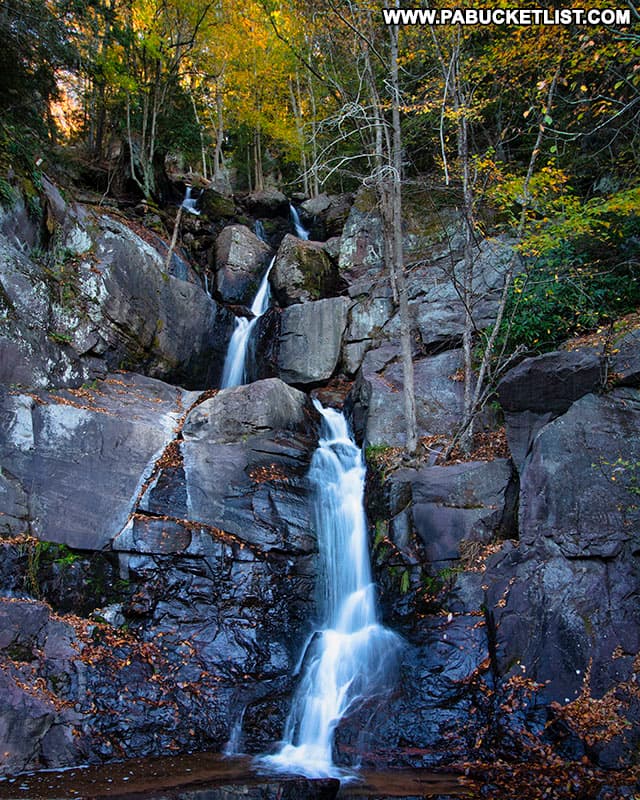
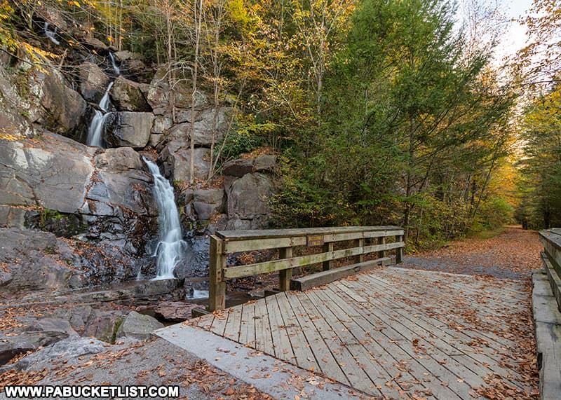
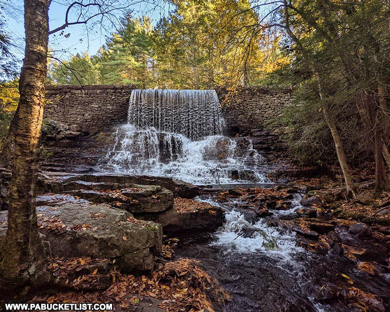
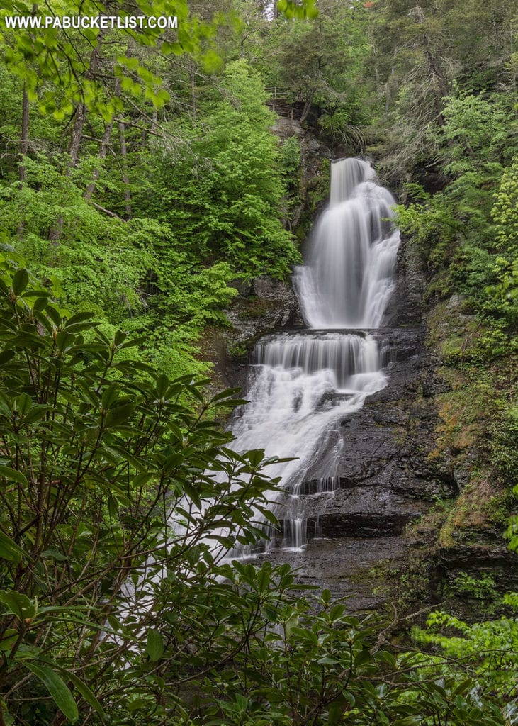
Luke’s Falls at Lehigh Gorge State Park is an easy 1/4 mile hike/bike ride south of the Rockport Access along the Lehigh Gorge Rail Trail.
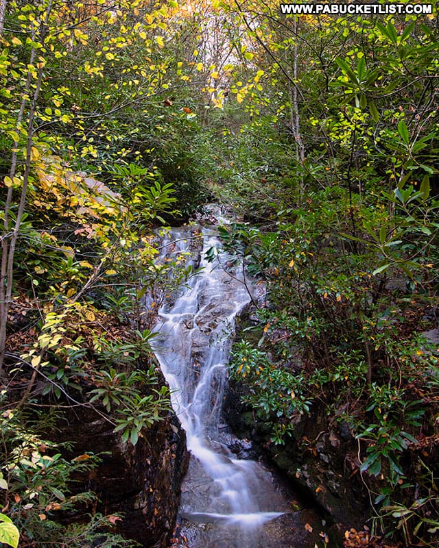
Located right along the rail trail, Luke’s Falls cascades down the walls of the Lehigh Gorge, passes beneath a bridge on the rail trail, and eventually spills into the Lehigh River.
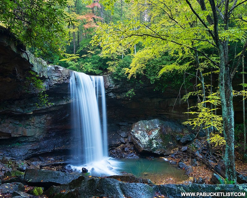
How to Find Luke’s Falls at Lehigh Gorge State Park
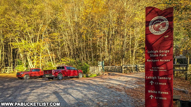
Luke’s Falls is located 1/4 mile south of the Rockport Access to Lehigh Gorge State Park.
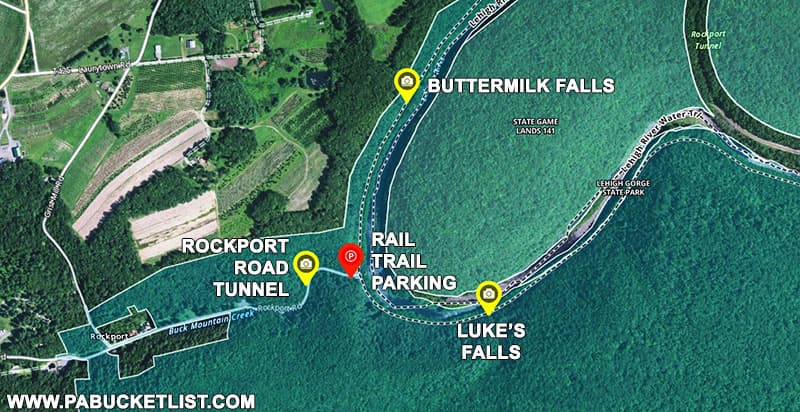
If navigating by GPS, use coordinates 40.96650, -75.75529 to find the parking area.
The trail is smooth and flat, as you’d expect a rail trail to be, and offers magnificent views of the Lehigh River along the way.
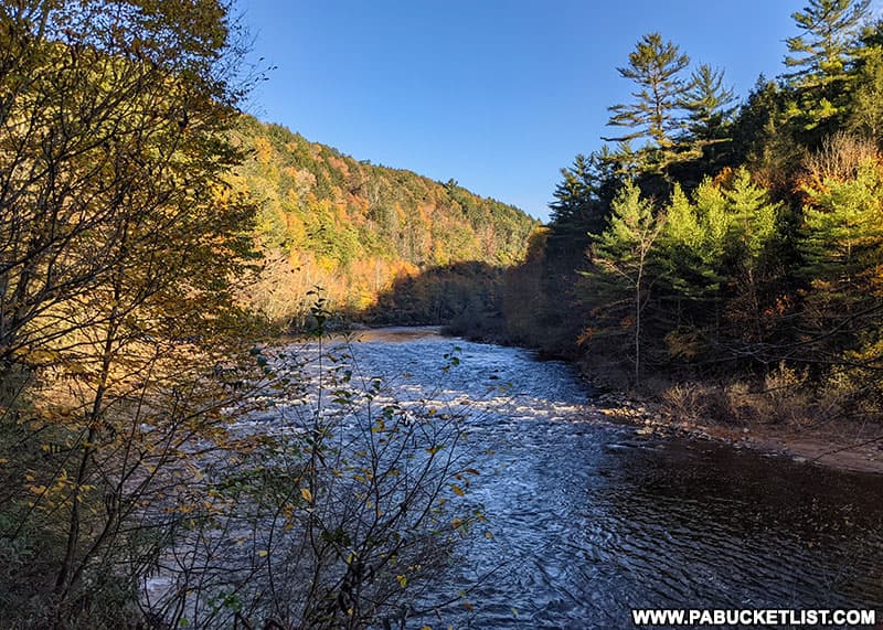
Walking at a comfortable pace, you’ll reach Luke’s Falls in roughly 10 minutes (or faster if riding your bike) at GPS coordinates 40.96553, -75.75058.
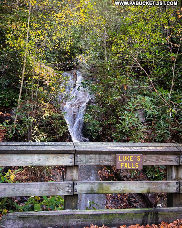
Luke’s Falls disappears into the foliage above it, so it’s difficult to say how tall it is – some trail guides put it at around 40 feet and that seems plausible to me as well.
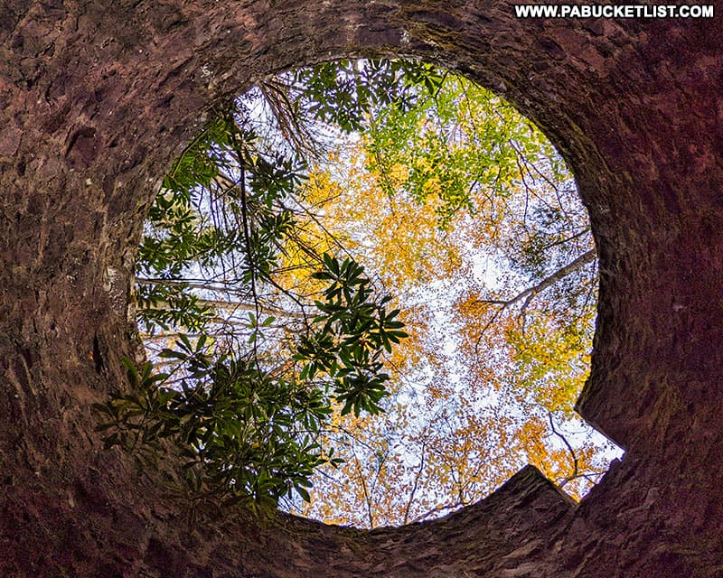
Next to Luke’s Falls you’ll notice the ruins of a tower structure.
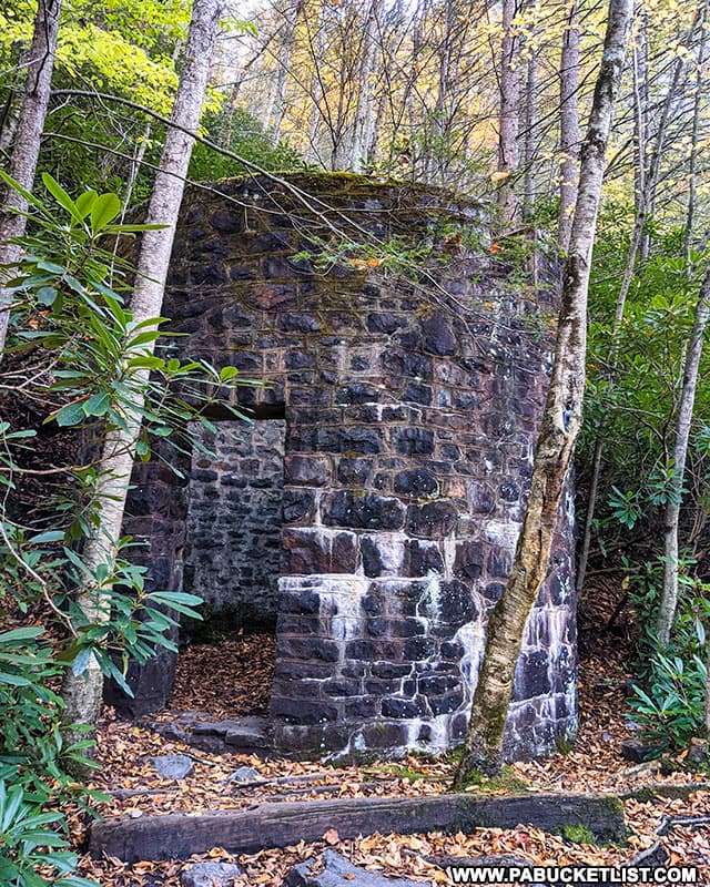
With no official interpretive signage near it, I won’t hazard a guess as to what it was or what might have been stored in it.
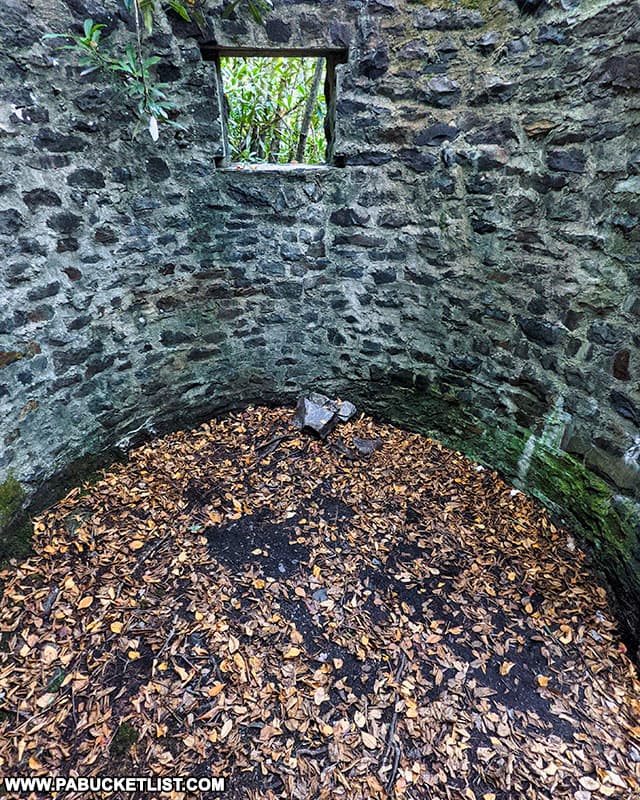
But I will say it provides a neat view of the sky above!
Nearby Points of Interest
If you looked closely at the map above, you saw that Buttermilk Falls is located just a 1/4 mile north of the Rockport Access parking lot.
As with Luke’s Falls, Buttermilk Falls is literally right along the rail trail.
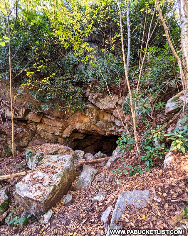
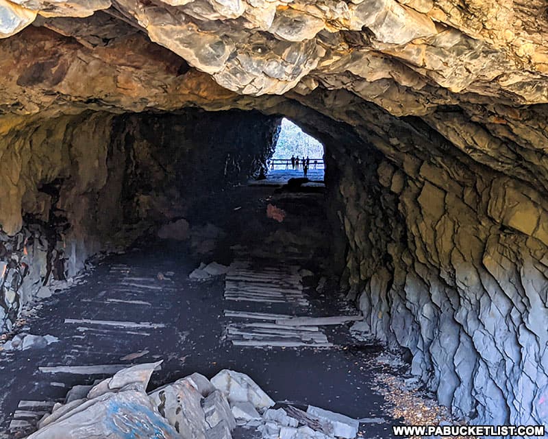
Located near the Rockport Access parking area, along Rockport Road, you’ll find an abandoned tunnel.
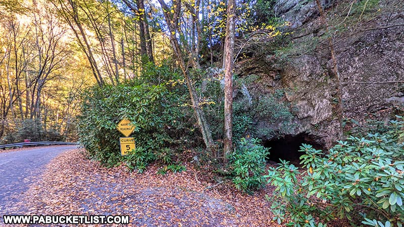
As with the tower near Luke’s Falls, I won’t hazard a guess as to the purpose of the tunnel, but you can make your way through it and out the other side.
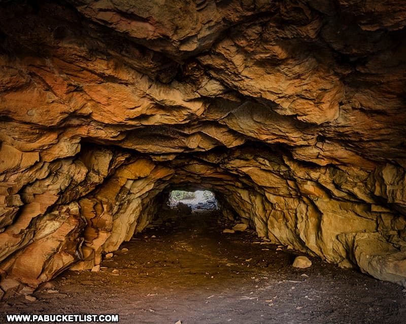
When you do emerge on the far side of the tunnel, you’ll find yourself looking down on the Rockport Access parking lot, the bike trail, and the Lehigh River.
Nearby Attractions
Hickory Run State Park is a magnificent 15,990-acre recreational area adjoining Lehigh Gorge State Park.
Featuring more than 40 miles of hiking trails, picturesque waterfalls, unique natural areas, and spectacular scenic overlooks, Hickory Run State Park has a LOT to offer!

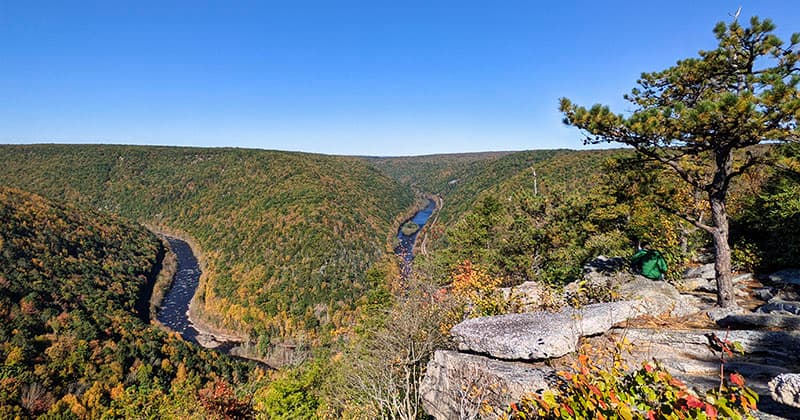
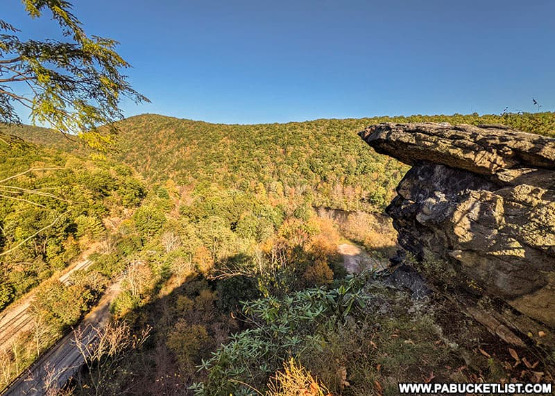
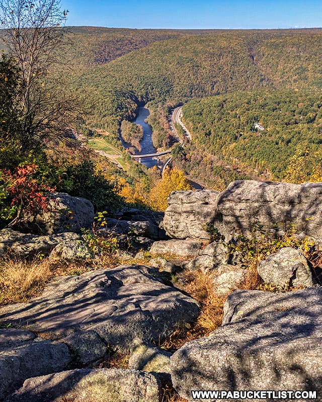
Tank Hollow Overlook in Carbon County offers visitors a stunning view of a bend in the Lehigh River in the western Poconos.
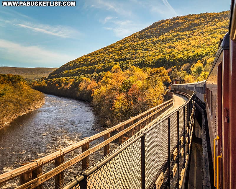
Riding the Lehigh Gorge Scenic Railway is one of the most enjoyable ways to experience the landscapes of the Lehigh Gorge.
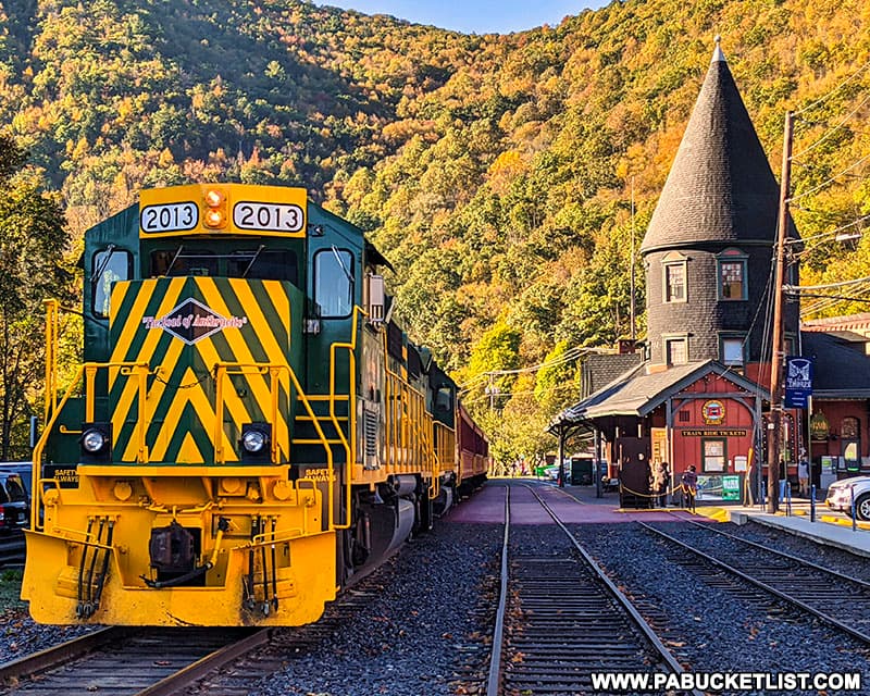
Departing from Jim Thorpe, the Lehigh Gorge Scenic Railway takes you north through the Lehigh Gorge, crossing the Lehigh River and into the heart of Lehigh Gorge State Park.
Turn Hole Tunnel is an abandoned railroad tunnel located near the Glen Onoko access to Lehigh Gorge State Park.
And directly above Turn Hole Tunnel you’ll find Moyer’s Rock Overlook, offering a commanding view of the Lehigh Gorge.
The Mount Pisgah Trail in Jim Thorpe is a steep but easy-to-follow trail leading up Mount Pisgah to a pair of fantastic Carbon County vistas.
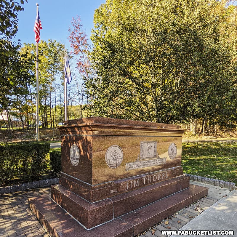
The Jim Thorpe Memorial in Carbon County is the final resting place of the man voted “The Greatest Athlete of the First Half of the 20th Century” by the Associated Press.
27 Must-See Waterfalls in the Poconos will introduce you to many more majestic waterfalls in the area, including the two tallest waterfalls in Pennsylvania!
20 Must-See Pennsylvania Waterfalls will show you how to find the finest waterfalls across the Keystone State.
Did you enjoy this article?
If so, be sure to like and follow PA Bucket List on Facebook, Instagram, and/or Pinterest to stay up-to-date on my latest write-ups about the best things to see and do in Pennsylvania!
Click on any of the icons below to get connected to PA Bucket List on social media.