
If you’re looking for the best things to see and do in the Forbes State Forest, you’re in the right place!

The Forbes State Forest encompasses more than 50,000 acres in western Pennsylvania, spanning Westmoreland, Somerset, and Fayette counties.
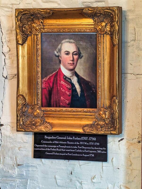
The forest is named in honor of British General John Forbes, who was a prominent figure in this area during the French and Indian War in the 1750s.
From scenic vistas to waterfalls to the highest point in Pennsylvania, here are 9 must-see attractions to check out in the Forbes State Forest!
Simply click on the blue text links on the map above or in the descriptions below (listed alphabetically) to read more in-depth information about each destination.
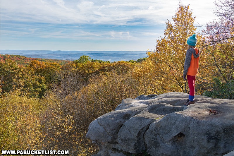
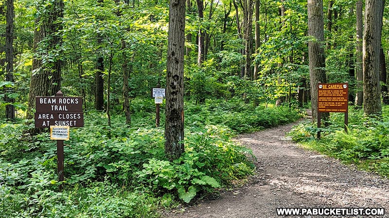
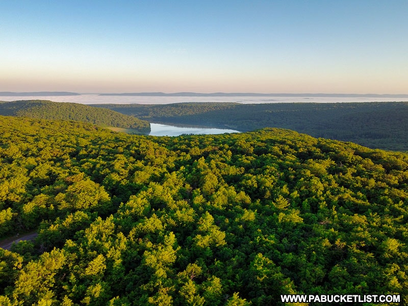
1. Beam Rocks Overlook
Beam Rocks Overlook in the Forbes State Forest offers a fantastic 180° eastern view from high above the treetops and the Laurel Highlands Hiking Trail below.
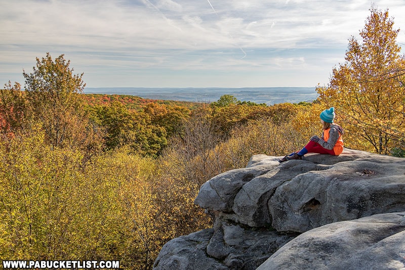
The hike to Beam Rocks Overlook involves a one mile out and back hike along a well maintained trail, with less than 100 feet of elevation change between the parking area and the overlook.
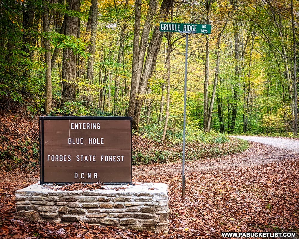
2. The Blue Hole
The Blue Hole is basically a deep roadside swimming hole in the Forbes State Forest.
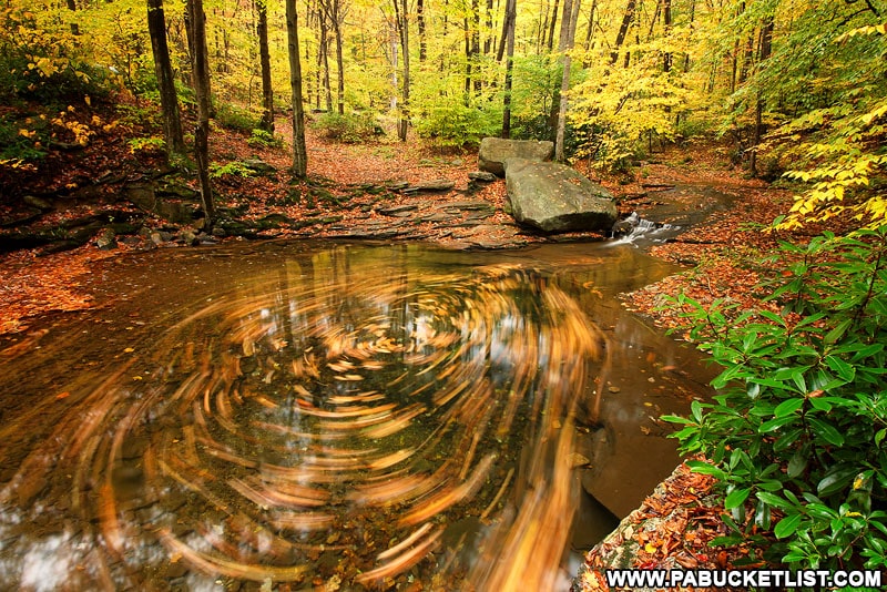
In the fall it more resembles the “gold hole”, perfect for long-exposure leaf swirl photos.
The Blue Hole is located just a few minutes west of Cole Run Falls, so if you stop at one, make sure to see the other!
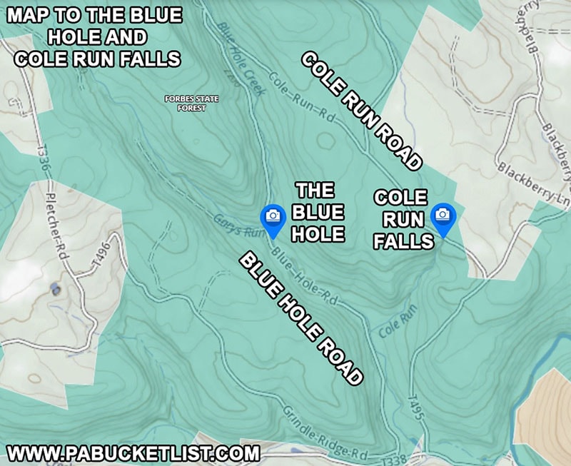
If navigating by GPS, use coordinates 39.97254, -79.29808 to find the Blue Hole.
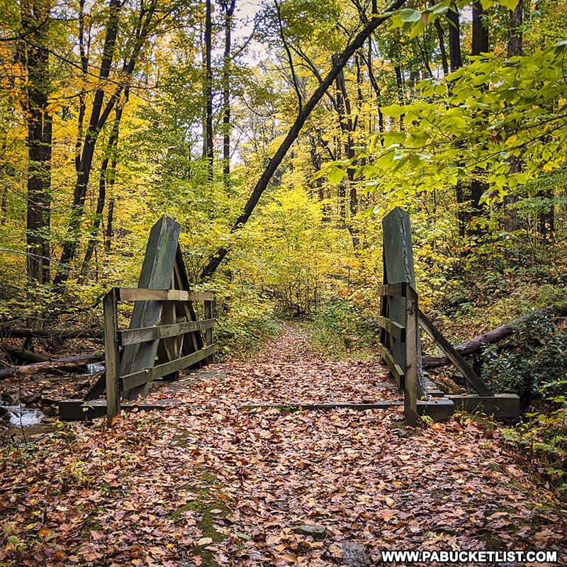
3. Blue Hole CCC Camp Picnic Area
In the early 1930s, the Blue Hole Picnic Area in the Forbes State Forest was home to a bustling Civilian Conservation Corps camp, resembling a small village.
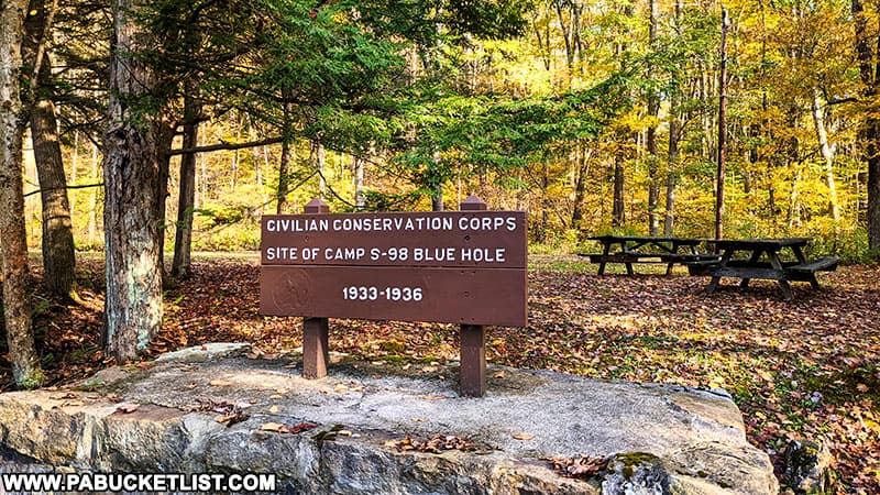
Between 1933-1937, the 200 young men stationed here built 7 fire towers, 21 miles of roads and trails, planted trees, and redirected waterways.
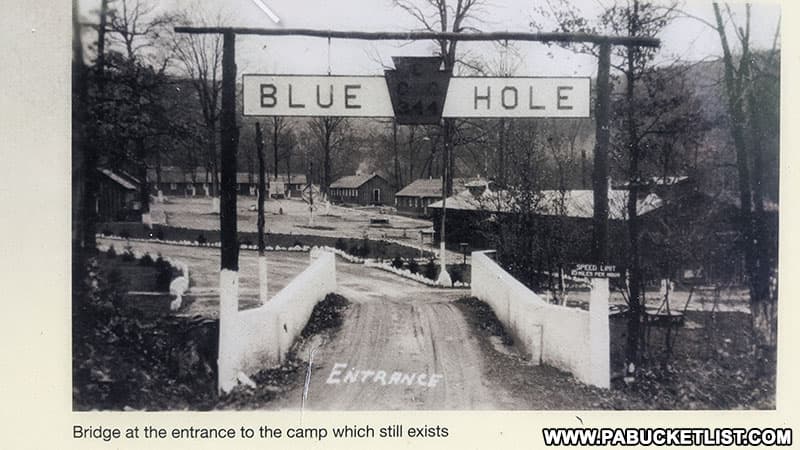
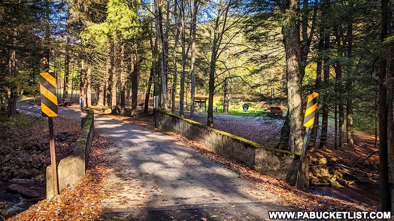
Today only the bridge over Fall Run remains, along with a few stoneworks and foundations.
If navigating by GPS, use coordinates 39.95800, -79.27999 to find the Blue Hole CCC Camp Picnic Area along Fall Run Road.
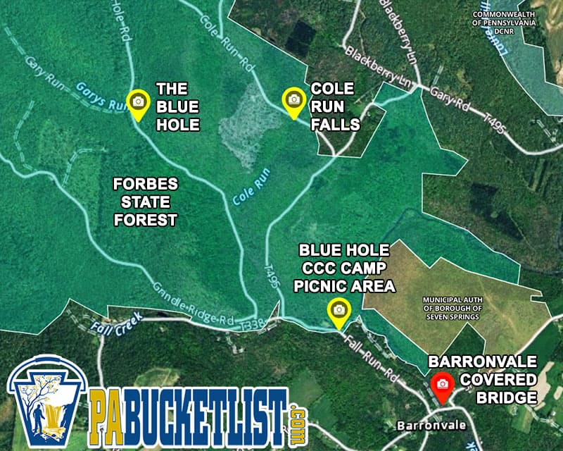
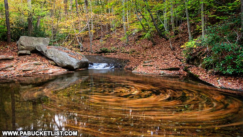
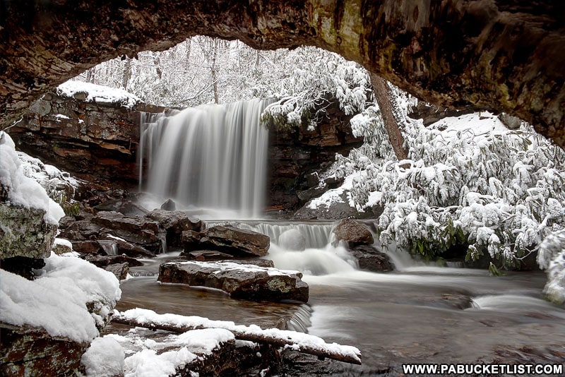
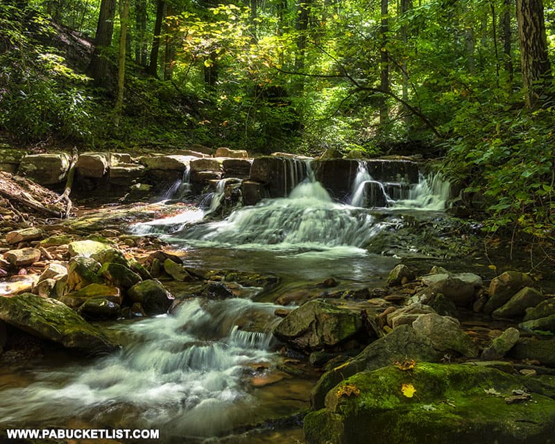
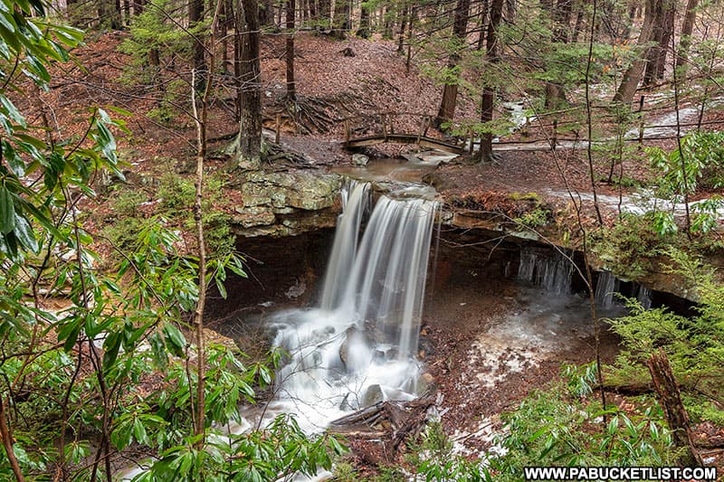
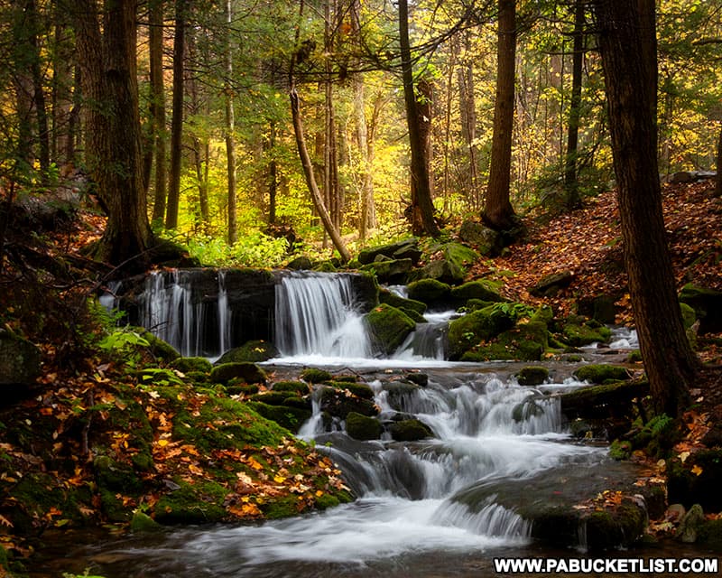
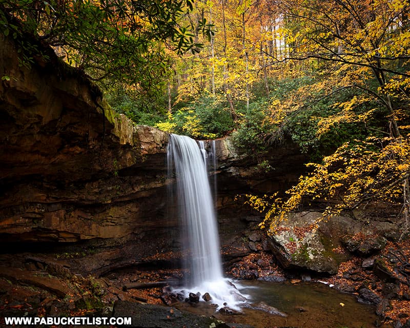
4. Cole Run Falls
Cole Run Falls is probably the most popular waterfall in the Forbes State Forest.
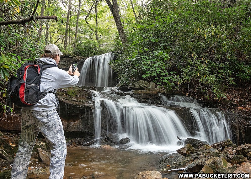
One of the great things about Cole Run Falls is the number of angles you can view and photograph it from.
There are additional waterfalls downstream from Cole Run Falls as well, and you’ll find directions to them HERE.
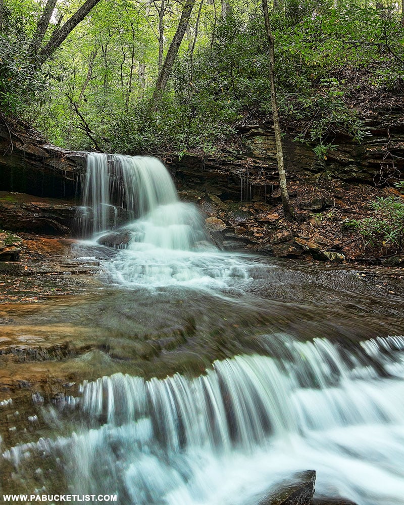
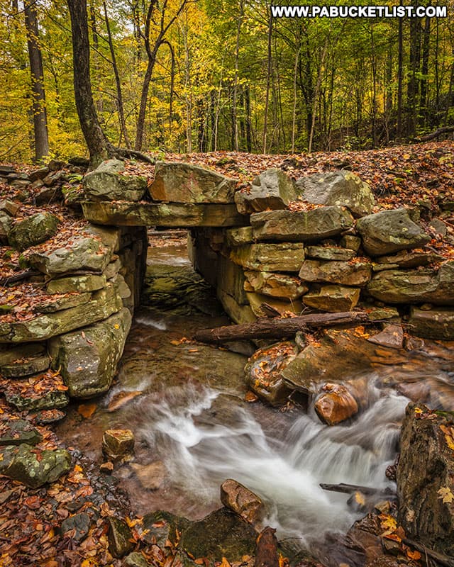
5. Fish Run Falls
Fish Run Falls in the Forbes State Forest may be the prettiest little waterfall in Westmoreland County that you’ve never heard of!
Fish Run Falls is located adjacent to the Pittsburgh, Westmoreland, and Somerset Railroad Mountain Bike Trail, or PW&S Trail for short.
Not only is the waterfall beautiful, but it’s located next to a historic railroad aqueduct built more than 120 years ago!
6. Mount Davis – the Highest Point in PA
Mount Davis in the Somerset County portion of the Forbes State Forest is the highest point in Pennsylvania!
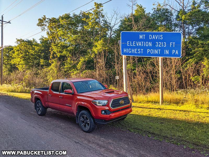
At 3,213 feet above sea level, this idyllic mountain setting is home to some incredible views of the surrounding Laurel Highlands.
The observation tower at Mount Davis is probably the most well-known overlook on the mountain.
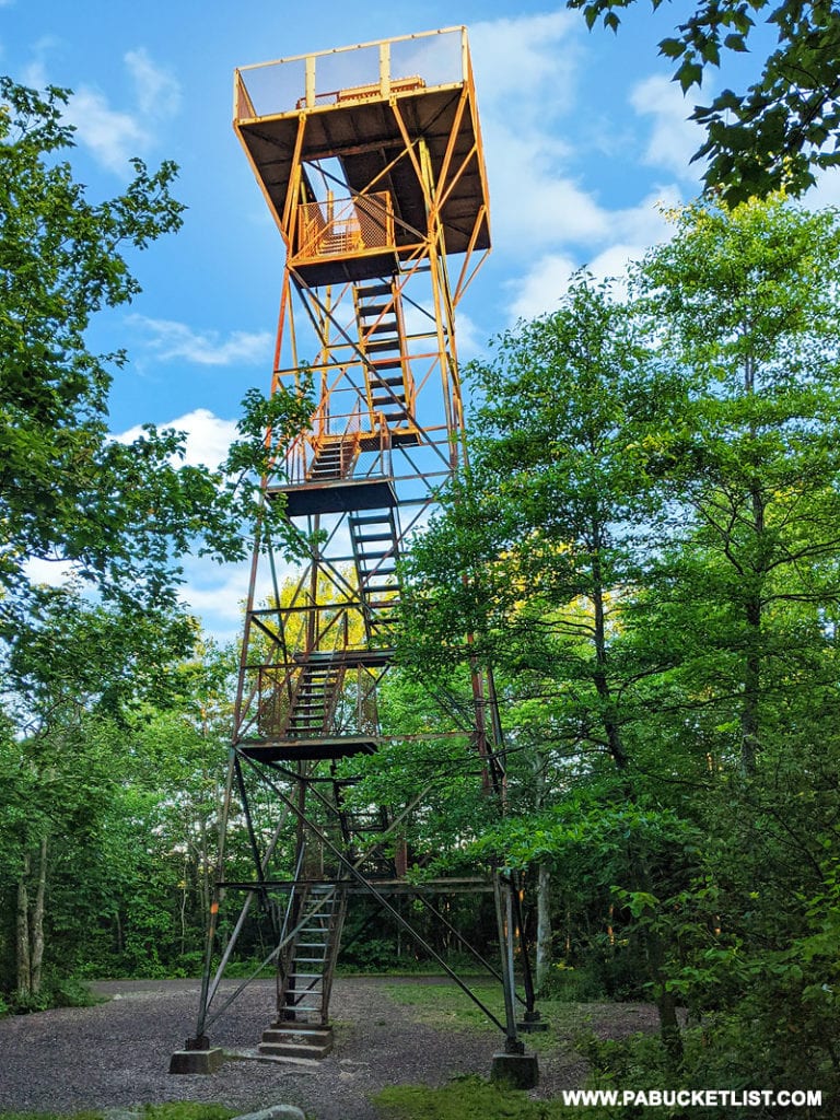
But there are several other ground-level overlooks nearby, and you find directions to them HERE.
7. Quebec Run Wild Area
Spanning approximately 7,400 acres within the Forbes State Forest, the Quebec Run Wild Area lies just north of the Pennsylvania/West Virginia border.

Hikers will find around 25 miles of interconnected trails to explore, catering to outdoor enthusiasts who enjoy rugged, forested landscapes.

8. Spruce Flats Bog
Spruce Flats Bog is one of the most unique ecosystems in all of Pennsylvania – a high altitude bog featuring plants and trees found nowhere else in the state.
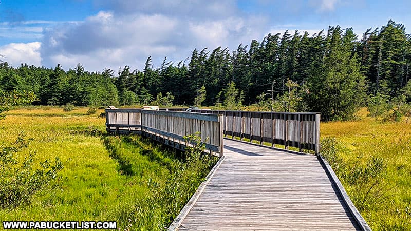
Bogs are typically found at much lower altitudes – Spruce Flats Bog sits on a mountaintop at 2,720 feet above sea level.
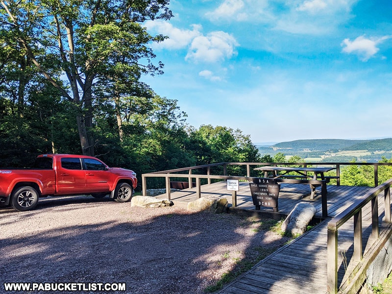
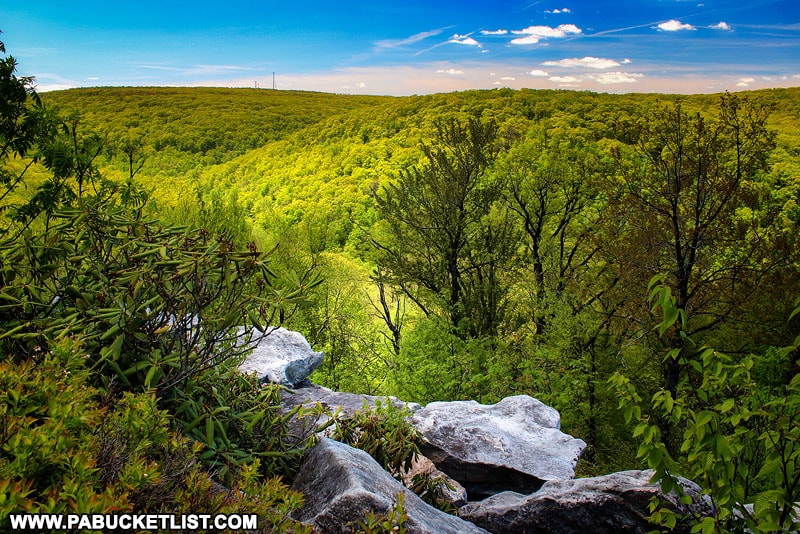
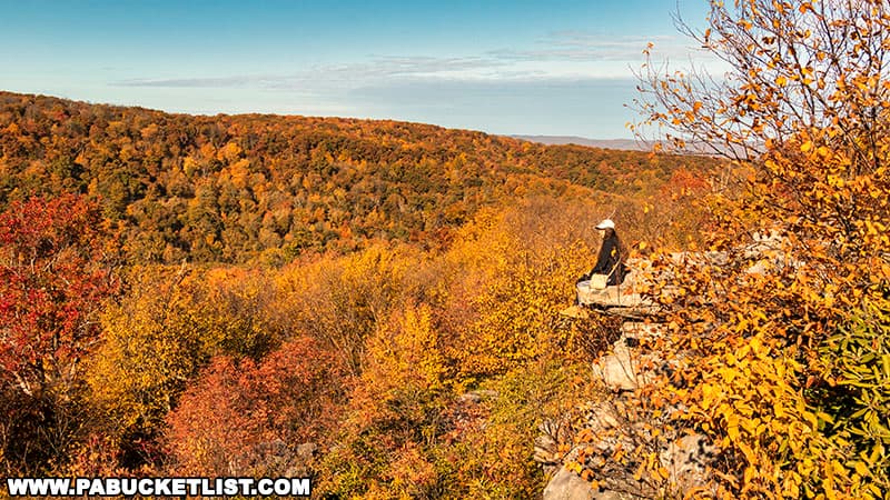
9. Wolf Rocks Overlook
Wolf Rocks Overlook in the Forbes State Forest is an outstanding scenic vista and rock formation in Westmoreland County.
The hike to Wolf Rocks Overlook takes place on a relatively flat, sometimes rocky, 2 mile trail (one-way).
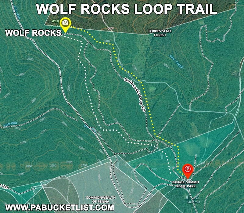
The payoff is at the western terminus of the Wolf Rocks Trail, where it dead-ends into a 180° view of Linn Run State Park and Westmoreland County.
Related Articles
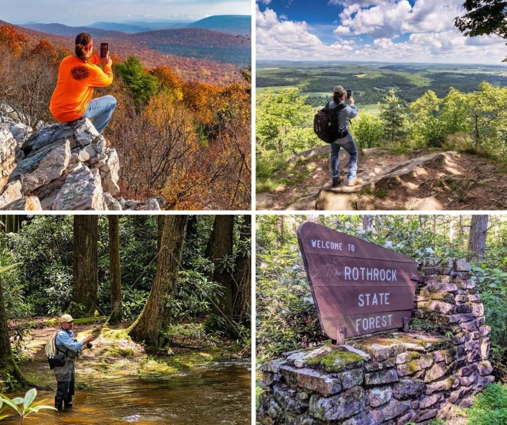
19 Must-See Attractions in the Rothrock State Forest is your guide to the best things to see and do in this forest which spans 96,956 acres across Huntingdon, Mifflin, and Centre counties, set amid the rugged terrain of Pennsylvania’s Ridge and Valley province.
16 Must-See Attractions in the Sproul State Forest highlights the best things to see and do in PA’s largest state forest, most of it located within western Clinton and northern Centre counties.
9 Must-See Attractions in the Buchanan State Forest showcases the best destinations within this 71,683-acre expanse stretching across Bedford, Fulton, and Franklin Counties, where rugged mountains and winding valleys define Pennsylvania’s Ridge-and-Valley region.

11 Must-See Attractions in the Bald Eagle State Forest showcases the best destinations within this forest that stretches across 194,602 acres in Snyder, Union, Centre, Mifflin, and Clinton counties, embracing central Pennsylvania’s high ridges, clear mountain streams, and several remarkable tracts of old-growth forest.
Nearby Attractions
Adam Falls at Linn Run State Park (not to be confused with Adams Falls at Ricketts Glen State Park) is a picturesque 12 foot tall waterfall in Westmoreland County.
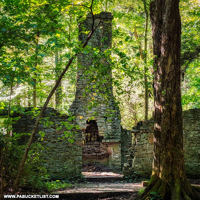
The abandoned hunting lodge at Linn Run State Park is a remarkable set of ruins from the early days of “retreat camping” in western Pennsylvania.
Mill Creek Falls is located on State Game Lands 42 in Westmoreland County.
Laurel Hill State Park is comprised of 4,062 acres of mountainous, wooded terrain in central Somerset County.
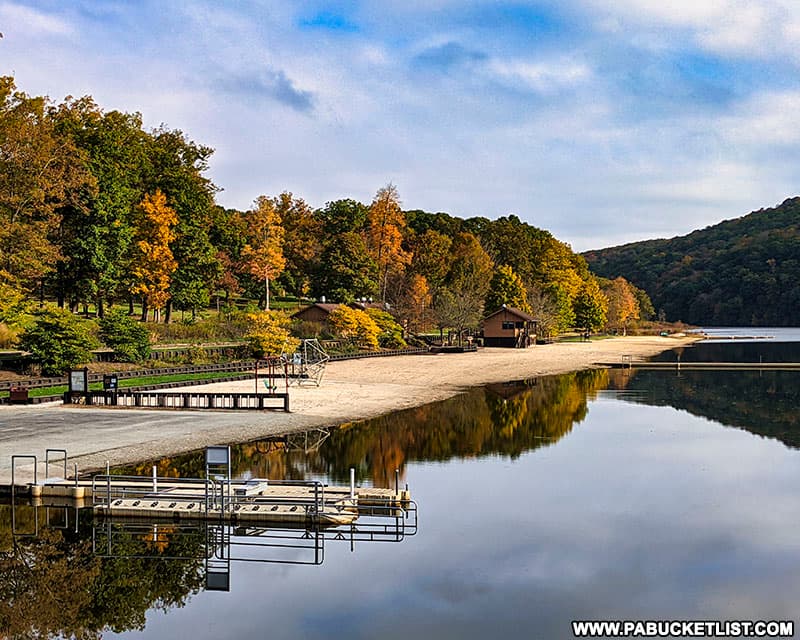
Kooser State Park occupies 250 wooded acres along Route 31 in Somerset County.
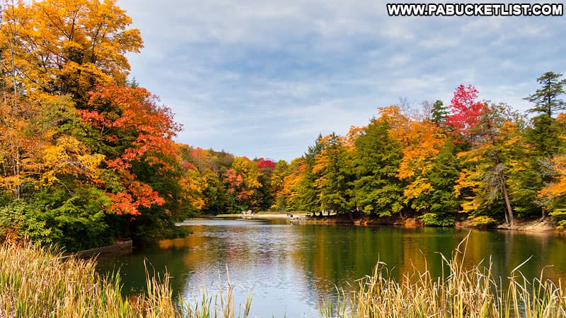
Ohiopyle State Park in Fayette County is THE BEST water-themed state park in western Pennsylvania.
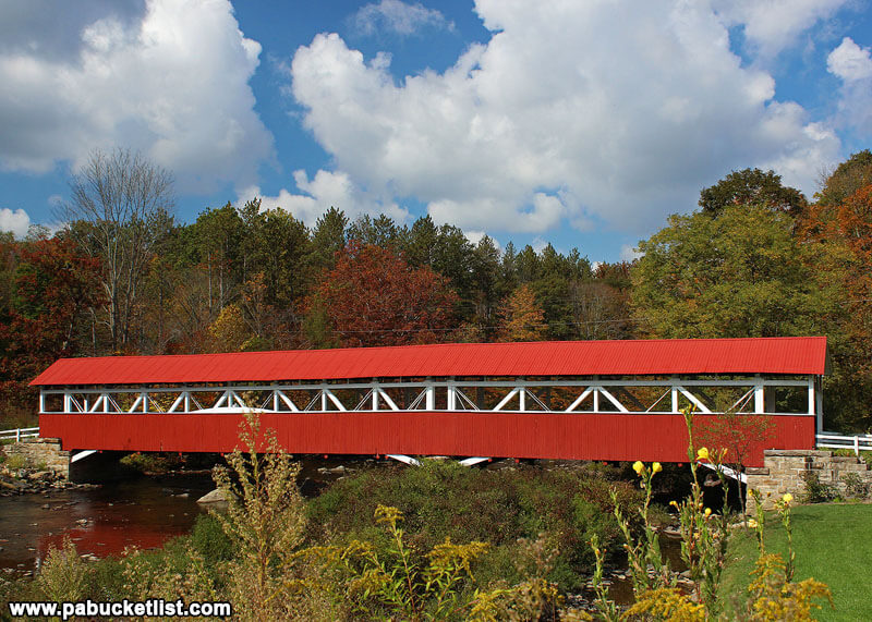
The Barronvale Covered Bridge is close to the Blue Hole, the Blue Hole CCC Camp, and Cole Run Falls in Somerset County.
Did you enjoy this article?
If so, be sure to like and follow PA Bucket List on Facebook, Instagram, and/or Pinterest to learn more about the best things to see and do in Pennsylvania!
Click on any of the icons below to get connected to PA Bucket List on social media.